
The 9 best small high-altitude villages that eat well in Trentino-Alto Adige/Südtirol
The air changes at altitude here, and so does the cooking. Above the apple orchards and the last of the Lagrein vineyards, the villages are built of larch and stone, with balconies stacked deep in geraniums through summer and split wood through winter. The food follows the height: barley soup, canederli in broth, speck cut by hand, cheese from the malga, roe deer and mushrooms in autumn, strudel that owes more to Vienna than to Rome. In the best of these kitchens the Ladin and Tyrolean traditions sit next to a proper wine list and a chef who trained somewhere serious, and the dining guides have noticed.
Most people meet these mountains through Bolzano and the drive up to the Sella group, or through Madonna di Campiglio in ski season, when the passes are full and the good tables are booked out weeks ahead. There is a reason. The Dolomites are extraordinary and the region eats better per head than almost anywhere in the Alps, so the famous names carry the load, and the famous names are expensive.
The same valleys keep going past them. The Val di Fassa, the Val Gardena, the Val di Fiemme, the Alta Badia, the Pustertal and the Val di Sole all hold smaller places at real altitude where the cooking is as good and the room is quieter, including a village up the Cimbrian plateau where the old language is still spoken. Those are the ones gathered here.
Of the 33 communes we have mapped in Trentino-Alto Adige/Südtirol, 12 qualify as high-altitude villages that eat well: each sits at 800 metres or higher, and a dining guide has named a table in each. This list is the small ones, 9 in all, ordered smallest first. The smallest, Luserna, has 267 residents.
If you are still choosing, we have also written The best small ski towns that eat well in Trentino-Alto Adige/Südtirol and The best high-altitude villages with a serious restaurant in Trentino-Alto Adige/Südtirol.
Luserna
Why visit Luserna
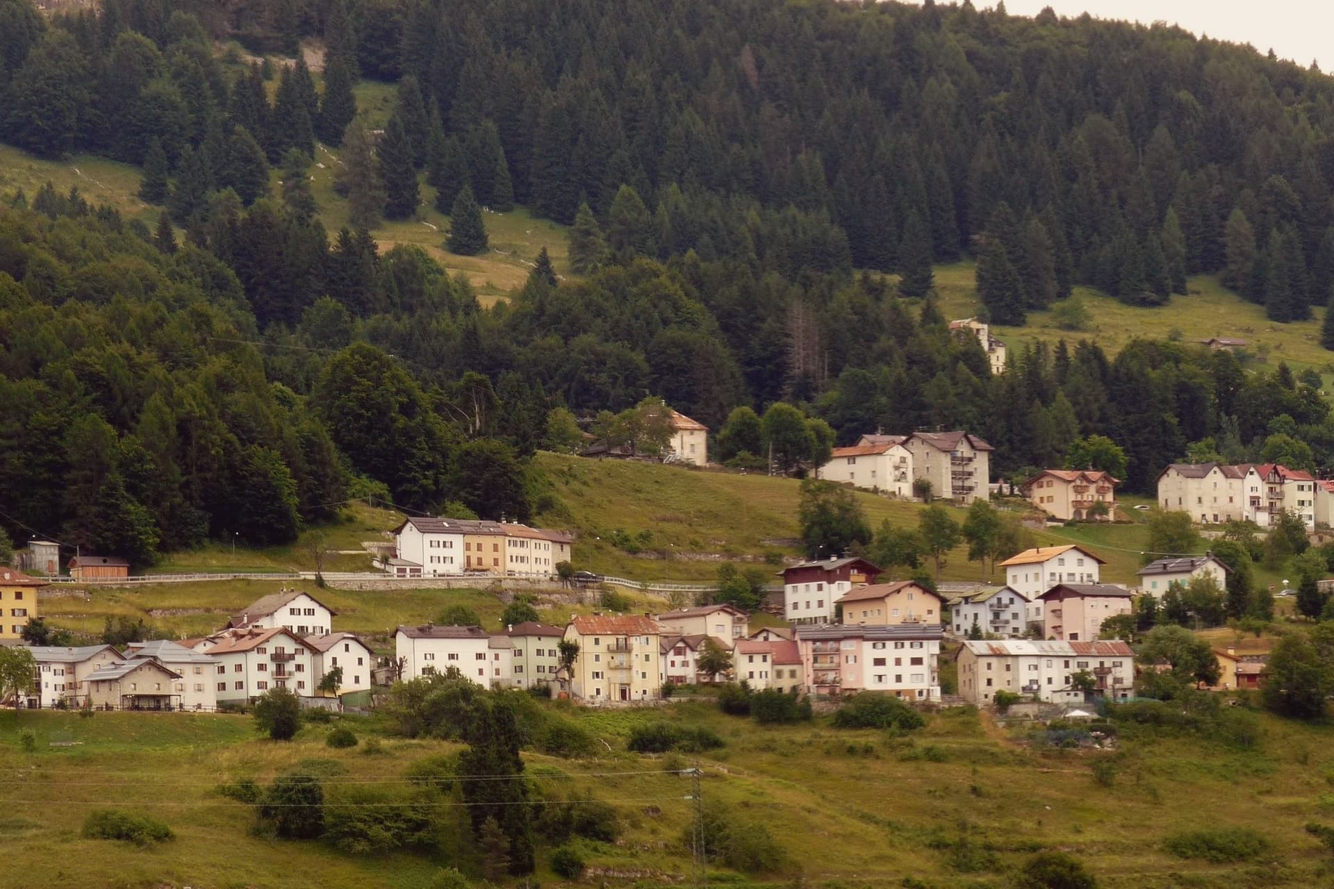
Luserna sits on the northwestern edge of the Folgaria plateau, four kilometres south of Lavarone and forty kilometres southeast of Trento. The village was founded around 1400 by Bavarian-Cimbrian colonists who moved up from nearby Lavarone, and the dialect they carried is classed by linguists as the oldest peripheral language of the German domain and the southernmost surviving in the Alps.
It was protected after the Second World War by the Gruber-De Gasperi Agreement and officially recognised in 2001 under Trentino's minority law, a legal history that runs a full half-century behind the community's own persistence in speaking the language at home. The village itself holds 267 residents, small enough that the museum complex, the restored peasant house, the old fort and the stone-and-wood core all sit within reach of each other rather than spread across a larger settlement.
What holds the place together is less any single building than the fact that the colonists' original tongue outlasted the empire whose frontier fort now stands as a museum piece nearby: the language, not the fortification, is what makes the plateau edge worth the four kilometres from Lavarone.
Lusernarhof have been named by a guide.
What to see in Luserna
- Centro Documentazione Lusérn. Documentation Centre with permanent exhibitions on the Cimbrian community, the Great War on the plateaus, prehistoric metallurgy, and Cimbrian bobbin lace.
- Casa Museo Haus von Prükk. House museum in a restored nineteenth-century Cimbrian peasant dwelling, presented by guides who explain the dialect and the traditions of plateau life.
- Werk Lusérn. Austro-Hungarian Great War fortress on the imperial frontier with Italy, heavily shelled in 1915 and now part of the plateau's fortification museum circuit.
How to get to Luserna
Trento is roughly 51 minutes away by road.
Our tip
June through September is the alpine summer at 1,333 metres: cool evenings even in July, hiking on the plateau between Luserna and Lavarone, and the museums open at full schedule. December through March is the ski season on the Alpe Cimbra circuit, with snow holding above 1,300 metres into early April. April and May are quiet shoulder months between the lift closure and the green-up of the high pastures; many services close.
Ossana
Why visit Ossana
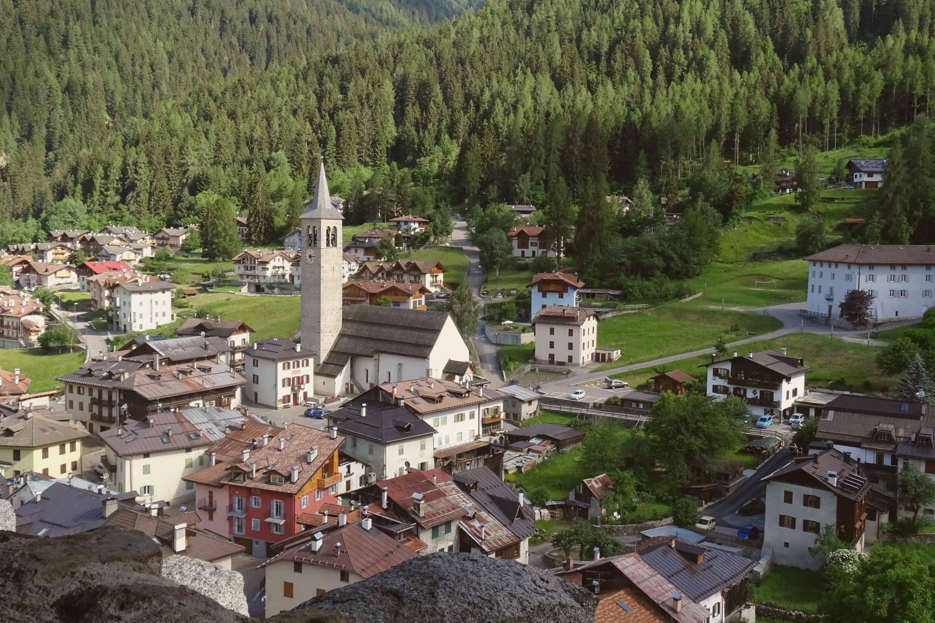
Ossana sits at 1,003 metres in upper Val di Sole, where the Vermigliana stream joins the Noce and the road climbs to the Passo del Tonale on the border with Lombardy. The keep was probably raised in the Lombard period, long before the 1191 record that first names it, and stood over the junction of the valley route and the mountain iron mines that made it worth holding.
Its owners changed with the centuries, prince-bishops, counts, and eventually an Austrian pacifist, tracing the wider shifts of power through the Adige and Sole valleys onto one hill above the village. The village below has kept its stone houses close around that hill, small enough that the castle is never out of sight from the streets.
What the place adds up to is a settlement built and rebuilt around a single point of control, the keep watching a road that once carried ore and armies and now carries travellers over the Tonale pass.
Antica Osteria have been named by a guide.
What to see in Ossana
- Castello di San Michele. Fortress dominating the village, restored by the Province of Trento and open as a visitable monument. It controlled the route between the Adige valley and the Brescian uplands, and the iron mines in the surrounding mountains.
- Borgo di Ossana. Compact historic centre of stone houses around the castle hill, recognised as one of I Borghi più Belli d'Italia in 2022.
- Chiesa di San Vigilio. Parish church of the village, with origins in the medieval period and frescoes inside the apse, a few steps below the castle.
How to get to Ossana
Trento is roughly 90 minutes away by road.
Our tip
June through September is the high-valley summer: trails open into the Stelvio National Park and the Adamello-Presanella group, the castle keeps long visiting hours, and night skies are dark enough for the village's dark-sky programme. December through March is the ski half of the year, with the Tonale and Pejo lifts ten kilometres away and the December presepi display drawing weekend visitors from across Trentino. April, May, October and November are the closure months.
Glurns
Why visit Glurns
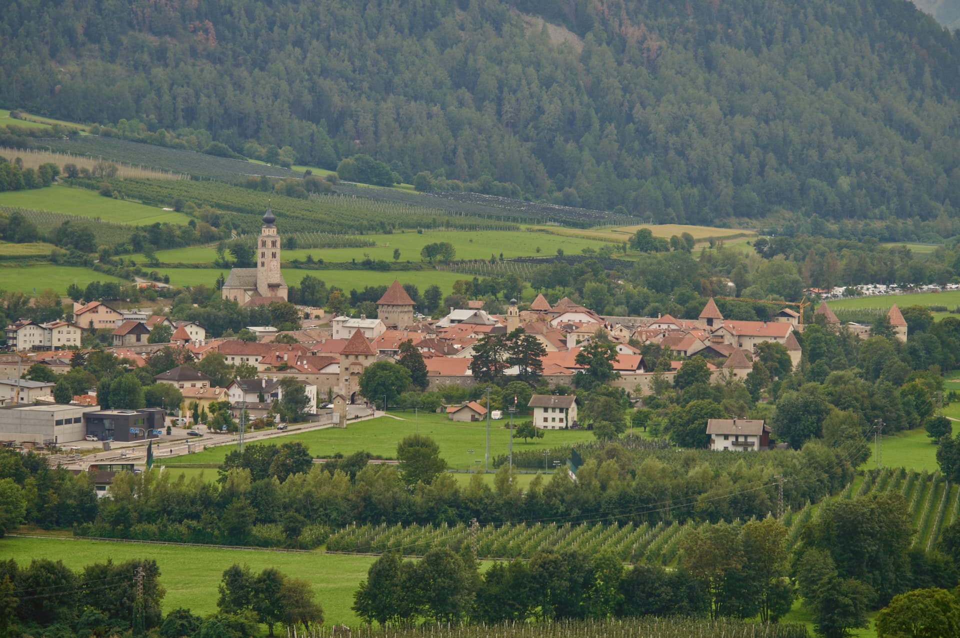
The town sits at 907 metres in the upper valley, twenty minutes by car from both the Austrian and Swiss borders, on the Adige river at the southern entrance to the national park. City status was awarded by Emperor Henry of Bohemia in 1304, an honor that has stayed attached to the place ever since even as the population inside the walls stayed under a thousand.
After the Battle of Calven in 1499, the Habsburgs under Emperor Maximilian I rebuilt the town as a bulwark against the forces of the Three Leagues of Graubünden, and it is that rebuilding which produced the fortification standing today. The walled core and the church outside it mark the two halves of the town: the streets and Lauben arcades, paved in cobble, enclosed within the ring of walls, and the parish church standing apart on the riverbank, holding its own late Gothic frescoes away from the defended center.
A city built for defense against the Three Leagues of Graubünden still reads, in its layout, as a place organized entirely around the line where the walls stand and the ground just beyond them: the guarded interior on one side, the river and the open approach to the mountains on the other.
Flurin have been named by a guide.
What to see in Glurns
- Mura cittadine. Walls built under Emperor Maximilian I after 1499, following the Battle of Calven, as a bulwark against the forces of the Three Leagues of Graubünden. The patrol path still runs continuous along the inside face.
- Centro storico. Walled core of unbroken three-storey Lauben arcades along the two main streets, paved in stone and listed on the Borghi più belli d'Italia.
- Chiesa di San Pancrazio. Parish church just outside the walls on the bank of the Adige, with a Gothic nave and a series of late medieval wall frescoes inside.
How to get to Glurns
There is a railway station in the town, so you can arrive without a car and never need one while you are here. Bolzano is roughly 102 minutes away by road.
Our tip
May through October is the open season in the upper Val Venosta. Late May brings green on the valley floor and the start of the Stelvio Park hiking calendar from Glorenza north. June through September is the busiest period, with the Stelvio passes open, the Adige cycle path running from Resia south, and Glorenza markets under the arcades on Tuesdays and Fridays.
Corvara in Badia
Why visit Corvara in Badia
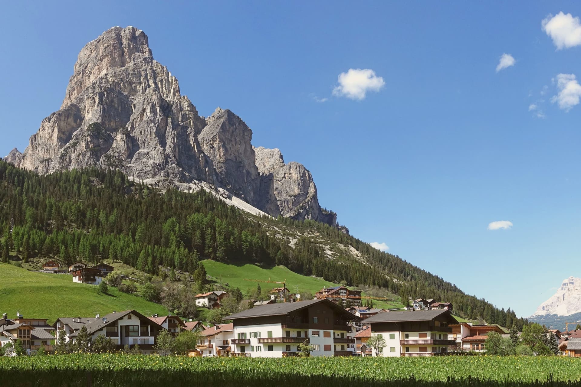
Corvara sits at 1,568 metres in a wide basin at the head of the Val Badia, below the rock spire of the Sassongher and inside the Dolomites UNESCO area. Ladin is the everyday language: in the 2024 census 87 percent of residents named it as their first tongue, with Italian and German distant second and third.
The settlement was a scattered group of farms until tourism arrived in the early twentieth century, and Corvara is considered the birthplace of organised Alpine tourism in the Val Badia. The village is one of four bases on the Sellaronda, the forty-kilometre ski circuit that loops the Sella massif through Corvara, Arabba, Canazei and Selva di Val Gardena on a single lift pass.
Above the village, the Pralongià plateau opens a long view to the Marmolada glacier. The Gran Risa piste at the next hamlet of La Villa hosts the men's giant slalom on the World Cup tour each December.
La Stüa de Michil - Simone Cantafio, KELINA Fine Dine, Ladinia and 4 more have been named by a guide.
What to see in Corvara in Badia
- Chiesa di Santa Caterina. Late Gothic church first documented in 1347 and consecrated to Saint Catherine in 1452, holding the only well-preserved winged altar in Val Badia, dated 1520.
- Sassongher. Rock peak at 2,665 metres above the village, the signature silhouette of Corvara and a classic via ferrata climb on the eastern flank.
- Altopiano di Pralongià. Grassy plateau above the village reached by cable car, with open views to the Marmolada glacier and the surrounding Dolomite groups.
How to get to Corvara in Badia
Bolzano is roughly 75 minutes away by road.
Our tip
December through March is the ski season, the village at full capacity around the Sellaronda lifts, with the men's World Cup giant slalom on the Gran Risa each December at La Villa next door. June through September is the summer Dolomite season, cool even in July at 1,568 metres, with hiking, via ferrata and gravel cycling across the Pralongià plateau and the Puez-Odle park. April and May are quiet shoulder months, snow gone from the village but lifts mostly closed and hotels shut between seasons.
Canazei
Why visit Canazei
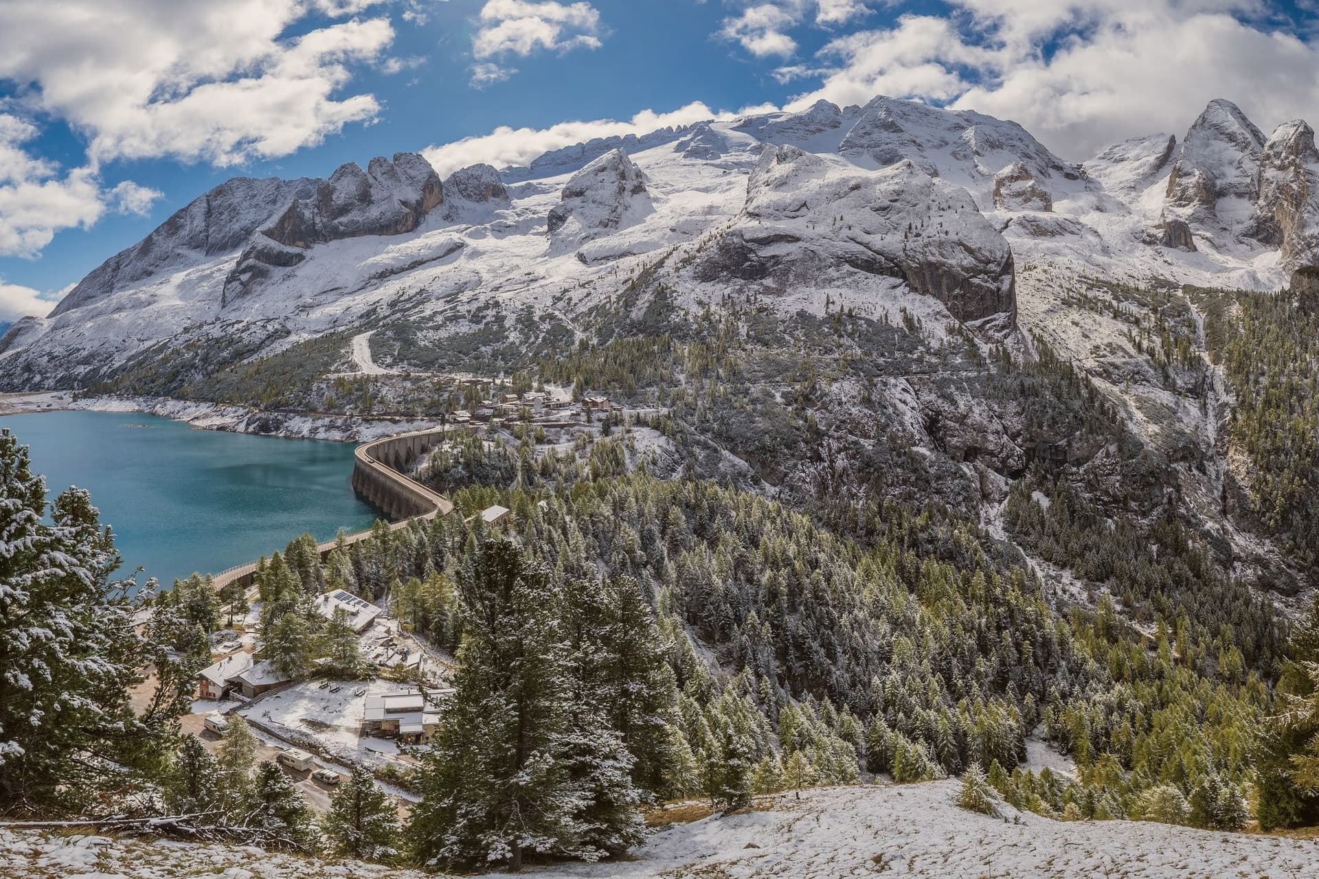
Canazei sits at 1,465 metres at the head of the Val di Fassa, one of the thirty highest towns in Italy, ringed by the Marmolada, the Sella Group and the Sassolungo. The commune includes the hamlets of Alba, Gries and Penia, which run together with the central village along the upper Avisio river.
Eight in ten residents speak Ladin as their first language, part of the small Dolomitic minority recognised by the autonomous statute, and the local Folk Group preserves the costumes, music and language traditions of the valley. Four ski areas connect from the village base: Belvedere, Ciampac, Col Rodella and the Marmolada cable car from Malga Ciapèla, all part of the Sellaronda and the wider Dolomiti Superski circuit.
The Pordoi cable car climbs to the Terrazza delle Dolomiti at 2,950 metres for a full view of the surrounding peaks, including the Marmolada at 3,343 metres, the highest summit in the Dolomites and a UNESCO World Heritage site since 2009.
Wine & Dine, Alla Locanda, Locanda degli Artisti Art Hotel and 1 more have been named by a guide.
What to see in Canazei
- Marmolada. Highest summit in the Dolomites at 3,343 metres, reached by cable car from Malga Ciapèla above Canazei, with the only Dolomitic glacier on its northern face.
- Passo Pordoi. Dolomite road pass at 2,239 metres with a cable car to Sass Pordoi at 2,950 metres, called the Terrazza delle Dolomiti for its 360-degree view.
- Belvedere Ski Area. Main winter base of Canazei, gondola-linked to the Sellaronda circuit and the lift system across the four Ladin valleys of the Sella group.
How to get to Canazei
Bolzano is roughly 86 minutes away by road.
Our tip
December through March is the ski season, the village's busiest months, with the Sellaronda circuit running from the Belvedere base and snow held above 1,500 metres into early April. June through September is the summer alpine season, with the Pordoi cable car running to the Terrazza delle Dolomiti and a full network of hiking and via ferrata routes on the Marmolada, Sassolungo and Sella. July and August are the peak months, with refuges full and bookings tight on the Fedaia and Pordoi passes. Gran Festa da d'Istà falls in September.
Moena
Why visit Moena
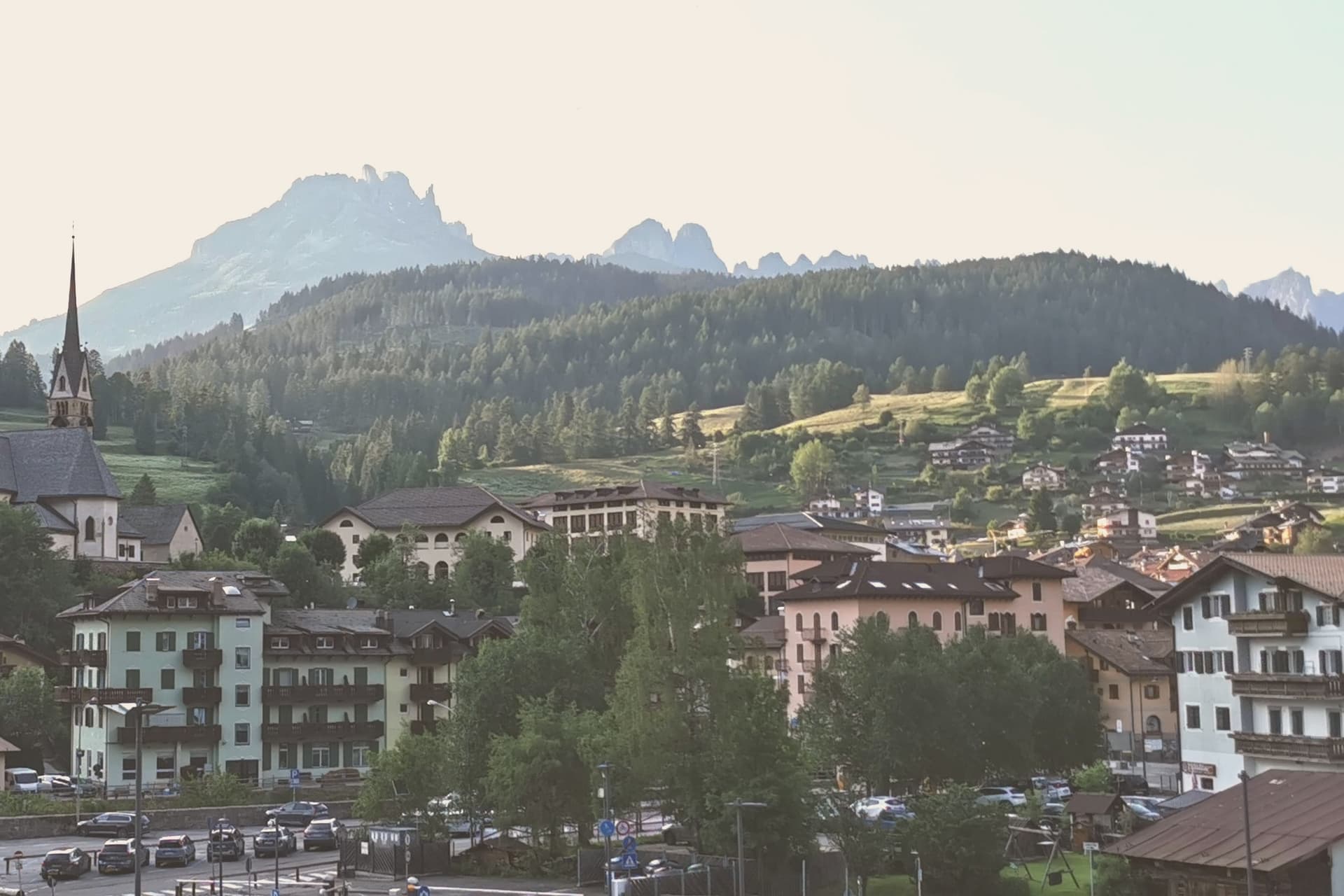
Moena sits at 1,184 metres at the entrance to Val di Fassa, which climbs north toward Canazei and the Sella massif. To the southeast a side valley rises toward the Passo San Pellegrino and the Marmolada group, while a plateau above the village, reached by cable car, opens onto the Catinaccio, Latemar and Pale di San Martino to the south.
The village is the largest in the valley and functions as its entrance point, with the high peaks visible on three sides and the pastures of San Pellegrino working land rather than backdrop. What holds the place together is less the geography than what the two festivals and the church commemorate: a language kept alive as an everyday tongue, a costume festival built around a foreign soldier's arrival, and a painter who left and came back.
Moena reads less like a single Alpine village and more like a crossing point, between valleys, and between a local story and the outside events that keep getting folded into it.
Malga Panna, Foresta, Ostaria Tyrol and 3 more have been named by a guide.
What to see in Moena
- Chiesa di San Vigilio. Parish church rebuilt across the centuries, with a gilded wooden altar by Valentino Poschiavin and 18th-century paintings by Valentino Rovisi. It also holds work by Domenico Chiocchetti.
- Chiesa di San Volfango. Small Romanesque church next to the parish, with 15th-century frescoes and a wooden Baroque ceiling carved by Giovanni Guadagnini in the 17th century.
- Museo Ladin de Fascia (sezione Moena). The Ladin cultural museum network with a Moena exhibit on local language, costume and rural life in the lower Val di Fassa.
How to get to Moena
Bolzano is roughly 65 minutes away by road.
Our tip
June through September brings the green Dolomite season: alpine pastures open, the Catinaccio and Latemar are walkable from the cable cars above town, and the August Turchia festival fills the streets for three days. December through March is the ski half of the year, with lifts running on Alpe Lusia and over the Passo San Pellegrino into the Tre Valli circuit. April, May, October and November are quiet, between seasons. Festival del Puzzone falls in September.
Toblach
Why visit Toblach
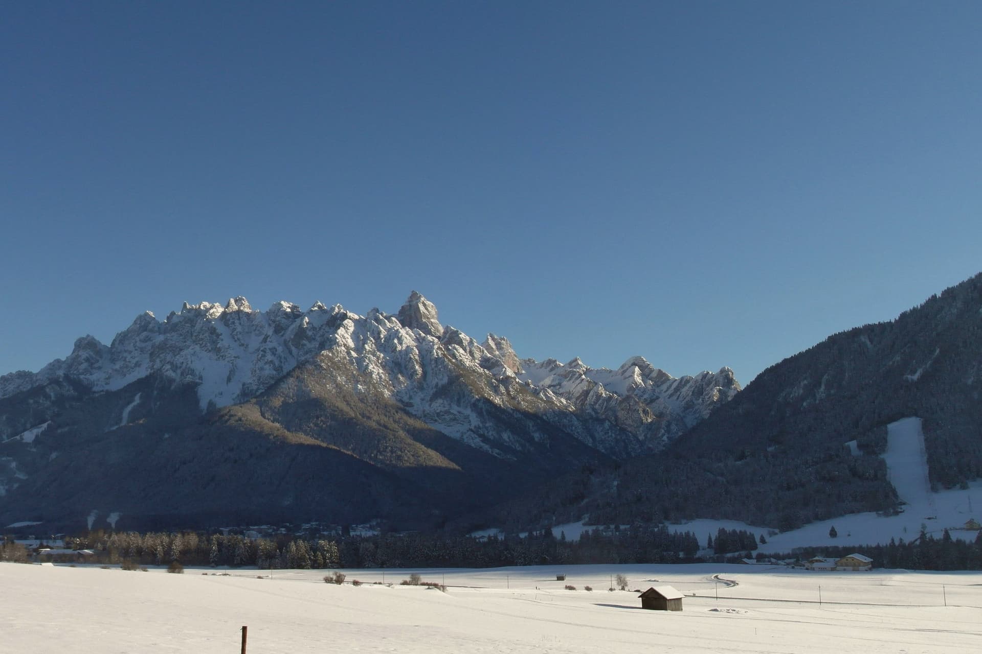
Dobbiaco sits at 1,256 metres in the upper Val Pusteria, on the Austrian border, its written record going back to 827. The old settlement, Alt-Toblach, grew around the parish church, while the newer part of town took shape lower down around the railway station built alongside the hotel that opened in 1877, which turned Dobbiaco into one of the first alpine resorts in the Habsburg empire.
Further out in the woods at Alt-Schluderbach stands the cabin where a composer once retreated each summer to write, apart from the hotel guests and the trains. South of the settlement the land opens into the Fanes-Sennes-Braies Nature Park, holding an alpine lake with a trail for walkers, and the old railbed continues in that direction as a route over Cimabanche pass toward Cortina d'Ampezzo.
Beyond all of it, reached by way of Val di Landro and Misurina, rise the three spires that anchor the eastern Dolomites. The Gustav Mahler Musikwochen festival fills the town each July and August with concerts named for the man who once needed its quiet.
Taken together, the town reads as three layers set one behind the other: a medieval nucleus, a Habsburg-era resort built on the railway, and beyond both, the mountains and woods that drew a composer to withdraw and now draw everyone else to pass through.
Tilia have been named by a guide.
What to see in Toblach
- Chiesa di San Giovanni Battista. Rebuilt 1764-1774 over the remains of a ninth-century Benedictine chapel, standing at the centre of the historic settlement of Alt-Toblach, the nucleus the rest of the town grew around.
- Grand Hotel Toblach. Built 1877-1878 beside the new railway station. The building now holds the nature park visitor centre and the Mahler Auditorium, where the composer's name is heard again each summer.
- Lago di Dobbiaco/Toblacher See. Alpine lake south of town in the Fanes-Sennes-Braies Nature Park, with a circular educational trail and observation platforms for waterfowl.
How to get to Toblach
There is a railway station in the town, so you can arrive without a car and never need one while you are here. Bolzano is roughly 93 minutes away by road.
Our tip
June through September is the summer Dolomite season, with cool evenings, the Mahler Musikwochen in July and August at the Grand Hotel auditorium, and the Tre Cime and Dobbiaco-Cortina cycle path at their busiest. December through March is the ski and Nordic season: the Dobbiaco-Cortina cross-country track replaces the cycle path, and the Tre Cime ski circuit runs from nearby Plan de Corones. April and May are quiet shoulder months, snow gone but many lifts and hotels closed.
Cavalese
Why visit Cavalese
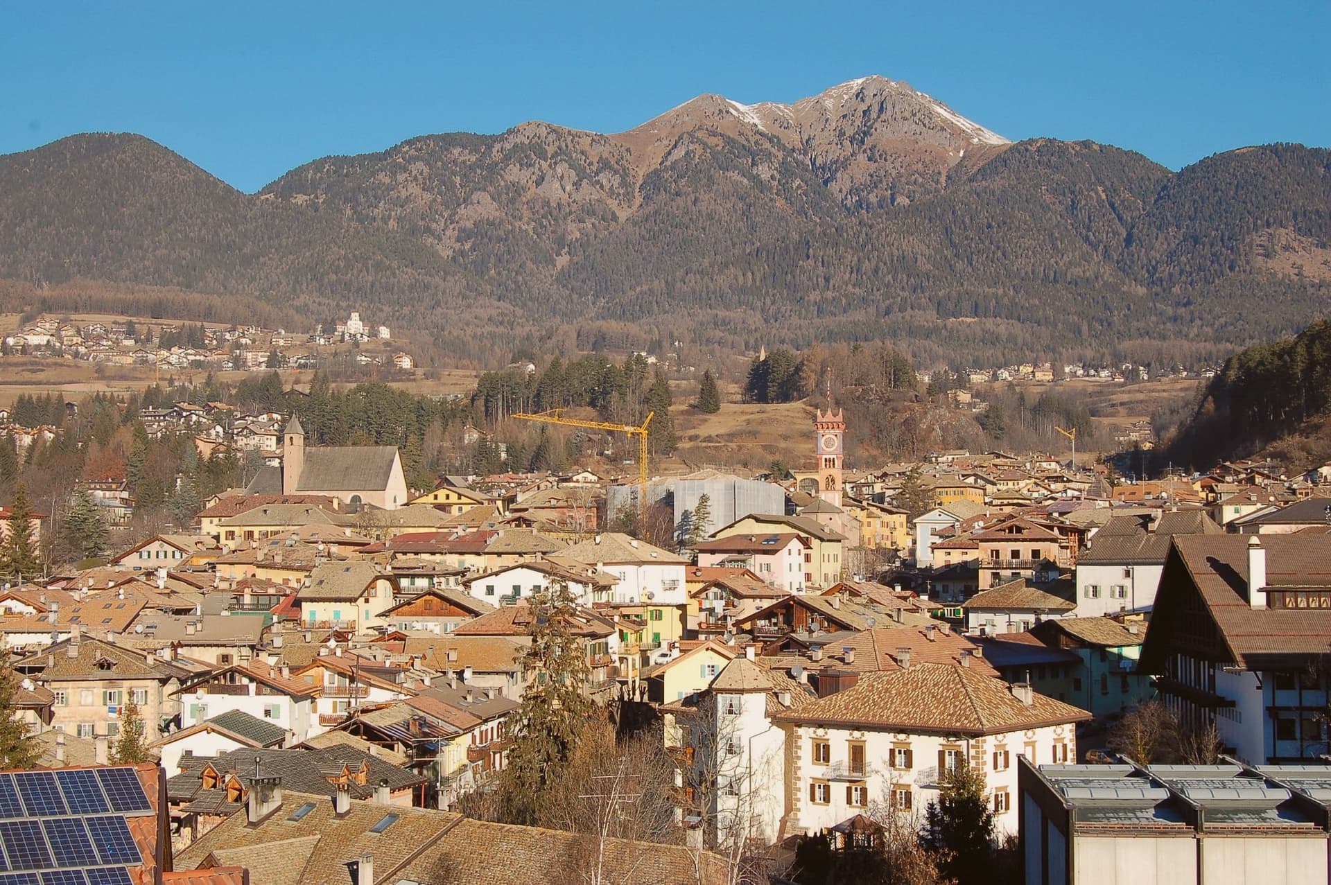
Cavalese sits at 1,000 metres on a south-facing terrace above the Avisio, forty kilometres northeast of Trento, the main town of the Val di Fiemme. The valley's eleven communes held their forest commons in common under the Magnifica Comunità, the self-governing body founded by the founding charter of 1111, and Cavalese has kept its seat through the Bavarian abolition of 1807 and every legal change since.
The valley floor carries the working memory of that governance: the archive of parchments, the frescoed council chambers, the bench in the open air where disputes were once judged. Above the town, the cableway to the Alpe Cermis climbs toward 1,912 metres, and the flat route along the Avisio ties Cavalese to the other Fiemme communes strung along the valley floor from Predazzo down toward the Adige.
Nine centuries of continuous self-rule and a valley of communes bound by a single river explain why Cavalese reads less like a single town than like the administrative floor of the whole valley.
El Molin, Orso Grigio have been named by a guide.
What to see in Cavalese
- Palazzo della Magnifica Comunità di Fiemme. Medieval bishop's residence enlarged in the Renaissance, seat of the community since 1810, with a picture gallery and an archive of parchments from the thirteenth to eighteenth centuries.
- Pieve di Santa Maria Assunta. Parish church of Cavalese, consecrated in 1134 on an older foundation, standing beside the park where the valley's representatives once sat in judgment.
- Banco della Reson. Stone bench in the Parco della Pieve where the representatives named in the Patti Ghebardini met as an open-air parliament to judge valley disputes.
How to get to Cavalese
Bolzano is roughly 95 minutes away by road.
Our tip
June through September is the high-valley season: meadows open above 1,000 metres, the Latemar and the Lagorai are reachable on day walks from the town, and the cycle path along the Avisio fills with day-trippers. December through March is the ski season on Alpe Cermis and the Lavazè plateau, with snow held above 1,000 metres into early April and the Tour de Ski final climb up the Cermis slope each January. April, May, October and November are the quiet shoulder months between the seasons, when the cable car runs reduced schedules and the valley returns to its residents.
St. Ulrich
Why visit St. Ulrich
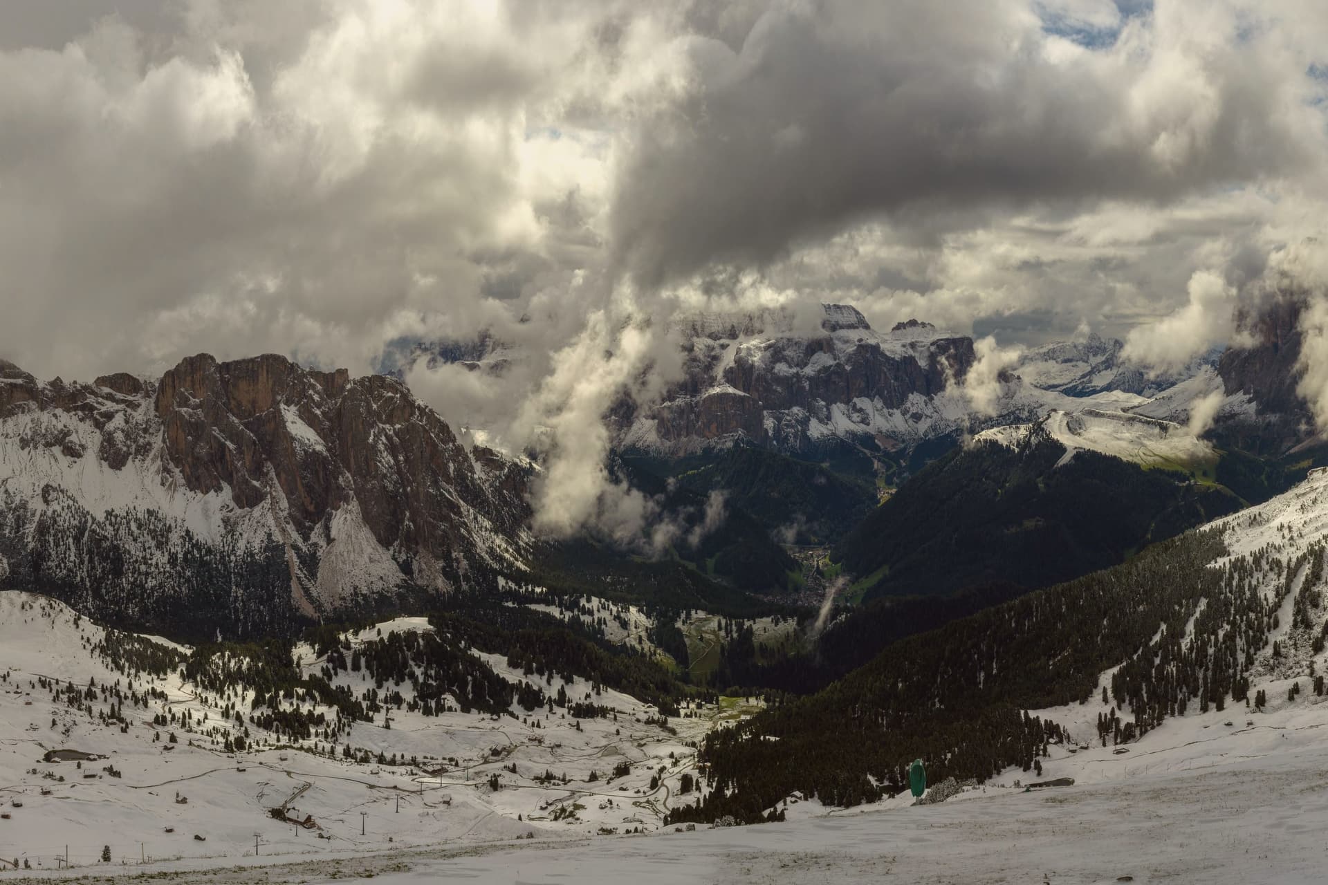
The valley climbs east from the Eisack toward the Sella and the Sassolungo, and the town sits at its middle point. Almost all residents speak Ladin at home, and signage runs trilingual in Ladin, German and Italian.
Three cable cars leave the village in three directions: one to the northwest onto a plateau, one north onto a long ridge below the Odle, and one south onto a high meadow that forms the valley's southern edge. The museum inside the Cësa di Ladins holds the record of the valley's carving tradition alongside fossils from the surrounding peaks and material on Luis Trenker, the mountaineer-actor-director who came from here.
The layout, a village hemmed by three lifts and named for the saint of its own parish church, reads as a place organized entirely around the ground it sits on: craft below, peaks and plateaus in every direction above.
Anna Stuben dell'Hotel Gardena have been named by a guide.
What to see in St. Ulrich
- Parish church (St. Ulrich/San Udalrico). Neoclassical church with Baroque elements, rebuilt in the late 18th century, dedicated to the Epiphany and to St. Ulrich, the patron saint who gives the town its German name.
- Museum Gherdëina. Local-heritage museum inside the Cësa di Ladins documenting four centuries of woodcarving, wooden toys, sacred sculpture, Dolomite fossils and the Trenker family archive.
- Seceda. Long limestone ridge reached by cable car from the village, with the Odle/Geisler peaks rising sharply to the north and high meadows dropping toward the valley.
How to get to St. Ulrich
Bolzano is roughly 43 minutes away by road.
Our tip
June through September is the green Dolomite season: the Alpe di Siusi opens fully, the Seceda ridge is walkable from the cable car, and the rifugi of the Odle and Sassolungo run their full summer programmes. December through March is the ski half of the year, with the Sellaronda circuit accessed directly from Ortisei. April, May and November are the closure months.
More from Anywhere Italy
- The best small ski towns that eat well in Trentino-Alto Adige/Südtirol
- The best high-altitude villages with a serious restaurant in Trentino-Alto Adige/Südtirol
- The best small towns that eat well in the province of Trento
- The best ski towns with a serious restaurant in Trentino-Alto Adige/Südtirol
- The 10 best high-altitude villages in the province of Trento
- The best small mountain towns within 90 minutes of Bolzano