
The 10 best high-altitude villages in the province of Trento
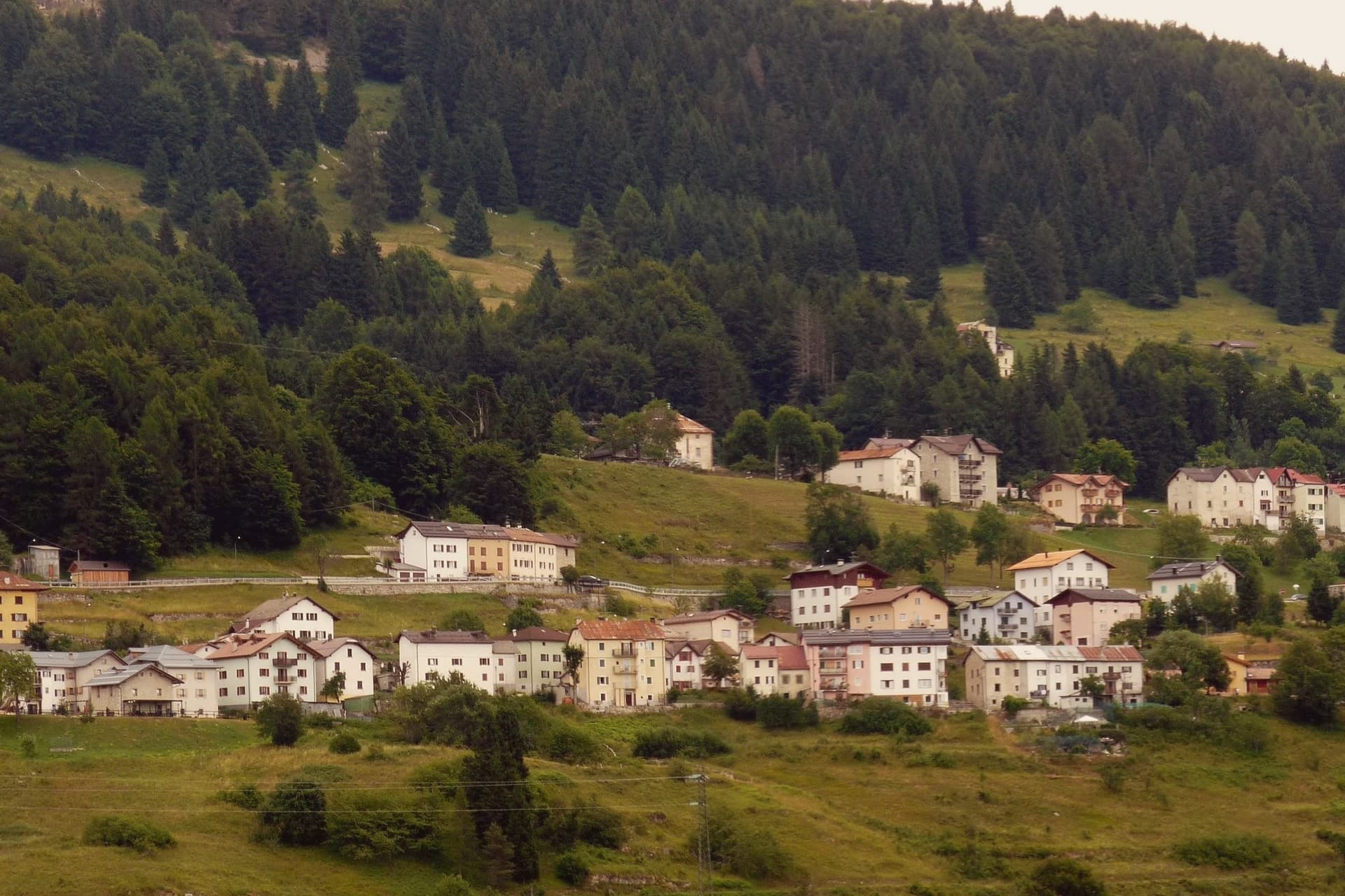
Altitude changes what a village in Trentino smells like. Up on the plateaux and the sunlit shelves above the valley floors, the air carries resin from spruce and larch, cut hay in high summer, woodsmoke by late September. The building material shifts with the height: stone and lime plaster at the base, timber balconies stacked above, roofs pitched hard for snow. Food follows the same logic, canederli in broth, barley soup, polenta with Trentino mountain cheese, apple strudel where the Austrian border is still audible in the dialect. Winter brings groomed pistes and ski touring routes; June brings wildflower meadows and the smell of the first cut.
Most visitors to the province arrive with one word in mind, and it is usually Madonna di Campiglio, or else the Dolomiti di Brenta and the lift-served circuits around it. The reasons are sound: serious skiing, high rock, a season that runs long. The consequence is car parks full by mid-morning, hotel rates that climb with the school holidays, and queues at the cable car that feel imported from somewhere else. The mountains hold up under it, but the villages beneath do not always feel like villages any more.
The same geology continues in every direction past the famous names. Trentino is largely a province of high shelves, plateaux and side valleys, and the towns on this list sit on them, at heights where the winter is long and the pasture starts where the road ends. Some have a ski area and a lift of their own, some have a lake and a forest and little else, one still speaks a Germanic language older than the state. Fewer people go, and the villages remain the size they always were.
Of the 21 communes we have mapped in the province of Trento, 10 qualify as high-altitude villages: each sits at 800 metres or higher. The smallest, Luserna, has 267 residents.
If you are still choosing, we have also written The best small high-altitude villages within 90 minutes of Trento and The best hidden ski towns in the province of Trento.
Luserna
Why visit Luserna
Luserna sits on the northwestern edge of the Folgaria plateau, four kilometres south of Lavarone and forty kilometres southeast of Trento. The village was founded around 1400 by Bavarian-Cimbrian colonists who moved up from nearby Lavarone, and the dialect they carried is classed by linguists as the oldest peripheral language of the German domain and the southernmost surviving in the Alps.
It was protected after the Second World War by the Gruber-De Gasperi Agreement and officially recognised in 2001 under Trentino's minority law, a legal history that runs a full half-century behind the community's own persistence in speaking the language at home. The village itself holds 267 residents, small enough that the museum complex, the restored peasant house, the old fort and the stone-and-wood core all sit within reach of each other rather than spread across a larger settlement.
What holds the place together is less any single building than the fact that the colonists' original tongue outlasted the empire whose frontier fort now stands as a museum piece nearby: the language, not the fortification, is what makes the plateau edge worth the four kilometres from Lavarone.
The village sits at 1333 metres.
What to see in Luserna
- Centro Documentazione Lusérn. Documentation Centre with permanent exhibitions on the Cimbrian community, the Great War on the plateaus, prehistoric metallurgy, and Cimbrian bobbin lace.
- Casa Museo Haus von Prükk. House museum in a restored nineteenth-century Cimbrian peasant dwelling, presented by guides who explain the dialect and the traditions of plateau life.
- Werk Lusérn. Austro-Hungarian Great War fortress on the imperial frontier with Italy, heavily shelled in 1915 and now part of the plateau's fortification museum circuit.
How to get to Luserna
Trento is roughly 51 minutes away by road.
Our tip
June through September is the alpine summer at 1,333 metres: cool evenings even in July, hiking on the plateau between Luserna and Lavarone, and the museums open at full schedule. December through March is the ski season on the Alpe Cimbra circuit, with snow holding above 1,300 metres into early April. April and May are quiet shoulder months between the lift closure and the green-up of the high pastures; many services close.
Pieve Tesino
Why visit Pieve Tesino
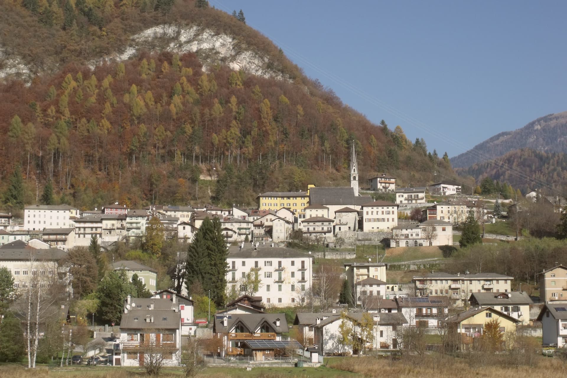
Pieve Tesino sits at 843 metres on the Altopiano del Tesino, a small plateau in eastern Trentino about forty kilometres from Trento, shared with the villages of Castello Tesino and Cinte Tesino. The plateau's isolation shaped its economy: with little arable land to keep them, generations of families went out across Europe instead, working as itinerant sellers of prints, books and small art objects, and some of them settled permanently, founding shops as far off as Madrid and Saint Petersburg.
That outward movement sits alongside the village's other export, a man rather than a trade. Alcide De Gasperi was born here in 1881 and went on to lead eight successive governments between 1945 and 1953, working alongside Schuman, Adenauer and Monnet on the early shape of European integration.
Above the houses, the arboretum climbs through alpine flora to a garden built in the shape of a parliamentary chamber, a piece of landscaping that answers his career directly rather than referring back to the trading families below. The plateau, in other words, has sent two things outward across the same borders: goods carried by hand, and an idea of how the continent's institutions might fit together.
Both are commemorated here, but neither was built here to stay.
The village sits at 843 metres.
What to see in Pieve Tesino
- Casa Museo Alcide De Gasperi. The statesman's birthplace, opened as a museum in 2006 and set on the European route of the founding fathers' homes, recognised with the European Heritage Label.
- Museo Per Via. A museum tracing the generations who left the plateau to sell prints, books and small art objects abroad, with the routes and trades they built laid out in detail.
- Arboreto di Pieve Tesino. Meadows, wetlands and woodland between 800 and 845 metres, crossed by a signed route of an hour and a half through alpine flora.
How to get to Pieve Tesino
Trento is roughly 75 minutes away by road.
Our tip
May through October is the open season for the plateau. The arboretum and the Giardino d'Europa run their full programmes, the trails into the Lagorai and toward Cima d'Asta are usable from late June through September, and the Casa Museo De Gasperi keeps long opening hours. April and November are quiet.
Ossana
Why visit Ossana
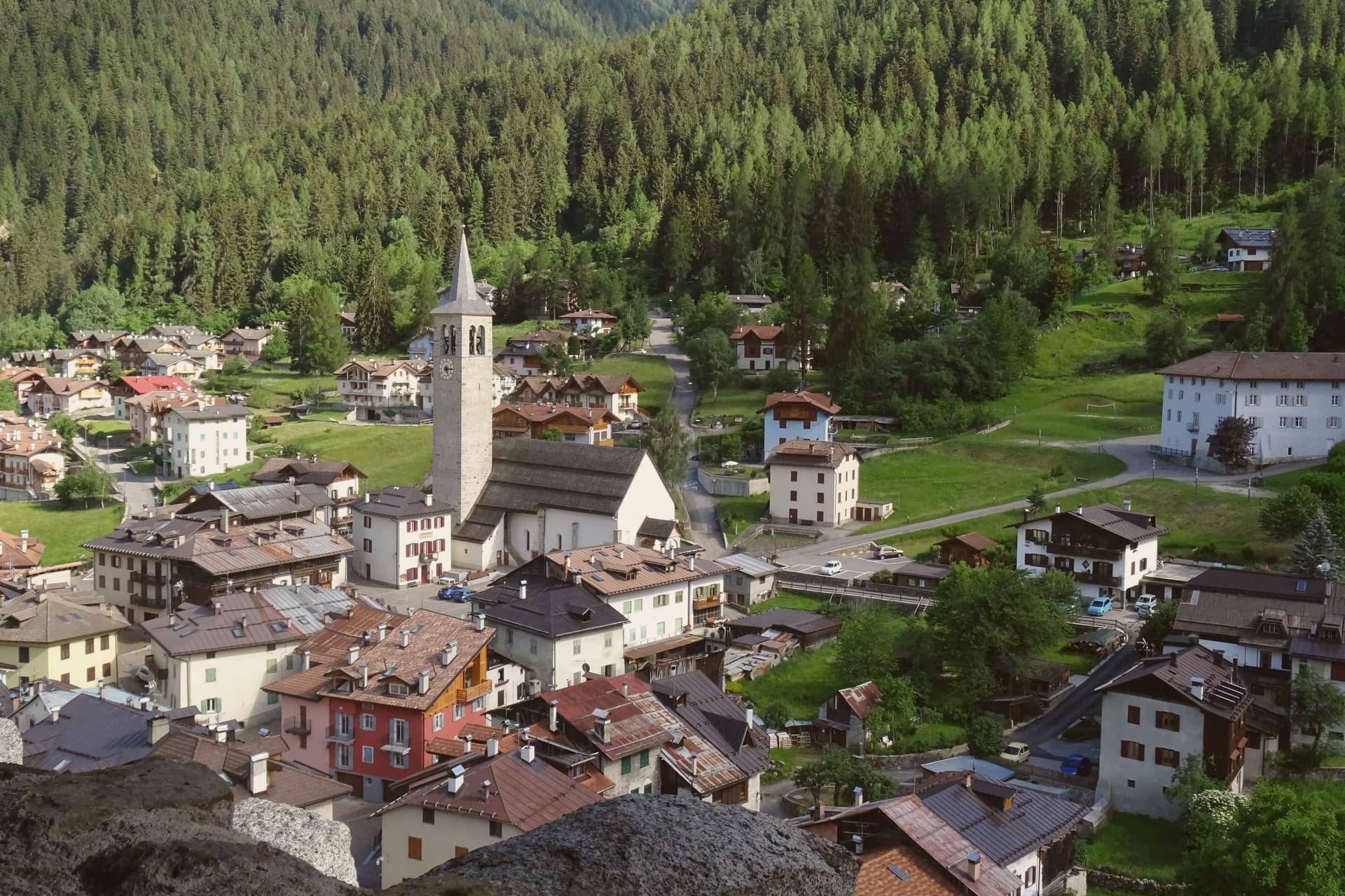
Ossana sits at 1,003 metres in upper Val di Sole, where the Vermigliana stream joins the Noce and the road climbs to the Passo del Tonale on the border with Lombardy. The keep was probably raised in the Lombard period, long before the 1191 record that first names it, and stood over the junction of the valley route and the mountain iron mines that made it worth holding.
Its owners changed with the centuries, prince-bishops, counts, and eventually an Austrian pacifist, tracing the wider shifts of power through the Adige and Sole valleys onto one hill above the village. The village below has kept its stone houses close around that hill, small enough that the castle is never out of sight from the streets.
What the place adds up to is a settlement built and rebuilt around a single point of control, the keep watching a road that once carried ore and armies and now carries travellers over the Tonale pass.
The village sits at 1003 metres.
What to see in Ossana
- Castello di San Michele. Fortress dominating the village, restored by the Province of Trento and open as a visitable monument. It controlled the route between the Adige valley and the Brescian uplands, and the iron mines in the surrounding mountains.
- Borgo di Ossana. Compact historic centre of stone houses around the castle hill, recognised as one of I Borghi più Belli d'Italia in 2022.
- Chiesa di San Vigilio. Parish church of the village, with origins in the medieval period and frescoes inside the apse, a few steps below the castle.
How to get to Ossana
Trento is roughly 90 minutes away by road.
Our tip
June through September is the high-valley summer: trails open into the Stelvio National Park and the Adamello-Presanella group, the castle keeps long visiting hours, and night skies are dark enough for the village's dark-sky programme. December through March is the ski half of the year, with the Tonale and Pejo lifts ten kilometres away and the December presepi display drawing weekend visitors from across Trentino. April, May, October and November are the closure months.
Molveno
Why visit Molveno
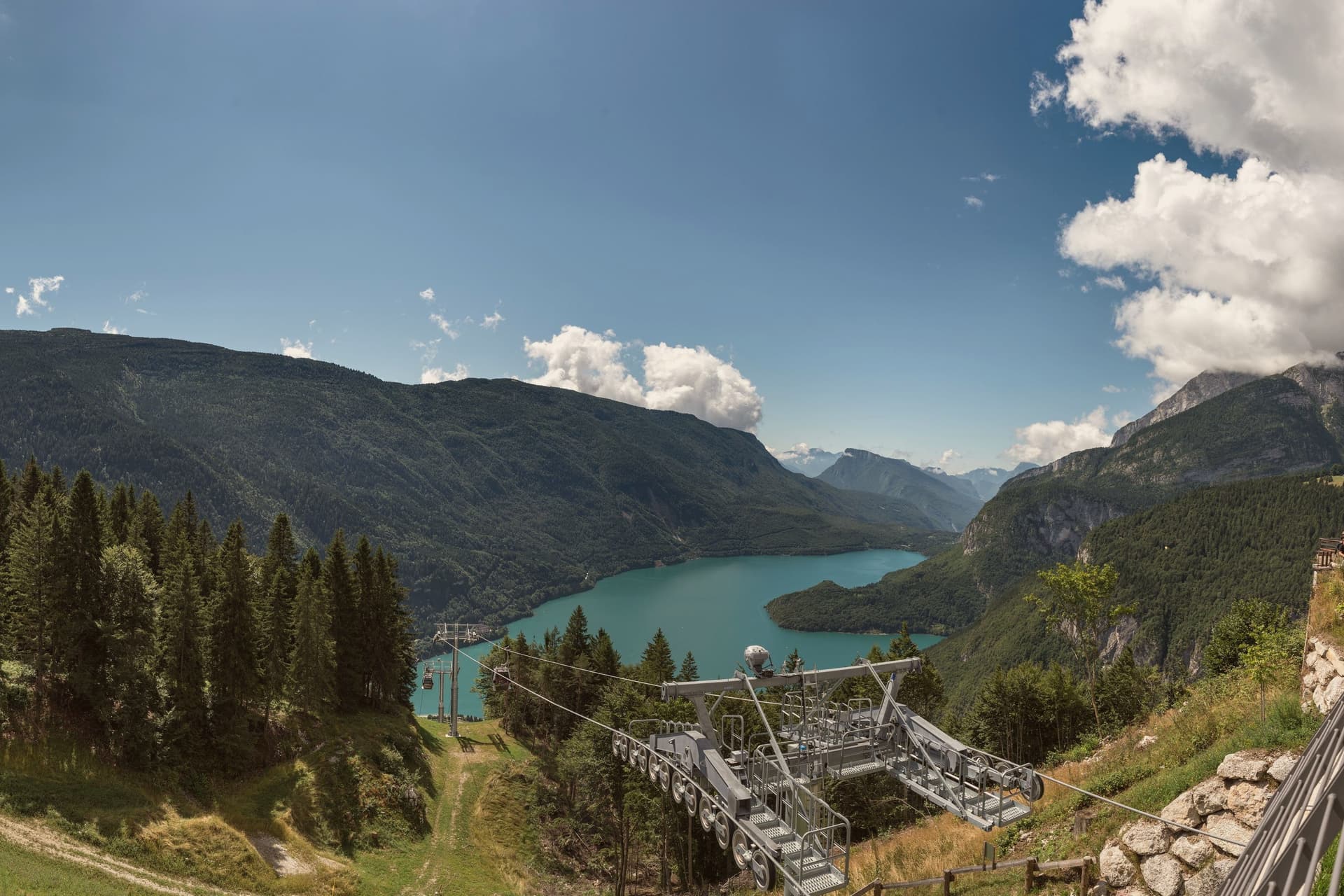
Molveno sits at 864 metres on the northern shore of a lake formed by a landslide about 4,000 years ago, held in on one side by the Brenta Dolomites and on the other by Monte Paganella. The village and its historic centre face the water from below the plateau of Pradel, which rises behind it and is reached by cable car, so the two halves of the place, lake shore and high ground, look at each other across the same stretch of blue.
The cemetery church stands slightly apart, above the centre, on the same slope. The lake is second-largest in the region by surface and the deepest in Trentino.
The nature park that holds the Brenta group begins right at the western shore, which means the mountains are not a backdrop seen from Molveno but a boundary the village is built against. The result is a place with almost no distance between the water, the settlement and the wild ground above it: the whole of Molveno can be read as a narrow shelf between a deep lake and a limestone wall.
The village sits at 864 metres.
What to see in Molveno
- Lago di Molveno. Four kilometres of water at 864 metres, formed by a landslide around 4,000 years ago, ringed by the Brenta Dolomites on one side and Monte Paganella on the other.
- Chiesa di San Vigilio. Gothic 13th-century church inside the village cemetery above the historic centre, with stone walls and a separate bell tower.
- Parco Naturale Adamello-Brenta. Largest protected area in Trentino, beginning at Molveno's western shore, with the Brenta Dolomites, brown bears, glaciers and a network of rifugi.
How to get to Molveno
Trento is roughly 71 minutes away by road.
Our tip
April through October is the running season for the lake. The water stays cold but is swimmable from late June through August; the perimeter path is 11 kilometres of mostly flat shoreline. July and August bring Italian-family crowds and full hotels around the small village core.
Andalo
Why visit Andalo
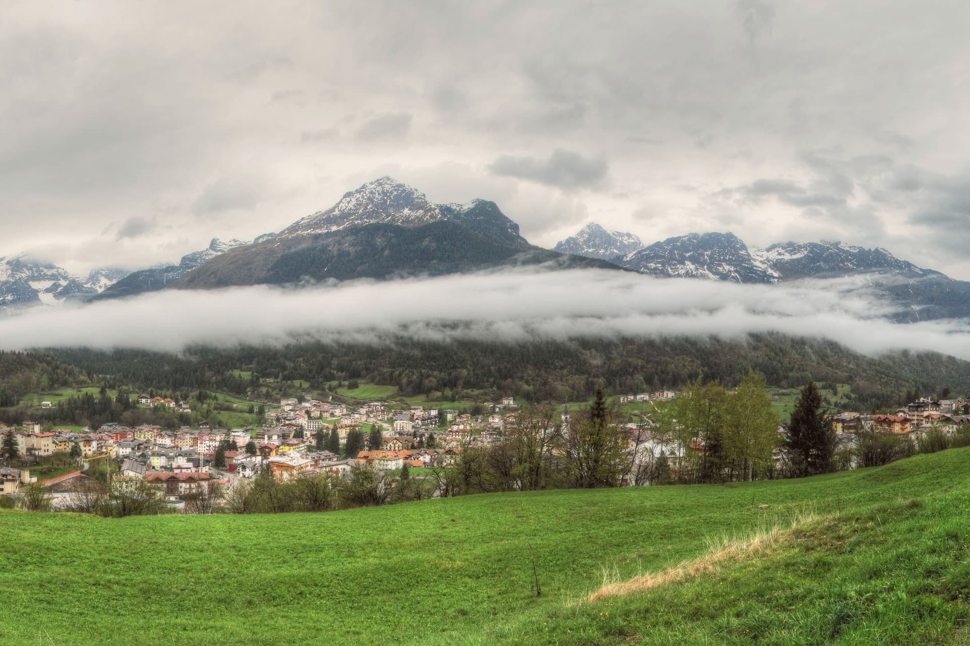
The plateau opens between Piz Galin at 2,442 metres and Cima Paganella at 2,125 metres, with the mountain massif on one side and Mount Paganella on the other. The settlement began in the Middle Ages as thirteen scattered masi, the farm clusters typical of Trentino's high pastures, which merged into a single town over the centuries: the grassy pass the village now occupies was, in effect, assembled from separate hamlets rather than founded as one place.
From the second half of the twentieth century the village grew into a winter sports resort, with lift infrastructure climbing from the village centre toward the higher slopes and summit. The lake at the edge of the settlement follows its own seasonal rhythm, full in spring and drained by late summer, apart from the built-up resort around it.
Together the pieces read as a farming settlement that kept its old shape at the centre while building a ski resort around its edge, with a nature park and a disappearing lake as the fixed, non-negotiable backdrop to both.
The village sits at 1042 metres.
What to see in Andalo
- Cima Paganella. Summit reached by gondola from the village centre via Doss Pelà, with panoramic views over the Brenta Dolomites and the Adige valley.
- Lago di Andalo. The lake sits at the edge of the village, a stretch of water that is full in spring and gone by late summer, its bed exposed where the shoreline had been.
- Parco Naturale Adamello-Brenta. The park covers most of the Andalo territory, taking in the Brenta Dolomites group inscribed in the UNESCO World Heritage list in 2009.
How to get to Andalo
Trento is roughly 39 minutes away by road.
Our tip
December through March is the ski season, the village's busiest months, with the Paganella lifts running from the centre and snow held above 1,000 metres into early April. June through September is the summer alpine season: cool evenings even in July, hiking and biking on the plateau, and the lake at its fullest in late June. April and May are quiet shoulder months when snow has gone and the meadows have not yet bloomed; many lifts and hotels close.
Lavarone
Why visit Lavarone
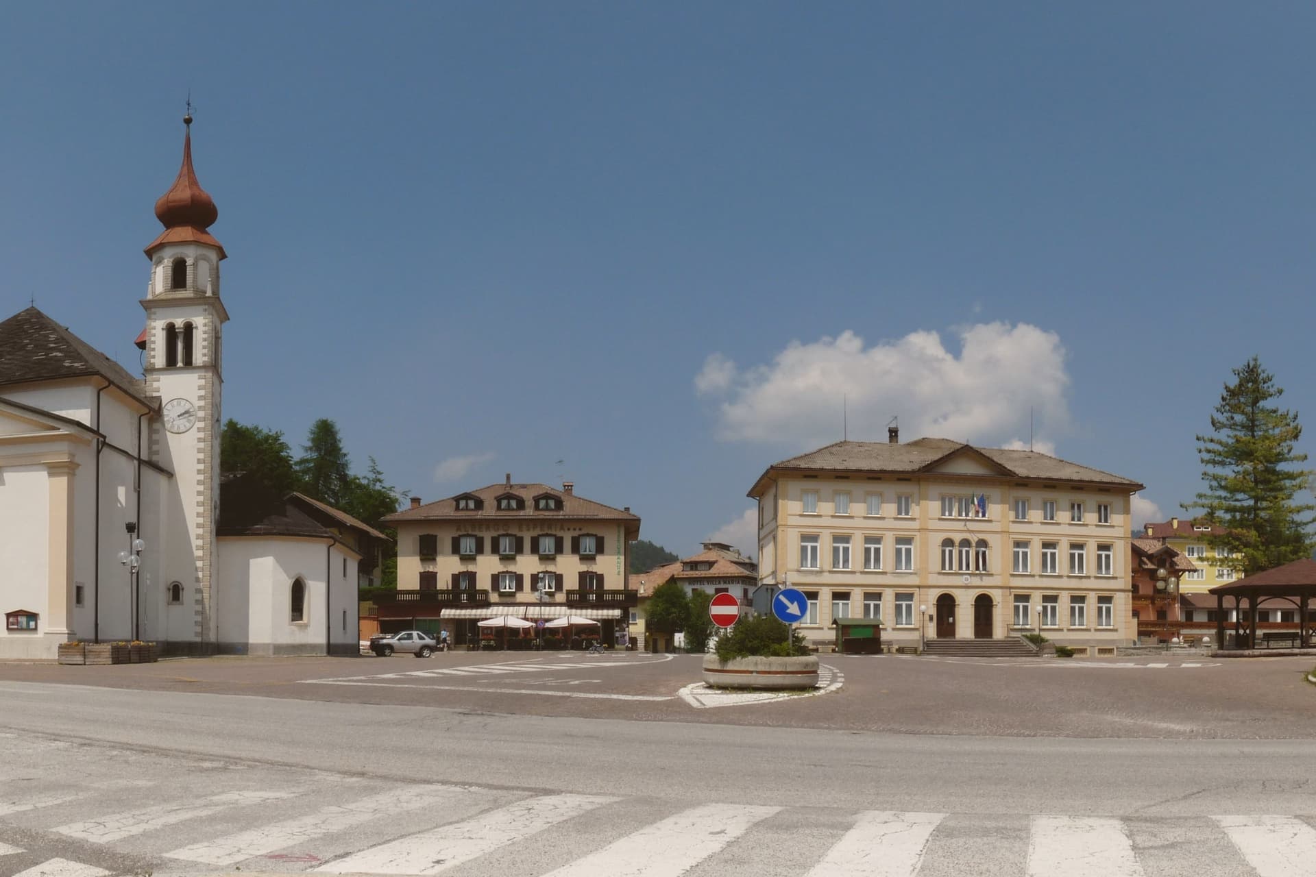
The plateau lies between the Folgaria highlands and the Cimbrian island of Luserna, forming the southern edge of the Alpe Cimbra ski circuit. Its territory is a scatter of twenty hamlets spread across pasture and conifer woods, settled by Bavarian-Cimbrian colonists between the tenth and thirteenth centuries, a history that still binds the plateau to Luserna under the same historic community.
At the centre of this scattered geography sits the lake, a sinkhole slowly filled with water, and to the south the ground rises to a limestone spur over the Val d'Astico where the fort was raised to mark the old imperial border with the Kingdom of Italy. The two landmarks sit at opposite ends of the same plateau, one low and wooded, one high and exposed, and both look out over the same valley that once divided empires.
In winter the lifts run from the hamlets above 1,000 metres, closing the loop between a pastoral upland and a line built for war.
The village sits at 1172 metres.
What to see in Lavarone
- Forte Belvedere Gschwent. Austro-Hungarian fortress built 1908-1912 on a limestone spur at 1,177 metres over the Val d'Astico, with armoured cupolas and a Great War museum.
- Lago di Lavarone. Karst lake at 1,079 metres, formed by the filling of a sinkhole, awarded the Bandiera Blu for water quality and ringed by a conifer-shaded walking path.
- Altopiano di Lavarone. Forested plateau between the Folgaria highlands and Luserna, a scatter of twenty hamlets across pasture and woods at 1,000 to 1,200 metres.
How to get to Lavarone
Trento is roughly 42 minutes away by road.
Our tip
June through September is the alpine summer: cool evenings even in July, hiking on the plateau, swimming and sailing on the Bandiera Blu lake, and the Forte Belvedere open to visitors. December through March is the ski season, with the Alpe Cimbra lifts running from the plateau hamlets above 1,000 metres and snow holding into early April. April and May are quiet shoulder months between the ski closure and the green-up of the meadows; many hotels close.
Canazei
Why visit Canazei
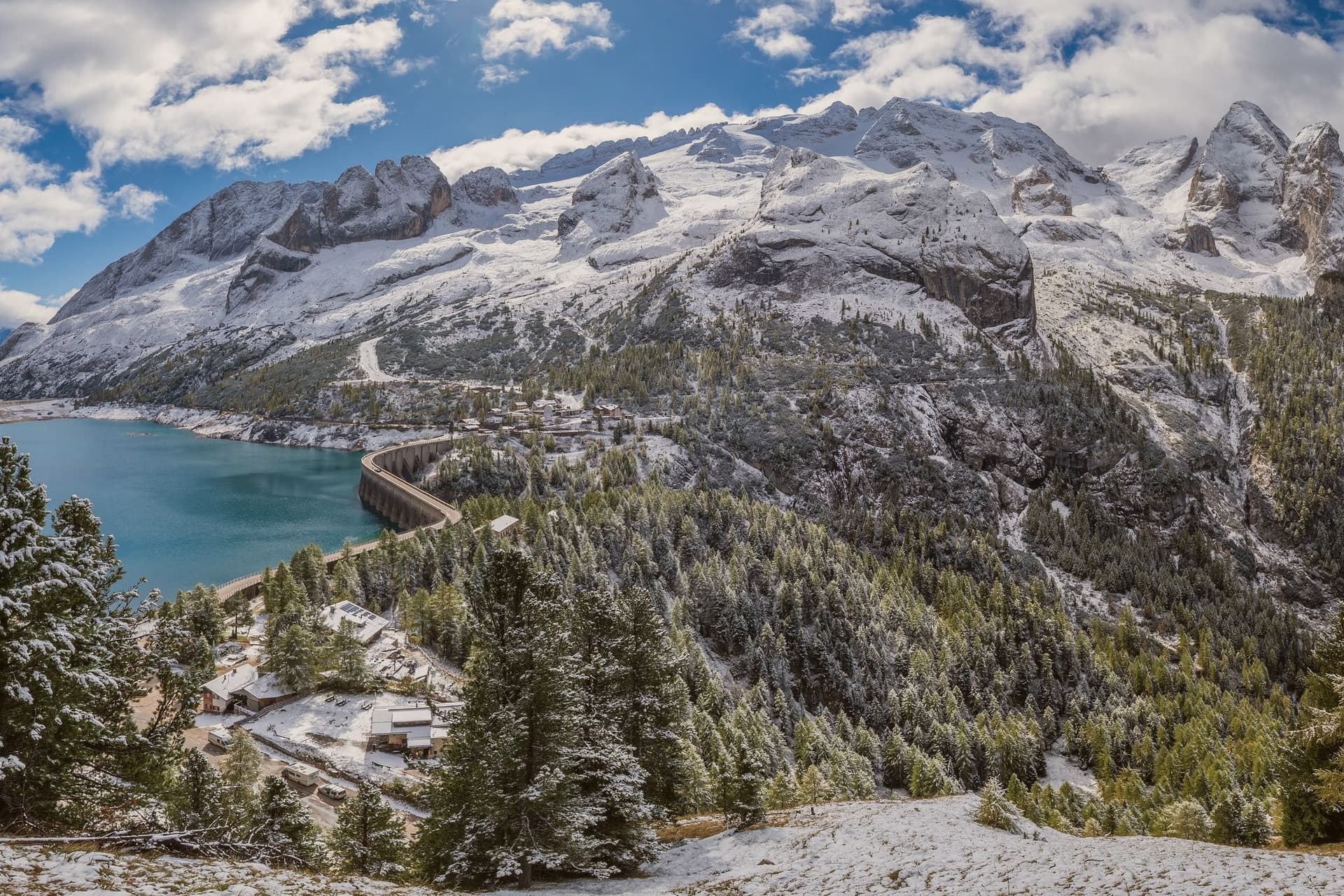
Canazei sits at 1,465 metres at the head of the Val di Fassa, one of the thirty highest towns in Italy, ringed by the Marmolada, the Sella Group and the Sassolungo. The commune includes the hamlets of Alba, Gries and Penia, which run together with the central village along the upper Avisio river.
Eight in ten residents speak Ladin as their first language, part of the small Dolomitic minority recognised by the autonomous statute, and the local Folk Group preserves the costumes, music and language traditions of the valley. Four ski areas connect from the village base: Belvedere, Ciampac, Col Rodella and the Marmolada cable car from Malga Ciapèla, all part of the Sellaronda and the wider Dolomiti Superski circuit.
The Pordoi cable car climbs to the Terrazza delle Dolomiti at 2,950 metres for a full view of the surrounding peaks, including the Marmolada at 3,343 metres, the highest summit in the Dolomites and a UNESCO World Heritage site since 2009.
The village sits at 1465 metres.
What to see in Canazei
- Marmolada. Highest summit in the Dolomites at 3,343 metres, reached by cable car from Malga Ciapèla above Canazei, with the only Dolomitic glacier on its northern face.
- Passo Pordoi. Dolomite road pass at 2,239 metres with a cable car to Sass Pordoi at 2,950 metres, called the Terrazza delle Dolomiti for its 360-degree view.
- Belvedere Ski Area. Main winter base of Canazei, gondola-linked to the Sellaronda circuit and the lift system across the four Ladin valleys of the Sella group.
How to get to Canazei
Bolzano is roughly 86 minutes away by road.
Our tip
December through March is the ski season, the village's busiest months, with the Sellaronda circuit running from the Belvedere base and snow held above 1,500 metres into early April. June through September is the summer alpine season, with the Pordoi cable car running to the Terrazza delle Dolomiti and a full network of hiking and via ferrata routes on the Marmolada, Sassolungo and Sella. July and August are the peak months, with refuges full and bookings tight on the Fedaia and Pordoi passes. Gran Festa da d'Istà falls in September.
Moena
Why visit Moena
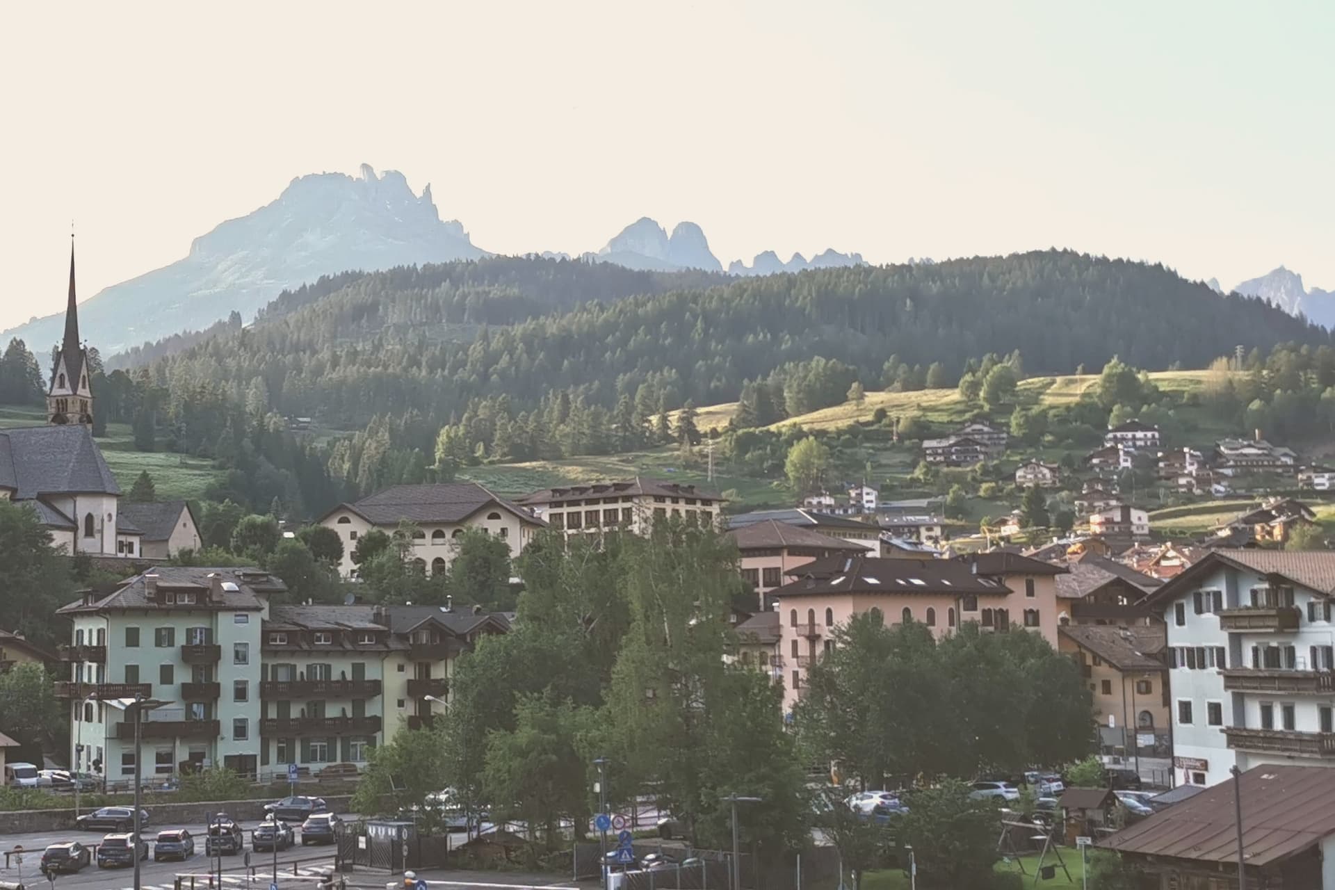
Moena sits at 1,184 metres at the entrance to Val di Fassa, which climbs north toward Canazei and the Sella massif. To the southeast a side valley rises toward the Passo San Pellegrino and the Marmolada group, while a plateau above the village, reached by cable car, opens onto the Catinaccio, Latemar and Pale di San Martino to the south.
The village is the largest in the valley and functions as its entrance point, with the high peaks visible on three sides and the pastures of San Pellegrino working land rather than backdrop. What holds the place together is less the geography than what the two festivals and the church commemorate: a language kept alive as an everyday tongue, a costume festival built around a foreign soldier's arrival, and a painter who left and came back.
Moena reads less like a single Alpine village and more like a crossing point, between valleys, and between a local story and the outside events that keep getting folded into it.
The village sits at 1184 metres.
What to see in Moena
- Chiesa di San Vigilio. Parish church rebuilt across the centuries, with a gilded wooden altar by Valentino Poschiavin and 18th-century paintings by Valentino Rovisi. It also holds work by Domenico Chiocchetti.
- Chiesa di San Volfango. Small Romanesque church next to the parish, with 15th-century frescoes and a wooden Baroque ceiling carved by Giovanni Guadagnini in the 17th century.
- Museo Ladin de Fascia (sezione Moena). The Ladin cultural museum network with a Moena exhibit on local language, costume and rural life in the lower Val di Fassa.
How to get to Moena
Bolzano is roughly 65 minutes away by road.
Our tip
June through September brings the green Dolomite season: alpine pastures open, the Catinaccio and Latemar are walkable from the cable cars above town, and the August Turchia festival fills the streets for three days. December through March is the ski half of the year, with lifts running on Alpe Lusia and over the Passo San Pellegrino into the Tre Valli circuit. April, May, October and November are quiet, between seasons. Festival del Puzzone falls in September.
Cavalese
Why visit Cavalese
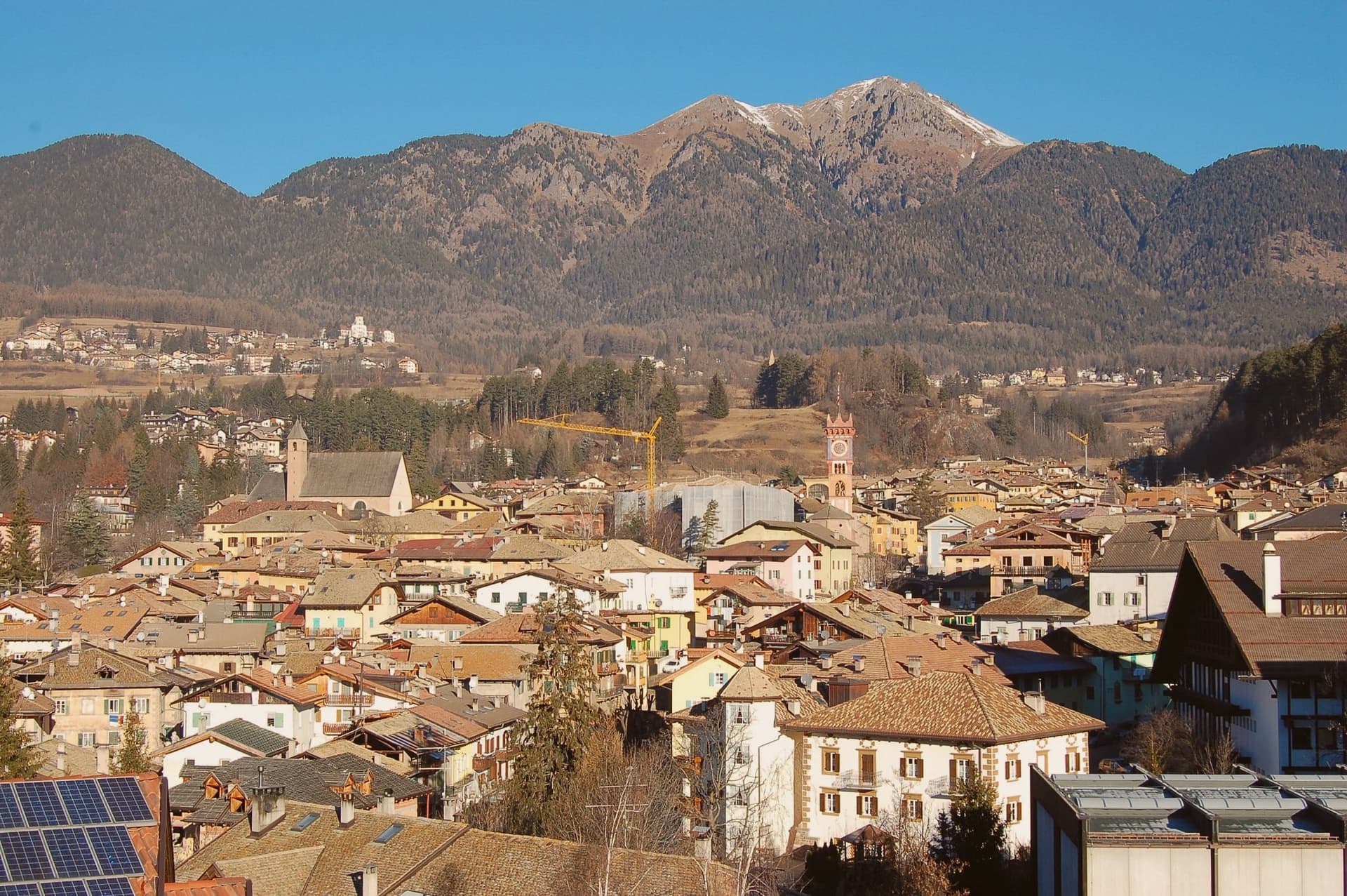
Cavalese sits at 1,000 metres on a south-facing terrace above the Avisio, forty kilometres northeast of Trento, the main town of the Val di Fiemme. The valley's eleven communes held their forest commons in common under the Magnifica Comunità, the self-governing body founded by the founding charter of 1111, and Cavalese has kept its seat through the Bavarian abolition of 1807 and every legal change since.
The valley floor carries the working memory of that governance: the archive of parchments, the frescoed council chambers, the bench in the open air where disputes were once judged. Above the town, the cableway to the Alpe Cermis climbs toward 1,912 metres, and the flat route along the Avisio ties Cavalese to the other Fiemme communes strung along the valley floor from Predazzo down toward the Adige.
Nine centuries of continuous self-rule and a valley of communes bound by a single river explain why Cavalese reads less like a single town than like the administrative floor of the whole valley.
The village sits at 1000 metres.
What to see in Cavalese
- Palazzo della Magnifica Comunità di Fiemme. Medieval bishop's residence enlarged in the Renaissance, seat of the community since 1810, with a picture gallery and an archive of parchments from the thirteenth to eighteenth centuries.
- Pieve di Santa Maria Assunta. Parish church of Cavalese, consecrated in 1134 on an older foundation, standing beside the park where the valley's representatives once sat in judgment.
- Banco della Reson. Stone bench in the Parco della Pieve where the representatives named in the Patti Ghebardini met as an open-air parliament to judge valley disputes.
How to get to Cavalese
Bolzano is roughly 95 minutes away by road.
Our tip
June through September is the high-valley season: meadows open above 1,000 metres, the Latemar and the Lagorai are reachable on day walks from the town, and the cycle path along the Avisio fills with day-trippers. December through March is the ski season on Alpe Cermis and the Lavazè plateau, with snow held above 1,000 metres into early April and the Tour de Ski final climb up the Cermis slope each January. April, May, October and November are the quiet shoulder months between the seasons, when the cable car runs reduced schedules and the valley returns to its residents.
Baselga di Pinè
Why visit Baselga di Pinè
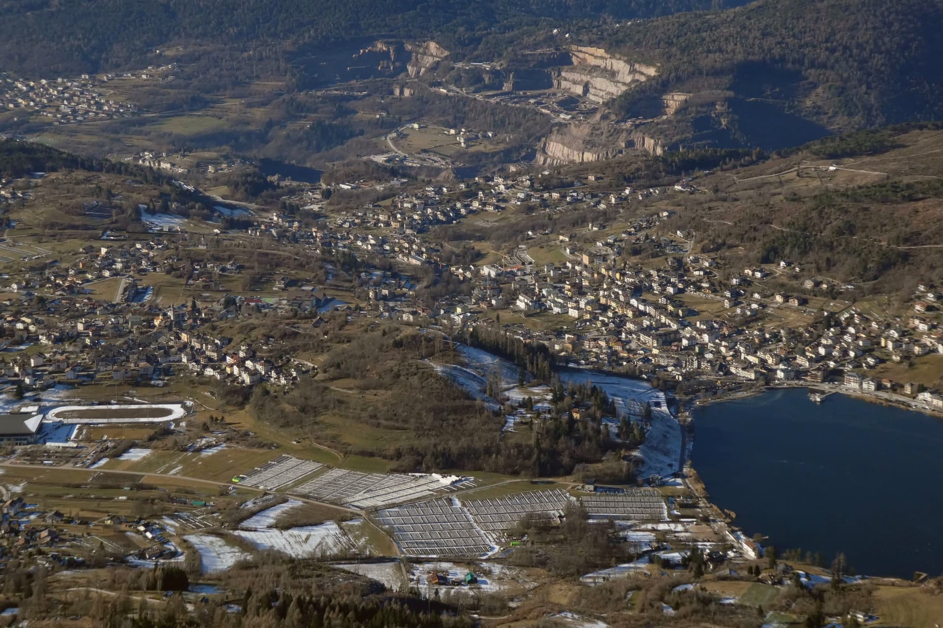
Baselga di Pinè is the main town of the Altopiano di Piné, a forested plateau at 964 metres northeast of Trento, between the Adige valley and the Val di Cembra. Its territory holds ten hamlets and four lakes: Serraia, Piazze, Lases and Laghestel.
Lake Serraia, at 974 metres, has been awarded the Bandiera Blu each year for the cleanliness of its waters, and freezes solid enough in winter to skate on. The Stadio del Ghiaccio di Piné in the hamlet of Miola is one of only three outdoor speed skating ovals in the world, hosting the Italian national team and the annual Piné 24 Hours endurance race.
The Santuario della Madonna di Pinè, in the hamlet of Montagnaga, was built in 1730 around a Marian apparition reported by the shepherdess Domenica Targa, and remains the most visited pilgrimage site in Trentino. The Church of San Mauro in the hamlet of San Mauro, documented in 1242, was the first pieve of the plateau.
The village sits at 964 metres.
What to see in Baselga di Pinè
- Lago di Serraia. Blue Flag lake at 974 metres at the edge of Baselga, used for swimming, canoeing and sailing in summer and skating when the surface freezes.
- Santuario della Madonna di Pinè. Baroque Marian sanctuary in Montagnaga, built in 1730 after the reported 1729 apparition to the shepherdess Domenica Targa, the most visited pilgrimage site in Trentino.
- Stadio del Ghiaccio di Piné. Outdoor speed skating oval in the hamlet of Miola, training home of the Italian national team and venue for the Piné 24 Hours endurance race.
How to get to Baselga di Pinè
Trento is roughly 57 minutes away by road.
Our tip
May through October is the lake season: Serraia warms enough for swimming by mid-June, the sailing and canoeing clubs run from May, and the surrounding forests open for hiking and mushroom foraging into late October. June and July bring pilgrims to the Madonna di Pinè sanctuary, with the main feast on 26 May. November through March is the ice season: the speed skating oval runs at full schedule, the lakes freeze for natural-surface skating, and the Piné 24 Hours race takes place in winter.
More from Anywhere Italy
- The best small high-altitude villages within 90 minutes of Trento
- The best hidden ski towns in the province of Trento
- The 9 best mountain towns within 90 minutes of Trento
- The 9 best small high-altitude villages that eat well in Trentino-Alto Adige/Südtirol
- The best small towns that eat well in the province of Trento
- The best high-altitude villages with a serious restaurant in Trentino-Alto Adige/Südtirol