
The best small mountain towns within 90 minutes of Bolzano
The country above Bolzano changes quickly. Vineyards give way to apple orchards, then to spruce, then to the pale rock of the Dolomites standing over meadows that are cut for hay twice a summer. The houses are timber over whitewashed stone, with balconies deep enough to stack firewood, and the food is the double inheritance of the place: canederli in broth, barley soup, speck cut by hand, strudel, alongside dishes that would not look out of place in a Trentino osteria. In winter the valleys smell of woodsmoke and diesel from the piste machines; in September they smell of cut grass and cattle coming down from the high pastures.
Most visitors point the car at Lago di Braies, or at the Alpe di Siusi cable car, or at Cortina d'Ampezzo over the provincial border. There are good reasons for all three, and there are also car parks that fill before breakfast in August, timed entry systems, and paths where you walk at the speed of the group ahead of you. The famous views are famous because they are worth seeing, and that is exactly why you rarely see them alone.
The same peaks, the same passes and the same kitchens carry on well past those car parks. The valleys that run off the Bolzano road, Val Gardena and Val Badia and Val di Fassa, and the quieter side valleys above Merano, hold smaller towns where the ski lifts and the walking trails are the same rock and the queues are shorter. These are those towns, all within about an hour and a half of the city, all small, all worth a detour.
Of the 11 communes we have mapped within 90 minutes of Bolzano, 9 qualify as mountain towns: each sits in the mountains. This list is the small ones, 6 in all, ordered smallest first. The smallest, Corvara in Badia, has 1,396 residents.
If you are still choosing, we have also written The 8 best high-altitude villages within 90 minutes of Bolzano and The 9 best small high-altitude villages that eat well in Trentino-Alto Adige/Südtirol.
Corvara in Badia
Why visit Corvara in Badia
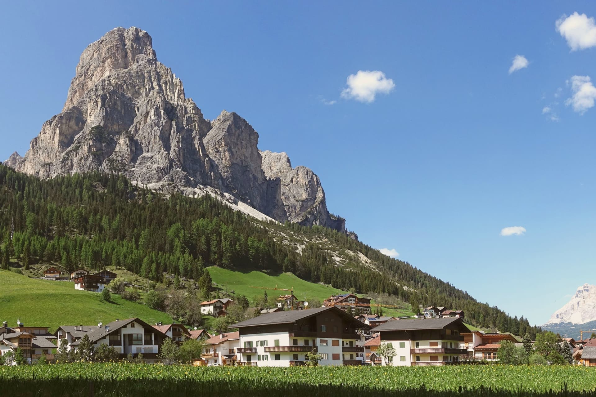
Corvara sits at 1,568 metres in a wide basin at the head of the Val Badia, below the rock spire of the Sassongher and inside the Dolomites UNESCO area. Ladin is the everyday language: in the 2024 census 87 percent of residents named it as their first tongue, with Italian and German distant second and third.
The settlement was a scattered group of farms until tourism arrived in the early twentieth century, and Corvara is considered the birthplace of organised Alpine tourism in the Val Badia. The village is one of four bases on the Sellaronda, the forty-kilometre ski circuit that loops the Sella massif through Corvara, Arabba, Canazei and Selva di Val Gardena on a single lift pass.
Above the village, the Pralongià plateau opens a long view to the Marmolada glacier. The Gran Risa piste at the next hamlet of La Villa hosts the men's giant slalom on the World Cup tour each December.
The village sits at 1568 metres.
What to see in Corvara in Badia
- Chiesa di Santa Caterina. Late Gothic church first documented in 1347 and consecrated to Saint Catherine in 1452, holding the only well-preserved winged altar in Val Badia, dated 1520.
- Sassongher. Rock peak at 2,665 metres above the village, the signature silhouette of Corvara and a classic via ferrata climb on the eastern flank.
- Altopiano di Pralongià. Grassy plateau above the village reached by cable car, with open views to the Marmolada glacier and the surrounding Dolomite groups.
How to get to Corvara in Badia
Bolzano is roughly 75 minutes away by road.
Our tip
December through March is the ski season, the village at full capacity around the Sellaronda lifts, with the men's World Cup giant slalom on the Gran Risa each December at La Villa next door. June through September is the summer Dolomite season, cool even in July at 1,568 metres, with hiking, via ferrata and gravel cycling across the Pralongià plateau and the Puez-Odle park. April and May are quiet shoulder months, snow gone from the village but lifts mostly closed and hotels shut between seasons.
San Pancrazio
Why visit San Pancrazio
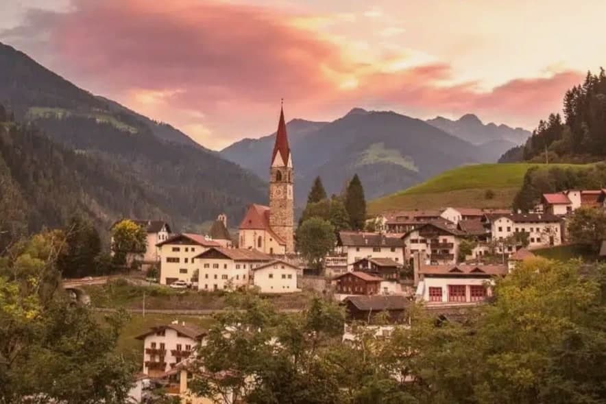
San Pancrazio (St. Pankraz in German) sits at 736 metres at the mouth of the Ultental — Val d'Ultimo in Italian — one of the most isolated alpine side-valleys of the Adige basin in South Tyrol.
The village is the largest of four comuni in the valley (San Pancrazio, San Walburga, Santa Gertrude, and the upper village around Pracupola), 92% of residents speak German as their first language, and the local economy is still organised around alpine pasturing on the south-facing slopes of the Maddalena group and the Ortles range to the south-west. The parish church of San Pancrazio Martire was rebuilt in 1796 in late-Baroque style after fire, with the tall narrow Tyrolean bell tower visible from the valley road.
The real draw is the Ultental itself: the protected Larici Millenari (Lahnerlärchen) above San Pancrazio include several larches over 800 years old, some of the oldest documented in Europe, and the Lahner Säge open-air sawmill museum a few kilometres up the valley preserves the 17th-century water-powered timber processing that built the Tyrolean church roofs. The Stelvio National Park boundary passes just south of the village.
The village sits at 736 metres.
What to see in San Pancrazio
- Larici Millenari di San Gertrude (Lahnerlärchen). Protected stand of larches above San Pancrazio, several documented at over 800 years old — some of the oldest verified larches in Europe. A signed circular walking trail.
- Chiesa di San Pancrazio Martire (St. Pankraz). Late-Baroque parish church rebuilt 1796 after a fire, with the tall Tyrolean bell tower that anchors the village skyline.
- Lahner Säge — open-air sawmill museum. 17th-century water-powered sawmill a few kilometres up the Ultental, preserved as an open-air museum demonstrating the Tyrolean timber processing that built the region's church roofs.
How to get to San Pancrazio
Bolzano is roughly 50 minutes away by road.
Our tip
May through October is the open season for the Ultental. June and September are the strongest months: alpine pastures green, the larch forests at their photogenic best (May for spring needle-out, October for autumn gold), and the high paths into the Stelvio NP comfortable. July and August are cool at this elevation but the lift queues at the Tyrolean honeypots stay south-east near Merano — Ultental stays empty.
Falcade
Why visit Falcade
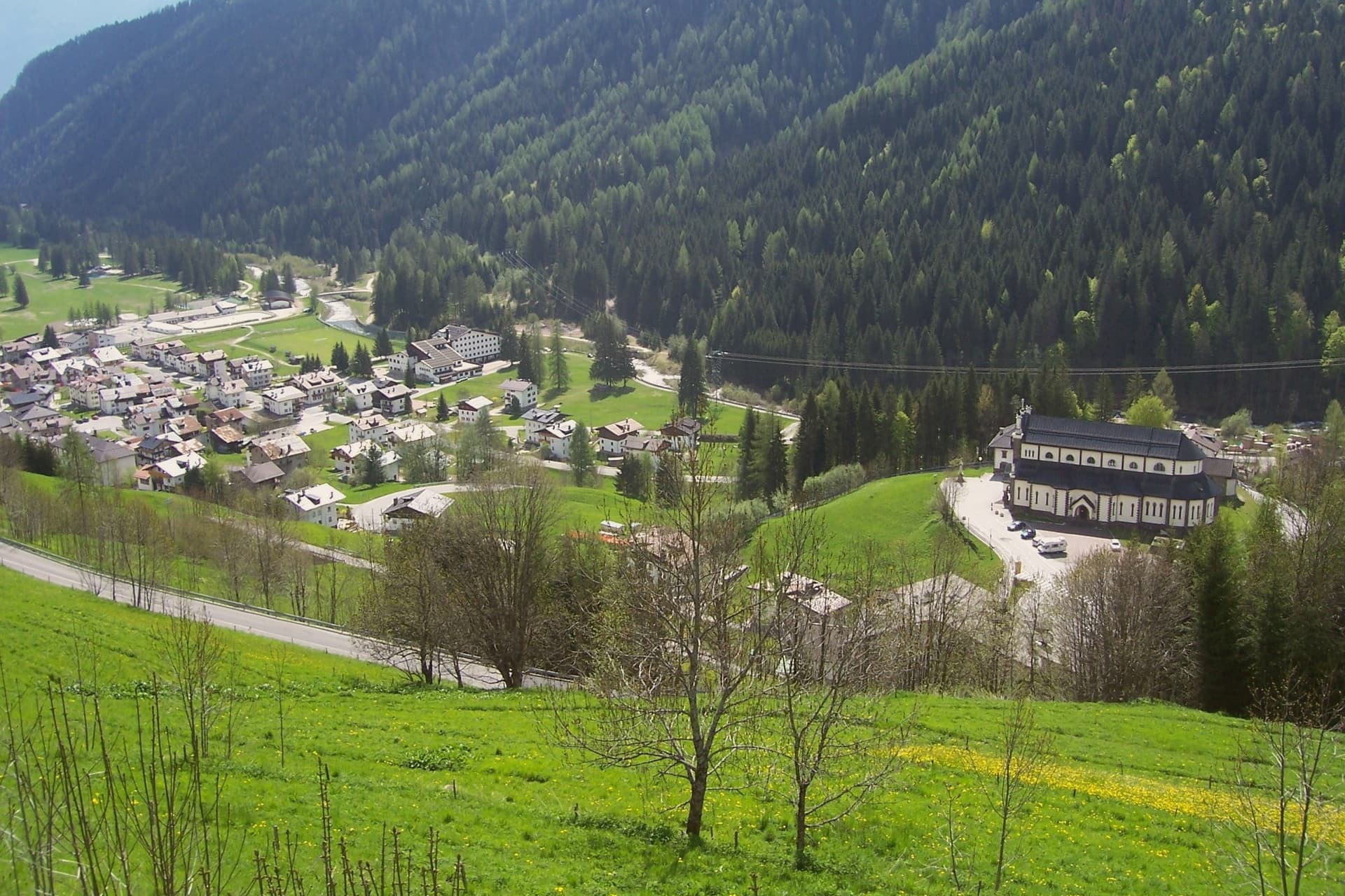
Falcade sits at 1,148 meters in the upper Biois valley, the southwestern corner of the Agordino, ringed by the Focobon group, the Pale di San Martino, the Marmolada and the Civetta. First settlers arrived between the tenth and eleventh centuries, and trade with the neighboring Fassa and Fiemme valleys built through the medieval period, carried over the col that still connects the Agordino to Trentino.
The village works as a hinge between two mountain worlds: the sharp Focobon spires and the broader Pale di San Martino to the west face each other across the valley, with the pass threading between them as it has since travelers first needed shelter there. Summer walkers follow the Alta Via 2 through this gap, between peaks that were shaped by the same geology the UNESCO listing recognizes.
The valley's long function as a crossing point, medieval trade route, refuge, ski link, explains why a settlement this size sits exactly where the Agordino gives way to Trentino.
The village sits at 1148 metres.
What to see in Falcade
- Focobon group. The massif rises directly north of the village, its spires visible from the valley floor. The Alta Via 2 threads past it toward the Forcella delle Comelle.
- Ski Civetta and Trevalli. Linked ski domain across the Falcade-Le Buse and Passo San Pellegrino-Alpe Lusia areas, slopes up to 2,500 meters.
- Passo San Pellegrino. 1,918-meter col into the Val di Fiemme, with a travelers' hospice documented from 1358 and now a working ski station.
How to get to Falcade
Bolzano is roughly 77 minutes away by road.
Our tip
December through March is the working winter: Ski Civetta and Trevalli open, the San Pellegrino pass runs as a ski station, and the village fills to capacity over Christmas and Carnival. June through September is the summer half, with walking on the Alta Via 2, the Forcella delle Comelle traverse to the Pale di San Martino, and refuge dinners on the Mulaz and the Bottari. April, May, October and November are the dead months.
Canazei
Why visit Canazei
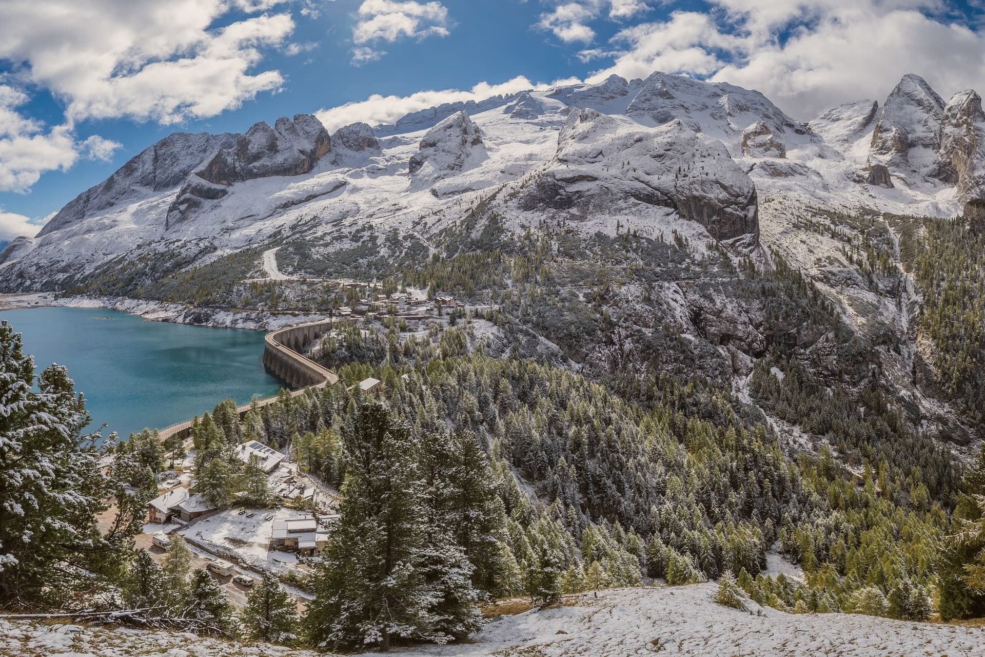
Canazei sits at 1,465 metres at the head of the Val di Fassa, one of the thirty highest towns in Italy, ringed by the Marmolada, the Sella Group and the Sassolungo. The commune includes the hamlets of Alba, Gries and Penia, which run together with the central village along the upper Avisio river.
Eight in ten residents speak Ladin as their first language, part of the small Dolomitic minority recognised by the autonomous statute, and the local Folk Group preserves the costumes, music and language traditions of the valley. Four ski areas connect from the village base: Belvedere, Ciampac, Col Rodella and the Marmolada cable car from Malga Ciapèla, all part of the Sellaronda and the wider Dolomiti Superski circuit.
The Pordoi cable car climbs to the Terrazza delle Dolomiti at 2,950 metres for a full view of the surrounding peaks, including the Marmolada at 3,343 metres, the highest summit in the Dolomites and a UNESCO World Heritage site since 2009.
The village sits at 1465 metres.
What to see in Canazei
- Marmolada. Highest summit in the Dolomites at 3,343 metres, reached by cable car from Malga Ciapèla above Canazei, with the only Dolomitic glacier on its northern face.
- Passo Pordoi. Dolomite road pass at 2,239 metres with a cable car to Sass Pordoi at 2,950 metres, called the Terrazza delle Dolomiti for its 360-degree view.
- Belvedere Ski Area. Main winter base of Canazei, gondola-linked to the Sellaronda circuit and the lift system across the four Ladin valleys of the Sella group.
How to get to Canazei
Bolzano is roughly 86 minutes away by road.
Our tip
December through March is the ski season, the village's busiest months, with the Sellaronda circuit running from the Belvedere base and snow held above 1,500 metres into early April. June through September is the summer alpine season, with the Pordoi cable car running to the Terrazza delle Dolomiti and a full network of hiking and via ferrata routes on the Marmolada, Sassolungo and Sella. July and August are the peak months, with refuges full and bookings tight on the Fedaia and Pordoi passes. Gran Festa da d'Istà falls in September.
Moena
Why visit Moena
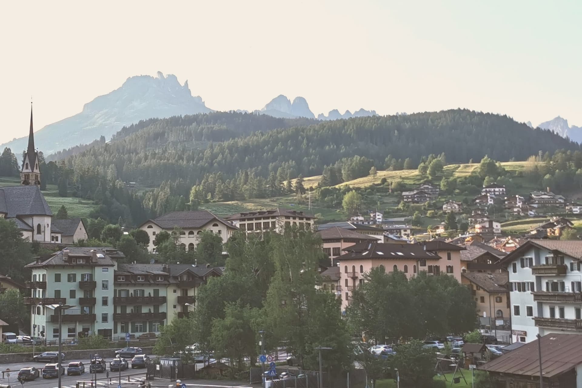
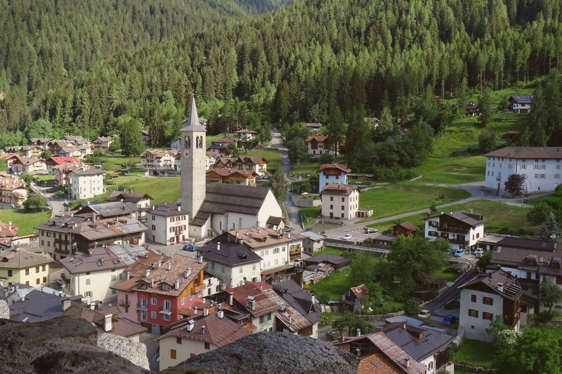
Moena sits at 1,184 metres at the entrance to Val di Fassa, which climbs north toward Canazei and the Sella massif. To the southeast a side valley rises toward the Passo San Pellegrino and the Marmolada group, while a plateau above the village, reached by cable car, opens onto the Catinaccio, Latemar and Pale di San Martino to the south.
The village is the largest in the valley and functions as its entrance point, with the high peaks visible on three sides and the pastures of San Pellegrino working land rather than backdrop. What holds the place together is less the geography than what the two festivals and the church commemorate: a language kept alive as an everyday tongue, a costume festival built around a foreign soldier's arrival, and a painter who left and came back.
Moena reads less like a single Alpine village and more like a crossing point, between valleys, and between a local story and the outside events that keep getting folded into it.
The village sits at 1184 metres.
What to see in Moena
- Chiesa di San Vigilio. Parish church rebuilt across the centuries, with a gilded wooden altar by Valentino Poschiavin and 18th-century paintings by Valentino Rovisi. It also holds work by Domenico Chiocchetti.
- Chiesa di San Volfango. Small Romanesque church next to the parish, with 15th-century frescoes and a wooden Baroque ceiling carved by Giovanni Guadagnini in the 17th century.
- Museo Ladin de Fascia (sezione Moena). The Ladin cultural museum network with a Moena exhibit on local language, costume and rural life in the lower Val di Fassa.
How to get to Moena
Bolzano is roughly 65 minutes away by road.
Our tip
June through September brings the green Dolomite season: alpine pastures open, the Catinaccio and Latemar are walkable from the cable cars above town, and the August Turchia festival fills the streets for three days. December through March is the ski half of the year, with lifts running on Alpe Lusia and over the Passo San Pellegrino into the Tre Valli circuit. April, May, October and November are quiet, between seasons. Festival del Puzzone falls in September.
St. Ulrich
Why visit St. Ulrich
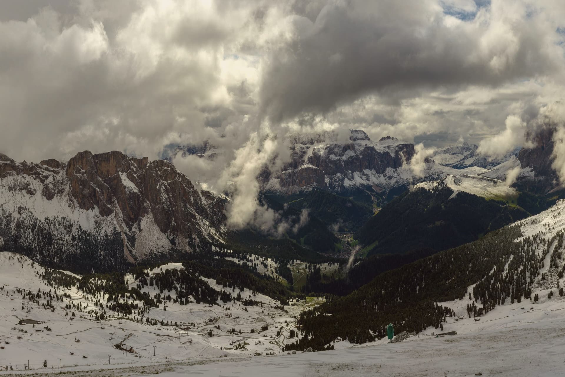
The valley climbs east from the Eisack toward the Sella and the Sassolungo, and the town sits at its middle point. Almost all residents speak Ladin at home, and signage runs trilingual in Ladin, German and Italian.
Three cable cars leave the village in three directions: one to the northwest onto a plateau, one north onto a long ridge below the Odle, and one south onto a high meadow that forms the valley's southern edge. The museum inside the Cësa di Ladins holds the record of the valley's carving tradition alongside fossils from the surrounding peaks and material on Luis Trenker, the mountaineer-actor-director who came from here.
The layout, a village hemmed by three lifts and named for the saint of its own parish church, reads as a place organized entirely around the ground it sits on: craft below, peaks and plateaus in every direction above.
The village sits at 1236 metres.
What to see in St. Ulrich
- Parish church (St. Ulrich/San Udalrico). Neoclassical church with Baroque elements, rebuilt in the late 18th century, dedicated to the Epiphany and to St. Ulrich, the patron saint who gives the town its German name.
- Museum Gherdëina. Local-heritage museum inside the Cësa di Ladins documenting four centuries of woodcarving, wooden toys, sacred sculpture, Dolomite fossils and the Trenker family archive.
- Seceda. Long limestone ridge reached by cable car from the village, with the Odle/Geisler peaks rising sharply to the north and high meadows dropping toward the valley.
How to get to St. Ulrich
Bolzano is roughly 43 minutes away by road.
Our tip
June through September is the green Dolomite season: the Alpe di Siusi opens fully, the Seceda ridge is walkable from the cable car, and the rifugi of the Odle and Sassolungo run their full summer programmes. December through March is the ski half of the year, with the Sellaronda circuit accessed directly from Ortisei. April, May and November are the closure months.
More from Anywhere Italy
- The 8 best high-altitude villages within 90 minutes of Bolzano
 The 9 best small high-altitude villages that eat well in Trentino-Alto Adige/Südtirol
- The best small ski towns that eat well in Trentino-Alto Adige/Südtirol
 The best mountain towns in the province of Bolzano/Bozen
- The best hidden towns worth staying overnight in Trentino-Alto Adige/Südtirol
 The best high-altitude villages with a serious restaurant in Trentino-Alto Adige/Südtirol