
Trentino-South Tyrol · Bolzano
Glurns
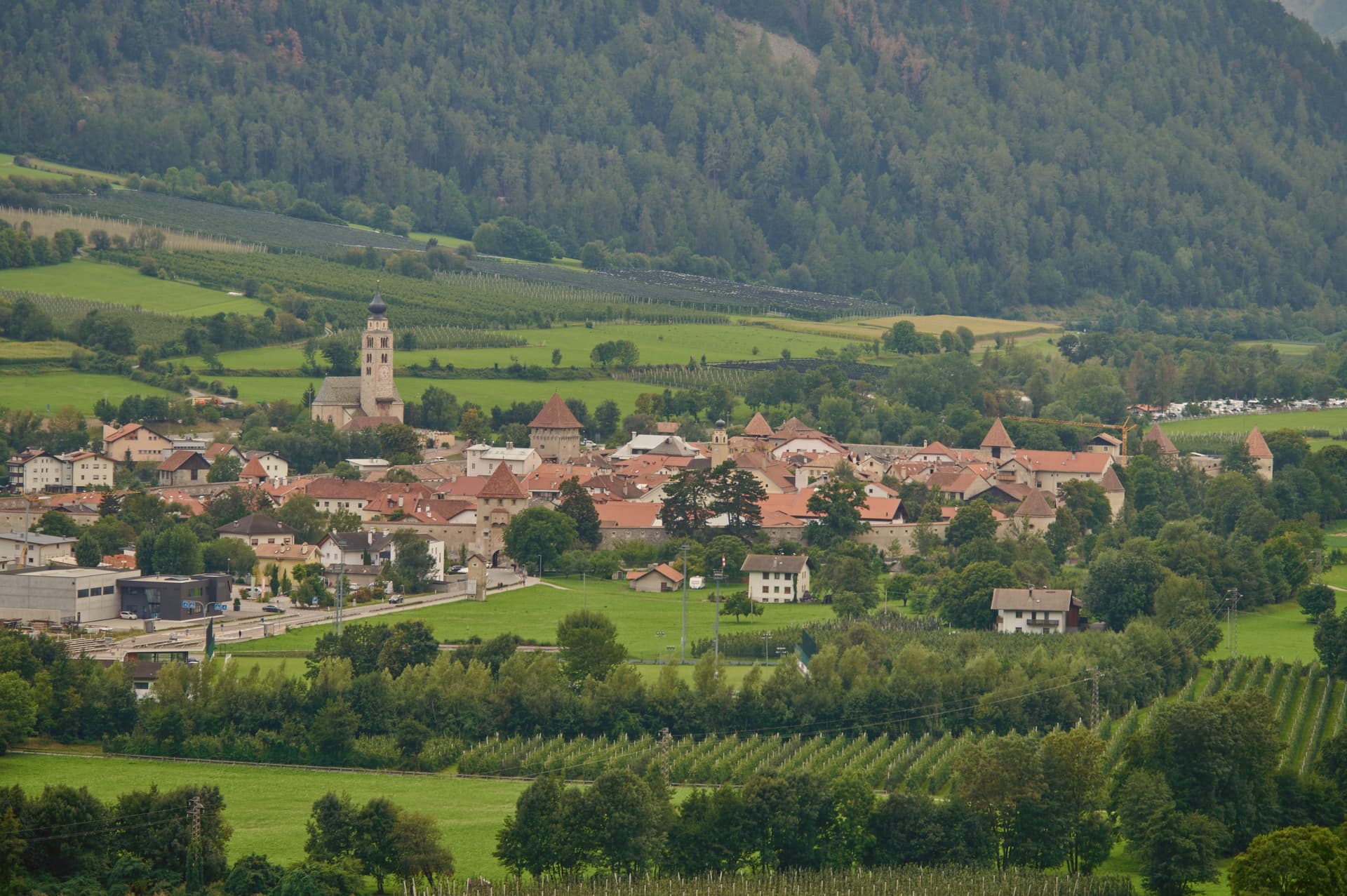
A ringed sixteenth-century circuit of walls encloses a city of 937 inhabitants near the Swiss border.
- Best time
- May–Oct
- By car
- 1 h 41 min from Bolzano
- By train
- Station in the comune
- Population
- 937
Known for
THE INTACT WALLS
Sixteenth-century circuit of city walls with three gates and seven watchtowers, the only complete medieval fortification in South Tyrol.
SMALLEST CITY
Granted city status in 1304 and still classified as such, despite a population of fewer than a thousand inside the walls.
STELVIO PARK GATEWAY
One of the ten gateway communes of Italy's largest alpine national park, on the southern entrance from the upper Val Venosta.
When to visit
Best · May–Oct
- J4°
- F8°
- M9°
- A13°
- M18°
- J23°
- J26°
- A25°
- S21°
- O16°
- N10°
- D5°
- Best
- Hot or crowded
- Quiet
- Mostly closed
Daytime averages, 2020–2024. Weather data by Open-Meteo.com.
The festa: San Pancrazio, 12 May
Why come
The town sits at 907 metres in the upper valley, twenty minutes by car from both the Austrian and Swiss borders, on the Adige river at the southern entrance to the national park. City status was awarded by Emperor Henry of Bohemia in 1304, an honor that has stayed attached to the place ever since even as the population inside the walls stayed under a thousand.
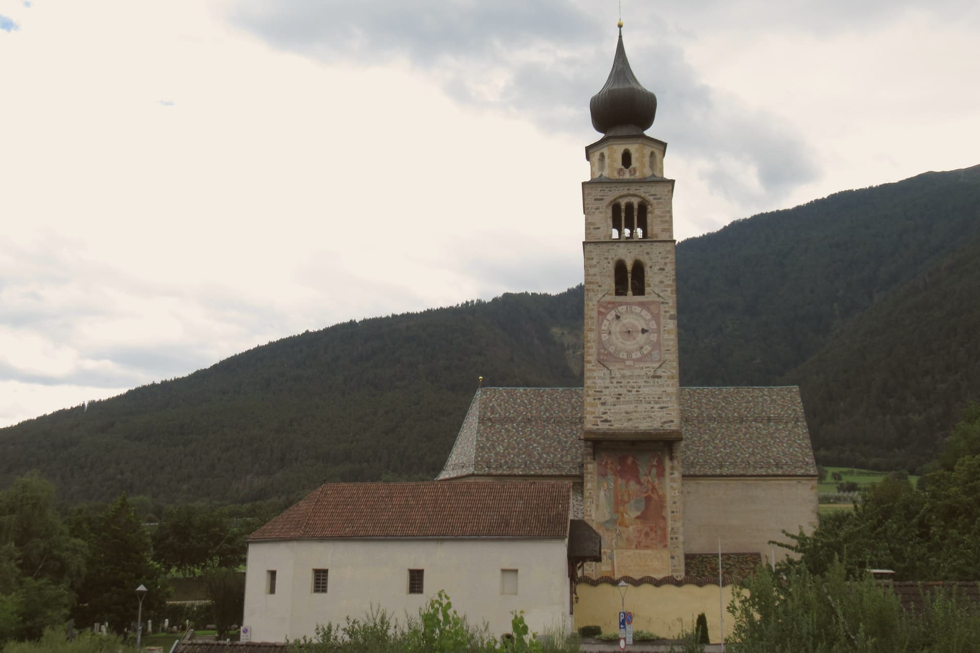
After the Battle of Calven in 1499, the Habsburgs under Emperor Maximilian I rebuilt the town as a bulwark against the forces of the Three Leagues of Graubünden, and it is that rebuilding which produced the fortification standing today. The walled core and the church outside it mark the two halves of the town: the streets and Lauben arcades, paved in cobble, enclosed within the ring of walls, and the parish church standing apart on the riverbank, holding its own late Gothic frescoes away from the defended center.
A city built for defense against the Three Leagues of Graubünden still reads, in its layout, as a place organized entirely around the line where the walls stand and the ground just beyond them: the guarded interior on one side, the river and the open approach to the mountains on the other.
The Sunday letter
Glurns is on our list. Its letter is still to come.
We are writing about all 1,000 of these towns, one at a time, in a free letter every Sunday: the photo, the food, the festa. That is our mission. Sign up and you will be there when Glurns comes up. By Peter & Sophia, from Pietrasanta.
Read on
Glurns in our articles
 The best mountain towns you can reach by train in Trentino-Alto Adige/Südtirol7 towns, Glurns among them.
 The best towns you can reach by train in the province of Bolzano/Bozen7 towns, Glurns among them.
 The towns under 1,000 people, above 500 meters, with a train station7 towns, Glurns among them.
 The 8 best hidden towns you can reach by train in Trentino-Alto Adige/Südtirol8 towns, Glurns among them.
How to get there
From Verona (VRN), about 3h 19m by car.
Milan (BGY) is about 4 hours away.
By car from the centre of Bolzano 1h 41m or Trento 2h 11m.
There is a railway station in the comune, so you can arrive without a car.
What to see
Mura cittadine
Walls built under Emperor Maximilian I after 1499, following the Battle of Calven, as a bulwark against the forces of the Three Leagues of Graubünden. The patrol path still runs continuous along the inside face.
Centro storico
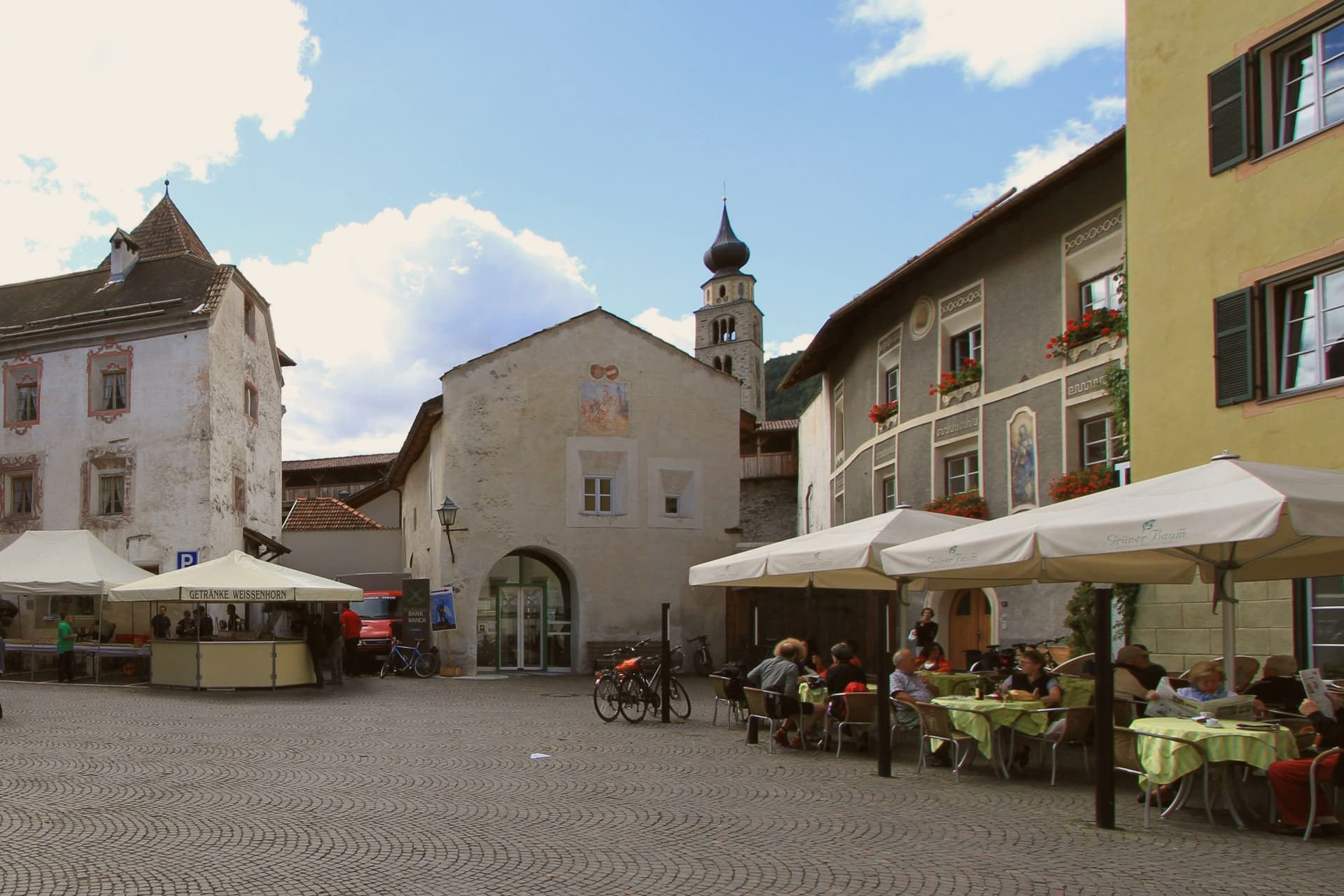
Walled core of unbroken three-storey Lauben arcades along the two main streets, paved in stone and listed on the Borghi più belli d'Italia.
Chiesa di San Pancrazio
Parish church just outside the walls on the bank of the Adige, with a Gothic nave and a series of late medieval wall frescoes inside.
Parco Nazionale dello Stelvio
Italy's largest alpine national park, with Glorenza listed as one of ten gateway communes at the southern entrance from the Val Venosta.
Torri delle mura
Seven watchtowers along the city wall, each tied to one of the three gates, with the patrol path running between them along the inside face of the wall.
The slow-trip planner
Building a trip? Find where Glurns fits in a slow Italy circuit.
Answer five questions. We will shape a geographically coherent slow trip from the 1,000 Italian towns most travelers skip. Yours to save and share.
We recommend
Where to eat
Not our picks, but places the guides put their name to: a Michelin star, a Gambero Rosso fork, a Slow Food snail, a Michelin Key for the hotels. Worth a table, a counter, or a night when you pass through.
FlurinBistrot
Two Gambero Rosso tables, at Flurin.
Living here
- Population 937
- Very remotei
- Pharmacy: none mapped
- Train station in the comune
- Nearest airport Verona, 3 h 19 min drive
- Regional capital Bolzano, 1 h 42 min drive
Common questions
- What is Glurns known for?
- Glurns is a ringed sixteenth-century circuit of walls encloses a city of 937 inhabitants near the Swiss border.
- Where is Glurns?
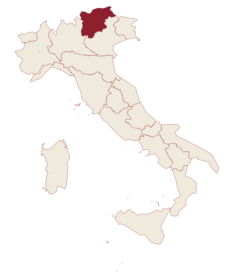
- Glurns is a comune in the province of Bolzano, in Trentino-Alto Adige/Südtirol, at 907 meters above sea level.
- What is the nearest airport to Glurns?
- Verona (VRN), about 3h 19m by car.
- Can you get to Glurns without a car?
- Yes. There is a railway station in the comune, so you can arrive by train.
- How long is the drive from Bolzano to Glurns?
- About 1h 41m by car.
- When is the best time to visit Glurns?
- Best in May–Oct. July is the warmest month, averaging 26 degrees, and May the wettest, with about 19 rain days.
- Is there a sagra or a festival in Glurns?
- The town keeps its patron saint's day: San Pancrazio, 12 May.
- Which other towns are like Glurns?
- Sadali, Civita d'Antino and Goriano Sicoli.
- How many people live in Glurns?
- 937 at the 2023 count.
Tags & datadesignations · numbers · sources
Recognised as
The numbers
- Elevation: 907 m
- Population: 937
- Surface area: 13.22 km²
These figures were compiled from public directories: ISTAT, OpenStreetMap and Wikidata, and from the official listings of the guides named on this page. Town details change; verify with official sources before you travel.
Similar
Towns like Glurns
Sadali
Province: Sud Sardegna
both mountain-valley towns · both under 1,000 people
Civita d'Antino
Province: L'Aquila
both mountain-valley towns · both under 1,000 people
Goriano Sicoli
Province: L'Aquila
both mountain-valley towns · both under 1,000 people
Anversa degli Abruzzi
Province: L'Aquila
both mountain-valley towns · both under 1,000 people
Alfedena
Province: L'Aquila
both mountain-valley towns · both under 1,000 people
Cimbergo
Province: Brescia
both mountain-valley towns · both under 1,000 people
🎨 Borghi più belli d'Italia
More Borghi più belli d'Italia towns in Trentino-Alto Adige/Südtirol
Bleggio Superiore
Province: Trento
A scattered Giudicarie commune whose hilltop hamlet of Rango holds the Christmas markets, with a Slow Food walnut grown on the terraces below.
Bondone
Province: Trento
A two-village commune above Lake Idro at the Lombard border, with a Lodron castle on the cliff between them.
Borgo Valsugana
Province: Trento
The valley town built on both banks of the Brenta in lower Valsugana, with a hilltop castle above and a contemporary art project in the side valley.
Caldes
Province: Trento
A scattered commune on the Noce, six hamlets gathered around a thirteenth-century tower-house castle that once belonged to the Thun family.
Kastelruth
Province: Bolzano
South Tyrolean village on a shelf below the Sciliar, eighty-two-metre bell tower over the square, home of the Kastelruther Spatzen.