
The best ski towns with a serious restaurant in Trentino-Alto Adige/Südtirol
Winter in Trentino-Alto Adige smells of woodsmoke and larch resin, and the houses are built to match: stone at the base, weathered timber above, deep eaves loaded with snow. The skiing here runs from December into April on north-facing slopes shaded by the Dolomites, and the eating runs alongside it, canederli in broth, barley soup, speck cut thick, Ladin casunziei, apple strudel that owes as much to Austria as to Italy. The wine lists carry Lagrein and Teroldego from the valley floors and Gewürztraminer from the vineyards above Bolzano. It is one of the few places in the Alps where a hard day on the piste can end at a table that would hold its own in a city.
Most people point their car at Cortina d'Ampezzo, just over the provincial line, where the shopping street is as much the point as the mountain and the good tables are booked out weeks before the season starts. The Sella Ronda circuit funnels the same crowd through the same lift queues on the same bluebird mornings, and February half term turns the valley roads into a slow procession. There is a reason for it. The terrain is superb, the setting is one of the most photographed in the Alps, and the reputation is earned.
The same peaks, the same snow and the same cooking carry on through valleys that take a little more effort to reach. Val di Fassa, Val di Fiemme, Val Badia, the Pusteria and the Rendena all have ski areas on their own territory and kitchens that the most demanding of the guides has gone out of its way to list. These are the towns in this article, and fewer people go.
Of the 33 communes we have mapped in Trentino-Alto Adige/Südtirol, 9 qualify as ski towns with a serious restaurant: each has a ski area on its own territory, and each holds a restaurant listed by the most demanding of the guides. The smallest, Corvara in Badia, has 1,396 residents.
Elsewhere in the catalogue: The best small ski towns that eat well in Trentino-Alto Adige/Südtirol and The best high-altitude villages with a serious restaurant in Trentino-Alto Adige/Südtirol.
Corvara in Badia
Why visit Corvara in Badia
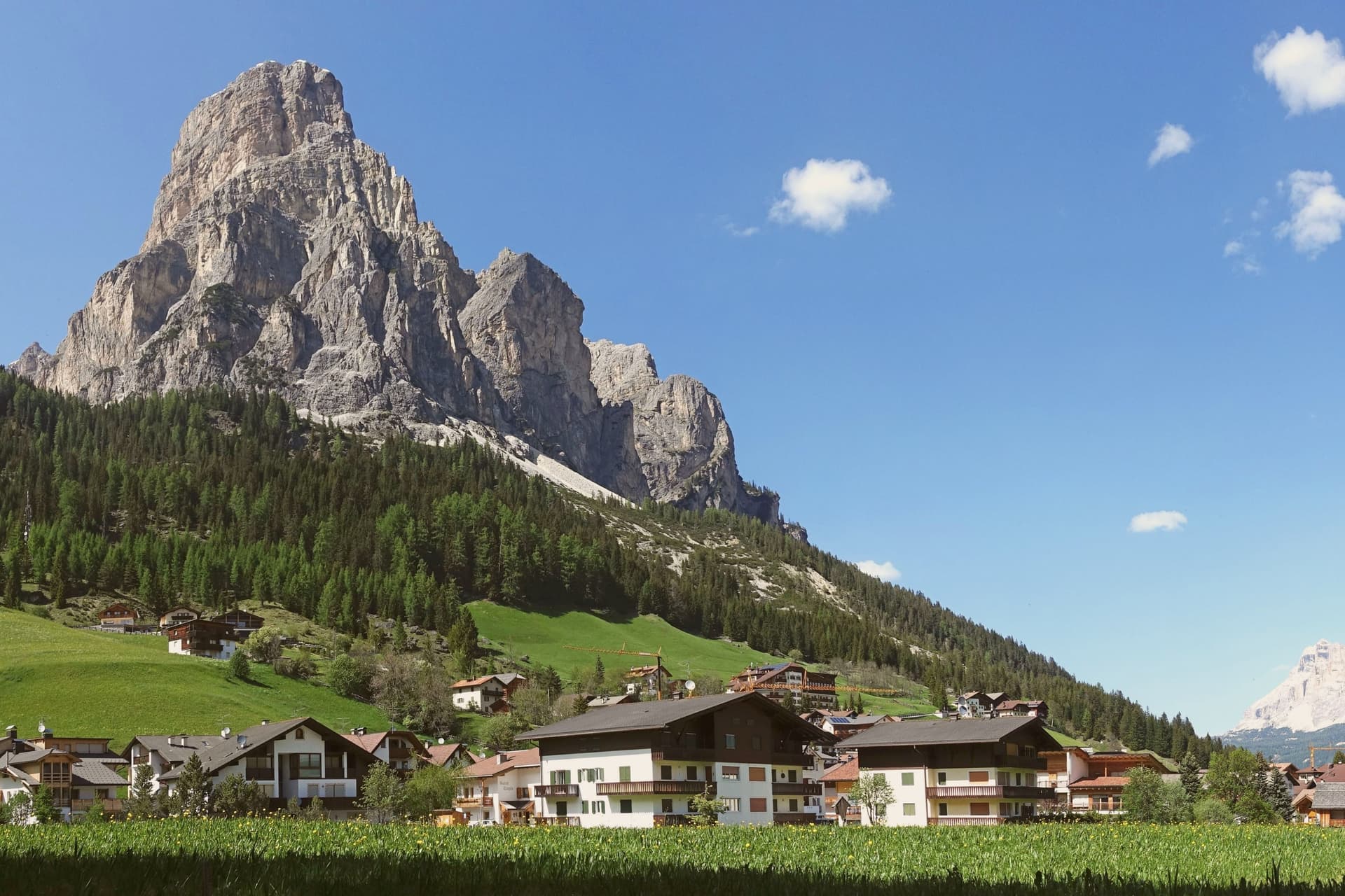
Corvara sits at 1,568 metres in a wide basin at the head of the Val Badia, below the rock spire of the Sassongher and inside the Dolomites UNESCO area. Ladin is the everyday language: in the 2024 census 87 percent of residents named it as their first tongue, with Italian and German distant second and third.
The settlement was a scattered group of farms until tourism arrived in the early twentieth century, and Corvara is considered the birthplace of organised Alpine tourism in the Val Badia. The village is one of four bases on the Sellaronda, the forty-kilometre ski circuit that loops the Sella massif through Corvara, Arabba, Canazei and Selva di Val Gardena on a single lift pass.
Above the village, the Pralongià plateau opens a long view to the Marmolada glacier. The Gran Risa piste at the next hamlet of La Villa hosts the men's giant slalom on the World Cup tour each December.
La Stüa de Michil - Simone Cantafio, KELINA Fine Dine, Ladinia and 4 more have been named by a guide.
What to see in Corvara in Badia
- Chiesa di Santa Caterina. Late Gothic church first documented in 1347 and consecrated to Saint Catherine in 1452, holding the only well-preserved winged altar in Val Badia, dated 1520.
- Sassongher. Rock peak at 2,665 metres above the village, the signature silhouette of Corvara and a classic via ferrata climb on the eastern flank.
- Altopiano di Pralongià. Grassy plateau above the village reached by cable car, with open views to the Marmolada glacier and the surrounding Dolomite groups.
How to get to Corvara in Badia
Bolzano is roughly 75 minutes away by road.
Our tip
December through March is the ski season, the village at full capacity around the Sellaronda lifts, with the men's World Cup giant slalom on the Gran Risa each December at La Villa next door. June through September is the summer Dolomite season, cool even in July at 1,568 metres, with hiking, via ferrata and gravel cycling across the Pralongià plateau and the Puez-Odle park. April and May are quiet shoulder months, snow gone from the village but lifts mostly closed and hotels shut between seasons.
Canazei
Why visit Canazei
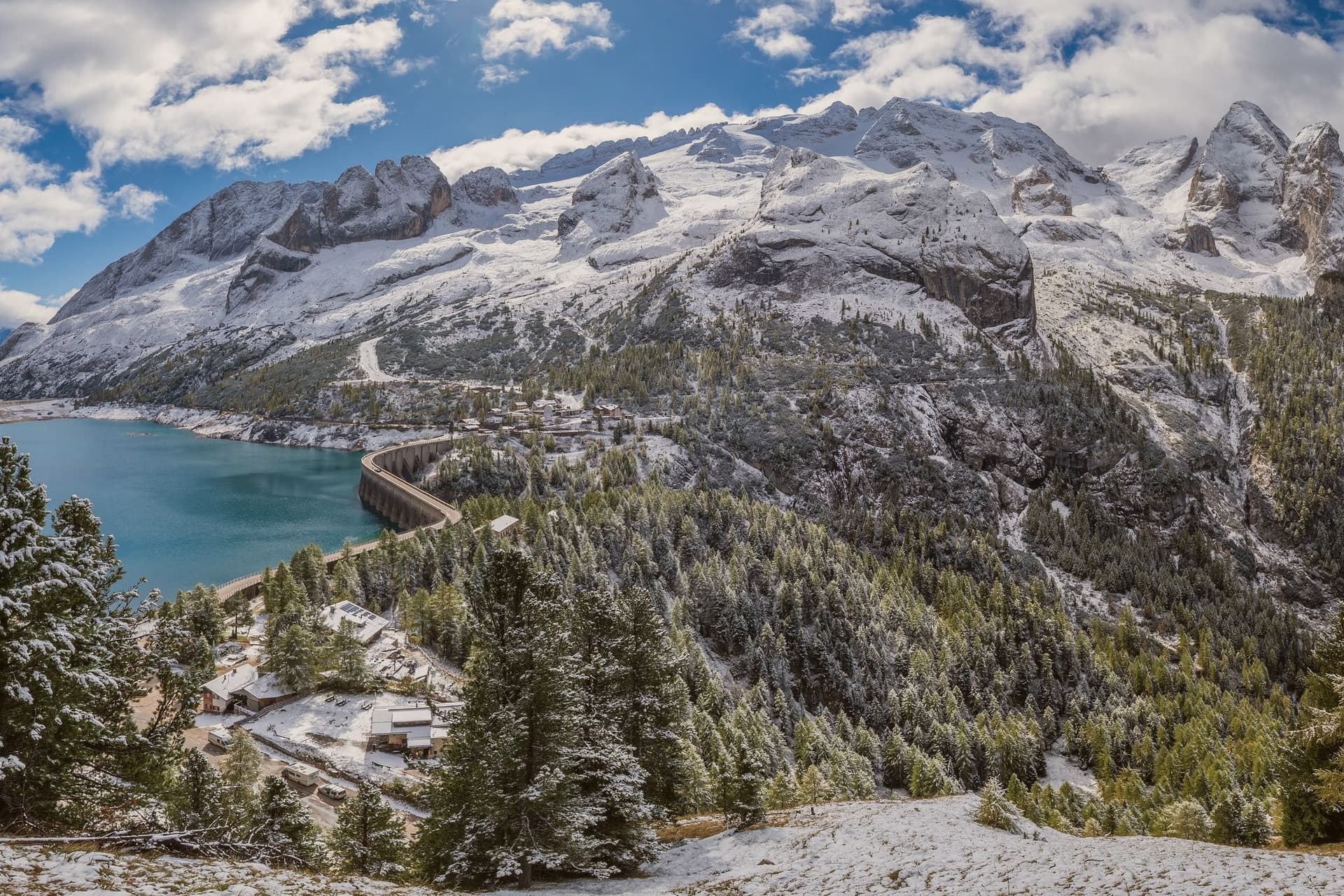
Canazei sits at 1,465 metres at the head of the Val di Fassa, one of the thirty highest towns in Italy, ringed by the Marmolada, the Sella Group and the Sassolungo. The commune includes the hamlets of Alba, Gries and Penia, which run together with the central village along the upper Avisio river.
Eight in ten residents speak Ladin as their first language, part of the small Dolomitic minority recognised by the autonomous statute, and the local Folk Group preserves the costumes, music and language traditions of the valley. Four ski areas connect from the village base: Belvedere, Ciampac, Col Rodella and the Marmolada cable car from Malga Ciapèla, all part of the Sellaronda and the wider Dolomiti Superski circuit.
The Pordoi cable car climbs to the Terrazza delle Dolomiti at 2,950 metres for a full view of the surrounding peaks, including the Marmolada at 3,343 metres, the highest summit in the Dolomites and a UNESCO World Heritage site since 2009.
Wine & Dine, Alla Locanda, Locanda degli Artisti Art Hotel and 1 more have been named by a guide.
What to see in Canazei
- Marmolada. Highest summit in the Dolomites at 3,343 metres, reached by cable car from Malga Ciapèla above Canazei, with the only Dolomitic glacier on its northern face.
- Passo Pordoi. Dolomite road pass at 2,239 metres with a cable car to Sass Pordoi at 2,950 metres, called the Terrazza delle Dolomiti for its 360-degree view.
- Belvedere Ski Area. Main winter base of Canazei, gondola-linked to the Sellaronda circuit and the lift system across the four Ladin valleys of the Sella group.
How to get to Canazei
Bolzano is roughly 86 minutes away by road.
Our tip
December through March is the ski season, the village's busiest months, with the Sellaronda circuit running from the Belvedere base and snow held above 1,500 metres into early April. June through September is the summer alpine season, with the Pordoi cable car running to the Terrazza delle Dolomiti and a full network of hiking and via ferrata routes on the Marmolada, Sassolungo and Sella. July and August are the peak months, with refuges full and bookings tight on the Fedaia and Pordoi passes. Gran Festa da d'Istà falls in September.
Moena
Why visit Moena
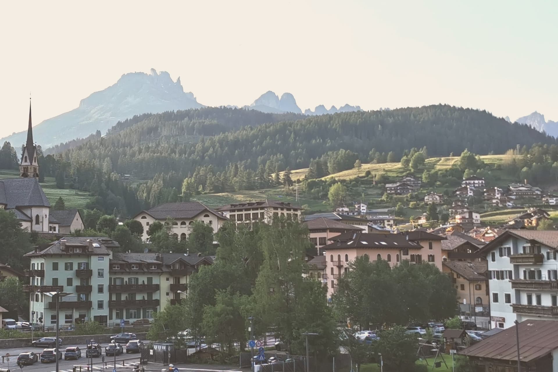
Moena sits at 1,184 metres at the entrance to Val di Fassa, which climbs north toward Canazei and the Sella massif. To the southeast a side valley rises toward the Passo San Pellegrino and the Marmolada group, while a plateau above the village, reached by cable car, opens onto the Catinaccio, Latemar and Pale di San Martino to the south.
The village is the largest in the valley and functions as its entrance point, with the high peaks visible on three sides and the pastures of San Pellegrino working land rather than backdrop. What holds the place together is less the geography than what the two festivals and the church commemorate: a language kept alive as an everyday tongue, a costume festival built around a foreign soldier's arrival, and a painter who left and came back.
Moena reads less like a single Alpine village and more like a crossing point, between valleys, and between a local story and the outside events that keep getting folded into it.
Malga Panna, Foresta, Ostaria Tyrol and 3 more have been named by a guide.
What to see in Moena
- Chiesa di San Vigilio. Parish church rebuilt across the centuries, with a gilded wooden altar by Valentino Poschiavin and 18th-century paintings by Valentino Rovisi. It also holds work by Domenico Chiocchetti.
- Chiesa di San Volfango. Small Romanesque church next to the parish, with 15th-century frescoes and a wooden Baroque ceiling carved by Giovanni Guadagnini in the 17th century.
- Museo Ladin de Fascia (sezione Moena). The Ladin cultural museum network with a Moena exhibit on local language, costume and rural life in the lower Val di Fassa.
How to get to Moena
Bolzano is roughly 65 minutes away by road.
Our tip
June through September brings the green Dolomite season: alpine pastures open, the Catinaccio and Latemar are walkable from the cable cars above town, and the August Turchia festival fills the streets for three days. December through March is the ski half of the year, with lifts running on Alpe Lusia and over the Passo San Pellegrino into the Tre Valli circuit. April, May, October and November are quiet, between seasons. Festival del Puzzone falls in September.
Pinzolo
Why visit Pinzolo
Val Rendena runs the length of the valley floor, separating the granite of the Adamello-Presanella to the west from the Dolomites to the east, and Pinzolo sits at its center at 770 metres. The settlement is documented from 1211 as Penzollo, a medieval community of farmers and pastoralists that kept a degree of independence from the D'Arco counts through its own village assembly, the Università.
Most of the municipal territory now falls inside the Adamello-Brenta Nature Park, the largest protected area in Trentino, which places both mountain ranges within the same administrative boundary as the town itself. Up the valley, the frazione of Madonna di Campiglio grew from a travelers' hospice into a resort, and the two settlements are now linked by gondola as well as by governance, the older farming village at the valley floor and the younger resort on the slopes above it.
Pinzolo became a ski town in the second half of the twentieth century, and the cable car climbing from its centre to 2,100 metres is the physical expression of that link, carrying the town's growth up toward the peaks that have always framed it.
Grual, Rendenèr Alpine Food, Il Gallo Cedrone dell'Hotel Bertelli have been named by a guide.
What to see in Pinzolo
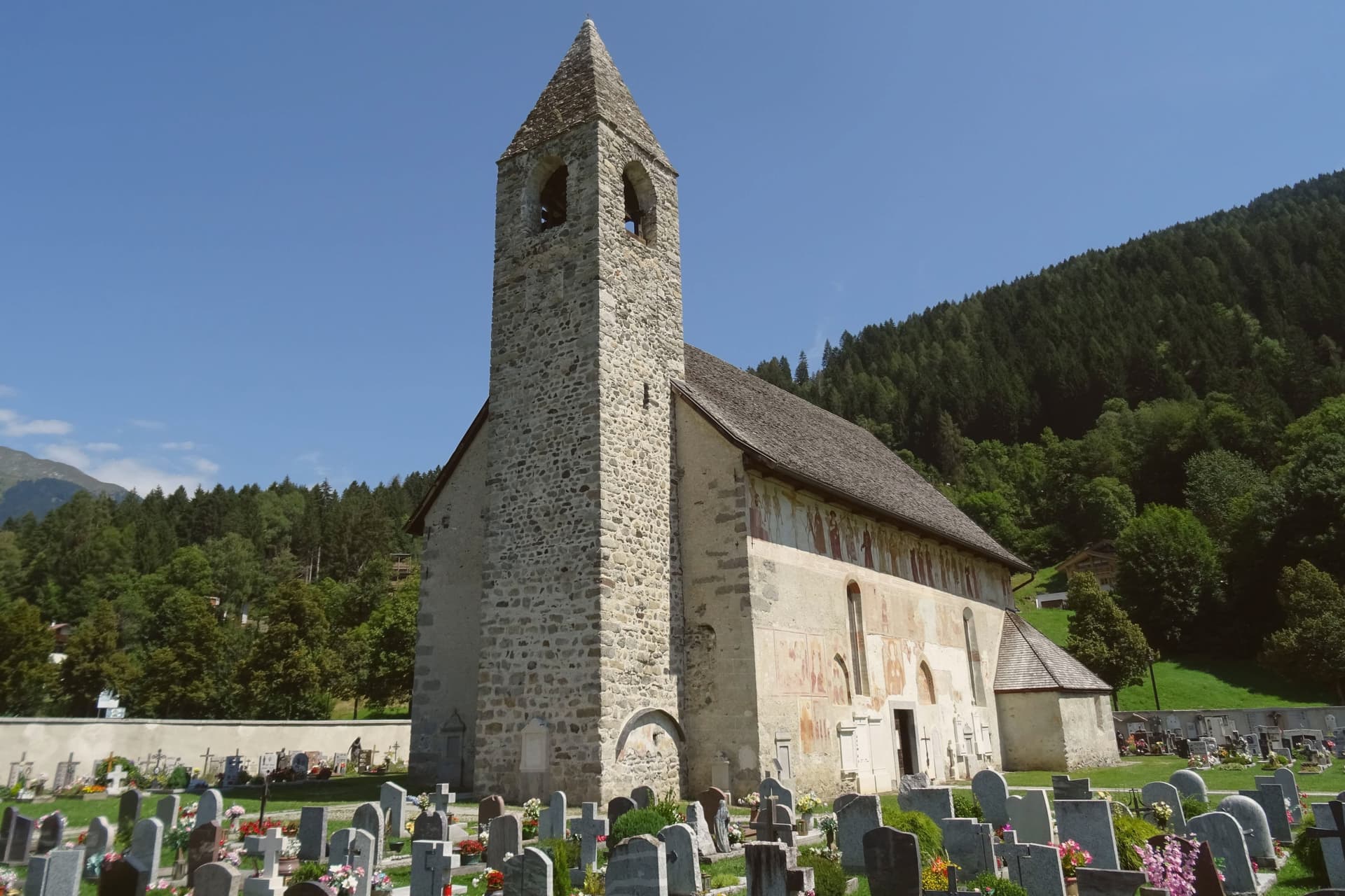
- Chiesa di San Vigilio. The church stands above the village. Its painted procession of eighteen skeleton pairs leads pope, emperor, king, beggar and child in a single line across the exterior wall, the fresco surviving in near-complete condition.
- Chiesa di Santo Stefano. Cemetery church on the edge of the village, frescoed inside and outside by the Baschenis painters with another Dance of Death cycle and scenes of saints.
- Parco Naturale Adamello-Brenta. Largest protected area in Trentino, covering most of the Pinzolo territory and including the Brenta Dolomites and the Adamello-Presanella glaciers.
How to get to Pinzolo
Trento is roughly 93 minutes away by road.
Our tip
May through October is the open season in Pinzolo, with the longest days in June and July and the Val Genova waterfalls running full from snowmelt. September is the cleanest light, the larches still green, the high refuges in the Brenta Dolomites still staffed. December through April reopens the village as a ski base, but the editorial calendar tracks summer use: hiking, the rifugio circuit, the Baschenis frescoes accessible without snow.
Cavalese
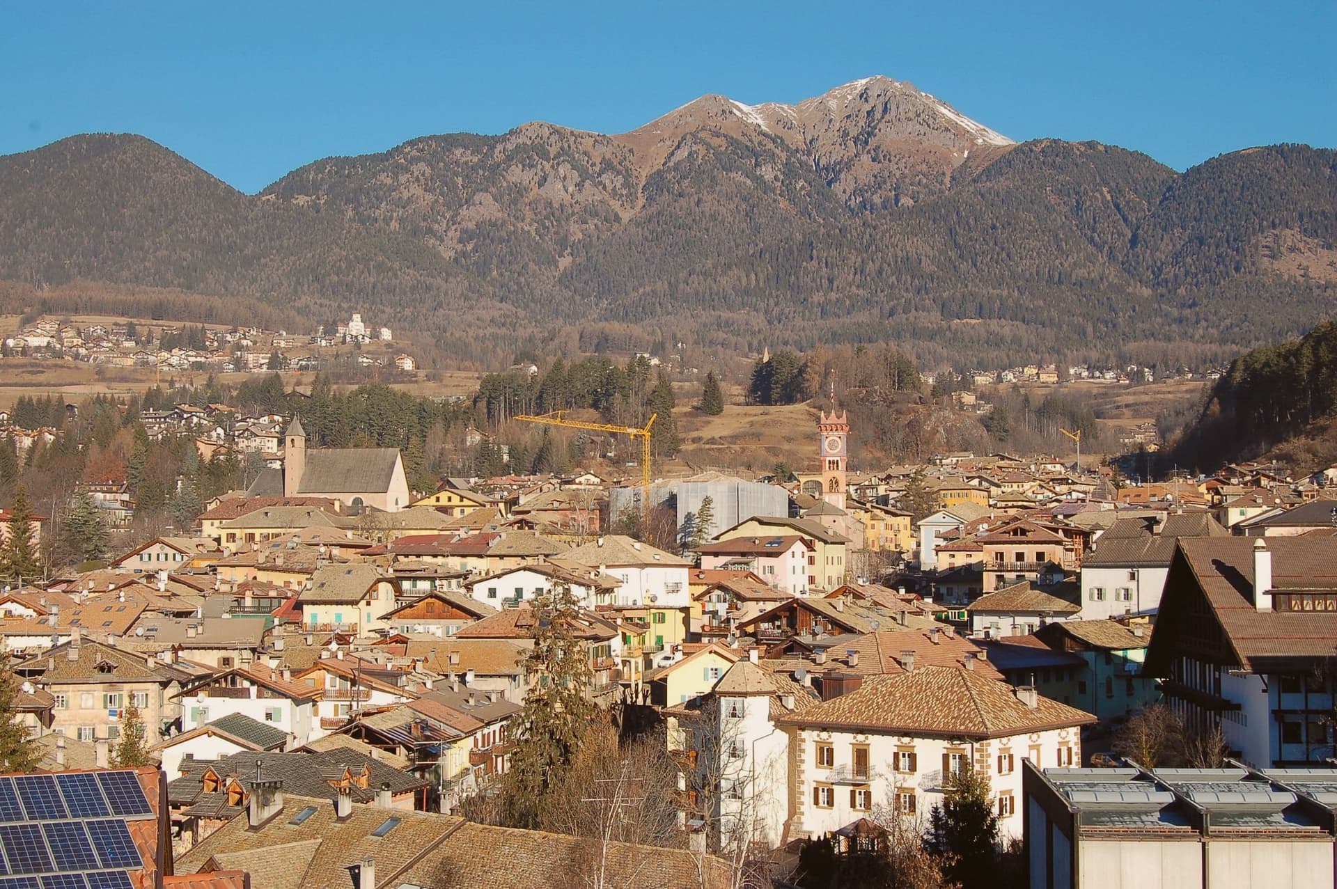
Why visit Cavalese
Cavalese sits at 1,000 metres on a south-facing terrace above the Avisio, forty kilometres northeast of Trento, the main town of the Val di Fiemme. The valley's eleven communes held their forest commons in common under the Magnifica Comunità, the self-governing body founded by the founding charter of 1111, and Cavalese has kept its seat through the Bavarian abolition of 1807 and every legal change since.
The valley floor carries the working memory of that governance: the archive of parchments, the frescoed council chambers, the bench in the open air where disputes were once judged. Above the town, the cableway to the Alpe Cermis climbs toward 1,912 metres, and the flat route along the Avisio ties Cavalese to the other Fiemme communes strung along the valley floor from Predazzo down toward the Adige.
Nine centuries of continuous self-rule and a valley of communes bound by a single river explain why Cavalese reads less like a single town than like the administrative floor of the whole valley.
El Molin, Orso Grigio have been named by a guide.
What to see in Cavalese
- Palazzo della Magnifica Comunità di Fiemme. Medieval bishop's residence enlarged in the Renaissance, seat of the community since 1810, with a picture gallery and an archive of parchments from the thirteenth to eighteenth centuries.
- Pieve di Santa Maria Assunta. Parish church of Cavalese, consecrated in 1134 on an older foundation, standing beside the park where the valley's representatives once sat in judgment.
- Banco della Reson. Stone bench in the Parco della Pieve where the representatives named in the Patti Ghebardini met as an open-air parliament to judge valley disputes.
How to get to Cavalese
Bolzano is roughly 95 minutes away by road.
Our tip
June through September is the high-valley season: meadows open above 1,000 metres, the Latemar and the Lagorai are reachable on day walks from the town, and the cycle path along the Avisio fills with day-trippers. December through March is the ski season on Alpe Cermis and the Lavazè plateau, with snow held above 1,000 metres into early April and the Tour de Ski final climb up the Cermis slope each January. April, May, October and November are the quiet shoulder months between the seasons, when the cable car runs reduced schedules and the valley returns to its residents.
Brentonico
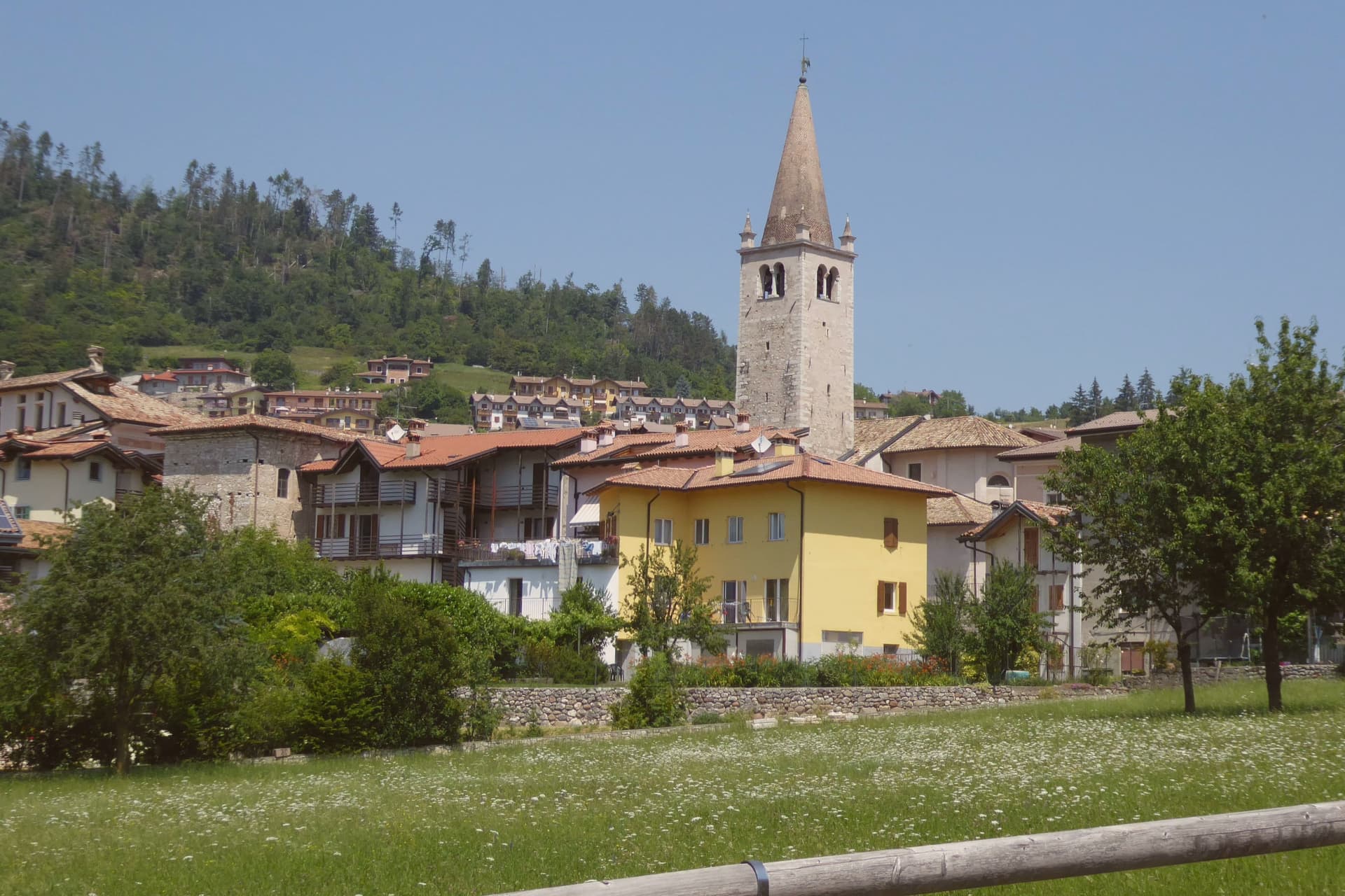
Why visit Brentonico
Brentonico sits at 692 metres on a plateau between Lake Garda and the Vallagarina. The commune runs from 500 metres in the valley to over 2,000 at the ridge, an altitude range wide enough to hold a chestnut hamlet at one end and ski hamlets at the other.
Castione, the lower hamlet, faces the Adige valley and lives by its terraces. San Valentino, Polsa and San Giacomo, the upper hamlets above 1,200 metres, face the opposite way, toward pasture and snow.
Palazzo Eccheli-Baisi anchors the centre and has changed hands once in a way that says something about the town: built in 1597 by mine managers, it passed in 1840 to a family of salami merchants, before ending up, in this century, as a house for fossils and for the office that manages the mountain's protected slope. That slope, and the garden set in front of the palace, both draw on the same fact: the mountain was named by European botanists for what grows on it, and the town's two conservation projects, one wild, one planted, sit on either side of the same building.
Above Crosano the ground still carries the trenches of the First World War, dug where the Austro-Hungarian line crossed the plateau. The valley below has been worked for chestnuts and the ridge above was fought over, and the palace in the centre now holds the record of both.
Maso Palù have been named by a guide.
What to see in Brentonico
- Palazzo Eccheli-Baisi. The building's later life traces the town's own turns: sold in 1840 by the founding mine-manager family to salami merchants, it now sits open to visitors as museum and park office at once, fossils in the rooms where ore accounts were once kept.
- Giardino Botanico di Brentonico. Opened in 2005 at 690 metres, directly in front of the palace, the garden gathers native and rare Monte Baldo plants into a plot small enough to walk in an afternoon.
- Parco Naturale Locale del Monte Baldo. The protected slope is where the mountain earns its old reputation: paths through it cross the endemic flora that gave the range its name among European botanists.
How to get to Brentonico
Trento is roughly 42 minutes away by road.
Our tip
May through October brings the warm months on the plateau, with the botanical garden in flower from late May, the Monte Baldo paths open above 1,500 metres, and the chestnut hamlets cool against the heat of the Vallagarina below. June and July see the rare Monte Baldo endemics in bloom on the upper slopes. October is the chestnut harvest, the busiest month in Castione, with the marroni roasted at autumn sagre.
Levico Terme
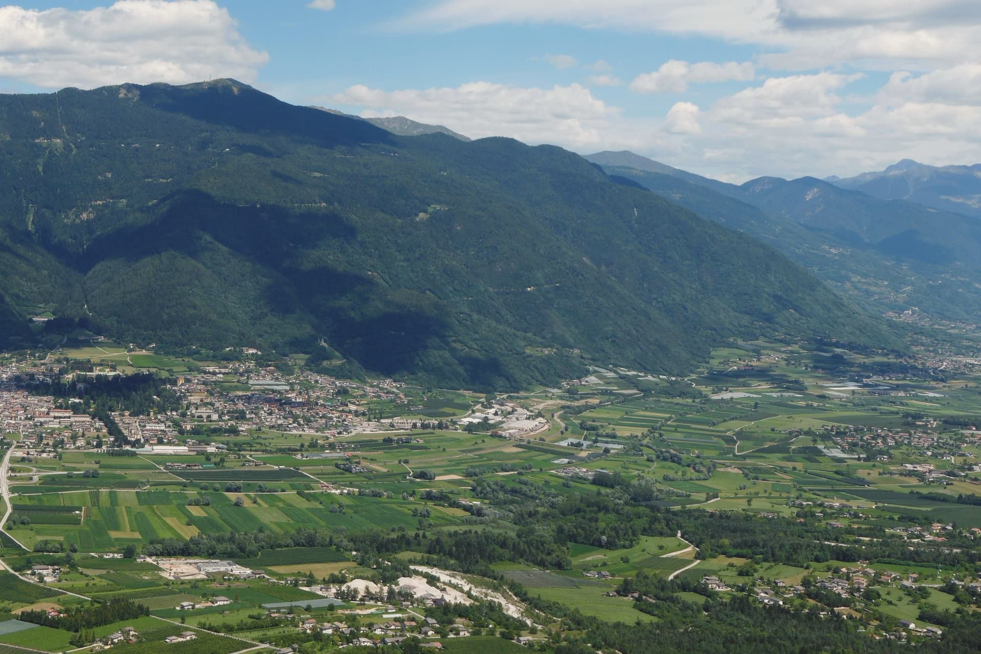
Why visit Levico Terme
Levico Terme sits at 520 metres in the Valsugana, twenty kilometres east of Trento, between the Lagorai chain and the high plateaus of Folgaria and Lavarone. The settlement passed under Habsburg jurisdiction in 1779 and was elevated to city rank in 1894 by decree of Franz Joseph I.
The spa quarter, the park and the lake sit close together at the edge of the old centre, with the fort watching all three from the hill above. The historic centre, with its imperial-era villas and the parish church of Santissimo Redentore, grew up around the spa rather than the other way round: the streets follow the shape of a resort built in the space of a few decades under Austro-Hungarian rule, rather than a town that predates it.
What survives is a place whose entire layout, from park gate to lakeshore to the fort on the ridge, still reads as the imperial spa it was built to be.
Boivin have been named by a guide.
What to see in Levico Terme
- Parco delle Terme. Grounds laid out by Georg Ziehl around the spa buildings and the hotel, with paths shaded by mature planting where the Christmas market sets up each winter.
- Grand Hotel Imperial. Art Nouveau facade facing the park it anchors, the rooms where Empress Elisabeth stayed still forming the core of the working hotel.
- Terme di Levico. The spa buildings that gave the town its purpose, drawing on water piped down from the mountain springs and still run as a treatment centre today.
How to get to Levico Terme
There is a railway station in the town, so you can arrive without a car and never need one while you are here. Trento is roughly 30 minutes away by road.
Our tip
Levico runs year-round: the thermal cures operate from spring through autumn, the Christmas market fills the Habsburg park through December, and the spa hotels stay open through the cold months. May through October is the lake season, with the Bandiera Blu waters warm enough for swimming from mid-June and the sailing and windsurfing clubs open. June through August can hit thirty degrees in the valley floor; the park and the lakeside hold the heat better than the centro storico in the afternoon.
Brunico
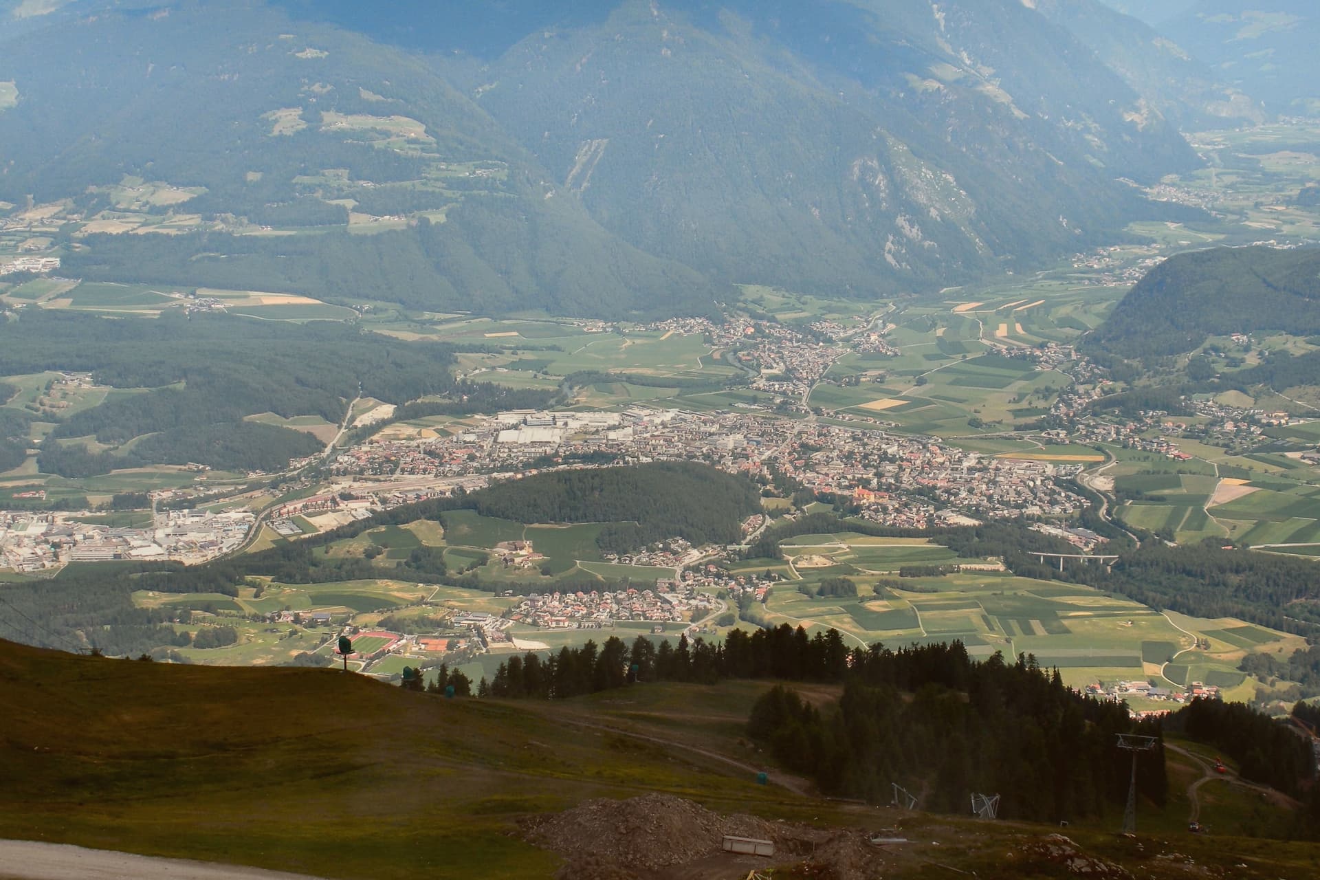
Why visit Brunico
Brunico, Bruneck in German, sits at 838 metres in the eastern Alto Adige, in the Val Pusteria. The name comes from the castle built above the settlement, and the town below grew up around it rather than the other way round.
First documented as Bruneke in 1256, it received weekly market rights and the privilege of high justice, and grew rich in the fourteenth and fifteenth centuries on the Augsburg-Venice trade that ran across the valley, the same trade that filled the Stadtgasse with merchant houses. The town has three distinct layers that sit close together but answer different purposes: the castle above holding the seat of the former prince-bishops, the walled Stadtgasse below as the commercial spine between the four gates, and Teodone at the edge of town, where the Mair am Hof Residence and its rebuilt farmhouses preserve a rural way of life that the town centre does not.
The mountain above the valley, reached from the town, adds a fourth register entirely, modern and built for a single striking structure rather than for defence or trade. Together these layers show a town shaped by three different economies in three different eras: episcopal power, alpine commerce, and now winter tourism, each leaving its own mark rather than replacing what came before.
Atelier Moessmer Norbert Niederkofler, AlpiNN by Norbert Niederkofler, b.local and 1 more have been named by a guide.
What to see in Brunico
- Castello di Brunico. The castle sits above the town as the former summer residence of the Brixen bishops. The museum inside occupies rooms that still read as a bishop's seat rather than a purpose-built gallery.
- Stadtgasse. Pedestrian street between the four gates, its townhouses carrying bay windows and ornate shop signs at close range, the kind of detail that only shows up on foot.
- Museo Etnografico Sudtirolese. South Tyrolean Folklore Museum in the Mair am Hof Residence at Teodone, built 1690-1700, with twenty-four rebuilt farmhouses from across the province in its open-air section.
How to get to Brunico
There is a railway station in the town, so you can arrive without a car and never need one while you are here. Bolzano is roughly 69 minutes away by road.
Our tip
May through October brings the warm months in the Pustertal, with the Stadtgasse and the castle terrace usable from early afternoon and Plan de Corones open for hiking and biking from late June. June and July are the cool alpine months, with long evenings in the historic centre and the cable cars running up from the south side of town. September and October bring the autumn colours and the start of Törggelen, the South Tyrolean chestnut-and-new-wine season. Festa dello Speck Alto Adige - Speckfest falls in September.
Bressanone
Why visit Bressanone
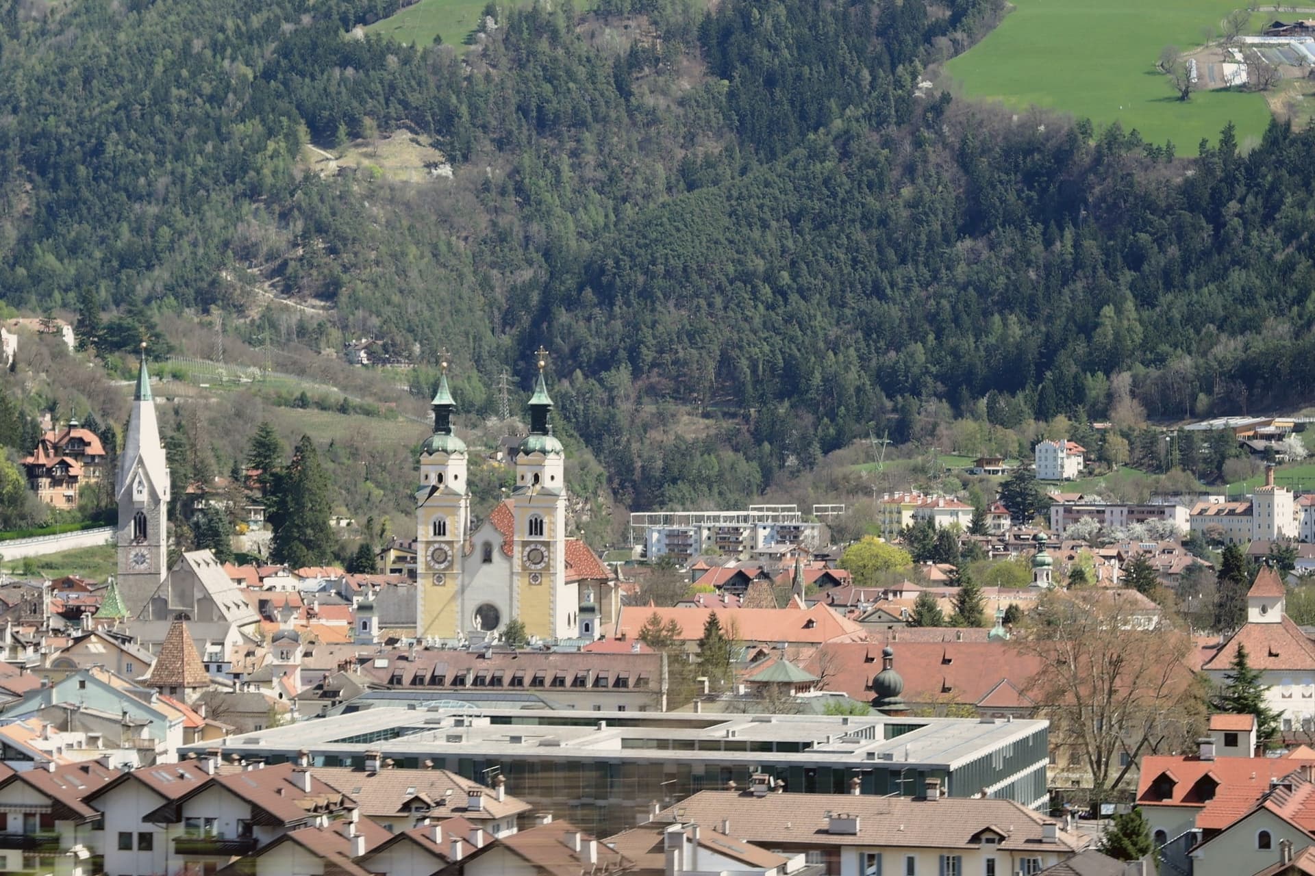
Bressanone, Brixen in German, is the third-largest town and the oldest urban settlement in South Tyrol, founded in the sixth century at the confluence of the Eisack and Rienz rivers at 560 metres, forty kilometres north of Bolzano. The bishopric was established here in the early Middle Ages and received imperial immediacy in 1027; in 1179 Frederick Barbarossa granted the bishop the title of prince of the Holy Roman Empire, and Brixen remained a prince-bishopric until secularisation in 1803.
The Hofburg, the bishops' palace, served as the seat of that power from the thirteenth century, with Renaissance courtyards, Baroque state rooms and the Diocesan Museum of religious art and historic nativity scenes inside. The Romanesque cathedral was rebuilt in Baroque form between 1745 and 1754, faced with thirty-three different types of marble and joined to the older cloister.
The Stufles district, across the Eisack bridge, is the oldest neighbourhood in the city. The Augustinian Abbey of Novacella, founded in 1142 by Bishop Hartmann four kilometres north, runs South Tyrol's northernmost winery, producing Müller-Thurgau, Kerner and Sylvaner.
Apostelstube, Vitis, Alpenrose and 3 more have been named by a guide.
What to see in Bressanone
- Duomo di Bressanone. Cathedral on the site of a tenth-century church, rebuilt as a Romanesque basilica in 1174 and reworked between 1745 and 1754 in Baroque form with thirty-three types of marble.
- Hofburg. Bishops' palace and seat of the prince-bishops from the thirteenth century to 1803, with Renaissance courtyard, Baroque state rooms and the Diocesan Museum.
- Torre Bianca / Weißer Turm. Seventy-eight metre bell tower of the parish church of San Michele, named for its bright tiled roof, with the present shape dating to 1459 and now a museum.
How to get to Bressanone
There is a railway station in the town, so you can arrive without a car and never need one while you are here. Bolzano is roughly 51 minutes away by road.
Our tip
April through June brings mild weather in the Eisack valley, with the cloister gardens of the Duomo and the courtyards of the Hofburg in shade and the high paths above the Plose opening from late May. September and October are dry and cool, with apple harvest across the orchards north of the city and the Törggelen season starting in early autumn. July and August can hit thirty degrees at 560 metres, with the Plose cable car carrying day-trippers up to cooler ridges. Mercato del Pane e dello Strudel falls in October.
More from Anywhere Italy
 The best small ski towns that eat well in Trentino-Alto Adige/Südtirol
 The best high-altitude villages with a serious restaurant in Trentino-Alto Adige/Südtirol
- The best towns with a serious restaurant in the province of Trento
- The best hidden ski towns in the province of Trento
- The 9 best small high-altitude villages that eat well in Trentino-Alto Adige/Südtirol
 The 9 best towns you can reach by train that eat well in Trentino-Alto Adige/Südtirol