
The best towns known for what they grow within 75 minutes of Rome
The country between Rome and the Cimini hills is volcanic, and everything tastes of it. Hazelnut groves run in low grey-green rows towards Lake Vico, chestnut woods take over above them, and the flat fields near the coast give up artichokes early in spring. The villages here are built from tuff, the soft dark stone that quarries out of the same ground the crops grow in, so a street and a hazelnut orchard are made of the same material. Autumn is the season to come: sagre for chestnuts and beans, new oil in the frantoi, mushrooms on every menu between the lakes.
Most visitors with a day to spare out of Rome go to Castel Gandolfo and the Castelli Romani, or head straight for the Villa d'Este gardens, and the coaches fill the car parks from mid-morning onwards. It is a sensible choice, and it is why the same handful of streets carries most of the traffic in the hills south and east of the city. The wine towns along the Appia see the rest.
The growing zones, though, extend well past the famous stops. The hazelnut and chestnut country of the Tuscia, the bean fields of the upper Treja valley, the market gardens of the old Etruscan coast: all of it is inside a short train or car ride of Rome, and far fewer people go. The towns below each sit inside the production area of a protected fruit or vegetable, which is a reliable way of finding somewhere that eats what it grows.
Of the 35 communes we have mapped in a 75-minute drive of Rome, 10 qualify as towns known for what they grow: each sits inside the production zone of a protected fruit or vegetable. The smallest, Calcata, has 905 residents.
If you are still choosing, we have also written The best hidden hill towns that eat well in the province of Viterbo and The 8 best hidden hill towns within 90 minutes of Roma.
Calcata
Why visit Calcata
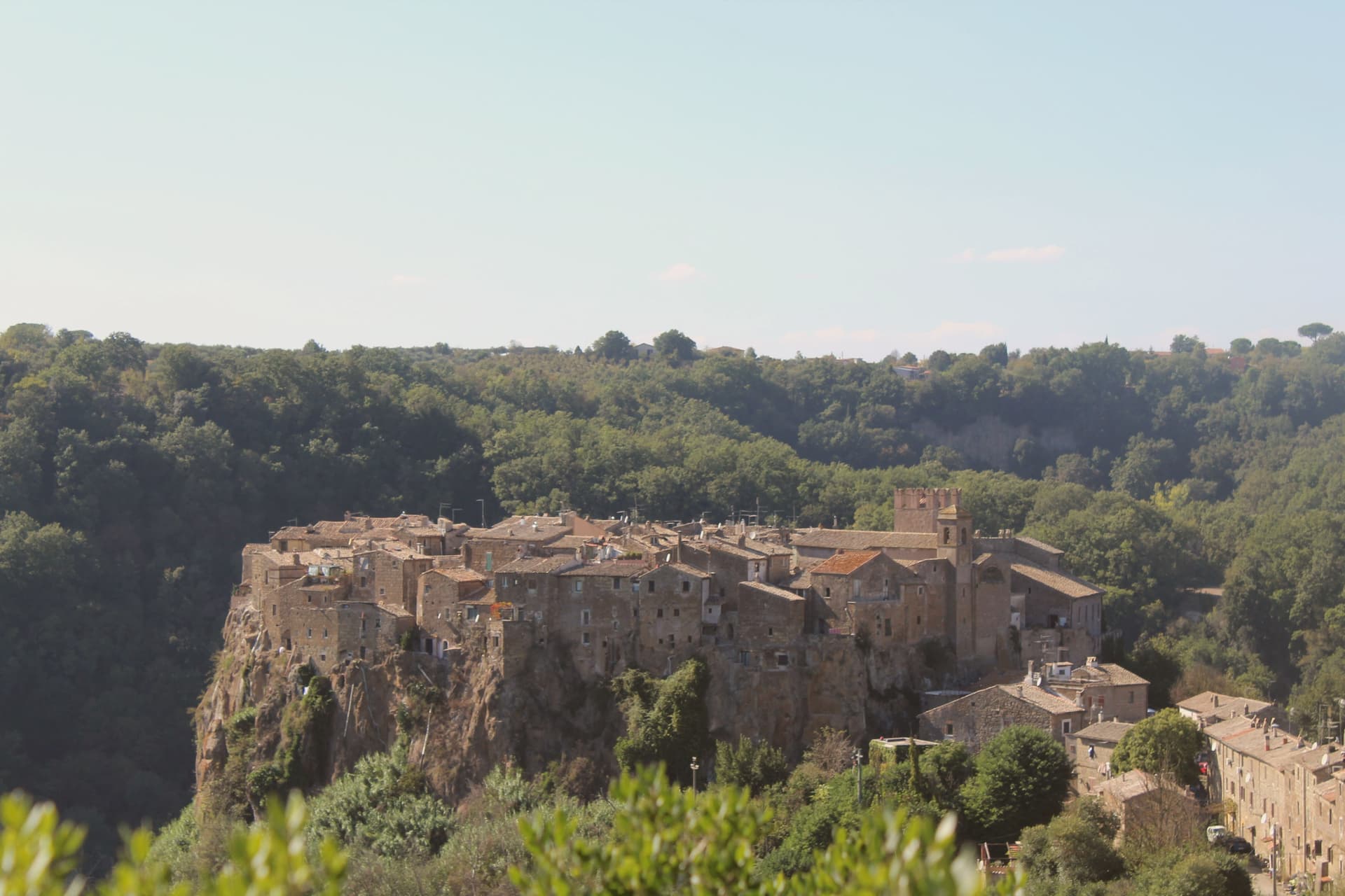
Calcata sits on a tufa cliff above the Treja valley, forty kilometers north of Rome. The Anguillara family walled and castled it in the 13th century.
In 1935 the Italian government condemned the village as structurally unsafe and ordered residents to move down to the new town in the valley below. Most did.
The empty houses on the cliff were re-occupied by artists, hippies and a small bohemian community from the late 1960s onward; they cleared the alleys, opened studios and bars, and turned an officially uninhabitable village into one of Lazio's strangest functioning settlements. The Holy Foreskin relic of Jesus was kept in the parish church here from 1527, taken from the Sancta Sanctorum during the Sack of Rome, and was an active object of pilgrimage until the relic was stolen in 1983 and the Vatican suppressed its cult.
Calcata Vecchia is now a single street of workshops on a cliff edge above the Parco della Valle del Treja.
La Piazzetta have been named by a guide.
What to see in Calcata
- Calcata Vecchia. Medieval village on a tufa cliff, condemned in 1935 and re-occupied from the 1960s by artists and craftspeople.
- Castello Anguillara. 13th-century baronial castle of the Anguillara family, partially restored, now owned by the Treja Valley park.
- Chiesa del Santissimo Nome di Gesù. Parish church that held the Holy Foreskin relic from 1527 until its theft in 1983.
How to get to Calcata
Terni is roughly 66 minutes away by road.
Our tip
April through June and September through October are when Calcata works. The Treja valley below is in leaf, the cliff in sun, the workshops and bars in the old village all open. July and August push past thirty degrees and the artist community thins out.
Bassano in Teverina
Why visit Bassano in Teverina
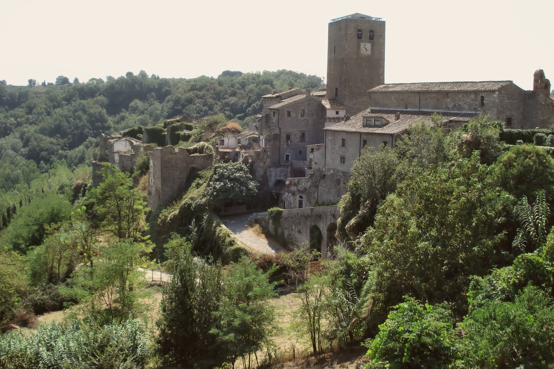
Bassano in Teverina sits at 304 meters on a tufa spur on the eastern offshoots of the Cimini hills, where Lazio meets Umbria above the Tiber valley. It is the smallest commune in the Tuscia Viterbese: 1,260 residents on a hill above the river.
The town is built around the Torre dell'Orologio, a twenty-five-meter peperino tower with a hand-painted majolica clock from around 1700 on its face. Inside it, walled into the structure, stands the Romanesque bell tower of the older church of the Madonna dei Lumi, built around 1100 and embedded within the new tower between 1559 and 1571 by the Madruzzo family.
The inner bell tower is one of the rare Italian campanili animati, with anthropomorphic figures carved into its peperino columns. The Madonna della Quercia chapel, built 1674-1678, stands around the oak where a tile of the Madonna and Child was found.
Bassano is a Borgo più Bello and a Città della Nocciola of the Tonda Gentile Romana DOP.
Olivo Ristorante dell'Olivo Country Club have been named by a guide.
What to see in Bassano in Teverina
- Torre dell'Orologio. Twenty-five-meter peperino tower of around 1500 with majolica clock face from 1700, built around an older Romanesque bell tower by the Madruzzo family.
- Campanile Animato (Madonna dei Lumi). Eleventh-century Romanesque bell tower walled inside the Torre dell'Orologio, with anthropomorphic figures carved into its peperino columns.
- Santuario della Madonna della Quercia. Built 1674-1678 around the oak where a tile of the Madonna and Child was found, on the road below the centro storico.
How to get to Bassano in Teverina
Terni is roughly 36 minutes away by road.
Our tip
April through June and September through October are the months for Bassano. Hazelnut groves leaf out in late April, harvest comes in late August into September, and the Tiber valley clears of haze in autumn. July and August touch the mid-thirties; the small centro storico empties in the afternoon heat.
Oriolo Romano
Why visit Oriolo Romano
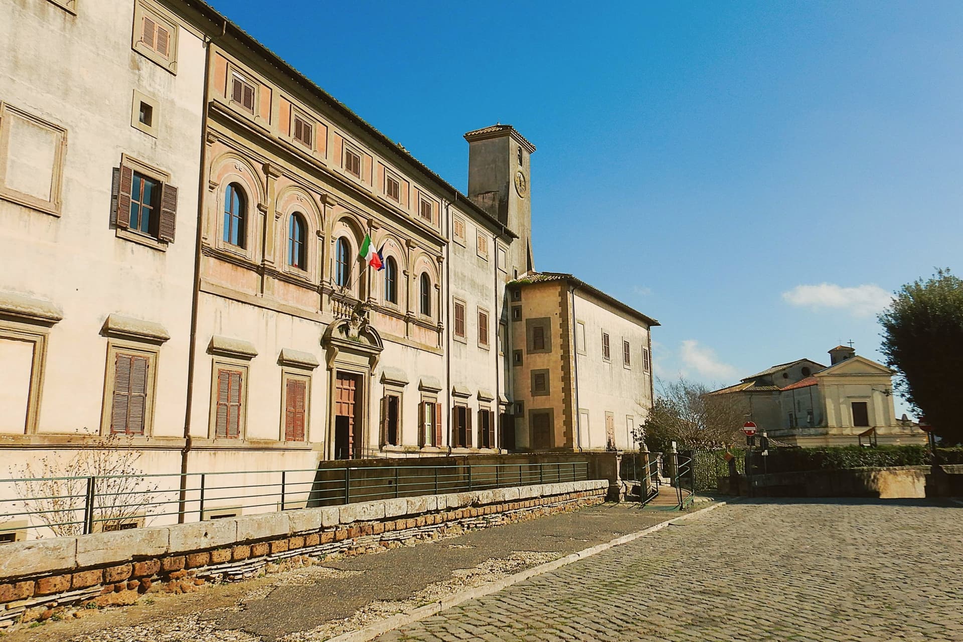
Oriolo Romano sits at 420 meters in the Sabatini hills, between Lake Bracciano and the volcanic Cimini, not far from the old Via Clodia. The village is unusually new for the Tuscia: in 1560 the Orsini family ceded a wooded fief to the nobleman Giorgio Santacroce, who began clearing the forest and founded a planned agricultural settlement.
The first inhabitants were farmers, shepherds and woodcutters drawn from Tuscany and Umbria, so the local accent kept Umbrian inflections for generations. The palace at the center of the village gave the settlement its shape, with the parish church and the main square arranged around it as the plan intended.
The forest that once covered the whole fief survives now at the margins, an exceptionally low-altitude stand for an Apennine beech wood, while hazelnut groves have taken over the lower slopes that were cleared for farming. The village, in effect, is the cleared half of a wooded fief, its cultivated ring still framed by the wood the Santacroce family left standing.
What to see in Oriolo Romano
- Palazzo Altieri. Sixteenth-century palace enlarged in 1674 under Pope Clement X, with Old Testament frescoes and painted views of the Altieri fiefs.
- Faggeta di Monte Raschio. Primeval beech forest of about eighty hectares between 400 and 550 meters, UNESCO World Heritage since 2017.
- Piazza Umberto I. Central square of the 1560 plan, anchored by the palace and the parish Chiesa di Sant'Anna at the head of the village.
How to get to Oriolo Romano
There is a railway station in the town, so you can arrive without a car and never need one while you are here. Roma is roughly 75 minutes away by road.
Our tip
April through June and September into October are the months for the beech forest, when the canopy is full and the trails on Monte Raschio are at their cleanest. The exceptionally low altitude of the faggeta means autumn color arrives earlier and lasts longer than in higher Apennine beech woods. July and August push the lower hills into the low thirties; the forest holds shade and stays five or six degrees cooler than the surrounding farmland. Oriolo Romano Porcini Mushroom Festival falls in September.
Caprarola
Why visit Caprarola
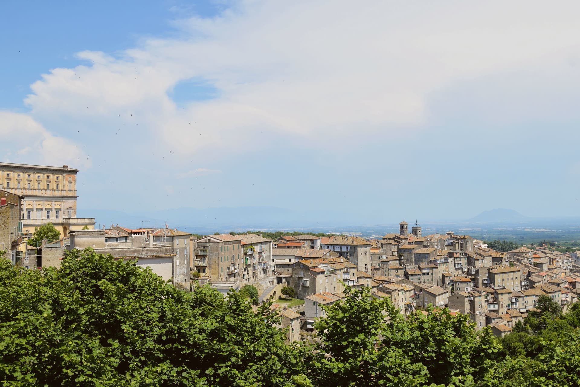
Caprarola stands at about 510 meters on the volcanic slopes of the Cimini, six kilometers east of Lago di Vico. The town is built on a single axis that climbs from the lower village to the Villa Farnese, the pentagonal Renaissance palace that organises everything below it.
Antonio da Sangallo the Younger designed the original fortress in 1530; after Sangallo's death the work was suspended, and Cardinal Alessandro Farnese the Younger reassigned it to Vignola in 1559. Vignola kept the pentagonal plan but turned it from a fortress into a Mannerist residence, with a circular colonnaded courtyard at its center, a scala regia spiraling between floors and the fresco cycles of the Zuccari brothers.
The plan was the model later copied for the Pentagon in Washington. Behind the villa, the Giardini Farnese climb into the chestnut and beech woods of the Cimini.
Caprarola is part of the Città della Nocciola and Città del Castagno networks, a recognition of the volcanic soils that produce both.
Trattoria del Cimino, Vineria Vignola Salumeria e cucina have been named by a guide.
What to see in Caprarola
- Villa Farnese. Pentagonal Mannerist palace by Vignola, built 1559-1573 on Sangallo's earlier fortress plan, with a circular colonnaded courtyard.
- Giardini Farnese. Sixteenth-century formal garden and casino di caccia behind the villa, climbing into the chestnut woods of the Cimini.
- Lago di Vico. Volcanic crater lake at 510 meters, one of the highest of the major Italian lakes, shared with Ronciglione.
How to get to Caprarola
Terni is roughly 67 minutes away by road.
✷ We have written about Caprarola
“We went there on a Saturday in July, straight from Ronciglione, since it is about a 15-minute drive. We expected hordes. I don’t remember exactly, but I’m sure there were no more than 10 people there, including us two. Literally no one was there. The garden, which is huge and worth a trip alone, was completely empty and only for us.”
Read our piece on Caprarola →Caprarola | The town that became a driveway
Our tip
April through June and September into October are the months for the villa and the Cimini woods, when the chestnut canopy holds shade and Lago di Vico is at its clearest. July and August push the lower town into the low thirties; the high ceilings of the Villa Farnese keep visitors cool through the heat. The hazelnut harvest runs late August and September, the chestnut harvest follows in October, and both fill the surrounding sagre. Hazelnut Festival falls in August.
Capranica
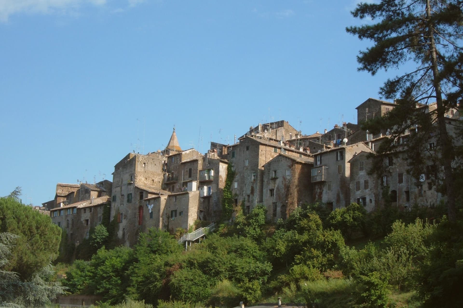
Why visit Capranica
Capranica sits in the Tuscia at the fifty-fifth kilometer of the Via Cassia, on a hill overlooking the Sutri valley between Lake Bracciano and Lake Vico. The Etruscans worked this ground; the medieval borgo grew along the Cassia after the road was rebuilt in the second century BC.
The Anguillara family appeared in 1305 and held the town through most of the fourteenth century. In 1337, under Orso degli Anguillara, Francesco Petrarca stayed here on his way south, the moment local memory still attaches to the place.
Castrovecchio is the oldest quarter, a wedge of stone houses and stepped streets above the Castello degli Anguillara. The town is one of the Italian comuni crossed by the Via Francigena, with a marked stage running north toward Sutri and Vetralla.
Hazelnut groves cover the surrounding slopes; Capranica is a member of the Città della Nocciola network and supplies the Tonda Gentile Romana, the local DOP variety.
What to see in Capranica
- Castello degli Anguillara. Medieval fortress at the head of Castrovecchio, seat of the Anguillara family from 1305 and the place Petrarch stayed in 1337.
- Castrovecchio. Oldest quarter of the town, a wedge of stone houses and stepped streets rising above the Cassia toward the castle.
- Chiesa di San Francesco. Fourteenth-century Franciscan church on the edge of Castrovecchio, with fresco fragments and Anguillara family tombs.
How to get to Capranica
There is a railway station in the town, so you can arrive without a car and never need one while you are here. Roma is roughly 72 minutes away by road.
✷ We have written about Capranica
“So a borgo like Capranica, and especially Capranica, has nothing to offer except this vibe. After darkness sets, the town becomes the same medieval village that it was 500 years ago. The only difference is the electric lighting and some satellite dishes on some roofs.”
Read our piece on Capranica →Capranica | The stop on the journey
Our tip
April through June and September into October are the walking months in the Tuscia, when the hazelnut groves are green and the Cassia is light. July and August push the slopes into the low thirties; the medieval centro storico holds shade well enough, but afternoons stay quiet. The hazelnut harvest runs through late August and September and the air around the town smells of toasted nuts for weeks. Festeggiamenti in Onore di San Terenziano falls in August.
Ronciglione
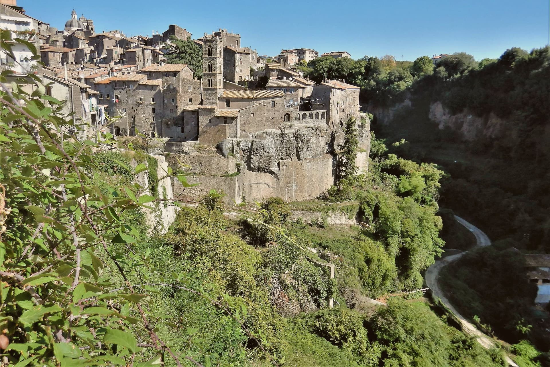
Why visit Ronciglione
The town stands on a tufa spur at 441 meters, five kilometers from the lake, with the Cimini hills and their hazelnut groves closing in around it on every side. The first record of it dates to 1103.
The Prefetti di Vico held it before the Farnese took it as a Duchy, and the sixteenth-century pontiff who granted the town its Carnival did so during that same passage of rule from prefects to dukes. The fortress's towers control the single natural approach to the historic center, so the medieval town and its defenses are really one structure: whoever held the towers held the road in.
Everything built afterward, the cathedral, the contrade, the Carnival itself, sits inside that same defended perimeter. What the RAI title recognized in 2023 was less a single monument than that whole arrangement still intact: a fortified approach, a walled center, and a lake and hills that have not changed shape around it.
Riva Felice have been named by a guide.
What to see in Ronciglione
- Rocca dei Borgia (I Torrioni). Medieval fortress of the Prefects of Vico, twin round towers guarding the only natural approach to the centro storico.
- Duomo dei Santi Pietro e Caterina. Baroque cathedral of 1671, polychrome marble altar, fifteenth-century triptych by a Viterbo painter, wooden statue of San Bartolomeo.
- Lago di Vico. Volcanic lake ringed by the Cimini hills, its waters filling the crater below the level of the town on its spur.
How to get to Ronciglione
There is a railway station in the town, so you can arrive without a car and never need one while you are here. Roma is roughly 64 minutes away by road.
✷ We have written about Ronciglione
“Suddenly, we weren't running around. Ronciglione has nothing, and I mean zero things to show you. It's a pretty generic medieval town near Rome. It doesn't have a big piazza. There is a gate, a duomo, 2-3 main streets, and pretty much that's it. Yet, it was the center of our attention at that time. After spending just a few days there, we went back to Rome without wrinkles, with an oddly weird smile on our faces.”
Read our piece on Ronciglione →Ronciglione | Baptism into the Other Italy
Our tip
April through June brings the Cimini hills into green, hazelnut groves in flower and Lake Vico cool enough for the morning. September and October are the harvest months, dry, mild, with the air clear enough to see Monte Cimino from the Rocca. July and August touch the upper thirties and fill the lake with Romans on weekends. Palio di Ronciglione falls in July.
Canale Monterano
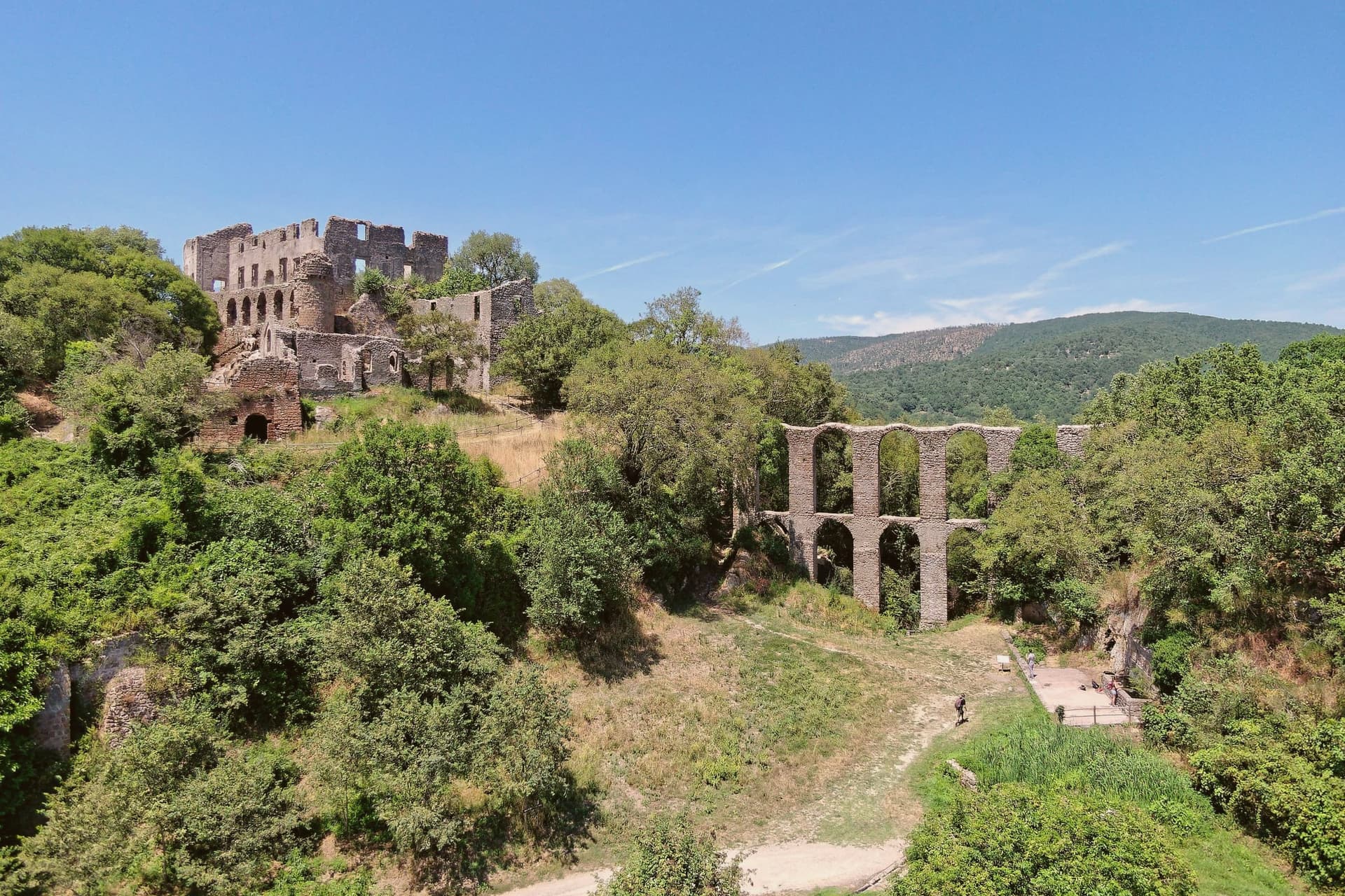
Why visit Canale Monterano
Canale Monterano sits at 376 meters on a tuff hill forty-five kilometers northwest of Rome, between the Bracciano basin and the Tolfa hills. The inhabited town is small, four thousand residents, built around a working bakery tradition.
Two kilometers away, on a separate tuff bluff above the confluence of the Mignone and Bicione rivers, is the reason most people make the trip: the ghost town, set on the far side of a valley the living town does not touch. The relationship between the two places is one of distance and separation rather than continuity.
Canale Monterano went on being a town; the settlement on the bluff did not, and the two kilometers between them mark the difference between a place that was rebuilt after the fire and one that never was. What is left on the bluff is masonry with the roofs and interiors gone, watched over from its highest point by the palace facade, with the fountain still running below in an otherwise empty piazza.
The regional reserve now holds the whole valley, ruin and river system together, so that the abandoned village survives inside protected land rather than beside a working one.
What to see in Canale Monterano
- Ruderi di Monterano. Ghost town two kilometers from Canale, burned by French Republican troops in 1799, never rebuilt; now the centerpiece of the regional reserve.
- Chiesa e Convento di San Bonaventura. Roofless, facing an open sky where the roof beams once sat. The façade and convent block still stand at the edge of the ruined village, built for the Altieri family by Gian Lorenzo Bernini.
- Fontana Ottagonale del Leone. Still flowing through the stone lion's mouth in the middle of an otherwise empty piazza, the only thing in the ghost town that still functions as built.
How to get to Canale Monterano
Roma is roughly 70 minutes away by road.
Our tip
April through June and September through October are the best months for the reserve. The trail from the parking lot to the ruins is exposed, and spring and autumn keep the temperatures comfortable. July and August push past thirty degrees on the tuff plateau, and the open ruins offer no shade after eleven in the morning; early-morning visits are the workaround. Sagra del Lombrichello a Canale Monterano falls in July.
Sutri
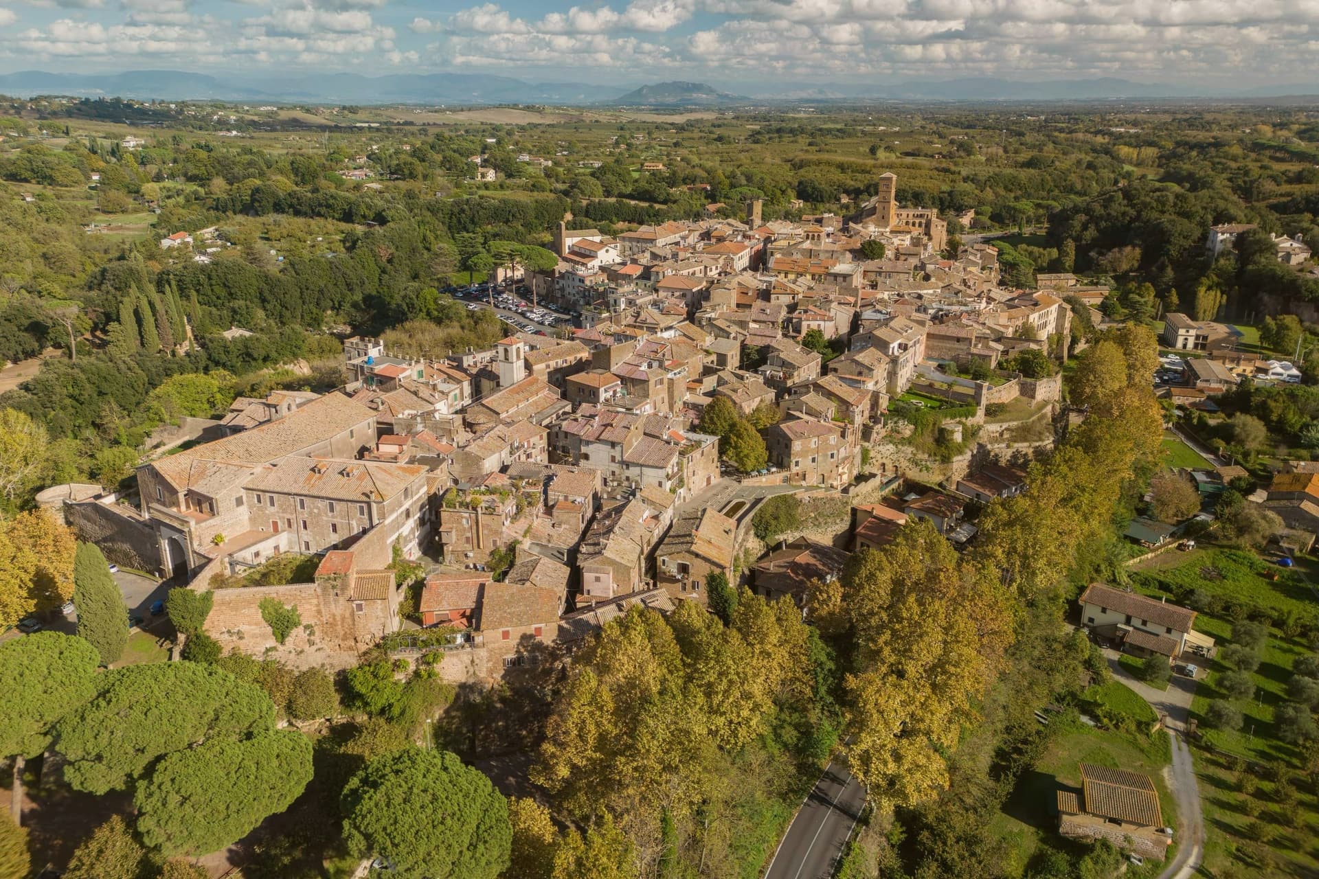
Why visit Sutri
Sutri sits at 291 meters on a narrow tuff spur, fifty kilometers north of Rome on the old road linking the two. The Etruscans held it before the Romans took it in the fourth century BC, and it was among the colonies that refused further military contributions to Rome during the Second Punic War in 209 BC.
The rock-cut monuments that define the town, the arena, the temple turned sanctuary, the chamber tombs, all come from the same tuff spur the town is built on, so the stone that gives Sutri its ground is also what its Etruscan and Roman residents carved into. The high ground above, where the eighteenth-century villa and its gardens sit, looks down over that older excavated town rather than sitting apart from it.
Local tradition ties the town's beans to Charlemagne, who passed through and was supposedly relieved of an attack of gout by Sutri's variety. What the place adds up to is a settlement where the town and its excavation are the same rock: nothing was built so much as removed.
N'uovo Vino e Cucina have been named by a guide.
What to see in Sutri
- Anfiteatro Romano. Elliptical amphitheater about forty-nine by forty meters, carved directly out of the tuff rock rather than built on it.
- Mithraeum / Madonna del Parto. Roman temple to Mithras hewn into the tuff and reused as a Marian sanctuary, accessed through the medieval rock-cut church.
- Necropoli rupestre. Etruscan necropolis with dozens of rock-cut chamber tombs in the cliff face along the Via Cassia.
How to get to Sutri
Roma is roughly 57 minutes away by road.
Our tip
April through June and September into October are the best months in the tuff country, when the amphitheater grass is green and the gardens of Villa Savorelli are open. July and August push afternoons into the mid-thirties; the rock-cut Mithraeum and tomb chambers stay cool and become the part of the visit that doesn't need to be timed. November through March is quiet. Sagra del Fagiolo falls in August.
Cerveteri
Why visit Cerveteri
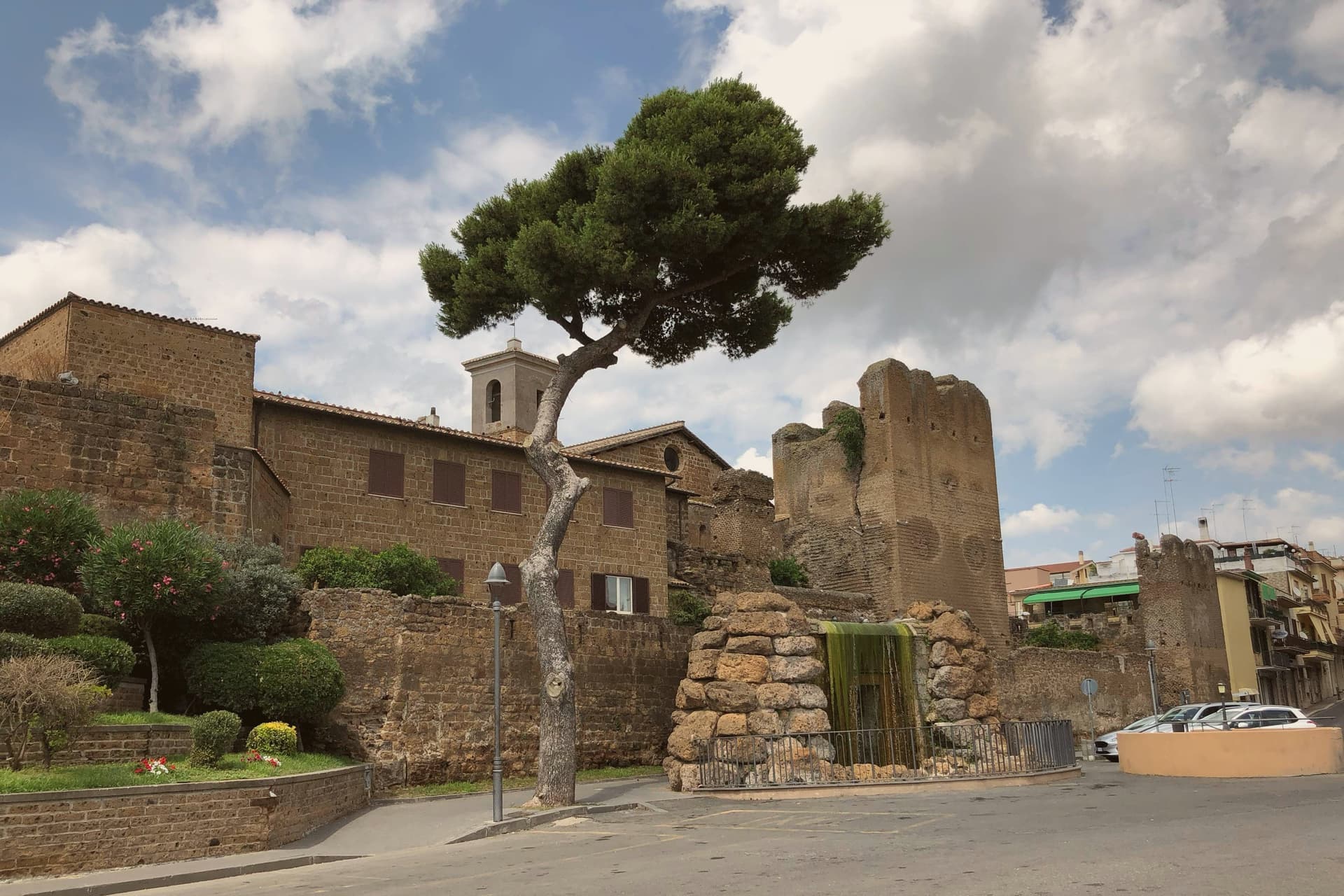
Cerveteri sits on a tufa outcrop at 81 meters above the coastal plain, seven kilometers inland from the Tyrrhenian and thirty-five northwest of Rome. The Etruscans called it Caisra, the Greeks Agylla, the Romans Caere; at its height around 600 BC it covered fifteen times the area of the modern town and held an estimated 25,000 to 40,000 people, the equal of Tarquinia at the peak of Etruscan power.
The medieval town inherited the central plateau and was renamed Caere Vetus, the Old Caere, to distinguish it from the coastal Caere Novum that no longer exists. The Castello Ruspoli at the centre of the medieval town encloses sections of fourth-century BC Etruscan walls in its base.
Two kilometers north, the Banditaccia necropolis covers 400 hectares of which 10 are visitable, with around 1,000 rock-cut tombs and the great earth tumuli that gave Etruscan funerary architecture its most concentrated expression. It joined the UNESCO list with Tarquinia in 2004.
Arià Osteria di Fuori Porta have been named by a guide.
What to see in Cerveteri
- Necropoli della Banditaccia. UNESCO Etruscan necropolis 2 km north of town, covering 400 hectares with around 1,000 tombs and the great earth tumuli that defined Etruscan funerary architecture.
- Museo Nazionale Cerite. National Etruscan museum inside the Castello Ruspoli, with sarcophagi, ceramics and grave goods recovered from the Banditaccia tombs.
- Castello Ruspoli. Medieval Orsini-Ruspoli fortress at the centre of the old town, with fourth-century BC Etruscan walls preserved in its base.
How to get to Cerveteri
There is a railway station in the town, so you can arrive without a car and never need one while you are here. Roma is roughly 50 minutes away by road.
Our tip
May through September is the strongest window. The Banditaccia tumuli need open ground and clear weather; April and October are workable but rain blurs the rock-cut interiors. Summer crowds concentrate on the coastal section of the comune around Marina di Cerveteri and Cerenova, leaving the necropolis quieter than the dates would suggest. Festa della Birra falls in August.
Tivoli
Why visit Tivoli
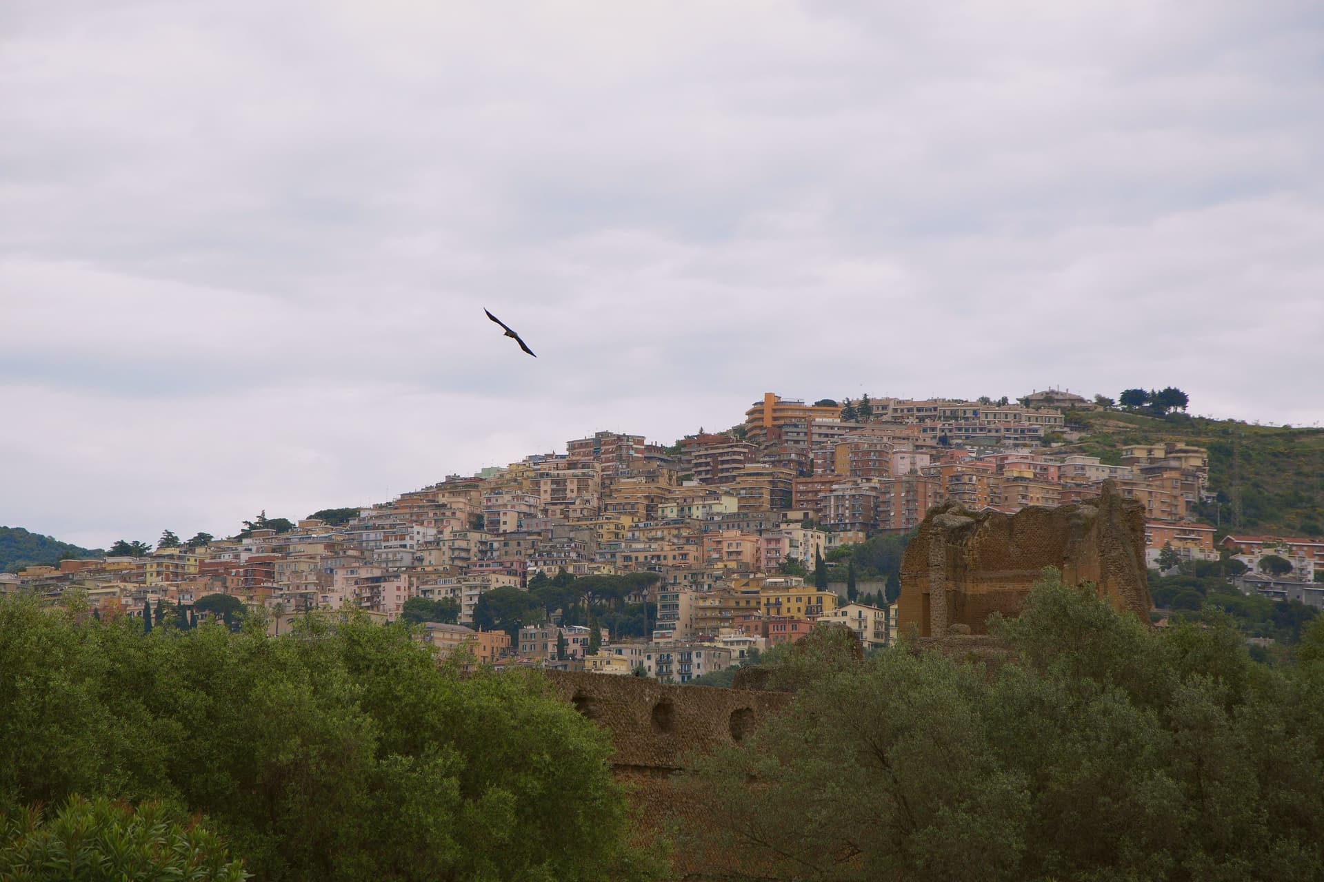
Tivoli sits at 235 meters on the Aniene where it drops 120 meters off the Tiburtini hills, twenty-five kilometers east of Rome. The Romans called it Tibur and built it up as their summer station; the moneyed classes carried on building here for two thousand years afterward.
Two of those projects became UNESCO sites, listed separately despite standing close together. Hadrian's estate, four kilometers below town, covers 120 hectares with the remains of thirty monumental buildings the emperor built between 117 and 138 AD to recreate the architectural memories of Egypt, Greece and Asia Minor.
The Renaissance garden inside the upper town was laid out from 1550 onward for a cardinal of the Este family; its grounds carry 51 fountains powered entirely by gravity from the Aniene. The cardinal stripped much of the marble from Hadrian's estate to decorate his own grounds, so the imperial villa on the plain and the garden in the upper town are bound together by more than proximity: one was quarried to build the other.
Below them both, the Villa Gregoriana park drops into the gorge where the river was diverted in 1832 to create the 120-meter Cascata Grande. The travertine quarries that built Rome are still working in the plain below.
The upper town, the lower estate, and the gorge between them form a single continuous cut through two thousand years of building, borrowing, and quarrying around the same fall of water.
Li Somari, NUH Osteria Contemporanea, Sibilla and 2 more have been named by a guide.
What to see in Tivoli
- Villa d'Este. The fountains step down the hillside in tiers, fed by nothing but gravity, so the sound of falling water carries through the whole garden. Cardinal Ippolito d'Este stripped much of the marble for it from Hadrian's villa down the hill.
- Villa Adriana. The remains of thirty monumental buildings spread across the Tiburtine plain, among them the Canopo and the Teatro Marittimo, a walled island retreat inside the larger estate.
- Villa Gregoriana. The park drops into the gorge cut by the Aniene, where the river was diverted through Monte Catillo to feed the fall below town.
How to get to Tivoli
There is a railway station in the town, so you can arrive without a car and never need one while you are here. Roma is roughly 31 minutes away by road.
Our tip
April through June and September through October are when the Aniene gardens look the way Cardinal Ippolito wanted them to. The Villa d'Este fountains run hardest in spring after the winter rains; the Villa Adriana hectares are walkable in shoulder weather without burning. July and August touch the upper thirties and the unshaded ruins at Villa Adriana become punishing by mid-morning; the gorge at Villa Gregoriana stays cooler. Festa dell'Inchinata falls in August.
More from Anywhere Italy
- The best hidden hill towns that eat well in the province of Viterbo
 The 8 best hidden hill towns within 90 minutes of Roma
- The best towns that eat well in the province of Viterbo
 The best hill towns with a food festival in Lazio
 The best towns known for what they grow within 90 minutes of Perugia
 The best hot-spring towns within two hours of Rome