
The best towns you can reach by train in the province of Viterbo
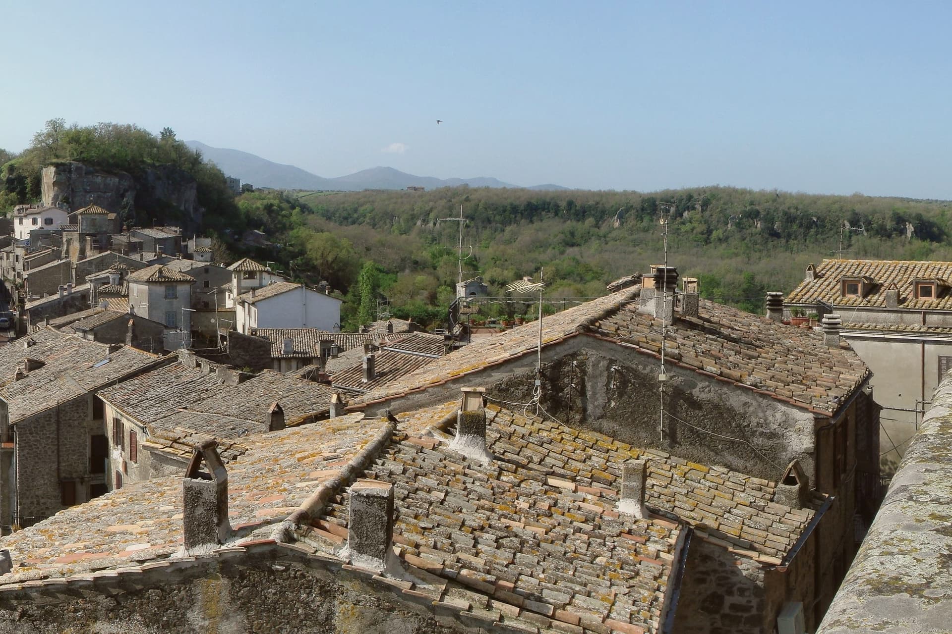
The province of Viterbo is built out of tuff, the grey-brown volcanic stone that the Etruscans quarried and everyone since has kept using, so whole streets look as though they were cut rather than assembled. The landscape behind them is volcanic too: the crater lakes of Bolsena and Vico, chestnut woods on the Cimini hills, hazelnut groves running in straight lines to the horizon. Autumn is the season that makes the most sense here, when the new olive oil comes out of the mills, the porcini appear in the market, and lunch tends towards pasta with sheep's cheese and pepper, lake fish, and the local white wine from the slopes above Bolsena. Winter mornings bring steam off the thermal springs outside Viterbo, which have been in use since Roman baths were the point of coming.
Most travellers arriving in this part of Lazio are on their way somewhere else, usually Rome, or else they are doing the day trip to the gardens of Villa Lante and Bagnaia, or driving up to Civita di Bagnoregio, the tuff outcrop reached by a footbridge that now charges admission and receives coachloads of visitors in every month with decent weather. The famous places absorb the crowds efficiently, and the roads to them are congested on Sundays. Parking is the constant problem, since the historic centres were never designed for cars and the car parks sit awkwardly below the walls. Northern Lazio has a reputation as driving country, and that reputation keeps people in traffic.
The tuff, the lake, the Etruscan necropoli and the good cheap lunches all continue past the famous stops, and a surprising amount of it sits within walking distance of a railway station. The regional lines out of Rome towards Viterbo, and the coastal line north towards Tarquinia, pass through towns where fewer people get off. These are the ones we have confirmed you can reach without a car, and what to do once the train leaves.
Of the 16 communes we have mapped in the province of Viterbo, 8 qualify as towns you can reach by train: we have confirmed each is reachable without a car. The smallest, Bomarzo, has 1,674 residents.
If you are still choosing, we have also written The best hill towns you can reach by train within 90 minutes of Roma and The 10 best hidden hill towns you can reach by train within 90 minutes of Terni.
Bomarzo
Why visit Bomarzo
Bomarzo sits on a lava spur of the Monti Cimini, fifteen kilometers east of Viterbo, on the wooded edge of the Tuscia. The village is small and medieval, dominated by the palazzo above it, its lanes stepping down to a lower piazza.
The wooded valley below holds the reason most people come: the Sacro Bosco, also called the Parco dei Mostri, designed for Vicino Orsini's garden by Pirro Ligorio, with sculptures attributed to Simone Moschino. The garden was abandoned for centuries before the Bettini family restored it in the 1950s; Salvador Dalí and Jean Cocteau visited in the 20th century, drawn by the same strangeness that had emptied the place out.
What the town adds up to is a pairing of restraint and excess set close together: a modest hill village and medieval rocca standing over a valley where one man built monsters in stone because ordinary grief needed no ordinary monument.
We confirmed you can reach this one by train.
What to see in Bomarzo
- Sacro Bosco (Parco dei Mostri). Stone giants, an ogre's mouth carved into the bedrock with a bench inside it as a tongue, and a house built to lean. The inscriptions across the rocks make clear the intent was to astonish rather than please.
- Palazzo Orsini. Built into the medieval rocca above the village, now partly a school and museum.
- Centro storico. Medieval village on a lava spur, with stepped lanes leading from the lower piazza up to the palazzo.
How to get to Bomarzo
There is a railway station in the town, so you can arrive without a car and never need one while you are here. Terni is roughly 48 minutes away by road.
Our tip
April through October is when the Sacro Bosco does what it was designed to do: stone monsters rising out of wet, green moss in the wooded valley. May and early June bring the strongest light through the chestnut canopy. July and August are hot in the open parts of the park but cool in the shade.
Oriolo Romano
Why visit Oriolo Romano
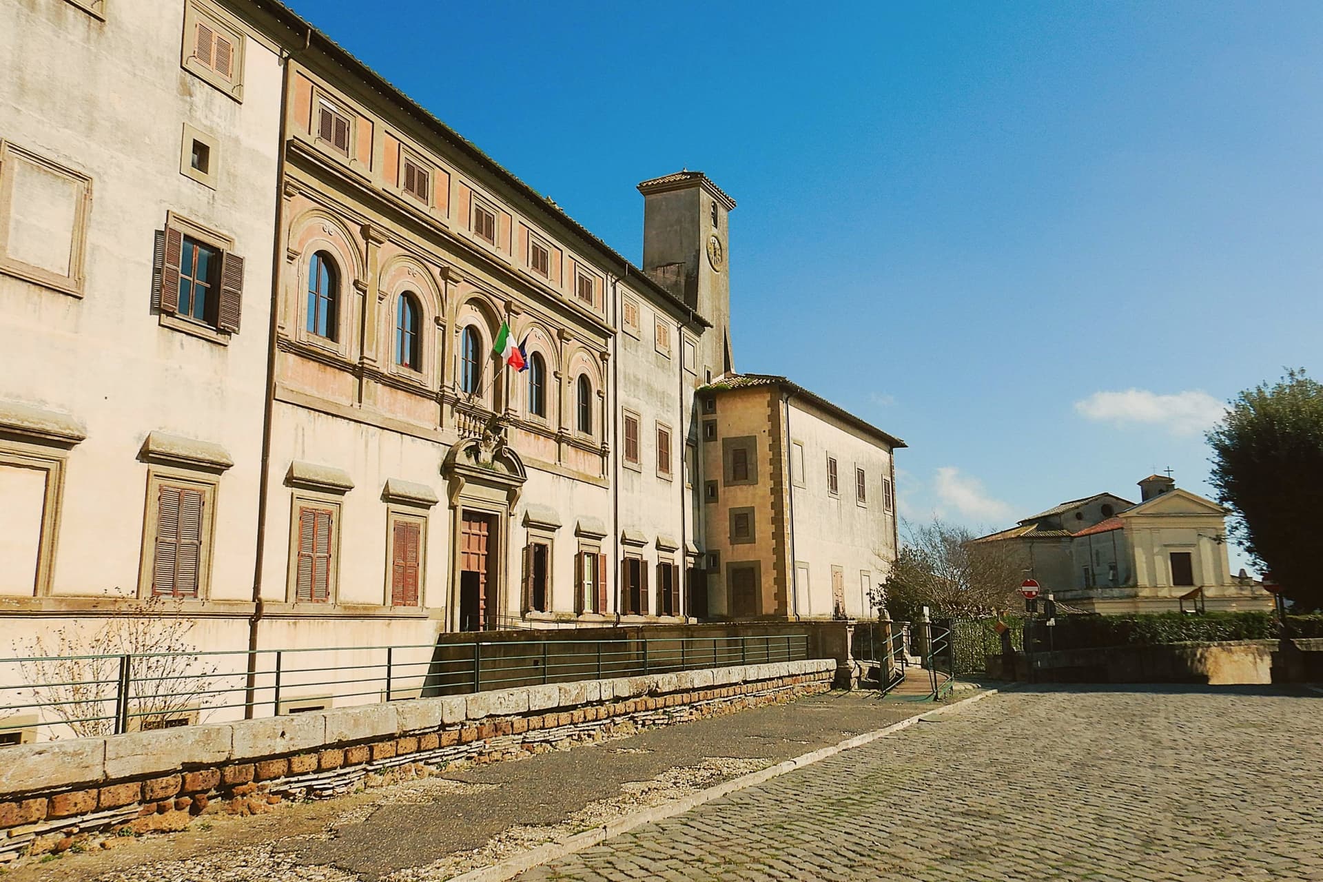
Oriolo Romano sits at 420 meters in the Sabatini hills, between Lake Bracciano and the volcanic Cimini, not far from the old Via Clodia. The village is unusually new for the Tuscia: in 1560 the Orsini family ceded a wooded fief to the nobleman Giorgio Santacroce, who began clearing the forest and founded a planned agricultural settlement.
The first inhabitants were farmers, shepherds and woodcutters drawn from Tuscany and Umbria, so the local accent kept Umbrian inflections for generations. The palace at the center of the village gave the settlement its shape, with the parish church and the main square arranged around it as the plan intended.
The forest that once covered the whole fief survives now at the margins, an exceptionally low-altitude stand for an Apennine beech wood, while hazelnut groves have taken over the lower slopes that were cleared for farming. The village, in effect, is the cleared half of a wooded fief, its cultivated ring still framed by the wood the Santacroce family left standing.
We confirmed you can reach this one by train.
What to see in Oriolo Romano
- Palazzo Altieri. Sixteenth-century palace enlarged in 1674 under Pope Clement X, with Old Testament frescoes and painted views of the Altieri fiefs.
- Faggeta di Monte Raschio. Primeval beech forest of about eighty hectares between 400 and 550 meters, UNESCO World Heritage since 2017.
- Piazza Umberto I. Central square of the 1560 plan, anchored by the palace and the parish Chiesa di Sant'Anna at the head of the village.
How to get to Oriolo Romano
There is a railway station in the town, so you can arrive without a car and never need one while you are here. Roma is roughly 75 minutes away by road.
Our tip
April through June and September into October are the months for the beech forest, when the canopy is full and the trails on Monte Raschio are at their cleanest. The exceptionally low altitude of the faggeta means autumn color arrives earlier and lasts longer than in higher Apennine beech woods. July and August push the lower hills into the low thirties; the forest holds shade and stays five or six degrees cooler than the surrounding farmland. Oriolo Romano Porcini Mushroom Festival falls in September.
Vitorchiano
Why visit Vitorchiano
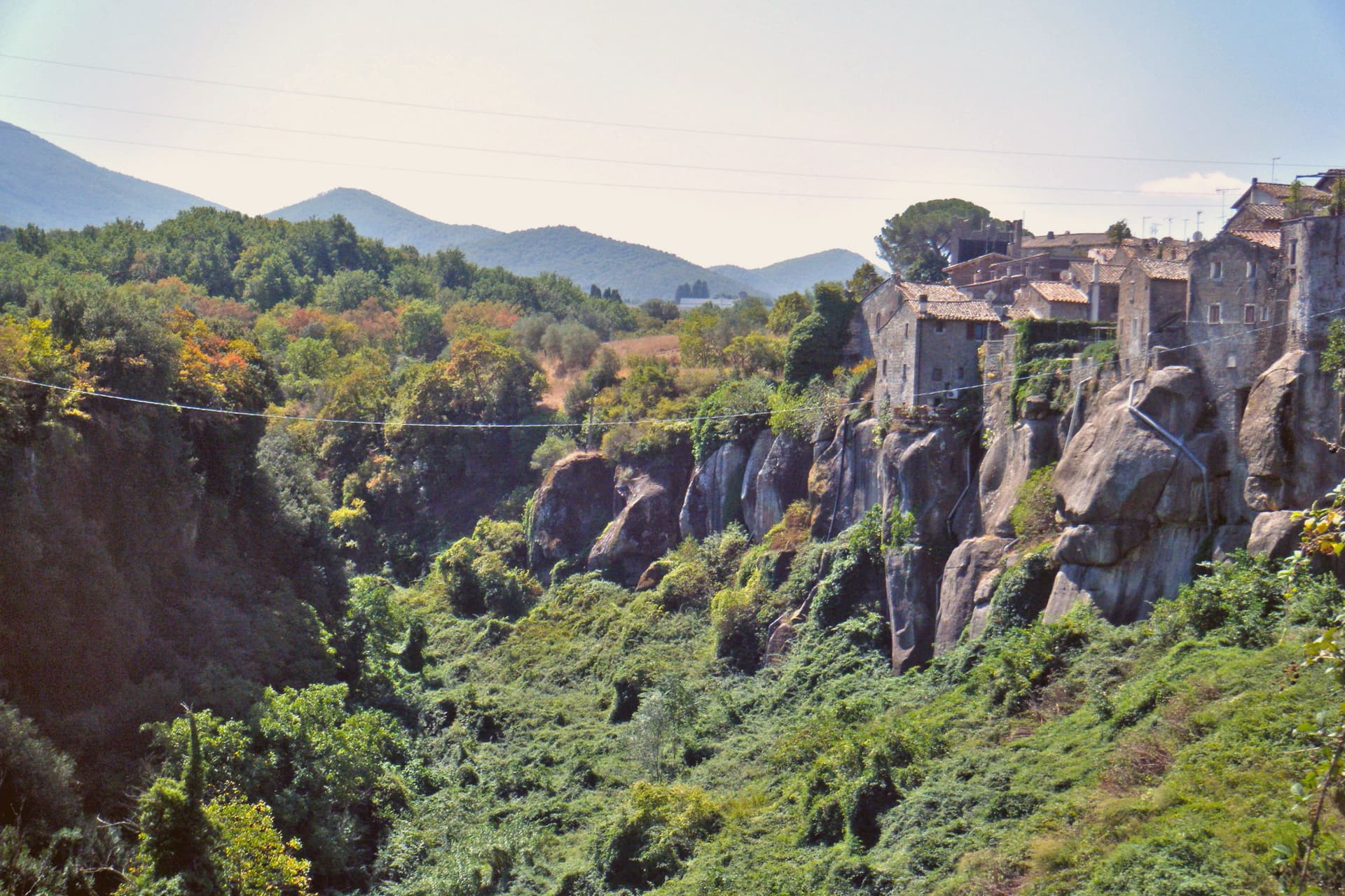
Vitorchiano sits at 285 meters on a single bank of peperino. Two ravines flank the town and meet at the Vezza torrent below, which is why the old center reads as an island of dark stone with the land falling away on both sides.
The quarries below the town are still working, and Vitorchiano peperino now ships to Canada, Japan and the Middle East, so the same rock that holds up the walls and staircases overhead also travels out from underneath the town in the other direction. The statue on the ridge was carved from a single block of that local stone by sculptors who came from the other side of the world to work it, which is its own kind of trade: peperino leaving Vitorchiano to be known abroad, and a foreign hand arriving to shape what stayed.
Above the rooftops, the Belvedere gives the wider frame the streets below cannot, the Cimini hills and the Tiber valley spread out past the ravine. Vitorchiano holds three institutional signals at once: Borghi più belli, Bandiera Arancione TCI, Città della Nocciola.
A small town, then, defined less by any one of its parts than by how completely the stone underneath it accounts for all of them.
We confirmed you can reach this one by train.
What to see in Vitorchiano
- Centro storico in peperino. Medieval old town cut from a single volcanic boulder, walls and houses built in dark Vitorchiano peperino quarried below.
- Moai di Vitorchiano. Six-meter peperino statue carved in 1990 by eleven sculptors of the Atan family from Easter Island, the only true Moai outside Rapa Nui.
- Belvedere. Cliff-edge terrace at the eastern end of the borgo, view across the Vezza ravine to the Cimini hills and the Tiber valley.
How to get to Vitorchiano
There is a railway station in the town, so you can arrive without a car and never need one while you are here. Terni is roughly 53 minutes away by road.
Our tip
April through June brings the Cimini hills into green and Vitorchiano into clear light, the peperino dark against new leaves. September and October are the harvest months for hazelnuts and the calmest period in the borgo. July and August touch the mid-thirties; the centro storico empties between two and five in the afternoon. Sagra del Cavatello falls in July.
Capranica
Why visit Capranica
Capranica sits in the Tuscia at the fifty-fifth kilometer of the Via Cassia, on a hill overlooking the Sutri valley between Lake Bracciano and Lake Vico. The Etruscans worked this ground; the medieval borgo grew along the Cassia after the road was rebuilt in the second century BC.
The Anguillara family appeared in 1305 and held the town through most of the fourteenth century. In 1337, under Orso degli Anguillara, Francesco Petrarca stayed here on his way south, the moment local memory still attaches to the place.
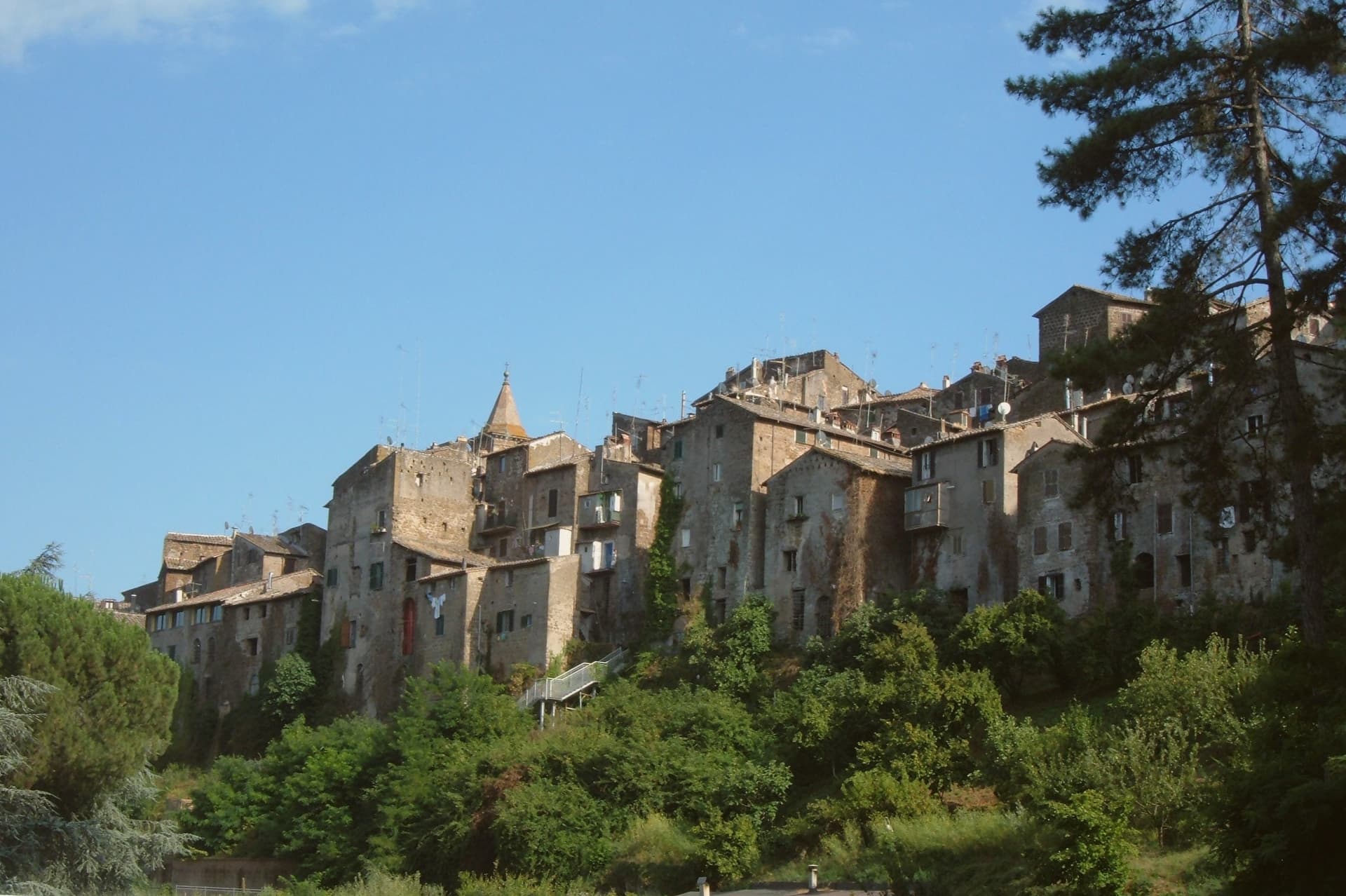
Castrovecchio is the oldest quarter, a wedge of stone houses and stepped streets above the Castello degli Anguillara. The town is one of the Italian comuni crossed by the Via Francigena, with a marked stage running north toward Sutri and Vetralla.
Hazelnut groves cover the surrounding slopes; Capranica is a member of the Città della Nocciola network and supplies the Tonda Gentile Romana, the local DOP variety.
We confirmed you can reach this one by train.
What to see in Capranica
- Castello degli Anguillara. Medieval fortress at the head of Castrovecchio, seat of the Anguillara family from 1305 and the place Petrarch stayed in 1337.
- Castrovecchio. Oldest quarter of the town, a wedge of stone houses and stepped streets rising above the Cassia toward the castle.
- Chiesa di San Francesco. Fourteenth-century Franciscan church on the edge of Castrovecchio, with fresco fragments and Anguillara family tombs.
How to get to Capranica
There is a railway station in the town, so you can arrive without a car and never need one while you are here. Roma is roughly 72 minutes away by road.
✷ We have written about Capranica
“So a borgo like Capranica, and especially Capranica, has nothing to offer except this vibe. After darkness sets, the town becomes the same medieval village that it was 500 years ago. The only difference is the electric lighting and some satellite dishes on some roofs.”
Read our piece on Capranica →Capranica | The stop on the journey
Our tip
April through June and September into October are the walking months in the Tuscia, when the hazelnut groves are green and the Cassia is light. July and August push the slopes into the low thirties; the medieval centro storico holds shade well enough, but afternoons stay quiet. The hazelnut harvest runs through late August and September and the air around the town smells of toasted nuts for weeks. Festeggiamenti in Onore di San Terenziano falls in August.
Ronciglione
Why visit Ronciglione
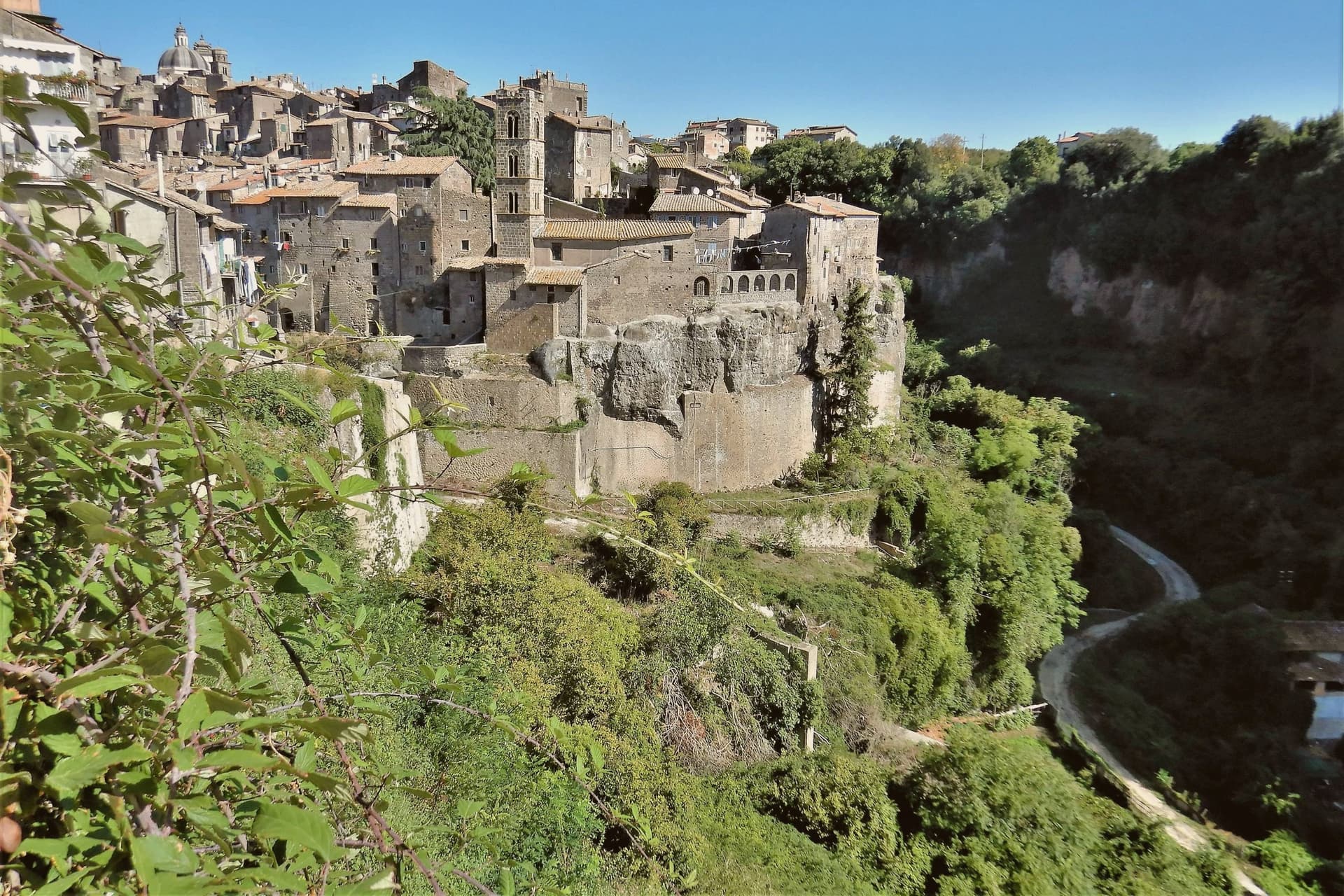
The town stands on a tufa spur at 441 meters, five kilometers from the lake, with the Cimini hills and their hazelnut groves closing in around it on every side. The first record of it dates to 1103.
The Prefetti di Vico held it before the Farnese took it as a Duchy, and the sixteenth-century pontiff who granted the town its Carnival did so during that same passage of rule from prefects to dukes. The fortress's towers control the single natural approach to the historic center, so the medieval town and its defenses are really one structure: whoever held the towers held the road in.
Everything built afterward, the cathedral, the contrade, the Carnival itself, sits inside that same defended perimeter. What the RAI title recognized in 2023 was less a single monument than that whole arrangement still intact: a fortified approach, a walled center, and a lake and hills that have not changed shape around it.
We confirmed you can reach this one by train.
What to see in Ronciglione
- Rocca dei Borgia (I Torrioni). Medieval fortress of the Prefects of Vico, twin round towers guarding the only natural approach to the centro storico.
- Duomo dei Santi Pietro e Caterina. Baroque cathedral of 1671, polychrome marble altar, fifteenth-century triptych by a Viterbo painter, wooden statue of San Bartolomeo.
- Lago di Vico. Volcanic lake ringed by the Cimini hills, its waters filling the crater below the level of the town on its spur.
How to get to Ronciglione
There is a railway station in the town, so you can arrive without a car and never need one while you are here. Roma is roughly 64 minutes away by road.
✷ We have written about Ronciglione
“Suddenly, we weren't running around. Ronciglione has nothing, and I mean zero things to show you. It's a pretty generic medieval town near Rome. It doesn't have a big piazza. There is a gate, a duomo, 2-3 main streets, and pretty much that's it. Yet, it was the center of our attention at that time. After spending just a few days there, we went back to Rome without wrinkles, with an oddly weird smile on our faces.”
Read our piece on Ronciglione →Ronciglione | Baptism into the Other Italy
Our tip
April through June brings the Cimini hills into green, hazelnut groves in flower and Lake Vico cool enough for the morning. September and October are the harvest months, dry, mild, with the air clear enough to see Monte Cimino from the Rocca. July and August touch the upper thirties and fill the lake with Romans on weekends. Palio di Ronciglione falls in July.
Montefiascone
Why visit Montefiascone
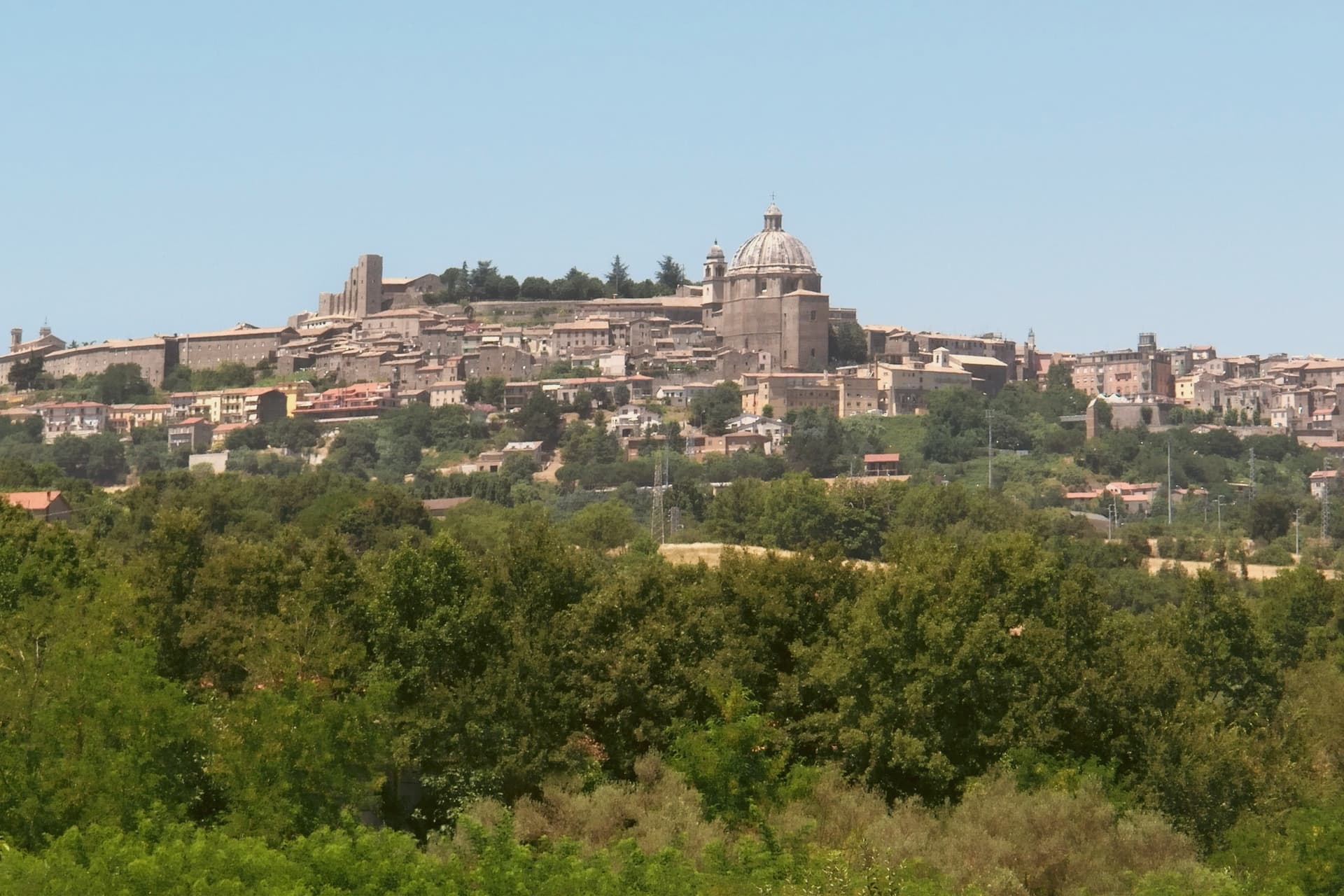
The town sits on the southeastern rim of a volcanic crater, about a hundred kilometers north of Rome, with the fortress at its highest point and the rest of the settlement built down the slope from there. The basilica stands just outside the walls at the lower end of that slope, separate enough from the fortress and the cathedral that the three read as three distinct centers of the town rather than one monument with satellites.
The wine takes its name from the same twelfth-century legend that put a German bishop's prelate on the road marking inn doors, and that bishop is the one buried in the basilica below, which ties the town's best-known export to a specific grave rather than to a floating story. The pilgrim route passes through on its way between Bolsena and Viterbo, so the hill that holds a papal summer residence and a wine legend was also, and still is, a stop on a much longer walk to Rome.
What the place adds up to is a small hill town where a fortress, a two-story church, and a road to somewhere else all sit within a short walk of one another, each one a different kind of stop on the same hill.
We confirmed you can reach this one by train.
What to see in Montefiascone
- Rocca dei Papi. The fortress walls enclose the summit; the tower stair is narrow and gives out onto the panorama at once, the water filling the whole crater rim below.
- Basilica di San Flaviano. Two churches stacked on each other, the lower nave older and darker, the upper one built two centuries later and open to more light. The frescoes are original to the walls, not restored copies, and the German bishop Johannes Defuk is buried here.
- Cattedrale di Santa Margherita. The octagonal dome is 27 meters across, third largest in Italy by base diameter, finished in the late sixteenth century. It dominates the town's roofline the way the fortress dominates its summit.
How to get to Montefiascone
There is a railway station in the town, so you can arrive without a car and never need one while you are here. Terni is roughly 75 minutes away by road.
Our tip
April through June and September through October are the strong months. The hilltop position keeps Montefiascone cooler than Viterbo down the road, and the air over the lake is clearest in spring and autumn. July and August reach the low thirties; afternoons in the centro storico thin out between two and five. Fiera Del Vino falls in August.
Tarquinia
Why visit Tarquinia
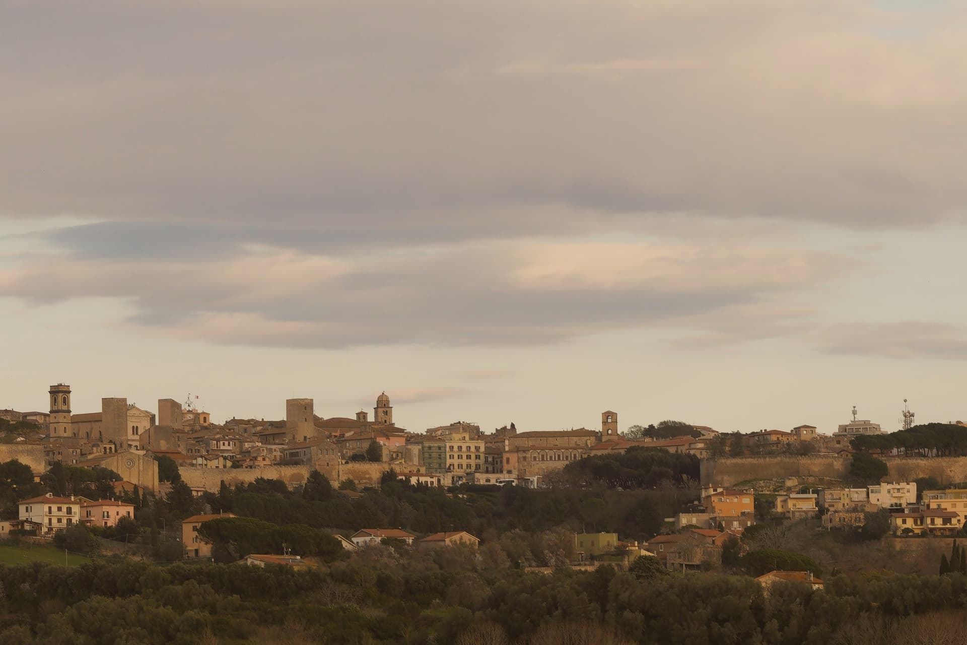
Tarquinia sits on a plateau at 133 meters above the Maremma plain in northern Lazio, six kilometers inland from the Tyrrhenian coast. The Etruscan city of Tarquinii stood on the adjacent Colle della Civita and was one of the twelve great Etruscan capitals, ringed by eight kilometers of sixth-century walls enclosing 135 hectares.
What survives above ground is mostly medieval: the present town moved here in the Middle Ages and was renamed Corneto until 1922, when Mussolini's regime restored the ancient name. What survives below ground is what made the place a UNESCO site in 2004.
The Monterozzi necropolis on the hill east of town holds 6,000 rock-cut tombs from the seventh century BC onward, and around two hundred of them carry painted interiors. The frescoed banquets, dancers, hunters and musicians inside Tarquinia's tombs are the largest body of pre-Roman painting in the Mediterranean.
The Palazzo Vitelleschi in the upper town houses the national museum and the Winged Horses terracottas.
We confirmed you can reach this one by train.
What to see in Tarquinia
- Necropoli dei Monterozzi. UNESCO Etruscan necropolis on the hill east of the medieval town, 6,000 rock-cut tombs with around 200 painted interiors from the 7th century BC onward.
- Museo Archeologico Nazionale Tarquiniense. Housed in the 15th-century Palazzo Vitelleschi, with Etruscan sarcophagi, painted slabs and the famous Cavalli Alati terracottas.
- Palazzo Vitelleschi. Early Renaissance palace built between 1436 and 1439 for Cardinal Vitelleschi, blending Gothic and Renaissance elements in a single façade.
How to get to Tarquinia
There is a railway station in the town, so you can arrive without a car and never need one while you are here. Roma is roughly 77 minutes away by road.
Our tip
April through June and September through October are the strongest months. The Maremma light is clean, the tomb interiors stay cool, and the wind off the Tyrrhenian keeps the plateau comfortable. July and August are workable but hot; the underground necropolis is the right place to be in the middle of the day, and Lido di Tarquinia six kilometers downhill takes the evening crowd.
Viterbo
Why visit Viterbo
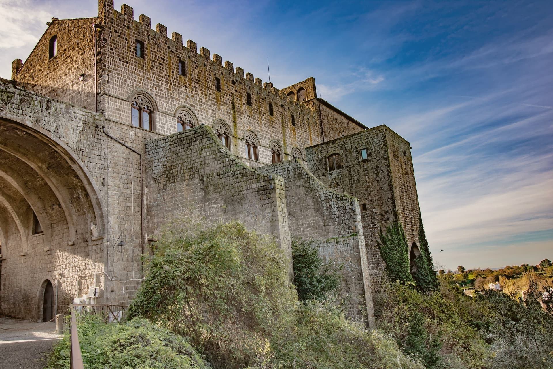
Viterbo sits at 326 meters in the Tuscia, surrounded by the volcanic Cimini hills and the thermal springs the Etruscans and Romans already used. The city became the favourite papal residence under Eugene III in the twelfth century; between 1257 and 1281, five popes were elected here, and the conclave of 1268-1271 ran nearly three years, the longest in Church history.
To end it, the city's people locked the cardinals inside the Palazzo dei Papi, tore the roof off, and reduced their rations. The decisive conclave is still the reason the word means a place under lock and key.
The San Pellegrino quarter is the largest continuous medieval district in central Italy, with profferli, the external stone staircases that climb to first-floor doorways. The Terme dei Papi outside the walls still draws sulfur-water bathers.
On 3 September the Macchina di Santa Rosa, a thirty-meter illuminated tower weighing five tons, is carried through the streets by a hundred Facchini, a tradition listed by UNESCO since 2013.
We confirmed you can reach this one by train.
What to see in Viterbo
- Palazzo dei Papi. Thirteenth-century papal palace with Gothic loggia and the Sala del Conclave, where the 1268-1271 conclave ran for nearly three years.
- Quartiere San Pellegrino. Largest continuous medieval quarter in central Italy, with stone profferli staircases, towers and the Piazza San Pellegrino.
- Terme dei Papi. Thermal complex outside the walls, fed by sulfur springs used since Etruscan times and named for the medieval popes.
How to get to Viterbo
There is a railway station in the town, so you can arrive without a car and never need one while you are here. Terni is roughly 58 minutes away by road.
Our tip
Viterbo works as a year-round destination because of the thermal springs. April through June and September into October give the easiest combination of clear weather, open monuments and warm pool water. July and August push the medieval quarter into the mid-thirties; the Macchina di Santa Rosa on 3 September is the single largest event in the calendar and the streets stay packed for the night. Festa Medievale Ludika 1243 a Viterbo falls in July.
More from Anywhere Italy
- The best hill towns you can reach by train within 90 minutes of Roma
 The 10 best hidden hill towns you can reach by train within 90 minutes of Terni
 The best towns on a walking route in the province of Viterbo
 The best towns that eat well in the province of Viterbo
- The best towns with a food festival that you can reach by train in Lazio
 The 8 best hidden hill towns within 90 minutes of Roma