The 6 best hill towns you can reach by train in Sardegna
Sardinia away from the water is a stone island. Granite domes above Gallura, basalt tablelands in the Barbagia, limestone cliffs going up sheer behind the Ogliastra villages, and houses built from whatever the hill gave. The food follows the same logic: pecorino, suckling pig cooked over myrtle wood, culurgiones pinched shut like a wheat ear, the flat carasau bread that keeps for weeks on a shepherd's route. Late spring and early autumn are the seasons for it, when the interior is warm rather than punishing and the festival calendar is busy.
Most visitors land at Olbia or Cagliari and drive straight to the Costa Smeralda, or to Villasimius, or to the beaches around Alghero. That is understandable, because the water really is that colour, but it means the coastal road in August moves at walking pace and the sand is booked out months ahead. The interior, an hour uphill, is where the island keeps its language and most of its people.
The same granite and limestone keep going inland, and so, usefully, does the railway. The state line and the narrow-gauge trains climb into Gallura, the Marmilla and the Ogliastra, reaching towns built on cork, wine, nuraghi and rock walls. These are the smaller places on that network, and fewer people go.
Of the 41 communes we have mapped in Sardegna, 6 qualify as hill towns you can reach by train: each is an inland hill settlement, and we have confirmed each is reachable without a car. The smallest, Barumini, has 1,156 residents.
Two more lists worth reading alongside this one: The best hidden towns you can reach by train in Sardegna and The best hill towns within two hours of Cagliari.
Barumini
Why visit Barumini
Barumini sits at 202 meters in the Marmilla, 55 kilometers north of Cagliari, on the plain at the foot of the Giara di Gesturi. About 1,150 people live here.
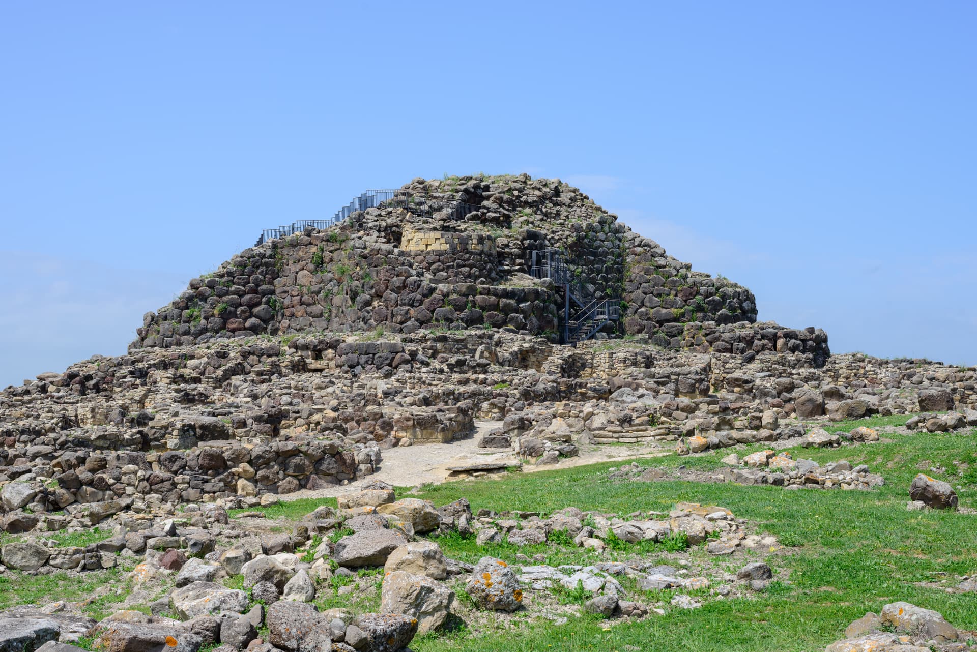
The village would be a small inland farming town except for what sits half a kilometer outside it: a complex of huts grew around a citadel between roughly 1500 and 100 BC, and the surrounding well and towers are the most complete and most studied of their kind on the island, with no parallel elsewhere. UNESCO inscribed the site in 1997, the first Sardinian entry on the World Heritage list.
The plateau rises above the plain on the other side of the village, basalt ground where wild horses live free and seasonal ponds form after rain. The town itself sits between the two, the excavated citadel on one side and the plateau on the other, with the historic centre and its parish church holding the space in between.
What the visitor finds at Barumini, then, is a small farming village whose ordinary footprint is bracketed by two much older and wilder things, one built up over centuries of the Bronze Age and long buried, the other still grazing above it.
We confirmed you can reach this one by train.
What to see in Barumini
- Su Nuraxi di Barumini. 18-meter central tower with four bastions and a surrounding village of huts, set half a kilometer outside the town on the open plain.
- Casa Zapata. Spanish-era noble residence built over a second nuraghe, the underlying tower visible under glass floors of the museum.
- Giara di Gesturi. Basalt plateau above the village at 500-600 meters, home to wild horses and seasonal paulis ponds.
How to get to Barumini
There is a railway station in the town, so you can arrive without a car and never need one while you are here. Cagliari is roughly 69 minutes away by road.
Our tip
April through June and September through November are the easiest months at Su Nuraxi. Spring brings green Marmilla wheat fields and wild flowers on the Giara above. October sees the harvest and the autumn migrations through the basalt ponds.
Ulassai
Why visit Ulassai
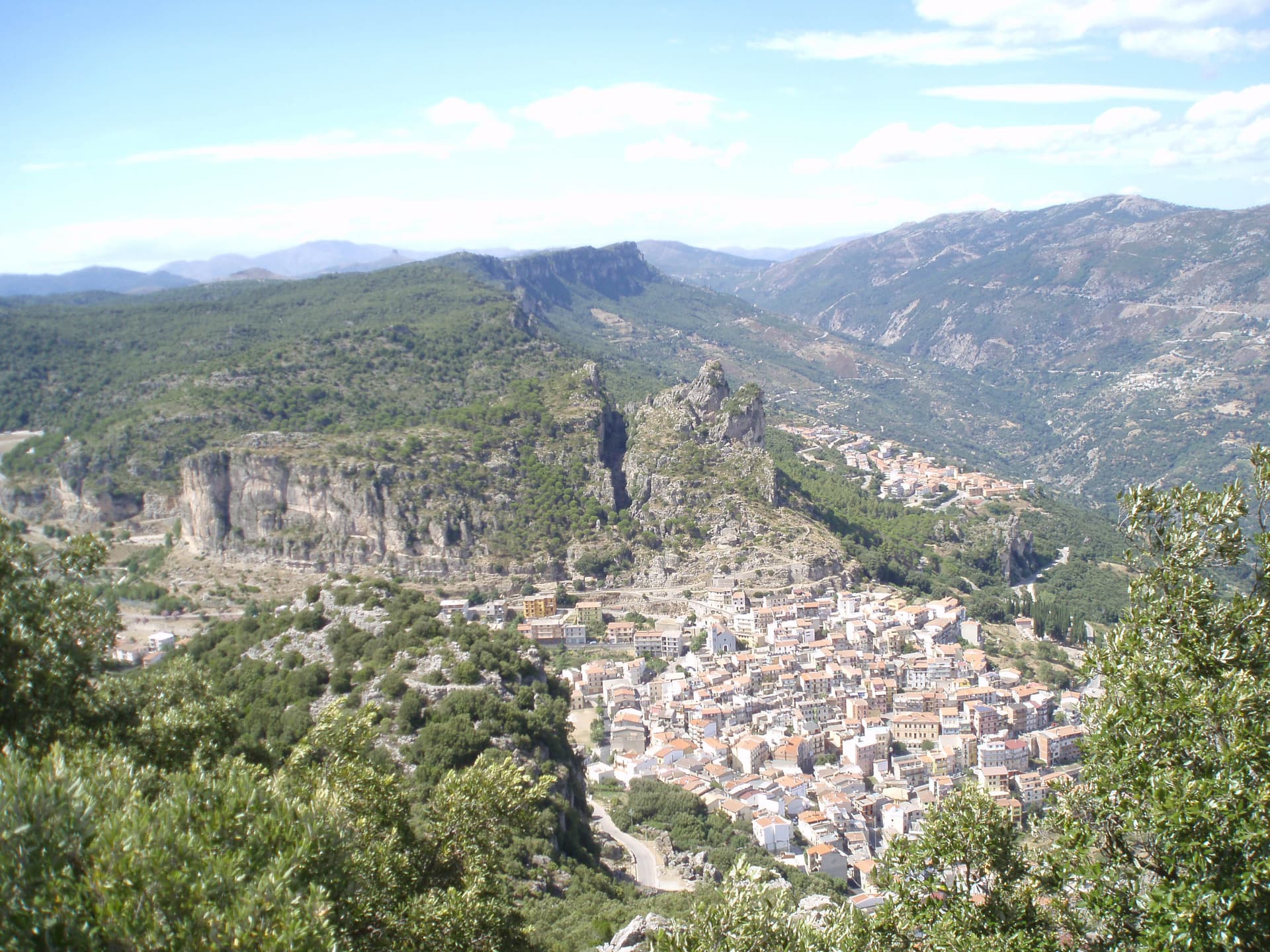
Ulassai sits on a ledge beneath the Tacchi d'Ogliastra, the limestone buttes that rise like broken teeth above the inland Ogliastra. Su Marmuri opens in the rock outside the village, and the Lequarci waterfalls drop off the Tacchi when winter rains fill them, dry again by summer.
The village itself is compact, its upper quarter built around the parish church, its lower streets running toward the old railway line that once connected Ogliastra to the coast and now ends at the station turned museum. Population has been declining here for decades, a pattern common across the inland villages of the subregion.
What keeps Ulassai distinct is the work Maria Lai made of it: a village small enough that one artist's ribbon could reach every house and still climb the mountain above it.
We confirmed you can reach this one by train.
What to see in Ulassai
- Stazione dell'Arte. Former railway station converted in 2006 into a museum holding 140 works by Maria Lai, housed in the platform building where trains once ran.
- Grotta di Su Marmuri. A single chamber deep enough to swallow the light within a few steps of the entrance, reached by guided tour into the limestone.
- Cascate Lequarci. A 100-meter waterfall on the Tacchi cliffs above the village, active after winter rains and usually dry by midsummer.
How to get to Ulassai
There is a railway station in the town, so you can arrive without a car and never need one while you are here. Cagliari is roughly 106 minutes away by road.
Our tip
April through June is the green window: the Lequarci waterfall runs, the Tacchi turn pale gold at sunset, and the trails are walkable without heat. September through November is the second window, drier and quieter, with cooler nights at 775 meters. Summer pushes thirty degrees on the lower slopes; the village stays cooler than the coast but the waterfall dries up by July.
Aggius
Why visit Aggius
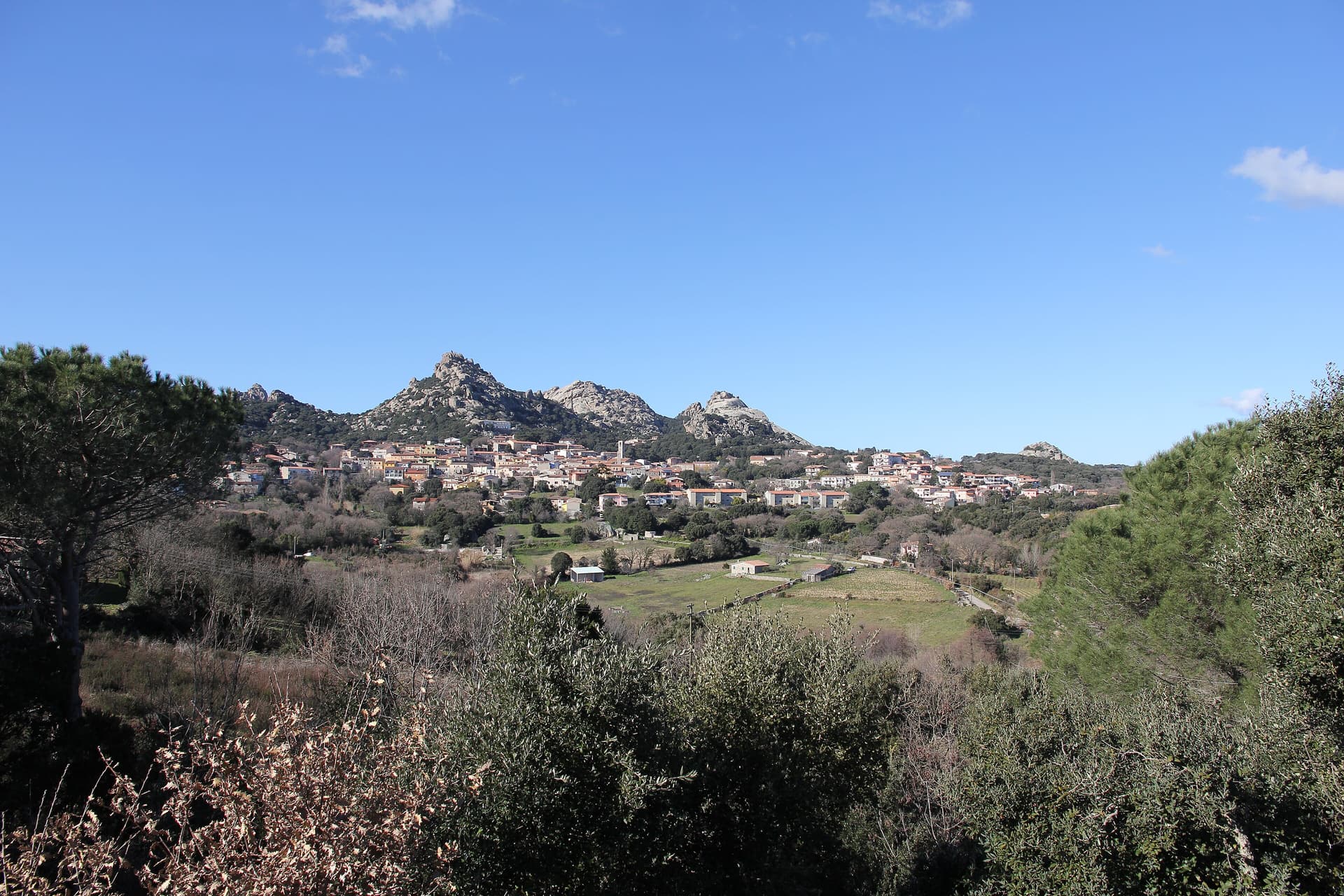
Aggius sits at 514 meters at the foot of the Monti di Aggius, the jagged granite ridge that defines this stretch of inland Gallura, fifty kilometers west of Sassari and thirty-five from Olbia. The granite is everywhere: in the walls of the houses, in the doorframes and stairs, and in the surrounding hills.
Just behind the village, the Valle della Luna is a flat expanse where rounded granite boulders sit like dropped stones across the plain. Aggius was the center of Gallurese banditry for roughly three centuries, from the mid-sixteenth-century Spanish period to the mid-nineteenth century under the Savoys.
The feud between the Vasa and Mamia families killed dozens between 1849 and 1857. The Museo del Banditismo, housed in the old Pretura, tells that history alongside the story of Sebastiano Tansu, the Mute of Gallura, who inspired Enrico Costa's novel.
The MEOC, the Oliva Carta Cannas ethnographic museum, is the largest of its kind on the island, with working looms still weaving the Aggius carpets.
We confirmed you can reach this one by train.
What to see in Aggius
- MEOC Museo Etnografico Oliva Carta Cannas. The largest ethnographic museum in Sardegna, fifteen rooms of Gallurese domestic and craft tradition, with working looms producing Aggius carpets.
- Museo del Banditismo. Housed in the former Pretura, four rooms documenting three centuries of Gallura banditry, including the Vasa-Mamia feud and the Mute of Gallura.
- Valle della Luna. Granite plain just behind the village where rounded boulders sit across flat ground, also called Piana dei Grandi Sassi.
How to get to Aggius
There is a railway station in the town, so you can arrive without a car and never need one while you are here. Sassari is roughly 69 minutes away by road.
Our tip
April through June and September through November are the windows. The Valle della Luna is best in cool light, and the granite façades of the centro storico read better without the high July sun. The Mediterranean heat is softer at 514 meters than on the coast, but July and August still cross thirty degrees and pull crowds toward the beaches at Badesi and Trinità d'Agultu.
Orroli
Why visit Orroli
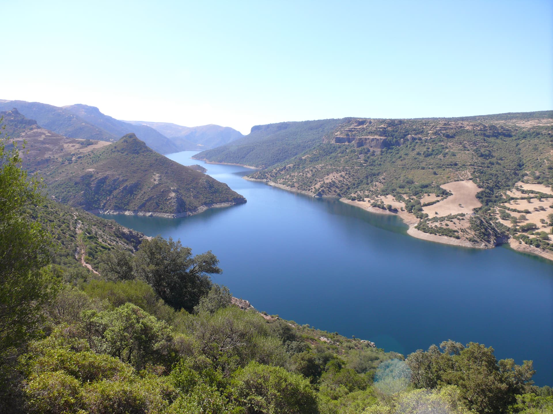
Orroli sits at 550 meters on the Pranemuru, a basalt plateau in the central-southern interior of Sardinia, fifty kilometers north of Cagliari. The village exists because of the plateau.
The dark basalt yielded the stone for the Nuraghe Arrubiu, the largest megalithic complex on the island and one of the most ambitious Bronze Age structures in western Europe: a central keep that originally reached thirty meters in height, surrounded by a bastion of five towers, in turn enclosed by a defensive wall with seven more towers connected by curtain walls. Twenty-one towers in total, on a footprint of five thousand square meters.
The complex was built between the fourteenth and twelfth centuries BC, occupied for five hundred years, and produced Mycenaean ceramics that confirm contacts with the eastern Mediterranean. The name Arrubiu, red, is from the lichens that color the basalt walls in summer.
The village itself, with its parish church and small piazze, sits a few kilometers from the site.
We confirmed you can reach this one by train.
What to see in Orroli
- Nuraghe Arrubiu. Bronze Age complex of 21 towers on the Pranemuru plateau, the only five-tower nuraghe and the largest megalithic structure in Sardinia.
- Chiesa parrocchiale di San Nicola. Parish church of the village, named for the patron saint of the Sarcidano, the religious center of the small centro storico.
- Lago Mulargia. Artificial basin south of the village, fed by the Flumendosa river, used for irrigation across the southern interior.
How to get to Orroli
There is a railway station in the town, so you can arrive without a car and never need one while you are here. Cagliari is roughly 103 minutes away by road.
Our tip
April through June is the best window on the Pranemuru. The plateau still holds spring water, the basalt walls of the Arrubiu sit warm in long evening light, and visitor numbers are manageable. September through November brings the second window, with cooler mornings and the basalt taking on the red of the lichens that gave the nuraghe its name.
Bolotana
Why visit Bolotana
Bolotana sits at 472 meters on a hill between the Marghine range and the middle valley of the Tirso, fifty-five kilometers from Sassari and thirty from Nuoro. The municipal territory runs from 1,200 meters at Punta Palai down to 144 meters in the valley below.
Above the village, the Badde Salighes forest holds Villa Piercy, the rural residence Benjamin Piercy built between 1879 and 1882. Piercy was the Welsh engineer who designed Sardegna's railway network from 1863 onward.
He turned a thousand hectares here into the largest livestock operation in the Mediterranean and laid out a four-hectare garden with native maples and oaks alongside Himalayan thuja, Spanish fir, and Lawson cypress. The villa, with four corner towers under metal domes, reopened to visits after a 2010 restoration.
The pre-Nuragic ritual circles of Ortachis sit higher on the mountain at 1,000 meters. The weaving tradition, yellow, black, and red geometric carpets on horizontal looms, made Bolotana one of the principal producers of Sardinian rugs.
We confirmed you can reach this one by train.
What to see in Bolotana
- Villa Piercy. 1879-82 rural residence of Welsh railway engineer Benjamin Piercy in the Badde Salighes forest, with four hectares of garden mixing native and exotic species.
- Foresta di Badde Salighes. Mountain forest above the village holding Villa Piercy and walking trails toward Punta Palai at 1,200 meters.
- Circoli rituali di Ortachis. Pre-Nuragic ritual circles and standing stones from the Neolithic period, at around 1,000 meters on the mountain.
How to get to Bolotana
There is a railway station in the town, so you can arrive without a car and never need one while you are here. Sassari is roughly 92 minutes away by road.
Our tip
April through June and September through November are the months for the Marghine. Walking the Badde Salighes forest and the trail to Punta Palai is best in spring or autumn, when the temperature stays under twenty-five degrees and the Tirso valley below is still green. July and August touch thirty-five degrees in the valley, though the higher woods around Villa Piercy stay cooler.
Tempio Pausania
Why visit Tempio Pausania
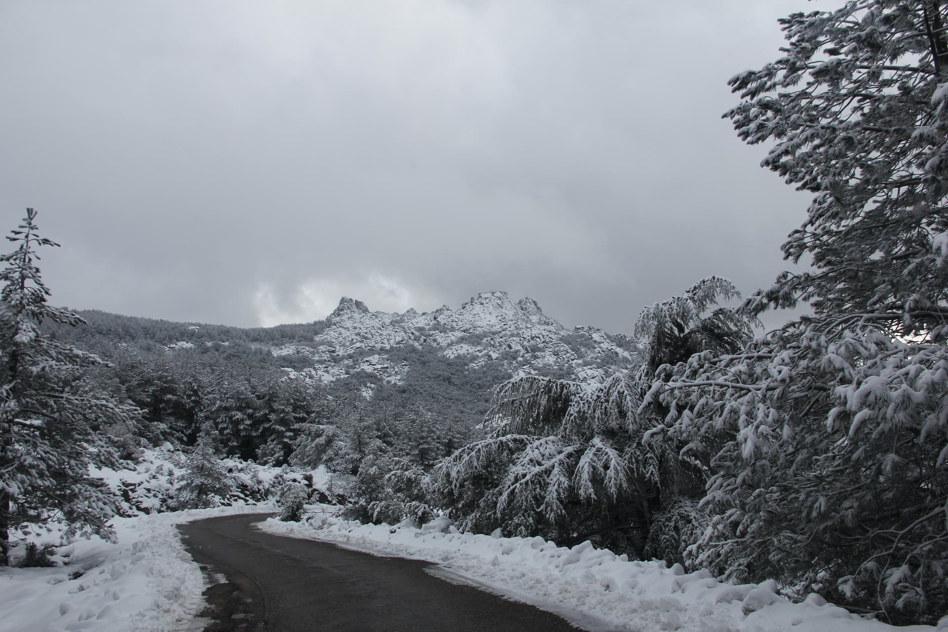
Tempio Pausania sits at 566 metres in central Gallura, at the foot of Monte Limbara, the 1,359-metre granite massif that anchors the north of the island. Almost every building in the centro storico is constructed from the grey-pink granite of the surrounding territory: noble palaces, ordinary houses, paving and kerbstones alike, the reason for the nickname città di pietra.
The town shares the role of provincial capital of Gallura Nord-Est Sardegna with Olbia. It was the seat of the ancient diocese of Phausania and added Pausania to its medieval name Templo in 1879.
The Cattedrale di San Pietro Apostolo, with a core from the early thirteenth century and a facade renovation between 1832 and 1839, sits at the centre. The Fonti di Rinaggiu, mineral springs known since Roman times for their therapeutic properties, run on the outskirts.
The Carnival of Tempio, the carrasciali timpiesu, draws around 100,000 visitors between February and March. Cork, granite and Vermentino di Gallura DOCG form the economic core.
We confirmed you can reach this one by train.
What to see in Tempio Pausania
- Cattedrale di San Pietro Apostolo. Cathedral of the diocese of Tempio-Ampurias, original layout from the early thirteenth century, current facade and bay added in renovations of 1832-1839.
- Centro storico di Tempio Pausania. Old town built entirely of grey-pink Gallurese granite, palaces, houses and paving cut from the same quarries, the basis of the città di pietra nickname.
- Fonti di Rinaggiu. Mineral and thermal springs on the outskirts known since Roman times for diuretic properties, on a tree-lined avenue overlooking the Limbara.
How to get to Tempio Pausania
There is a railway station in the town, so you can arrive without a car and never need one while you are here. Sassari is roughly 97 minutes away by road.
Our tip
April through June and September through November are the working months at 566 metres: dry warmth on the granite, walks up the Limbara, cellar visits in the Gallura. July and August are warm but bearable thanks to altitude, with thirty to thirty-two degrees in the centro storico. The biggest event is the Carrasciali Timpiesu, the Carnival of Tempio, running between February and March with allegorical floats, masks and around 100,000 visitors.