The best high-altitude villages in Lombardia
Lombardia climbs a long way above its lakes and its rice fields, and the villages up there are built for it: stone bases, larch balconies stacked with split wood, roofs weighted in slate against the snow load. The air changes at the point where chestnut gives way to spruce, and so does the food. Buckwheat becomes flour for pizzoccheri, rye goes into dark bread, and the cheese comes off summer pasture as Bitto, Casera and Formai de Mut. Winter brings ski lifts and salted roads, and summer brings hay cut on slopes too steep for machines, wild raspberries along the mule tracks, and rifugi opening for the walking season.
Most people meet mountain Lombardia at the lakes, on the Como shore, where the ferries run all day between Bellagio and Varenna and the lakefront gardens fill from Easter onwards. It is a fine thing to see, and it is also the most photographed water in northern Italy, which shows in the parking, the queues for the funicular and the price of a coffee facing the promenade. The peaks visible from those terraces are the appealing part of the view, yet almost nobody on the ferry goes up into them.
The same mountains carry on north and east past the lake, into the Valtellina, the Valchiavenna, the Val Camonica and the ridges under the Presolana, and that is where these villages sit, all of them high, several of them very high indeed. Some are ski towns with real lift systems and thermal water; others are terraced wine or rock-carving villages reached by a road of switchbacks or, in one case, by cable car alone. Fewer people go, and the ones who do tend to be walking, skiing or eating rather than queueing. Worth a detour, and worth a night, because these are places that look best early and late.
Of the 65 communes we have mapped in Lombardia, 8 qualify as high-altitude villages: each sits at 800 metres or higher. The smallest, Monteviasco, has 12 residents.
Two more lists worth reading alongside this one: The best ski towns in Lombardia and The best hidden ski towns in Lombardy.
Monteviasco
Why visit Monteviasco
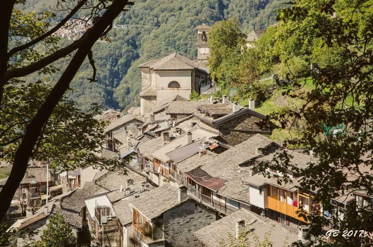
Monteviasco is the highest frazione of Curiglia con Monteviasco, sitting at 928 metres on a terrace above the Val Veddasca near the Swiss border. There is no road.
For half a century the village was reached by a small aerial cable-car (funivia di Monteviasco) installed in 1989; the cable-car has been suspended since a fatal accident in 2018 and the village is now reached only by the historic stone mule path of approximately 1,400 steps from the valley floor, a one-hour climb through chestnut woods. The permanent population is in the single digits — most of the houses are summer residences for descendants of former villagers — but the church of Sant'Antonio Abate, the wash-house at the village fountain, and the small alpine rifugio at the centre remain in use.
The view from the village balcony covers the entire Val Veddasca and, on clear days, Monte Rosa to the west. The 1,400-step climb is the attraction as much as the village itself: a documented historic mule path with stations of the cross along the ascent.
Pair with the Lago di Lugano cable-car at the Cima di Sasso above the valley and a meal at one of Curiglia's small osterie.
The village sits at 928 metres.
What to see in Monteviasco
- Sentiero dei 1.400 gradini. Historic stone mule path of approximately 1,400 steps from the Val Veddasca floor to the village — the only current access. Climbs through chestnut woods past stations of the cross.
- Chiesa di Sant'Antonio Abate. Parish church at the village centre, dating to the 17th century, with a single nave and a stone-roofed bell tower.
- Panorama sulla Val Veddasca. Village balcony at 928 m looking down the entire Val Veddasca toward Lake Maggiore, with Monte Rosa visible on the western horizon in clear weather.
How to get to Monteviasco
There is a railway station in the town, so you can arrive without a car and never need one while you are here. Milano is roughly 131 minutes away by road.
Our tip
May through October is the practical season — the mule path is dry, the alpine rifugio is open weekends, and the chestnut woods stay green into late autumn. June and September are ideal: cool climbing temperatures, long light. July-August stay mild at this elevation but the 1,400 steps need an early start.
Madesimo
Why visit Madesimo
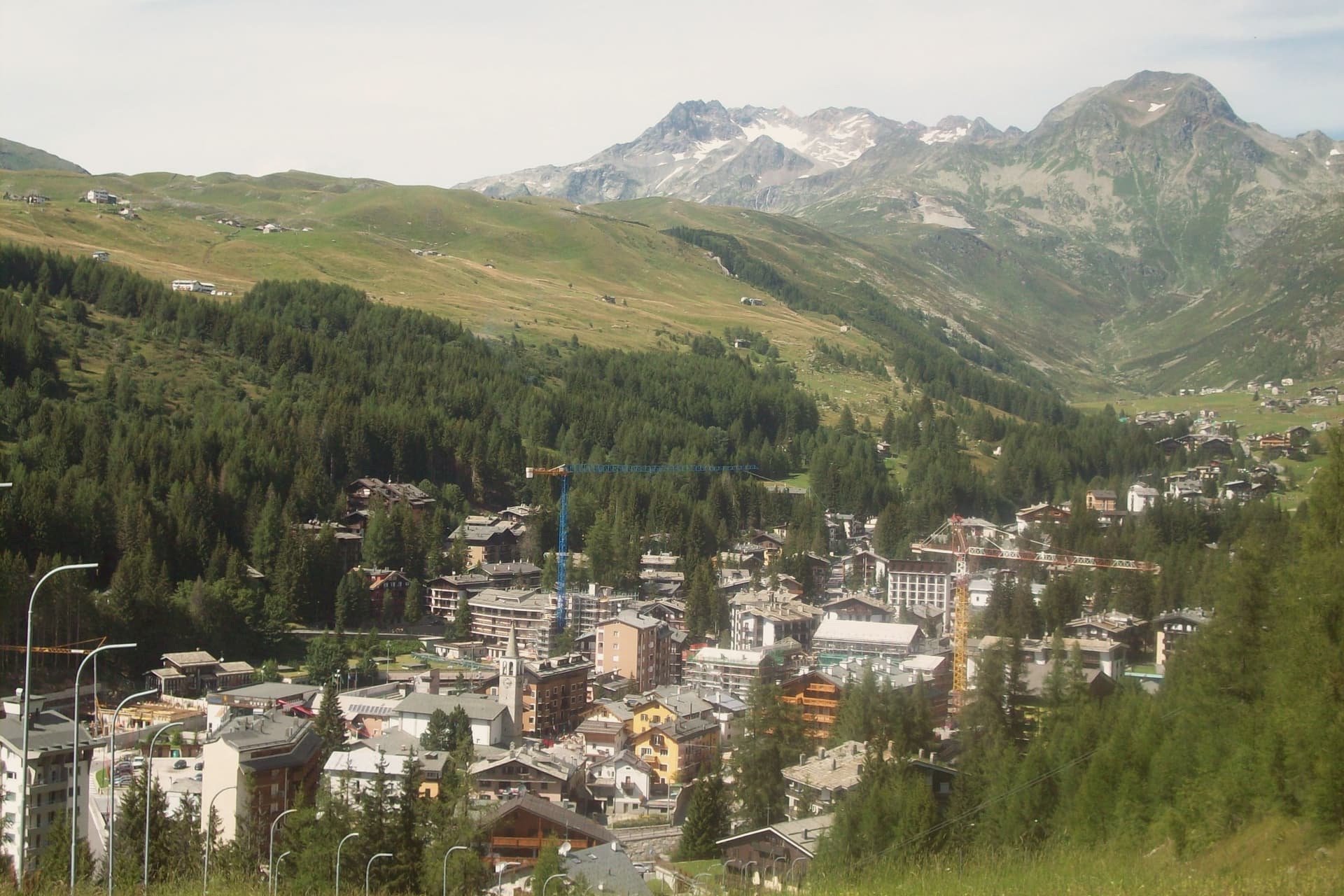
The village sits at the head of Valle Spluga, near enough to the Splügen Pass and the Swiss border that it counts as the most northerly commune in Lombardia. A funicular drops six kilometers down the valley to Campodolcino, climbing on the return to the Motta high station at 1,723 meters, the link that ties the two settlements into a single ski domain rather than two separate villages sharing a road.
Most of the resident population, 507, works in winter tourism, and the rhythm of the place follows the lifts as much as the calendar. Summer changes the traffic rather than the terrain: hikers replace skiers on the way up to the Laghi d'Emet and the high passes toward Switzerland, where the air is clean enough that the Pizzo Stella is visible from the village square on most days.
A small year-round population supporting a domain built for winter, and a valley oriented so squarely toward the high ground that even the summer view looks toward the peaks rather than back down the valley, is what the geography of Madesimo comes down to.
The village sits at 1550 metres.
What to see in Madesimo
- Comprensorio sciistico Madesimo. Ski domain from 1,550 to 2,880 meters across 30 runs, served by the funicular link to Motta and the lifts on the peak above the village.
- Canalone Stretto. A steep natural couloir on Pizzo Groppera, the kind of line where the marked piste ends and the descent is left to the skier's own judgment of the snow.
- Cascata del Groppera. Waterfall on the upper Liro near the village, fed by glacier meltwater from the massif above.
How to get to Madesimo
Monza is roughly 147 minutes away by road.
Our tip
December through March is the season Madesimo was built for. Lifts open in early December, snow falls reliably above 1,500 meters, and the funicular from Campodolcino runs daily through to mid-April in good years. June through September is the alpine summer: the trails to the Laghi d'Emet and the passes toward Switzerland clear by mid-June, and at 1,550 meters even August afternoons stay below 22 degrees.
Cimbergo
Why visit Cimbergo
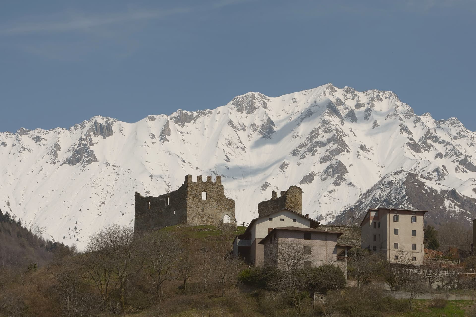
Cimbergo holds a balcony position at 851 meters above the Oglio, looking across Val Camonica toward Paspardo and Capo di Ponte. The reason most visitors climb up here is the Riserva Naturale delle Incisioni Rupestri di Ceto, Cimbergo e Paspardo, the UNESCO-listed rock-art protected area that shares its name with the commune.
On a granite spur above the village stand the ruins of the medieval Castello, where in 1378 Guelphs and Ghibellines of Val Camonica met to attempt a peace, and where in 1430 Bartolomeo of Cemmo received the investiture of the Cemmo-Cimbergo county from Venice. The frazioni Cimbergo and Paspardo were united and re-divided more than once between 1805 and 1947.
Today the village keeps its narrow lanes and stacked stone houses, and the surrounding woods open onto sandstone outcrops covered in figures cut between the Neolithic and the Iron Age.
The village sits at 851 metres.
What to see in Cimbergo
- Castello di Cimbergo. Ruined medieval castle on a granite outcrop above the village, site of the 1378 peace attempt between Guelphs and Ghibellines of Val Camonica.
- Incisioni rupestri di Cimbergo. Sector of the UNESCO Ceto-Cimbergo-Paspardo reserve, with engraved surfaces accessible from marked paths below the village.
- Chiesa di San Martino. Parish church at the center of the village, with a bell tower visible from the valley floor.
How to get to Cimbergo
Brescia is roughly 104 minutes away by road.
Our tip
May through October is the window for Cimbergo. The petroglyph paths through the woods need dry weather and clear ground, both of which arrive late at this altitude. June and September are the most reliable months.
Ponte di Legno
Why visit Ponte di Legno
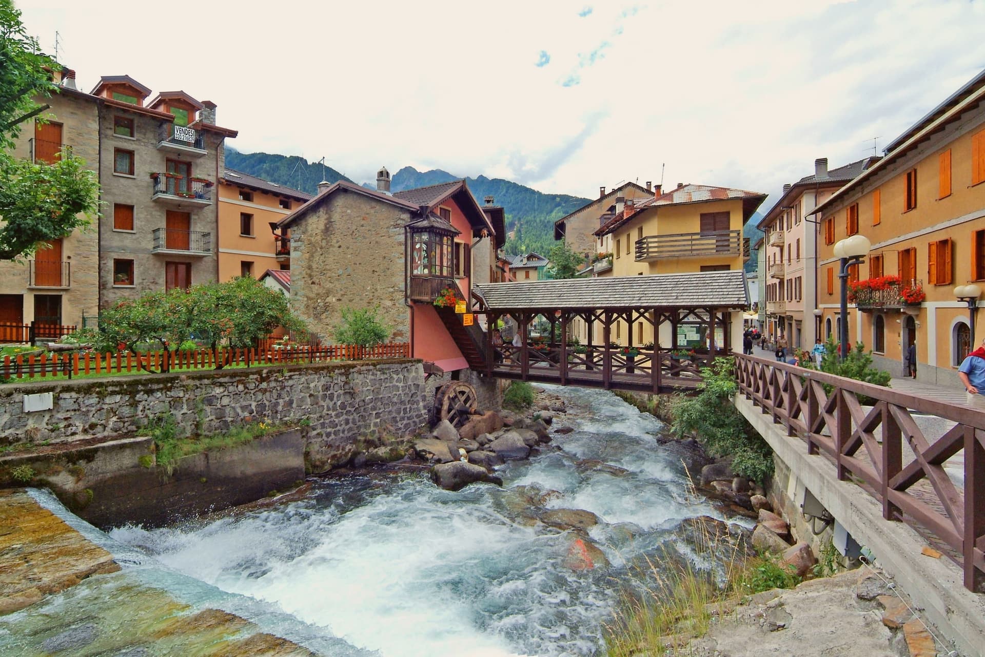
At 100 square kilometres this is the second-largest commune in the province of Brescia after Bagolino, a size that shows in how far its territory reaches: from the valley floor up into the park south and east of town and over the watershed into Trentino. The upper town has burned more than once in its history, rebuilt in wood each time along with the parish church that anchors the main square.
Ski Club Ponte di Legno was founded in 1911, one of the first in Italy, and a hundred years of investment turned that early club into the ski area whose lifts now serve both the pass and the glacier above it. Winter and summer use the same infrastructure differently: in season the lifts run skiers over forty-one runs and up onto the ice, and in summer the same cars carry hikers onto the plateau while the tables fill on Piazza XXVII Settembre in place of ski boots.
The town's whole shape, valley floor, upper slopes, and the pass beyond, follows the terrain that a century of skiers and a century of soldiers before them had no choice but to work with.
The village sits at 1257 metres.
What to see in Ponte di Legno
- Chiesa della SS. Trinità. 18th-century parish church on the main square, rebuilt after fires that periodically hit the wooden upper town.
- Passo del Tonale. The road north over the watershed into Val di Sole, still climbed today by the lifts that once carried troops and now carry skiers.
- Ghiacciaio della Presena. Accessible by cable car above the pass, open through the year for skiing on the ice itself rather than groomed snow below it.
How to get to Ponte di Legno
Trento is roughly 98 minutes away by road.
Our tip
December through March is the main season. The Pontedilegno-Tonale lifts open, the upper town fills with skiers from Brescia and Milan, and the Presena glacier extends the season into May. June through September is the summer half.
Castione della Presolana
Why visit Castione della Presolana
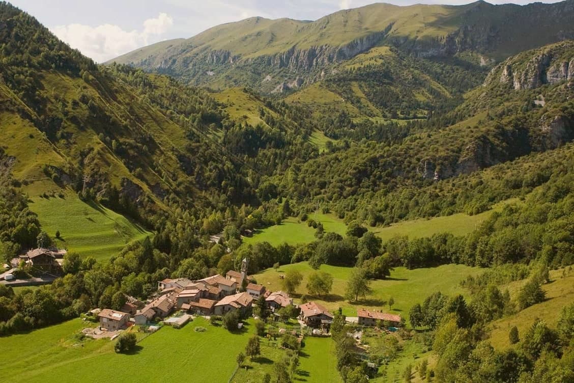
The territory is broad, 42 square kilometres, and it climbs from the 780-metre Gera stream up through the pass at 1,297 metres to the summit ridge above. Tombs from the Neo-Eneolithic period have been recovered on the slopes, evidence of how long this ground has been worked and crossed.
Rusio still keeps its medieval agricultural layout, narrow streets and rural houses gathered around a small church with a wooden altar, a lower and older counterpart to the hamlets higher on the mountain. Bratto and Dorga, at roughly 1,000 metres, took the opposite path: built up as summer resorts at the start of the 20th century, their streets still carry the villas that Bergamasco industrialists put up for their own summer use.
The commune holds the Bandiera Arancione of the Touring Club Italiano, the inland equivalent of a Bandiera Blu, awarded for keeping both the peasant village below and the mountain environment above intact. Together the two settlements show a single territory read in two directions: one preserved because it was left alone, the other because it was deliberately built for leisure.
The village sits at 870 metres.
What to see in Castione della Presolana
- Pizzo della Presolana. Dolomite-type limestone gives the southern face its sheer walls and climbing routes, the same rock mass that stands over the whole commune.
- Chiesa di Sant'Alessandro. Parish church in the historic centre, with a marble altar carved with figurative sculptures.
- Chiesa di San Rocco. Smaller village church holding fragments of ancient frescoes.
How to get to Castione della Presolana
Bergamo is roughly 49 minutes away by road.
Our tip
May through October is the main season for Castione della Presolana. Trails open through the Orobie pre-Alps, the Passo della Presolana is clear, and the limestone walls of the Pizzo dry out for climbers. July and August bring Bergamo and Milan families up to Bratto and Dorga, where the temperatures stay ten degrees cooler than in the city.
Bormio
Why visit Bormio
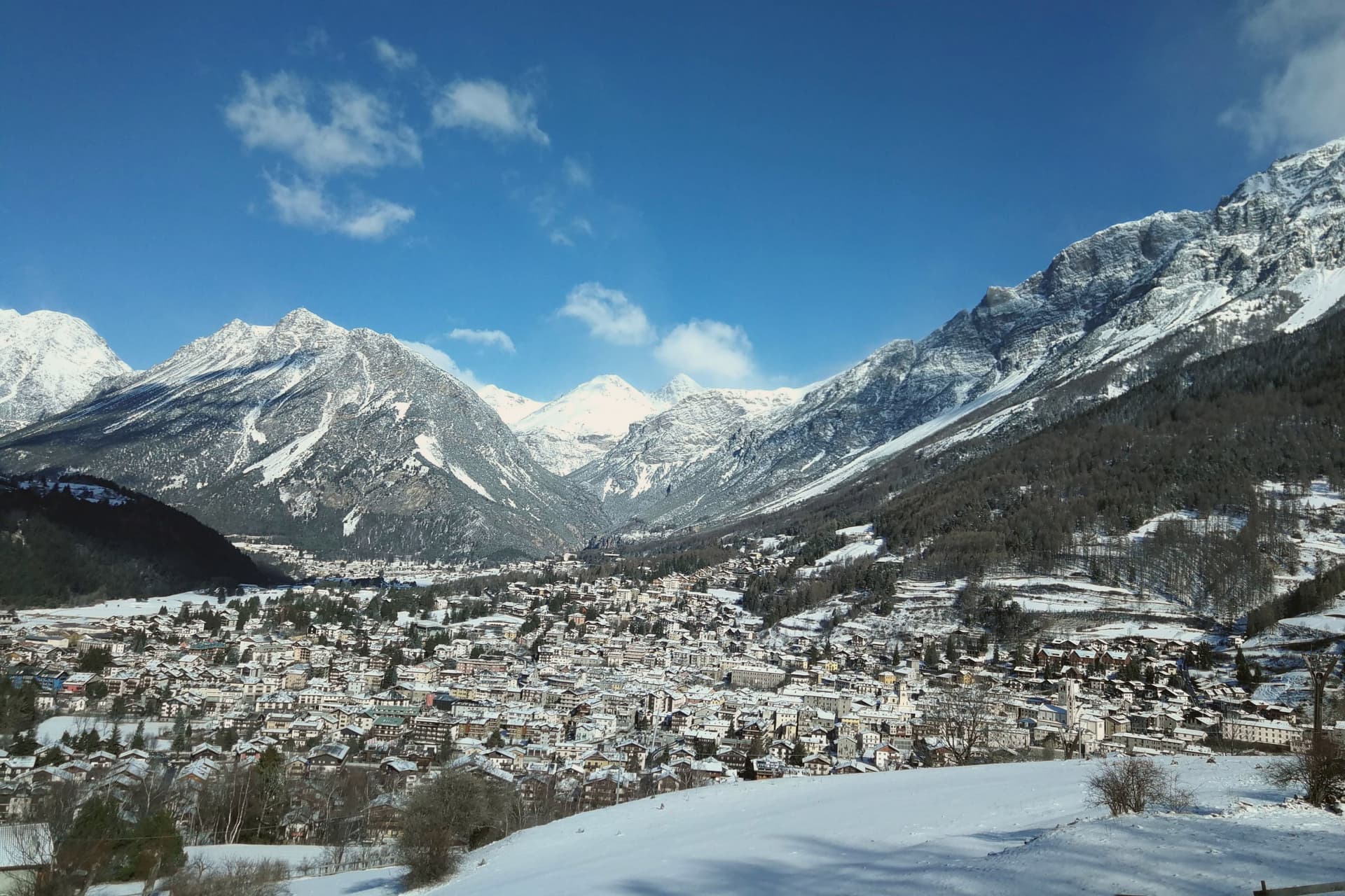
Bormio sits at 1,225 meters in upper Valtellina, at the junction where three high passes, the Stelvio, the Gavia, and the Mortirolo, converge inside the Stelvio National Park. The park ranges from 650 to 3,905 meters, and the springs that feed the town's baths rise separately at 1,420 meters, well above the settlement itself, before being carried down to the three thermal centres: QC Terme Bagni Vecchi, QC Terme Bagni Nuovi, and Bormio Terme.
The town's layout follows this same split between high and low. The Bagni Vecchi sit above the town in caves cut into the rock, closer to the mountain than to the streets, while the medieval center, the Kuerc, with its ninth-century podestà building, holds the civic and commercial life down in the commune itself.
The pass road above, meanwhile, belongs to a separate register entirely, an engineered climb rather than a settled place. What holds Bormio together is this vertical arrangement: water, rock, and road stacked above a small alpine commune that has stayed the administrative and social center while the mountain around it accumulated separate identities, as thermal ground, as national park, as pass, as ski slope.
The village sits at 1225 metres.
What to see in Bormio
- QC Terme Bagni Vecchi. Stone rooms and caves above the town, where the same water has run over Roman-era construction for two thousand years.
- QC Terme Bagni Nuovi. Belle Époque thermal complex below the Bagni Vecchi, with outdoor pools facing the Alpine peaks and the Valtellina valley.
- Kuerc e Palazzo del Podestà. Medieval civic center of Bormio, the Kuerc loggia and the ninth-century Podestà building in the heart of the centro storico.
How to get to Bormio
Bolzano is roughly 119 minutes away by road.
Our tip
December through March is the season Bormio was built for, with the Cima Bianca lifts open, the Stelvio downhill course hosting the men's World Cup, and the Bagni Vecchi running outdoor thermal pools against the snow. June through September is the second season: 1,225 meters keeps the air cool when the plain hits thirty-five, the Stelvio Pass road is open for bikes and cars, and the National Park trails are dry. April, May, October, November are the shoulder months.
Teglio
Why visit Teglio
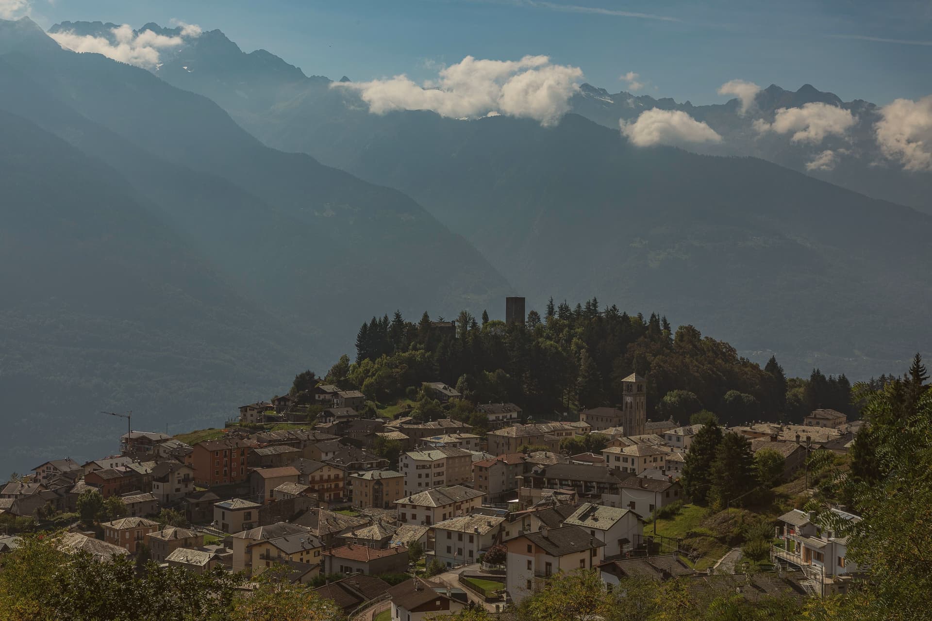
Teglio sits on the south-facing slope of the Valtellina, terraced vineyards dropping toward the Adda below the village and pine forest climbing behind it to the Orobie ridge. The Latin Tellina Vallis, valley of Teglio, gave the whole Valtellina its name, and the comune's own records reach back to the 9th century, when the village held the strategic centre of the valley.
The upper village keeps that older, defensive character; the vineyards and the valley floor below are where the food and wine culture of the place plays out, the two halves of the town facing different directions in what they do. Pizzoccheri, buckwheat tagliatelle with savoy cabbage, potato, garlic-and-butter sauce and casera cheese, has its official home here, and Teglio holds Cittaslow status on the strength of that food culture together with the terraced viticulture below the village.
A hill town that named a valley, still turned toward the river and the vines that keep its economy going, while its height and its records point back to why it was worth holding in the first place.
The village sits at 856 metres.
What to see in Teglio
- Palazzo Besta. The courtyard cycle depicts Virgil's Aeneid; the upper salons hold further biblical and mythological scenes. The Antiquarium Tellinum inside holds Iron Age and Roman material from the valley.
- Accademia del Pizzocchero. The body that certifies trattorie and holds the recipe to its original form: buckwheat tagliatelle with savoy cabbage, potato, and a butter-garlic sauce alongside the cheese.
- Vigneti terrazzati della Valtellina. South-facing terraces stepping down toward the Adda, part of a viticultural landscape under UNESCO candidacy, producing Sforzato and Inferno Nebbiolo.
How to get to Teglio
There is a railway station in the town, so you can arrive without a car and never need one while you are here. Brescia is roughly 142 minutes away by road.
Our tip
May through October is the open season at 856 metres — Palazzo Besta open daily, terraced vineyards green, and the Valtellina wine route in full operation. June and September are the best months for both architecture and wine: long warm light, fewer tourists than peak summer, and the Sforzato and Inferno harvests just preparing in September. July-August stay temperate at this elevation and the trattorie are at full pizzocchero output.
Livigno
Why visit Livigno
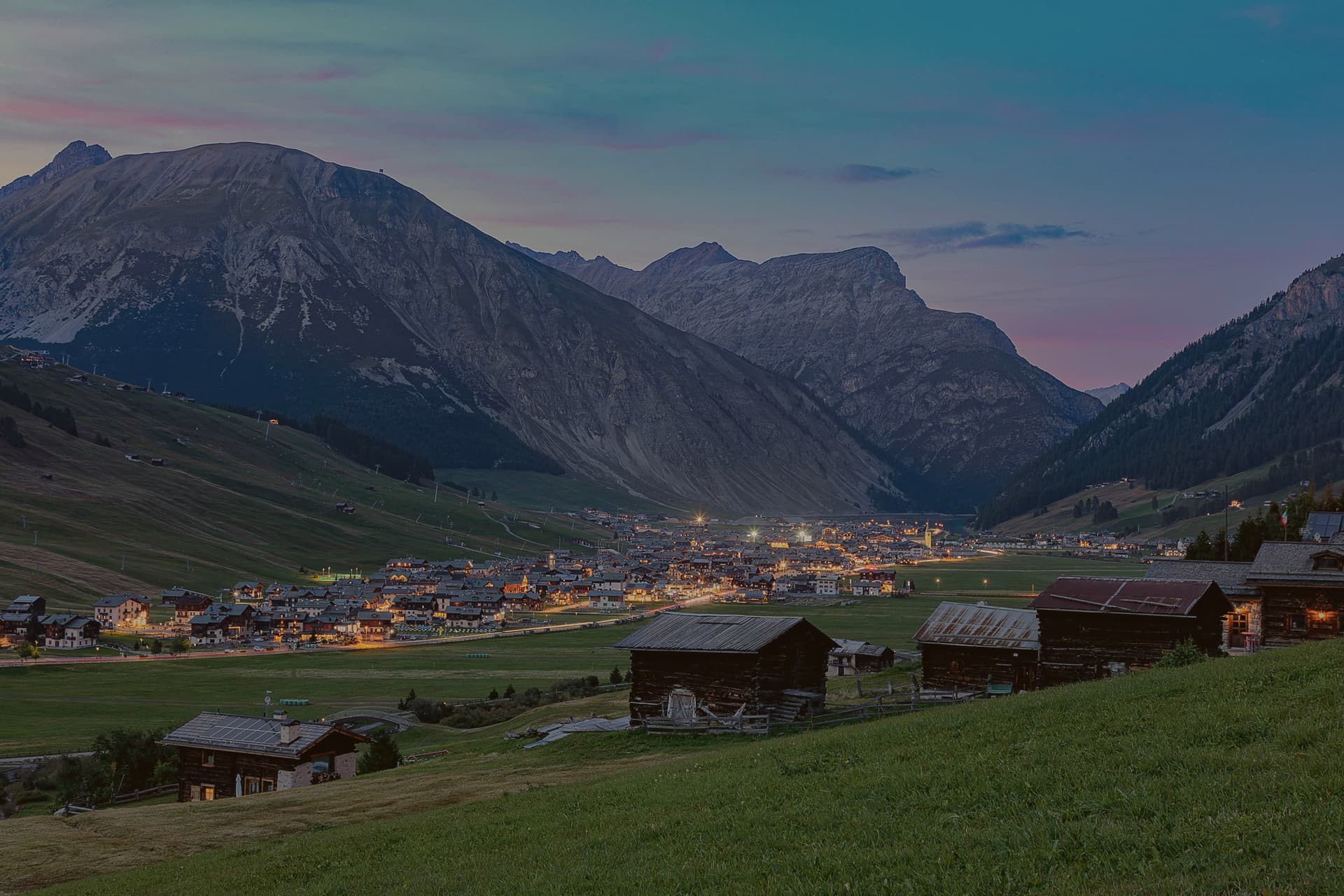
Livigno sits at 1,816 meters in a high valley between the Stelvio National Park and Switzerland's Engadine, one of the few Italian communes whose waters drain north to the Black Sea rather than south to the Mediterranean. The name probably comes from an old German word for avalanche; the last one to hit the village killed seven people in 1951.
Until the 1970s this was a farming village of shepherds and small farms. The duty-free status, first granted by Austria around 1840 and confirmed by Italy in 1960, is what changed it.
Today the slopes of Carosello 3000 on one side of the valley and Mottolino on the other carry the ski traffic that arrives by the busload from Milan and the rest of Europe. Saint Mary's parish church, rebuilt at the end of the 19th century around its older predecessor, still anchors the centre.
The duty-free shops along Via Plan handle the rest of the visitor economy.
The village sits at 1816 metres.
What to see in Livigno
- Chiesa di Santa Maria Nascente. Late 19th-century parish church built around the older church it replaced, so that services continued during construction.
- Chiesa di San Rocco. Small votive church built at the start of the 16th century as protection against plague, on the edge of the historic settlement.
- Chiesa della Madonna di Caravaggio. Country church holding ex voto paintings and a picture traditionally attributed to Caravaggio.
How to get to Livigno
Bolzano is roughly 152 minutes away by road.
Our tip
December through March is the ski season Livigno was built for: 1,816 meters guarantees snow, the duty-free shops stay open late, and the two ski areas run at capacity. June through September is the second season. Trails climb into the Stelvio park, the valley keeps temperatures under 25 degrees even in August, and bike traffic replaces ski traffic on Mottolino.