
The best hidden olive oil towns within 90 minutes of Foggia
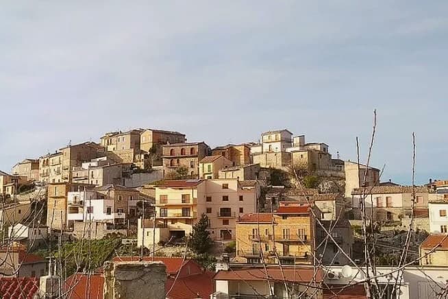
Olive harvest in northern Puglia and lower Molise runs from late October into December, and for those weeks the whole landscape smells faintly green and bitter. The trees here are old, often centuries old, with trunks like twisted rope, and the frantoi work through the night to press fruit within hours of picking. New oil comes out cloudy and peppery enough to catch at the back of the throat, and it is poured over bruschetta, over broad bean puree, over boiled chicory without ceremony. The towns themselves are built from local limestone and tufa, pale in the flat winter light, set on ridges above the plain where the wind keeps the air clear.
Most visitors to this part of Italy point themselves at the Gargano coast, at Vieste and Peschici, or push south to Alberobello and the trulli. Those places are well organised for arrivals, with car parks and signposted routes and restaurants that print menus in several languages. In summer the coastal roads back up badly and the historic centres fill by mid-morning. The oil is good there too, but you are unlikely to be in the room when it is pressed.
The olive belt does not stop at the resorts. It climbs inland through the Daunian hills, crosses into Molise along the Biferno, and spreads across the Murgia towards the escarpment, and that is where these towns sit. Fewer people go, the mills are smaller, and the harvest is still a working season rather than an attraction. All of them belong to the national association of olive-oil towns, which is a reasonable sign that the oil is taken seriously and made close to where you are standing.
Of the 23 communes we have mapped within 90 minutes of Foggia, 11 qualify as olive oil towns: each belongs to the national association of olive-oil towns. This list is the hidden ones, 7 in all, ordered smallest first. The smallest, Zungoli, has 942 residents.
Two more lists worth reading alongside this one: The best hidden hill towns within 90 minutes of Foggia and The 8 best olive oil towns you can reach by train within 90 minutes of Foggia.
Zungoli
Why visit Zungoli
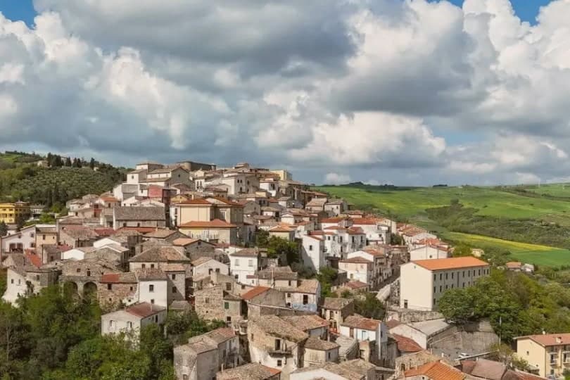
Zungoli sits on the eastern edge of the province of Avellino, one of the higher villages in Irpinia, with the Ufita valley on one side and the Daunian Mountains on the other. The settlement dates to around 900 AD.
Frederick II made it a universitas in 1232, by which point a Norman captain had already built the first fortification and left the place his name. The houses of the centro storico climb the ridge around that castle, and the ground beneath them is hollow: the whole old quarter sits over a network of caves cut by hand in the Byzantine period, long before the cheese and oil that now fill them.
Above ground the stone and the towers date the village; below it, the caves keep it at a constant temperature, which is why what was dug for one purpose is still put to use for another.
What to see in Zungoli
- Castello dei Susanna. The castle's three surviving towers rise over the roofline of the village, the fourth lost to the 1456 earthquake; the walls are the highest point on the ridge.
- Grotte Bizantine. The cave network runs beneath the streets, low and cool, still stacked with wheels of Caciocavallo Podolico and jars of oil the way it has been used for centuries.
- Centro storico medievale. Stone alleys and stairways around the castle on a 657-meter ridge, a Borgo più Bello d'Italia and Bandiera Arancione with views toward the Daunian Mountains.
How to get to Zungoli
Foggia is roughly 81 minutes away by road.
Our tip
April through June and September into October are the dry months on the Irpinia ridge, when the Ufita valley is green and the cave temperature stays even for cheese tasting. July and August touch the low thirties, lighter than the coastal heat but still drying the surrounding pasture; the tuff caves below the houses become the cool refuge. November through March is cold, with rain and occasional snow above six hundred meters, the castle silhouette appearing through low fog.
Biccari
Why visit Biccari
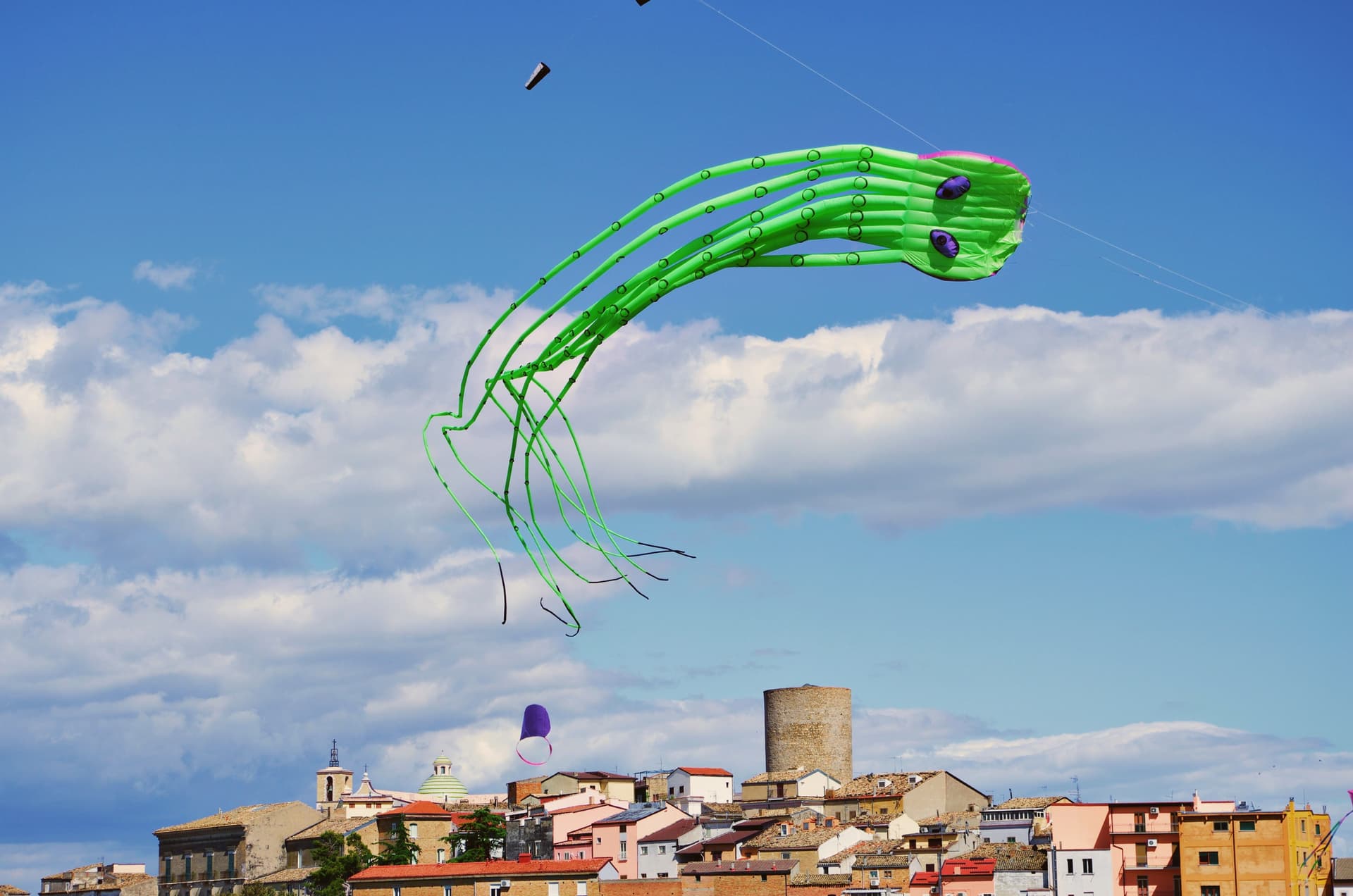
Biccari sits at 450 meters on the eastern slope of the Subappennino Dauno, with Monte Cornacchia rising behind it at 1,151 meters, the highest point in Puglia. The municipal territory runs from the peak down to the Tavoliere plain, an unusual vertical range for a Puglian commune.
The village was founded by Byzantine catepan Basilio Boioannes around 1024, then taken in the 1050s by a Norman called Pagano who fortified the original tower into a small castrum. The Torre Bizantina still stands at the centre of the village, a square stone tower that names everything around it.
The town carries four institutional signals at once, including Bandiera Arancione and Comuni Virtuosi, and runs an active second-home repopulation scheme. A Neolithic site at Boschetto, 700 meters up the Organo torrent, is one of the highest of its age in Puglia, evidence of seasonal habitation four thousand years before Christ.
What to see in Biccari
- Torre Bizantina. Square stone watchtower built by the Byzantine catepan around 1024, the structure the Norman fortifications grew around, still the highest point in the village.
- Chiesa Madre di Santa Maria Assunta. Mother church in the centro storico, rebuilt over the centuries on Byzantine and Norman foundations, anchoring the upper village.
- Lago Pescara. Small upland lake in the Cornacchia foothills, used for fishing and a summer walking circuit, at the edge of the beech and oak woodland.
How to get to Biccari
Foggia is roughly 40 minutes away by road.
Our tip
April through October are the months the Subappennino Dauno stays workable: cool evenings, dry summer air, the Cornacchia trails open. June through August reach the high twenties at 450 meters while Foggia bakes; the village climate is the main argument for visiting in high summer. October brings the chestnut and porcini season in the woods above the lake.
Guglionesi
Why visit Guglionesi
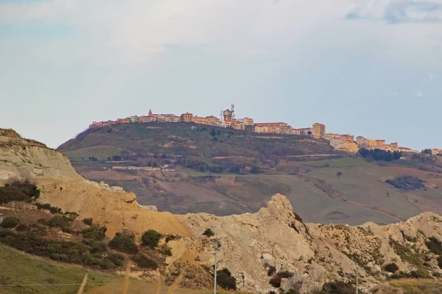
Guglionesi sits on a 369-meter ridge between the Biferno and Trigno valleys, halfway between the Adriatic coast and the inland hills of Molise. The Frentani founded the place in the fifth century BC, under the name Uscosium, and it was one of their principal centres before Rome absorbed the confederation.
In the sixteenth century the Dominican Serafino Razzi listed Guglionesi alongside the Slav-founded villages of lower Molise; he also recorded that Brother Serafino led the local defence against an Ottoman raid led by Sulayman at the city walls. The Romanesque Chiesa di San Nicola di Bari and the Collegiata di Santa Maria Maggiore are the medieval anchors of the centro storico; the latter goes back to the twelfth century and holds the relics of the abate Sant'Adamo.
The hills produce olive oil good enough for the Città dell'Olio designation, and on a clear afternoon you can see the Tremiti islands offshore.
What to see in Guglionesi
- Collegiata di Santa Maria Maggiore. Collegiate church with twelfth-century origins, reworked in the eighteenth century in Baroque style; holds the relics of Sant'Adamo Abate.
- Chiesa di San Nicola di Bari. Romanesque church in the centro storico, the oldest documented religious building in the town.
- Centro storico. Stone old town along the ridge, with city walls Brother Serafino is recorded as defending against an Ottoman raid in the sixteenth century.
How to get to Guglionesi
There is a railway station in the town, so you can arrive without a car and never need one while you are here. Foggia is roughly 82 minutes away by road.
Our tip
April through October is the working window. Spring greens the valleys and brings the long Adriatic views back into focus. June and September are the calmest months for the centro storico.
Mattinata
Why visit Mattinata
Mattinata sits at seventy-five meters on the eastern Gargano. The Iapyges, immigrants from Greece and the Balkans, settled the surrounding hills from the fifth century BC; the Roman port of Matinum, on the modern seafront, gave the town its name.
The current settlement is younger than most Garganic centers: it was administered as part of Monte Sant'Angelo until 1955, when it became an independent comune. The town proper sits below the mountain that watches over it, the two bound by the same limestone that runs from the abbey ruins down to the coast.
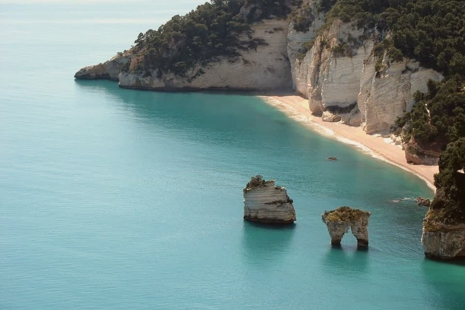
South of town the shoreline drops toward the sea stacks and, ten kilometers further on, the pebble crescent and cliffs of Baia di Vignanotica. The national park covers all of it, mountain, coast and town alike.
A settlement younger than its neighbors, built on ground far older: the Roman port beneath the seafront, the settled hills behind it, the abbey above it, all folded into a comune that has only carried its own name since the middle of the last century.
La Locanda del Maniscalco have been named by a guide.
What to see in Mattinata
- Baia delle Zagare. Bay south of town with two iconic limestone sea stacks, the arch-shaped Arco di Diomede and the scissor-shaped Le Forbici.
- Baia di Vignanotica. Pebble crescent under tall limestone cliffs, reached on foot from the Sentiero dell'Amore from Baia dei Mergoli.
- Monte Sacro and Abbazia della Santissima Trinità. Ruined abbey standing where Benedictine monks raised it to abbey status in 1138, after annexation to the abbey of Siponto brought its abandonment.
How to get to Mattinata
Foggia is roughly 72 minutes away by road.
Our tip
May through September is the season Mattinata runs at full strength. The Adriatic water at Vignanotica and Baia delle Zagare is swimmable from late May, the Monte Sacro trail is at its best when the orchids flower in May and June, and the coastal cliffs catch a long evening light through the summer. July and August push past thirty degrees and fill the beaches; the boat shuttle to the faraglioni is the easier access.
Larino
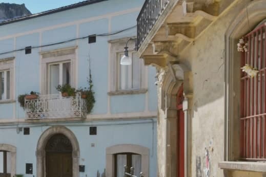
Why visit Larino
Larino sits at 341 meters in the lower Biferno valley, twenty kilometers inland from Termoli. The Frentani held the place before Rome and minted bronze coins here in the third century BC; the wool trade made it a regional centre.
The orator Cicero defended a Larino-born equestrian, Aulus Cluentius Habitus, in his Pro Cluentio of 66 BC, a case that ties the town to the wider world of the capital beyond its own remains. The old town runs along the ridge above the ancient city, so the medieval borgo and the old street plan sit in view of each other rather than layered one on top of the other.
The cathedral stands at one end of this arrangement, the arena and forum fragments at the level below. Every 25 to 27 May the streets carry the Carrese di San Pardo, a three-day procession of oxen and flower-decked carts that retraces the eleventh-century translation of the patron's relics from Daunia, linking the medieval town's religious life to the same ground the Frentani and the arena's builders had already used.
The surrounding hills carry the Città dell'Olio mark. What holds the town together, across the Frentani coinage, the law case, the arena, and the May procession, is that each layer used the same ridge and valley without erasing what came before it.
Osteria del Borgo, Ciafi dal 1976 have been named by a guide.
What to see in Larino
- Anfiteatro Romano. Elliptical arena, 100 by 80 meters, built by a Larinum citizen who made his fortune in Rome. It stands within walking distance of the old town, its outline still legible against the surrounding streets.
- Cattedrale di San Pardo. The portal is the work to look at closely, carved by Francesco Petrini of Lanciano, its stone figures still sharp against the facade's plainer masonry.
- Centro storico (borgo). Medieval old town stretched along the ridge above the Roman remains, with Renaissance palazzi and narrow stone streets.
How to get to Larino
There is a railway station in the town, so you can arrive without a car and never need one while you are here. Foggia is roughly 82 minutes away by road.
Our tip
April through October is the working season. May is the month most travellers come for: the three-day Carrese di San Pardo runs 25 to 27 May, with around 130 flower-decked ox carts moving through the town. June and September keep the Roman amphitheatre and cathedral comfortable to walk.
Minervino Murge
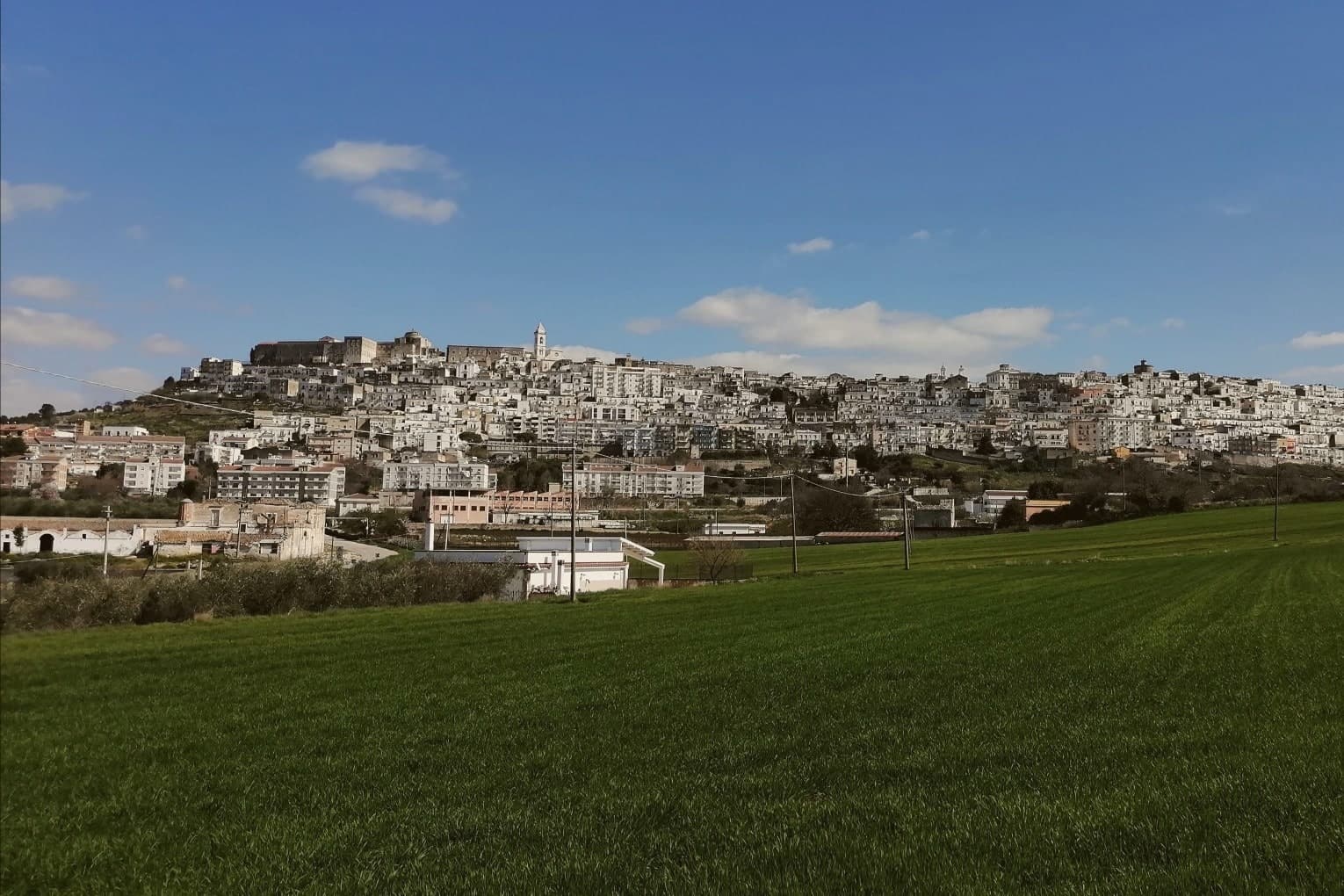
Why visit Minervino Murge
The town is built on two hills at the western edge of the Murgia plateau, where the limestone tableland gives out and the ground drops toward lower country on three sides. That break is what gives the ridge its long view and its nickname: to the east the eye crosses Murgia limestone toward the Gargano and the Adriatic, to the west it crosses cultivated fields into Basilicata, and to the north it runs the length of the Ofanto valley.
The old town sits above this drop, castle and tower on the high ground, cathedral below, the settlement organized around the same ridge that draws the view. Olive oil, almonds and grain define the rural economy beyond the walls, the plateau put to farming where it is not left to steppe grass and karst.
A ridge town, in other words, whose whole character, defensive site, pilgrimage cave, farmed hinterland, follows from the one geological fact of where the plateau ends.
La Tradizione - Cucina Casalinga, Masseria Barbera, A Sud dell'Anima have been named by a guide.
What to see in Minervino Murge
- Castello Normanno-Svevo. Norman fortress remodeled in the baronial period, with surviving towers and bastions on the high ridge above the old town.
- Torre di Pirro del Balzo. Fifteenth-century tower built between 1460 and 1490 when Minervino came to Pirro del Balzo as part of Maria Donata's dowry.
- Grotta di San Michele. Cave formed roughly two million years ago, reached through the karst rather than built, and still kept as a place of pilgrimage rather than display.
How to get to Minervino Murge
There is a railway station in the town, so you can arrive without a car and never need one while you are here. Foggia is roughly 62 minutes away by road.
Our tip
April through June and September through October are the months the Alta Murgia plateau runs best. The wildflower steppe peaks in May, almond blossom comes earlier in February, and the Ofanto valley below stays mild through autumn. July and August push past thirty-five degrees on the limestone with little shade; the centro storico empties between two and five and the panoramic belvedere is best at dawn or dusk.
Trinitapoli
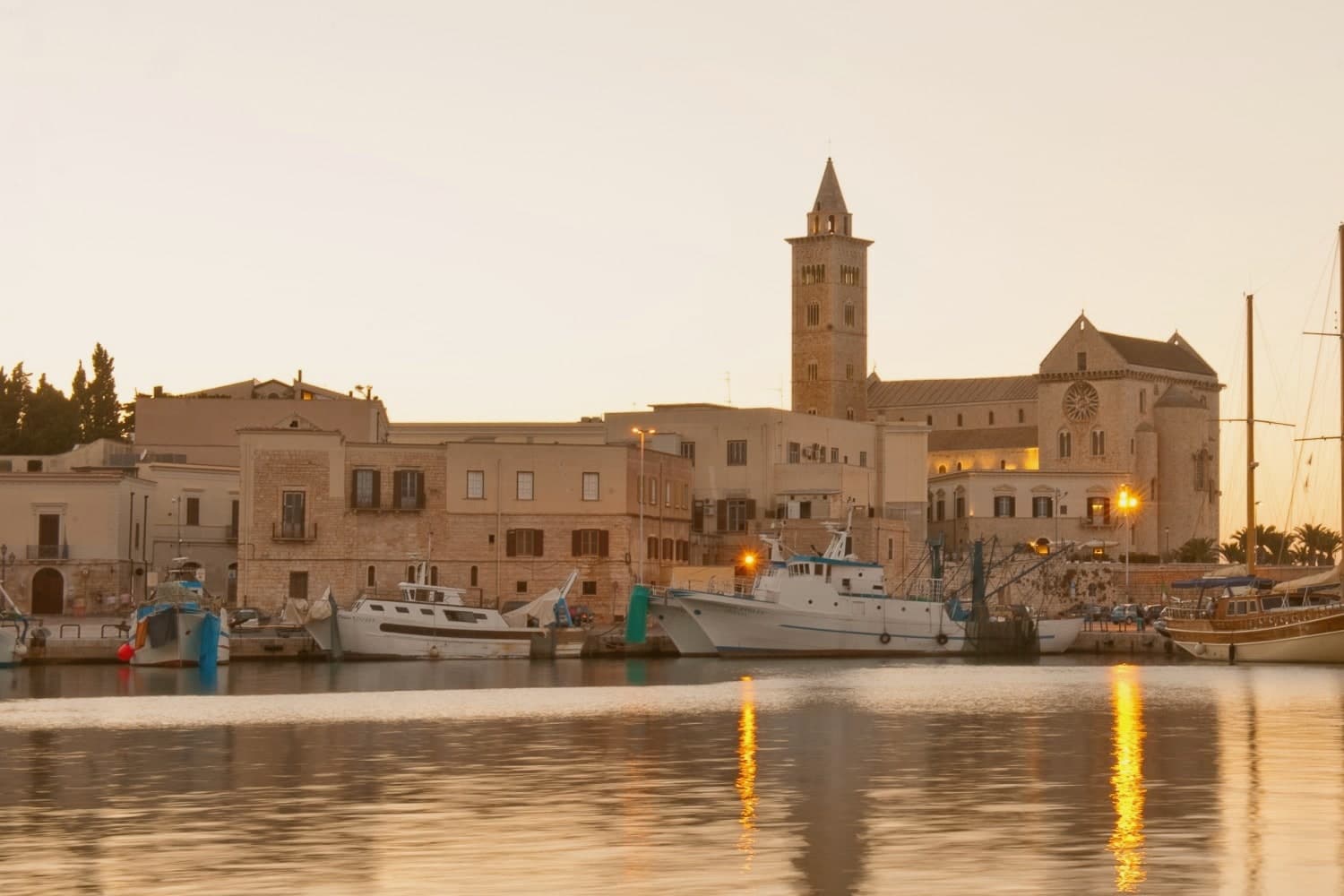
Why visit Trinitapoli
Trinitapoli sits on the Tavoliere plain four kilometers from the Adriatic and three kilometers from the Saline di Margherita di Savoia, the largest salt works in Europe and a wetland thick with pink flamingos. The town grew around a Casaltrinità chapel of the Holy Trinity first mentioned in 1186; Victor Emmanuel II changed the name from Casaltrinità to Trinitapoli by royal decree in 1863.
The Bronze Age Ipogei, discovered in 1987 in the Madonna di Loreto locality, turned out to be one of the most important religious sites of the second millennium BC in the Mediterranean: a complex of underground sanctuaries used for fertility rituals, with grave goods now displayed in the Museo Archeologico dei Dolmen e degli Ipogei. The Santuario della Beata Maria Vergine di Loreto, first recorded in 1204, was rebuilt in the nineteenth century and elevated to a diocesan sanctuary in 1971.
The nearby Salapia ruins anchor the town's deep history.
What to see in Trinitapoli
- Parco Archeologico degli Ipogei. Bronze Age underground sanctuary complex discovered in 1987, one of the most important Mediterranean ritual sites of the second millennium BC.
- Museo Archeologico dei Dolmen e degli Ipogei. Town museum displaying the grave goods and ritual objects recovered from the Ipogei, including bronzes, amber and Mycenaean ceramics.
- Santuario della Beata Maria Vergine di Loreto. Diocesan sanctuary on the western edge of town, first recorded in 1204 and rebuilt as a three-nave church in the early nineteenth century.
How to get to Trinitapoli
There is a railway station in the town, so you can arrive without a car and never need one while you are here. Foggia is roughly 59 minutes away by road.
Our tip
May, June and September are the easiest months on the Tavoliere: warm but not yet oven-hot, with the saline wetland in full flamingo season. October brings the olive harvest and the new oil. July and August touch forty degrees on the plain and the town quiets to dawn and dusk hours; the saline visitor center keeps reduced summer hours.
More from Anywhere Italy
- The best hidden hill towns within 90 minutes of Foggia
- The 8 best olive oil towns you can reach by train within 90 minutes of Foggia
- The best hidden olive oil towns in Puglia
- The best olive oil towns that eat well within 90 minutes of Foggia
 The best hill towns you can reach by train within 90 minutes of Foggia
 The best hidden olive oil towns in Molise