
The 9 best small mountain towns you can reach by train in the province of L'Aquila
The province of L'Aquila is mountain country in the fullest sense: limestone ridges holding snow into spring, high pastures grazed by sheep that still move on the old drovers' routes, and villages built from the pale grey stone quarried out of the slope behind them. The food follows the altitude, with lentils from the Fucino plain, saffron threads dried over embers, mutton stewed slowly, and pecorino aged in cellars cut into rock. Winter brings genuine cold and reliable snow; summer up here is cool enough to sleep under a blanket in August. The railway lines that thread these valleys were engineered through gradients and tunnels that make the journey itself worth the ticket.
The name most people attach to the region is Gran Sasso, and the Campo Imperatore plateau below it fills with cars every clear weekend from June onwards, coaches at the funivia station, walkers queuing at the trailhead for Corno Grande. It earns the attention. The plateau is one of the great high landscapes in Italy and the approach road is spectacular. But it is also the one place in the province that everybody has already put on the list, and the car park tells you so.
The same mountains carry on south and west, into the Peligna valley, the Marsica and the upper Sangro, and the trains carry on with them. Roccaraso has skiing on its doorstep; Campo di Giove sits under the Maiella with lifts a walk from the platform; Anversa degli Abruzzi guards the mouth of the Sagittario gorge. Fewer people get off at these stations, which is mostly a matter of habit rather than merit. Every town here sits in the mountains, and we have confirmed each one can be reached without a car.
Of the 42 communes we have mapped in the province of L'Aquila, 13 qualify as mountain towns you can reach by train: each sits in the mountains, and we have confirmed each is reachable without a car. This list is the small ones, 9 in all, ordered smallest first. The smallest, Anversa degli Abruzzi, has 312 residents.
Elsewhere in the catalogue: The best mountain towns you can reach by train within 90 minutes of Roma and The best hidden mountain towns within 90 minutes of Roma.
Anversa degli Abruzzi
Why visit Anversa degli Abruzzi
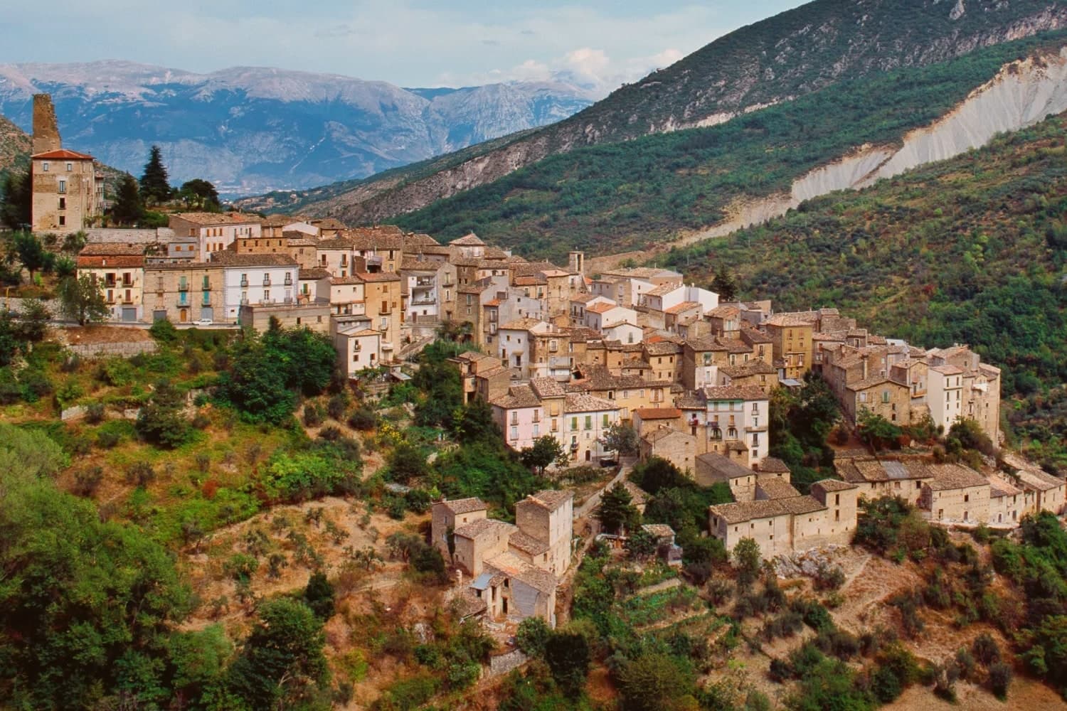
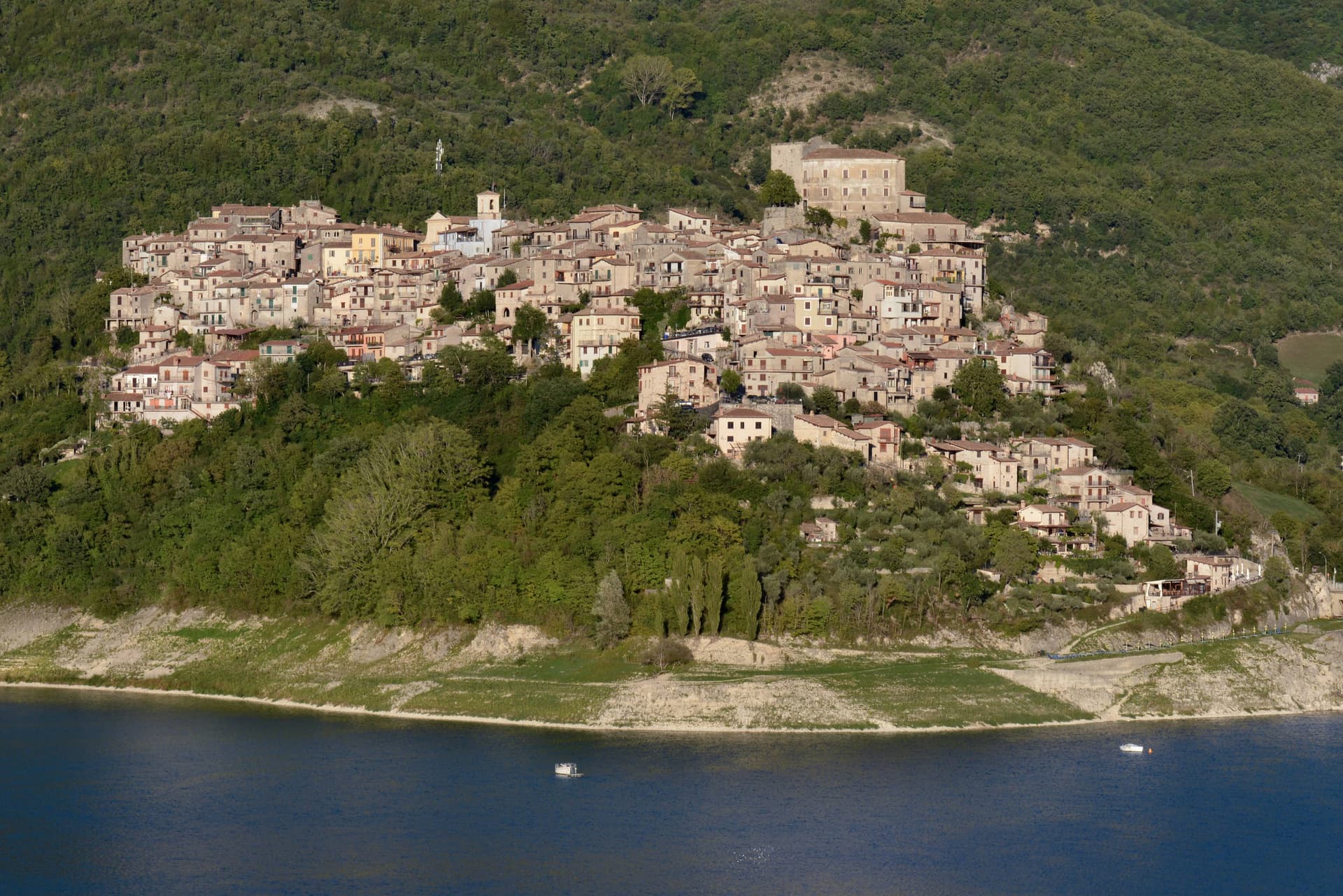
Anversa degli Abruzzi occupies a spur in the upper Sagittario valley, between the Peligna plain and the national park, with the gorges falling away directly beneath the walls. The Normans built here to hold the southern approach to the plain, and the Counts of Sangro controlled the site from the mid-1100s until the 1400s, when Antonio di Sangro gave the fortification its present form.
That same family supplied the material Gabriele D'Annunzio drew on for La Fiaccola sotto il moggio, written in the village in 1905. The borgo itself is compact: an outer ring of houses built into the cliff functions as the town wall, stone alleys thread through it on Norman-era foundations, and the church of Santa Maria delle Grazie, with its 1540 portal, sits as the principal religious building above.
Below, the 400-hectare reserve protects the limestone canyons cut by the river, sheltering wolves and Marsican bears where the village drops toward the water. Population has fallen from 1,934 in 1901 to about 300, and the ceramic tradition, the pignata and the cucù, persists as one of the few threads still tying the present village to the working town the Sangro family once ruled.
A place built for defense, held long enough to enter literature, and now sustained mainly by what it once was.
We confirmed you can reach this one by train.
What to see in Anversa degli Abruzzi
- Castello Normanno. Rebuilt in the 15th century by Antonio di Sangro on the site of the original Norman fortification, perched on cliffs above the village.
- Gole del Sagittario. The reserve's canyons lie directly below the village walls, home to wolves, Marsican bears, dormice, hawks and owls.
- Chiesa di Santa Maria delle Grazie. Late medieval church with a Renaissance portal dated 1540, the principal religious building in the upper borgo.
How to get to Anversa degli Abruzzi
There is a railway station in the town, so you can arrive without a car and never need one while you are here. Pescara is roughly 65 minutes away by road.
Our tip
May through October is the open season for Anversa. The gorges reserve runs guided walks, the upper village stays warm enough in the evening to eat outside, and the D'Annunzio literary trail is fully marked. July and August are hot in the canyon and busy on weekends with day visitors from Pescara and Sulmona.
Goriano Sicoli
Why visit Goriano Sicoli
Goriano Sicoli sits in the eastern Marsica between L'Aquila and the Adriatic. Italian documents reference the village from 816, though local tradition claims a Roman foundation.
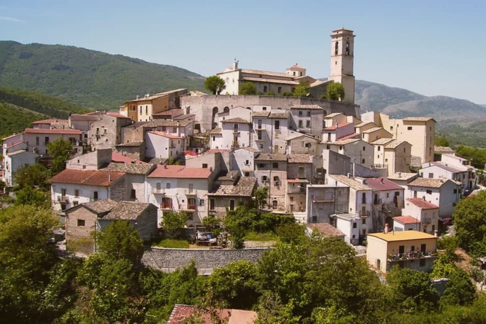
Population is about 511 and falling. The village is built on a slope, its stone houses climbing from the valley floor toward the ridge, with the piazza and its fountain as the fixed point where the streets converge and the town's social life gathers.
Below and around it, the Subequana valley opens into agricultural land and pasture running between Sulmona and L'Aquila, with Sirente rising over the eastern Marsica. The village survives on its position rather than its size: the Terni-Sulmona railway runs through it, the A25 autostrada is twenty minutes away, and Pescara is within an hour.
A place this small, sitting on a rail line and near a motorway between two larger cities, has stayed inhabited by being passed through rather than sought out, which is also how a printmaker's sketch and a Greek-Cretan agrarian myth both ended up attached to it.
We confirmed you can reach this one by train.
What to see in Goriano Sicoli
- Santuario di Santa Gemma. Sanctuary that holds the annual ritual, the busiest fixed point on the village calendar and the reason the piazza and streets around it fill each May.
- Piazza della Fontana. Central piazza, the social heart of the village, built around the stone fountain.
- Borgo medievale. Stone village climbing the slope, the same view drawn by M.C. Escher in a print now in the National Gallery of Art.
How to get to Goriano Sicoli
There is a railway station in the town, so you can arrive without a car and never need one while you are here. Pescara is roughly 68 minutes away by road.
Our tip
May through October is the active window. The Santa Gemma feast falls in early May and is the moment the village fills, with returning emigrants and locals from neighboring villages walking the streets all day. June, September and early October are the cleanest months for walking: cool mornings, long evenings, and the Subequana valley still green. Tartufo della Valle Subequana falls in the season.
Campo di Giove
Why visit Campo di Giove
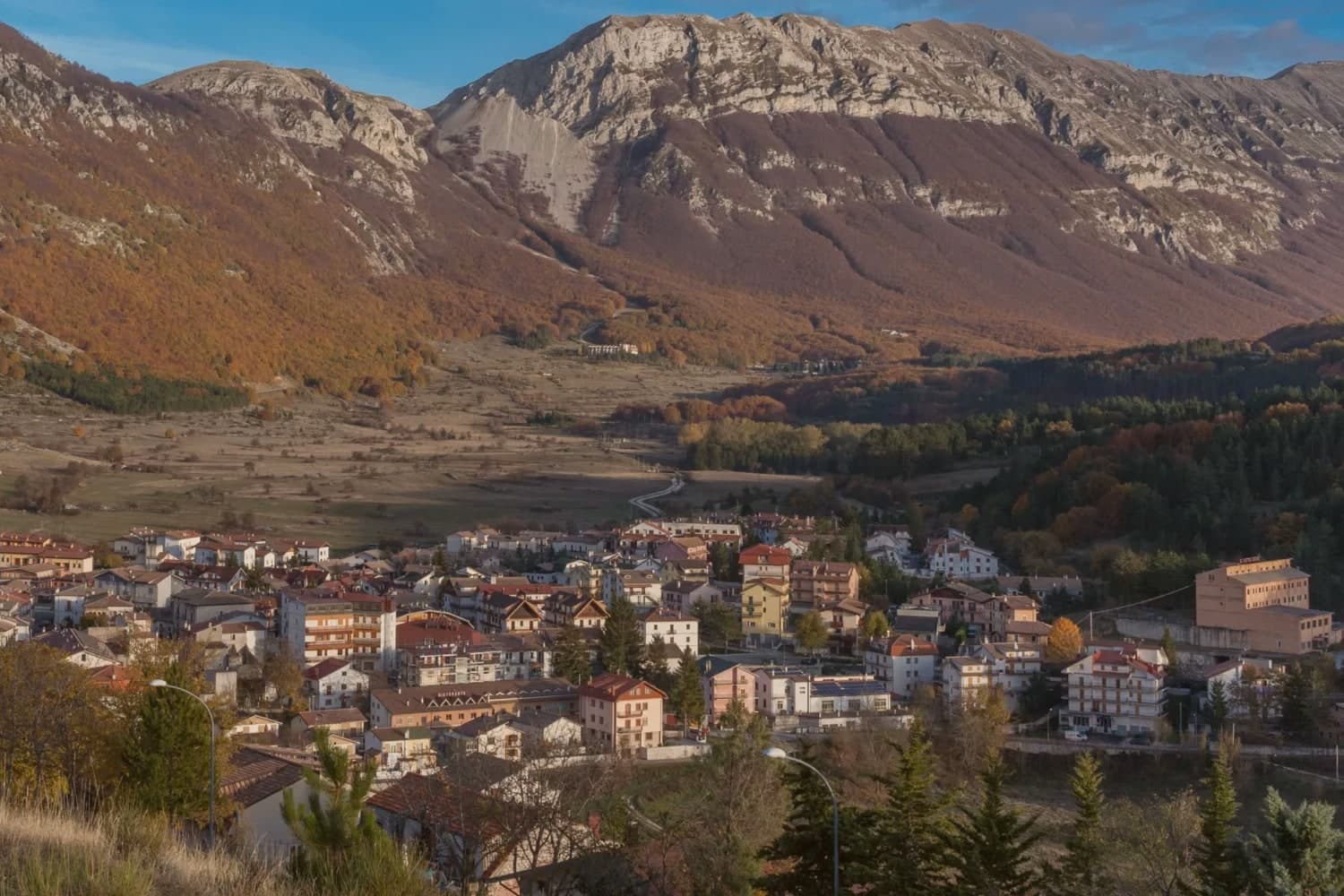
Campo di Giove sits at 1,064 meters at the foot of the southwestern Maiella, the highest commune inside the Maiella National Park. The name is documented as Campo Jovis from the 4th century AD, with local tradition claiming a Roman temple to Jupiter on the site after a victory over the Paeligni.
A villager called Odorisio appears in a document from January 1136. In the 14th century the village was a Cantelmo stronghold; it then passed to the Caldora, the Belprato, the Pignatelli, and finally the Recupito.
Above the village, the ski station operates between 1,150 and 2,360 meters, the highest piste in Abruzzo. The mother church of Sant'Eustachio holds the statue of the patron saint.
Sant'Antonino was one of the sixteen convents founded by Fra Pietro da Morrone, the hermit who would become Pope Celestine V. The Master of Campo di Giove, an anonymous 15th-century painter named for the polyptych he made for the village church, is on display at the Museo Nazionale d'Abruzzo in L'Aquila.
We confirmed you can reach this one by train.
What to see in Campo di Giove
- Chiesa Madre di Sant'Eustachio. Parish church of the village patron, with the statue of Sant'Eustachio, the saint celebrated each September with the village feast.
- Convento di Sant'Antonino. One of the sixteen convents founded by Fra Pietro da Morrone, the hermit who became Pope Celestine V, documented in a 1274 papal bull.
- Palazzo delle Logge. 16th-century palazzo with arched loggia on the main piazza, one of several Renaissance buildings from the Caldora and Pignatelli periods.
How to get to Campo di Giove
There is a railway station in the town, so you can arrive without a car and never need one while you are here. Pescara is roughly 82 minutes away by road.
Our tip
Campo di Giove runs on two seasons. December through March, the Maiella ski lifts run from the village edge to 2,360 meters, the highest piste in Abruzzo. June through September is the second season: temperatures stay below 25 even in August at 1,064 meters, and the Sentiero della Libertà hike, retracing the WWII escape route over the Maiella, draws walkers.
Civita d'Antino
Why visit Civita d'Antino
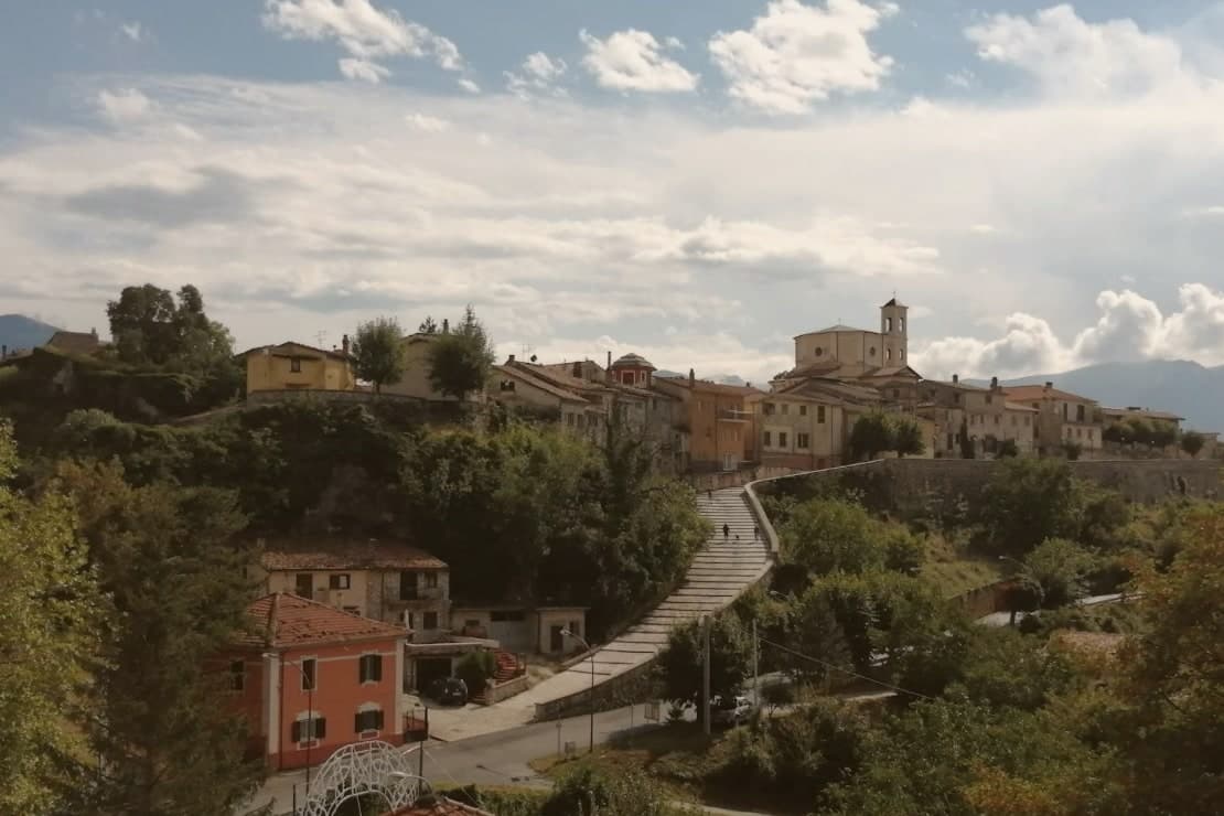
The plateau at 904 meters sits above the Roveto valley with the Liri running below it, and the natural rock barrier that rings the village is the same wall that once enclosed the Marsi town whose Latin name, Antinum, Pliny recorded. The inscriptions built into the modern walls are the physical continuity between the ancient settlement and the village that stands on it now: one place, occupied and rebuilt on itself for centuries rather than abandoned and resettled elsewhere.
The Scandinavian colony that formed here from 1883 was not incidental to the setting. The painters came for the light over the valley and stayed because the plateau offered the same view, session after session, for thirty years.
The painter behind the colony had been noticed by Gabriele D'Annunzio at his school in Venice in 1895, a decade into its run. The 1915 Marsica earthquake ended it in a single day.
What is left is a village whose Roman fragments and painters' colony both depend on the same geography: a defensible height above a valley, isolated enough to hold a community, whether Marsi or Danish, for as long as circumstance allowed.
We confirmed you can reach this one by train.
What to see in Civita d'Antino
- Centro storico. Stone village on a plateau at 904 meters, ringed by a natural rock barrier that has survived into the present.
- Casa-museo Zahrtmann. Cerroni family house where Kristian Zahrtmann lodged every summer from 1883 to 1911, now a memorial museum to the painters' colony. Zahrtmann was made an honorary citizen in 1902, and in 1908 held a Copenhagen exhibition marking 25 years of the connection.
- Resti di Antinum. Roman-era inscriptions and fragments of the ancient Marsi municipal town, scattered through the modern village walls.
How to get to Civita d'Antino
There is a railway station in the town, so you can arrive without a car and never need one while you are here. Roma is roughly 100 minutes away by road.
Our tip
May through October is the open stretch for Civita d'Antino. At 904 meters the village stays cool in July and August when the Roveto valley below climbs into the mid-thirties, and the plateau light, the one that drew the Danish painters, is at its longest in June and September. Early July through mid-August fills the few rental rooms with returning families.
Sante Marie
Why visit Sante Marie
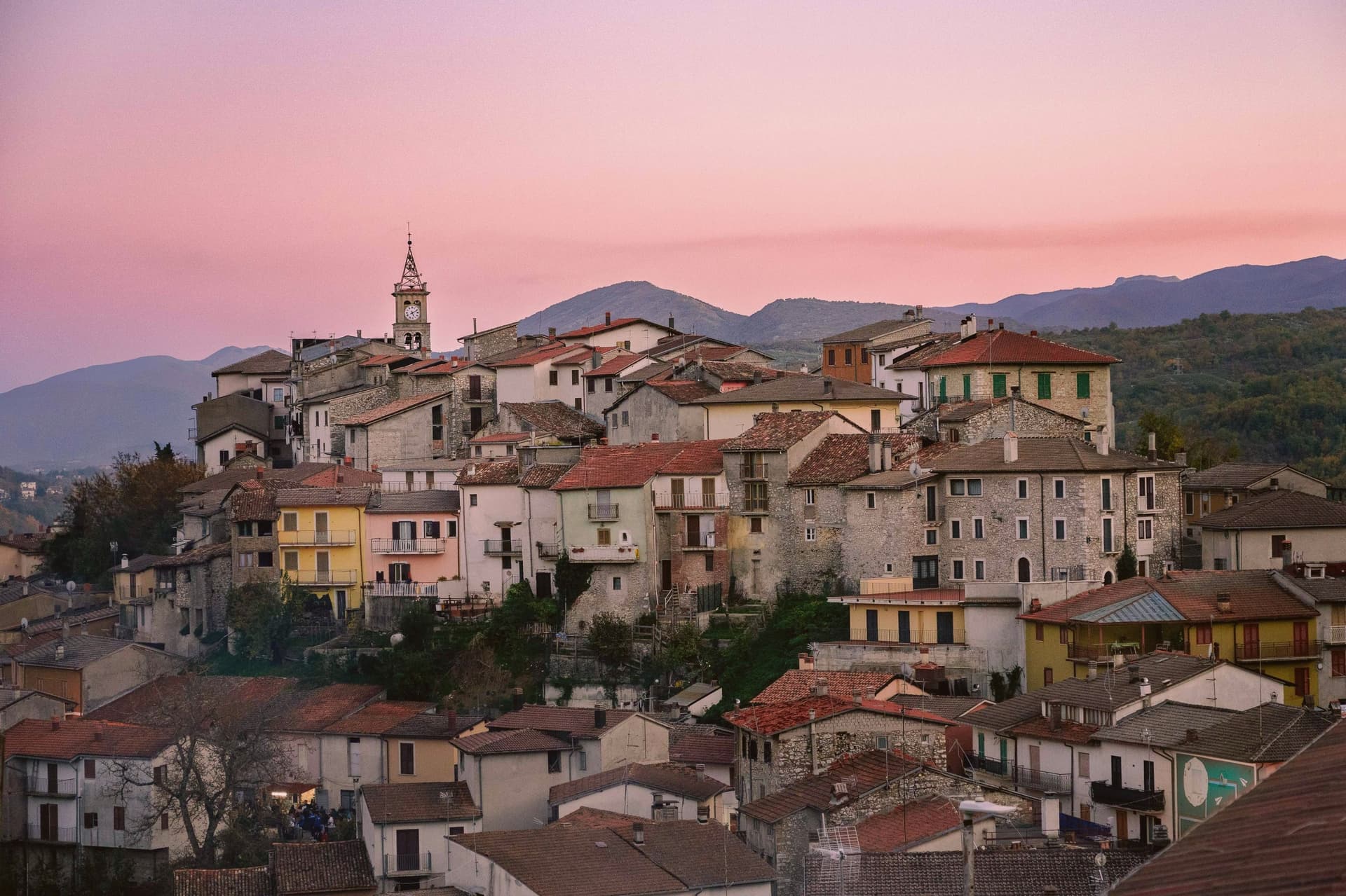
Sante Marie sits at 950 meters in the western Marsica, at the border between L'Aquila and Rieti provinces. The town is the capoluogo of six fractions scattered through the hills: Scanzano, Castelvecchio, Val dei Varri, Santo Stefano, Tubione, and San Giovanni.
Its medieval history runs with the Fief of Tagliacozzo, held in turn by the Counts of Marsi, the De Pontibus, the Orsini and finally the Colonna. The Grotte di Luppa Reserve, established in 2005, sits in the surrounding karst country of the Simbruini and Carseolani mountains.
The town is best known now as the starting point of the Cammino dei Briganti, a seven-day circular trail at altitudes between 800 and 1,300 meters that follows the routes of the Cartore brigands, the post-Risorgimento bands who used these forests as cover. Walkers pick up a safe-conduct pass at the reserve office in the village before setting out.
We confirmed you can reach this one by train.
What to see in Sante Marie
- Cammino dei Briganti. Seven-day circular hiking trail at 800 to 1,300 meters along the routes of the Cartore brigands, starting from Sante Marie.
- Riserva Naturale Grotte di Luppa. Karst reserve established in 2005 protecting caves and Apennine landscape on the Simbruini and Carseolani mountains border.
- Centro storico. Medieval hill village above the modern lower town, the historic core of the Tagliacozzo fief held by Marsi, Orsini and Colonna.
How to get to Sante Marie
There is a railway station in the town, so you can arrive without a car and never need one while you are here. Roma is roughly 68 minutes away by road.
Our tip
May through October is the hiking window. Late May and early June bring the slopes into bloom and the Cammino dei Briganti at its best, with cool morning starts and 1,300-meter ridge crossings still open. September and October dry out the trail and turn the chestnut woods gold. Sagra del Porcino falls in August.
Roccaraso
Why visit Roccaraso
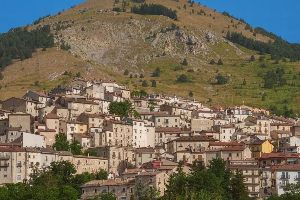
The town sits where the plateaus of Aremogna and Pizzalto meet the higher ground toward Monte Greco, the peak that anchors the whole range at 2,283 meters. The two plateaus are joined by lift, grazed and hiked in summer, cut into pistes in winter: the same trails serve both seasons under different cover.
Four kilometers uphill sits the older, smaller settlement, a medieval frazione that took the weight of the war the valley town below did not escape either. The Germans dug into the Gustav Line where it crossed through here, the Allies bombed in response, and the town below was leveled along with it.
What stands in Roccaraso now was rebuilt after that, stone by stone, from what the bombing left. The first ski lift on Monte Zurrone went up in 1936, years before any of it, and skiing resumed after the rebuilding and never really stopped.
The area has held its place as the south's ski capital since, though the snow line keeps rising: in January 2024 only twenty of Abruzzo's 122 pistes were open. A resort built twice, once by engineers before the war and once by survivors after it, still runs on the same slopes either way.
We confirmed you can reach this one by train.
What to see in Roccaraso
- Chiesa di Santa Maria Assunta. Baroque travertine façade, gilded walnut pulpit in the shape of a Greek cross, painted and gilded wooden organs.
- Pietransieri. Medieval frazione where the Limmari Massacre took place; the Gold Medal of Military Valour recognizes what its people lost that winter.
- Piano Aremogna. High pasture and ski terrain at 1,650 meters, the eastern flank of the Alto Sangro ski domain.
How to get to Roccaraso
There is a railway station in the town, so you can arrive without a car and never need one while you are here. Pescara is roughly 94 minutes away by road.
Our tip
December through March is the season Roccaraso was built for. The Alto Sangro lifts open, the slopes fill, and the town doubles on weekends. June through September is the second season: 1,236 meters means temperatures rarely cross 23 degrees even in August, and the same plateaus that hold the lifts become hiking and pasture country.
Scurcola Marsicana
Why visit Scurcola Marsicana
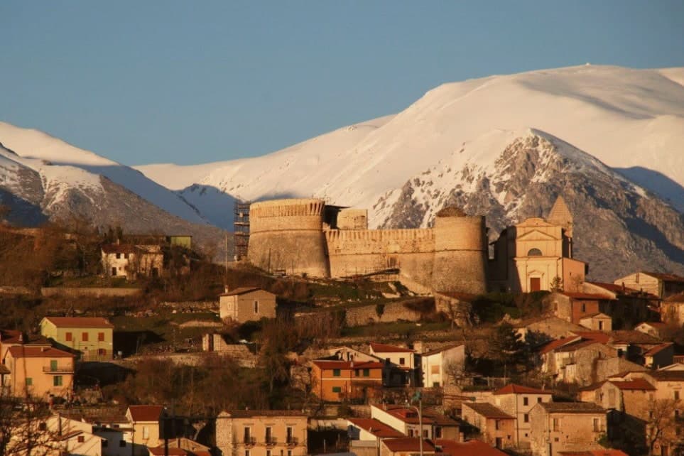
Scurcola Marsicana sits on the western rim of what was once the Fucine lake. The earliest finds in the area date to the ninth and eighth centuries BC; the toponym is Lombard and shows up around 1150, long before the events that made the place known.
The village and its castle sit on the hill, the abbey and the battlefield lie on the plain below, and the mountain rises behind the whole arrangement: high ground, open ground, and the ruin that commemorates what happened on the open ground, all within sight of one another on the plain. The other layer of history is darker: after Italian unification in 1861, Piedmontese troops carried out a massacre of the local population.
The commune has 2,670 residents today, and the Festone every August reenacts the Madonna della Vittoria tradition. A small town, then, built around a plain that settled a dynastic war, with a second, more recent violence folded into the same small territory without any monument to answer it.
We confirmed you can reach this one by train.
What to see in Scurcola Marsicana
- Ex Abbazia di Santa Maria della Vittoria. Now ruined but still readable: broken walls and arches standing in the open plain, the clearest physical trace left of the 1268 victory and the monks who once held the site.
- Castello Orsini. Medieval fortress on the hill above the village, later passed to the Colonna family with the rest of the marquisate.
- Piani Palentini. The wide plain stretches flat in front of the village, open ground with little to break the sightline, the kind of terrain that explains why an army would meet another here rather than in the hills.
How to get to Scurcola Marsicana
There is a railway station in the town, so you can arrive without a car and never need one while you are here. Roma is roughly 71 minutes away by road.
Our tip
May through October is the working window on the Marsica plateau. The Piani Palentini and Monte San Nicola open to walkers, the August Festone fills the streets with the Madonna della Vittoria procession, and the air at 700 meters stays cool through summer. June and September are the cleanest months for the battlefield walk and the abbey ruins. Sagra della Coda alla Vaccinara falls in August.
Pescina
Why visit Pescina
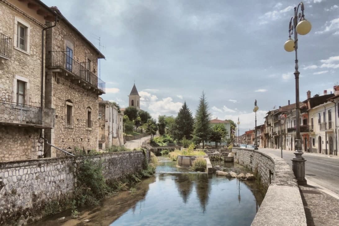
Pescina sits on the rim of the Marsica basin, the dry plain left when Lago Fucino was drained in the nineteenth century. The town splits into two eras rather than two quarters: an upper settlement, now a field of ruins reached by a literary trail, and a lower town rebuilt after 1915 around a new cathedral holding the historical seat of the diocese of Marsi.
The two houses that survived belonged to families whose sons left very different marks, one through his novels and one through his rise at a royal court, and both births are now kept as museums in the rebuilt streets below the ruin. What the rebuilt town and the ruin together show is a place still organized around a single morning: everything standing today either predates it by centuries or was raised after it.
We confirmed you can reach this one by train.
What to see in Pescina
- Torre Piccolomini. Medieval tower of the ruined upper castle, one of the few structures left standing, now marking the writer's grave at its foot.
- Centro Studi Ignazio Silone. The birth house, now a museum holding manuscripts, photographs, and his personal library.
- Casa Museo Cardinale Mazzarino. Birthplace of Mazarin, rebuilt into a museum that traces the path from this house to the court of Louis XIV.
How to get to Pescina
There is a railway station in the town, so you can arrive without a car and never need one while you are here. Pescara is roughly 66 minutes away by road.
Our tip
May through October is when Pescina works. The Marsica plain is dry and warm in summer, with temperatures pleasant at 735 meters compared to the Fucino basin below. April can be cold and wet, and snow lingers on the surrounding peaks into May.
Capistrello
Why visit Capistrello
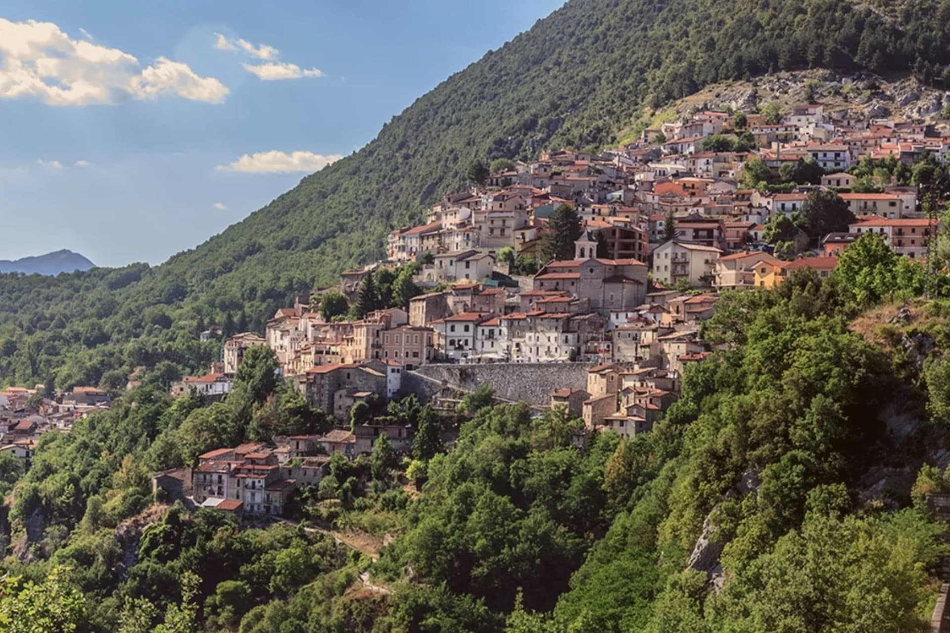
The first settlements on the site date to the Neolithic, and the modern town grew up around the tunnel mouth rather than the other way around. Capistrello borders Avezzano and Tagliacozzo along with five other communes, sitting at the corner where Abruzzo meets Lazio, with Filettino just across the regional line.
The population is around 4,800. The old village sits above the river on the valley's upper lip, stone houses stepped toward a small piazza, while the tunnel outflow lies below at the level of the water itself.
Behind the rooftops the Simbruini slopes rise into chestnut wood, the same high ground that feeds the river its cold, constant flow before it turns south for Lazio. The town reads as a hinge point: plateau above, valley below, and underground, still doing the job it was built for, the channel that connects them.
We confirmed you can reach this one by train.
What to see in Capistrello
- Cunicoli di Claudio. The tunnel runs six kilometers underground with a drop of about eight meters, an average gradient of 1.5 meters per kilometer, still traceable beneath the town.
- Borgo storico. Old village above the river, with stone houses stepped up the slope and a small piazza at the upper edge.
- Fiume Liri. Cold river that emerges from the Simbruini springs and runs south through the valley, picking up the Fucino outflow at Capistrello.
How to get to Capistrello
There is a railway station in the town, so you can arrive without a car and never need one while you are here. Roma is roughly 80 minutes away by road.
Our tip
May through October works for Capistrello: the chestnut woods on the Simbruini fully leaf out, the Liri runs clear, and the Roman tunnel mouth is accessible without snow risk. July and August bring heat in the lower valley and a steady stream of weekend visitors from the Avezzano basin. June and September are quieter and cooler, the better months for walking the upper village or the trails toward Cappadocia and Filettino.
More from Anywhere Italy
- The best mountain towns you can reach by train within 90 minutes of Roma
 The best hidden mountain towns within 90 minutes of Roma
 The best small towns with a food festival in Abruzzo
 The best small ski towns in the province of L'Aquila
 The best mountain towns within 75 minutes of Rome
 The best towns you can reach by train that sit inside a national park in Abruzzo