
The prettiest villages in the province of Roma

The province of Roma climbs quickly once you leave the ring road. Volcanic hills give way to lake craters, then to the limestone ridges of the Monti Lucretili and the Simbruini, and the villages up there are built of dark local tufa and pale stone, with arcaded piazzas that look down over the Campagna towards the sea. Food follows the altitude: porchetta and wood-fired bread in the Castelli, wild strawberries by the lake at the start of summer, chestnuts and mushrooms in the beech woods in October, and the white wine of the hills poured cold from the tap in cellars cut into the rock. Spring and autumn are the best of it, when the light is long and the terraces are open but not full.
Almost nobody treats this as a destination in its own right. Rome absorbs the visit, and the province becomes a day trip: Tivoli for the fountains of Villa d'Este and the ruins of Hadrian's Villa, arrived at by coach mid-morning and gone by four. It is a fair thing to want to see, and it is also the most crowded ticket queue outside the city walls, with the same buses, the same lunch stops, the same hour of the day.
The hills do not stop at Tivoli. The same tufa ridges, the same monasteries and lake craters and chestnut woods continue east into the Aniene valley and south around the volcanic lakes, and there sit villages that the association of Italy's most beautiful villages has assessed and admitted, where fewer people go because the coaches do not come. These are the ones on this list: papal gardens above a lake, a rock-cut monastery over a gorge, a hill village with a piazza built into a Roman terrace wall.
Of the 15 communes we have mapped in the province of Roma, 7 qualify as prettiest villages: each has passed the assessment of the national association of Italy's most beautiful villages. The smallest, Percile, has 219 residents.
Two more lists worth reading alongside this one: The prettiest villages inside a nature park within 90 minutes of Roma and The best hidden towns inside a nature park in the province of Roma.
Percile
Why visit Percile
Percile sits sixty kilometers from Rome, on the border between the Roma and Rieti provinces. The name derives from gens Porcia, a Roman family of the area, and the earliest documented evidence of habitation dates between 314 and 335, in the biography of Pope Sylvester I.
The village occupies the rocky spur itself, walled stone houses and vaulted passages built to the shape of the ground; above it the slopes rise into oak and beech woods that belong to the wider park, climbing toward Monte Pellecchia. The relation between the two levels is the whole of the place: the settlement below, compact and defensible on its spur, and the water held above it in limestone basins fed by underground springs.
What the borgo protected on the ground, the park has protected in the hills. The population today is 219, spread across a comune territory of 24 square kilometers, which makes Percile a small fixed point inside a much larger stretch of protected woodland.
What to see in Percile
- Lagustelli di Percile. The walk up from the village runs through oak forest and ends at clear water held in two limestone basins between 674 and 704 meters, filled by underground springs.
- Centro storico. Medieval stone village on a rocky spur, with vaulted passages, surviving gates and the panorama from the upper terrace.
- Parco Naturale dei Monti Lucretili. Regional park covering oak and beech woods on the karst slopes around the village, with marked trails to the lakes and toward Monte Pellecchia.
How to get to Percile
Roma is roughly 54 minutes away by road.
Our tip
April through June and September through October are the best months at 575 meters. The Lucretili woods are green into June and the walks up to the Lagustelli are at their best when the karst basins are full from spring rain. July and August are workable; the village stays cooler than Rome forty kilometers downhill, but the open trails go silent in midday heat.
Capranica Prenestina
Why visit Capranica Prenestina
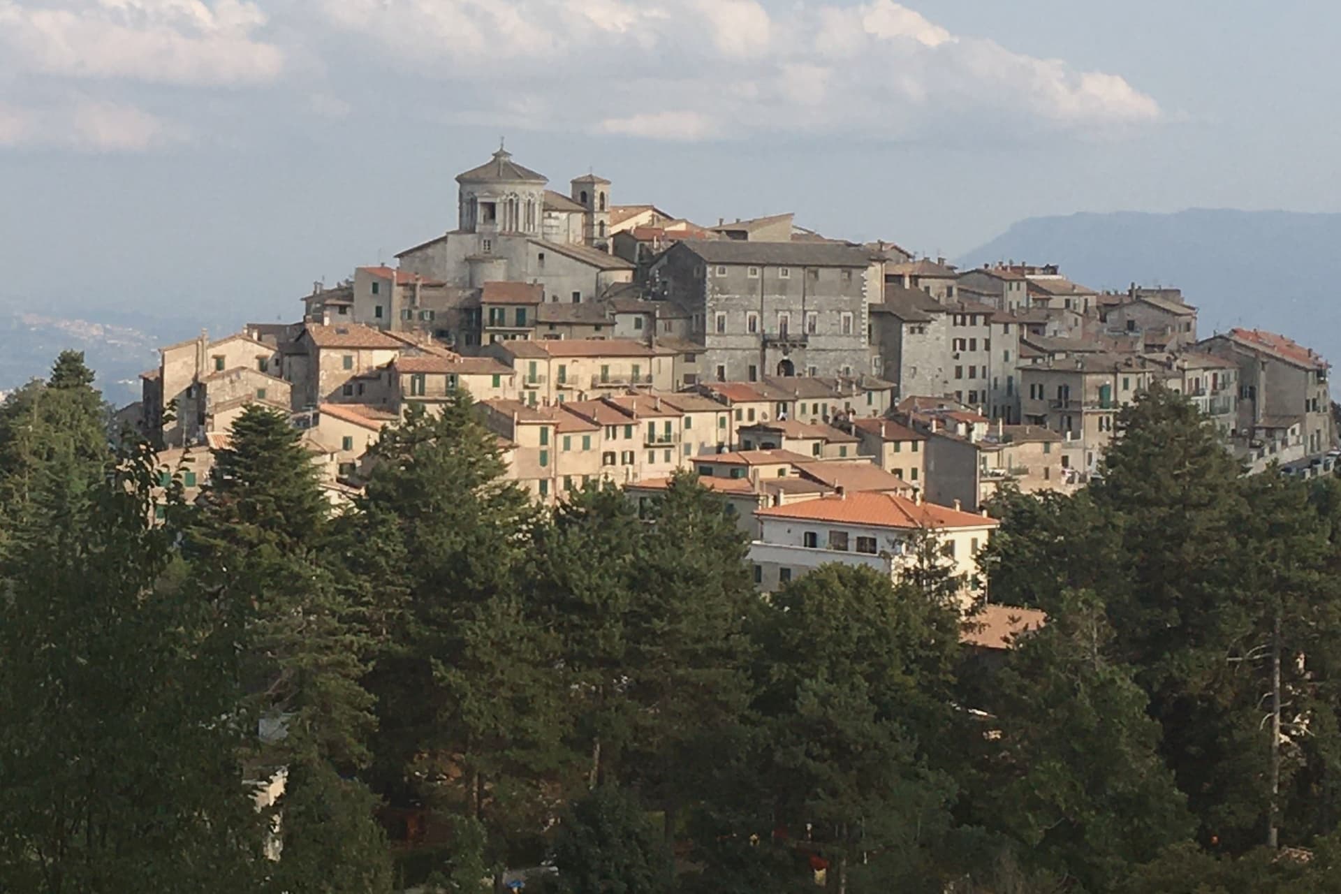
The Monti Prenestini are a small sub-Apennine range east of Rome, with Castel San Pietro Romano and Palestrina anchoring the southern flank and Capranica Prenestina set higher on the ridge above them. The village has three hundred residents and one institutional signal, the Borghi più belli d'Italia membership it received in 2024.
Beech forest covers the slopes above the houses, and the ground beneath is karst, the subject the civic museum in the old Barberini residence was built to explain. Above it all, in the frazione of Guadagnolo, the Mentorella sanctuary sits at 1,018 meters below Monte Guadagnolo itself, and tradition ties its founding to Constantine in the fourth century; Pope John Paul II went there as cardinal and as pope.
The village is half an hour by car from Tivoli, the via Empolitana threading through the woods between them. A small ridge settlement, then, with its natural history collected in a converted palace at its center and its oldest sacred site set apart on the mountain above it, the two poles, civic and devotional, that the range holds together.
What to see in Capranica Prenestina
- Santuario della Madre di Dio alla Mentorella. The sanctuary stands on a cliff, managed today by the Polish Resurrectionist order.
- Palazzo Barberini. The residence's rooms now hold the civic natural history collection, the grandest building the centro storico has.
- Museo Civico Naturalistico dei Monti Prenestini. Civic natural history museum dedicated to the karst geology, beech forests and fauna of the surrounding range.
How to get to Capranica Prenestina
Roma is roughly 70 minutes away by road.
Our tip
May through September is the working window. At 915 meters the village stays ten degrees cooler than Rome and the beech forests on the slopes above are walkable through August. October still holds for the autumn light on the Aniene valley and for the pilgrim traffic up to Mentorella.
Castel San Pietro Romano
Why visit Castel San Pietro Romano
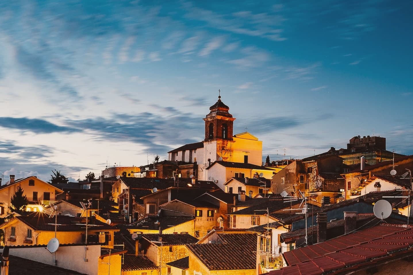
The hilltop sits three kilometers above Palestrina and forty east of Rome, and has been inhabited since the late Bronze Age. The acropolis of ancient Praeneste, the Latin city known for the sanctuary of Fortuna Primigenia, occupied this same ground before the medieval village grew inside it, which is why cyclopean walls from that earlier phase still ring the upper settlement built centuries later.
In the twelfth century the Colonna raised a castrum here for defensive control over Palestrina below. It was destroyed in 1298 and rebuilt twice over the following two centuries, then restored again in 1482, after which it lost its military role entirely and served the community as a grain store.
The village also saw the 1848 Battle of Palestrina, when Garibaldi's Roman Republic troops fought soldiers of the Kingdom of the Two Sicilies on these slopes, and later lent its streets and terraces to Wyler's cameras before the Borghi più belli d'Italia membership followed. What stands today is a single hill occupied twice over, once for a Latin acropolis and once for a Colonna stronghold, with the second built directly on the bones of the first.
What to see in Castel San Pietro Romano
- Rocca Colonna. The fortress on the summit of Monte Ginestro stands over the grain store it became after Stefano Colonna's 1482 rebuilding; the walls that face Palestrina still carry the bulk of a structure built for defense, not storage.
- Cyclopean walls of Praeneste. Pre-Roman polygonal masonry from the Latin acropolis, sections still visible inside the medieval village.
- Chiesa di San Pietro Apostolo. Parish church enlarged in 1732 under Clement XII on a project by Nicola Michetti, replacing an earlier thirteenth-century structure.
How to get to Castel San Pietro Romano
Roma is roughly 57 minutes away by road.
Our tip
May through September is the strongest window. The 763-meter altitude takes the edge off Roman summer heat and the view from the castle terrace opens cleanest in late spring and early autumn. October holds for the autumn light over the Sacco valley and the Lepini ridges. Festeggiamenti Patronali San Rocco falls in July.
Nemi
Why visit Nemi
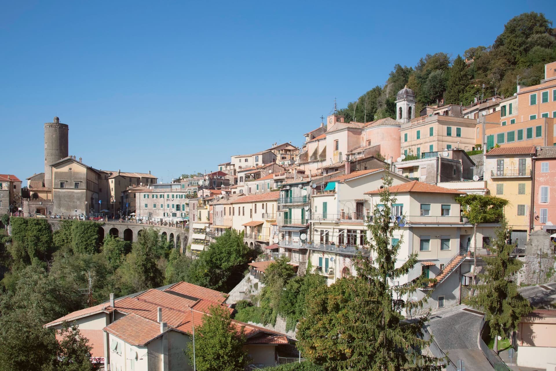
Nemi sits at 521 meters on the rim of a volcanic crater, the smallest of the Castelli Romani and thirty kilometers southeast of Rome. The lake below was the Speculum Dianae, the mirror of Diana, with a sanctuary on its northern shore that covered around 45,000 square meters and drew pilgrims from across Latium.
Emperor Caligula built two ceremonial ships on the lake, ninety meters of timber and bronze that sat on the water until they sank. Mussolini drained part of the lake between 1929 and 1932 to recover them.
They were destroyed by fire in 1944, almost certainly by retreating German troops. The Museo delle Navi Romane, built in 1940 to hold them, now shows scaled reconstructions and salvaged fragments.
Palazzo Ruspoli, a ninth-century castle restored by Valadier, anchors the centro storico. The wild strawberries grown on the inner slopes of the crater are sold from stalls along Via Roma and celebrated each June at the Sagra delle Fragole.
What to see in Nemi
- Palazzo Ruspoli. Ninth-century castle of the Counts of Tuscolo, restored by Valadier, with cylindrical tower and hanging garden over the lake.
- Museo delle Navi Romane. Lakeshore museum built in 1940 for Caligula's two recovered ships, destroyed by fire in 1944, now housing scaled models and fragments.
- Santuario di Diana Nemorense. Remains of the federal sanctuary on the lake's northern shore, once 45,000 square meters of temple, porticoes and theater.
How to get to Nemi
Roma is roughly 52 minutes away by road.
Our tip
April through June and September into October are the dry months on the crater rim, when the wild strawberries ripen and the lake holds its color. The Sagra delle Fragole runs the first Sunday of June and draws thousands. July and August push the basin into the low thirties; the centro storico stays cooler at 521 meters than the coast or the city, but weekends fill with day-trippers from Rome. Borgo diVino in tour falls in September.
Subiaco
Why visit Subiaco
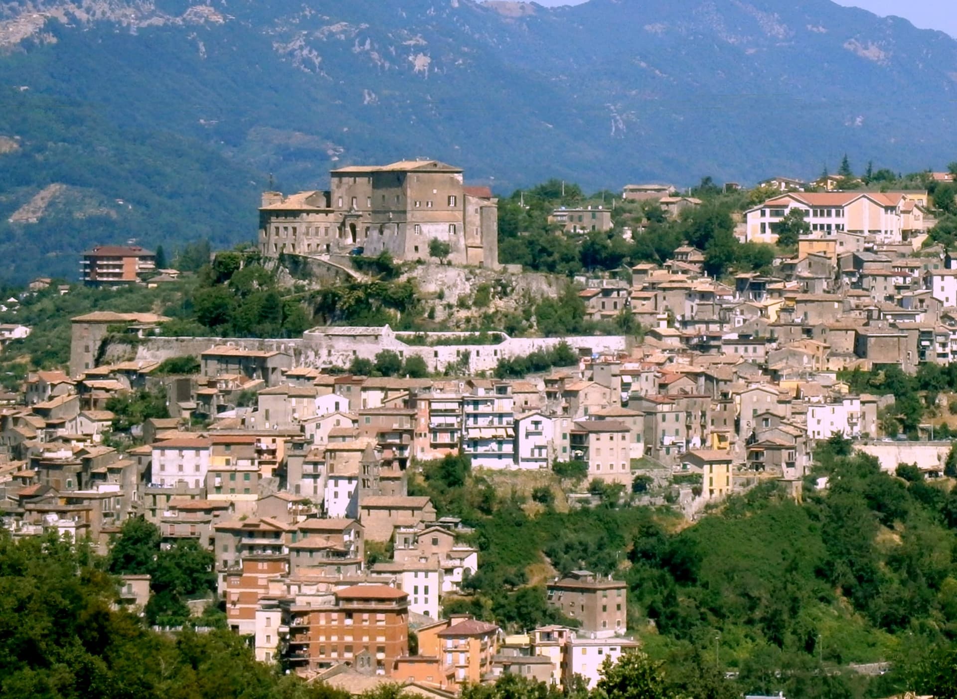
Subiaco sits at 408 meters along the upper Aniene, seventy-three kilometers east of Rome and forty from Tivoli. Nero built a villa here in the first century, damming the river into artificial lakes known as Sublaqueum, below the lake, and the name outlasted the villa and the emperor both.
The town that grew up here reads in layers going up the valley side: the river and the bridge at the bottom, the abbey partway up the hill, the fortress at the summit, and the cliff sanctuary further out along the cliff face that gave the hermit's cave its shelter, each one built at a different remove from the water and from the town center. What holds these layers together is a single life.
A man who came here as a young man to live alone in a cave gave his name to a monastery down the hill, and centuries later that same monastery's press put the first printed book on Italian soil into circulation. The fortress above answers to a different history, the abbots who ruled here as feudal lords, one of whom fathered a child who became one of the most written-about women of her age.
A river valley that supplied an emperor's pleasure lakes became, without much overlap, the ground where monastic life took its early shape.
What to see in Subiaco
- Monastero del Sacro Speco. Built into the cliff face of Monte Taleo, the sanctuary rises in tiers over the cave itself, and the frescoes by Conxolus and the school of Cimabue cover walls that follow the rock rather than a flat plan.
- Abbazia di Santa Scolastica. The only one of Benedict's twelve original monasteries still standing, sixth century in origin; its library holds three hundred manuscripts, including a copy of the Lactantius run off the abbey's own press.
- Rocca Abbaziale (Rocca dei Borgia). Set on the highest ground of the borgo, the fortress was raised by abbot Giovanni V in the twelfth century and later gave Lucrezia Borgia, daughter of the abbot Rodrigo Borgia, a birthplace in 1480.
How to get to Subiaco
There is a railway station in the town, so you can arrive without a car and never need one while you are here. Roma is roughly 70 minutes away by road.
Our tip
April through June and September through October are the months for Subiaco: the Aniene runs full, the cliff sanctuaries are open from morning, and the pilgrim road south fills with walkers on the Cammino di San Benedetto. July and August are warm in town and cool in the monasteries; the cave at the Sacro Speco holds twelve degrees year-round. November through March is the quiet pilgrim season, mist on the river and few coaches in the lots. Festa Madonna di Pompei Rione Colle falls in August.
Castel Gandolfo
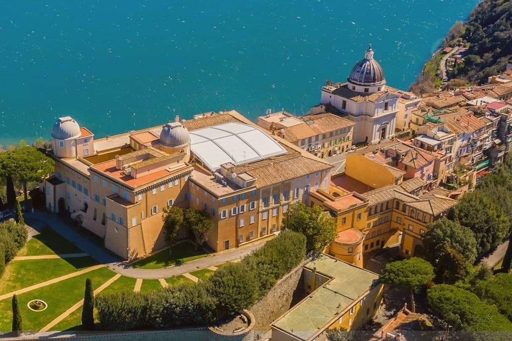
Why visit Castel Gandolfo
The town sits at 426 meters on the rim of the Lake Albano crater, twenty-five kilometers southeast of Rome among the Castelli Romani. It stands on the site of Alba Longa, the city Aeneas's son Ascanius is said to have founded.
The lake below was formed by the fusion of two volcanic craters and reaches 170 meters deep. The Villa Barberini stands adjacent to the palace, acquired by Taddeo Barberini in 1631, its gardens running down toward the water.
Pope Francis kept the palace as a museum after 2016; Leo XIV restored it to residential use in June 2025 and resides in the Villa Barberini next door, while the Borgo Laudato Si', created by Francis in 2023, carries ecological education across 55 hectares of the same estate. A town built on legend, given over for a time to public viewing, and returned to private residence: three uses of the same ground, laid one on top of the other without erasing what came before.
What to see in Castel Gandolfo
- Palazzo Apostolico. The palace Carlo Maderno raised between 1623 and 1626 stood open as a museum from 2016, its rooms given over to display cases and visitors. In June 2025 it returned to residential use, the museum arrangement dismantled to make way for a household again.
- Ville Pontificie e Giardini Barberini. Fifty-five hectares of papal villas and gardens running down to Lake Albano, with the seventeenth-century Villa Barberini at their center.
- Lago Albano. The crater lake sits at 293 meters above sea level and covers five square kilometers, its rim shared between this town and Albano Laziale.
How to get to Castel Gandolfo
There is a railway station in the town, so you can arrive without a car and never need one while you are here. Roma is roughly 35 minutes away by road.
Our tip
April through October is the open season for Castel Gandolfo, with the gardens open and the lake at swimming temperature from June. June and September are the calmer months and the historic papal-residence weeks. July and August fill with Roman day-trippers and Vatican tourists; the lake shore is busy.
Castelnuovo di Porto
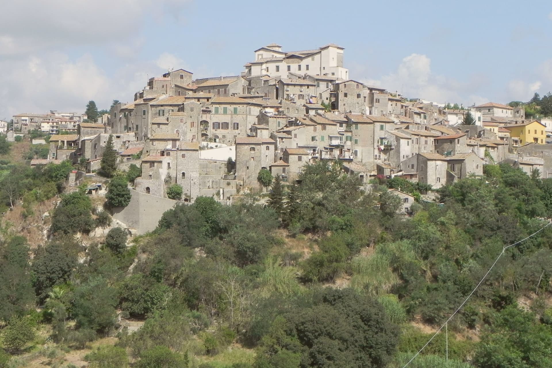
Why visit Castelnuovo di Porto
Castelnuovo di Porto sits at 250 meters on a tufa spur between the Chiarano and Mola valleys. The first fortification went up before the year 1000 under the senator Alberico, and the medieval village grew around it in concentric loops that still shape the centro storico today.
The Colonna family took the fief in the late Middle Ages and built the fortress that occupies the highest point of the ridge, the keep from which the whole settlement takes its layout, houses and passages stepping down the slope in rings. The town's name preserves its administrative link to the river: this was the Castrum Novum of the bishop of Porto, the old diocesan seat at the Tiber mouth, a naming that ties a tufa hilltop village to an ecclesiastical authority seated on the coast.
The Borghi più belli d'Italia membership covers the centro storico and the fortress together, while Etruscan and Roman archaeology runs through the Veio park that surrounds both. The result is a village whose name records a bishop's jurisdiction, whose form records a medieval defense, and whose surroundings record two much older civilizations, all still legible on the same ridge.
What to see in Castelnuovo di Porto
- Rocca Colonna. Ducal palace inside the keep at the highest point of the ridge, used by Marcantonio Colonna after Lepanto and later by Christina of Sweden passing through to Rome.
- Centro storico. Tufa houses and vaulted passages along the concentric loops, with the surviving village gates still marking the old perimeter.
- Chiesa di Santa Lucia. Parish church inside the walls, with Renaissance frescoes and a baptismal font dating to the period of the fortress above it.
How to get to Castelnuovo di Porto
There is a railway station in the town, so you can arrive without a car and never need one while you are here. Roma is roughly 37 minutes away by road.
Our tip
April through June and September through October are the strongest months. The Tiber valley is green in spring and the rocca terraces open cleanest at low sun. July and August touch the upper thirties; the centro storico stays cooler than Rome twenty-five kilometers downhill but the Veio park trails go silent in midday heat. Sagra Degli Gnocchi A Castelnuovo Di Porto falls in September.
More from Anywhere Italy
- The prettiest villages inside a nature park within 90 minutes of Roma
- The best hidden towns inside a nature park in the province of Roma
- The best towns inside a nature park in the province of Roma
- The prettiest small villages within 90 minutes of Roma
- The 8 best hidden hill towns within 90 minutes of Roma
- The best hill towns in the province of Roma