
The best hidden hill towns within 90 minutes of Taranto
The land behind Taranto climbs quickly. Olive groves give way to karst plateau, the Murgia, where the stone comes out of the ground in slabs and goes straight into walls, terraces and houses without much in between. Towns here are white against pale rock, built tight for shade, with balconies over streets narrow enough to hold the cool until midday. Autumn is the season that rewards a drive inland: new oil in the frantoi, wild chicory and broad bean purée on every table, roast lamb and small dark glasses of Primitivo from the vineyards on the lower slopes.
Most travellers who come this way inland are heading for Matera, and with reason. The sassi are extraordinary, and the walk down through the rock-cut quarters and up to the churches carved into the tufa is one of the great things to do in southern Italy. It is also now booked out from spring through October, with coach parties working the viewpoints in shifts and restaurant tables gone by noon. Ostuni takes the overflow, and the white town on its hill spends the summer at capacity.
The same plateau, the same white stone, the same food carries on well past those two, and much of it sits inside an easy drive of Taranto. There are ridge towns looking over the Ionian coast, trulli country villages where the conical roofs are still lived in rather than let by the week, and a ghost town abandoned to landslip that has been left standing on its ridge. These are the smaller places, the ones people pass on the way somewhere better known, and they are worth the detour.
Of the 20 communes we have mapped within 90 minutes of Taranto, 12 qualify as hill towns: each is an inland hill settlement. This list is the hidden ones, 6 in all, ordered smallest first. The smallest, Craco, has 620 residents.
If you are still choosing, we have also written The best hill towns worth staying overnight in Puglia and The best hidden hill towns that eat well in Puglia.
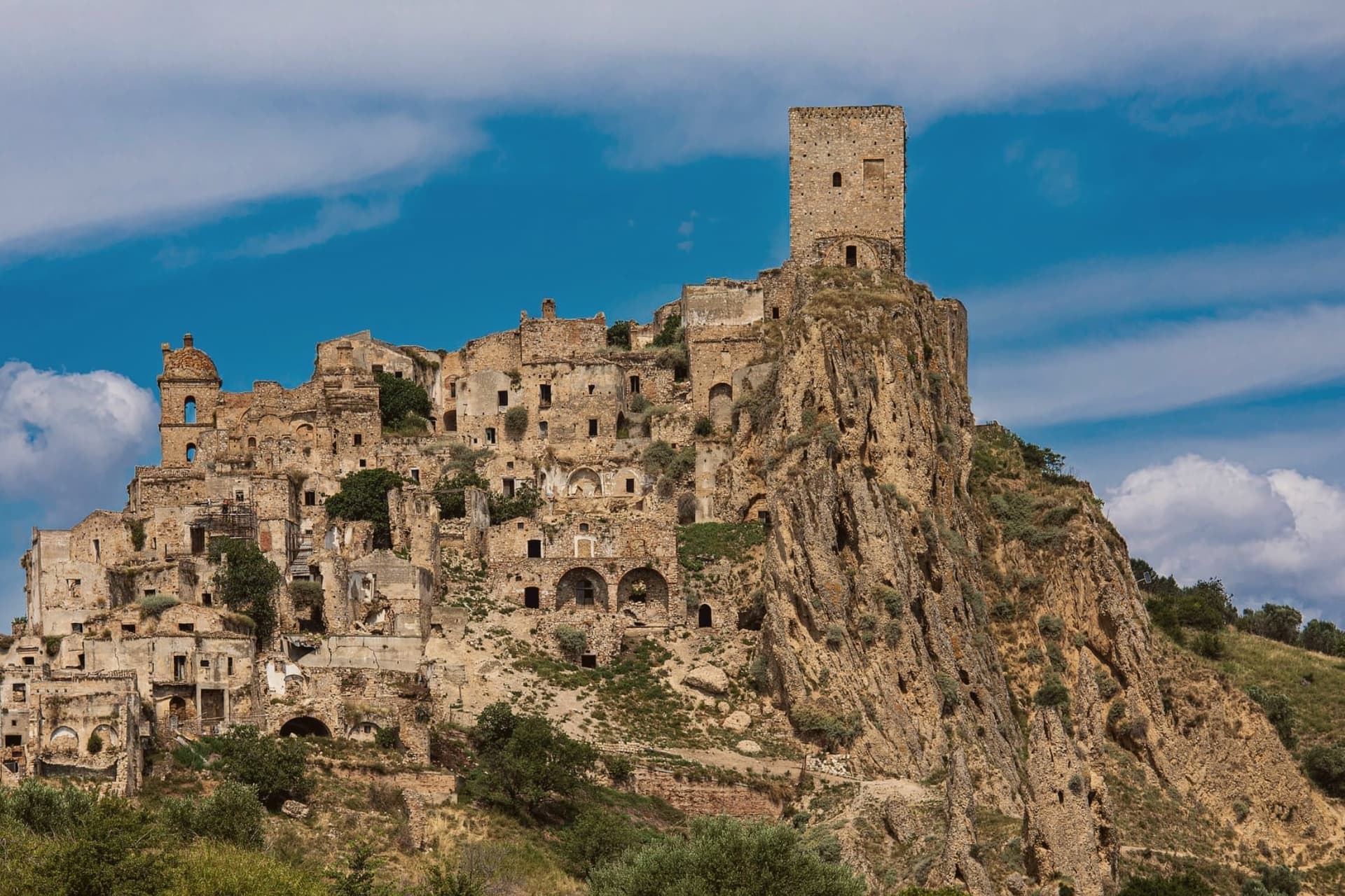
Why visit Craco
The cliff rises above the Cavone valley, west of the Ionian plain, and the old village on top was abandoned in stages rather than all at once. Heavy autumn rains in 1963 set off a landslide that tore through the slope below and condemned several hundred buildings; the 1,800 residents were evacuated the following year to a planned settlement three kilometers down on the plain.
A 1972 flood worsened the failure in the years that followed, and the earthquake of 1980 finished what the landslide had started. Nothing has been rebuilt on the hilltop since.
The two halves of Craco now sit in a fixed relationship: the ruined village above, empty and fenced into a walking route, and the resettled town below, where the population that once lived on the cliff has continued its life on the plain for six hundred people and counting. The abandonment was not a single event but three separate failures of the same ground, and the empty hilltop is what that slow, repeated collapse left standing.
What to see in Craco
- Craco Vecchia. The abandoned hilltop is accessible only by guided tour with hard hat, walked through marked routes past the ruined buildings.
- Torre Normanna. The tower stands at the summit of the marked tour route, the tallest point of the ruins and the first thing visible from the valley below.
- Chiesa Madre di San Nicola. Gutted but still upright on the marked tour route, its bare walls and open roof are among the most photographed ruins on the walk.
How to get to Craco
Taranto is roughly 77 minutes away by road.
Our tip
April through October is the tour season. The guided routes through Craco Vecchia run on a fixed schedule from the Peschiera ticket office; July and August can hit forty degrees on the exposed clay cliff, and the tour shifts to early morning and late afternoon to make the heat manageable. May, June, September and October are the best months for the route and the light, with the surrounding calanchi turning gold in October.
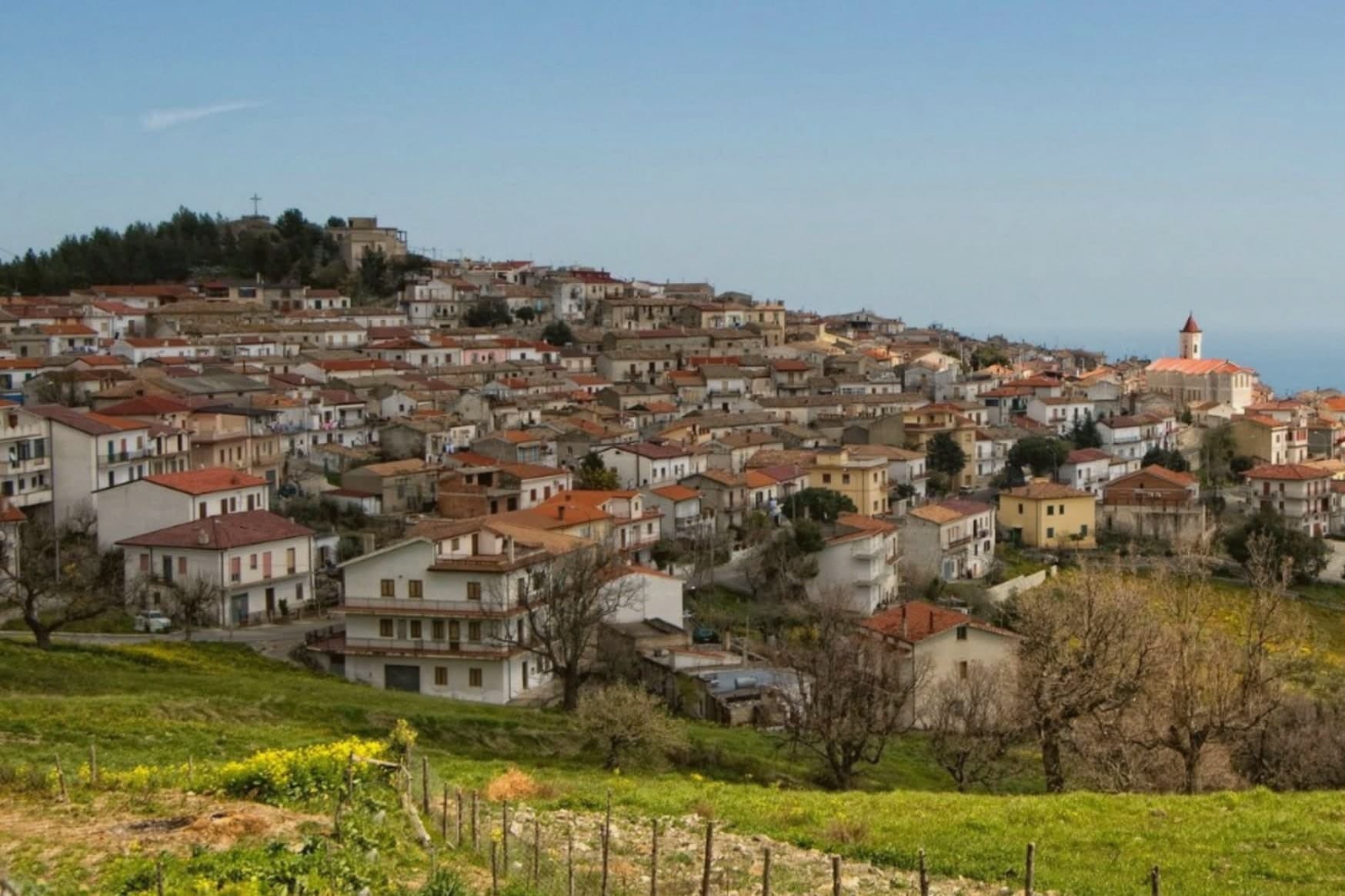
Why visit Montegiordano
The commune sits on a ridge above the Ionian in the Alto Jonio Cosentino, with the Pollino massif behind it. It has two centres, the hill town at 619 meters and the marina on the coast below, joined by the road that passes the small chapel on the plain.
Records of settlement here go back to the fourth century BC. The castle stands in the Piano delle Rose locality, built by the Pignone del Carretto as a winter residence and hunting lodge; the de Martino family later ruled the feudo from 1748 until the abolition of feudalism in 1806.
The commune carries the designations Borgo Autentico, Spiga Verde and Città del Vino. What holds the two centres and the centuries together is the sense of a working village rather than a preserved one: a hill town still occupied and repainted, a castle still standing over its own courtyard, a marina still adding beach length, and a plain between them still crossed on the old route from residence to coast.
What to see in Montegiordano
- Castello Pignone del Carretto. Four kilometers from the marina, built as a winter residence by the Neapolitan Pignone del Carretto family who held the feudo from the seventeenth century.
- Centro storico dei murales. The hilltop old town itself, its walls and lanes given over entirely to the mural project, each one telling a piece of the village story rather than standing as decoration alone.
- Cappella Madonna del Carmine. Small chapel on the plain near the castle, a few hundred meters from the Pignone residence, on the road between hill and marina.
How to get to Montegiordano
There is a railway station in the town, so you can arrive without a car and never need one while you are here. Taranto is roughly 88 minutes away by road.
Our tip
April through June and September into October are the right months to walk Montegiordano's mural-painted alleys and look from the 619-meter ridge over the Ionian. July and August are hot on the coast but the hill stays at workable temperatures and catches the sea breeze in the evening. November through March is quiet: most of the marina lidi close, the castle keeps limited hours, and the cantine work but visit by appointment. Sagra della Stigliola falls in August.
Why visit Alberobello
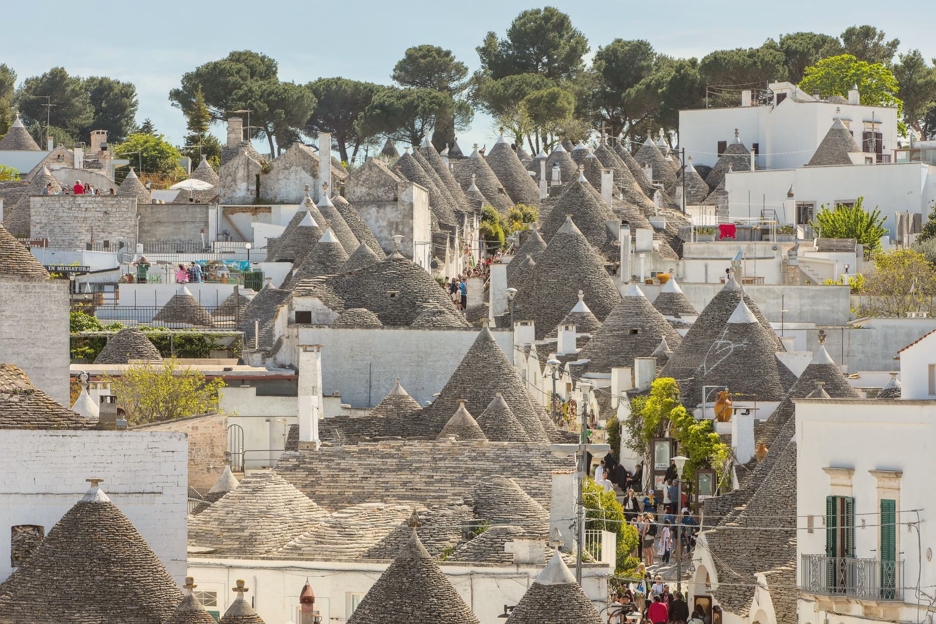
Alberobello sits at 402 meters in the Valle d'Itria, forty-five kilometers southeast of Bari. Two quarters of the town, Rione Monti and Aja Piccola, hold more than 1,500 trulli: limestone cones built from corbelled drystone, with conical or pyramidal roofs piled course by course without mortar.
The technique is prehistoric and still in use across the Murge, but nowhere else is the density and preservation what it is here. The Counts of Conversano enforced drystone construction on their tenant farmers to dodge a Spanish viceroy's tax on permanent settlements: a building that could be dismantled in an afternoon did not count as a town.
UNESCO listed the trulli in 1996. Some are houses, some are shops, some are inhabited by the same families that built them.
The Trullo Sovrano, the only two-storey trullo, was built around 1750 and now functions as a small museum.
What to see in Alberobello
- Rione Monti. The larger of the two trulli quarters, a thousand cones running down the hillside, mostly converted to shops and accommodation.
- Aja Piccola. The smaller residential quarter, about four hundred trulli, still occupied as primary housing and quieter than Rione Monti.
- Trullo Sovrano. The only two-storey trullo in town, built around 1750 by the Perta family, now a small museum of trullo construction and daily life.
How to get to Alberobello
There is a railway station in the town, so you can arrive without a car and never need one while you are here. Taranto is roughly 56 minutes away by road.
Our tip
April through June and September through October are the months the Itria valley is green and the trulli are walkable without sweat. July and August push past thirty-three degrees and the Rione Monti fills with day-trippers from the coast; by ten in the morning the main streets are shoulder to shoulder. Late afternoon and after dusk are the times to walk, when the cones cast long shadows and the crowds thin.
Why visit Cisternino
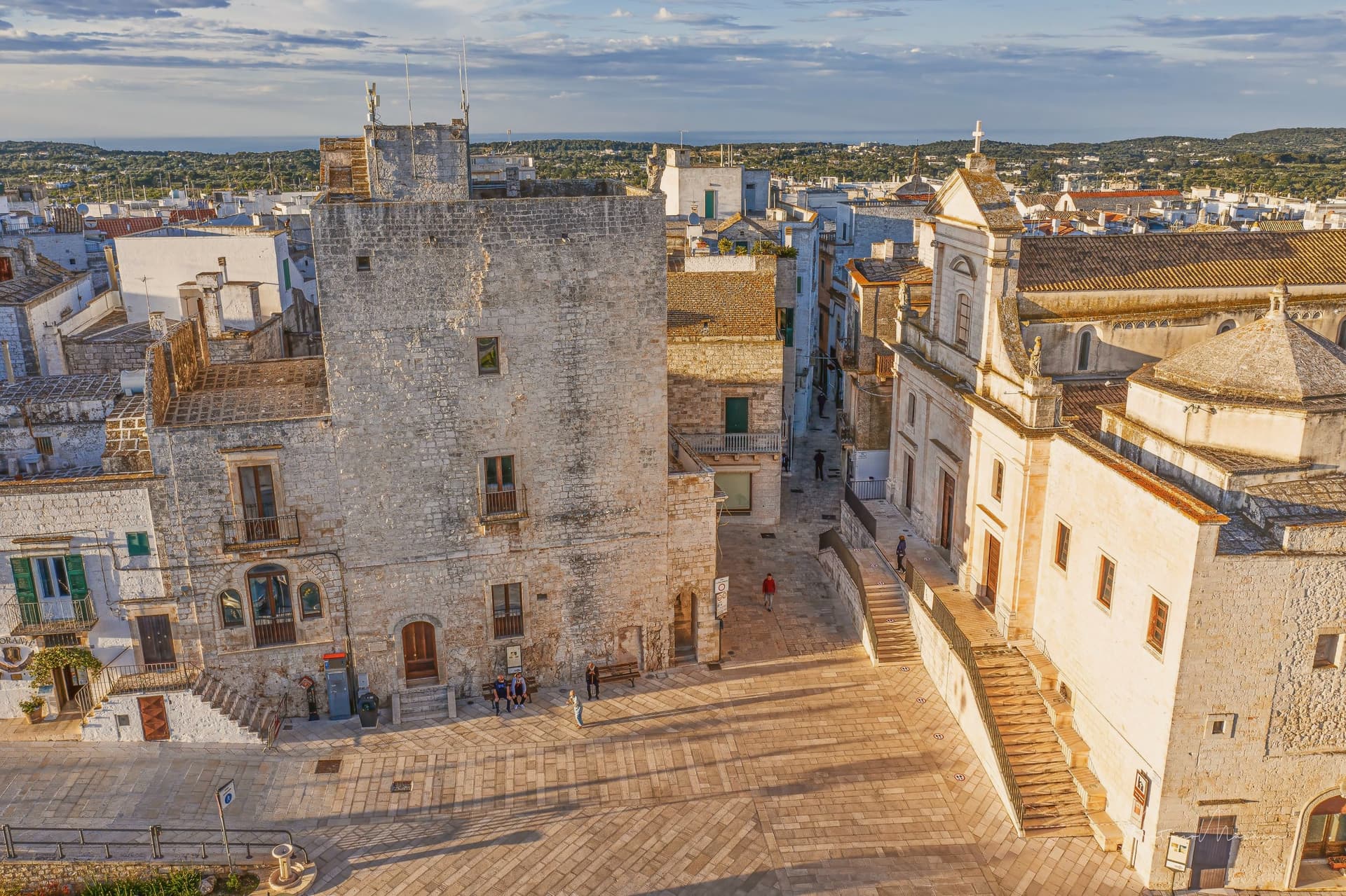
Cisternino occupies the last rise of the southern Murgia, its whitewashed houses looking down over drystone walls, vineyards and trulli in the Valle d'Itria. The town sits within the Itria Valley DOC wine zone, and the older quarter is built as a tight knot against the edge of the plateau, its stone alleys and courtyards folded close enough together that the comparison to a North African medina has stuck.
The civic tower in the main square marks where the newer town gives way to that older core, a single threshold between the two. Cisternino, a Cittaslow member since 2003, was named Cittaslow City of the Year in 2014, a designation that formalizes what the town already does at the butcher-restaurants of the old quarter: meat grilled to order and eaten at a counter or a side table, nothing rushed.
Between the drystone valley below, the huddled white quarter above, and a civic identity built on not hurrying, the town reads as a place organized around slowness at every scale, from its walls to its kitchens.
What to see in Cisternino
- Chiesa Madre di San Nicola di Patara. The neoclassical facade dates from around 1848, standing over a floor where excavations between 1999 and 2000 uncovered thirteen burials, Byzantine fresco fragments and coins.
- Centro storico. Stone alleys, low arches and small courtyards on the Murgia edge, close enough in plan and whitewash to draw comparison to a North African medina.
- Torre Civica. Civic clock tower in the main square at the entrance to the centro storico, the gateway between the modern town and the white labyrinth.
How to get to Cisternino
There is a railway station in the town, so you can arrive without a car and never need one while you are here. Taranto is roughly 50 minutes away by road.
Our tip
April through June and September through October are the months the Itria valley is green and the centro storico is walkable without sweat. July and August reach the mid-thirties on the plateau and the white alleys fill with day-trippers; by ten in the morning the main passages can be shoulder to shoulder. Late afternoon and dusk are the times to walk, when the limestone catches the sun and the crowds thin. Fiera della Bomminella falls in September.
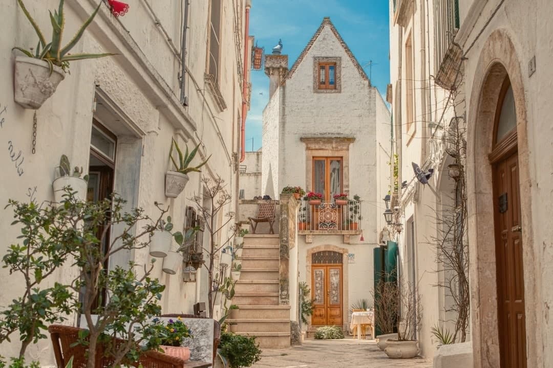
Why visit Locorotondo
Locorotondo sits on a natural terrace at 410 meters, the high edge of the Valle d'Itria looking south over the trulli countryside between Alberobello, Cisternino and Martina Franca. The name means round place: the centro storico is a perfect circle of whitewashed houses, and the architecture is unique to this town.
The cummerse are stone houses with steep pitched roofs covered in two thin layers of limestone slabs, a profile that exists nowhere else in Puglia. The streets between them run in concentric arcs and are narrow enough to lose the sun by mid-afternoon.
Both the Borghi più belli d'Italia and the Touring Club's Bandiera Arancione recognize the place. The town also makes a white DOC wine from Verdeca and Bianco d'Alessano grapes, grown on 1,650 hectares of vineyards across the surrounding plateau, plus a Città dell'Olio membership for the oil that comes off the same hills.
What to see in Locorotondo
- Centro storico. Circular old town of whitewashed cummerse, an architectural type with double-pitch limestone-slab roofs found only here.
- Villa Garibaldi. Public garden on the ridge with the widest panoramic view over the Itria valley and its trulli countryside.
- Chiesa Madre di San Giorgio. Eighteenth-century parish church on the highest point of the historic center, with a neoclassical façade and a tall central nave.
How to get to Locorotondo
There is a railway station in the town, so you can arrive without a car and never need one while you are here. Taranto is roughly 48 minutes away by road.
Our tip
April through June and September through October are the best months on the Itria plateau. Mornings are clear, the surrounding vineyards green up, and the wind off the Murge keeps evenings cool even in summer. July and August push past thirty degrees, the centro storico fills with day-trippers from Alberobello, and the narrow streets get crowded between ten and one.
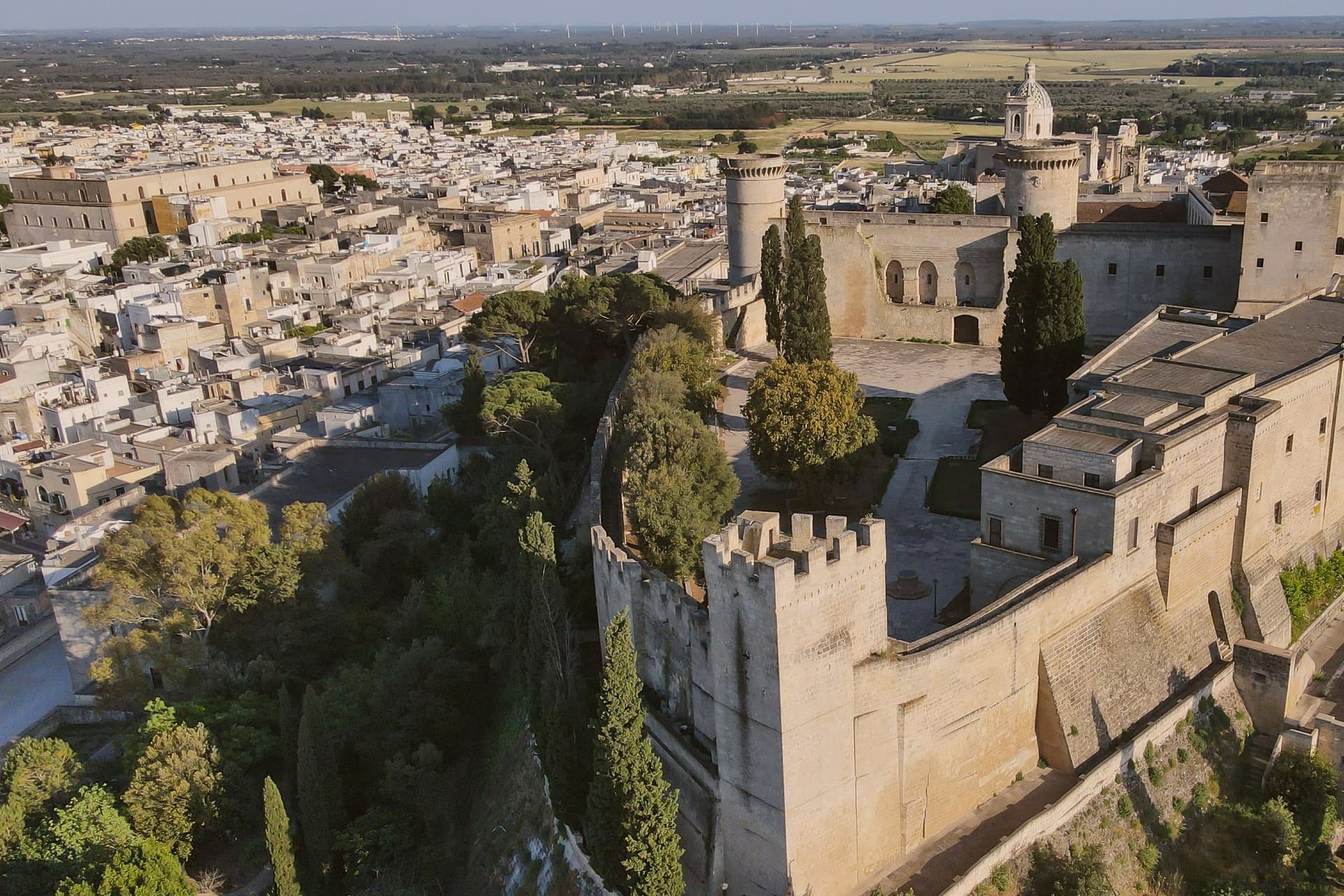
Why visit Oria
Oria sits at 166 meters on a Salento ridge between Taranto and Brindisi, north of Manduria and southeast of the ancient Taras. The town was Hyria, one of the principal Messapian cities, before the Romans absorbed the region.
Frederick II rebuilt the castle on the Messapian acropolis between 1227 and 1233; the triangular plan he chose is unique in southern Italian military architecture, with three towers, the Quadrata (Frederician), the Del Cavaliere and the Del Salto (both Angevin additions). Oria also held one of the oldest Jewish communities in Europe, a study center where philosophy, the Talmud, Greek, Latin, medicine and natural science were taught from the ninth century.
Shefatya ben Amitai and Shabbethai Donnolo, two of the first Hebrew writers native to Europe, both lived and worked here. The Jewish quarter, the Giudecca, still organizes the southern edge of the centro storico.
What to see in Oria
- Castello Svevo di Federico II. Frederician castle of 1227-1233 on the Messapian acropolis, triangular plan with three towers, one Frederician and two Angevin, the town's defining monument.
- Cattedrale di Oria. Eighteenth-century Baroque cathedral raised over earlier medieval foundations, the seat of the diocese of Oria since the Lombard era.
- Giudecca. Old Jewish quarter on the southern flank of the centro storico, organized around the Vico degli Ebrei, a continuous medieval settlement from the ninth century.
How to get to Oria
There is a railway station in the town, so you can arrive without a car and never need one while you are here. Taranto is roughly 46 minutes away by road.
Our tip
April through June and September through October are the Salento interior months: clear light on the castle ridge, mild evenings, olive country in flower or harvest. July and August touch thirty-six degrees on the hilltop and the centro storico empties between two and five; the Corteo Storico di Federico II runs in mid-August anyway and pulls a regional crowd. October is the olive harvest. Palio di Oria falls in July.
More from Anywhere Italy
- The best hill towns worth staying overnight in Puglia
 The best hidden hill towns that eat well in Puglia
 The best hidden olive oil towns in Puglia
 The best hidden olive oil towns you can reach by train in Puglia
- The 9 best hidden towns you can reach by train that eat well in Puglia
- The 9 best hill towns you can reach by train in the province of Bari