
The best cheese towns within 90 minutes of Milan
Lombard and Piedmontese cheese is a landscape before it is a food. The rice plains and maize fields around the Po feed the herds that give gorgonzola its damp, mineral bite, while the high pastures above the Ossola valleys produce the summer alpine wheels that only exist because cattle walk uphill in June. In the lake towns the houses are built of grey Baveno granite and lake stone, and the shops sell goat robiola wrapped in paper, taleggio in its rind, ricotta so fresh it weeps. Autumn is the season to go, when the herds come down and the sagre start, and a plate of polenta with melted cheese stops being a cliche and starts being lunch.
Most people leaving Milan for the day head to Como, and Como earns some of it: the water, the villas, the ferries that thread between them. But the lakefront in Bellagio and Varenna in high season is a queue with a view, the trattorie there price for people who will not come back, and the cheese on the board is often bought in rather than made anywhere nearby. It is a fine day out and a poor way to eat.
The same water and the same mountains carry on past the crowds, and so do the dairies. Head up the Toce towards the Simplon, along the quieter Piedmontese shore of Maggiore, over to Ceresio on the Swiss border, or south into the vine and rice country of Monferrato, and you are inside the production zones rather than looking at them from a boat. These are the towns where the cheese counter belongs to someone whose supplier is a name, not a distributor.
Of the 45 communes we have mapped in a 90-minute drive of Milan, 6 qualify as cheese towns: each sits inside the production zone of a protected cheese. The smallest, Vogogna, has 1,680 residents.
Two more lists worth reading alongside this one: The best cheese towns within two hours of Turin and The best towns with a serious restaurant that eat well within 90 minutes of Novara.
Vogogna
Why visit Vogogna
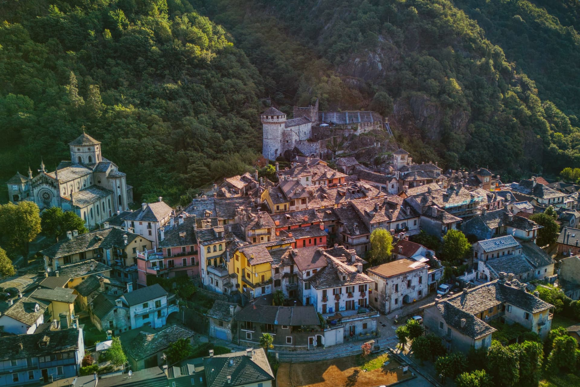
Vogogna sits at 226 meters on the floor of Val d'Ossola, at the narrow point of the valley where the Toce bends south toward Lago Maggiore. The castle went up on the spur above the village as part of a broader reinforcement of the Duchy of Milan against Swiss incursions over the Sempione, built alongside an older fortified rock that had already held the same defensive line.
Together they anchored the town's promotion to administrative seat for the lower half of the valley, in balance with Domodossola further up, which held the upper half. Spanish rule from the sixteenth century onward reduced the castle's strategic weight, and in 1798 it passed into municipal hands, used at one stage as a prison, before the long restoration that closed in 2005.
The borgo carries Borghi più belli d'Italia and the Bandiera Arancione, and Val Grande National Park borders the commune on the west. What the town amounts to is a lower valley's seat of government grown around a fortress that outlived its military purpose by centuries, wedged between wilderness on one side and the river's bend on the other.
What to see in Vogogna
- Castello Visconteo. Restored from 1990 to 2005, the castle is now open to visitors with a multimedia conference room installed inside its walls.
- Rocca di Vogogna. Earlier fortified rock above the Visconti castle, the original medieval defensive post over the narrow point of the Toce valley.
- Centro storico. Medieval core below the castle with stone houses, narrow streets and the Palazzo Pretorio, the historic administrative seat of Ossola Inferiore.
How to get to Vogogna
There is a railway station in the town, so you can arrive without a car and never need one while you are here. Novara is roughly 75 minutes away by road.
Our tip
April through June brings clear walking weather to the Toce valley, with the upper Val Grande slopes drying out and the Visconti castle terraces open for full hours. September and October are the harvest months in Ossola, when chestnut woods turn on the lower slopes and the cooler air carries the view from the Rocca down the valley toward Lago Maggiore. July and August warm the valley floor, but the stone houses of the centro storico keep the streets shaded.
Mergozzo
Why visit Mergozzo
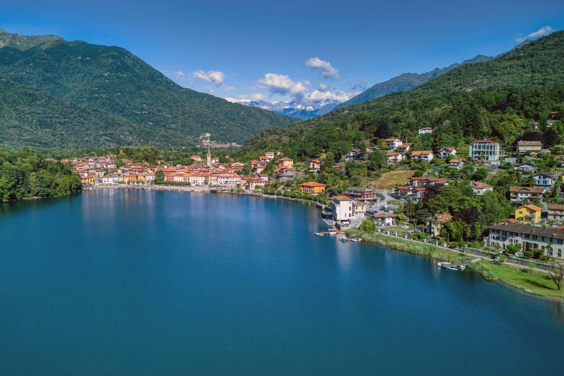
The lake is 74 meters deep and sits at 204 meters, separated in antiquity from its larger neighbor when sediment from the Toce river closed the channel between them. The village faces the water from the western shore, folded behind a lakefront piazza where the parish church holds a painting from 1623 already showing the elm that gives the square its character.
Behind the piazza, narrow stone-paved lanes called strece climb toward terraced gardens, the houses built of the same granite quarried on neighboring Montorfano hill. Stone has long been the local economy, tying Mergozzo to the wider region: the same quarries that cut the lanes' paving supplied material used in Rome and across northern Italy.
Trailheads above the village lead into Val Grande, so the same slopes that shelter the piazza from behind also open, higher up, onto one of the wildest valley systems in the Alps. What holds the place together is this stacking of scales: a small, closed-off lake at the bottom, a worked hillside of stone above it, and beyond that, wilderness.
La Fugascina Ristorante, La Quartina have been named by a guide.
What to see in Mergozzo
- L'Olmo di Mergozzo. Hollow-trunked field elm on the lakefront piazza, still standing and shading the square it has watched over for generations.
- Lago di Mergozzo. 2.5 km lake separated from Lago Maggiore by Toce sediment, motorboat-free and ranked among Europe's cleanest waters.
- Centro storico. Stone-paved lanes (strece) and granite houses climbing the slope behind the lakefront piazza.
How to get to Mergozzo
There is a railway station in the town, so you can arrive without a car and never need one while you are here. Novara is roughly 67 minutes away by road.
Our tip
April through June and September into October are the months the lakefront works best: mild water, open trattorie and Val Grande trails clear of snow but cool enough to walk. July and August fill the small beach and the parking lots, though Mergozzo never reaches the volume of nearby Stresa on Maggiore. November through March is quiet.
Porto Ceresio
Why visit Porto Ceresio
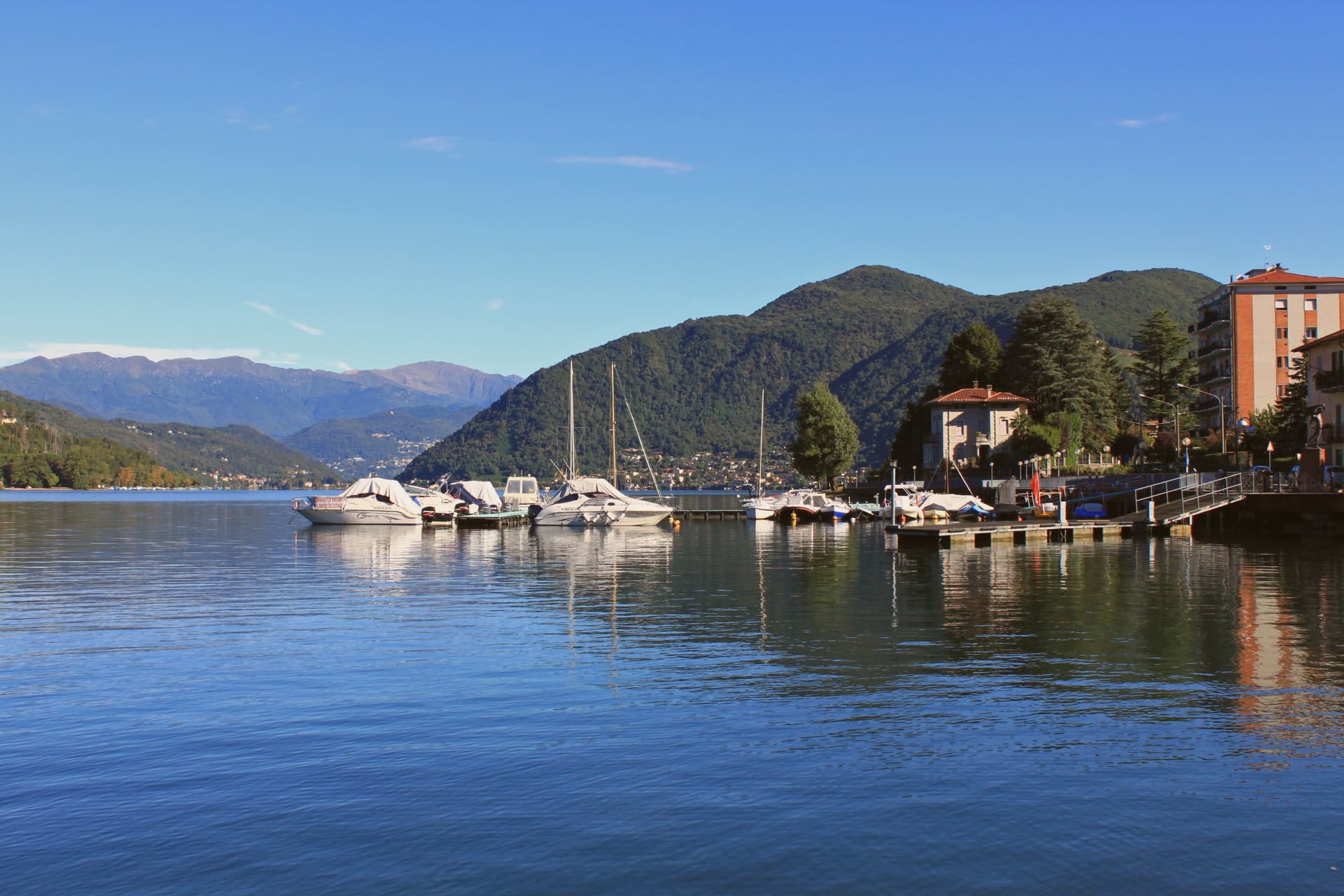
Porto Ceresio sits on the south shore, 11 kilometers northeast of Varese and directly on the Swiss frontier. The lake is also called Ceresio, named for the cherry trees that once lined its banks.
Boats run from the pier across to Lugano and Morcote in Canton Ticino, and an electric railway from Varese, the first in Italy, reached the lake in the early twentieth century. The mountain behind the town covers a tropical sea floor from 240 million years ago, and the 2010 UNESCO extension tied Porto Ceresio to Besano and Viggiù and to the original Swiss site across the water.
The lakefront promenade, with its colored houses, sits between that green mountain slope and the lake itself, looking straight across to the Swiss shore. The town reads as a hinge point: a rail line built to reach the water, a pier built to cross it, and a mountain behind that turns the crossing into a border between two countries and two geological eras.
What to see in Porto Ceresio
- Lungolago di Porto Ceresio. Lakefront promenade with the ferry pier and the colored houses that face Lake Lugano and the Swiss shore opposite.
- Chiesa di Sant'Ambrogio. Parish church in the centro storico, the religious center of the village since the medieval era.
- Monte San Giorgio. Rises to 1,097 meters behind the town, the world's richest Middle Triassic marine fossil site, its green slopes forming the backdrop to the lake.
How to get to Porto Ceresio
There is a railway station in the town, so you can arrive without a car and never need one while you are here. Milano is roughly 66 minutes away by road.
Our tip
April through October is the lake season. The ferries to the Swiss shore run frequent crossings, and the lungolago fills with day-trippers from Varese and Milano on summer weekends. July and August push temperatures into the high twenties; the mountain shade behind the town keeps evenings tolerable, and the lake water stays cool.
Ornavasso
Why visit Ornavasso
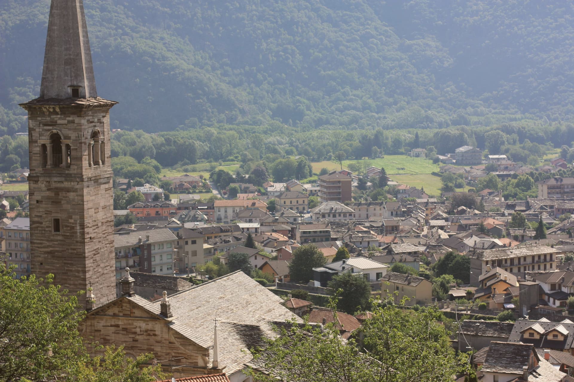
Ornavasso sits on the Toce river just upstream from Gravellona, where the valley narrows toward the southern threshold of the Val Grande. The quarries worked the right bank of the Ossola valley opposite Candoglia, and their stone traveled well beyond the commune: besides the Milan cathedral, it went into the facade of the Certosa di Pavia and the Octagon of the Duomo di Pavia, a supply line running from the fourteenth century onward.
The town's frazione, Migiandone, formed part of the same Walser settlement, colonists from the Simplon who kept a German dialect alive here into the late nineteenth century, longer than in any Walser community further up the Ossola. The ground beneath the town has its own older history: two pre-Roman necropolises, Celtic and Italic, with burials spanning the second century BC to the first century AD.
Above the centro, the devotional life of the upper Toce climbed the hillside, and in 1944 that same high ground sheltered soldiers and then partisans of the Valtoce division, in the brief Allied-recognised partisan state that held the upper valley that year. A quarry town, a language outpost, and a wartime redoubt turn out to be the same few square kilometers, stacked in time rather than spread across it.
What to see in Ornavasso
- Santuario della Madonna del Boden. Sanctuary above the town, standing 475 meters over the centro, reached by a climb that has drawn devotion from the surrounding valley since it was built.
- Santuario della Madonna della Guardia. Hilltop sanctuary that housed Italian army troops and then partisans during the brief Allied-recognised partisan state of autumn 1944.
- Cave di marmo. Quarries on the right bank of the Toce, still legible in the rock face, the source of stone for both the Duomo di Milano and the Arco della Pace.
How to get to Ornavasso
Novara is roughly 77 minutes away by road.
Our tip
April through June brings the Toce down high and clean, the chestnut and beech woods on the marble slopes filling in. July and August are warm and busy with Val Grande trekkers entering through Migiandone; the centro is quieter than Lake Maggiore but the trails fill on weekends. September and October are the strongest months: clear light on the marble quarries, the Boden sanctuary backlit at dusk, and the Val Grande in its autumn copper.
Laveno-Mombello
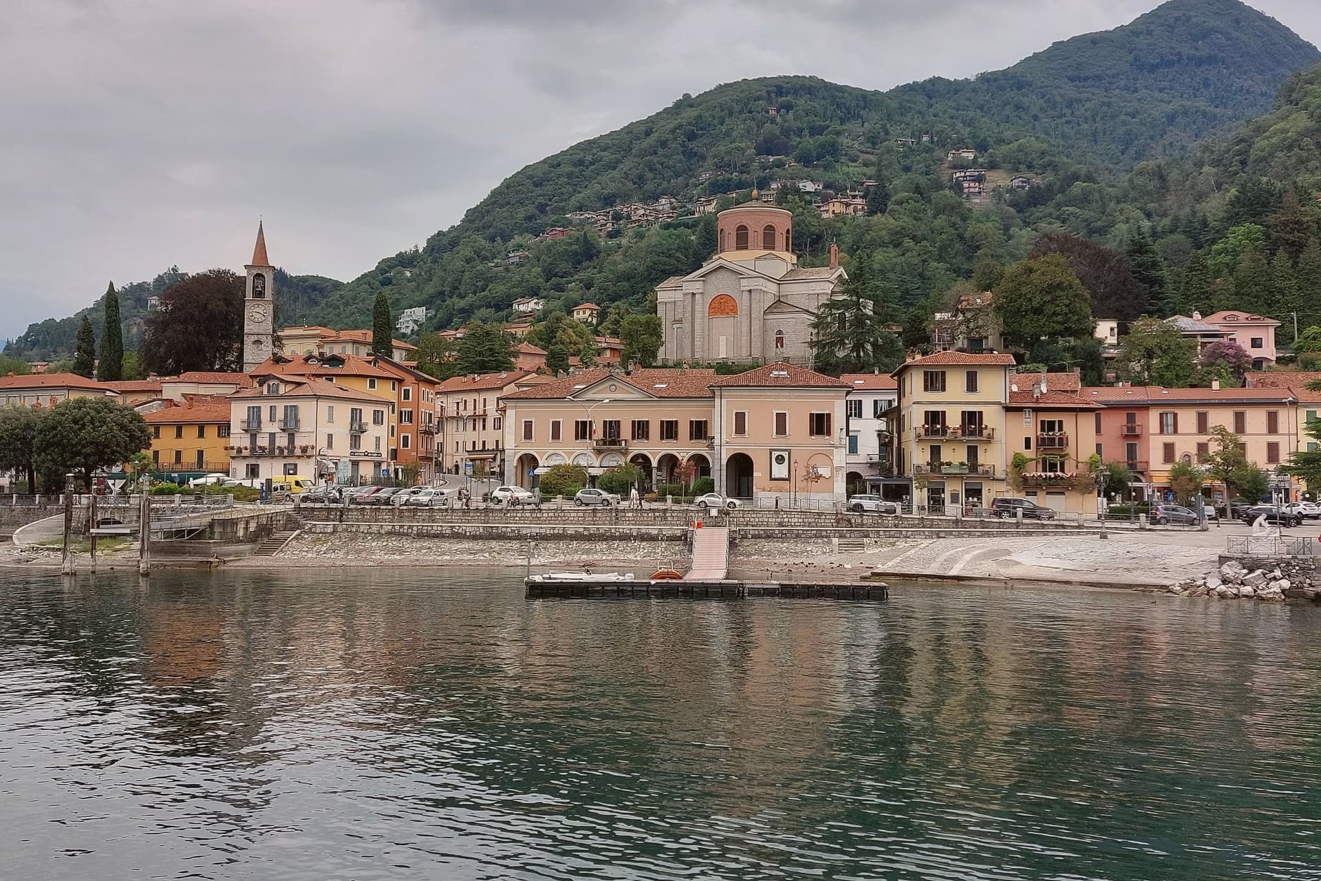
Why visit Laveno-Mombello
Laveno-Mombello sits on Lake Maggiore's eastern shore in the province of Varese, where a limestone wall drops directly to the water at the town's back. The ferry here crosses to Verbania and the Borromean Islands on the opposite shore, making the town as much a hinge point between Lombardia and Piemonte as a destination in itself.
Cerro, the lakefront hamlet folded into the town, kept the workshops after the ceramics factories closed in the 1990s, and its Palazzo Perabò now holds the museum that charts that industry from 1856 forward. South along the shore, a fifteen-minute drive reaches the monastery built into the cliff face, reachable by stairs, lift or boat where the road does not reach directly.
The town's shape follows the lake and the rock in equal measure: industry and transit at the shoreline, the mountain rising straight behind it, and the monastery holding on to the cliff a short way south as if the same geology that made Laveno a port also made it a place for building into stone.
La Tavola have been named by a guide.
What to see in Laveno-Mombello
- MIDeC – Museo Internazionale Design Ceramico. Ceramics design museum in the sixteenth-century Palazzo Perabò at Cerro, covering Laveno production from 1856 to the 1990s.
- Sasso del Ferro. Limestone summit reached by the bucket funicular, with a terrace looking across Lake Maggiore to Lago d'Orta and the southern Alps.
- Santa Caterina del Sasso. Fourteenth-century monastery clinging to a cliff above Lake Maggiore, fifteen minutes south, reached by stairs, lift or boat.
How to get to Laveno-Mombello
There is a railway station in the town, so you can arrive without a car and never need one while you are here. Novara is roughly 74 minutes away by road.
Our tip
April through October covers the working calendar. The Sasso del Ferro funicular runs most days from spring through autumn, weather permitting, and is unreliable in winter. May, June, September and October are the calmest weeks on the eastern shore.
Casale Monferrato
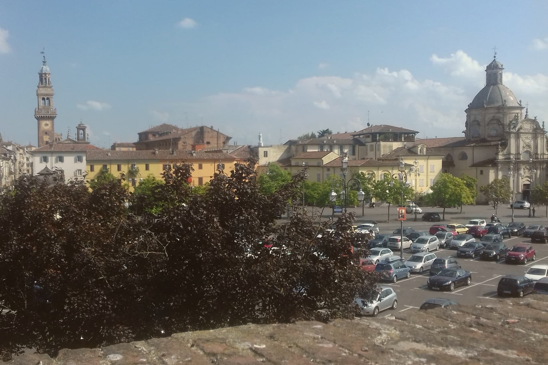
Why visit Casale Monferrato
Casale Monferrato sits at 116 meters on the right bank of the Po, sixty kilometers east of Torino, at the foot of the Monferrato hills. Casale fell to the Marquess of Montferrat in 1292 and rose as capital of the Marchesato in the fifteenth and sixteenth centuries, on the strategic edge of the Po Valley.
The Duomo di Sant'Evasio is its oldest stone: consecrated on January 7, 1107 by Pope Paschal II on the site of a Roman temple to Jupiter and a Liutprandian-era church to Saint Lawrence, the basilica is one of the most important Romanesque-Lombard cathedrals in Piedmont, with five naves and a matroneum of trifore and quadrifore galleries. The Castello dei Paleologi, raised in 1352 by Giovanni II Paleologo, runs an asymmetric hexagonal plan with circular corner towers and a dry moat.
The Sinagoga, completed in 1595 in the old Jewish quarter, holds a gilded Piedmontese Baroque interior and a museum of Jewish history. The town is also the historic capital of Italian cement and Krumiri biscuits.
Osteria Bar Sport, Accademia Ristorante, Faletta 1881 and 1 more have been named by a guide.
What to see in Casale Monferrato
- Duomo di Sant'Evasio. Romanesque-Lombard cathedral consecrated 1107 by Pope Paschal II, with five naves, barrel and cross vaults, and a matroneum of trifore galleries.
- Castello dei Paleologi. 1352 castle by Giovanni II Paleologo, asymmetric hexagonal plan with circular corner towers and a dry moat, now used for exhibitions.
- Sinagoga di Casale Monferrato. 1595 synagogue in the old Jewish quarter, gilded Piedmontese Baroque interior, restored 1968 with a Jewish history museum on the upper floor.
How to get to Casale Monferrato
There is a railway station in the town, so you can arrive without a car and never need one while you are here. Novara is roughly 41 minutes away by road.
Our tip
April through June and September into October are the months Casale opens up. The Po valley clears of winter fog, the Monferrato vineyards leaf or harvest, and the Duomo's matroneum holds light it does not get in winter. July and August are hot and still on the river plain; the Paleologi castle's underground passages and the synagogue's gilded hall hold cool, but most days the town empties between two and five. Mercatino dell'antiquariato di Casale Monferrato falls in August.
More from Anywhere Italy
 The best cheese towns within two hours of Turin
 The best towns with a serious restaurant that eat well within 90 minutes of Novara
 The best hill towns within 90 minutes of Milan
- The best lake towns that eat well within 90 minutes of Novara
- The best lake towns within two hours of Turin
 The best cheese towns within two hours of Genoa