
Puglia · Foggia
Roseto Valfortore
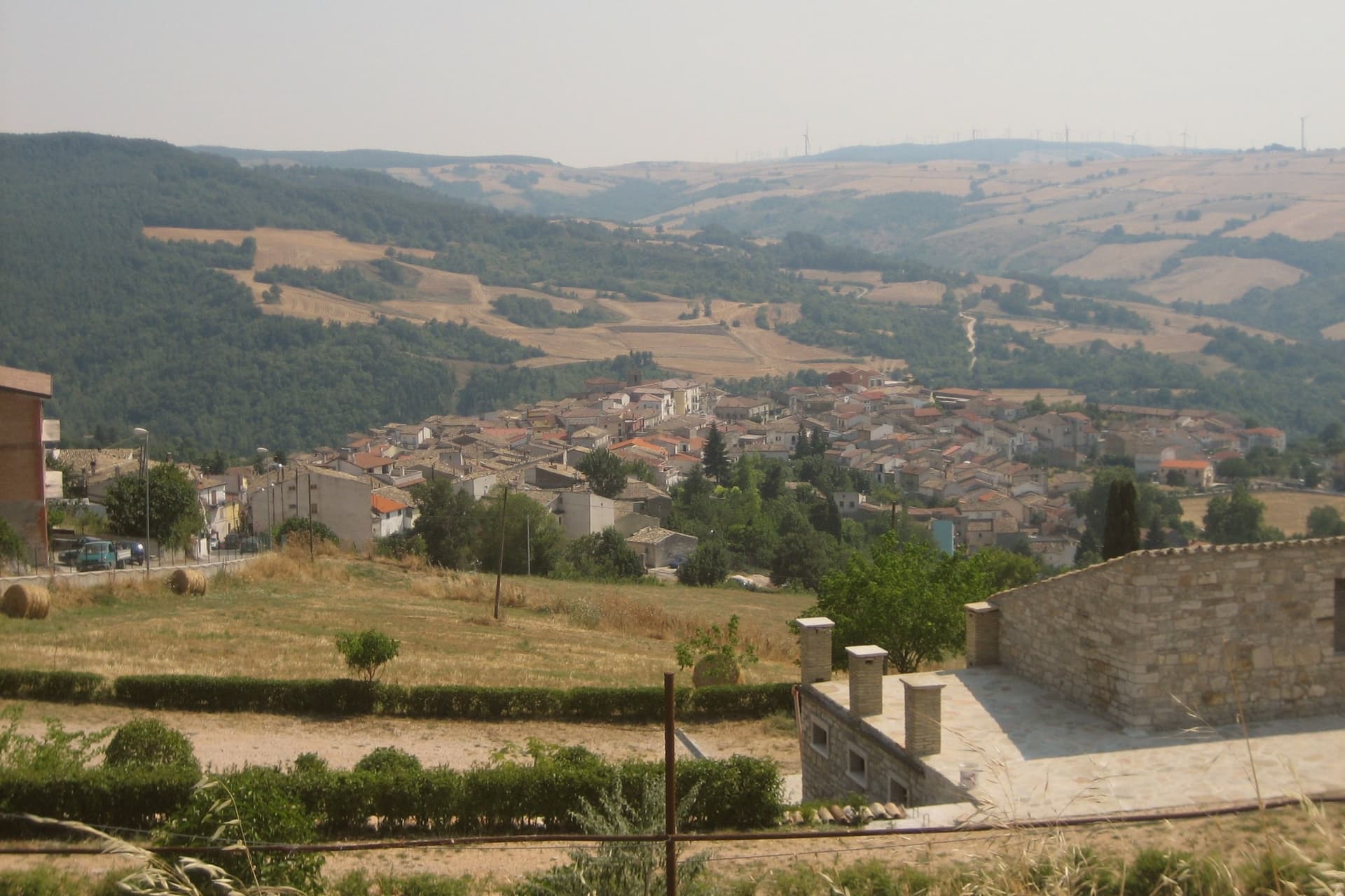
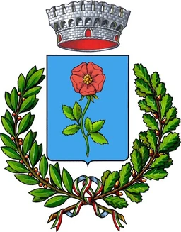
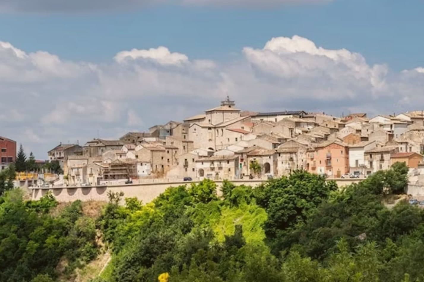
A Daunian Mountain stone village at 658 meters near the Fortore springs, named for the wild roses and known for black truffles and acacia honey.
Picked by Peter Benei
Letter to come
Why Roseto Valfortore is on our list
It holds Borghi più belli d'Italia and Città del Tartufo.
Subscribe and you get Roseto Valfortore's letter the day it comes out.
Visiting
- Best time
- May–Oct
- By car
- 2 h 15 min from Salerno
- Population
- 981
- J8°
- F10°
- M11°
- A14°
- M19°
- J26°
- J30°
- A29°
- S24°
- O19°
- N13°
- D10°
- Best
- Hot or crowded
- Quiet
- Mostly closed
Daytime air temperature, averages for 2020–2024. Weather data by Open-Meteo.com.
Why come
Roseto Valfortore sits at 658 meters on a steep slope of the Fortore valley in the Daunian Mountains, below Monte Cornacchia, the highest peak in Puglia at 1,151 meters. The name records the wild roses that cover the slopes and the Fortore river whose springs rise east of the village. Urban planning follows a Lombard pattern: stréttole, the narrow alleys, fan out from Piazza Vecchia, alternating wider stepped lanes with narrower channels that collect rainwater.
The stone houses, the sculpted balustrades, and the decorated doorways were cut by generations of local stonemasons. Acacia honey and black truffles come out of the surrounding beech and oak forests, and the Sagra del Tartufo fills the village on the first Saturday of August. Roseto Valfortore carries Borghi più belli d'Italia and Città del Tartufo, with a population under a thousand and falling. The first immigrants to Roseto, Pennsylvania, left in 1883 for the slate quarries of the Lehigh Valley.
How to get there
From Naples (NAP), about 2 h 18 min by car.
Bari (BRI) is about 2 h 22 min away.
By car from the center of Salerno 2 h 15 min, Naples 2 h 22 min or Bari 2 h 25 min.
Coming by train into Foggia? Roseto Valfortore is about 59 min away by road.
First time driving in Italy? Read our complete manual.
What to see
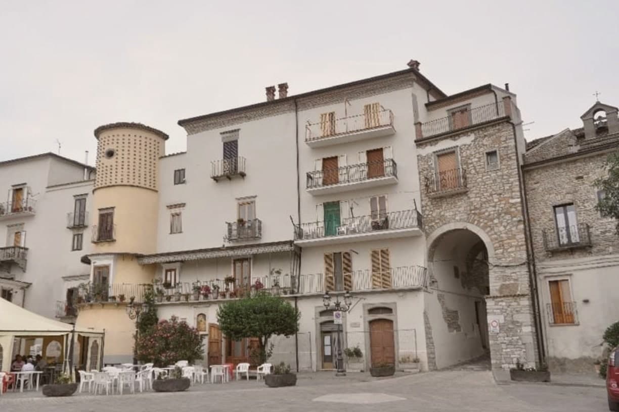
Piazza Vecchia
Medieval origin square at the foot of the village, from which the stréttole fan out, the Lombard core of the urban layout.
Centro storico in pietra
Stone-cut village on the Fortore slope, narrow stepped lanes, balustrades and portals shaped by generations of local stonemasons.
Chiesa Madre di Santa Maria Assunta
Mother church beside Piazza Vecchia, built in 1507 by the feudal lord Bartolomeo III Di Capua, with a balustrade carved in local stone by Roseto craftsmen.
Monte Cornacchia
Highest peak in Puglia at 1,151 meters, in neighboring Biccari and Faeto, part of the same protected site as Roseto's Bosco Vetruscelli.
Sagra del Tartufo
Truffle festival on the first Saturday of August, built around the black truffles found in the surrounding beech and oak forests.
Living here
Could you live here?
Roseto Valfortore is at the end of the road.
- A village of 981. The nearest town of 5,000 people, Lucera, is 40 min away: past our 15-minute rule, which makes this the end of the road.
- Foggia, a city of 145,198, is 1 h 3 min by car. Further than our 30 to 60 minutes, a long way for the hospital visit or the monthly shopping.
The rules come from our series Where to Move in Italy, written from the places we have lived: Part 1, The End of the Road · Part 2, The Small Town · Part 3, The City · Part 4, The Postcard · Part 5, The Other Half. The towns we would pick are in Part 6, The Best Towns.
- Population 981, down 10.4% since 2015 (Italy's emptying towns)
- Nearest city Foggia, 1 h 3 min drive
- Nearest national health service hospital Ariano Irpino, 23 km as the crow flies · how healthcare works in Italy
- Homes in the center: €300 to €450 per m² to buy, €1.20 to €1.80 per m² a month to rent
All the numbers Common questions, designations, lists and sources.
More about living here
- Remote
- Pharmacy: none mapped
- High school within a 30-minute drive
- Full fibre reaches 100% of homes
- Primary school in the comune
- Earthquake zone 2, medium hazard
- Naples airport (NAP), 2 h 18 min drive, the nearest with scheduled flights
- Regional capital Bari, 2 h 25 min drive
If you are moving here
Who lives here
3% of residents are foreign citizens, most often from Canada and Argentina, against 9% across Italy. 15 of them come from English-speaking countries or western and northern Europe, mostly Canada. There are 290 people over 65 for every 100 children under 15, against 216 across Italy. 67% of homes have no resident, holiday homes and empty ones counted together, against 27% across Italy. Foggia province ranks 98th of 107 in Il Sole 24 Ore's quality of life ranking for 2025.
Health and schools
The nearest emergency room is in Ariano Irpino, 23 km as the crow flies. The nearest major one is in Benevento, 36 km away. The nearest children's emergency room is in Benevento, 36 km away. The nearest IB school is St. Stephen's School, 224 km as the crow flies. The nearest school listed as international is École Francaise de Naples Alexandre-Dumas, 94 km away.
Information, not medical advice. Confirm with a professional.
Taxes
A home that is not your main one pays 0.96% a year in property tax, charged on the cadastral value rather than the price. A main home pays none unless it is in a luxury category. The town adds nothing to your income tax. 7% pensioner tax: this town qualifies, for someone with a foreign pension who has lived abroad for five years: 7% on foreign income, for ten years.
Information, not tax advice. Confirm with a professional.
What it costs
The average household in Puglia spends about €1,500 a month, €440 of it on food, against about €2,170 across Italy. A family of three pays about €545 a year for water, on the Puglia average.
Climate and risk
It is in climate zone E, on a scale from A, the warmest, to F, the coldest, and heating may run from October 15 to April 15, up to 14 hours a day, unless the mayor changes it. The national maps show no residents in a high or medium flood zone. 20% live in a zone rated high or very high for landslides.
These shares cover the whole comune, not any one street. Check an address on IdroGEO.
Moving from abroad? Which visa you need. Sources: ISTAT, the Ministry of Health, ISPRA, the Finance Ministry, the Ministry of Enterprise, Poste Italiane, the comuni, the IB, International Schools Database, Il Sole 24 Ore, Cittadinanzattiva.
Known for
TRUFFLES
Black truffles from the surrounding Daunian forests, celebrated at the Sagra del Tartufo each August and behind the town's name as the town of honey and truffles.
STONE VILLAGE
Lombard-pattern stréttole and stone houses cut by local stonemasons, the basis for the Borghi più belli d'Italia listing on the Fortore slope.
ROSETO PENNSYLVANIA
The first emigrants left for the Lehigh Valley slate quarries in 1883, founding Roseto, Pennsylvania, an enclave named after the home village.
Common questions
- What is Roseto Valfortore known for?
- Roseto Valfortore is a Daunian Mountain stone village at 658 meters near the Fortore springs, named for the wild roses and known for black truffles and acacia honey.
- Where is Roseto Valfortore?
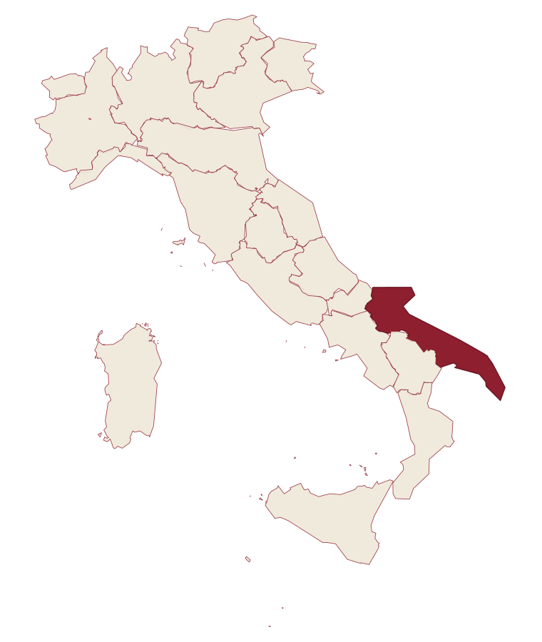
- Roseto Valfortore is a comune in the province of Foggia, in Puglia.
- What is the nearest airport to Roseto Valfortore?
- The nearest airport with scheduled flights is Naples (NAP), about 2 h 18 min by car.
- How long is the drive from Salerno to Roseto Valfortore?
- About 2 h 15 min by car.
- When is the best time to visit Roseto Valfortore?
- Best in May–Oct. July is the warmest month, averaging 30 degrees, and November the wettest, with about 15 rain days.
- Which other towns are like Roseto Valfortore?
- Faeto, Celle di San Vito and Castel San Vincenzo.
- How many people live in Roseto Valfortore?
- 981 residents, by ISTAT's count on 1 January 2025.
- Is Roseto Valfortore a good place to live?
- By the rules in our Where to Move in Italy series, Roseto Valfortore is at the end of the road: the nearest town of 5,000 people, Lucera, is 40 min away. The nearest city, Foggia, is 1 h 3 min away by car. The nearest national health service hospital is in Ariano Irpino, 23 km as the crow flies. Full fibre reaches 100% of homes.
Tags & data designations · numbers · sources
Recognized as
Landscape
The numbers
- Elevation: 658 m
- Population: 981
- Surface area: 50.06 km²
These figures were compiled from public directories: ISTAT, OpenStreetMap and Wikidata, and from the official listings of the guides named on this page. Town details change; verify with official sources before you travel.
The ranked lists
Lists Roseto Valfortore appears in
- The prettiest small villages within 90 minutes of FoggiaNear Foggiawithin 90 minprettiest villagessmall6 towns · smallest 682 residents · closest 34 min away
- The best mountain towns within 90 minutes of FoggiaNear Foggiamountainwithin 90 min9 towns · smallest 142 residents · closest 34 min away
- The prettiest villages within 90 minutes of FoggiaNear Foggiawithin 90 minprettiest villages9 towns · smallest 682 residents · closest 34 min away
Similar
Towns like Roseto Valfortore
What all six share with Roseto Valfortore: mountain-valley towns · under 1,000 people
Faeto
Province: Foggia
both high up, between 600 and 1,000 metres
Celle di San Vito
Province: Foggia
both high up, between 600 and 1,000 metres
Castel San Vincenzo
Province: Isernia
both high up, between 600 and 1,000 metres
Letino
Province: Caserta
both high up, between 600 and 1,000 metres
Pizzone
Province: Isernia
both high up, between 600 and 1,000 metres
Preci
Province: Perugia
The letter
Read a sample letter
Chioggia | Everyone is wrong about this town
It’s not an alternative to Venice
Letters from the towns we visit. Free.
Paid plans, the moving year and the books are on the membership page.