
Campania · Caserta
Letino
At 961 meters the highest commune in the province of Caserta, where in April 1877 anarchists declared a Republic of Letino in the village hall.
- Best time
- May–Oct
- By car
- 1 h 50 min from Naples
- Population
- 631
Known for
REPUBLIC OF LETINO
Anarchist insurrection of April 1877, when Malatesta, Cafiero and the Matese Band declared King Victor Emanuel II deposed in the village hall.
FIUME LETE
Karst river that rises at 1,028 meters in Campo delle Secine and disappears underground into the Grotte del Caùto cave system.
BANDIERA ARANCIONE
Touring Club Italiano Orange Flag awarded in 2014, only the fifth commune in Campania to receive the quality-of-hospitality mark.
When to visit
Best · May–Oct
- J6°
- F9°
- M9°
- A12°
- M17°
- J22°
- J26°
- A26°
- S21°
- O16°
- N11°
- D8°
- Best
- Hot or crowded
- Quiet
- Mostly closed
Daytime averages, 2020–2024. Weather data by Open-Meteo.com.
The festa: Giovanni Battista, domenica più vicina
Why come
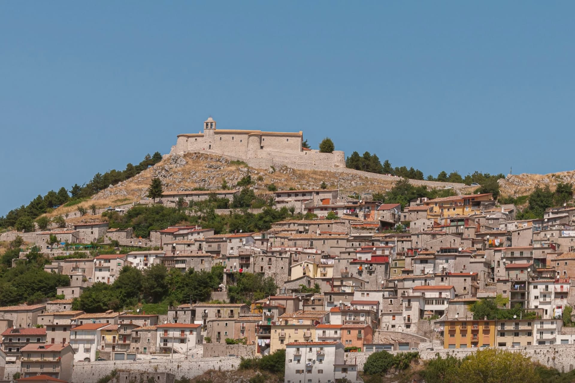
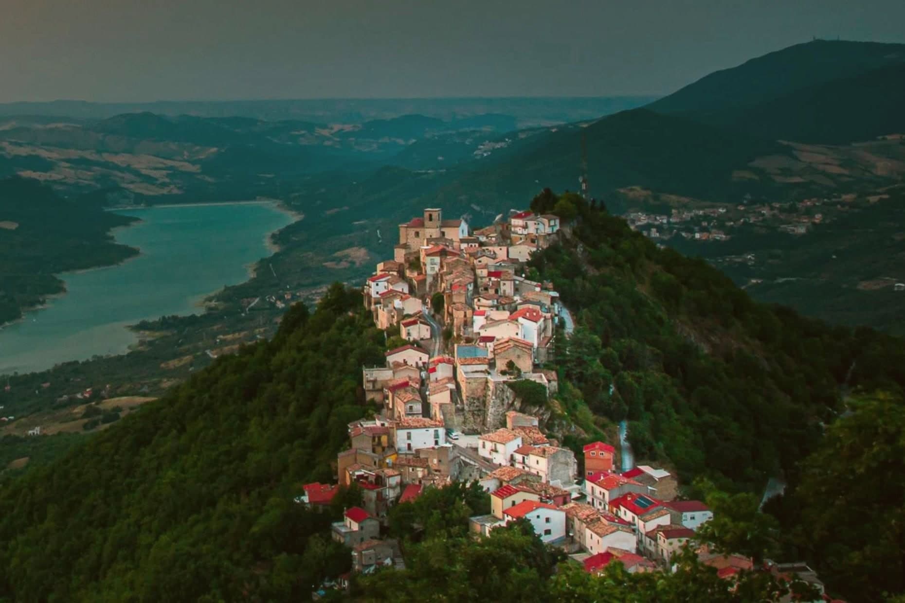
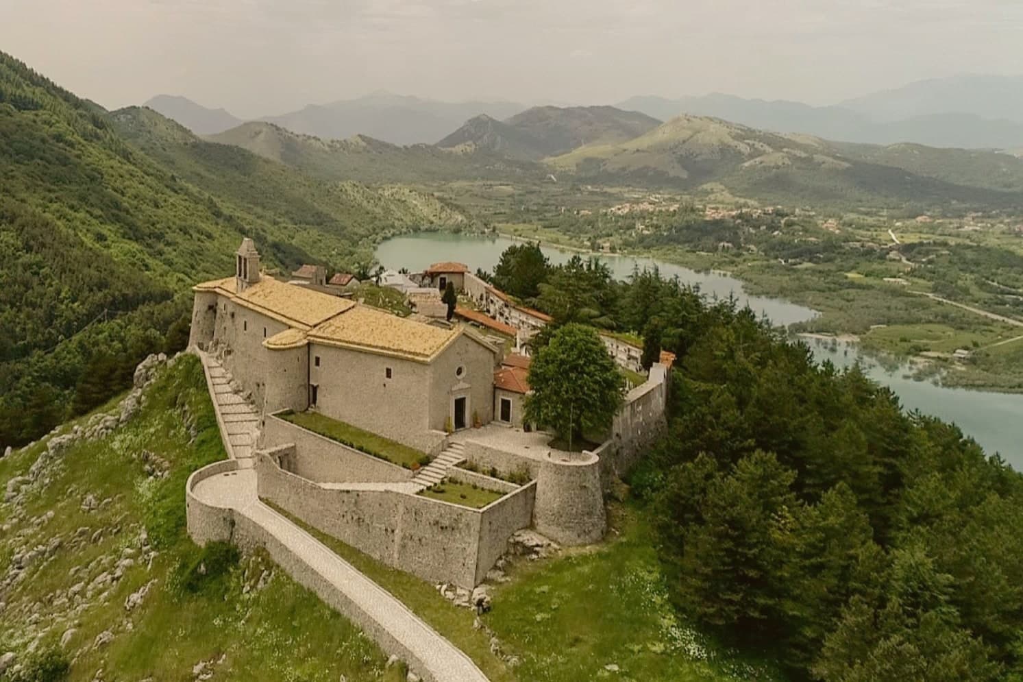
Letino sits in the Matese, a mountain settlement whose elevation shapes everything else about it: thin roads up, a short growing season, a village built to a scale that stops where the rock starts. The town's parts sit on a vertical axis rather than a horizontal one. The castle occupies the high rock above the settlement, the artificial lake lies in the basin below it, and the karst river connects the two by running above ground for a stretch before vanishing underground entirely, so the visible landscape is only part of what is actually there.
The insurrection of 1877 lasted days: the group marched in during a council session, burned tax records in the square, distributed arms to peasants and ordered the lands divided before it was over. That the whole episode fit inside a handful of days, in a village this small and this high, is why the local museum still keeps it as its own subject rather than a footnote to regional history. The lake itself is not natural; it was built for a hydroelectric plant in the early twentieth century, which means the calmest-looking feature of the town is the newest and the most engineered. What Letino adds up to is a place where altitude, water and a brief political rupture all left permanent marks on a settlement too small to absorb any of them quietly.
The Sunday letter
Letino is on our list. Its letter is still to come.
We are writing about all 1,000 of these towns, one at a time, in a free letter every Sunday: the photo, the food, the festa. That is our mission. Sign up and you will be there when Letino comes up. By Peter & Sophia, from Pietrasanta.
Read on
Letino in our articles
 The best towns known for their meat within two hours of Naples7 towns, Letino among them.
 10 comuni that share a patron saint and nothing else10 towns, Letino among them.
 The best small mountain towns in Campania10 towns, Letino among them.
 The highest comune in each region of Italy20 towns, Letino among them.
How to get there
From Naples / Salerno (NAP), about 1h 46m by car.
Rome (FCO) is about 3h 19m away.
By car from the centre of Naples 1h 50m or Salerno 2h 15m.
What to see
Castello di Letino
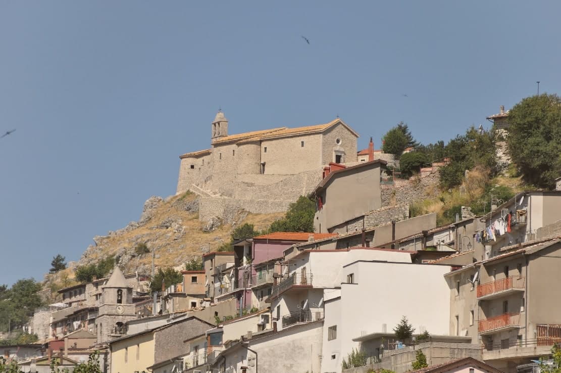
Castle on a rock above the village at roughly 1,200 meters, walls dating to the 1600s, hosting the Sanctuary of the Madonna del Castello.
Lago di Letino
Artificial lake (also called Lago Caùto) of 1.1 km², built in the early 1900s for the Prata Sannita hydroelectric plant.
Grotte del Caùto
Karst cave system carved by the Lete river, explored since the 1920s, with two parallel galleries averaging 89 meters apart.
Fiume Lete
The river runs above ground briefly after its source before descending into the cave system, a short visible stretch bracketed by rock on both sides.
Museo dell'Internazionalismo Anarchico
Permanent exhibition in the municipal building on the insurrection, with local documents and press of the era: the archive kept where the events themselves took place.
The slow-trip planner
Building a trip? Find where Letino fits in a slow Italy circuit.
Answer five questions. We will shape a geographically coherent slow trip from the 1,000 Italian towns most travelers skip. Yours to save and share.
Living here
- Population 631
- Remotei
- Pharmacy: none mapped
- Nearest high school over ~30 minutes away
- Nearest airport Naples / Salerno, 1 h 46 min drive
- Regional capital Napoli, 1 h 50 min drive
Common questions
- What is Letino known for?
- At 961 meters the highest commune in the province of Caserta, where in April 1877 anarchists declared a Republic of Letino in the village hall.
- Where is Letino?
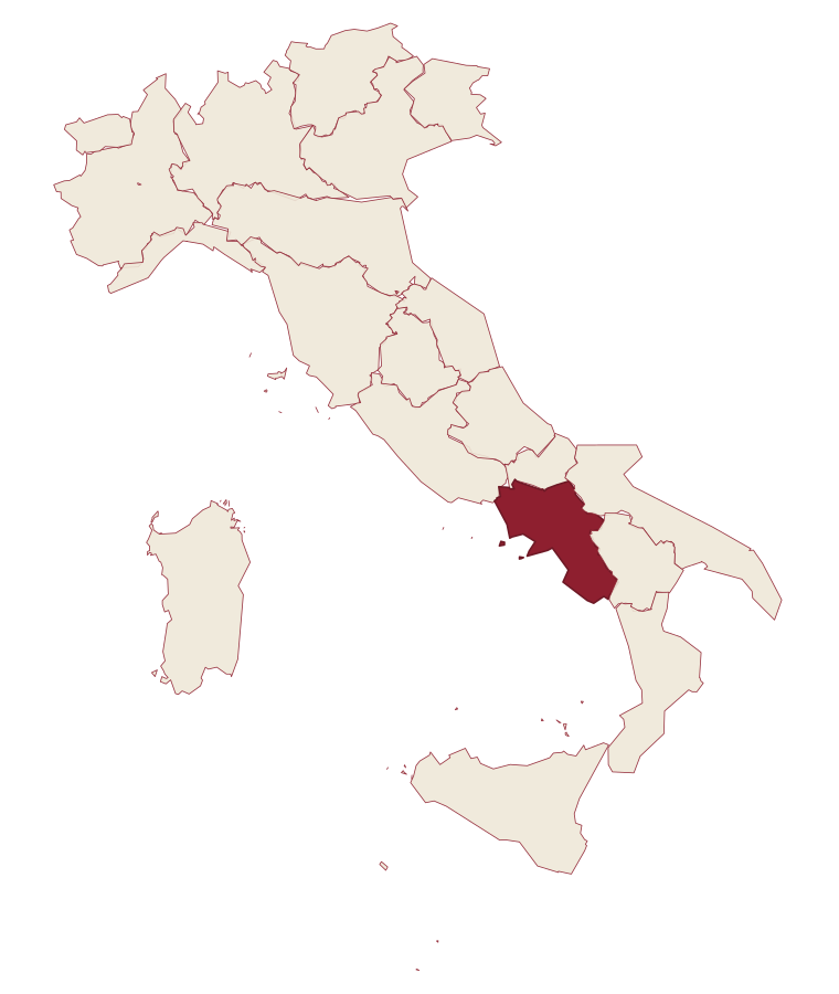
- Letino is a comune in the province of Caserta, in Campania.
- What is the nearest airport to Letino?
- Naples / Salerno (NAP), about 1h 46m by car.
- How long is the drive from Naples to Letino?
- About 1h 50m by car.
- When is the best time to visit Letino?
- Best in May–Oct. July is the warmest month, averaging 26 degrees, and May the wettest, with about 19 rain days.
- Is there a sagra or a festival in Letino?
- The town keeps its patron saint's day: Giovanni Battista, domenica più vicina.
- Which other towns are like Letino?
- Faeto, Castel San Vincenzo and Roseto Valfortore.
- How many people live in Letino?
- 631 at the 2023 count.
Tags & datadesignations · numbers · sources
Recognised as
The numbers
- Elevation: 961 m
- Population: 631
- Surface area: 31.59 km²
These figures were compiled from public directories: ISTAT, OpenStreetMap and Wikidata, and from the official listings of the guides named on this page. Town details change; verify with official sources before you travel.
Similar
Towns like Letino
Faeto
Province: Foggia
both mountain-valley towns · both under 1,000 people
Castel San Vincenzo
Province: Isernia
both mountain-valley towns · both under 1,000 people
Roseto Valfortore
Province: Foggia
both mountain-valley towns · both under 1,000 people
Pizzone
Province: Isernia
both mountain-valley towns · both under 1,000 people
Celle di San Vito
Province: Foggia
both mountain-valley towns · both under 1,000 people
Monteverde
Province: Avellino
both mountain-valley towns · both under 1,000 people
🟠 Bandiera Arancione
More Bandiera Arancione towns in Campania
Cerreto Sannita
Province: Benevento
A Sannio ceramics town at 290 meters, replanned on an orthogonal grid after the 1688 earthquake leveled the old hill.
Morigerati
Province: Salerno
A 608-person Cilento village above the Bussento gorge, the river surfacing from underground caves directly beneath the cliffs.
Sant'Agata de' Goti
Province: Benevento
A medieval town built on a tuff cliff between two gorges, the houses standing flush with the edge over the Isclero river below.
Zungoli
Province: Avellino
An Irpinia ridge between the Ufita valley and the Daunian hills, with walls above and tuff caves below the houses.