
Veneto · Treviso
Farra di Soligo
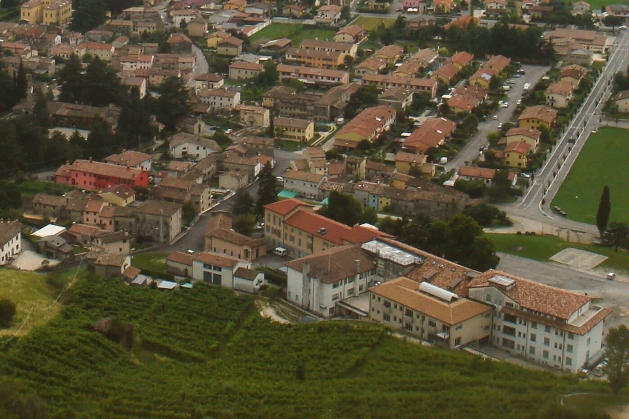
An 8,510-resident comune in the Conegliano-Valdobbiadene DOCG zone, with the three medieval Torri di Credazzo crowning a hilltop above its vineyards and Cittaslow plus Città del Vino status alongside it.
Picked by Peter Benei
Letter to come
Why Farra di Soligo is on our list
It holds UNESCO, Cittaslow and Città del Vino.
Subscribe and you get Farra di Soligo's letter the day it comes out.
Visiting
- Best time
- Apr–Jun, Sep–Oct
- By car
- 1 h 8 min from Venice
- Population
- 8,510
- J8°
- F10°
- M13°
- A16°
- M20°
- J25°
- J28°
- A28°
- S23°
- O18°
- N12°
- D8°
- Best
- Hot or crowded
- Quiet
- Mostly closed
Daytime air temperature, averages for 2020–2024. Weather data by Open-Meteo.com.
Why come
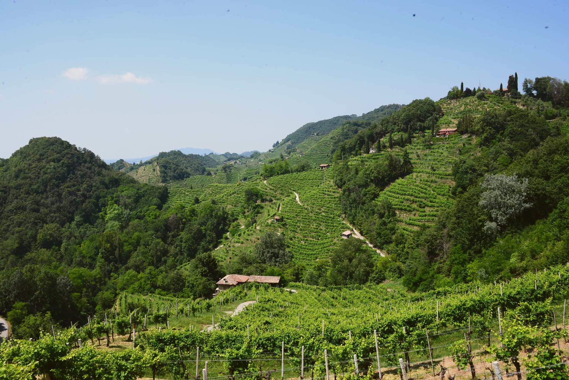
The Conegliano-Valdobbiadene Prosecco Hills take their local name, rive, from the steep hogback ridges that corrugate the landscape, terraced by hand over more than a thousand years and planted almost entirely to Glera. The whole landscape was inscribed as 'Le Colline del Prosecco di Conegliano e Valdobbiadene' in 2019, recognizing both the vineyard cultivation system and the long history of hillside terracing behind it. Farra di Soligo sits at the literal center of this territory, one of 15 comuni inside the inscribed area, an 8,510-resident commune altitude positioned between Conegliano (10 km east) and Valdobbiadene (5 km west), with the most-photographed stretch of the rive running through its own ground.
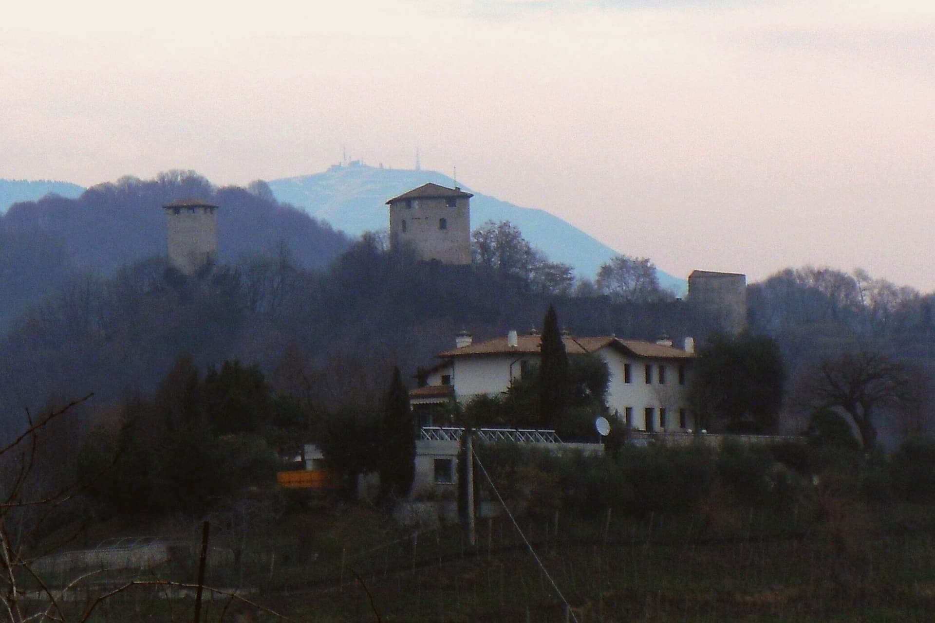
The hill between Farra and Col San Martino holds the Torri di Credazzo, reached by marked paths climbing directly from the village rather than by road. Beyond the towers and the vineyards, the territory holds two Romanesque parish churches, one in Farra itself with its campanile standing detached from the main body, another at Col San Martino with later frescoes added to its 12th-century fabric, and, just over the border in Refrontolo, a working wooden watermill on the Lierza river, the photogenic centrepiece of a Sunday walking circuit that closes vineyard roads to cars between April and October. The Cistercian abbey at Follina extends the same religious-medieval layer about 8 km to the north, ranking among the more important monastic ensembles in the Veneto.
The comune also carries the Cittaslow and Città del Vino marks alongside the UNESCO inscription, a rare triple signal for a town this size. Wine production runs through all of it: over 200 producers work the DOCG zone across the comune and its immediate neighbors, making the extra-dry Prosecco Superiore, the dry Cartizze grand-cru, and the rarer col fondo, unfiltered and naturally cloudy, the traditional version before the modern method took over. Food follows the same prealpine register: spaghetti with duck ragù, baccalà alla vicentina, formaggio di Malga, tiramisù, invented 30 km south at Treviso.
The Festa del Vino in May and the Sagra dell'Uva in October mark the calendar's two fixed points. What holds the place together is the terracing itself: a landscape shaped by a single, continuous agricultural practice long enough that the medieval towers, the parish churches, and the working mill all read as features of one worked hillside rather than separate monuments set into it.
How to get there
From Treviso (TSF), about 52 min by car.
Verona (VRN) is about 2 h 10 min away.
By car from the center of Padua 1 h 20 min or Udine 1 h 43 min.
Coming by train into Venezia Santa Lucia? Farra di Soligo is about 1 h 8 min away by road.
Every town within reach of Treviso airport.
First time driving in Italy? Read our complete manual.
What to see
Conegliano-Valdobbiadene Prosecco Hills (UNESCO)
The corrugated rive landscape of steep hogback ridges with Glera vineyards, inscribed as UNESCO World Heritage in 2019. Farra sits centrally in the inscribed area, with the most-photographed stretch running through its territory.
Torri di Credazzo
The towers stand above Soligo, a frazione of Farra, reached by marked paths climbing from the village itself rather than by road.
Molinetto della Croda
The mill's wheel still turns on the Lierza river at Refrontolo, a short drive east, its wooden works exposed to view. It anchors the Rive Vive walking route, when vineyard roads nearby close to cars.
Pieve di San Pietro + Abbazia di Follina
The Romanesque parish church in Farra stands with its campanile detached from the main body, an 11th-c arrangement. The Cistercian abbey at Follina lies about 8 km north and ranks among the more important monastic ensembles in the Veneto.
Cartizze + Rive Vive walks
Grand-cru Cartizze and extra-dry Prosecco Superiore come from over 200 producers across the comune and its immediate neighbors. On Rive Vive Sundays, April to October, the vineyard roads belong to walkers moving cellar to cellar.
From the guides
Where to eat
Not our picks, but places the guides put their name to: a Michelin star, a Gambero Rosso fork, a Slow Food snail, a Michelin Key for the hotels. Worth a table, a counter, or a night when you pass through.
Locanda da CondoRistorante
Locanda da Condo has a Michelin Bib Gourmand to its name.
SedaRistorante
Two Gambero Rosso forks (81/100), at Seda.
Tino Gourmet dell'Hotel Villa SoligoRistorante
Tino Gourmet dell'Hotel Villa Soligo holds one Gambero Rosso fork (79/100).
Before you sit down: how to order at a restaurant, how to spot a tourist trap, what aperitivo is and how the Italian bar works.
Living here
Could you live here?
Farra di Soligo meets both of our rules for a small town.
- 8,510 people, inside our sweet spot of 5,000 to 20,000: a real town, still one community.
- Treviso, a city of 85,652, is 45 min by car. Inside our 30 to 60 minutes: close for the services, far enough to keep its own life.
The rules come from our series Where to Move in Italy, written from the places we have lived: Part 1, The End of the Road · Part 2, The Small Town · Part 3, The City · Part 4, The Postcard · Part 5, The Other Half. The towns we would pick are in Part 6, The Best Towns.
- Population 8,510, down 5.7% since 2015
- Nearest city Treviso, 45 min drive
- Nearest national health service hospital Conegliano, 14 km as the crow flies · how healthcare works in Italy
- Ordinary homes in excellent condition in the center: €1,100 to €1,200 per m² to buy, €4.10 to €5.70 per m² a month to rent
Weighing a move here? See the moving year.
All the numbers Common questions, designations, lists and sources.
More about living here
- Commuter belt
- Pharmacy in town
- High school within a 30-minute drive
- Full fibre reaches 93% of homes
- Primary school in the comune
- Earthquake zone 2, medium hazard
- Treviso airport (TSF), 52 min drive, the nearest with scheduled flights
- Market day Tuesday
- Regional capital Venice, 1 h 8 min drive
If you are moving here
Who lives here
9% of residents are foreign citizens, most often from Morocco, North Macedonia and Bangladesh, against 9% across Italy. 10 of them come from English-speaking countries or western and northern Europe. There are 188 people over 65 for every 100 children under 15, against 216 across Italy. 23% of homes have no resident, holiday homes and empty ones counted together, against 27% across Italy. Treviso province ranks 6th of 107 in Il Sole 24 Ore's quality of life ranking for 2025.
Health and schools
The nearest emergency room is in Conegliano, 14 km as the crow flies. The nearest major one is in Treviso, 28 km away. The nearest children's emergency room is in Pordenone, 42 km away. The nearest IB school is Collegio Vescovile Pio X International, 28 km as the crow flies.
Information, not medical advice. Confirm with a professional.
Taxes
A home that is not your main one pays 0.86% a year in property tax, charged on the cadastral value rather than the price. A main home pays none unless it is in a luxury category. The town adds 0.6% to your income tax. 7% pensioner tax: this town is not in a qualifying area.
Information, not tax advice. Confirm with a professional.
What it costs
The average household in Veneto spends about €2,310 a month, €560 of it on food, against about €2,170 across Italy. A family of three pays about €490 a year for water, on the Veneto average. In Treviso, the provincial capital, in September 2026, an espresso cost €1.44, a meal in a pizzeria €12.22 and a man's haircut €28.82.
Climate and risk
It is in climate zone E, on a scale from A, the warmest, to F, the coldest, and heating may run from October 15 to April 15, up to 14 hours a day, unless the mayor changes it. Under 1% of residents live in a zone the national maps rate high for floods. They show no residents in a high landslide zone.
These shares cover the whole comune, not any one street. Check an address on IdroGEO.
Moving from abroad? Which visa you need. Sources: ISTAT, the Ministry of Health, ISPRA, the Finance Ministry, the Ministry of Enterprise, Poste Italiane, the comuni, the IB, International Schools Database, Il Sole 24 Ore, Cittadinanzattiva.
Known for
UNESCO PROSECCO HILLS
Heart of the Conegliano-Valdobbiadene DOCG zone. The rive corrugated ridge landscape that produces Italy's most exported sparkling wine.
TORRI DI CREDAZZO
Medieval watchtowers on a hilltop between Farra and Col San Martino, thought to date from the 9th to 10th century. Direct walking access from the village.
CITTASLOW + CITTÀ DEL VINO
Both Italian quality marks on top of the UNESCO inscription, the rare triple-signal small Veneto town.
MOLINETTO DELLA CRODA
Working wooden watermill on the Lierza river at nearby Refrontolo. Photogenic centrepiece of the Rive Vive cellar-walking circuit.
Common questions
- What is Farra di Soligo known for?
- Farra di Soligo is an 8,510-resident comune in the Conegliano-Valdobbiadene DOCG zone, with the three medieval Torri di Credazzo crowning a hilltop above its vineyards and Cittaslow plus Città del Vino status alongside it.
- Where is Farra di Soligo?
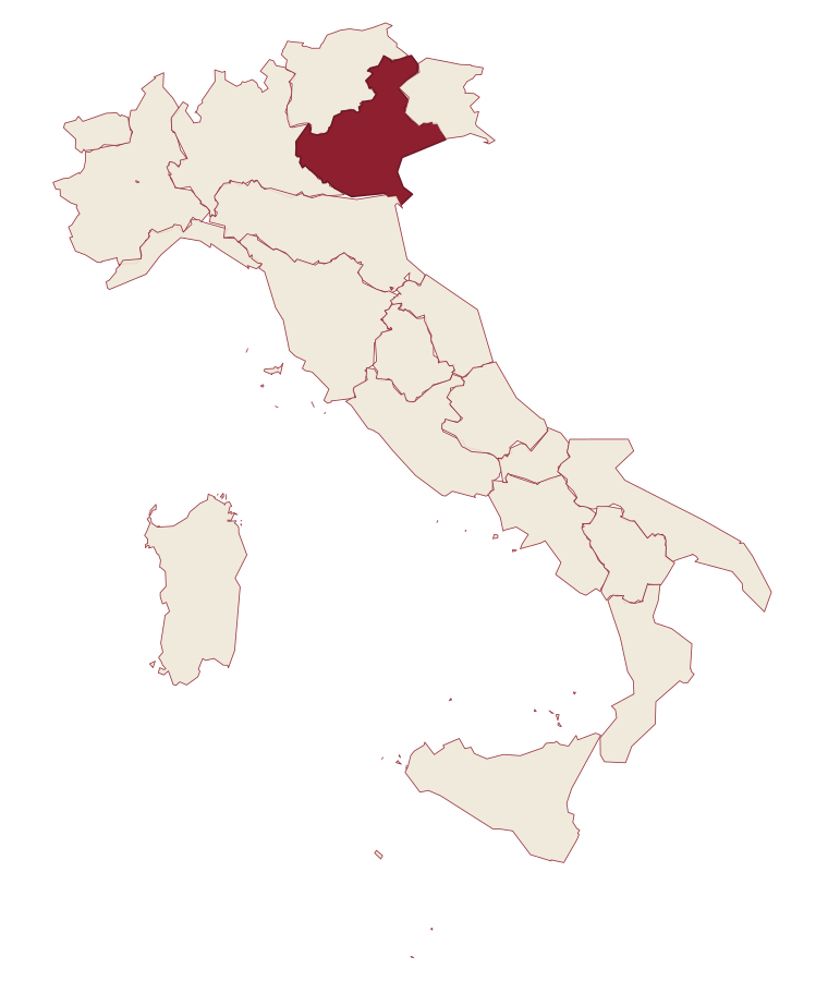
- Farra di Soligo is a comune in the province of Treviso, in Veneto, at 161 meters above sea level.
- What is the nearest airport to Farra di Soligo?
- The nearest airport with scheduled flights is Treviso (TSF), about 52 min by car.
- How long is the drive from Padua to Farra di Soligo?
- About 1 h 20 min by car.
- When is the best time to visit Farra di Soligo?
- Best in Apr–Jun, Sep–Oct. July is the warmest month, averaging 28 degrees, and May the wettest, with about 17 rain days.
- Which other towns are like Farra di Soligo?
- Follina, Battaglia Terme and Fagagna.
- How many people live in Farra di Soligo?
- 8,510 residents, by ISTAT's count on 1 January 2025.
- Is Farra di Soligo a good place to live?
- By the rules in our Where to Move in Italy series, Farra di Soligo is a small town that meets both of our rules. The nearest city, Treviso, is 45 min away by car. The nearest national health service hospital is in Conegliano, 14 km as the crow flies. Full fibre reaches 93% of homes.
Tags & data designations · numbers · sources
Recognized as
The numbers
- Elevation: 161 m
- Population: 8,510
- Surface area: 28.34 km²
These figures were compiled from public directories: ISTAT, OpenStreetMap and Wikidata, and from the official listings of the guides named on this page. Town details change; verify with official sources before you travel.
The ranked lists
Lists Farra di Soligo appears in
- The best hidden hill towns within 90 minutes of VeniceNear Venicehill townwithin 90 minhidden6 towns · smallest 2,478 residents · closest 64 min away
- The best hill towns within 75 minutes of VeniceNear Venicehill townwithin 75 min6 towns · smallest 1,779 residents · closest 50 min away
- The best towns with a serious restaurant in the province of TrevisoTreviso provinceserious restaurant6 towns · smallest 3,607 residents
- The best wine towns within 75 minutes of VeniceNear Venicewithin 75 minwine zone6 towns · smallest 3,607 residents · closest 53 min away
- The 7 best hidden towns with a World Heritage site in VenetoVenetoWorld Heritagehidden7 towns · smallest 2,478 residents
- The best hill towns in the province of TrevisoTreviso provincehill town7 towns · smallest 2,478 residents
Similar
Towns like Farra di Soligo
What all six share with Farra di Soligo: between 3,000 and 10,000 people · near sea level
Follina
Province: Treviso
14 min apart by road
Battaglia Terme
Province: Padova
1 h 26 min apart by road
Fagagna
Province: Udine
1 h 38 min apart by road
Cormons
Province: Gorizia
1 h 47 min apart by road
Grado
Province: Gorizia
1 h 51 min apart by road
San Dorligo della Valle-Dolina
Province: Trieste
2 h 6 min apart by road
The letter
Farra di Soligo is on our list. Its letter is still to come.
We are writing about all 1,000 of these towns, one at a time, in a free letter: the photo, what is worth eating, and when to turn up. That is our mission. Sign up and you will be there when Farra di Soligo comes up. By Peter & Sophia, from Turin.
The nearest town we have written up is Chioggia, 77 km away. Read its letter →
Paid plans, the moving year and the books are on the membership page.