
Aosta Valley · Aosta Valley
Courmayeur
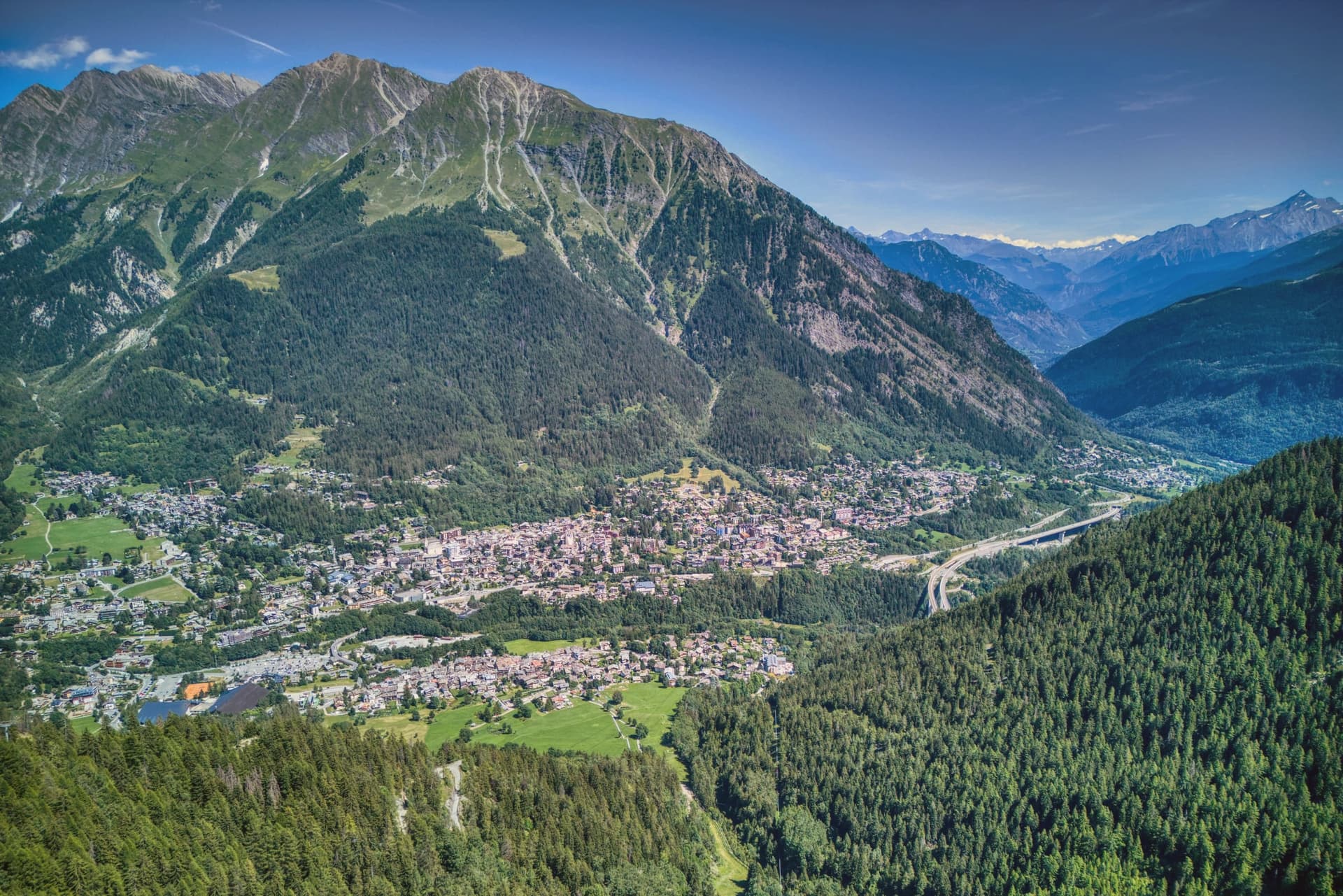
The Italian base of the 4,810-meter peak, a Roman waystation on the Via delle Gallie that became the country's highest commune and its best-known ski address.
- Best time
- Jun–Sep, Dec–Mar
- By car
- 2 h from Turin
- Population
- 2,602
Known for
MONT BLANC
4,810 meters, shared with Saint-Gervais-les-Bains across the French border and linked to Chamonix by the 1965 tunnel.
SKYWAY
The 110-million-euro cable car opened in 2015, lifting visitors from 1,300 to 3,466 meters in rotating cabins.
SKI RESORT
One hundred kilometers of pistes spread across Plan Chécrouit and Val Veny, a year-round mountaineering and ski capital since the early twentieth century.
When to visit
Best · Jun–Sep, Dec–Mar
- J3°
- F6°
- M7°
- A9°
- M15°
- J21°
- J24°
- A24°
- S19°
- O14°
- N8°
- D4°
- Best
- Hot or crowded
- Quiet
- Mostly closed
Daytime averages, 2020–2024. Weather data by Open-Meteo.com.
The festa: Pantaleone di Nicomedia, 27 July
Why come
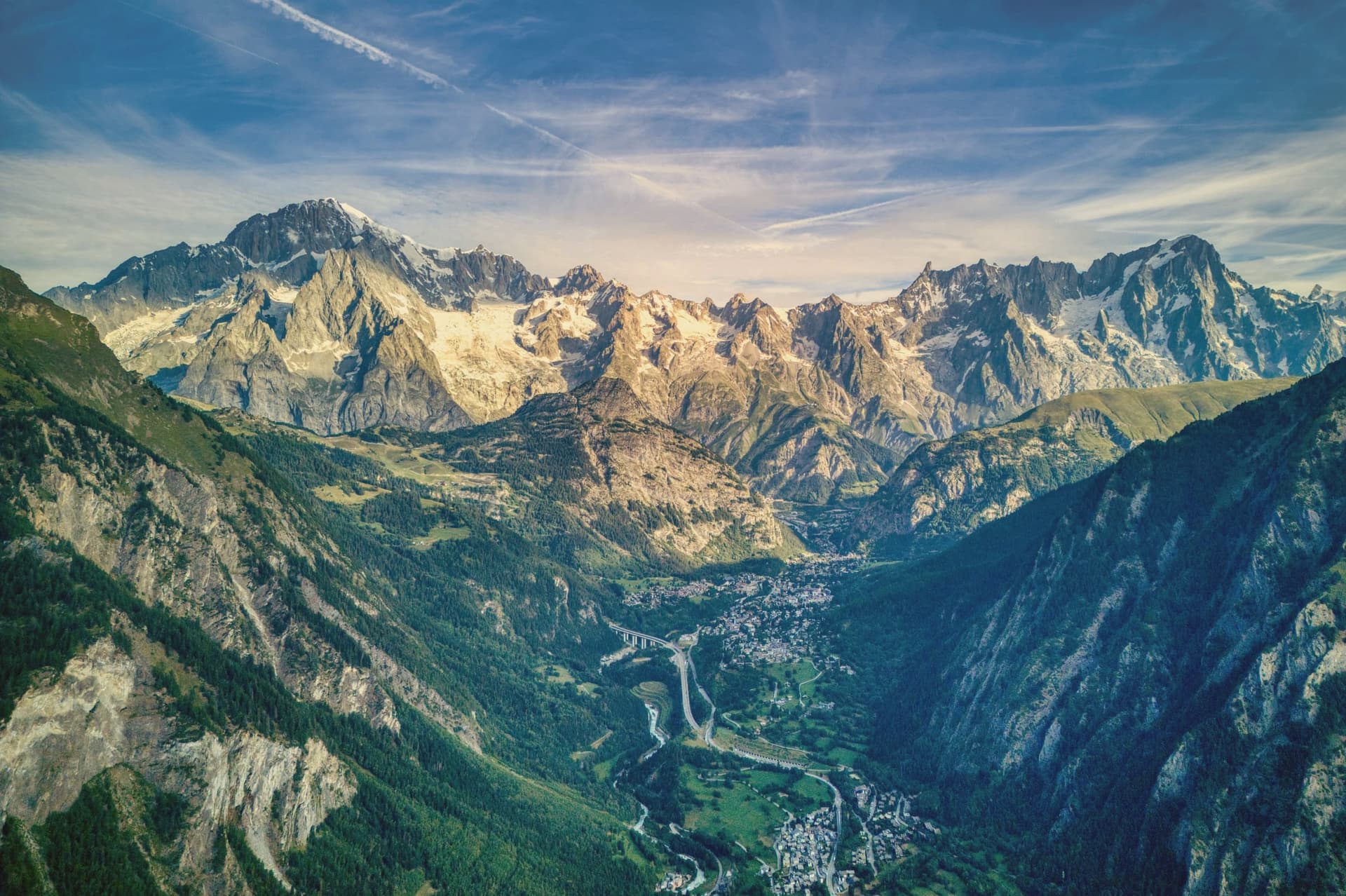
Courmayeur sits at 1,224 meters, at the foot of the southern face of the peak it shares with Saint-Gervais-les-Bains in France. The Romans called the place Curia Major and used it as a stop on the Via delle Gallie, the road running over the Little Saint Bernard pass. The tunnel to Chamonix, opened in 1965, runs eleven kilometers and turned what had been a remote valley head into a year-round border town.
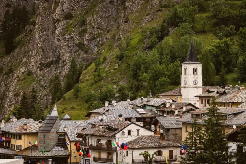
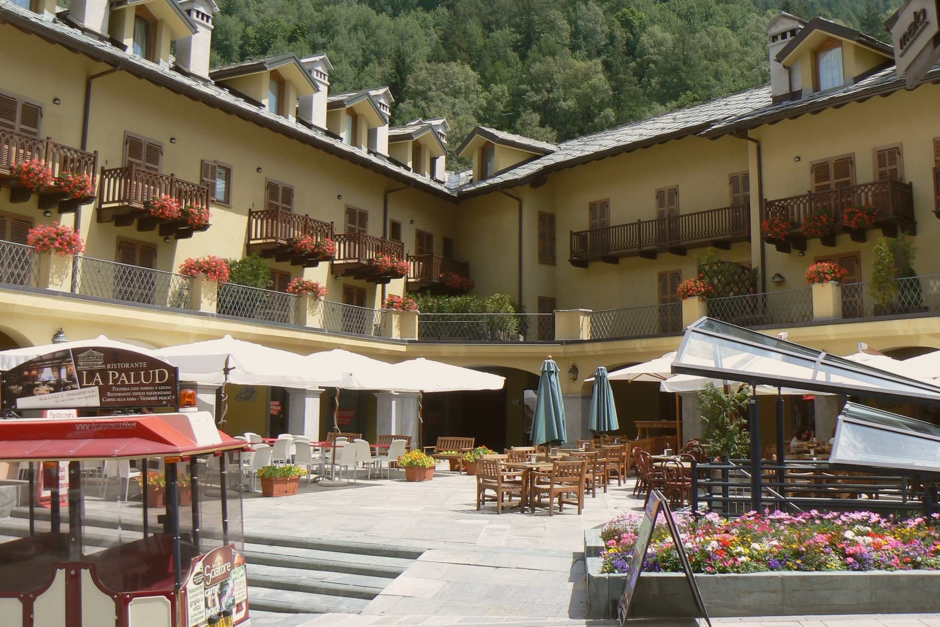
Above the village, two side valleys open on either side: Val Ferret to the northeast and Val Veny below the Brenva and Miage glaciers, each carrying a stretch of the Tour du Mont Blanc and the Tor des Géants. Via Roma, the old pilgrim route, still runs through the center between them, its line unchanged even as cafés and hotels have filled in around the church and the medieval tower that predate the resort.
What holds the town together is that layering: a Roman crossing, a pilgrim street, a mountaineering village, and a modern lift system all occupying the same narrow ground at the base of one mountain, each era built over rather than replacing the last.
The Sunday letter
Courmayeur is on our list. Its letter is still to come.
We are writing about all 1,000 of these towns, one at a time, in a free letter every Sunday: the photo, the food, the festa. That is our mission. Sign up and you will be there when Courmayeur comes up. By Peter & Sophia, from Pietrasanta.
Read on
Courmayeur in our articles
 The 7 Aosta Valley villages above 1,000 metres7 towns, Courmayeur among them.
 The best ski towns in the province of Valle d'Aosta/Vallée d'Aoste8 towns, Courmayeur among them.
 The best towns that eat well in the province of Valle d'Aosta/Vallée d'Aoste8 towns, Courmayeur among them.
 10 mountain comuni near Turin10 towns, Courmayeur among them.
How to get there
From Turin (TRN), about 2 hours by car.
Milan (BGY) is about 3h 13m away.
By car from the centre of Genoa 3h 22m.
What to see
Skyway Monte Bianco
Two-stage ascent from Pontal d'Entrèves to Punta Helbronner, the cabins rotating slowly as they climb so the panoramic terrace on the Mont Blanc massif comes into view from every side before arrival.
Val Ferret
Side valley running northeast along the Italian flank of the massif, traversed by the Tour du Mont Blanc and Tor des Géants.
Val Veny
Parallel side valley below the Brenva and Miage glaciers, with road access in summer and the Notre-Dame de Guérison sanctuary.
Chiesa di San Pantaleone
Parish church on Via Roma, dedicated to the town's patron and standing among the cafés and hotels that now line the old pilgrim street.
Tour Malloquin
Medieval residential tower on Via Roma, the surviving fragment of the village that existed before the resort grew around it.
Giardino Botanico Saussurea
Alpine botanical garden at the Pavillon du Mont Fréty station, reached by the cable car partway up, one of the highest gardens in Europe with around 800 species growing at 2,200 meters.
The slow-trip planner
Building a trip? Find where Courmayeur fits in a slow Italy circuit.
Answer five questions. We will shape a geographically coherent slow trip from the 1,000 Italian towns most travelers skip. Yours to save and share.
We recommend
Where to eat and stay
Not our picks, but places the guides put their name to: a Michelin star, a Gambero Rosso fork, a Slow Food snail, a Michelin Key for the hotels. Worth a table, a counter, or a night when you pass through.
Pierre Alexis 1877Ristorante
Two Gambero Rosso forks (80/100) for Pierre Alexis 1877, and a spot in the Michelin Guide.
Aubergine Restaurant de l'Auberge de La MaisonRistorante
Aubergine Restaurant de l'Auberge de La Maison carries one Gambero Rosso fork (79/100).
Bistrot RoyalRistorante
Bistrot Royal holds a spot in the Michelin Guide.
Caffè della postaCaffè
Caffè della posta carries a place on Italy's historic-locali register.
Crème et ChocolatGelateria
Crème et Chocolat carries a Gambero Rosso listing.
Enoteca L'ArmadilloRistorante
Enoteca L'Armadillo carries a spot in the Michelin Guide.
L'ArmadilloRistorante
L'Armadillo holds one Gambero Rosso fork (79/100).
Grand Hotel Courmayeur Mont BlancHotel
Grand Hotel Courmayeur Mont Blanc holds a place in the Michelin hotel guide.
Le Massif Hotel & LodgeHotel
A Leading Hotels of the World listing, at Le Massif Hotel & Lodge.
Living here
- Population 2,602
- In-betweeni
- Pharmacy in town
- Nearest airport Turin, 1 h 58 min drive
- Regional capital Aosta, 42 min drive
Common questions
- What is Courmayeur known for?
- Courmayeur is the Italian base of the 4,810-meter peak, a Roman waystation on the Via delle Gallie that became the country's highest commune and its best-known ski address.
- Where is Courmayeur?
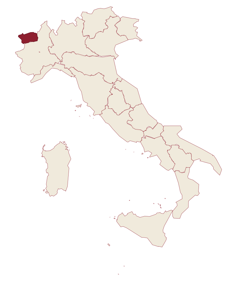
- Courmayeur is a comune in the province of Aosta Valley, in Aosta Valley, at 1224 meters above sea level.
- What is the nearest airport to Courmayeur?
- Turin (TRN), about 2 hours by car.
- How long is the drive from Genoa to Courmayeur?
- About 3h 22m by car.
- When is the best time to visit Courmayeur?
- Best in Jun–Sep, Dec–Mar. July is the warmest month, averaging 24 degrees, and June the wettest, with about 17 rain days.
- Is there a sagra or a festival in Courmayeur?
- The town keeps its patron saint's day: Pantaleone di Nicomedia, 27 July.
- Which other towns are like Courmayeur?
- Limone Piemonte, Ovindoli and Andalo.
- How many people live in Courmayeur?
- 2,602 at the 2023 count.
Tags & datadesignations · numbers · sources
Recognised as
The numbers
- Elevation: 1224 m
- Population: 2,602
- Surface area: 209.61 km²
These figures were compiled from public directories: ISTAT, OpenStreetMap and Wikidata, and from the official listings of the guides named on this page. Town details change; verify with official sources before you travel.
Featured on
Courmayeur appears on this themed pick from our Collections:
Similar
Towns like Courmayeur
Limone Piemonte
Province: Cuneo
both high in the mountains · both under 3,000 people
Ovindoli
Province: L'Aquila
both high in the mountains · both under 3,000 people
Andalo
Province: Trento
both high in the mountains · both under 3,000 people
Valtournenche
Province: Aosta Valley
both high in the mountains · both under 3,000 people
Cogne
Province: Aosta Valley
both high in the mountains · both under 3,000 people
Ayas
Province: Aosta Valley
both high in the mountains · both under 3,000 people
⛷️ Ski Area
More Ski Area towns in Aosta Valley
Ayas
Province: Aosta Valley
A scattered upper-valley commune of three villages, where Walser settlers and Romance-speaking herders share the slopes below Castor and Pollux.
Aymavilles
Province: Aosta Valley
A village at 646 metres above a river gorge, where the road up the valley begins and a Roman aqueduct still crosses the Grand'Eyvia on a single arch.
Cogne
Province: Aosta Valley
The mining town turned capital of the Gran Paradiso, the Aosta Valley's largest commune with 95 percent of its land inside Italy's oldest park.
Gressoney-Saint-Jean
Province: Aosta Valley
A Walser village in the Lys valley where Titsch is still spoken and the Lyskamm glacier closes the view.
La Thuile
Province: Aosta Valley
Italy's gateway to the Petit Saint-Bernard pass: a 1,441m alpine village under Mont Blanc, with the Rutor glacier and its tiered waterfalls behind it and a Roman-Salassi history that goes back two millennia.