
The 7 Aosta Valley villages above 1,000 metres
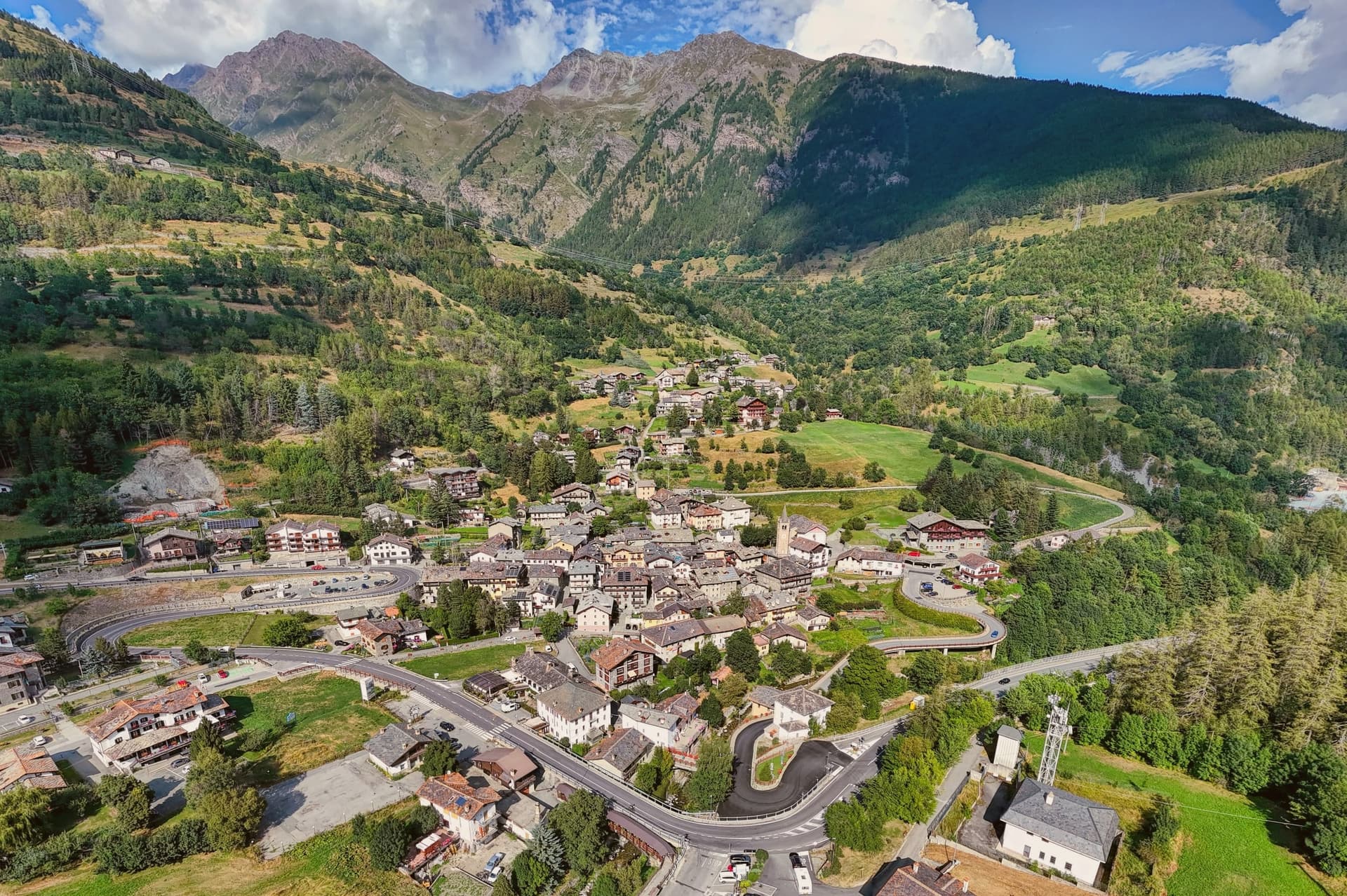
The Aosta Valley is a single deep trench with Mont Blanc at one end, the Matterhorn on one side and Monte Rosa and the Gran Paradiso on the other. Everything else is a side valley climbing off it, and the villages sit where those side valleys flatten out enough to build. Several of them were settled by Walser families who came over the passes from Switzerland in the thirteenth century and are still speaking a German dialect up there.
Most people arrive for one of two things. Courmayeur under Mont Blanc in winter, or the Gran Paradiso in July, and the road up either fills accordingly.
The side valleys in between hold villages at the same altitude with none of the arrivals. Glaciers at the head, larch forest below, a stone church, and a dairy that has been making the same cheese since the region had its own dukes.
Of the 14 Aosta Valley communes in our catalogue, these are the ones sitting above 1,000 metres. The highest, Ayas, is at 1710 metres.
Two more lists worth reading alongside this one: The best ski towns in the province of Valle d'Aosta/Vallée d'Aoste and The best towns that eat well in the province of Valle d'Aosta/Vallée d'Aoste.
Etroubles
Why visit Etroubles
Etroubles sits at 1,280 metres on the Italian side of the pass, the last full village before the climb to the border. The Romans called it Restopolis, a transit point on the way to the Alpis Poenina, and the same line of travel became the pilgrimage route that later carried traffic between Canterbury and Rome and beyond.
The village holds Borghi più Belli d'Italia and Bandiera Arancione status, a rare combination for a settlement of fewer than 500 people. The historic centre doubles as the open-air museum: sculptures, installations and contemporary works by international artists sit on house façades and in the squares, so a walk through the lanes and past the parish church is also a walk through a curated route of outdoor art.
The first dairy in Valle d'Aosta opened on the road to the hamlet of Vachéry, founding the local Fontina production chain that still runs through the upper valley. Summer brings La Veillà, an evening of revived old trades, wheat threshing and live cheesemaking, a reminder that the pass traffic and the dairy trade are the two things that built the village: one brought travelers through on their way to somewhere else, the other gave the place something of its own to make, sell, and be known for beyond the route across the border.
The village sits at 1280 metres.
What to see in Etroubles
- Musée à ciel ouvert. Sculptures, installations and contemporary paintings fixed to house façades and set along the streets, turning a walk through the village into a curated route rather than a stroll past monuments.
- Chiesa parrocchiale di Sainte-Marie-Madeleine. Parish church at the centre of the village, dedicated to Mary Magdalene and rebuilt on earlier medieval foundations.
- Centro storico. Stone-walled historic centre with narrow lanes and traditional Valdostan houses with wooden balconies, the streets themselves lined with the museum's outdoor works.
How to get to Etroubles
Torino is roughly 127 minutes away by road.
Our tip
June through September is the open season for hiking and the Via Francigena traffic from the Great St Bernard Pass, with daytime temperatures in the high teens to low twenties and the open-air museum at its most photographed. La Veillà falls in summer, with cheesemaking demonstrations and wheat threshing. December through March turns Etroubles into a quieter winter base for skiers headed to Crévacol next door and to the surrounding Grand Combin and Mont Vélan slopes. Veillà falls in August.
Gressoney-Saint-Jean
Why visit Gressoney-Saint-Jean
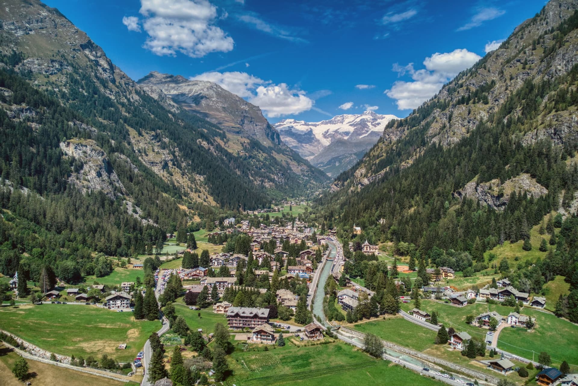
Gressoney-Saint-Jean sits at 1,385 meters in the upper Lys valley, the southernmost outpost of the Walser, a German-speaking people who crossed the Theodul Pass from the Valais in the thirteenth century and settled the slopes around Monte Rosa. The local dialect, Titsch, is an Alemannic variant still taught in the village school.
The traditional Walser stadel, a wood-and-stone barn raised on staddle stones, survives in dozens of hamlets above the village, from the centre up toward Belvedere at the foot of the Colle Ranzola, where older residents still use Titsch daily. The village and its hamlets read as layers of the same migration: the parish sits in the valley bottom, the stadel-built hamlets climb the slopes above it, and the Lys glacier and the peaks that feed it close the valley at its head, the river taking its name from that same ice.
What began as a thirteenth-century Alemannic settlement on the far side of an alpine pass has kept its language, its barns, and its orientation toward the mountain that still supplies its water.
The village sits at 1385 metres.
What to see in Gressoney-Saint-Jean
- Castel Savoia. Five asymmetric turrets in grey local stone, standing above the village as a regional museum open to visitors.
- Walser Cultural Center / Ecomuseum. Museum on Via Castello documenting Walser language, costume, architecture and migration, with reconstructed stadel and traditional interiors.
- Chiesa di San Giovanni Battista. Parish church in the village centre, replaced over the centuries on the site of the earliest medieval chapel of the upper Lys.
How to get to Gressoney-Saint-Jean
Torino is roughly 90 minutes away by road.
Our tip
December through March is the ski season, with lift access onto the Monterosa Ski domain from neighbouring Gressoney-La-Trinité and 1,385 meters of altitude that holds snow on the valley floor. June through September is the high-mountain season, the months when the refuges on the Lyskamm open and the Walser cultural festival fills the village. April, May, October and November are quiet.
La Thuile
Why visit La Thuile
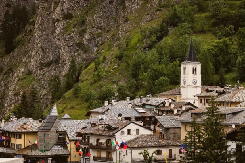
La Thuile sits at 1,441m in the upper Valdigne, the last Italian village before the pass crosses into France's Tarentaise valley. Population 790 year-round, with Mont Blanc as the western skyline.
The Romans built a paved road over the col in the 1st century BC, the original Alpis Graia route linking Augusta Praetoria (Aosta) to Lugdunum (Lyon), and that same line is still the one drivers follow today, now a paved road rather than the Roman original. The village reads as two halves stacked by season and by direction.
Winter identity climbs west and up, toward the ski domain that shares its pistes with the French resort across the border, one pass covering both sides between roughly 1,200m and 2,642m, snow reliable enough that it draws top-level downhill racing to the slopes above town. Summer identity climbs south instead, toward the glacier on the valley's south wall, ice that feeds tiered waterfalls on its way down and a trail that continues higher still to a refuge looking back over that same ice.
Cross-border traffic by road takes a third line entirely, up the old route to the col itself, where a prehistoric stone circle stands next to a medieval hospice: Roman engineering, Bronze Age ritual, and church foundation stacked on the same patch of high ground. The food stays close to the valley floor: fontina made just down-valley, bread-cheese-cabbage soup, polenta concia, cured beef, a local génépy liqueur, and in August a harvest of blueberries grown at altitude, celebrated with a festival that doubles as the village's main civic gathering of the year.
Between the pass, the glacier, and the ski slopes, the village works less like a single place and more like a junction: a spot where Roman road, alpine ice, and modern piste all happen to converge on one small settlement under the same mountain.
The village sits at 1441 metres.
What to see in La Thuile
- Espace San Bernardo (cross-border ski). Pistes run between 1,200 and 2,642m, with ski-to-lift crossings at the top of the col into France. One pass covers both sides at La Rosière.
- Cascate del Rutor + Rifugio Deffeyes. Three tiered glacier-fed waterfalls reached by a half-day walk from town. Trail continues to Rifugio Deffeyes (2,494m) for proper alpine views over the glacier.
- Colle del Piccolo San Bernardo + Cromlech. The paved SS26 climbs to the pass into France, open mid-June to mid-October. The stone circle measures 72m across; the Hospice beside it was founded by Bernard of Menthon.
How to get to La Thuile
Torino is roughly 161 minutes away by road.
Our tip
La Thuile is twin-season — January–March for skiing (Espace San Bernardo opens late November to late April depending on snow) and July–September for alpine summer. Late June – mid-October is the only window for the Petit Saint-Bernard pass road. April–May and October–November are the in-between shoulders when most amenities close. Festa della birra - La Thuile falls in September.
Cogne
Why visit Cogne
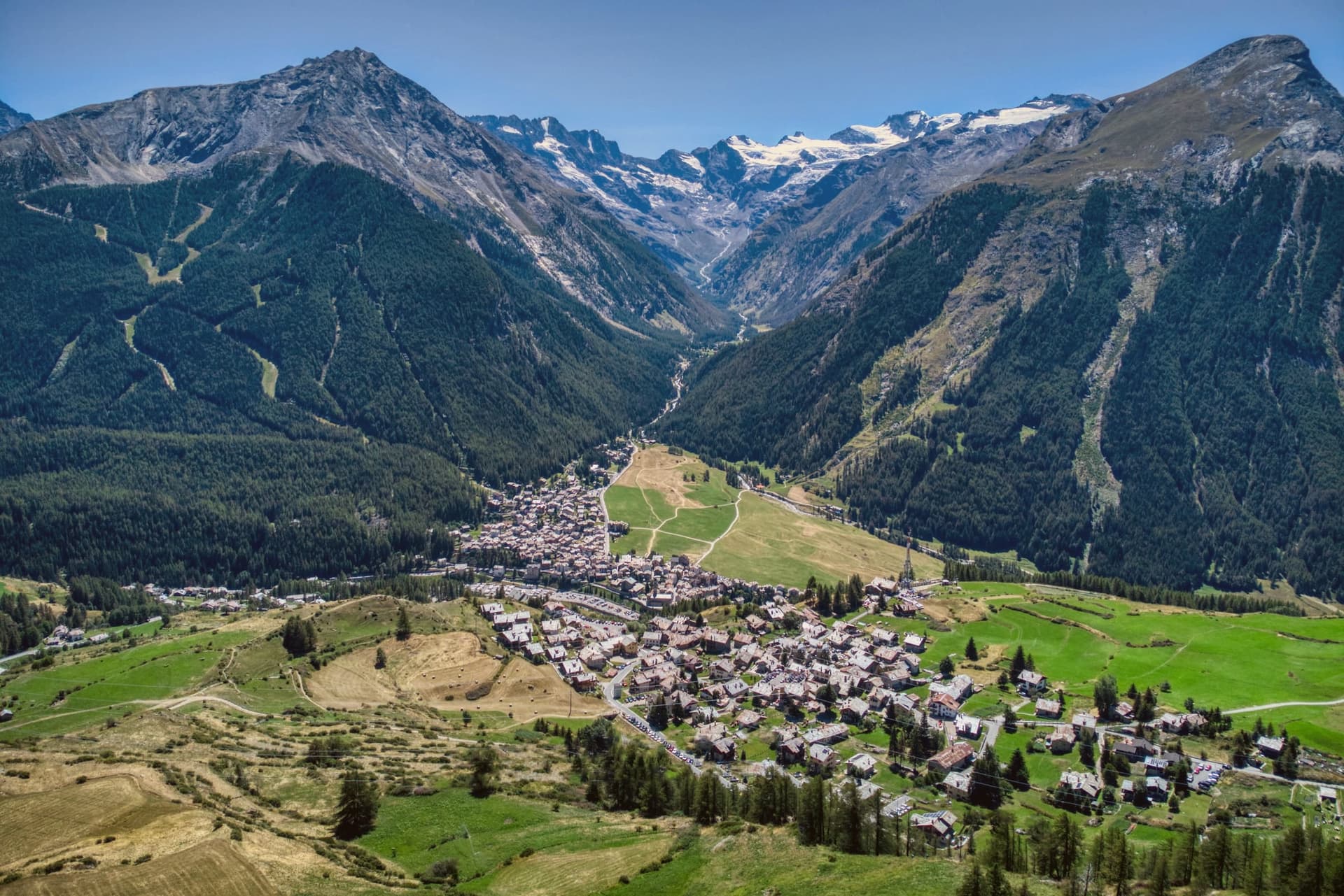
Cogne sits at 1,534 meters on the Grand Eyvia torrent, the largest commune in the Aosta Valley by surface area and the southern gateway to the Gran Paradiso National Park. More than 95 percent of its territory falls inside the park, established in 1922 as Italy's first.
Until 1979 this was an iron-mining town: magnetite was extracted from the Colonna mine above the village and carried down by cableway and rail to the foundries in Aosta. When the mines closed, the village pivoted to cross-country skiing and ice climbing.
The Prato di Sant'Orso, the flat meadow at the foot of the village, holds 40 kilometers of groomed Nordic tracks in winter and grazing cattle in summer. The Cascate di Lillaz, three drops totaling roughly 150 meters along the Urtier, freeze solid between December and March and draw climbers to more than 150 ice routes on the surrounding walls.
The parish church of Sant'Orso fronts the centro storico.
The village sits at 1534 metres.
What to see in Cogne
- Prato di Sant'Orso. Flat alpine meadow at the foot of the village facing the Gran Paradiso, used for grazing in summer and 40 kilometers of cross-country ski tracks in winter.
- Cascate di Lillaz. Three-tiered waterfall on the Urtier torrent in the hamlet of Lillaz, around 150 meters total drop, a major ice-climbing site in winter.
- Chiesa di Sant'Orso. Parish church in the centro storico dedicated to the patron saint, fronting the village square.
How to get to Cogne
Torino is roughly 121 minutes away by road.
Our tip
December through March is the cold-weather season Cogne was rebuilt for: the Sant'Orso meadow fills with Nordic skiers, and the Lillaz waterfalls freeze hard enough to climb. June through September is the second season, when the same trails open for hiking and the glaciers of the Gran Paradiso stay visible from the village. April, May, October and November are the quiet months. La Devétéya de Cogne falls in September.
Ayas
Why visit Ayas
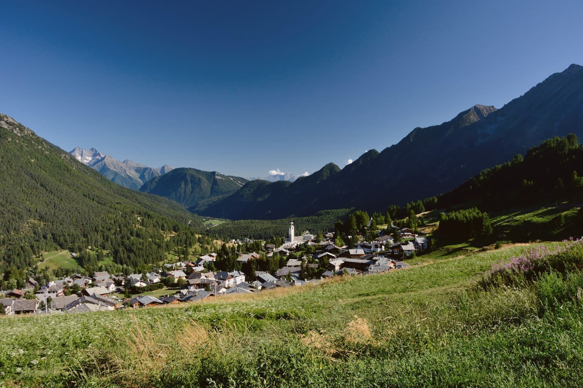
Ayas runs along the upper Évançon valley, its municipal seat at Antagnod (1,710 meters) and its main resort centers at Champoluc (1,568 meters) and the hamlet at the valley head. The 1,357 residents are spread across these three villages and dozens of smaller hamlets.
Antagnod is the older village, its parish church holding the seventeenth-century altar that makes it the religious seat of the commune. Champoluc sits lower, on a flat stretch of the upper valley, and functions as the working entry point to the lift domain, with gondola and cable car reaching across two cols into Piedmont.
The hamlet at the valley head keeps the medieval name of the German-speaking settlers who farmed these slopes after crossing from Valais in the thirteenth century, while the valley itself is watered by glacial melt from above. The commune, in short, is a set of villages at different altitudes doing different jobs: worship in one, skiing in another, memory of settlement in a third, all fed by the same glacier and the same river.
The village sits at 1710 metres.
What to see in Ayas
- Chiesa di San Martino. Parish church in Antagnod with a seventeenth-century polyptych altar, the religious seat of the commune.
- Monterosa Ski. Lift-linked domain reaching 3,250 meters, crossing two cols to link the valley with Gressoney-La-Trinité and Alagna Valsesia.
- Castore e Polluce. The 4,226-meter Castor and 4,091-meter Pollux, twin peaks of the Monte Rosa massif on the Italy-Switzerland border above the valley head.
How to get to Ayas
Torino is roughly 98 minutes away by road.
Our tip
December through March is the Monterosa Ski season, when the lifts at Champoluc run and the link across to Gressoney-La-Trinité and Alagna fills with skiers chasing the Monte Rosa's north-facing snow. June through September is the climbing and hiking season, the months when the Quintino Sella and Mezzalama refuges open and the high routes onto Castor and Pollux become viable. April, May, October and November are the off-months.
Valtournenche
Why visit Valtournenche
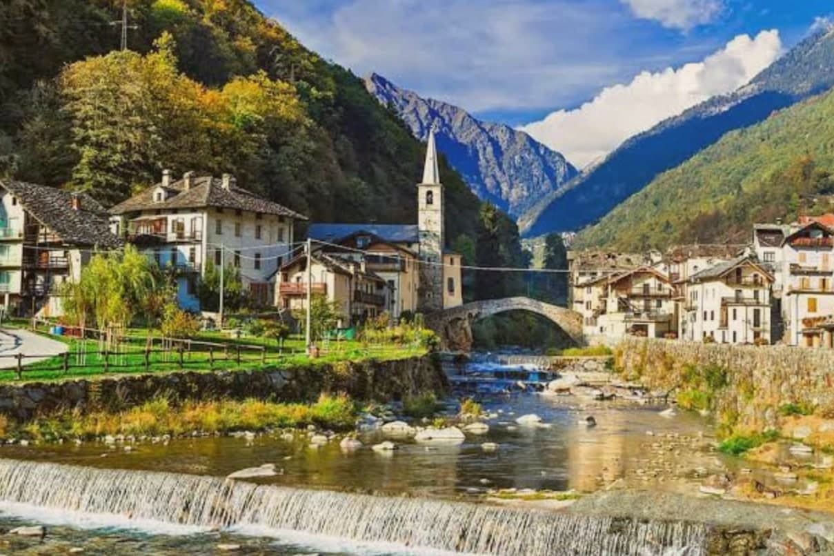
Valtournenche sits at 1,524 meters along the Marmore torrent, a long upper-valley commune running from Châtillon up to the Italian foot of the peak the Swiss call the Matterhorn. The road from Châtillon climbs 1,000 meters over 27 kilometers and ends at the glacier, tracing the whole rise of the valley in a single line from river town to ice.
The village itself is the older story, set apart from the resort that grew up at the valley head. It was here that the guide who led the Italian race for the mountain was born in 1829, reaching the summit from the southwest ridge three days after the British party arrived from the Swiss side.
The gorge below the resort was opened to visitors that same year, a second, quieter opening alongside the mountain's. Upper valley and lower village, resort and centro storico, read together as one place organized around a single ascent: the mountain gave the valley its name abroad, the village gave it the men who first climbed it.
The village sits at 1524 metres.
What to see in Valtournenche
- Il Cervino. The pyramidal peak closes the valley head, a wall of rock and ice standing over the resort and the village below it.
- Breuil-Cervinia. Resort frazione with around 150 kilometers of pistes linked across the border to Zermatt.
- Piazza delle Guide. Main square of Valtournenche village, with a plaque listing the names of the Matterhorn guides born in the valley, Carrel among them.
How to get to Valtournenche
Torino is roughly 158 minutes away by road.
Our tip
December through April is the long ski season at Breuil-Cervinia, with the Theodul lifts running into Switzerland and the Plateau Rosa glacier holding snow long enough to keep skiing into summer. June through September is the climbing and hiking season, the months when the Carrel hut on the southwest ridge is staffed and the Tour du Cervino draws walkers around the mountain. May, October and November are the empty months. Festa Patronale di Cignana falls in August.
Courmayeur
Why visit Courmayeur
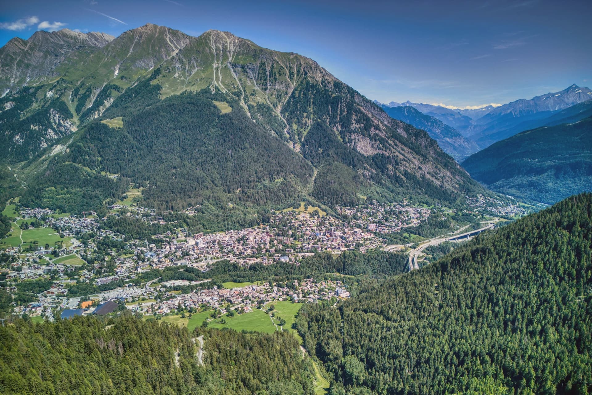
Courmayeur sits at 1,224 meters, at the foot of the southern face of the peak it shares with Saint-Gervais-les-Bains in France. The Romans called the place Curia Major and used it as a stop on the Via delle Gallie, the road running over the Little Saint Bernard pass.
The tunnel to Chamonix, opened in 1965, runs eleven kilometers and turned what had been a remote valley head into a year-round border town. Above the village, two side valleys open on either side: Val Ferret to the northeast and Val Veny below the Brenva and Miage glaciers, each carrying a stretch of the Tour du Mont Blanc and the Tor des Géants.
Via Roma, the old pilgrim route, still runs through the center between them, its line unchanged even as cafés and hotels have filled in around the church and the medieval tower that predate the resort. What holds the town together is that layering: a Roman crossing, a pilgrim street, a mountaineering village, and a modern lift system all occupying the same narrow ground at the base of one mountain, each era built over rather than replacing the last.
The village sits at 1224 metres.
What to see in Courmayeur
- Skyway Monte Bianco. Two-stage ascent from Pontal d'Entrèves to Punta Helbronner, the cabins rotating slowly as they climb so the panoramic terrace on the Mont Blanc massif comes into view from every side before arrival.
- Val Ferret. Side valley running northeast along the Italian flank of the massif, traversed by the Tour du Mont Blanc and Tor des Géants.
- Val Veny. Parallel side valley below the Brenva and Miage glaciers, with road access in summer and the Notre-Dame de Guérison sanctuary.
How to get to Courmayeur
Torino is roughly 121 minutes away by road.
Our tip
December through March is the high season: the Plan Chécrouit and Val Veny lifts run, the Skyway draws lines for the Punta Helbronner terrace, and the Mont Blanc Tunnel funnels weekend traffic from Chamonix. June through September is the mountaineering season, when the Tour du Mont Blanc passes through Val Ferret and the high refuges open. April, May, October and November are the shoulder months.
More from Anywhere Italy
- The best ski towns in the province of Valle d'Aosta/Vallée d'Aoste
 The best towns that eat well in the province of Valle d'Aosta/Vallée d'Aoste
 The best mountain towns within two hours of Turin
- The best hidden hill towns you can reach by train within 90 minutes of Torino
- The 6 best hidden towns you can reach by train that eat well within 90 minutes of Torino
 The best small wine towns within 90 minutes of Torino