
Umbria · Perugia
Bettona
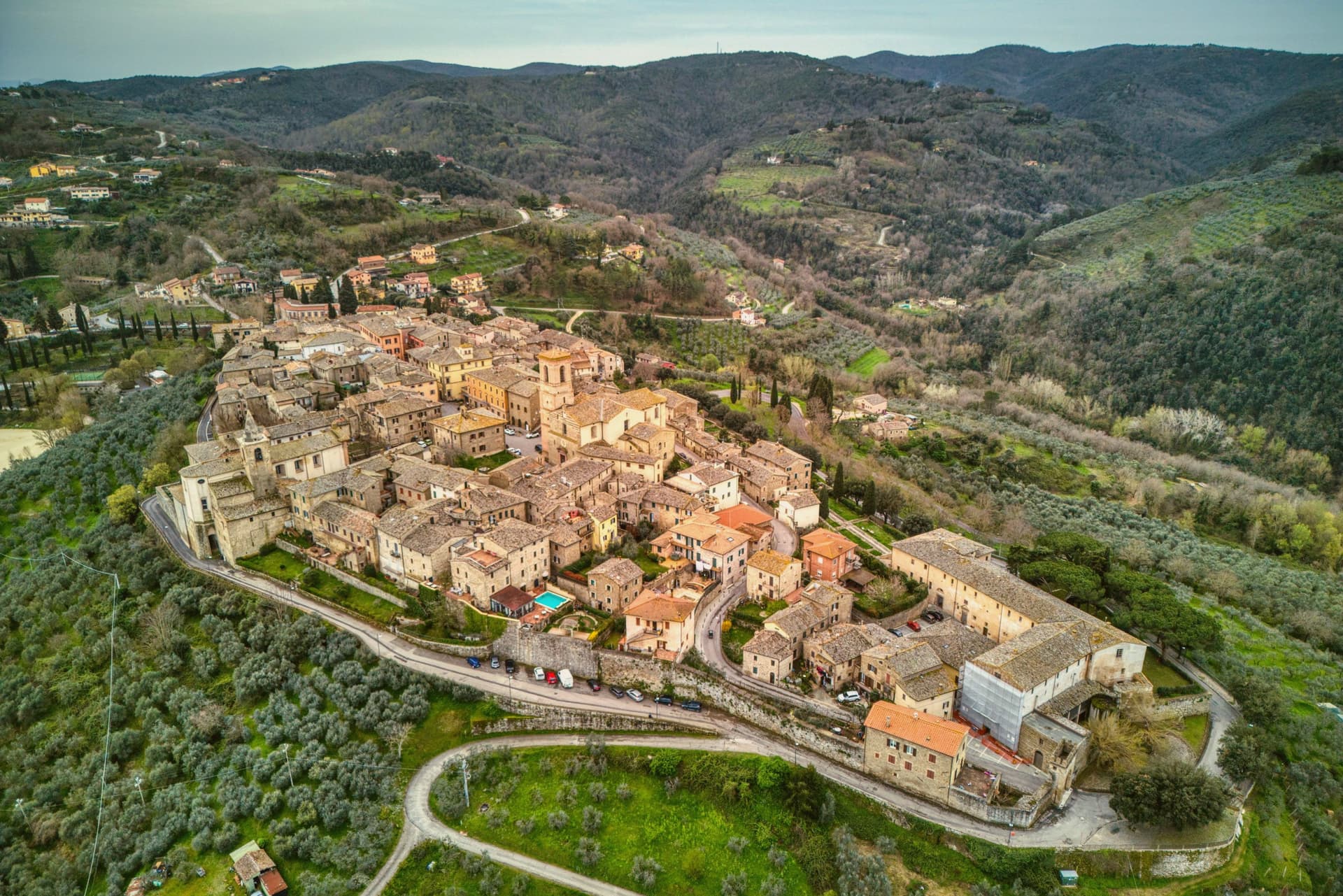
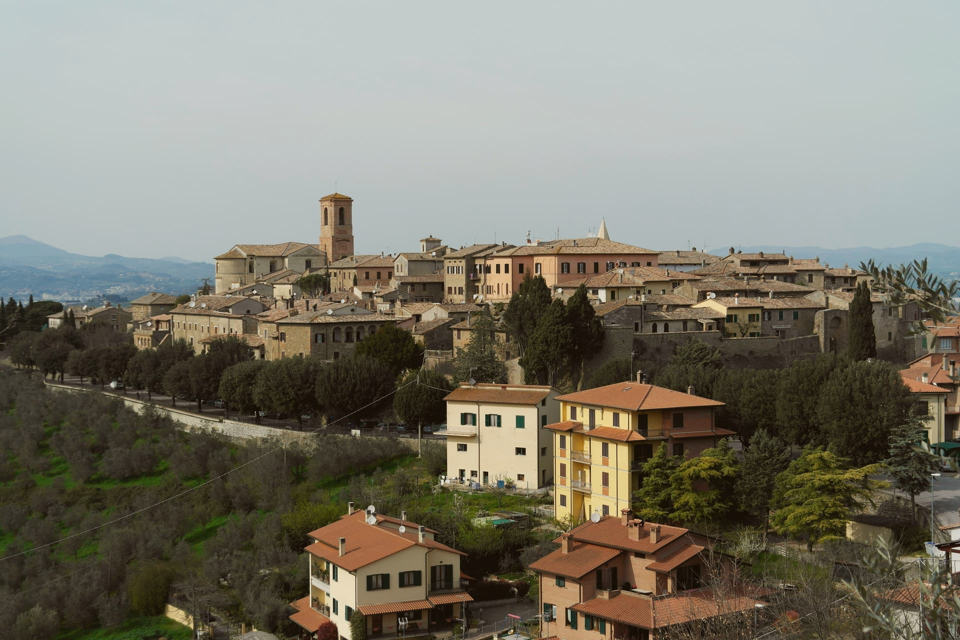
A hill town between the Topino and Chiascio rivers, the only Etruscan settlement ever built east of the Tiber.
By Peter Benei
Written about. No. 76.
The letter
Bettona got its letter. One town at a time, free. The photo, the food, the festa.
Visiting
- Best time
- Apr–Oct
- By car
- 25 min from Perugia
- Population
- 4,227
- J9°
- F12°
- M14°
- A17°
- M23°
- J28°
- J32°
- A32°
- S26°
- O21°
- N14°
- D10°
- Best
- Hot or crowded
- Quiet
- Mostly closed
Daytime air temperature, averages for 2020–2024. Weather data by Open-Meteo.com.
Why come
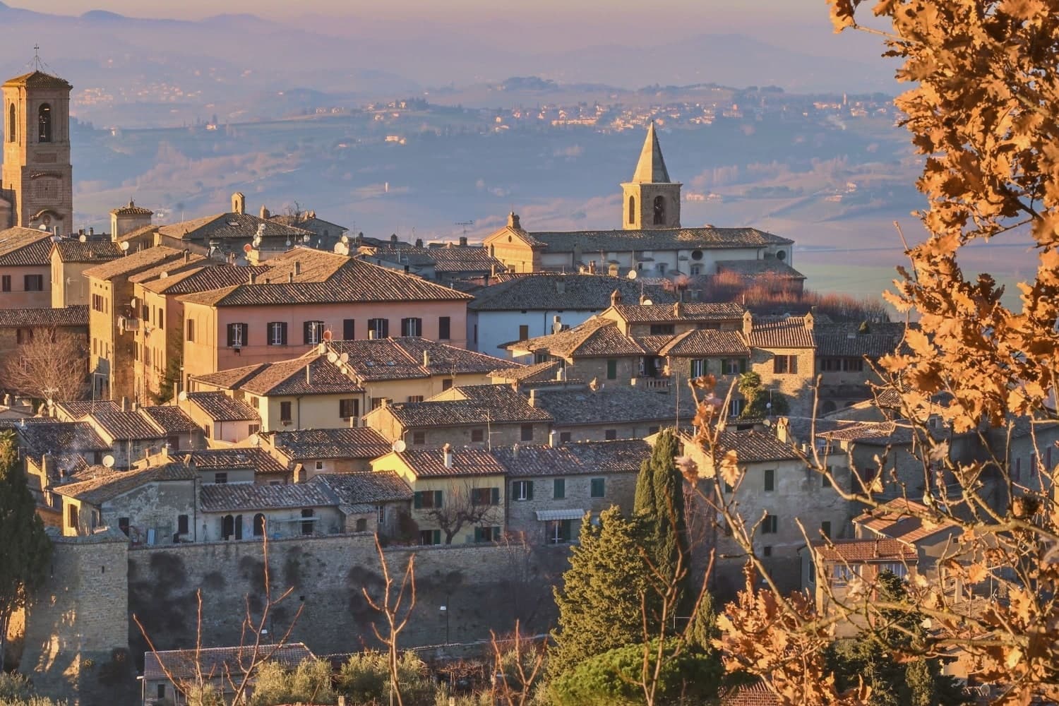
Bettona sits on a hill north of the Colli Martani, looking across the cultivated plain toward Perugia. The Etruscans built here in the seventh century BC, and Bettona remains the only known Etruscan settlement east of the Tiber. Stretches of polygonal walls from that period are still visible at the base of the medieval circuit, mixed with later Roman blocks.
The town became a municipium under Augustus, declined during the barbarian invasions, was sacked by Totila in 548, and rebuilt as a self-governing commune by the late twelfth century. Papal rule held from 1648 to unification. The Pinacoteca Civica, housed in the Palazzetto del Podestà on Piazza Cavour, keeps two paintings by Pietro Perugino (Sant'Antonio da Padova and Madonna della Misericordia), tabernacle panels attributed to El Greco, and Etruscan funerary stones and architectural terracottas from the territory. The olive groves below town carry the Città dell'Olio designation.
How to get there
From Ancona (AOI), about 1 h 50 min by car.
Rome Fiumicino (FCO) is about 2 h 21 min away.
By car from the center of Perugia 25 min, Siena 1 h 47 min or Ancona 2 h 2 min.
Coming by train into Perugia? Bettona is about 25 min away by road.
Every town within reach of Ancona airport.
First time driving in Italy? Read our complete manual.
What to see
Mura etrusche
Stretches of polygonal Etruscan walls visible at the base of the medieval circuit, from the seventh and sixth centuries BC.
Pinacoteca Civica
Civic art gallery in the Palazzetto del Podestà holding two Perugino paintings, tablets attributed to El Greco and Etruscan finds.
Chiesa di Santa Maria Maggiore
Main parish church on Piazza Cavour, with a reordered interior holding altarpieces and a Crocifissione fresco.
Piazza Cavour
Small central square framed by the Palazzetto del Podestà and the parish church, the social heart of the borgo.
Chiesa di San Crispolto
Romanesque church on the edge of the centro storico, dedicated to the first bishop and patron of the town.
Living here
Could you live here?
Bettona is at the end of the road.
- A village of 4,227. The nearest town of 5,000 people, Deruta, is 16 min away: past our 15-minute rule, which makes this the end of the road.
- Perugia, a city of 162,050, is 25 min by car. Closer than our 30 to 60 minutes: handy for everything, so check the town still keeps a life of its own.
The rules come from our series Where to Move in Italy, written from the places we have lived: Part 1, The End of the Road · Part 2, The Small Town · Part 3, The City · Part 4, The Postcard · Part 5, The Other Half. The towns we would pick are in Part 6, The Best Towns.
- Population 4,227, down 2.2% since 2015
- Nearest city Perugia, 25 min drive
- Nearest national health service hospital Assisi, 14 km as the crow flies · how healthcare works in Italy
- Homes in the center: €520 to €730 per m² to buy, €1.80 to €2.50 per m² a month to rent
All the numbers Common questions, designations, lists and sources.
More about living here
- Commuter belt
- Pharmacy: none mapped
- High school within a 30-minute drive
- Full fibre reaches 55% of homes
- Primary school in the comune
- Earthquake zone 2, medium hazard
- Perugia airport (PEG), 21 min drive, the nearest with scheduled flights
- Regional capital Perugia, 25 min drive
If you are moving here
Who lives here
9% of residents are foreign citizens, most often from Romania, Morocco and Albania, against 9% across Italy. 25 of them come from English-speaking countries or western and northern Europe, mostly the United States. There are 228 people over 65 for every 100 children under 15, against 216 across Italy. 26% of homes have no resident, holiday homes and empty ones counted together, against 27% across Italy. Perugia province ranks 37th of 107 in Il Sole 24 Ore's quality of life ranking for 2025.
Health and schools
The nearest emergency room is in Assisi, 14 km as the crow flies. The nearest major one is in Perugia, 16 km away. The nearest IB school is Viterbo International School, 73 km as the crow flies. The nearest school listed as international is Assisi International School, 10 km away.
Information, not medical advice. Confirm with a professional.
Taxes
A home that is not your main one pays 1.06% a year in property tax, charged on the cadastral value rather than the price. A main home pays none unless it is in a luxury category. The town adds 0.8% to your income tax. 7% pensioner tax: this town is not in a qualifying area.
Information, not tax advice. Confirm with a professional.
What it costs
The average household in Umbria spends about €2,310 a month, €550 of it on food, against about €2,170 across Italy. A family of three pays about €677 a year for water, on the Umbria average. In Perugia, the provincial capital, in September 2026, an espresso cost €1.23, a meal in a pizzeria €12.04 and a man's haircut €20.47.
Climate and risk
It is in climate zone E, on a scale from A, the warmest, to F, the coldest, and heating may run from October 15 to April 15, up to 14 hours a day, unless the mayor changes it. 12% of residents live in a zone the national maps rate high for floods, 15% in a high or medium one. Under 1% live in a zone rated high or very high for landslides.
These shares cover the whole comune, not any one street. Check an address on IdroGEO.
Moving from abroad? Which visa you need. Sources: ISTAT, the Ministry of Health, ISPRA, the Finance Ministry, the Ministry of Enterprise, Poste Italiane, the comuni, the IB, International Schools Database, Il Sole 24 Ore, Cittadinanzattiva.
Known for
ETRUSCAN OUTLIER
The only known Etruscan settlement east of the Tiber, with polygonal walls and tular boundary stones from the seventh century BC.
PERUGINO
Two paintings by Pietro Vannucci in the Pinacoteca: Sant'Antonio da Padova and the Madonna della Misericordia with Saints.
OLIVE OIL
Carries the Città dell'Olio designation; the Bettonese olive groves cover the hills sloping down toward the Chiascio valley.
Common questions
- What is Bettona known for?
- Bettona is a hill town at 353 meters between the Topino and Chiascio rivers, the only Etruscan settlement ever built east of the Tiber.
- Where is Bettona?
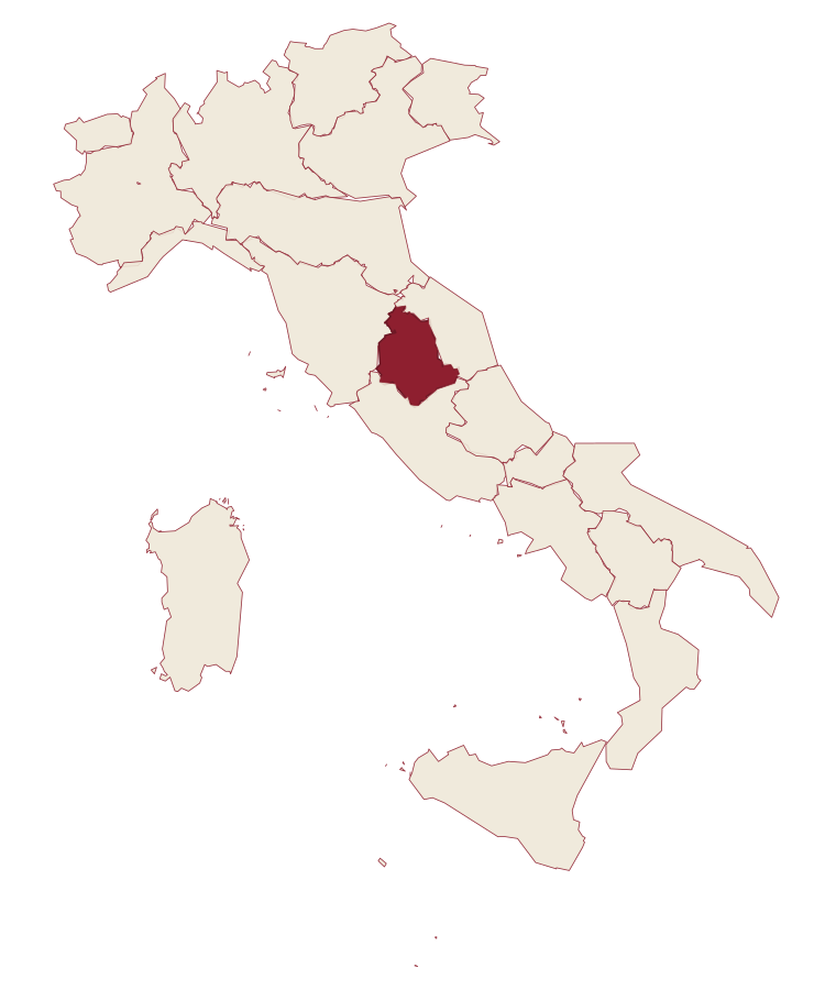
- Bettona is a comune in the province of Perugia, in Umbria.
- What is the nearest airport to Bettona?
- The nearest airport with scheduled flights is Perugia (PEG), about 21 min by car.
- How long is the drive from Perugia to Bettona?
- About 25 min by car.
- When is the best time to visit Bettona?
- Best in Apr–Oct. July is the warmest month, averaging 32 degrees, and December the wettest, with about 13 rain days.
- Which other towns are like Bettona?
- Bevagna, Montefalco and Nocera Umbra.
- How many people live in Bettona?
- 4,227 residents, by ISTAT's count on 1 January 2025.
- Is Bettona a good place to live?
- By the rules in our Where to Move in Italy series, Bettona is at the end of the road: the nearest town of 5,000 people, Deruta, is 16 min away. The nearest city, Perugia, is 25 min away by car. The nearest national health service hospital is in Assisi, 14 km as the crow flies. Full fibre reaches 55% of homes.
Tags & data designations · numbers · sources
Landscape
The numbers
- Elevation: 353 m
- Population: 4,227
- Surface area: 45.08 km²
These figures were compiled from public directories: ISTAT, OpenStreetMap and Wikidata, and from the official listings of the guides named on this page. Town details change; verify with official sources before you travel.
The ranked lists
Lists Bettona appears in
- The 6 best olive oil towns inside a nature park in UmbriaUmbriaolive oilinside a park6 towns · smallest 937 residents
- The best small olive oil towns in the province of PerugiaPerugia provinceolive oilsmall6 towns · smallest 334 residents
- The best small olive oil towns within 90 minutes of PerugiaNear Perugiaolive oilwithin 90 minsmall7 towns · smallest 937 residents · closest 27 min away
- The 9 best small olive oil towns in UmbriaUmbriaolive oilsmall9 towns · smallest 334 residents
- The prettiest villages inside a nature park within 90 minutes of PerugiaNear Perugiainside a parkwithin 90 minprettiest villages9 towns · smallest 937 residents · closest 19 min away
- The best hidden towns inside a nature park in the province of PerugiaPerugia provinceinside a parkhidden10 towns · smallest 937 residents
Near here, with a letter
- Written about. No. 89.
Torgiano
Province: Perugia
A walled river town at 219 meters at the confluence of the Tiber and the Chiascio, the first DOC and DOCG zone in Umbria.
17 min by car
- Written about. No. 79.
Foligno
Province: Perugia
A valley town at 235 meters on the Topino, where Dante's Divine Comedy was first printed in 1472.
19 km away
- Written about. No. 81.
Montefalco
Province: Perugia
The hilltop wine capital of Umbria at 472 meters, where Sagrantino is grown almost nowhere else.
19 km away
The letter
Bettona got its letter. One town at a time, free. The photo, the food, the festa.
Paid plans, the moving year and the books are on the membership page.