
The best towns you can reach by train within an hour of Trieste
This is the corner of Italy where the Alps, the Karst and the Adriatic all run out at once, and the railway threads between them. Within an hour of Trieste's station you can be standing on a Roman basilica floor of coloured mosaic, walking the ramparts of a Venetian fortress laid out as a star, or eating boiled pork with mustard and grated horseradish in an inn that leans more towards Vienna than Rome. The houses are built from pale Istrian and Karst limestone, which holds the light differently from Tuscan render. Autumn is the season that rewards the trip most, when the Collio hills turn and the new white wines, friulano, ribolla gialla, malvasia, come out of the cellars.
Most travellers heading this way are actually heading somewhere else. Venice is a couple of hours down the same line, and it absorbs almost everyone who buys a rail ticket in this part of the country, filling its vaporetti and its bridges while the plain behind Monfalcone stays empty. The regional trains that run inland and along the gulf carry commuters, students and very few visitors. It is one of the least contested railway networks in Italy.
The stations, though, keep going past the famous name. The same line that brings people to the lagoon also stops at towns with Roman ports silted up under farmland, at garrison towns built to hold a frontier, at hill towns where the border with Slovenia runs through the middle of a square. These are the places in this list, all of them with a station we have confirmed you can arrive at without a car.
Of the 10 communes we have mapped in a one-hour drive of Trieste, 8 qualify as towns you can reach by train: we confirmed a station you can arrive at. The smallest, Aquileia, has 3,128 residents.
Elsewhere in the catalogue: The best hidden towns you can reach by train in Friuli-Venezia Giulia and The best wine towns in Friuli-Venezia Giulia.
Aquileia
Why visit Aquileia
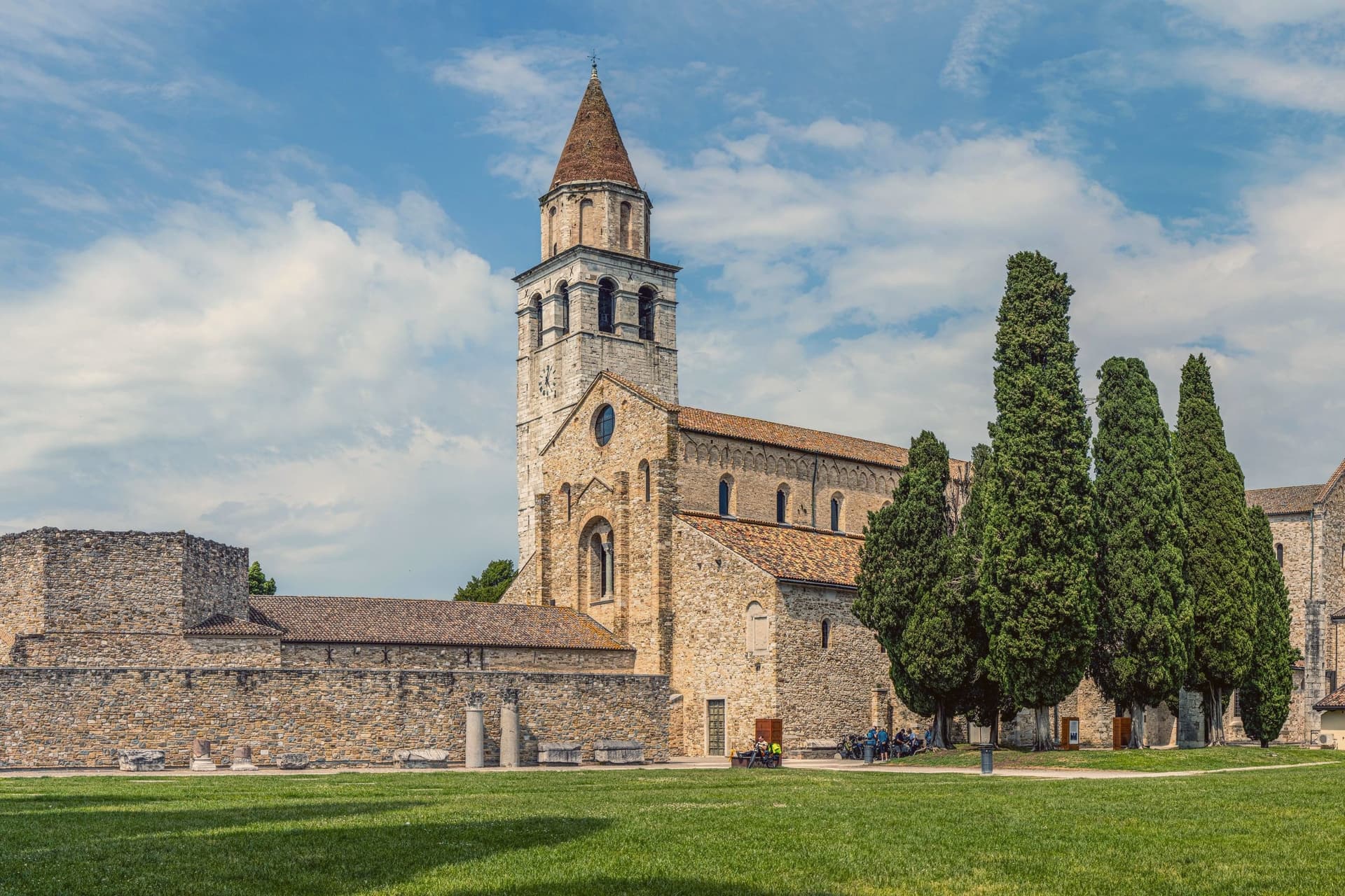
Aquileia sits at five meters above sea level on the Friuli plain, ten kilometers inland from the Adriatic at the head of the Grado lagoon. Rome founded it as a military colony in 181 BC.
By the second century AD it held close to 100,000 people, was the capital of Augustus's Regio X, and ranked among the nine great cities of the empire. Attila's Huns sacked it in 452, the population scattered to the lagoon islands, and the surface town never recovered.
The Roman city below is largely unexcavated, which makes Aquileia, in UNESCO's words, the most complete example of an Early Roman city in the Mediterranean. Above it, Patriarch Poppo rebuilt the basilica in 1031 over a fourth-century church.
Its floor is the largest paleochristian mosaic in the Western world, 760 square meters of fish, birds, jonah and the whale, uncovered by archaeologists in 1909. The 73-meter campanile uses stone quarried from the Roman amphitheater.
The Patriarchate of Aquileia survived until 1751.
We confirmed you can reach this one by train.
What to see in Aquileia
- Basilica di Santa Maria Assunta. Patriarch Poppo's eleventh-century basilica over a fourth-century church, with a 760-square-meter paleochristian mosaic floor uncovered in 1909.
- Campanile di Poppo. Free-standing 73-meter bell tower built in the eleventh century with stone quarried from the Roman amphitheater, raised again in the fourteenth.
- Foro Romano. Excavated section of the Roman forum along the Via Sacra, with the bases of columns and reused capitals from the second century AD.
How to get to Aquileia
There is a railway station in the town, so you can arrive without a car and never need one while you are here. Udine is roughly 43 minutes away by road.
Our tip
May through September is the working season for Aquileia. The basilica is open daily, the archaeological park stays light until late, and the lagoon at Grado five kilometers south is swimmable. July and August are hot and humid on the plain, often pushing above thirty-two degrees, and the mosaic floor is the coolest room in town. Festa dell'Unità falls in July.
Palmanova
Why visit Palmanova
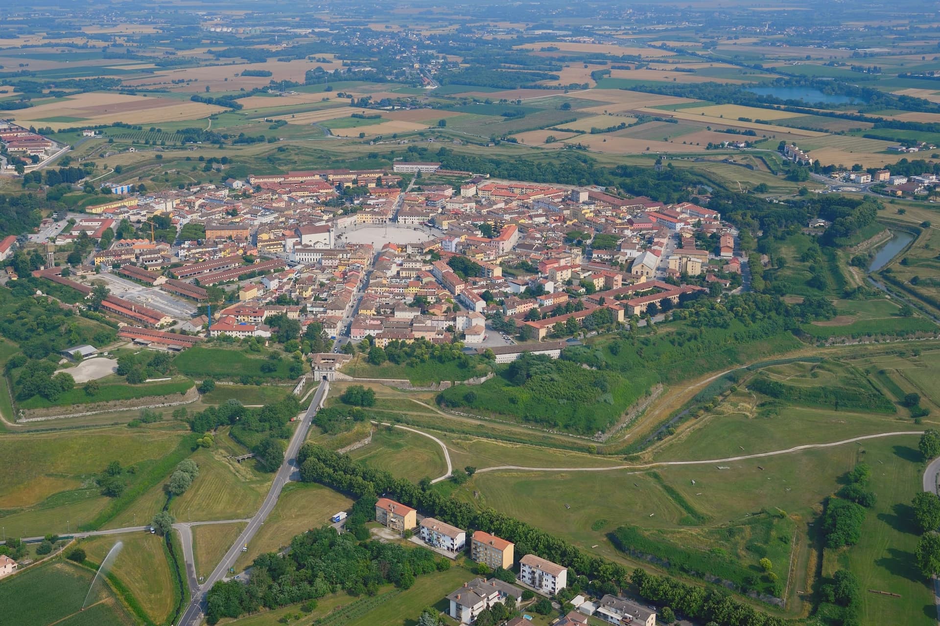
Palmanova stands at 26 meters on the Friuli plain, between Udine and the Adriatic, on ground that in 1593 was open country twenty kilometers from the Habsburg border. The Venetian Republic chose the feast of Santa Giustina to found it, and built the geometry on Marcantonio Barbaro's design: nine points radiating from a six-sided center, three ring streets running concentric to the walls, ramparts angled so each point covers the one beside it.
The town has no separate old and new quarter, no upper and lower half. It is one plan, laid down whole and then filled in slowly: the piazza paved in 1602, the first ring of bastions closed in 1623, the second between 1658 and 1690, the third under a different army entirely between 1806 and 1813.
Venice began the design, an emperor finished it, and the interval between the two is longer than most towns take to form by accident. The city never had to defend itself in earnest.
What was built as a machine for war became, over three centuries and two occupations, simply a shape. Everything the town now shows a visitor, the star, the gates, the ring roads, is the residue of a defense that was never used.
We confirmed you can reach this one by train.
What to see in Palmanova
- Piazza Grande. Hexagonal square laid out in 1602, six sides facing six radiating streets, ringed by the Duomo Dogale, the Loggia della Gran Guardia, and six bronze statues of the founding Provveditori.
- Duomo Dogale. Commissioned 1603, finished 1636, attributed to Scamozzi and Longhena. Baroque facade fronting a single Venetian nave, standing at the piazza's edge.
- Cinta muraria. The rings can still be walked in sequence: the 1623 line, the 1690 line, and the outer 1813 line, each built to a different generation of cannon range.
How to get to Palmanova
There is a railway station in the town, so you can arrive without a car and never need one while you are here. Udine is roughly 29 minutes away by road.
Our tip
April through June and September into October are the months Palmanova rewards. The fortress walls and the glacis around them are walkable in the cool, the Piazza Grande sits in shade by mid-afternoon, and the historical reenactment A.D. 1615 fills the centro in early September with Venetian-era costume drills. July and August push past thirty-three degrees on the open plain and the hexagonal piazza, fully exposed, becomes one of the hotter squares in the region between noon and four. Palmanova torna al 1615 falls in the season.
Gradisca d'Isonzo
Why visit Gradisca d'Isonzo
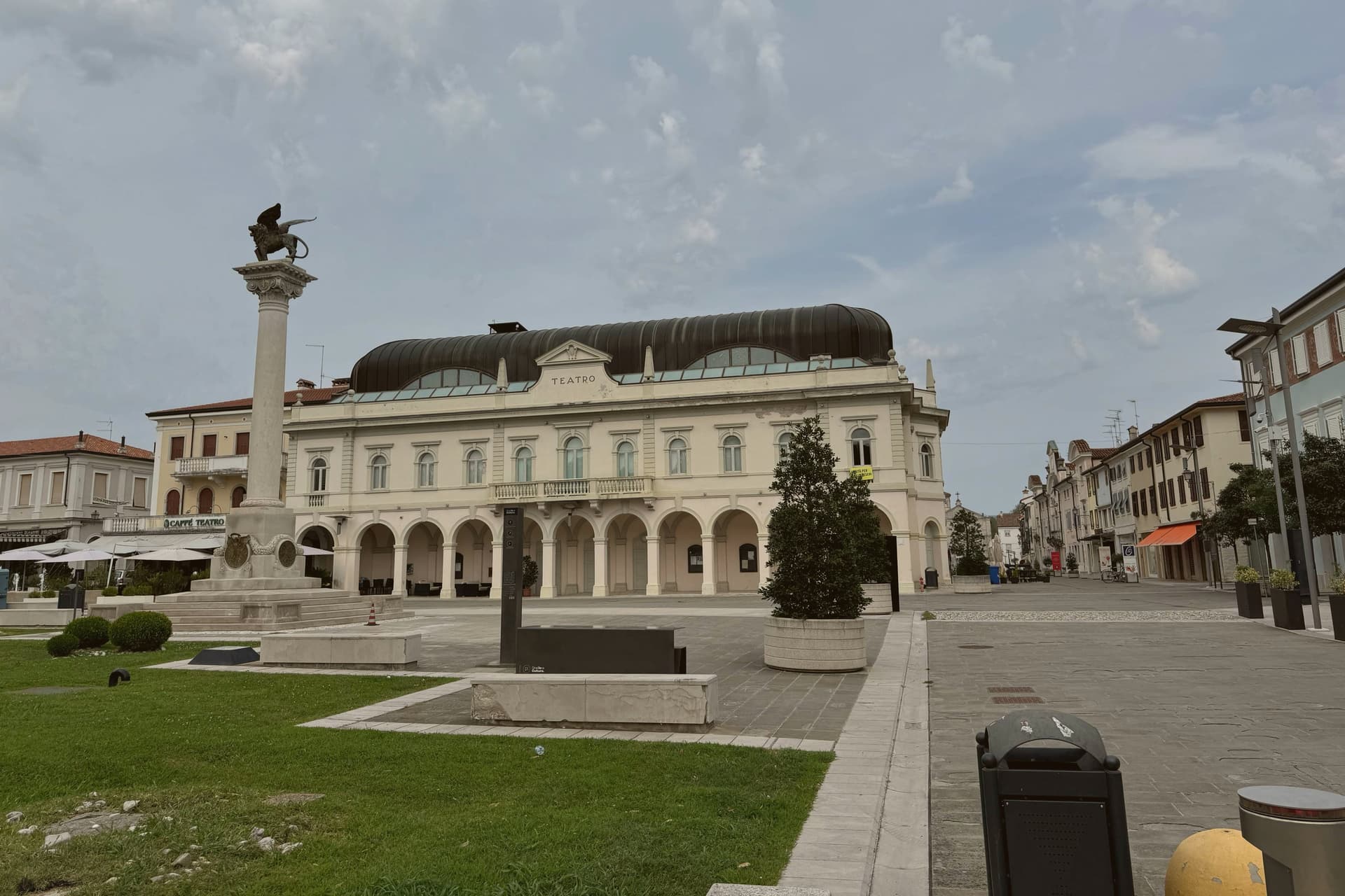
Gradisca d'Isonzo sits at 32 meters on the right bank of the Isonzo, ten kilometers downriver from Gorizia. The Venetian Republic built it from scratch starting in 1479 as a frontier bastion against Ottoman raids that had reached Friuli the previous decade.
The fortification consumed twenty years and the advice of Leonardo da Vinci, sent here by the Senate in 1500 to redesign the artillery defenses. The result was a walled town twenty meters high, ringed by seven towers and a wide moat, with the river itself diverted into the defenses.
Maximilian I took it for the Habsburgs in 1511 during the War of the League of Cambrai, and it stayed in Austrian hands as the seat of the Principesca Contea di Gorizia e Gradisca for the next four centuries. The town that grew inside the walls is Baroque: the Palazzo Torriani, the Loggia dei Mercanti, the Casa de Fin, all built under the Habsburgs.
Casanova passed through in 1773. Today the walls, towers, and grid still hold.
We confirmed you can reach this one by train.
What to see in Gradisca d'Isonzo
- Fortezza Veneziana. Walled town from 1479, twenty meters high, ringed by seven towers and a wide moat, designed in part by Leonardo da Vinci in 1500.
- Torre di San Giorgio. Northwest bastion tower of the Venetian wall, the most complete of the seven and the symbol of the borgo.
- Palazzo Torriani. Sixteenth-century palazzo of the Della Torre family, later the residence of the Austrian Capitano, now the Town Hall on Via Roma.
How to get to Gradisca d'Isonzo
There is a railway station in the town, so you can arrive without a car and never need one while you are here. Udine is roughly 34 minutes away by road.
Our tip
April through June and September into October are the best months for Gradisca. The Isonzo runs blue-green from the Julian Alps snowmelt, the cycle path along the river opens, and the Saturday market fills the Spianata. July and August bring the heat the Friuli plain is known for, often above thirty-three degrees with high humidity, and the centro storico empties from two until six.
Cormons
Why visit Cormons
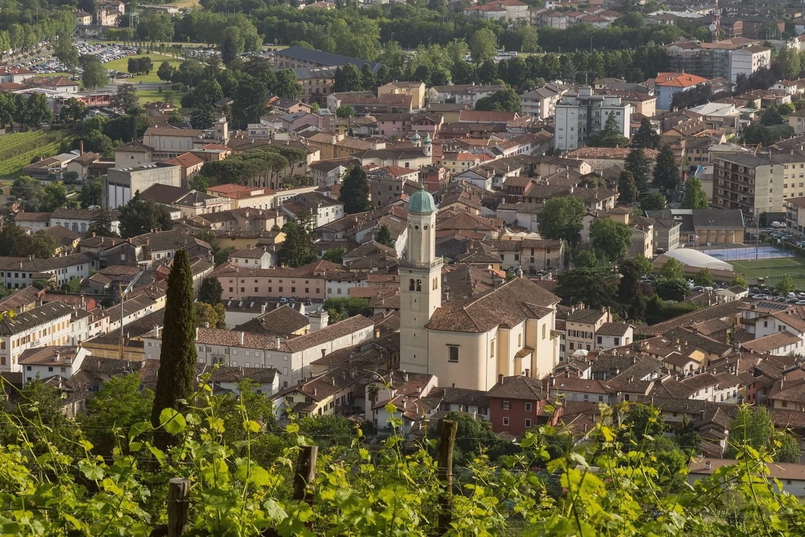
Cormons sits at 51 meters where the Friulian plain rises into the Collio hills, twelve kilometers west of Gorizia on the Slovenian border. Once a Lombard fortress, then a residence of the Patriarchs of Aquileia, the town was contested between Venice and the Habsburgs and stayed Austrian from 1500 to 1918.
Palazzo Locatelli and Palazzo Waiz Del Mestri, facing the main square, keep the Viennese restraint of that period, and the church that anchors the square dates from the same Habsburg-era rebuilding. The vineyards begin on the slopes immediately north of town, where the soil locals call ponka gives way to the hill of Monte Quarin above, its ruined fortress looking down over the DOC zone and across the border into Slovenia.
The cooperative cellar draws its grapes from growers scattered through those same slopes. In 1870 Count La Tour brought French vines into nearby Russiz di Capriva for the Imperial Court palate, which the 1891 Austrian Oenological Congress in Gorizia codified.
What holds the town together is the border itself: a fortress height, a planted slope, and a square built by the empire that once ruled both, still standing in the order Austrian rule left them.
We confirmed you can reach this one by train.
What to see in Cormons
- Piazza della Libertà. Central Habsburg-era square framed by Palazzo Locatelli and other Austrian-influenced civic buildings, with the statue of Emperor Maximilian I at its center.
- Duomo di Sant'Adalberto. Eighteenth-century cathedral on the central square, the principal church of the Habsburg-era town, with painted ceiling and altarpieces of the period.
- Monte Quarin. Hill above Cormons (274 m) with ruins of the Lombard-patriarchal fortress, panoramic views over the Collio vineyards and into Slovenia.
How to get to Cormons
There is a railway station in the town, so you can arrive without a car and never need one while you are here. Udine is roughly 34 minutes away by road.
Our tip
April through June is the green window on the Collio hills, vines budding then leafing, ponka soil still cool from spring. September and October are the vendemmia months, the harvest dictating the rhythm of every cantina in the commune. July and August are warm and humid, the plain's heat pushed into the hills; tasting rooms run on appointment. Borgnano in Festa! falls in August.
Muggia
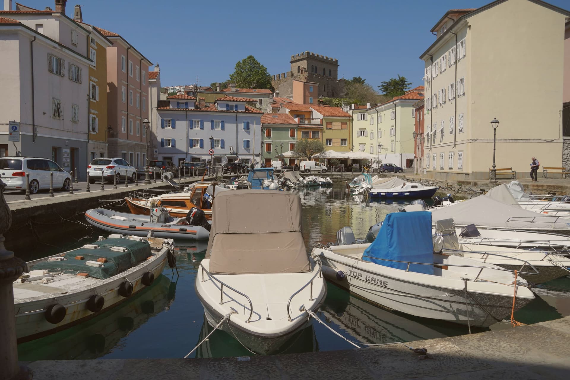
Why visit Muggia
Muggia sits at 13 meters on the eastern flank of the Gulf of Trieste, the only Italian port town on the Istrian peninsula and the last commune before the Slovenian border. The bones go back to a prehistoric castelliere, eighth or seventh century BC, which the Romans turned into Castrum Muglae in 178 BC.
After Venice took it in 1420 the town acquired the architecture it still wears: tri-lobed Gothic facades, narrow calli, a mandracchio harbor ringed by pastel houses. The Duomo of Santi Giovanni e Paolo was consecrated in 1263 and faced with Aurisina limestone in 1467 in Venetian Renaissance Gothic.
After Venice fell in 1797, Muggia entered the Austrian Empire and grew on naval shipbuilding through World War II. The town joined Italy in 1918.
The Carnevale, ten parading companies in custom costumes, runs as the oldest in Friuli-Venezia Giulia.
We confirmed you can reach this one by train.
What to see in Muggia
- Duomo dei Santi Giovanni e Paolo. Cathedral consecrated in 1263, refaced in 1467 with Aurisina limestone and a tri-lobed Venetian Renaissance Gothic façade, the visual symbol of the town.
- Castello di Muggia Vecchia. Hilltop fortress above the town on the site of the prehistoric castelliere, rebuilt by Romans, the Patriarchate of Aquileia, and Venice, then abandoned.
- Mandracchio. Sheltered small-boat harbor at the center of the town, pastel houses lining the water, ranked among the fifteen most beautiful small ports in Italy.
How to get to Muggia
There is a railway station in the town, so you can arrive without a car and never need one while you are here. Trieste is roughly 22 minutes away by road.
Our tip
May through September is the open season on the gulf. The mandracchio fills with boats, tables spread along the water, evening temperatures stay in the low twenties. July and August bring crowds out of Trieste; the harborfront restaurants book up. Carnevale Estivo di Muggia falls in August.
Cervignano del Friuli
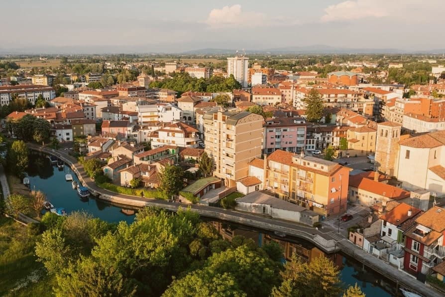
Why visit Cervignano del Friuli
Cervignano del Friuli sits at five meters on the lower Friuli plain, eight kilometers north of Aquileia and forty from Trieste. The town's origin is tied to Aquileia's founding in 181 BC: the Ausa, a short river that rises in karst springs and reaches the lagoon, served as a service port for the Roman colony, and the anchor in the comune's coat of arms still records that function.
The eleventh-century abbey dedicated to San Michele Arcangelo placed the village under the monastery of Aquileia. Venice took it in 1420, the Habsburgs retook it in 1521 with the Treaty of Worms, and it remained Austrian until World War I.
The railway to Trieste opened in 1860 and the station became one of the principal stops on the Vienna-Trieste line, which is why Cervignano grew faster than the older centers around it. Today, with 13,573 residents, it is the largest commune of the Bassa and the administrative anchor between Palmanova, Aquileia, and Grado.
We confirmed you can reach this one by train.
What to see in Cervignano del Friuli
- Duomo dei Santi Michele e Adalberto. Modern cathedral consecrated in 1964 on the site of the medieval abbey church, dedicated to the archangel and to the missionary saint of Prague.
- Chiesa di San Michele Arcangelo. 1780 parish church on the former Benedictine abbey footprint, with a single nave and a Baroque altar from the eighteenth century.
- Fiume Ausa. Short spring-fed river running through the centro, the historic inland port that linked Cervignano to Aquileia and the Adriatic in Roman times.
How to get to Cervignano del Friuli
There is a railway station in the town, so you can arrive without a car and never need one while you are here. Udine is roughly 31 minutes away by road.
Our tip
April through June is the right window in Cervignano. The plain is green, the cycle path along the Ausa runs all the way to Grado, and the temperature still leaves the centro walkable at three in the afternoon. July and August push into thirty-three degrees with high humidity coming off the lagoon; the centro empties between two and six.
Gorizia
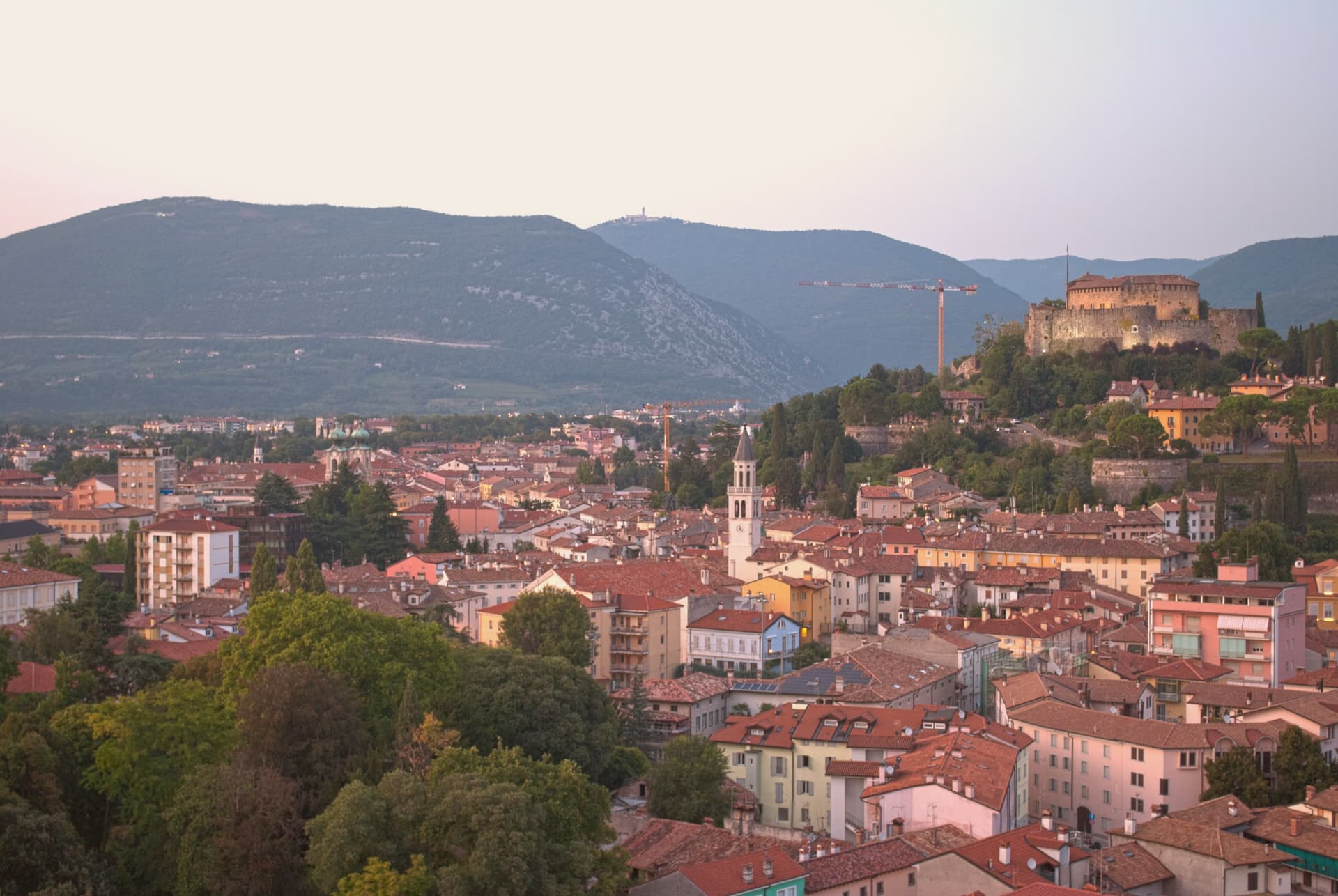
Why visit Gorizia
Gorizia sits at 84 meters at the foot of the Julian Alps, on the Slovenian border. The Counts of Gorizia held the town as an independent county from 1127 until 1500, when it passed to the Habsburgs, who kept it until 1918.
Annexed to Italy after World War I, the city lost part of its territory to Yugoslavia in 1947, when a wall went up that became one of the symbols of the Iron Curtain, cutting the border square in front of the railway station the Austrians had built in 1906 into two halves. Schengen lifted the border in 2007, and in 2025 Gorizia and Nova Gorica together held the joint cultural title that marked the year, the first cross-border holders in the program's history.
The city itself divides between the medieval upper town, Borgo Castello, rising around the eleventh-century castle, and the plain below, where the Isontino stretches out to produce Collio and Carso wines. The rebozzato cafés on Corso Verdi still serve in Friulian, Italian, Slovenian, and German, a hangover from a border that has moved but never quite disappeared.
A city built on a fault line, first political, then physical, now a shared cultural address for two towns that were once one and then were forced apart.
We confirmed you can reach this one by train.
What to see in Gorizia
- Castello di Gorizia. Eleventh-century castle on the hill above the city, restored after World War I damage, with museum rooms and ramparts open to walk.
- Borgo Castello. Medieval upper town inside the castle ramparts, the original nucleus of the city before it spread onto the plain below.
- Piazza della Transalpina (Trg Evrope). Border square cut in two by the 1947 line, reunited in 2004, with the old dividing line still marked by a strip of pavement tile. Served as the inauguration stage of European Capital of Culture.
How to get to Gorizia
There is a railway station in the town, so you can arrive without a car and never need one while you are here. Udine is roughly 41 minutes away by road.
Our tip
April through June and September into October are the working windows, the Isontino plain green or gold, the hill paths around the castle walkable without humidity. July and August carry the Friulian-plain heat moderated only slightly by altitude. The European Capital of Culture program in 2025 stretched events across all twelve months and proved that the city carries shoulder-season weight. Flavors of the Frontier falls in September.
Trieste
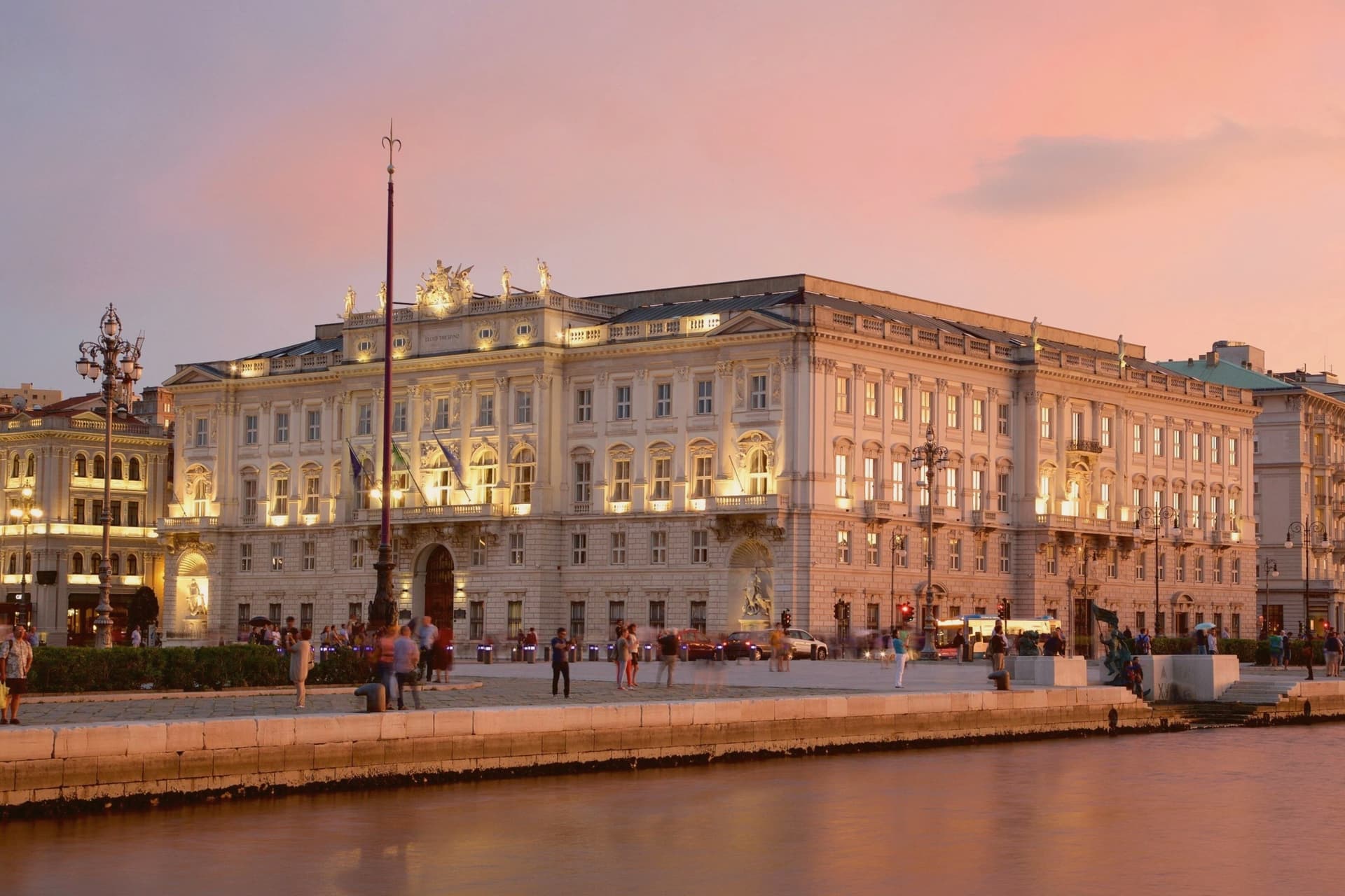
Why visit Trieste
Trieste sits at the head of its gulf, on a narrow strip of Italian land between the Adriatic and Slovenia. Rome made it a colony under Julius Caesar; Augustus built the harbor and walls around 33 BC.
The Habsburgs held the city from 1382 until 1918 and ran it as their empire's free port, the access route to the sea for Vienna: that arrangement set the shape of the modern city, laying out the Borgo Teresiano and the Canal Grande that cuts into it, and opening the great sea-facing square onto the water where the old town meets the Habsburg extension. The castle on the cliffs north of town was built by Archduke Maximilian, who left it for Mexico in 1864 and was executed three years later.
The former rice-husking plant used as the only Nazi camp on Italian soil with a crematorium sits in the southern industrial belt, apart from the imperial center. A city built as an empire's outlet to the sea, then handed over at the end of that empire, carries both the harbor it was built for and the border it was built against.
We confirmed you can reach this one by train.
What to see in Trieste
- Piazza Unità d'Italia. The largest sea-facing square in Europe, framed by Habsburg-era municipal and Austrian Lloyd buildings opening directly onto the Adriatic.
- Castello di Miramare. White castle on the cliffs north of the city, set in a park of acclimatized Mediterranean and exotic species.
- Cattedrale di San Giusto. Romanesque cathedral on the San Giusto hill, formed from the eleventh-century fusion of two adjoining basilicas, with fifth-century mosaics and a fourteenth-century rose window.
How to get to Trieste
There is a railway station in the town, so you can arrive without a car and never need one while you are here. Trieste is roughly 10 minutes away by road.
Our tip
May through September is the open season on the gulf. The bora, the dry northeast wind that defines Trieste weather, drops off, the cafés put tables on Piazza Unità, and the Barcola sea promenade fills with swimmers. July and August are warm but moderated by the sea, less heavy than the Friulian plain. Sagra di San Marco falls in April.
More from Anywhere Italy
 The best hidden towns you can reach by train in Friuli-Venezia Giulia
- The best wine towns in Friuli-Venezia Giulia
- The best hidden wine towns you can reach by train within 90 minutes of Udine
 The best towns that eat well within 75 minutes of Trieste
- The best towns you can reach by train that eat well in Friuli-Venezia Giulia
- The 6 best towns you can reach by train in the province of Udine