
The best towns known for their meat within two hours of Turin
Piedmont eats meat with a seriousness that borders on liturgy. Raw beef dressed with nothing but oil, lemon and a little garlic. Salami cured slowly in stone cellars where the damp does the work, boiled cuts served with green sauce and mustard fruits, and in autumn the long braises that want a glass of Nebbiolo beside them. The landscape backs it up: chestnut woods, rice plain edges, stone and brick villages with slate roofs, butchers who still name the farm. Come between October and February and the menus turn frankly carnivorous.
Most people who want to eat well near Turin drive to Alba and the Langhe, and with reason, because the truffle fair and the wine cellars are good. The result in autumn is booked tables, coach parties on the hill roads and prices that reflect the postcode. The same weekend, valleys an hour in the other direction are quiet.
The protected meats do not stop at the famous hills. The cured pork zones run west into the Ligurian interior above Albenga and north through the Novarese and the Biellese, and that is where these towns are. Fewer visitors, cellars and butchers that supply their own province, and lunch at a price that still makes sense.
Of the 84 communes we have mapped in a 120-minute drive of Turin, 7 qualify as towns known for their meat: each sits inside the production zone of a protected meat. The smallest, Castelvecchio di Rocca Barbena, has 130 residents.
Elsewhere in the catalogue: The best towns known for their meat within two hours of Genoa and The best hill towns within 90 minutes of Novara.
Castelvecchio di Rocca Barbena
Why visit Castelvecchio di Rocca Barbena
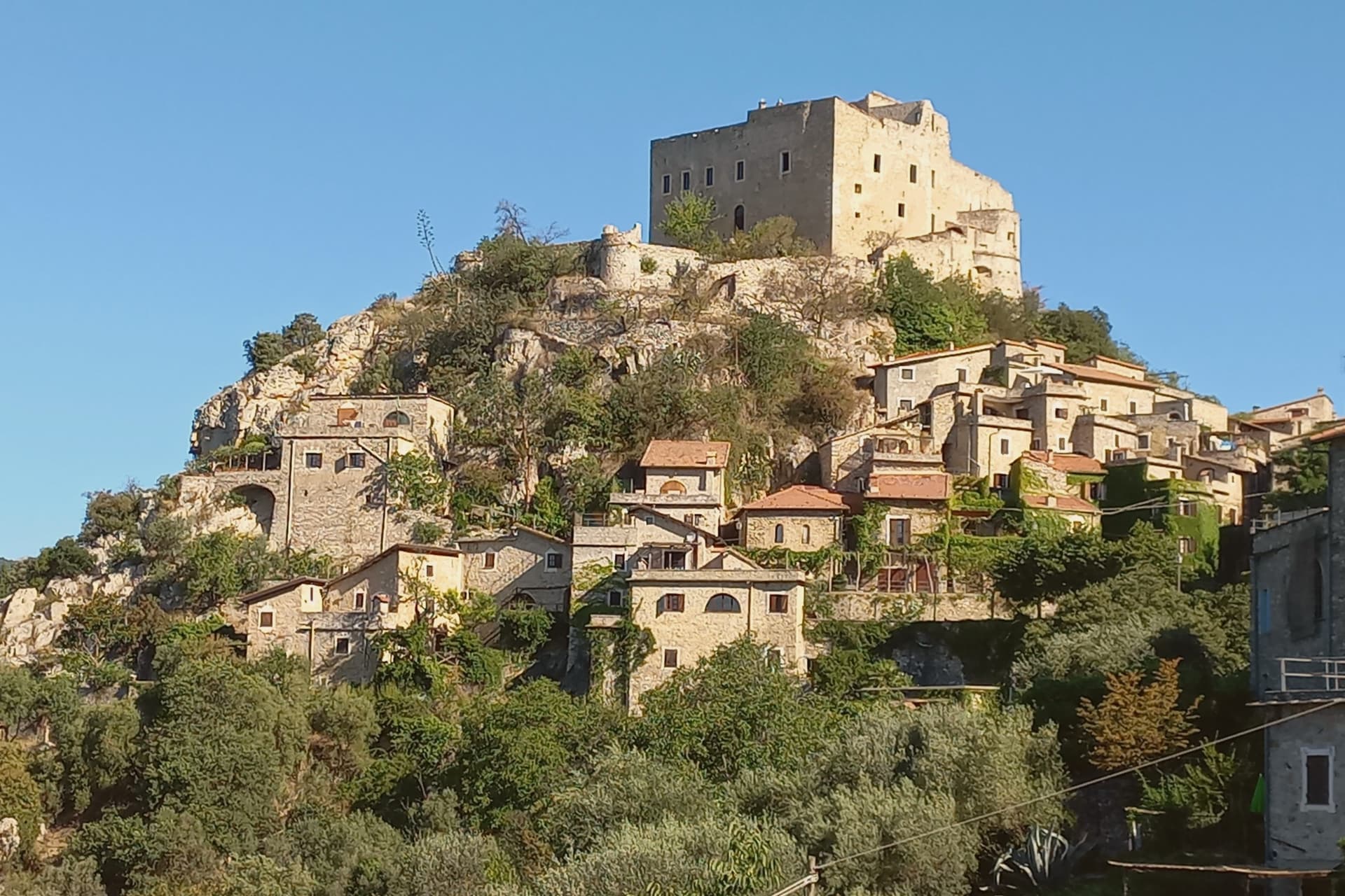
The village takes its second name from the outcrop at whose southern foot it sits, above the valley that gives the area its own name. It dates to the eleventh century and was a fief of the Marquis of Clavesana through the twelfth and thirteenth, before losing importance to neighboring Zuccarello.
It was sold to the House of Savoy in 1623, besieged in 1672, and ceded to the Republic of Genoa. The commune is the second-smallest in Savona province by population.
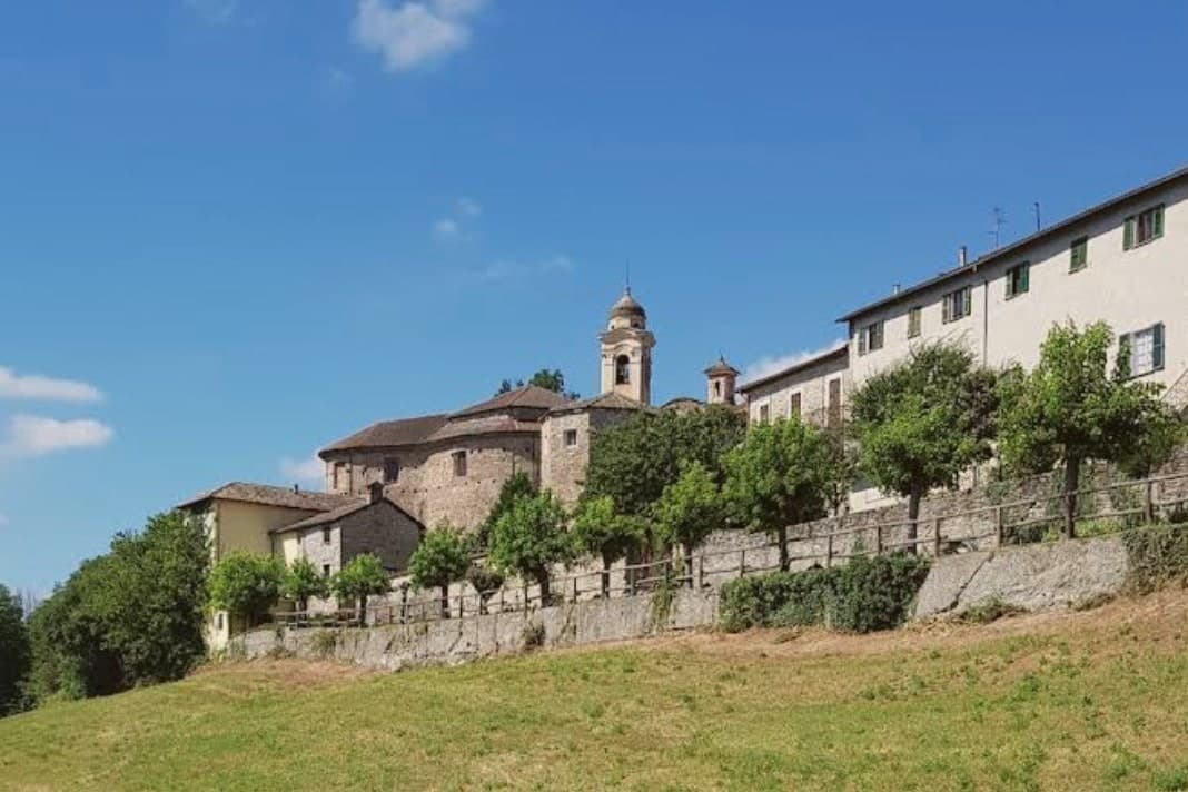
The fortress stands above the rooftops, reached by its own footpath, while the old core occupies the ground below it, houses and passages knit together by the vaulting that has kept them standing through the region's earthquakes. The parish church sits within that same fabric, its bell tower the one part of the settlement visible from the road below.
What the sequence of ownership and siege did not undo, the building method did: a settlement still standing because its stone was braced to move with the ground rather than break against it.
What to see in Castelvecchio di Rocca Barbena
- Castello dei Clavesana. Quadrangular fortress later held by the Del Carretto after the Clavesana line, square-walled and partly collapsed from old sieges, reachable only on foot and still in private ownership.
- Chiesa dell'Assunta. Parish church rebuilt on a medieval core, with an arcaded bell tower visible from the valley road.
- Centro storico. A sequence of arched passages where stone houses lean on each other, the streets passing under the load-bearing vaults below the castle.
How to get to Castelvecchio di Rocca Barbena
Genova is roughly 93 minutes away by road.
Our tip
April through June and September through October are the dry months in the Val Neva, with mild temperatures at 420 meters and the rock face of Rocca Barbena clear of haze. July and August warm up but the village sits high enough above the coastal corridor to stay tolerable; locals leave the shutters closed in the afternoon. November through March is quiet.
Zuccarello
Why visit Zuccarello
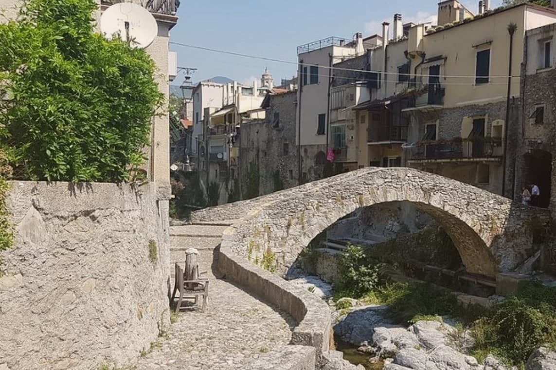
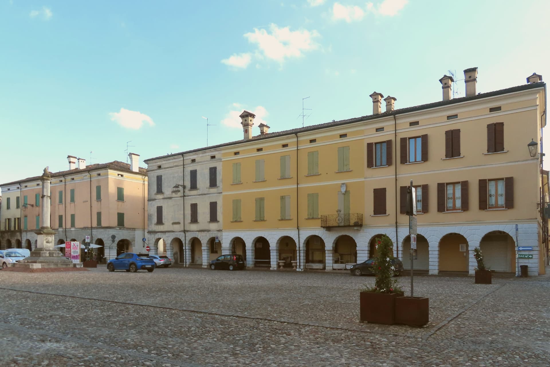
Zuccarello sits at 130 meters in the lower Neva valley, seven kilometers north of Albenga and the coast. The borgo was founded in 1248 by the inhabitants of the surrounding valley together with the Marquises of Clavesana, laid out as a single porticoed street that still runs the length of the town, with the bridge closing it off to the south and the church marking its far end to the north.
The castle stands above both, on the hill, the seat from which the marquises held the place. The Marquisate of Zuccarello passed to the Del Carretto branch and ruled the upper valley as an independent fief until the seventeenth century.
It was into this family that the woman born in the town in 1379 belonged, and it was this family's alliance with Lucca that took her away from it: she married to seal the connection between the two houses and died at twenty-six giving birth to her second daughter. The valley that produced her is a minor tributary above a coastal town, and the marble sarcophagus that made her name lasting was carved and placed far from here.
What remains in Zuccarello is the setting rather than the monument: the street, the bridge, the ruined seat of the family, and a house pointed to as the one where she was born.
What to see in Zuccarello
- Ponte Medievale sul Neva. Late medieval, restored in the nineteenth century. The single arch clears the riverbed in one span, and the hump in the deck is steep enough to hide the far bank until the crown of the arch.
- Via Centrale. The length of it reads as one built gesture rather than a row of separate houses: the arcades never break stride from one end of the borgo to the other.
- Castello dei Del Carretto. Ruined fortress on the hill above the village, residence of the Del Carretto marquises, four cylindrical towers and a central keep.
How to get to Zuccarello
Genova is roughly 82 minutes away by road.
Our tip
April through June and September to October are the windows when the Neva valley walks open and the borgo's porticoes hold their shade. The Festa Medievale in the second half of July fills the main street with costumed crafts and music for two weekends. July and August can hit 30 degrees on the valley floor, though the porticoes and the river keep the borgo cooler than the coast. Fiera Della Zucca falls in October.
Millesimo
Why visit Millesimo
Millesimo sits sixty kilometers inland from Genoa, over the Apennine watershed, in the upper reaches of the valley that gives the wider area its name. Enrico II Del Carretto turned the village into a fortified borgo in 1206, and his successors raised the castle later in the same century on the high ground above the settlement.
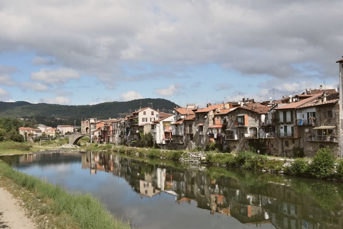
The town itself grew on the right bank of the river below that castle, its stone houses laid out in a triangle around the central piazza, with the fortified bridge carrying the crossing at the valley floor and the pilgrimage sanctuary set apart on the outskirts as the valley's separate religious focus. More than three thousand casualties fell on each side when Napoleon Bonaparte defeated the combined Austro-Sardinian forces here on 13-14 April 1796, directing the campaign from the Del Carretto palazzo on the piazza that now serves as the town hall.
The pattern is one of a small defensive settlement whose river crossing, castle and family seat all sit within sight of each other, later put to use for a battle whose scale had nothing to do with the size of the place that hosted it.
Locanda dell'Angelo have been named by a guide.
What to see in Millesimo
- Ponte della Gaietta. The old fortified body still spans the river below the village, narrow enough that its defensive purpose is obvious from either bank.
- Castello Del Carretto. Tower, keep and east wall stand above the village on the high ground, the stronghold that gave the marquis line command of the valley approach.
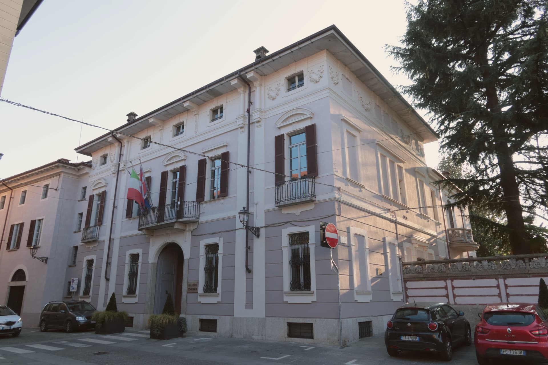
- Palazzo Del Carretto. The family palazzo faces the central piazza and now serves as the town hall, its rooms the setting for the 1796 headquarters rather than a battlefield relic.
How to get to Millesimo
Genova is roughly 73 minutes away by road.
Our tip
April through June and September through October are the dry months in the upper Val Bormida. The interior of Liguria runs cooler than the coast at this elevation, with mild days and chilly evenings; the rivers run higher in spring after the watershed melt. July and August warm up but Millesimo's 429 meters stay tolerable. XXXIV Festa nazionale del tartufo della Val Bormida a Millesimo falls in October.
Gozzano
Why visit Gozzano
Gozzano sits at 367 meters above the southern tip of Lake Orta, the smaller of the Italian subalpine lakes. The Latin name Gaudianum meant 'place of enjoyment,' a Roman villa from the late imperial era.
By the fourth century the area had been evangelized by two saints who arrived together, brothers by tradition, and their memory shaped the town's religious geography for centuries after. Gozzano is the largest town on the southern Orta shore and the main road access to the lake from the Po valley, the point where travelers from the Po valley meet the water.
The basilica sits at the center of town while the lookout tower stands above it on higher ground, watching the lake rather than living beside it, one building for worship and pilgrimage, the other for defense and signaling. The lake itself holds a Bandiera Blu for water quality, one of the few inland lakes in Italy to qualify.
Together the low church and the high tower mark Gozzano as a place shaped by both the water at its feet and the routes passing over it.
What to see in Gozzano
- Basilica di San Giuliano. The bell tower dates to the eleventh century, older than the reconstruction around it. The building follows the model of the basilica on Isola San Giulio and the old Novara cathedral, a copy of a copy standing at the water's edge.
- Torre di Buccione. The tower is the remnant of a vanished castle, standing alone where walls and keep did not survive. Three internal wooden decks remain inside, a climb above the lake rather than a ruin at ground level.
- Lago d'Orta lungolago. Southern shore lakefront at 290 meters of water elevation, the gateway to Orta San Giulio and the Isola San Giulio.
How to get to Gozzano
There is a railway station in the town, so you can arrive without a car and never need one while you are here. Novara is roughly 41 minutes away by road.
Our tip
April through October is when the lake town opens. May and June bring camellias and the lake at its clearest, with the Buccione tower visible from the southern lungolago. September and October are dry and the chestnut woods on the surrounding hills turn.
Candelo
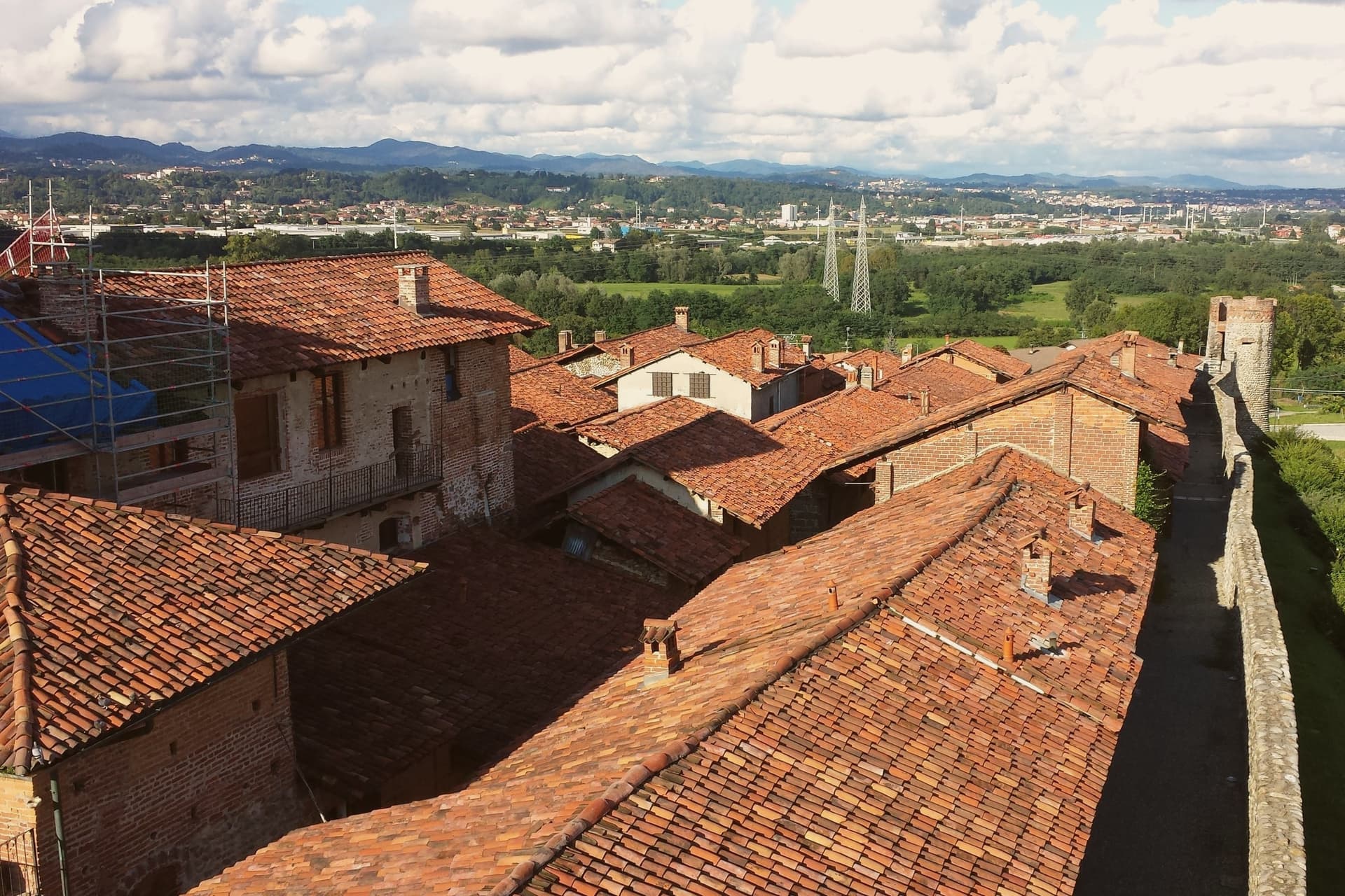
Why visit Candelo
Candelo sits at 350 meters on the right bank of the Cervo torrent, ten kilometers from Biella, with a third of its territory on the Baraggione plateau, a wild grassland of about 5,000 hectares now protected as the Riserva Naturale delle Baragge. The Ricetto is what people come for.
It is a late-medieval fortified shelter built by the local farming community in the thirteenth and fourteenth centuries: roughly two hundred stone cellule arranged on a pentagonal plan of 13,000 square meters, crossed by five east-west rue and two transverse, the perimeter walls running 470 meters. Goods, grain, wine and forage were stored here under the protection of the local lord.
Only in extreme attack did the population itself withdraw inside. It is the best-preserved structure of its kind in Piedmont.
Candelo joined the Borghi più belli d'Italia in 2002 and has held the Bandiera Arancione of the Touring Club Italiano since 2007.
What to see in Candelo
- Ricetto di Candelo. Thirteenth- to fourteenth-century fortified shelter on a pentagonal plan, with about two hundred stone cellule and 470 meters of walls.
- Rue del Ricetto. Five east-west streets and two transverse, paved in river stone, the cellule grouped along them for storing grain and wine.
- Chiesa di Santa Maria Maggiore. Parish church of Candelo next to the Ricetto, on the centro storico side of the town.
How to get to Candelo
Novara is roughly 54 minutes away by road.
Our tip
April through June brings the Baraggia into bloom and the Ricetto walls dry enough for the swallows. September and October are the harvest months on the Cervo plain, with vineyards on the Coste della Sesia turning to gold. July and August can sit humid in the river basin; the cellule, half-underground in places, hold cool inside even when the piazza is hot.
Gattinara
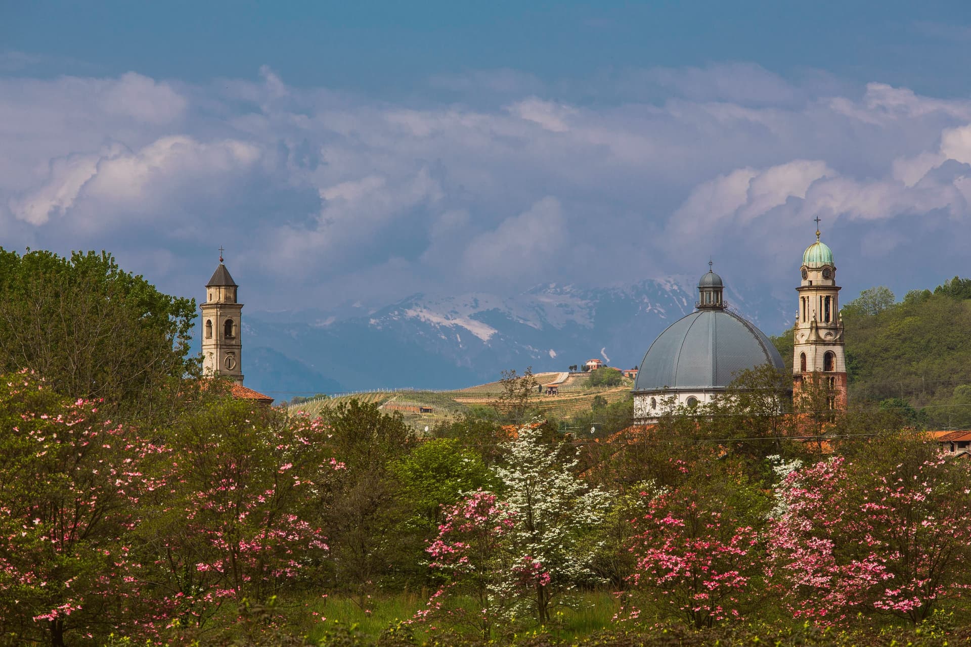
Why visit Gattinara
Gattinara sits on the right bank of the Sesia, north of Vercelli, in the Alto Piemonte wine zone where Nebbiolo is called Spanna. The hills behind the town are volcanic, the surface gravel pushed up when Africa met Europe and built Monte Rosa sixty million years ago.
Romans planted vineyards here in the second century BC. In 1242, the commune of Vercelli established a borgofranco that became the modern town.
In the early sixteenth century Cardinal Mercurino Arborio di Gattinara, Grand Chancellor to Emperor Charles V, served the local wine at his diplomatic dinners in Spain and Flanders; it stayed a court favorite for decades. The Torre delle Castelle, tenth-century watchtower above the vineyards, still stands on the ridge.
Gattinara became Italy's twentieth DOCG in 1990. The wine is at least ninety percent Nebbiolo, aged three years in wood for the riserva, and the bottles age longer than most Barolo because the volcanic minerality slows everything down.
Cucine Nervi, Osteria Contemporanea have been named by a guide.
What to see in Gattinara
- Torre delle Castelle. Tenth-century watchtower on the ridge above the vineyards, part of a fortified system that guarded the wine hills.
- Castello di San Lorenzo. Medieval fortress on the hill, paired with the Torre delle Castelle as the upper defensive line.
- Chiesa di San Pietro. Parish church in the historic center, the religious anchor of the borgofranco founded in 1242.
How to get to Gattinara
There is a railway station in the town, so you can arrive without a car and never need one while you are here. Novara is roughly 45 minutes away by road.
Our tip
April through June and September through October are the best months. The vineyards green up by Easter and the wine roads through the hills are walkable without heat. Harvest in late September pulls visitors to the cellars.
Biella
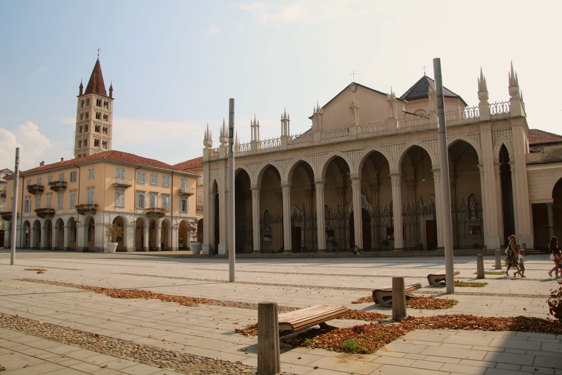
Why visit Biella
Biella sits at 417 meters at the foot of the Biellese Alps, in a basin where fast Alpine streams cut down from Mont Mars and the Oropa range. The statutes of 1245 already named the woolworkers' and weavers' guilds, and the city built itself around them: by the nineteenth century, vertical mills along the streams had turned Biella into the Manchester of Italy.
The names still on the labels, Zegna, Cerruti, Loro Piana, Piacenza, Fila, were founded here. The upper town, Biella Piazzo, sits above the modern Piano on a small hill, reached since 1885 by a water-counterbalance funicular that still runs the same 60-meter climb.
The Romanesque Baptistery on Piazza Duomo is the city's oldest stone, ninth or tenth century, set next to the cathedral. Above the city, the Sacro Monte di Oropa belongs to the UNESCO Sacri Monti site, and Biella was named a UNESCO Creative City for Crafts and Folk Art in 2019.
Il Patio, Matteo Ristorante, Regallo and 2 more have been named by a guide.
What to see in Biella
- Biella Piazzo. Medieval upper town on a small hill above the modern Piano, with arcaded palazzi and narrow stone streets, reached by funicular since 1885.
- Funicolare del Piazzo. Historic funicular opened in December 1885, covering a 60-meter altitude gradient in 177 meters between Via Curiel and Via Avogadro.
- Battistero di Biella. Romanesque baptistery on Piazza Duomo, ninth to tenth century, the oldest standing monument in the city.
How to get to Biella
There is a railway station in the town, so you can arrive without a car and never need one while you are here. Novara is roughly 63 minutes away by road.
Our tip
April through June brings green pastures on the Biellese Alps and clean light off the streams that built the mills. September and October are the dry, gold months, when the chestnut woods around Oropa turn and the textile fairs run in town. July and August stay cooler than the Po Valley but can sit humid; the upper Piazzo holds breeze that the Piano does not. Bolle di Malto - Salone Italiano della Birra falls in August.
More from Anywhere Italy
- The best towns known for their meat within two hours of Genoa
 The best hill towns within 90 minutes of Novara
- The prettiest villages in the province of Savona
- The best olive oil towns within two hours of Turin
 The best towns known for what they grow within two hours of Milan
 The 10 best hill towns within 90 minutes of Genova