
The best towns known for what they grow within two hours of Florence
Italian agriculture is specific to the point of stubbornness, and the country marks that specificity with protected names tied to a valley, a soil, a slope. Within two hours of Florence, in either direction, the map fills with towns that are known first for what grows there: cherries ripening in late spring on the Modenese foothills, chestnuts dried in stone metati above the Serchio, shallots, artichokes, olives pressed into oil with a bitter green finish, grapes for Lambrusco and Sangiovese. The building materials change as the crop changes, from Apuan marble and river stone in the west to warm brick and terracotta towards the Po plain. Markets follow the harvest rather than the tourist calendar, so a visit in May tastes nothing like a visit in October. The food is the reason to go, and the towns are where the food is made.
Most people spend their Tuscan food days in Florence itself, or on the tight loop through Chianti and the Val d'Orcia towards Montepulciano, and the reasons are good ones: the vineyards are beautiful, the cellars are set up for visitors, the restaurants are excellent. The consequence is coach parking, timed tastings and a booking system for lunch. By high summer the same handful of hill roads carries most of the region's traffic. It is a fine thing to do once and a tiring thing to do twice.
The growing does not stop at the edge of that loop. Cross the Apennines or run north up the Serchio valley and the protected crops keep going, into Garfagnana, the Lunigiana, the Modena hills, the Romagna plain and the orchards around Imola and Ferrara. These are the towns in this list: smaller places where the fruit, the flour and the vinegar carry the name of the comune, and where fewer people come to eat them. Several are reachable on the Florence railway lines, which makes a harvest lunch a day trip rather than a campaign.
Of the 98 communes we have mapped in a 120-minute drive of Florence, 14 qualify as towns known for what they grow: each sits inside the production zone of a protected fruit or vegetable. This list is 10 of them. The smallest, Bagnara di Romagna, has 2,392 residents.
Two more lists worth reading alongside this one: The best towns known for what they grow within 45 minutes of Bologna and The best towns known for what they grow within two hours of Pisa.
Castrocaro Terme e Terra del Sole
Why visit Castrocaro Terme e Terra del Sole
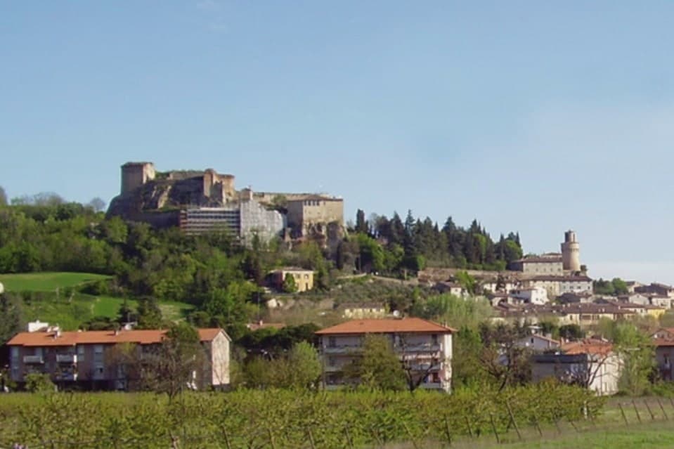
The commune sits at 68 meters on the Montone river, ten kilometers southwest of Forlì in the Apennine foothills, and is the union of two distinct towns rather than one that simply grew. Castrocaro occupies the hill, its castle controlling the valley from above.
The fortress town on the plain below it was built in one campaign to project the authority of the Grand Duchy of Tuscany into Romagna, rather than accumulated over centuries like its neighbor. The Medici governed it until 1923, when the provincial border finally moved and the arrangement ended.
The two halves of the commune read like two different centuries standing next to each other: one shaped by defense over generations, the other stamped out whole by a single ducal decision in 1564. What the pairing adds up to is a rare chance to see, in the space of one small commune, both how a medieval hill fortress evolved and what a Renaissance planner intended a fortress town to look like when built from nothing, a place called Terra del Sole.
Essentia have been named by a guide.
What to see in Castrocaro Terme e Terra del Sole
- Rocca di Castrocaro. One of the oldest castles in Italy, standing on the hill above the centro with three concentric defensive rings, built to command the valley below.
- Terra del Sole. Two squares, four gates, and bastioned walls still standing, laid out with the geometric symmetry of a town designed on paper rather than grown over time.
- Palazzo dei Commissari e del Pretorio. On the central square, the residence of the Medici governors of Romagna Fiorentina until 1772, its facade facing the town's planned axis.
How to get to Castrocaro Terme e Terra del Sole
Forlì is roughly 19 minutes away by road.
Our tip
Castrocaro Terme runs all twelve months because the thermal water does. The Terme stay open year-round, with the lowest tariffs from November to March and the most space in spa hotels through mid-week stays in winter. April through June brings green on the Apennine slopes and the gardens around Terra del Sole.
Dozza
Why visit Dozza
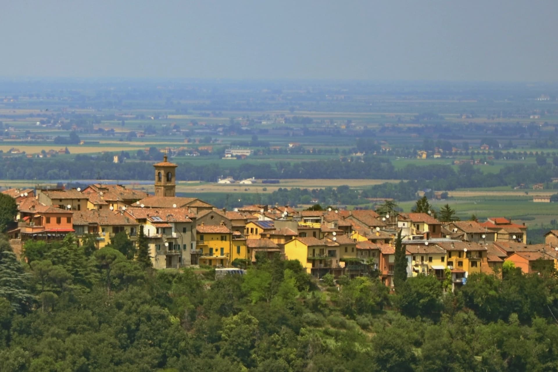
Dozza sits on a low ridge at 190 meters above the Sellustra valley, six kilometers from Imola and twenty-five southeast of Bologna. The medieval village runs along a single curved spine of stone houses, with the Rocca Sforzesca closing the upper end.
Caterina Sforza rebuilt the fortress at the end of the fifteenth century on the remains of earlier Bolognese defences; the Malvezzi-Campeggi family turned it into a palazzo in the late sixteenth century, and the cellars now hold the Enoteca Regionale dell'Emilia-Romagna, which curates the wines of the whole region. The Biennale del Muro Dipinto began in 1960, when the opening of the Rocca to the public was paired with a contemporary-painting competition that worked directly on the village walls.
Over sixty years later, more than 100 murals cover the borgo, repainted and added to every other year by invited Italian and international artists. The municipality holds Borghi più belli and Bandiera Arancione recognition.
Population 6,582.
What to see in Dozza
- Rocca Sforzesca. Late fifteenth-century fortress rebuilt by Caterina Sforza, transformed into a palazzo by the Malvezzi-Campeggi family at the end of the 1500s.
- Muro Dipinto. Over 100 murals on the house walls of the medieval village, repainted and added to every two years since the first Biennale in 1960.
- Enoteca Regionale dell'Emilia-Romagna. Regional wine cellar inside the Rocca's underground levels, curating about 800 labels from across the region's DOC and DOCG zones.
How to get to Dozza
Bologna is roughly 37 minutes away by road.
Our tip
April through June and September through October are the working months in Dozza. The murals look best in oblique morning or late-afternoon light, and the Sellustra valley below stays green into early summer. The Biennale del Muro Dipinto runs in September of odd-numbered years and is when the borgo is fullest, with painters working on scaffolding through the whole month.
Brisighella
Why visit Brisighella
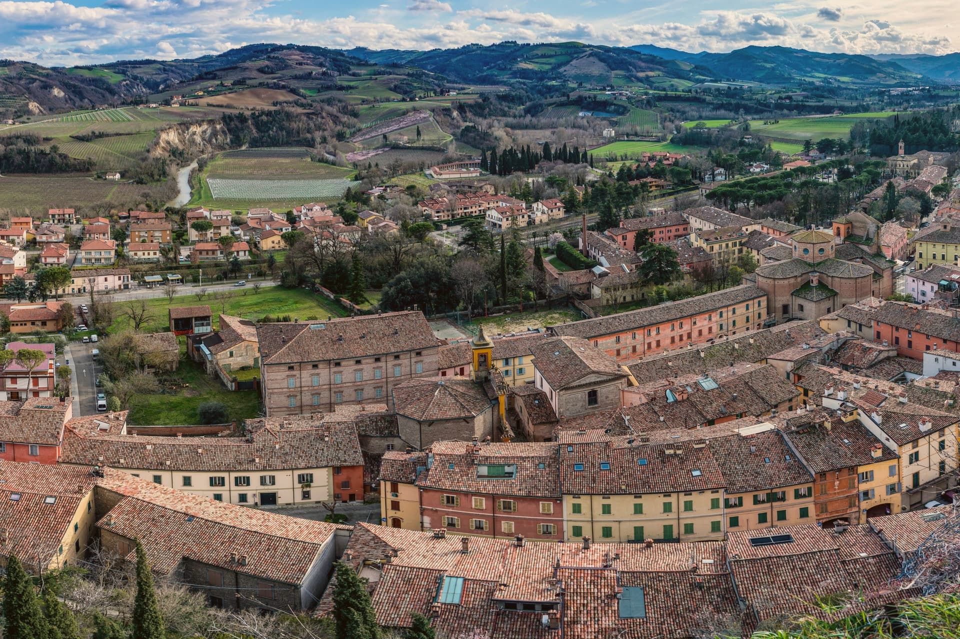
Brisighella sits in the Lamone valley at 115 meters, forty-five kilometers southeast of Bologna, on the Apennine slope where Romagna meets the gypsum vein the UNESCO list added in 2023. Three selenite hills rise above the rooftops, each carrying a building: the Rocca Manfrediana, built in 1310 by Francesco Manfredi and reinforced by the Venetians after 1503; the Torre dell'Orologio, rebuilt in 1850 with a six-hour dial instead of twelve; and the Santuario del Monticino above the town.
The Via degli Asini runs through the centro storico as a covered elevated street, originally a fourteenth-century patrol walkway, later excavated into stables for the donkeys that hauled gypsum down from the quarries. The Nostrana di Brisighella olive, grown on the same hills, makes the Brisighello DOP oil that has carried European protection since 1996.
The town holds four institutional signals at once: Borghi più belli, Bandiera Arancione, Cittaslow, Città dell'Olio.
What to see in Brisighella
- Rocca Manfrediana. Hilltop fortress begun in 1310 by Francesco Manfredi of Faenza, reinforced by Astorgio II in the 1460s and held by Venice after 1503.
- Torre dell'Orologio. Clock tower rebuilt in 1850 on an earlier defensive structure, with a dial that marks six hours rather than the usual twelve.
- Santuario del Monticino. Eighteenth-century sanctuary on the third selenite hill, overlooking the town and the Lamone valley below.
How to get to Brisighella
There is a railway station in the town, so you can arrive without a car and never need one while you are here. Forlì is roughly 55 minutes away by road.
Our tip
April through June and September through October are the working months in Brisighella. The hills around the Lamone valley turn green in spring and gold in autumn; the olive harvest in November fills the frantoi along the road to Faenza. July and August touch thirty-five degrees and the centro storico empties between two and five. Sagra Della Collina E Del Cinghiale falls in July.
Fosdinovo
Why visit Fosdinovo
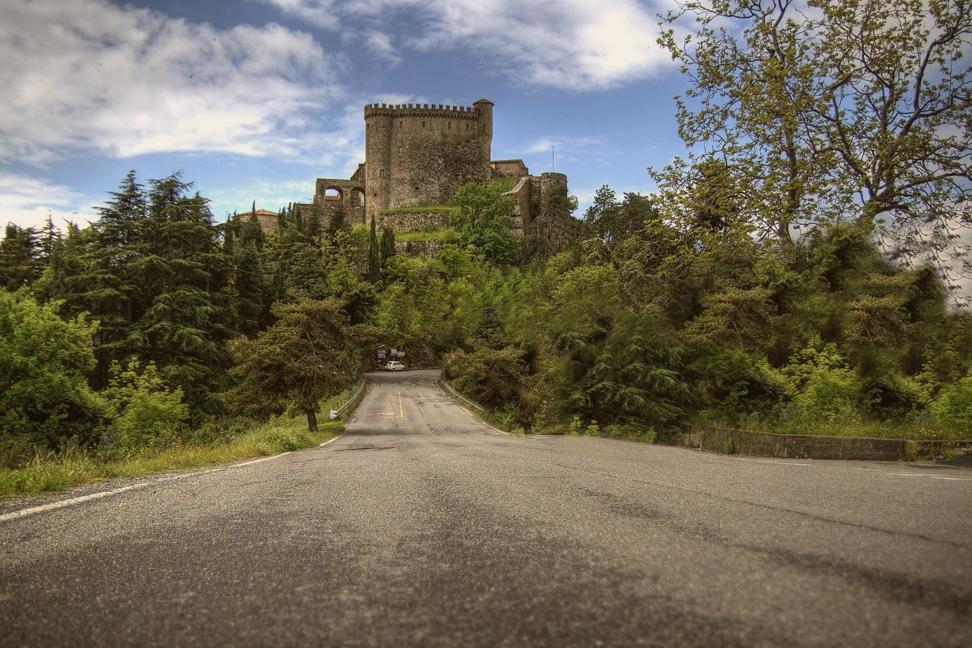
Fosdinovo sits at 500 meters on a ridge between the Apuan Alps and the Magra valley, with the Tyrrhenian visible on a clear day. The Castello Malaspina dominates the village: a fourteenth-century fortress on earlier foundations, continuously inhabited by the same family branch from 1340 until 1916, one of the longest unbroken castle dynasties in Europe.
Dante took shelter here in 1306, hosted by Moroello Malaspina, and the encounter became Canto VIII of the Purgatorio. The current owner is the same Malaspina line; the castle is open for guided tours that include the room where the poet is said to have slept.
The town sits at the southern edge of the Lunigiana, with the marble peaks of the Apuane behind and the Versilia coast in front. The Linea Gotica ran through these hills in 1944, and the Museo Audiovisivo della Resistenza in the centro storico documents what happened to the villages below.
Locanda de Banchieri, La Burlanda have been named by a guide.
What to see in Fosdinovo
- Castello Malaspina. Fourteenth-century fortress on earlier foundations, held by the same Malaspina branch from 1340 to 1916, with the Dante room open on guided tours.
- Museo Audiovisivo della Resistenza. Documentation center on the Gothic Line and the partisan war in the Apuane and Lunigiana, with films and oral histories.
- Centro storico. Walled village climbing the ridge below the castle, with stone houses and steep lanes between gardens facing the sea.
How to get to Fosdinovo
Pisa is roughly 70 minutes away by road.
✷ We have written about Fosdinovo
“We chose it the way you choose a card from a deck. We pulled up the map, ignored everything we recognized, scrolled north until the roads thinned out and the names stopped meaning anything to us, and there, behind the marble of Carrara, in a fold of the Apuane I had never heard of, was a borgo called Marciaso. There was one Airbnb.”
Read our piece on Fosdinovo →The Lunigiana | The Real Off the Beaten Path Italy
Our tip
April through June is the dry green window, with the Apuane still snow-streaked and the coast already warm below. July and August push the lowlands into the thirties; Fosdinovo at 500 meters stays a few degrees cooler and the breeze off the ridge holds. September and October are the second window, with the new oil from the lower slopes and the chestnuts higher up.
Castelnuovo di Garfagnana
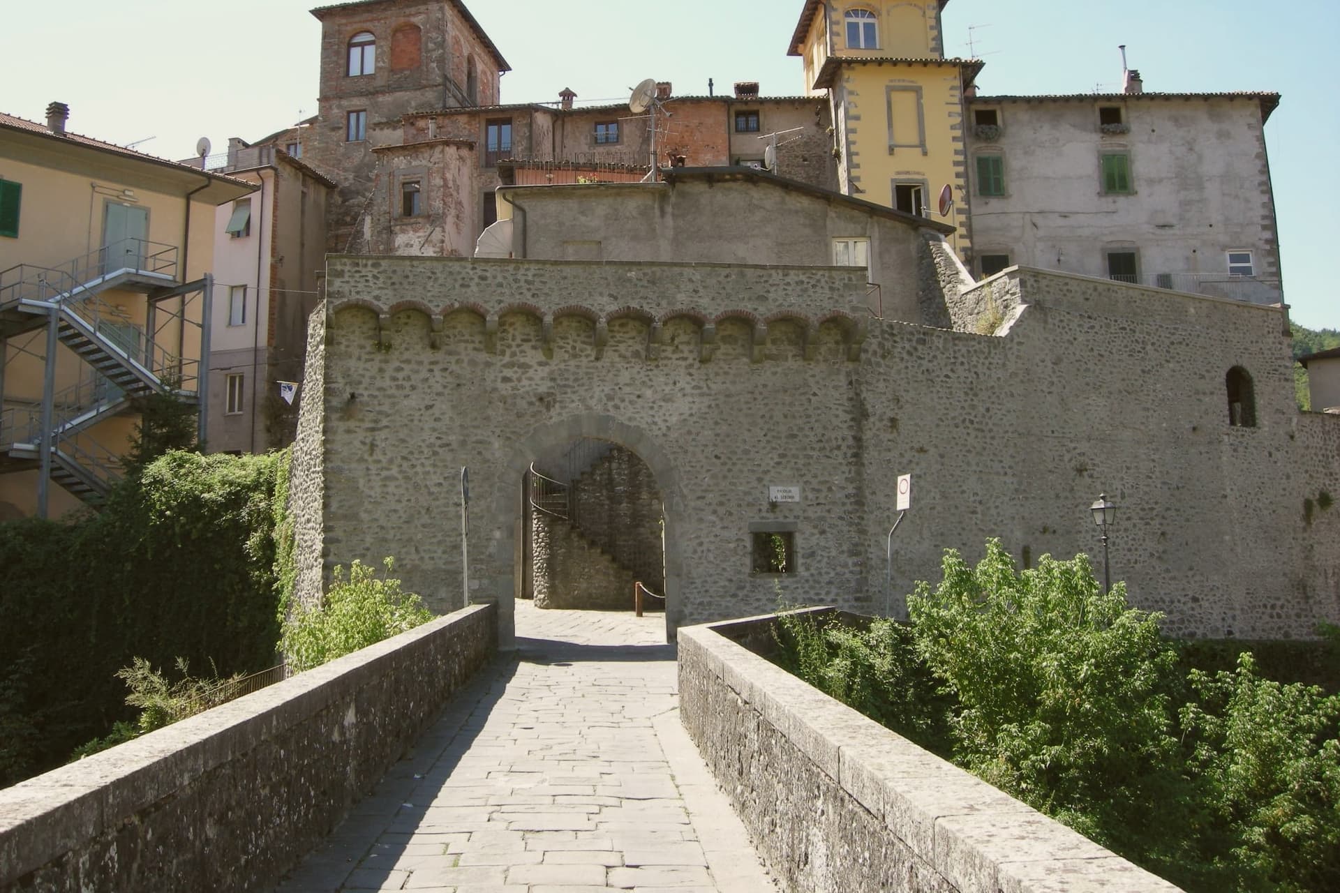
Why visit Castelnuovo di Garfagnana
Castelnuovo di Garfagnana is the historic capital of the Garfagnana, the deep mountain valley between the Apuane Alps and the Tuscan Apennine main ridge, 50 km north of Lucca along the Serchio river. The town sits where the Serchio meets the Turrite, and it anchors the valley both politically and economically: 5,600 residents, and the only real services, hospital, secondary schools, government offices, for the 30,000 people spread across the Garfagnana comuni around it.
The historic core is the fortress that now serves as the municipal museum, the building where the Este governor lived out his posting writing to friends about being stuck among bandits and chestnut-eaters even as he completed the final additions to his poem. Above the town, on the hill, stands the much larger Este fortress of 1579, built to control the trans-Apennine trade route and now a cultural centre and concert venue with the most photographed view of the Apuane peaks.
The two fortresses read together as a record of how the valley was held: one seat of government inside the town, one larger garrison commanding the pass above it. Castelnuovo is also the point of departure for the higher ground: the Apuane Regional Park, whose white-marble peaks are the same stone quarried at Carrara seen from the back, the Parco dell'Orecchiella further up, the show cave reached 45 minutes to the south, the Eremo di Calomini cliff-monastery, and over 200 km of marked Apennine trails.
The valley's food follows the same logic of scarcity turned to identity: alongside the farro and the chestnut dishes there is formentone otto file, a local maize cornbread, pecorino della Garfagnana, biroldo, a sweet-spiced blood sausage, and salt-cured prosciutto bazzone from the indigenous Garfagnana pig breed. A town built to govern a valley still does exactly that: the fortress on the hill and the one in the center were both instruments of control over a mountain pass, and the food still served in its bakeries and trattorie is what the same isolation once made necessary.
Bonini, Il Vecchio Mulino have been named by a guide.
What to see in Castelnuovo di Garfagnana
- Rocca Ariostesca. The fortress core of the town, now the municipal museum. Its rooms hold the record of the governor who complained about the posting even as he finished his poem here.
- Fortezza di Mont'Alfonso. Larger Este fortress on the hill above town (1579), built to control the trans-Apennine route. Now a cultural centre and concert venue with the great Apuane view.
- Farro della Garfagnana IGP + zuppa di farro. Terraced hillsides still grow the grain that shows up in every trattoria's soup bowl. Bags of it are sold at the Saturday market.
How to get to Castelnuovo di Garfagnana
There is a railway station in the town, so you can arrive without a car and never need one while you are here. Pisa is roughly 84 minutes away by road.
✷ We have written about Castelnuovo di Garfagnana
“There are two ways to drive from Aulla to Lucca. The first is the one everyone takes: the coast, the A12, the cruise control, ninety minutes of the same Tyrrhenian to your right. The second is the one we took with Daniel, on a clear day in November, and it is two and a half hours longer if you stop, but it is in a different country.”
Read our piece on Castelnuovo di Garfagnana →Apuan Roadtrip | A Steak, a Friend, and the Long Way Down to Lucca
Our tip
Castelnuovo di Garfagnana is mountain-seasonal — June through September is the sweet spot, when the trails are clear, the festivals run (Sagra del Farro late August, San Pellegrino in Alpe pilgrimages), and the high refugi are open. October is chestnut and porcini season — the best food month. Winter is alpine — heavy snow possible above 800m, several ski-touring options, but the borgo itself stays accessible.
Barga
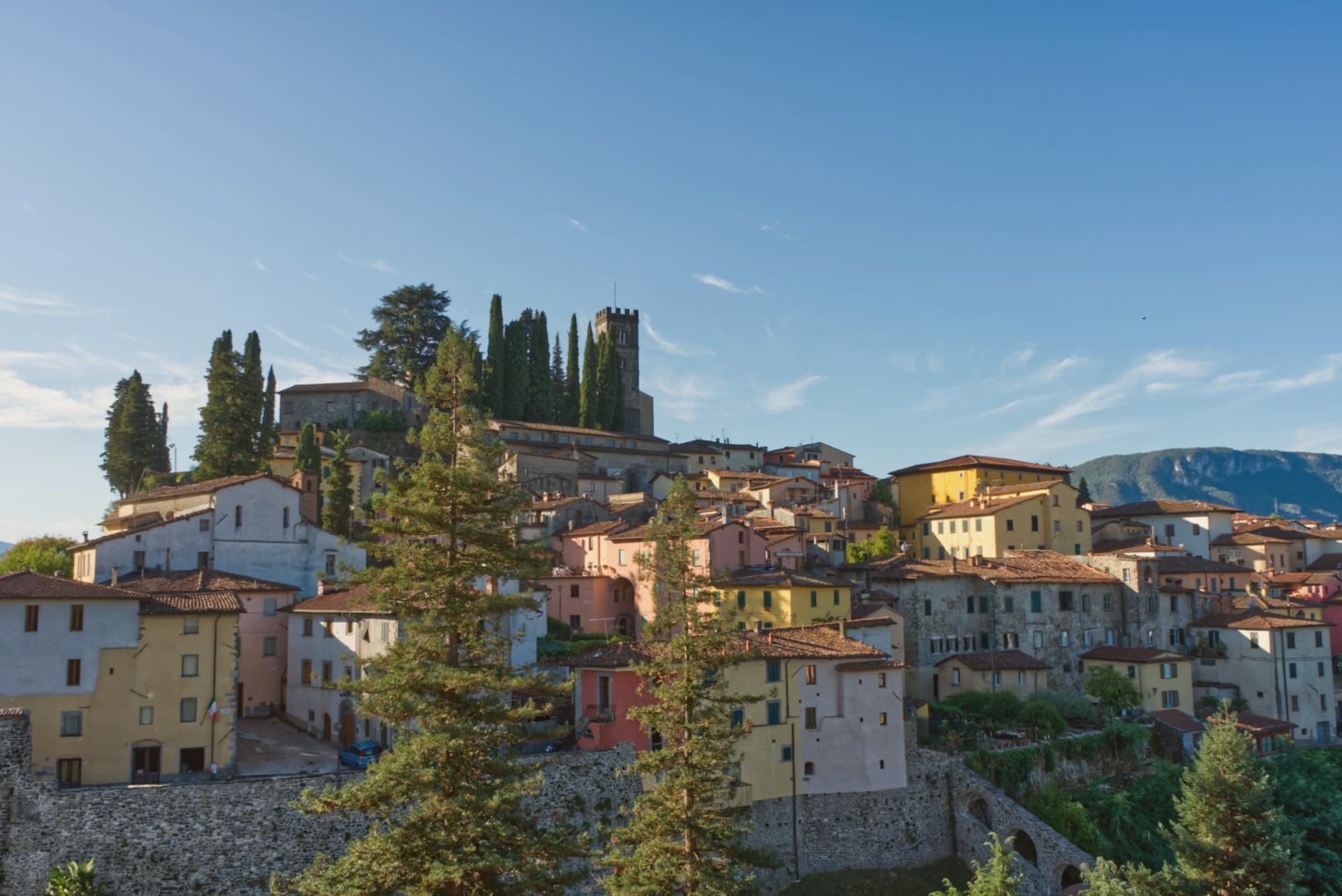
Why visit Barga
The town sits on the Colle Remeggio above the Serchio river, the Apennine ridge rising to the east as a counterpart to the Apuan Alps on the western side of the valley. The walled centro storico climbs the hill from Porta Reale, its stone houses narrowing as the streets rise toward the highest terrace, where the collegiate church stands.
The Colle di Caprona, a separate rise from the walled town itself, holds the house where Pascoli lived out his last years and the chapel where he is buried. The town also carries a Scottish thread: a wave of late nineteenth-century emigration sent generations of Barga families into the chip shop trade in Glasgow, and their descendants' festival now fills the streets every August with fish and chips rather than any dish more expected of the Tuscan hills.
A hill town built in stone around a Romanesque church, with a poet's house on one rise and a Glasgow-born sagra filling its streets each summer, holds more than its size would suggest.
What to see in Barga
- Duomo di San Cristoforo. The church climbs from the eleventh century into the sixteenth, four red marble columns of the pulpit resting on stone lions. It occupies the highest terrace of the town, above the streets that lead up to it.
- Casa Museo Giovanni Pascoli. The house is preserved with its original furnishings and library, the chapel next door holding the poet's tomb.
- Centro storico. Walled medieval town climbing the hill, narrow streets of stone houses leading from Porta Reale up to the church on the highest terrace.
How to get to Barga
There is a railway station in the town, so you can arrive without a car and never need one while you are here. Pisa is roughly 74 minutes away by road.
✷ We have written about Barga
“We were trying to get to Garfagnana. It was July, the coast was unlivable, we pointed the car at the Serchio Valley with a vague idea of chestnut forests and cool air, and somewhere on the road up we took a turn we should not have taken and ended up at the gate of a town I had never heard of. Barga was today's accident.”
Read our piece on Barga →Barga | The Scottish Accent
Our tip
April through June and September into October are the working months in the middle Serchio valley: green pasture, mild days at 410 meters, walking weather to the Apuan ridges. The Opera Barga festival fills the Teatro dei Differenti in July with chamber concerts. The Sagra del Pesce e Patate runs for two weeks in August and brings Glasgow-Barga families home.
Castelvetro di Modena
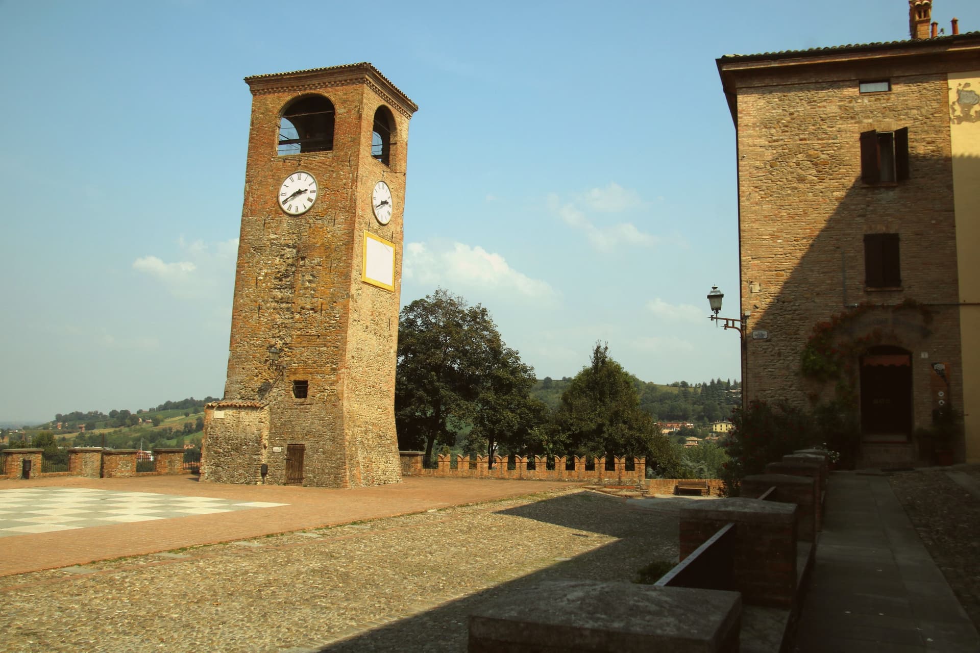
Why visit Castelvetro di Modena
Castelvetro di Modena sits on a hill at 152 meters, eighteen kilometers southeast of Modena and at the northern edge of the Apennine foothills. The medieval centro storico rises around the Piazza Roma, paved in alternating white and black stones that earned it the name Piazza della Dama, the checkerboard piazza, framed by the four surviving towers of the old castle.
The Grasparossa grape grows on the clay slopes around the town, the sandy soil and the south-facing aspect producing the deepest, most tannic of the three main Lambruschi; Lambrusco Grasparossa di Castelvetro received DOC status in 1970. Above the piazza, the Palazzo Rinaldi houses the Museo del Vino and the Museo dell'Aceto Balsamico, the second tracing the same Modenese tradition that nearby Spilamberto codifies.
The municipality holds three institutional signals: Borghi più belli, Bandiera Arancione, Città del Vino. The Sagra dell'Uva e del Lambrusco runs the last weekend of September, when the streets fill with the chess players from the surrounding Lambrusco towns dressed as living pieces on the piazza.
Locanda del Feudo, Opera|02 have been named by a guide.
What to see in Castelvetro di Modena
- Piazza Roma. Checkerboard piazza paved in alternating white and black stones, framed by the four surviving towers of the medieval castle.
- Castello di Levizzano Rangone. Tenth-century fortified frazione four kilometers north, with a tower built in the 990s and a fully preserved medieval village.
- Museo del Vino. Wine museum inside the Palazzo Rinaldi, tracing the Grasparossa production cycle and the DOC zone established in 1970.
How to get to Castelvetro di Modena
There is a railway station in the town, so you can arrive without a car and never need one while you are here. Modena is roughly 28 minutes away by road.
Our tip
April through June and September through October are the Castelvetro months. The hills around the borgo turn green in spring and red in autumn when the Grasparossa vines colour up before the harvest. July and August are hot, thirty-five degrees in the valley, less in the hills above, and the cantine slow down. Sagra dell'Uva e del Lambrusco Grasparossa di Castelvetro falls in September.
Castel San Pietro Terme
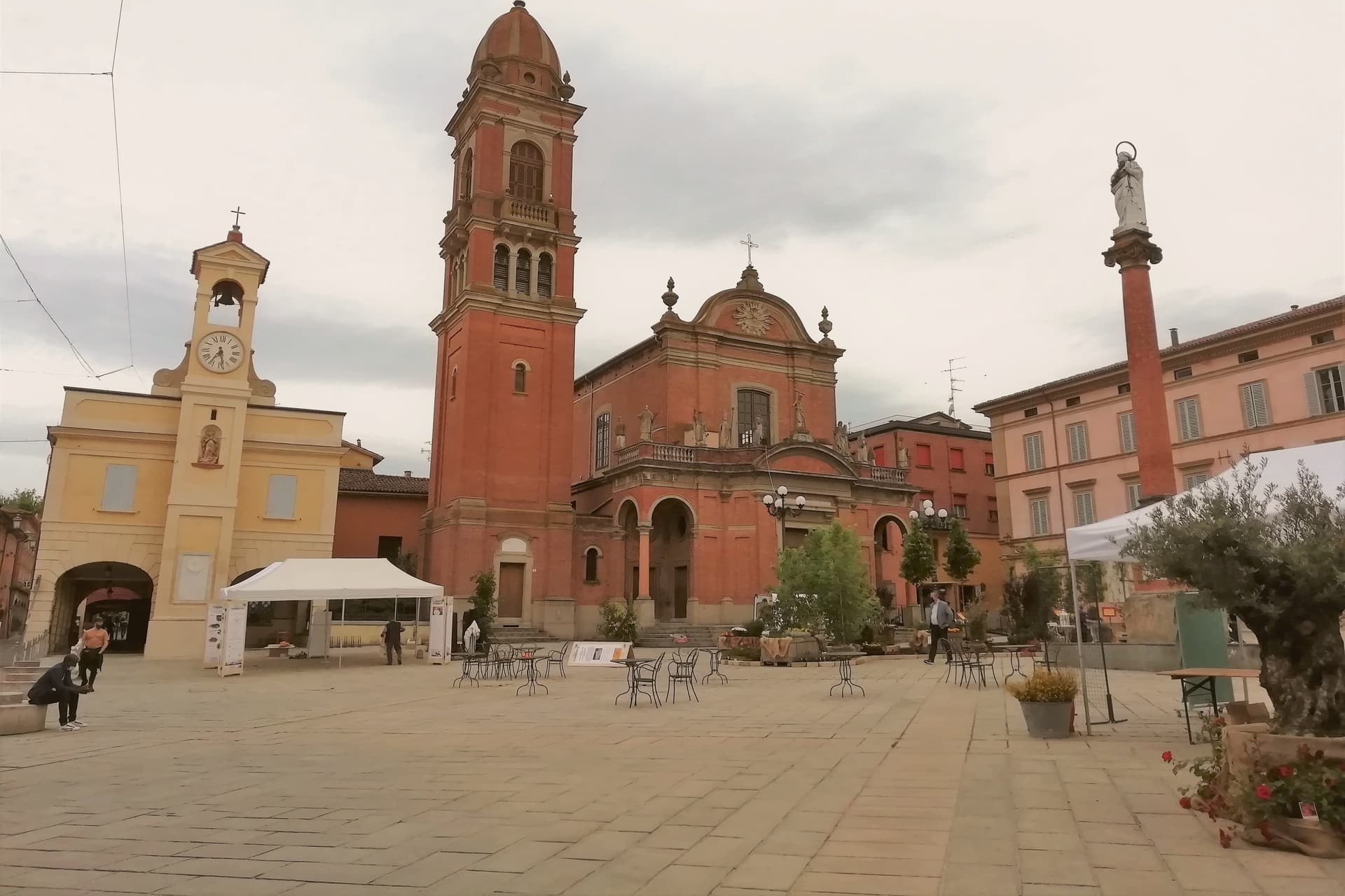
Why visit Castel San Pietro Terme
The town sits on the Sillaro river, which marks the historic border between Emilia and Romagna, twenty kilometers east of Bologna on the Via Emilia. It was founded as a Bolognese castrum in 1200, and the walled core still follows that original plan, with the river bridge on one edge and the road toward Imola leading out past the walls to the pilgrimage shrine beyond.
Castel San Pietro also joined the Città dell'Olio network for its hillside olive cultivation, a rural counterpart to the spa and civic life inside the walls. The Conservatorio Santa Caterina, founded in 1741, is one of the older female educational institutions still active in the region, sitting inside the same historic core as the gateway and the town hall.
The town reads as two things held together: a walled medieval seat on a border river, and a spa destination whose waters predate the walls by decades. Both draw on what was already there long before either was built up for visitors.
Il Grifone, Osteria La Civichella, Gastarea have been named by a guide.
What to see in Castel San Pietro Terme
- Cassero. The gateway stands at the southern edge of the old walls, its stone face marking what was once the main entry into the castrum. Inside, the civic theater now occupies the space, so the structure that once controlled access to the town now hosts its audiences.
- Terme di Castel San Pietro. The complex draws on sulphurous, ferruginous and salt-bromine-iodide springs, with the first establishment opened in 1870. The waters run year-round from the same sources used centuries before the modern building existed.
- Santuario del Crocifisso del Piratello. Pilgrimage shrine on the Via Emilia toward Imola, built around a fifteenth-century crucifix and decorated by Innocenzo da Imola. It drew pilgrim traffic from across northern Emilia, standing apart from the walled town on the road out toward Romagna.
How to get to Castel San Pietro Terme
There is a railway station in the town, so you can arrive without a car and never need one while you are here. Bologna is roughly 39 minutes away by road.
Our tip
Castel San Pietro Terme runs all twelve months because the thermal water does. Spring and autumn are the easier months for walking the centro storico and the Sillaro valley, with mild light and the olive groves on the hill above town green or harvest-coloured. June through August touches the low thirties and humid, but the spa runs longer hours in summer and the riverside frazione of Osteria Grande stays cool.
Vignola
Why visit Vignola
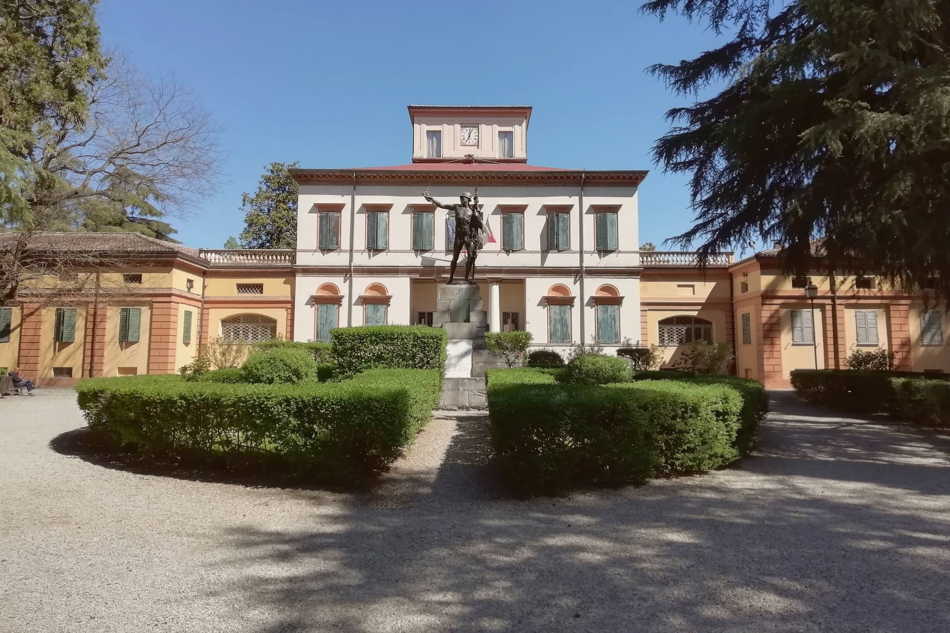
Vignola sits at 125 meters on the right bank of the Panaro, twenty-five kilometers south of Bologna and twenty east of Modena, where the Modenese plain meets the Apennine foothills. The fortress there is documented from the eighth century, raised by the Abbot of Nonantola to guard the abbey's lands before the Contrari family rebuilt it in the fifteenth century as a fortified residence; in 1577 it passed to the Boncompagni-Ludovisi, who held it until 1965.
The palace beside it takes its second name from the family that acquired it, and from the architect born in the town in 1507, who died in 1573 after a career among the leading figures of late Renaissance architecture. The cherries that carry the town's name upriver and down are IGP-protected across twenty-eight communes stretching from Modena to Bologna, and the blossom that precedes the fruit each spring fills the Panaro valley below the walls.
A disused railway, now a greenway, threads through the same ground on its way between Mirandola and Bologna. The town's identity rests on this pairing of a fortified height above the river and an agricultural valley beneath it, one lineage of stone, one of orchards, both still legible in the place today.
What to see in Vignola
- Rocca di Vignola. Eighth-century origin, built to guard the lands of an abbey and later rebuilt as a fortified residence. The frescoed interiors and four corner towers stand over the river much as the rebuilding left them.
- Scala a Chiocciola di Palazzo Barozzi. The 106 steps rise with no central support, an engineering feat as much as a decorative one, tucked inside the palace next to the fortress.
- Palazzo Boncompagni. The palace passed to the family that gives it its name in the late sixteenth century and held the fortress until 1965. Its reception rooms carry frescoes alongside the staircase it is best known for.
How to get to Vignola
There is a railway station in the town, so you can arrive without a car and never need one while you are here. Modena is roughly 34 minutes away by road.
Our tip
April through June and September through October are the working months on the Panaro foothills. The first two weekends of April fill the centro with the Festa dei Ciliegi in Fiore, when the orchards along the river bloom. June brings cherries to market and the Panaro at high water.
Faenza
Why visit Faenza
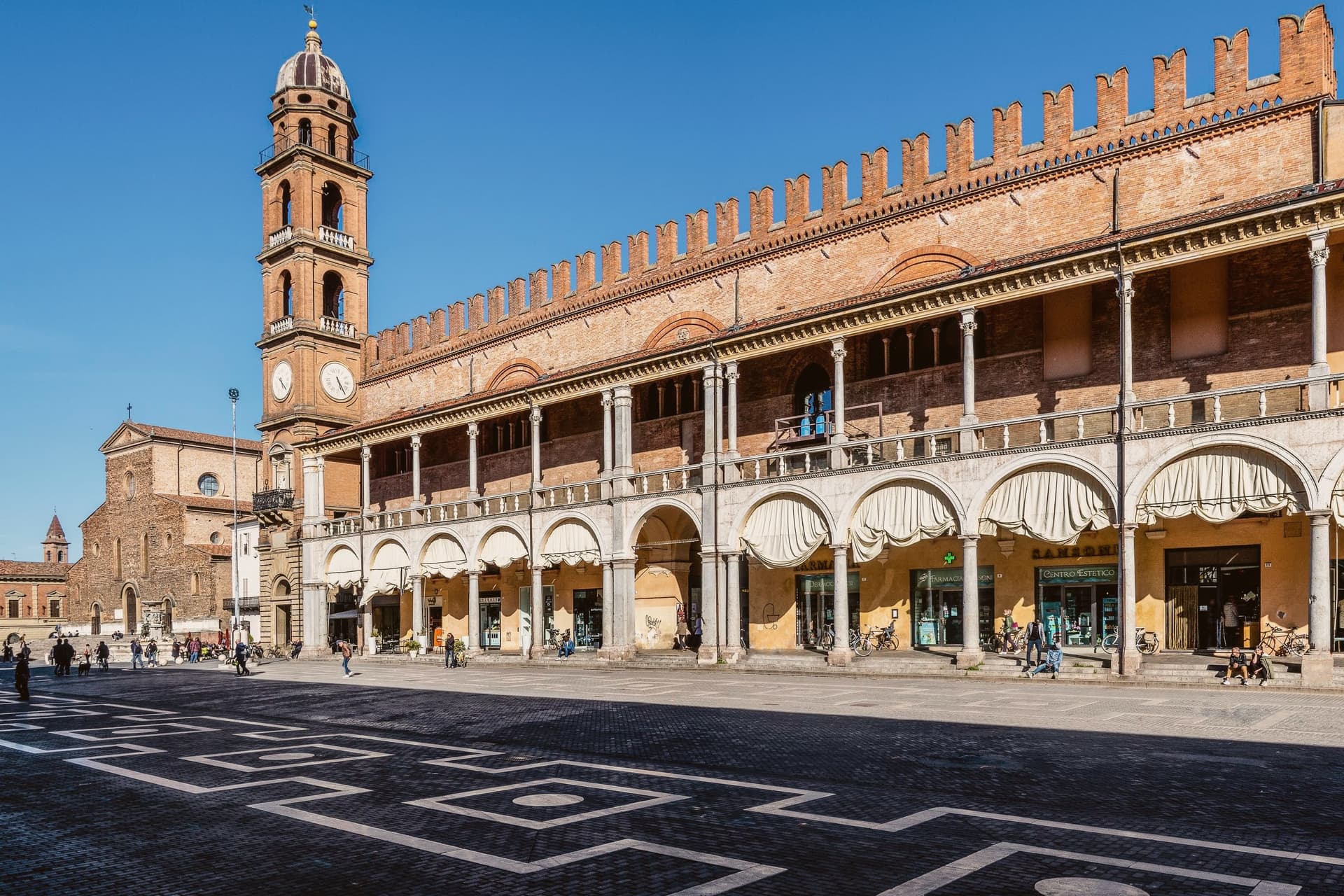
Faenza sits at 34 meters on the Via Emilia between Bologna and Rimini, on the Lamone river fifty kilometers southeast of Bologna. The city gave its name to faïence: tin-glazed earthenware that emerged here in the late fourteenth century and reached its peak in the early sixteenth, when the bianchi di Faenza, white-on-white ceramics exported across Europe, set the standard for Renaissance maiolica.
The Museo Internazionale delle Ceramiche, founded in 1908 by Gaetano Ballardini, holds 15,000 square meters of collections from 4000 BC to the present, with rooms dedicated to Picasso, Matisse, Chagall, Léger, Dalí, Burri, and Fontana. UNESCO named it a Monument Witness to a Culture of Peace in 2000.
The Cattedrale di San Pietro Apostolo, begun by Giuliano da Maiano in 1474, dominates Piazza della Libertà; Piazza del Popolo next door holds the medieval Palazzo del Podestà and the municipal palace. The Palio del Niballo, an equestrian competition between the five city rioni, runs every June.
La Baita, Manueli have been named by a guide.
What to see in Faenza
- Museo Internazionale delle Ceramiche. Founded in 1908 by Gaetano Ballardini, 15,000 square meters spanning 4000 BC to contemporary work by Picasso, Matisse, Chagall, and Fontana.
- Cattedrale di San Pietro Apostolo. Renaissance cathedral begun by Giuliano da Maiano in 1474, completed by 1515, with sculptures by Benedetto da Maiano in the nave.
- Piazza del Popolo. Twin medieval square to Piazza della Libertà, framed by the Palazzo del Podestà and the porticos of the municipal palace.
How to get to Faenza
There is a railway station in the town, so you can arrive without a car and never need one while you are here. Forlì is roughly 26 minutes away by road.
Our tip
April through June and September through October are the working months on the Romagna plain. Spring brings the Palio del Niballo at the end of June and clear water in the Lamone; autumn dries the fields gold and brings the ceramics fairs back to the centro. July and August touch thirty-six degrees with high humidity, and Piazza del Popolo empties between two and five.
More from Anywhere Italy
- The best towns known for what they grow within 45 minutes of Bologna
 The best towns known for what they grow within two hours of Pisa
 The best towns known for what they grow within 75 minutes of Parma
- The best towns known for what they grow within an hour of Rimini
- The best wine towns within 75 minutes of Rimini
 The best hill towns within 75 minutes of Bologna