
The best hill towns within 75 minutes of Bologna
Bologna sits on the flat, but the land starts climbing almost as soon as the ring road ends. Within an hour you are among sandstone ridges and clay badlands, terraced vines running down towards the via Emilia, cherry trees that turn the slopes white in spring and heavy with fruit by early summer. The food changes with the altitude: tortellini in brodo in the valley kitchens, chestnut flour and porcini higher up, Lambrusco Grasparossa on the Modenese slopes and Albana or Sangiovese as you move east into Romagna. Autumn is the best season for it, when the fog lies on the plain and the hill towns stand clear above it.
Most visitors keep to the city, and understandably so. The porticoes, the towers, the tortellini and the market streets around the Quadrilatero absorb almost everyone who comes to this part of Emilia-Romagna, and on a spring weekend the queue for the Asinelli tower stretches down the street. Bologna is a compact city that receives a great many people at once, and the crowd is concentrated in a few blocks.
The hills do not stop where the day trippers turn back. The same ridges continue west into the Modenese wine country, south into the Mugello and east towards the Romagnolo terraces, and they carry small towns built of the local stone, some walled, some circling a castle, most of them with a view back over the plain. Fewer people go, and the drive or the local train is short. These are the ones worth the detour.
Of the 17 communes we have mapped in a 75-minute drive of Bologna, 7 qualify as hill towns: each stands on high ground rather than on the plain. The smallest, Arquà Petrarca, has 1,810 residents.
If you are still choosing, we have also written The best towns that eat well within an hour of Bologna and The best hill towns within 75 minutes of Parma.
Arquà Petrarca
Why visit Arquà Petrarca
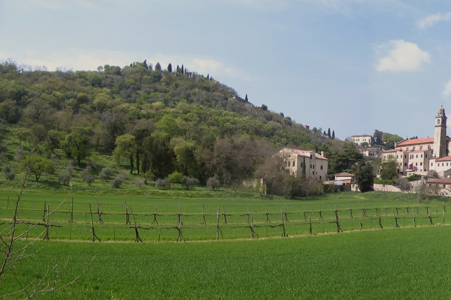
Arquà sits between Monte Ventolone and Monte Castello, in the Euganean Hills south of Padova. The name dates to medieval records; the suffix Petrarca was added in 1868, after the Veneto's annexation to the Kingdom of Italy, as a public homage to the poet who chose to die here.
Francesco Petrarca arrived in 1370 and lived in a thirteenth-century house he renovated himself across two stories, the Casa del Petrarca, now a museum with frescoes from the fifteenth and sixteenth centuries. He died at his desk on the night of 18-19 July 1374.
His tomb, an ark in red Verona marble inspired by Roman sarcophagi, was placed in the churchyard of Santa Maria Assunta in 1380 and reset in 1965. The village kept its medieval layout: two piazzas linked by a stepped path, the Casa above and the church and tomb below.
The hills around it grow Colli Euganei DOC wine, olives, and the giuggiole that go into the local liqueur Brodo di Giuggiole.
What to see in Arquà Petrarca
- Casa di Francesco Petrarca. The poet's thirteenth-century house, renovated by him on two floors and now a museum with frescoes added by later owners in the fifteenth and sixteenth centuries.
- Tomba di Petrarca. Sarcophagus in red Verona marble in the churchyard of Santa Maria Assunta, placed in 1380, six years after the poet's death.
- Chiesa di Santa Maria Assunta. Parish church first documented in 1026, enlarged through the centuries, with frescoes of the Venetian-Byzantine school up to the fifteenth century.
How to get to Arquà Petrarca
There is a railway station in the town, so you can arrive without a car and never need one while you are here. Padova is roughly 28 minutes away by road.
Our tip
April through June and September through October are the months Arquà is built for. The hills are green in spring and gold in autumn; the slope from Piazza Roma down to the church is comfortable walking weather. July and August push past thirty degrees and the village empties between two and six, though Padova day-trippers still arrive in the late afternoon.
Dozza
Why visit Dozza
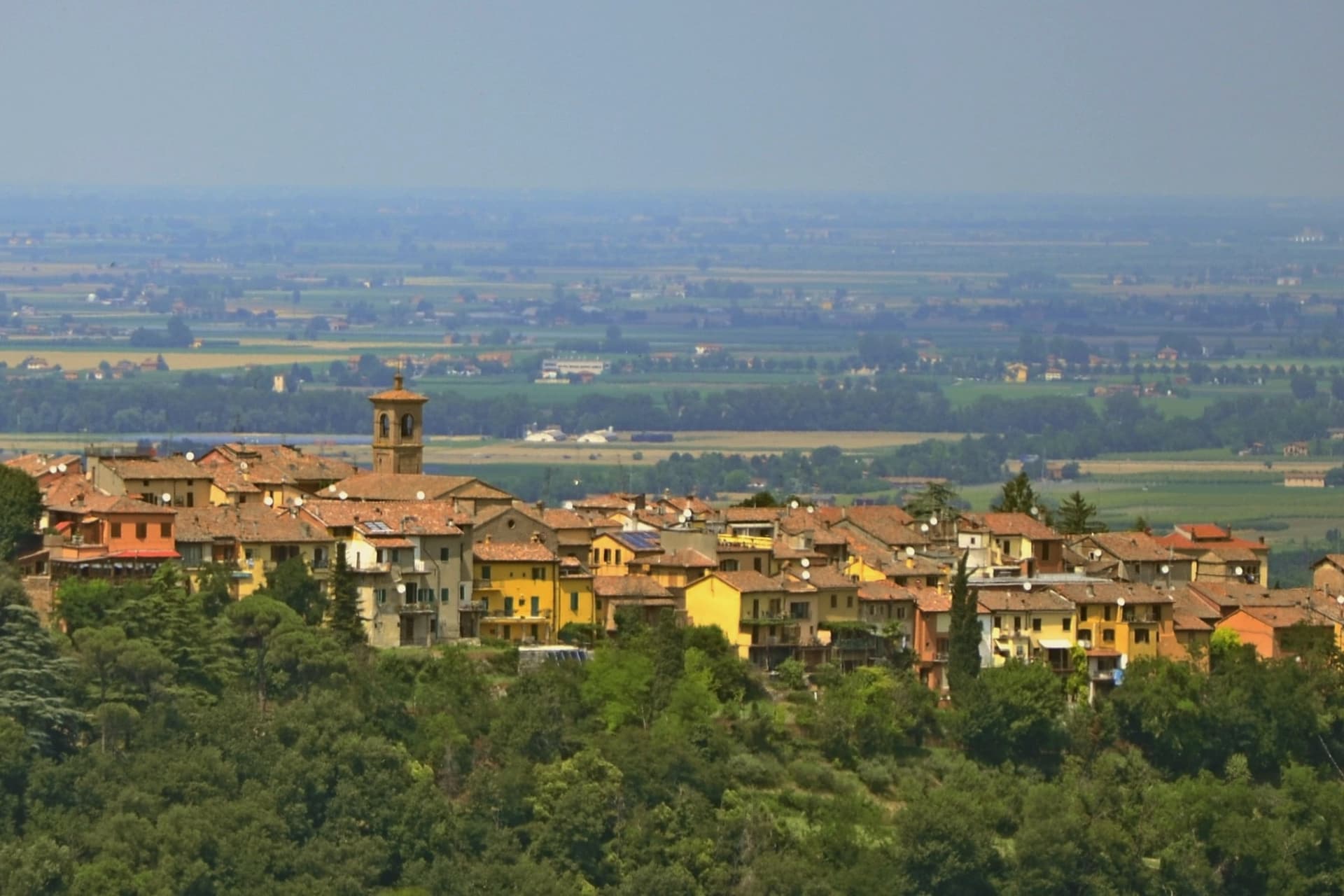
Dozza sits on a low ridge at 190 meters above the Sellustra valley, six kilometers from Imola and twenty-five southeast of Bologna. The medieval village runs along a single curved spine of stone houses, with the Rocca Sforzesca closing the upper end.
Caterina Sforza rebuilt the fortress at the end of the fifteenth century on the remains of earlier Bolognese defences; the Malvezzi-Campeggi family turned it into a palazzo in the late sixteenth century, and the cellars now hold the Enoteca Regionale dell'Emilia-Romagna, which curates the wines of the whole region. The Biennale del Muro Dipinto began in 1960, when the opening of the Rocca to the public was paired with a contemporary-painting competition that worked directly on the village walls.
Over sixty years later, more than 100 murals cover the borgo, repainted and added to every other year by invited Italian and international artists. The municipality holds Borghi più belli and Bandiera Arancione recognition.
Population 6,582.
What to see in Dozza
- Rocca Sforzesca. Late fifteenth-century fortress rebuilt by Caterina Sforza, transformed into a palazzo by the Malvezzi-Campeggi family at the end of the 1500s.
- Muro Dipinto. Over 100 murals on the house walls of the medieval village, repainted and added to every two years since the first Biennale in 1960.
- Enoteca Regionale dell'Emilia-Romagna. Regional wine cellar inside the Rocca's underground levels, curating about 800 labels from across the region's DOC and DOCG zones.
How to get to Dozza
Bologna is roughly 37 minutes away by road.
Our tip
April through June and September through October are the working months in Dozza. The murals look best in oblique morning or late-afternoon light, and the Sellustra valley below stays green into early summer. The Biennale del Muro Dipinto runs in September of odd-numbered years and is when the borgo is fullest, with painters working on scaffolding through the whole month.
Barberino di Mugello
Why visit Barberino di Mugello
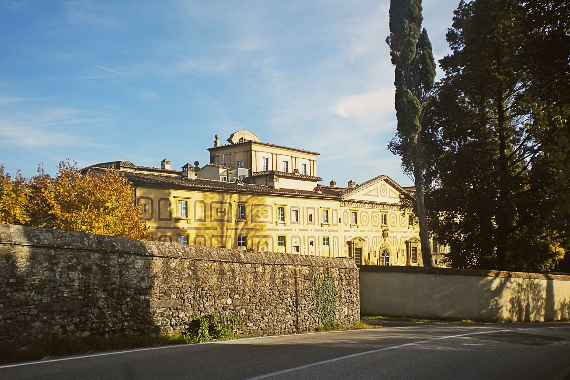
Barberino di Mugello sits at 272 meters in the upper Sieve valley, twenty-five kilometers north of Florence, the road and rail gateway from the city to the Mugello and onward to Bologna across the Apennines. The Medici family had its roots in this territory: Cosimo the Elder commissioned Michelozzo around 1451 to transform the medieval castle at Cafaggiolo into a country villa, the first in the Medici building campaign that would later run through Poggio a Caiano and Cerreto Guidi.
In 2013 Villa di Cafaggiolo and the nearby Villa del Trebbio joined eleven other Medici properties on the UNESCO list. Michelozzo's hand also shows on the fourteenth-century loggia in the main piazza of Barberino.
South of the town lies the Lago di Bilancino, an artificial reservoir completed in 1999, the largest in Tuscany at five square kilometers, built to feed the water supply of Florence, Prato and Pistoia, and now used for sailing, windsurfing and birdwatching.
What to see in Barberino di Mugello
- Villa Medicea di Cafaggiolo. Medieval castle transformed into a country villa by Michelozzo around 1451 for Cosimo the Elder, UNESCO World Heritage since 2013.
- Villa Medicea del Trebbio. Smaller medieval Medici castle on a wooded hilltop near San Piero a Sieve, also inscribed on the UNESCO list of Medici Villas in 2013.
- Lago di Bilancino. Artificial reservoir completed in 1999, five square kilometers, the largest in Tuscany, built to supply Florence, Prato and Pistoia.
How to get to Barberino di Mugello
Prato is roughly 33 minutes away by road.
Our tip
April through June brings the Mugello hills into clear green and the lake of Bilancino into its season for windsurfing and small-boat sailing. September and October are dry and gold, the harvest in the upper Sieve and the chestnut woods on the higher ridges. July and August are hot enough in the valley to drive most weekenders to the lake; the two Medici villas are cool inside year-round.
Bertinoro
Why visit Bertinoro
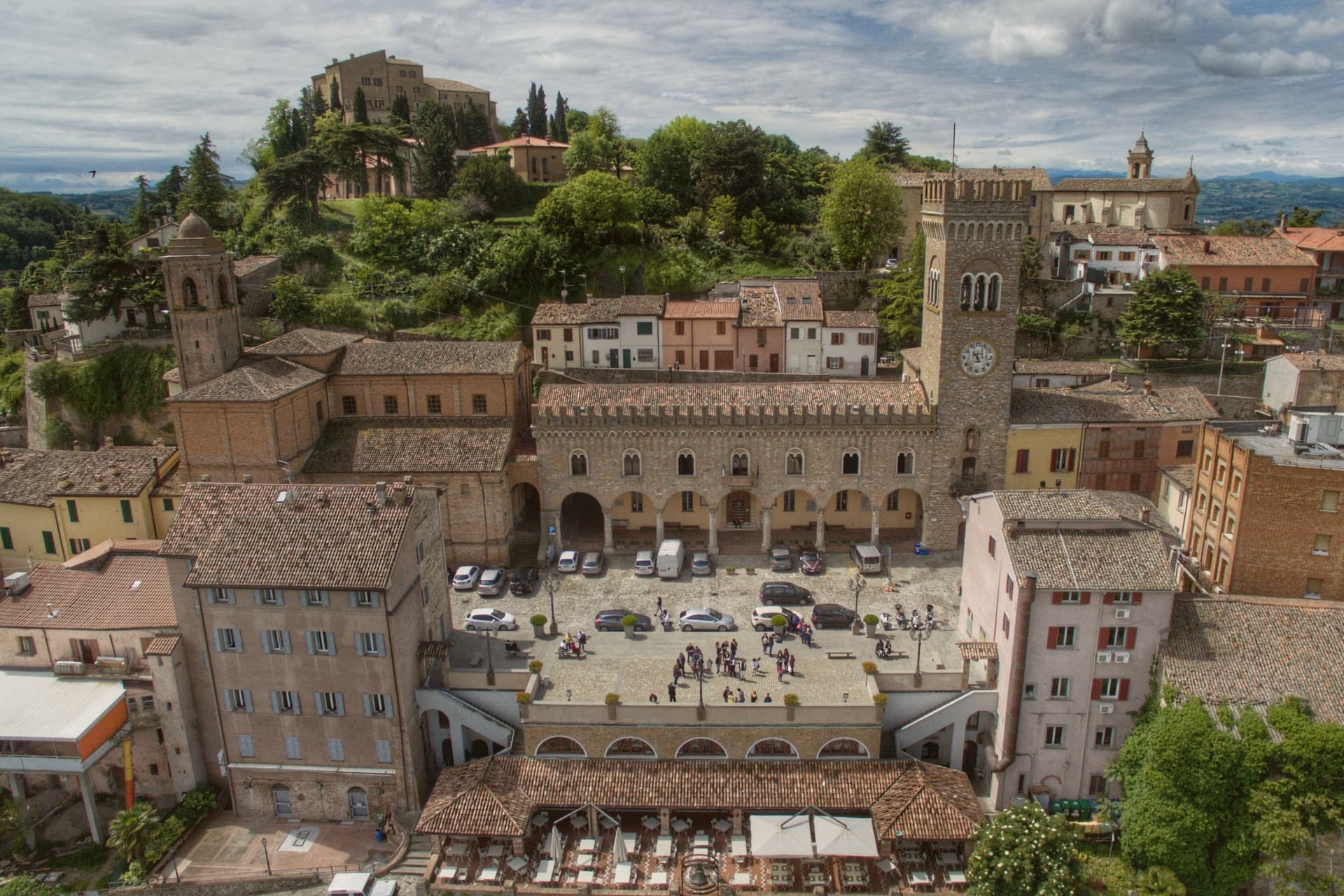
Bertinoro sits at 254 meters on Mount Cesubeo, a few kilometers south of the Via Emilia between Forlì and Cesena, the Romagna hills rolling toward the Adriatic on a clear day visible from the panoramic balcony locals call the Belvedere. The town's signature object is the Colonna delle Anella in Piazza della Libertà, a white-stone column with twelve iron rings, erected in 1300 by the noble families of the borgo so visitors arriving from the Via Emilia could tie their horse to a ring and be hosted by the family it belonged to.
The Albana grape grown on the surrounding slopes became, in 1987, the first Italian white wine to receive DOCG status; the artist Guerrino Bardeggia's Campana dell'Albana still rings to mark the opening of the harvest. Bertinoro joined the Borghi più belli d'Italia network in 2025.
The municipality holds two institutional signals: Borghi più belli, Città del Vino. Population 11,026.
What to see in Bertinoro
- Colonna delle Anella. White-stone column with twelve iron rings, erected 1300 in Piazza della Libertà so visitors could tie their horse to the ring of the family who would host them.
- Rocca Vescovile. Tenth-century fortress on the summit of Mount Cesubeo, expanded by the Ordelaffi and Malatesta and used as the bishop's residence from the sixteenth century.
- Cattedrale di Santa Caterina. Sixteenth-century cathedral on the upper part of the borgo, rebuilt over an earlier Pieve dedicated to Saint Catherine of Alexandria.
How to get to Bertinoro
Forlì is roughly 20 minutes away by road.
Our tip
April through June brings green hills, mild evenings, and the first events in Piazza della Libertà. September and October are the strongest months: the Albana harvest runs through late September, and the Festa dell'Ospitalità on the first Sunday of September re-enacts the old ring ritual, drawing visitors paired by lottery to twelve host families. July and August touch thirty-two degrees but the 254-meter elevation cools the borgo earlier than the plain below.
Castelvetro di Modena
Why visit Castelvetro di Modena
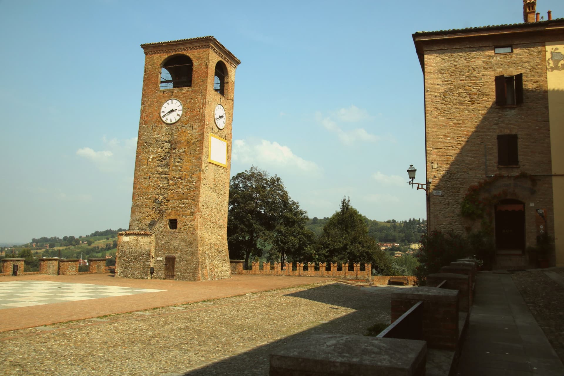
Castelvetro di Modena sits on a hill at 152 meters, eighteen kilometers southeast of Modena and at the northern edge of the Apennine foothills. The medieval centro storico rises around the Piazza Roma, paved in alternating white and black stones that earned it the name Piazza della Dama, the checkerboard piazza, framed by the four surviving towers of the old castle.
The Grasparossa grape grows on the clay slopes around the town, the sandy soil and the south-facing aspect producing the deepest, most tannic of the three main Lambruschi; Lambrusco Grasparossa di Castelvetro received DOC status in 1970. Above the piazza, the Palazzo Rinaldi houses the Museo del Vino and the Museo dell'Aceto Balsamico, the second tracing the same Modenese tradition that nearby Spilamberto codifies.
The municipality holds three institutional signals: Borghi più belli, Bandiera Arancione, Città del Vino. The Sagra dell'Uva e del Lambrusco runs the last weekend of September, when the streets fill with the chess players from the surrounding Lambrusco towns dressed as living pieces on the piazza.
What to see in Castelvetro di Modena
- Piazza Roma. Checkerboard piazza paved in alternating white and black stones, framed by the four surviving towers of the medieval castle.
- Castello di Levizzano Rangone. Tenth-century fortified frazione four kilometers north, with a tower built in the 990s and a fully preserved medieval village.
- Museo del Vino. Wine museum inside the Palazzo Rinaldi, tracing the Grasparossa production cycle and the DOC zone established in 1970.
How to get to Castelvetro di Modena
There is a railway station in the town, so you can arrive without a car and never need one while you are here. Modena is roughly 28 minutes away by road.
Our tip
April through June and September through October are the Castelvetro months. The hills around the borgo turn green in spring and red in autumn when the Grasparossa vines colour up before the harvest. July and August are hot, thirty-five degrees in the valley, less in the hills above, and the cantine slow down. Sagra dell'Uva e del Lambrusco Grasparossa di Castelvetro falls in September.
Sasso Marconi
Why visit Sasso Marconi
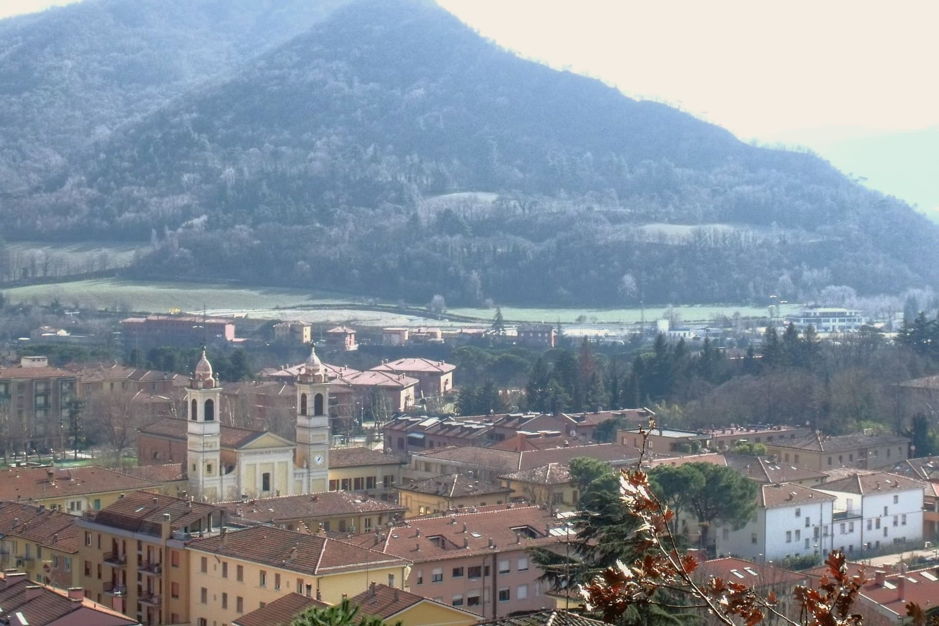
The Setta and Reno rivers meet below the rock that gives the town its name, at the point where the pre-Apennine hills begin their climb south of Bologna. The Sasso della Glosina dominates the bend, a Pliocene formation old enough to have shaped how the crossing below it was used long before the valley took its modern name.
The town itself was called Sasso Bolognese until 1938, when it was renamed for the family whose estate lies in the frazione of Pontecchio, on the valley floor rather than on the rock itself. The territory reaches from that river confluence up into the Apennine slopes, and the change in elevation shows in what the land produces: white truffle from the valley floor near the Reno, and vineyards on the hills around Pieve del Pino and Mongardino, recognition earned on two different registers of the same ground.
The lower town, built around the rivers and the old road to Pistoia, and the upper slopes, given to woods and terraced vines, read as one territory doing two different kinds of work.
What to see in Sasso Marconi
- Villa Griffone - Museo Marconi. Marconi family villa in the frazione of Pontecchio. The mausoleum sits alongside the attic laboratory, and the museum holds working reproductions of his early apparatus.
- Sasso della Glosina. The rock rises directly over the river bend, its bulk visible from the crossing below and from much of the surrounding valley.
- Confluenza Setta-Reno. Meeting of the two valleys at the foot of the rock, with the historic crossing of the Via Porrettana toward Pistoia.
How to get to Sasso Marconi
There is a railway station in the town, so you can arrive without a car and never need one while you are here. Bologna is roughly 26 minutes away by road.
Our tip
April through October is the working season in Sasso Marconi. Spring and early autumn are best on the Reno valley trails and at Villa Griffone, with mild temperatures and the Apennine foothills green or autumn-coloured. July and August can touch thirty-five degrees in the valley, though the higher frazioni stay cooler; many visitors come up from Bologna for a day on a weekend. Fira di Sdaz di Sasso Marconi falls in September.
Vignola
Why visit Vignola
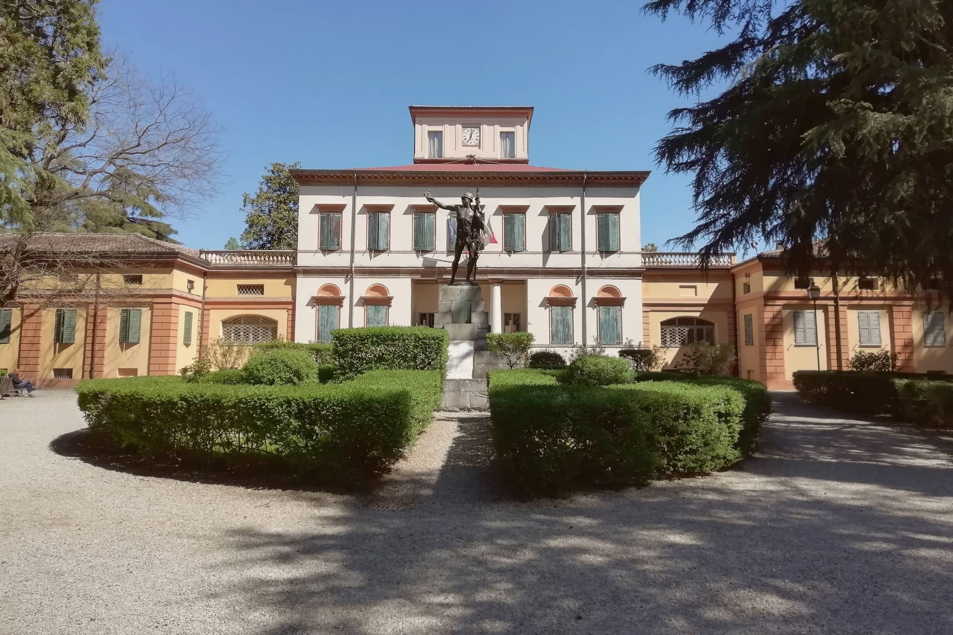
Vignola sits at 125 meters on the right bank of the Panaro, twenty-five kilometers south of Bologna and twenty east of Modena, where the Modenese plain meets the Apennine foothills. The fortress there is documented from the eighth century, raised by the Abbot of Nonantola to guard the abbey's lands before the Contrari family rebuilt it in the fifteenth century as a fortified residence; in 1577 it passed to the Boncompagni-Ludovisi, who held it until 1965.
The palace beside it takes its second name from the family that acquired it, and from the architect born in the town in 1507, who died in 1573 after a career among the leading figures of late Renaissance architecture. The cherries that carry the town's name upriver and down are IGP-protected across twenty-eight communes stretching from Modena to Bologna, and the blossom that precedes the fruit each spring fills the Panaro valley below the walls.
A disused railway, now a greenway, threads through the same ground on its way between Mirandola and Bologna. The town's identity rests on this pairing of a fortified height above the river and an agricultural valley beneath it, one lineage of stone, one of orchards, both still legible in the place today.
What to see in Vignola
- Rocca di Vignola. Eighth-century origin, built to guard the lands of an abbey and later rebuilt as a fortified residence. The frescoed interiors and four corner towers stand over the river much as the rebuilding left them.
- Scala a Chiocciola di Palazzo Barozzi. The 106 steps rise with no central support, an engineering feat as much as a decorative one, tucked inside the palace next to the fortress.
- Palazzo Boncompagni. The palace passed to the family that gives it its name in the late sixteenth century and held the fortress until 1965. Its reception rooms carry frescoes alongside the staircase it is best known for.
How to get to Vignola
There is a railway station in the town, so you can arrive without a car and never need one while you are here. Modena is roughly 34 minutes away by road.
Our tip
April through June and September through October are the working months on the Panaro foothills. The first two weekends of April fill the centro with the Festa dei Ciliegi in Fiore, when the orchards along the river bloom. June brings cherries to market and the Panaro at high water.
More from Anywhere Italy
- The best towns that eat well within an hour of Bologna
 The best hill towns within 75 minutes of Parma
 The best hill towns you can reach by train in Emilia-Romagna
- The best towns known for what they grow within 45 minutes of Bologna
- The best towns you can reach by train within 45 minutes of Bologna
 The best towns known for what they grow within two hours of Florence