
The best wine towns within two hours of Ancona
The land behind Ancona rises quickly into limestone ridges and clay hills, and almost all of it grows wine. Verdicchio comes off the Esino valley slopes in a lean, almond-edged style that goes with the local brodetto and with fried olives stuffed with meat; further inland and south the reds take over, Sangiovese on the Romagna side of the Apennines, Sagrantino in the Umbrian hills, big enough to sit beside pigeon or a plate of grilled lamb. The towns are built of warm brick or pale sandstone, walled, with a piazza that fills at the passeggiata and empties by supper. Autumn is the season: grape harvest, new oil, truffle stalls in the market squares, and cellars open for tasting on a Saturday morning.
Most visitors arriving into Ancona head for Urbino or press straight on to Assisi, and both deserve the traffic they get. The result is coach parks, timed entry and restaurants working three sittings, which is a poor setting for drinking wine slowly. Riviera del Conero beaches near the port fill from June, and Ravenna's mosaics absorb the wet-weather crowd. The wine, meanwhile, is made somewhere else entirely.
The same ridges and the same grapes carry on past all of that, and the production zones are drawn around towns whose names rarely appear on an itinerary. These are places with a fortress or a set of walls, a wine consortium, an osteria that pours by the glass, and space at the table. Each one here sits inside the boundaries of a protected wine, close enough to Ancona for a day out and better as a night. Worth a detour for the cellar alone, and worth staying for the dinner after it.
Of the 93 communes we have mapped in a 120-minute drive of Ancona, 9 qualify as wine towns: each sits inside the production zone of a protected wine. The smallest, Offagna, has 2,047 residents.
If you are still choosing, we have also written The best towns known for what they grow within two hours of Ancona and The best towns with a serious restaurant that eat well within 90 minutes of Ancona.
Offagna
Why visit Offagna
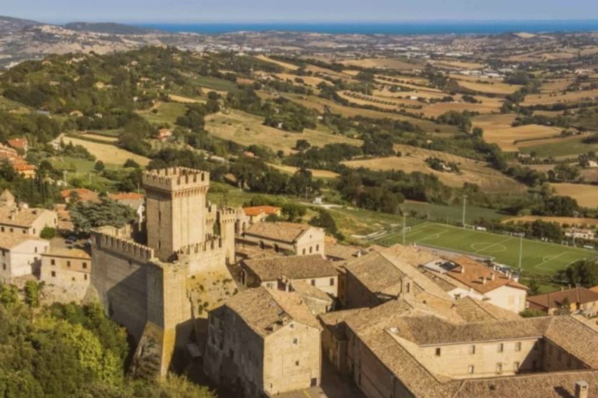
Offagna sits at 309 meters on a sandstone outcrop between Ancona and Osimo, ten kilometers from the Adriatic. The Rocca was built by the city of Ancona between 1454 and 1456 as a fortified outpost to defend its inland frontier, raised in just two years on the ruins of an earlier castle and well preserved through the centuries.
Tall walls, four square towers and a slender keep make it one of the cleanest examples of mid-fifteenth-century military architecture in central Italy. Inside, the Museo della Rocca holds medieval and renaissance arms and a collection of crossbows.
The walled village around it received both the Borghi più Belli recognition and the Touring Club Bandiera Arancione in May 2013. The Feste Medievali in the last week of July fill the centro storico with neighborhood Quarters competing in archery and crossbow, fairs and processions through the Maniero square.
The Conero is visible from the towers.
What to see in Offagna
- Rocca di Offagna. Mid-fifteenth-century fortress built by Ancona 1454-1456 in just two years, with four square towers, a slender keep and one of the best-preserved military profiles in the Marche.
- Museo della Rocca. Inside the fortress, holding medieval and renaissance arms, crossbows and military objects from the Anconitan territorial defense.
- Centro storico. Walled medieval village around the Rocca, with stepped streets, the Maniero square at the centre, and both Borghi più belli and Bandiera Arancione recognition from 2013.
How to get to Offagna
Ancona is roughly 24 minutes away by road.
Our tip
April through June and September into October are the best months for Offagna. The Aspio valley turns green in spring and gold through the late summer harvest, with the Adriatic visible from the Rocca walls and the Conero promontory rising above the coast ten kilometers east. July and August touch the low thirties; the centro storico quietens between three and seven in the afternoon. Fiera del Colombaccio falls in September.
Numana
Why visit Numana
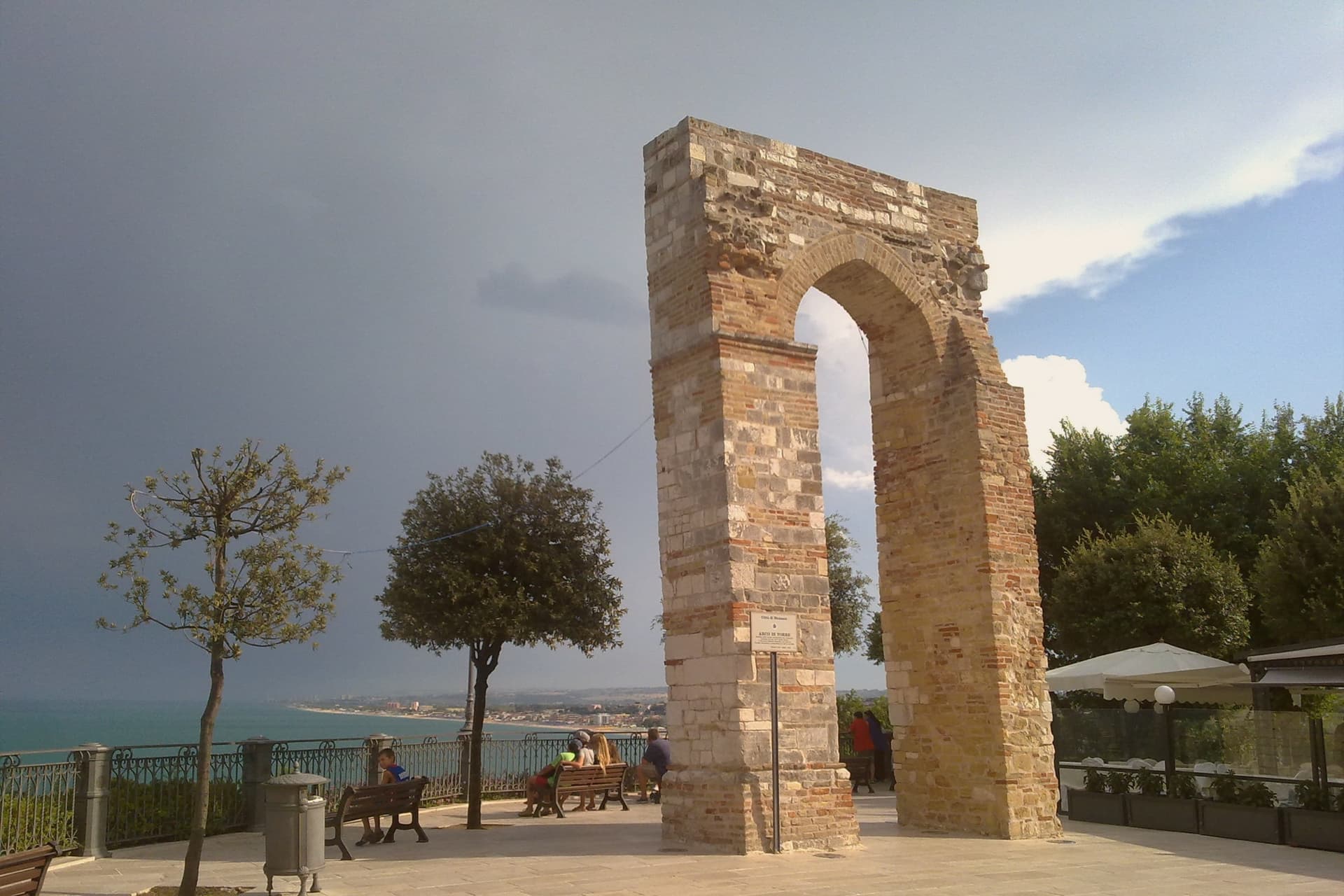
Numana sits fifteen kilometers south of Ancona, on a cliff overlooking the Adriatic at the foot of the promontory that shapes this stretch of coast. The old town, Numana alta, runs along the ridge in continuity with Sirolo, while Numana bassa wraps around the port below, so the visitor moves between two settlements joined by a single slope rather than one town with two names.
The place was a Picene harbour that traded with Greek and Etruscan ships from the sixth century BC, and a major centre of pre-Roman Italy before the rise of Ancona pushed it into decline around 500 BC. That decline is what left the burial grounds undisturbed long enough to be excavated centuries later, and it is also why the town's oldest identity is archaeological rather than architectural: a harbour that mattered, stopped mattering, and was rediscovered through what it buried.
In Riva a Numana, Casa Rapisarda, Riva Restaurant del View Place Hotel and 1 more have been named by a guide.
What to see in Numana
- Antiquarium Statale di Numana. Opened 1974, holding more than five hundred Picene burials from the Conero necropolises, plus a sixth-century BC limestone warrior's head found on a Numana beach in 1892.
- Santuario del Crocifisso. Rebuilt in 1969 on a 1566 foundation, the current structure standing on a sanctuary site with roots three centuries older than the rebuild itself.
- Porto di Numana. Working fishing and pleasure port at the foot of the cliff, with daily boat services along the Conero cliffs to the otherwise inaccessible Due Sorelle beach.
How to get to Numana
Ancona is roughly 30 minutes away by road.
Our tip
May through September are the months for Numana. The Conero water clears from late May and stays warm through September, with the port's daily boats running to Due Sorelle and the other Conero cliff beaches. July and August are the busiest weeks of the Marche coast: parking is metered into the late evening and the Numana bassa restaurants book ahead.
Sirolo
Why visit Sirolo
Sirolo sits at 125 meters, twenty kilometers from Ancona, on ground that belonged to the Conti Cortesi family. The medieval village kept one of the two original castle towers, folded now into the parish church, and the belvedere above Piazza Vittorio Veneto looks out across the bay.
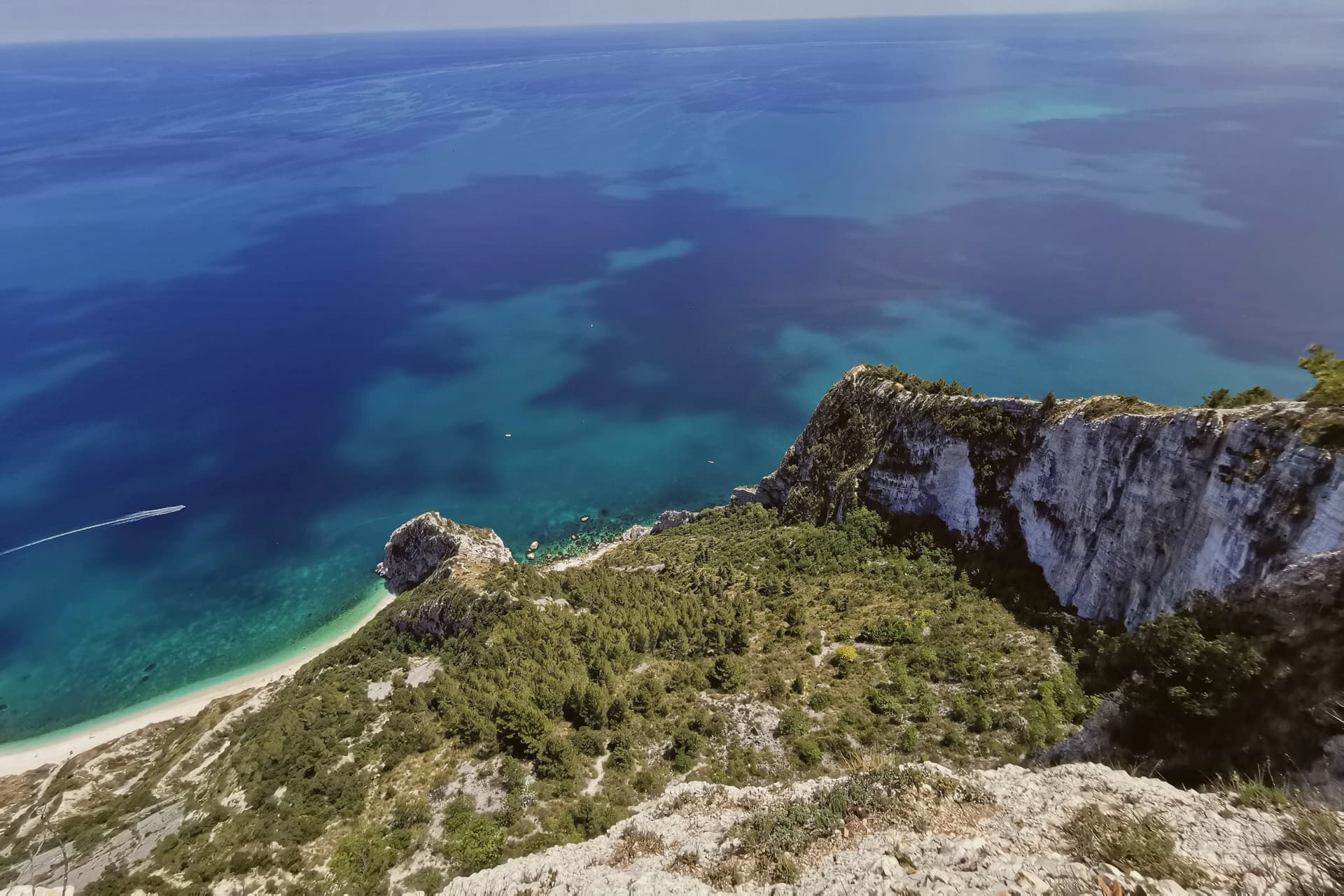
Below town, the ridge drops toward the Picene necropolis of I Pini, and further down still toward the water. The mountain above the village and the water below it are the same geology: limestone that falls straight into the sea rather than tapering through a coastal plain, which is why the village sits on a clifftop rather than a shoreline.
Upper Sirolo is the castle, the church and the theatre, all cut from the same pale stone. Lower Sirolo is reached by boat or by trail, down through the park to the cove where the sea stacks stand.
The grave goods from the necropolis have left town entirely, kept at the Antiquarium in neighbouring Numana, so what remains above ground here is the tomb site itself rather than its contents. The town doubles in summer and empties again in October: a place shaped less by what happens in it than by the drop between its two levels, the built one and the wild one.
Lofficina, Convivio have been named by a guide.
What to see in Sirolo
- Centro storico. Medieval village on the clifftop with the Arco Gotico from around the year 1000, the Piazzetta and a belvedere looking out across the Adriatic.
- Chiesa di San Nicolò di Bari. Eighteenth-century parish church built over a thirteenth-century structure, incorporating one of the two surviving towers of the medieval Sirolo castle.
- Teatro Cortesi. Municipal theatre inaugurated in 1875, built in white Conero stone, restored and reopened in 1989.
How to get to Sirolo
Ancona is roughly 31 minutes away by road.
Our tip
May through September is the window for Sirolo. The water warms enough for the Conero beaches from late May, the boat shuttle to the Due Sorelle runs daily through summer, and the belvedere stays cool when the Adriatic plain below is hot. July and August are the busiest weeks: parking limits in the centro storico, queues for Spiaggia Urbani and Sassi Neri, evening passeggiate spilling out of every trattoria.
Bevagna
Why visit Bevagna
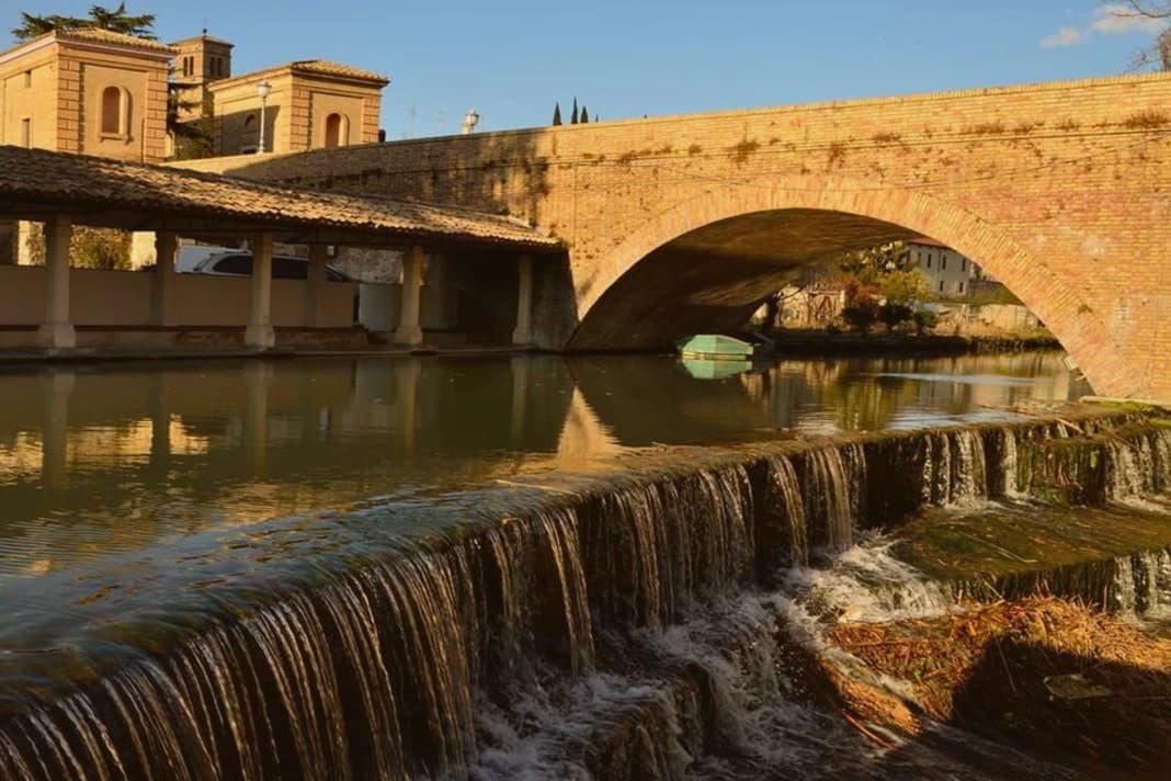
Bevagna sits on the floor of the Umbrian valley at 225 meters, where the Clitunno meets the Timia. Ancient Mevania, the name means she who stands in the middle, was a Roman mansio on the Via Flaminia, listed in the Antonine Itinerary.
A black-and-white mosaic of the 2nd century AD survives almost intact in the frigidarium of the Roman baths, twelve meters by seven, octopuses and dolphins in the center, tritons and sea-horses on the short sides. Piazza Silvestri at the heart of the centro storico holds two Romanesque churches that face each other at odd angles, San Michele Arcangelo and San Silvestro, built within years of each other in the late 12th century.
The Mercato delle Gaite each June turns the town into the year 1300 for ten days, four quarters competing on medieval trades and tavern menus, no anachronisms allowed. The Sagrantino slopes of Montefalco are nine kilometers up the road.
Serpillo, Ottavi Mare have been named by a guide.
What to see in Bevagna
- Piazza Silvestri. Twelfth-century civic square ringed by the Palazzo dei Consoli, the churches of San Silvestro and San Michele, and the fountain of 1896.
- Chiesa di San Michele Arcangelo. Romanesque collegiate church built by Binello and Rodolfo at the end of the 12th century, on the main square.
- Chiesa di San Silvestro. Romanesque parish church across the piazza, signed and dated 1195 by Binello, the same builder as San Michele.
How to get to Bevagna
Perugia is roughly 39 minutes away by road.
Our tip
April through June and September into October are the months for Bevagna. The valley fills with green, the Sagrantino vines run on the slopes above town, and the rose festival fills the gardens around the walls in May. The Mercato delle Gaite runs the second half of June and is the single most concentrated weekend on the Umbrian medieval calendar. Sagra della Lumaca falls in August.
Torgiano
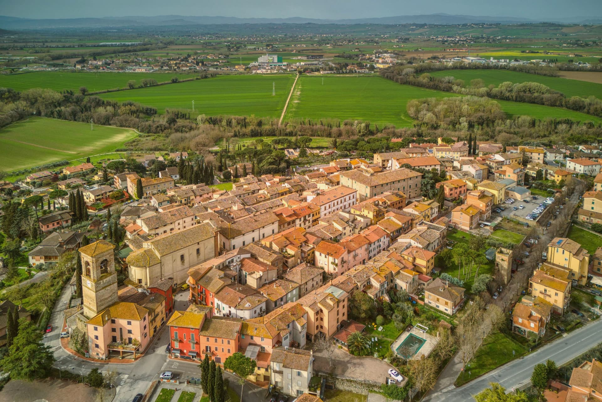
Why visit Torgiano
Torgiano sits at 219 meters at the point where the Chiascio joins the Tiber, ten kilometers south of Perugia. The Torre della Guardia, also called Torre Baglioni, was raised in 1274 to control the river customs traffic that moved up toward Rome from the Tiber valley.
Torgiano was the first Umbrian wine area to receive the DOC mark in 1968 and to be elevated to DOCG in 1990. Giorgio and Maria Grazia Lungarotti turned the wine economy of the town into a cultural project: the MUVIT, opened in 1974 inside the seventeenth-century Palazzo Graziani-Baglioni, holds three thousand pieces across twenty rooms documenting five thousand years of wine history.
The companion MOO, on the olive and oil, is inside a small medieval cluster within the castle walls. Both are managed by the Lungarotti Foundation.
The cantina itself, on the edge of the centro storico, has been the largest single Umbrian producer for half a century.
Elementi Fine Dining - Hotel Borgo Brufa, Olimpia Ristorante have been named by a guide.
What to see in Torgiano
- MUVIT Museo del Vino. Wine museum opened 1974 in 17th-century Palazzo Graziani-Baglioni, with 3,000 pieces across 20 rooms covering 5,000 years of wine history.
- MOO Museo dell'Olivo e dell'Olio. Olive and oil museum in a medieval cluster within the castle walls, managed alongside MUVIT by the Lungarotti Foundation.
- Torre della Guardia (Torre Baglioni). Defensive tower raised 1274 to control the Tiber-Chiascio customs traffic, the only standing element of the original river fortifications.
How to get to Torgiano
Perugia is roughly 26 minutes away by road.
Our tip
April through June and September into October are the working months. The vineyards run their full cycle on the slopes around the confluence, and MUVIT and MOO keep regular hours. The Banco di Assaggio dei Vini d'Italia is the historical late-summer tasting that put Torgiano on the wider Italian wine map. Vinarelli - Agosto Torgianese falls in August.
Longiano
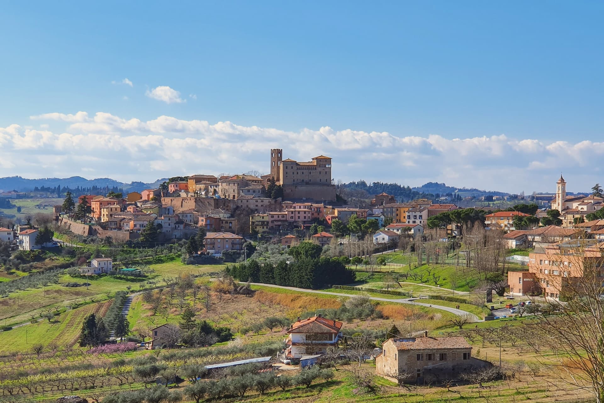
Why visit Longiano
Longiano sits at 179 meters on the first hill line between Cesena and Rimini, eleven kilometers inland from Cesenatico and within sight of the Adriatic. The town shifted from the plain to the hill in the seventh and eighth centuries, when the local population moved up to escape Lombard raids, and the settlement that resulted is the hilltop borgo still walled today, with the castle at its center and the theater just below it.
Longiano passed to the Church in 1581 and stayed under papal rule until unification, before the castle came to the commune in 1989. The sanctuary stands apart from this hilltop cluster, built around its painted crucifix and held by Franciscan presence for over seven centuries, a separate thread of the town's history running alongside the Malatesta line and the civic one.
What ties the parts together is the hill itself: a defensive move made in the seventh and eighth centuries left Longiano with a compact center where a former ruling family's fortress, a nineteenth-century theater and a walled medieval borgo all sit within reach of each other, while the sanctuary's much older devotional history runs on its own separate track nearby.
Magnolia, Dei Cantoni, Terre Alte have been named by a guide.
What to see in Longiano
- Castello Malatestiano. Fortified hilltop seat of the Malatesta of Rimini, later passing to the Church and then the commune. Its rooms now hold the Fondazione Tito Balestra, so the walls that once housed a ruling family now hold paintings, drawings and sculpture.
- Teatro Petrella. Sits just below the castle. Restored in 1986, it is known today for its acoustics inside the horseshoe-shaped hall.
- Santuario del Santissimo Crocifisso. Franciscan sanctuary built around a thirteenth-century painted crucifix on oak panel, with continuous Franciscan presence for over seven centuries.
How to get to Longiano
There is a railway station in the town, so you can arrive without a car and never need one while you are here. Rimini is roughly 30 minutes away by road.
Our tip
April through June and September through October are the months for Longiano. The hilltop catches a breeze the coastal plain below does not, and the views run from the Apennines to the Adriatic on clear days. July and August touch the low thirties and the centro storico empties between two and five; many visitors come up from Cesenatico and Cervia in the late afternoon for the cooler air and the castle. Crocetta 30 in Festa falls in August.
Bertinoro
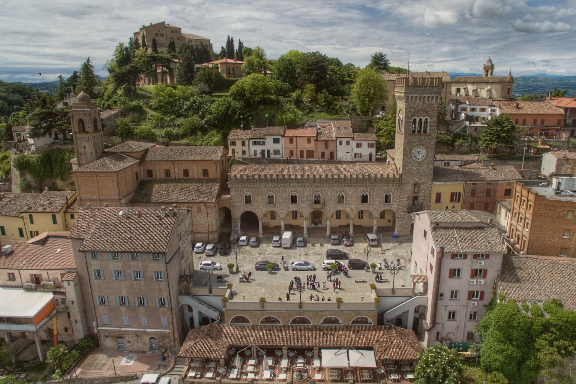
Why visit Bertinoro
Bertinoro sits at 254 meters on Mount Cesubeo, a few kilometers south of the Via Emilia between Forlì and Cesena, the Romagna hills rolling toward the Adriatic on a clear day visible from the panoramic balcony locals call the Belvedere. The town's signature object is the Colonna delle Anella in Piazza della Libertà, a white-stone column with twelve iron rings, erected in 1300 by the noble families of the borgo so visitors arriving from the Via Emilia could tie their horse to a ring and be hosted by the family it belonged to.
The Albana grape grown on the surrounding slopes became, in 1987, the first Italian white wine to receive DOCG status; the artist Guerrino Bardeggia's Campana dell'Albana still rings to mark the opening of the harvest. Bertinoro joined the Borghi più belli d'Italia network in 2025.
The municipality holds two institutional signals: Borghi più belli, Città del Vino. Population 11,026.
What to see in Bertinoro
- Colonna delle Anella. White-stone column with twelve iron rings, erected 1300 in Piazza della Libertà so visitors could tie their horse to the ring of the family who would host them.
- Rocca Vescovile. Tenth-century fortress on the summit of Mount Cesubeo, expanded by the Ordelaffi and Malatesta and used as the bishop's residence from the sixteenth century.
- Cattedrale di Santa Caterina. Sixteenth-century cathedral on the upper part of the borgo, rebuilt over an earlier Pieve dedicated to Saint Catherine of Alexandria.
How to get to Bertinoro
Forlì is roughly 20 minutes away by road.
Our tip
April through June brings green hills, mild evenings, and the first events in Piazza della Libertà. September and October are the strongest months: the Albana harvest runs through late September, and the Festa dell'Ospitalità on the first Sunday of September re-enacts the old ring ritual, drawing visitors paired by lottery to twelve host families. July and August touch thirty-two degrees but the 254-meter elevation cools the borgo earlier than the plain below.
San Severino Marche
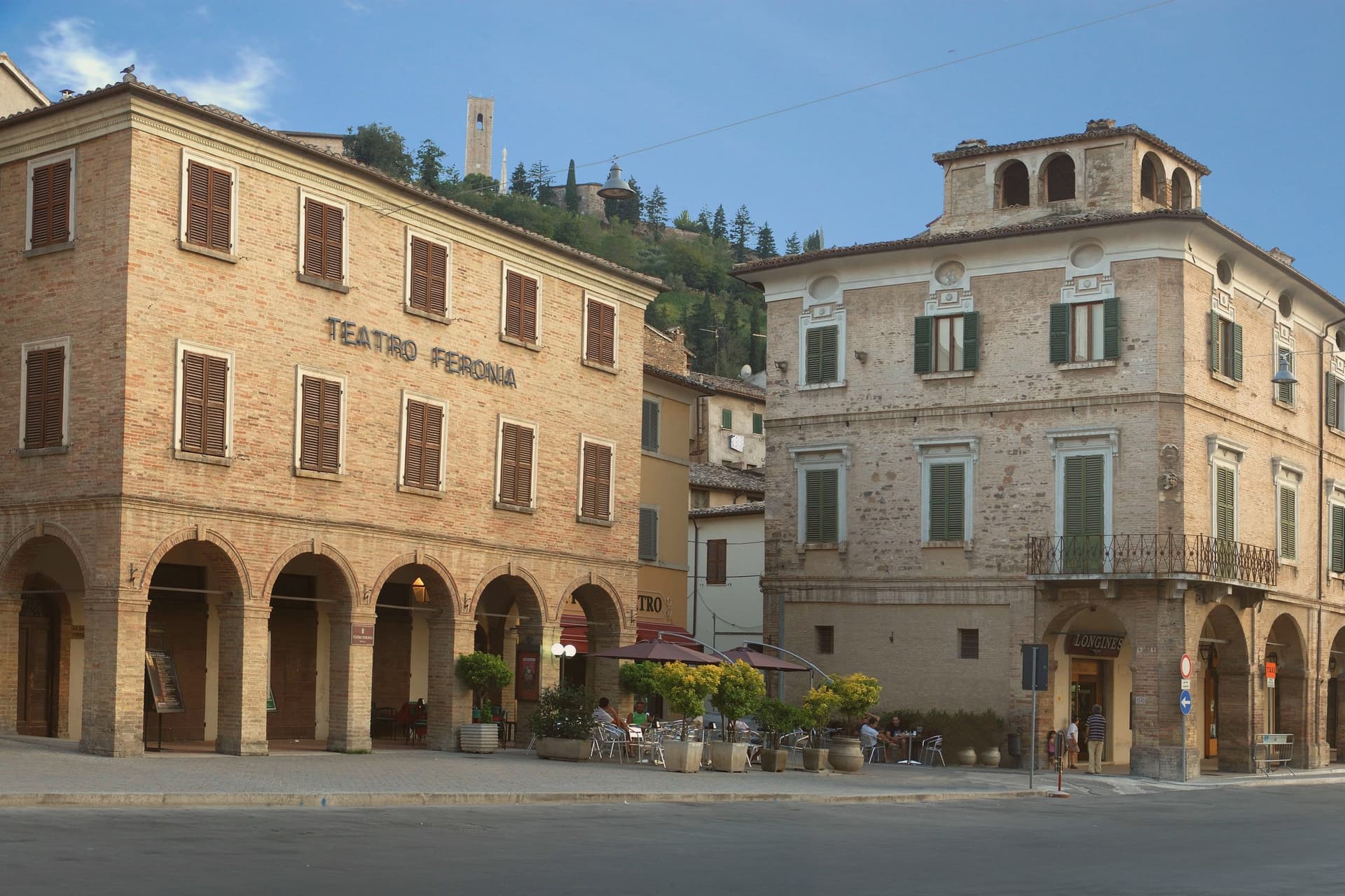
Why visit San Severino Marche
San Severino Marche sits at 235 meters in the Potenza valley, fifty kilometers southwest of Ancona, and the town is built in two distinct pieces rather than one continuous fabric. The medieval Castello occupies the hill above the town, still ringed by surviving city walls, while the Borgo below grew up around its own civic center on the valley floor.
The two parts do different jobs: the hill was governed and defended, walled and towered under the Smeducci dynasty through the fourteenth century, while the valley floor was built for markets and public life, organized around the wide colonnaded ellipse that still serves as the town's gathering space. The Salimbeni brothers, Lorenzo and Jacopo, were born in the town and worked across both halves of it, painting in a hilltop church and in a crypt-church alike, and their frescoes, along with a Vittore Crivelli polyptych, have since been gathered into a civic gallery in the lower town.
That movement of paintings from hill to valley mirrors the town's own shift in weight over time, from a fortified seat of government above to a civic and commercial center below, with the art now sitting closer to the square than to the walls that first sheltered it.
Cavallini have been named by a guide.
What to see in San Severino Marche
- Piazza del Popolo. The elliptical square anchors the lower town, its porticoes running unbroken around the full curve, giving the Borgo a single continuous gathering space rather than a scattering of smaller squares.
- Duomo Vecchio. The bell tower and the raised setting on Monte Nero are what register first, the cathedral standing above the walls rather than among them. Inside, the chapel that once held the Salimbeni Saint John cycle is now empty, the frescoes moved elsewhere in town.
- Torre degli Smeducci. The tower is the only structure on the hill that reads as purely defensive, plain where the church nearby is decorated, and it still dominates the skyline of the upper town.
How to get to San Severino Marche
There is a railway station in the town, so you can arrive without a car and never need one while you are here. Ancona is roughly 71 minutes away by road.
Our tip
April through June and September into October are the working months for San Severino Marche. The Potenza valley turns green from April, the climb to the Duomo Vecchio holds its best light through the autumn afternoons, and the Palio dei Castelli on the second Sunday of June fills both city centers with neighborhood processions. July and August touch the low thirties; the elliptical Piazza del Popolo offers shaded porticoes through the hottest hours and the lower city empties between four and seven.
Faenza
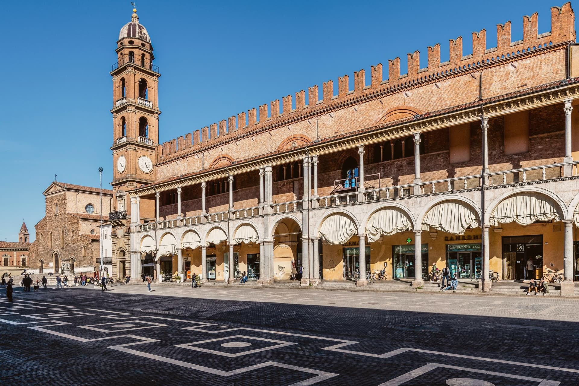
Why visit Faenza
Faenza sits at 34 meters on the Via Emilia between Bologna and Rimini, on the Lamone river fifty kilometers southeast of Bologna. The city gave its name to faïence: tin-glazed earthenware that emerged here in the late fourteenth century and reached its peak in the early sixteenth, when the bianchi di Faenza, white-on-white ceramics exported across Europe, set the standard for Renaissance maiolica.
The Museo Internazionale delle Ceramiche, founded in 1908 by Gaetano Ballardini, holds 15,000 square meters of collections from 4000 BC to the present, with rooms dedicated to Picasso, Matisse, Chagall, Léger, Dalí, Burri, and Fontana. UNESCO named it a Monument Witness to a Culture of Peace in 2000.
The Cattedrale di San Pietro Apostolo, begun by Giuliano da Maiano in 1474, dominates Piazza della Libertà; Piazza del Popolo next door holds the medieval Palazzo del Podestà and the municipal palace. The Palio del Niballo, an equestrian competition between the five city rioni, runs every June.
La Baita, Manueli have been named by a guide.
What to see in Faenza
- Museo Internazionale delle Ceramiche. Founded in 1908 by Gaetano Ballardini, 15,000 square meters spanning 4000 BC to contemporary work by Picasso, Matisse, Chagall, and Fontana.
- Cattedrale di San Pietro Apostolo. Renaissance cathedral begun by Giuliano da Maiano in 1474, completed by 1515, with sculptures by Benedetto da Maiano in the nave.
- Piazza del Popolo. Twin medieval square to Piazza della Libertà, framed by the Palazzo del Podestà and the porticos of the municipal palace.
How to get to Faenza
There is a railway station in the town, so you can arrive without a car and never need one while you are here. Forlì is roughly 26 minutes away by road.
Our tip
April through June and September through October are the working months on the Romagna plain. Spring brings the Palio del Niballo at the end of June and clear water in the Lamone; autumn dries the fields gold and brings the ceramics fairs back to the centro. July and August touch thirty-six degrees with high humidity, and Piazza del Popolo empties between two and five.
More from Anywhere Italy
 The best towns known for what they grow within two hours of Ancona
- The best towns with a serious restaurant that eat well within 90 minutes of Ancona
 The best wine towns within 75 minutes of Rimini
- The 10 best hidden towns with a serious restaurant in Marche
- The best towns known for what they grow within an hour of Rimini
 The 6 best towns inside a nature park in the province of Ancona