
The best hot-spring towns within two hours of Rimini
The water comes up warm here, and it has for a very long time. Along the Apennine edge of Romagna it arrives sulphurous and iron-heavy, drawn from wells beneath towns built of river stone and warm brick, with arcaded streets that keep the shade in August and the drizzle off in November. Closer to the coast the springs turn saline and bromine-rich, tied to the old salt pans and the pine woods behind the dunes. The season for it is not high summer but the shoulder months, when the pools steam in the morning air and the local kitchens turn to cappelletti in broth, piadina straight off the testo, grilled castrato and Sangiovese from the hills above.
People come to this stretch of Italy for Rimini itself, for the long groomed beach, the rows of umbrellas, the nightclubs on the hill and the Roman bridge in the middle of town. It works, and in July and August the whole Riviera Romagnola fills accordingly, umbrella row after umbrella row from the Marecchia to the Marche border. The queues are for lidos and lungomare, not for thermal water.
The same geology that heats the spa hotels of the coast keeps going inland, up the Savio and Santerno valleys towards the Tuscan watershed, and sideways into the lagoons north of the Po delta. That is where these towns are: places with a bathhouse at the centre of civic life rather than a nightclub, where the water is drunk as well as bathed in, and where the pines, the salt and the limestone gorges are part of the cure. Fewer people go, and several are close enough to Rimini for a day of it.
Of the 82 communes we have mapped in a 120-minute drive of Rimini, 7 qualify as hot-spring towns: each has thermal water a town has been built around. The smallest, Genga, has 1,682 residents.
Two more lists worth reading alongside this one: The best hot spring towns in Emilia-Romagna and The best hot-spring towns within 90 minutes of Bologna.
Genga
Why visit Genga
Genga sits at 322 meters on the Sentino river in the Apennine foothills of the Marche, seven kilometers downstream from Sassoferrato and twelve north of Fabriano. The commune is the ancestral seat of the della Genga, the noble family that gave the Catholic Church Pope Leo XII, born at the Castello della Genga in 1760.
The territory is best known for the Grotte di Frasassi, a thirteen-kilometer karst system whose entrance was found in 1971 and opened to visitors in 1974. The Abisso Ancona, a single chamber roughly 180 by 120 meters and nearly 200 tall, is large enough to hold the Milan cathedral.
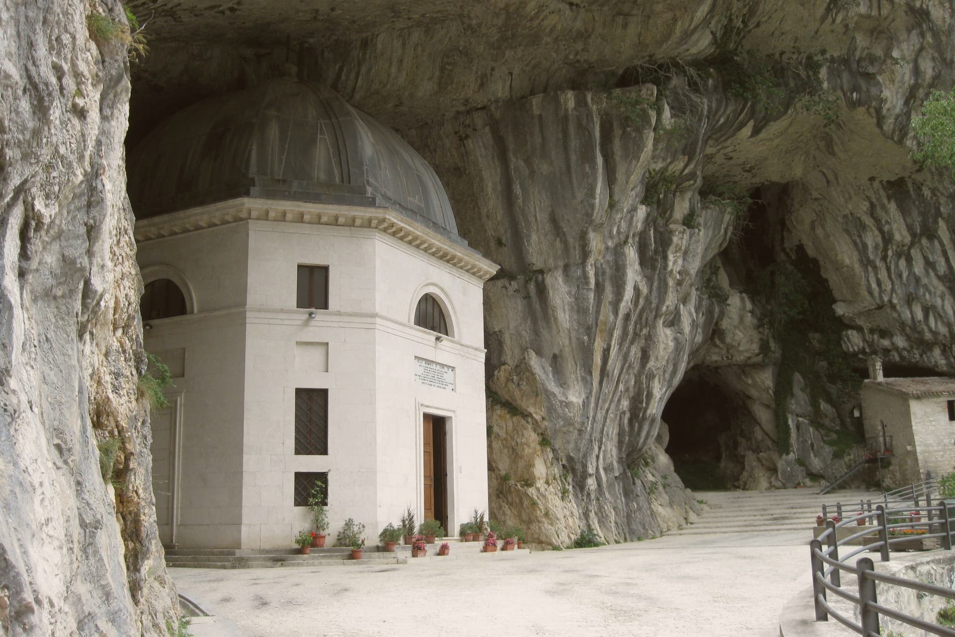
Above the cave entrance, the Tempio del Valadier, an octagonal neoclassical chapel set into a cliff wall, was commissioned by Leo XII from Giuseppe Valadier in 1828. The Abbazia di San Vittore alle Chiuse, a Romanesque Benedictine church on a Greek-cross plan, stands at the gorge mouth and dates to before 1080.
What to see in Genga
- Grotte di Frasassi. Thirteen kilometers of karst passageways found in 1971 and opened in 1974, with the Abisso Ancona chamber 180 by 120 meters wide and 200 meters tall.
- Tempio del Valadier. Octagonal neoclassical chapel commissioned by Pope Leo XII from Giuseppe Valadier in 1828, built of travertine and set into the cliff above the gorge.
- Abbazia di San Vittore alle Chiuse. Romanesque Benedictine church on a Greek-cross plan with four columns, built of local limestone, attested before 1080 at the mouth of the Frasassi gorge.
How to get to Genga
There is a railway station in the town, so you can arrive without a car and never need one while you are here. Ancona is roughly 62 minutes away by road.
Our tip
April through June and September into October are the best months for Genga. The Sentino valley turns green from April, the limestone gorges hold the cool, and the woodland trails through the Gola della Rossa park stay open through autumn. The Frasassi caves run at a constant fourteen degrees year-round; a light jacket is needed even in August.
Bagno di Romagna
Why visit Bagno di Romagna
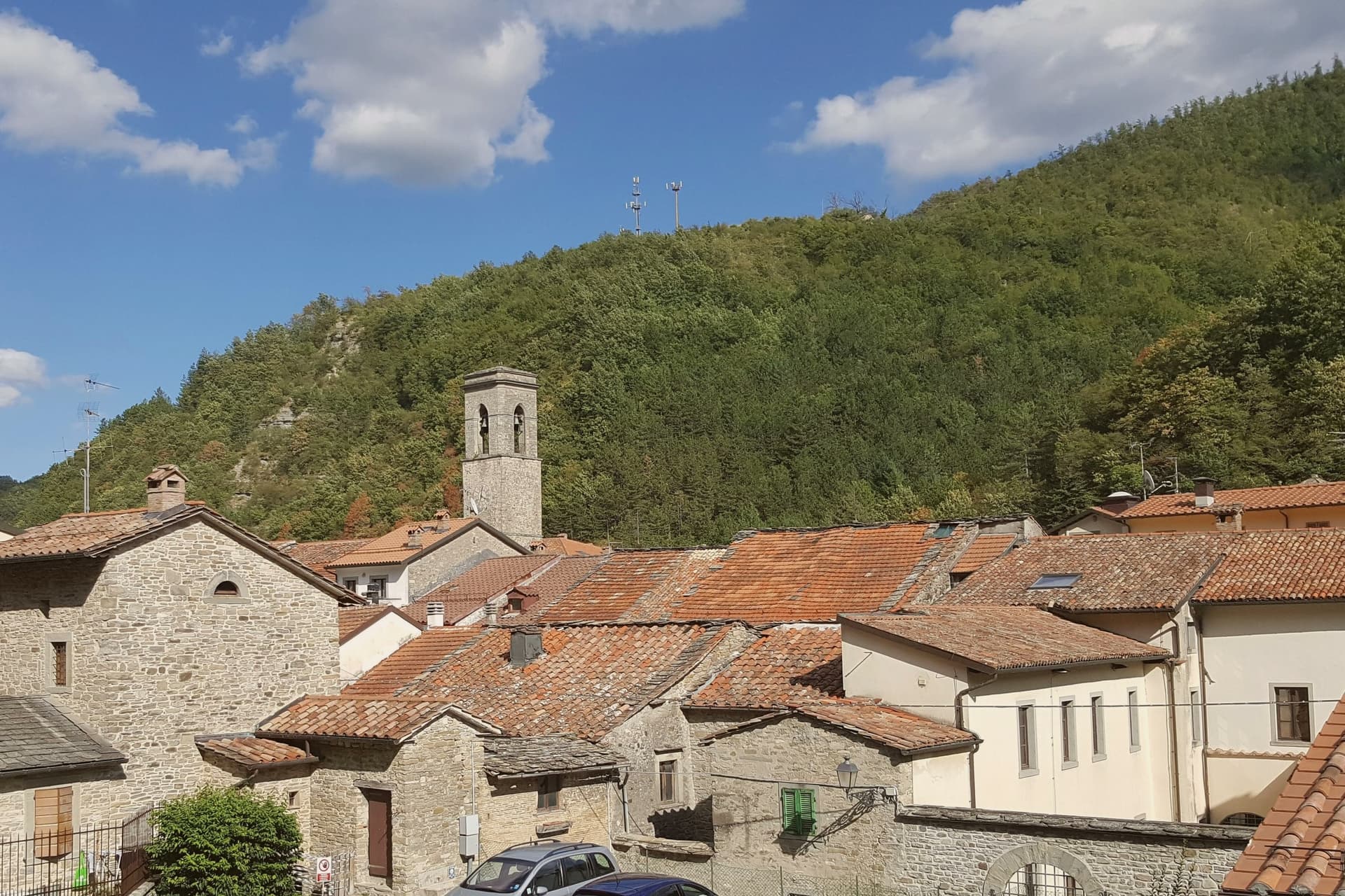
Bagno di Romagna sits at 491 meters at the head of the Savio valley, on the Apennine ridge that separates Romagna from Tuscany. The town belonged to Tuscany until 1923, when Mussolini moved the provincial border so the source of the Tiber would fall inside his native Forlì.
Its name comes from the thermal springs that surface at 47 degrees, rich in sodium-carbonate-sulphur, used by the Romans and continuously since. Two thermal complexes still operate in the centro storico.
The municipality reaches into the Parco Nazionale delle Foreste Casentinesi, the largest old-growth beech and silver-fir forest in central Europe, where the Ridracoli reservoir holds the drinking water for most of Romagna. San Piero in Bagno, the larger frazione four kilometers down the road, was made the administrative seat by royal decree in 1865 while the older Bagno kept the name and the springs.
The town carries Borghi più belli, Bandiera Arancione, and Parco Nazionale recognition.
What to see in Bagno di Romagna
- Terme di Sant'Agnese. Sulphurous thermal complex in the centro storico, drawing on springs that surface at 47 degrees and have been in continuous use since Roman times.
- Basilica di Santa Maria Assunta. Twelfth-century church with a fifteenth-century Della Robbia terracotta and a wooden crucifix attributed to the school of Brunelleschi.
- Parco Nazionale delle Foreste Casentinesi. Old-growth beech and silver-fir forest spanning the Apennine ridge, the largest continuous protected forest in central Europe.
How to get to Bagno di Romagna
Forlì is roughly 78 minutes away by road.
Our tip
Bagno di Romagna runs all twelve months because the thermal water does. June through August brings hiking weather in the Foreste Casentinesi and crowds at Ridracoli; July and August can touch thirty-two degrees in the centro storico, though the valley cools sharply after sunset. September and October bring the chestnut and porcini season, and the forest changes colour into November. I giorni del Capitano falls in July.
Castrocaro Terme e Terra del Sole
Why visit Castrocaro Terme e Terra del Sole
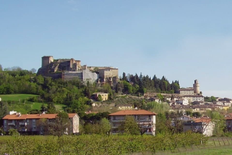
The commune sits at 68 meters on the Montone river, ten kilometers southwest of Forlì in the Apennine foothills, and is the union of two distinct towns rather than one that simply grew. Castrocaro occupies the hill, its castle controlling the valley from above.
The fortress town on the plain below it was built in one campaign to project the authority of the Grand Duchy of Tuscany into Romagna, rather than accumulated over centuries like its neighbor. The Medici governed it until 1923, when the provincial border finally moved and the arrangement ended.
The two halves of the commune read like two different centuries standing next to each other: one shaped by defense over generations, the other stamped out whole by a single ducal decision in 1564. What the pairing adds up to is a rare chance to see, in the space of one small commune, both how a medieval hill fortress evolved and what a Renaissance planner intended a fortress town to look like when built from nothing, a place called Terra del Sole.
What to see in Castrocaro Terme e Terra del Sole
- Rocca di Castrocaro. One of the oldest castles in Italy, standing on the hill above the centro with three concentric defensive rings, built to command the valley below.
- Terra del Sole. Two squares, four gates, and bastioned walls still standing, laid out with the geometric symmetry of a town designed on paper rather than grown over time.
- Palazzo dei Commissari e del Pretorio. On the central square, the residence of the Medici governors of Romagna Fiorentina until 1772, its facade facing the town's planned axis.
How to get to Castrocaro Terme e Terra del Sole
Forlì is roughly 19 minutes away by road.
Our tip
Castrocaro Terme runs all twelve months because the thermal water does. The Terme stay open year-round, with the lowest tariffs from November to March and the most space in spa hotels through mid-week stays in winter. April through June brings green on the Apennine slopes and the gardens around Terra del Sole.
Castel San Pietro Terme
Why visit Castel San Pietro Terme
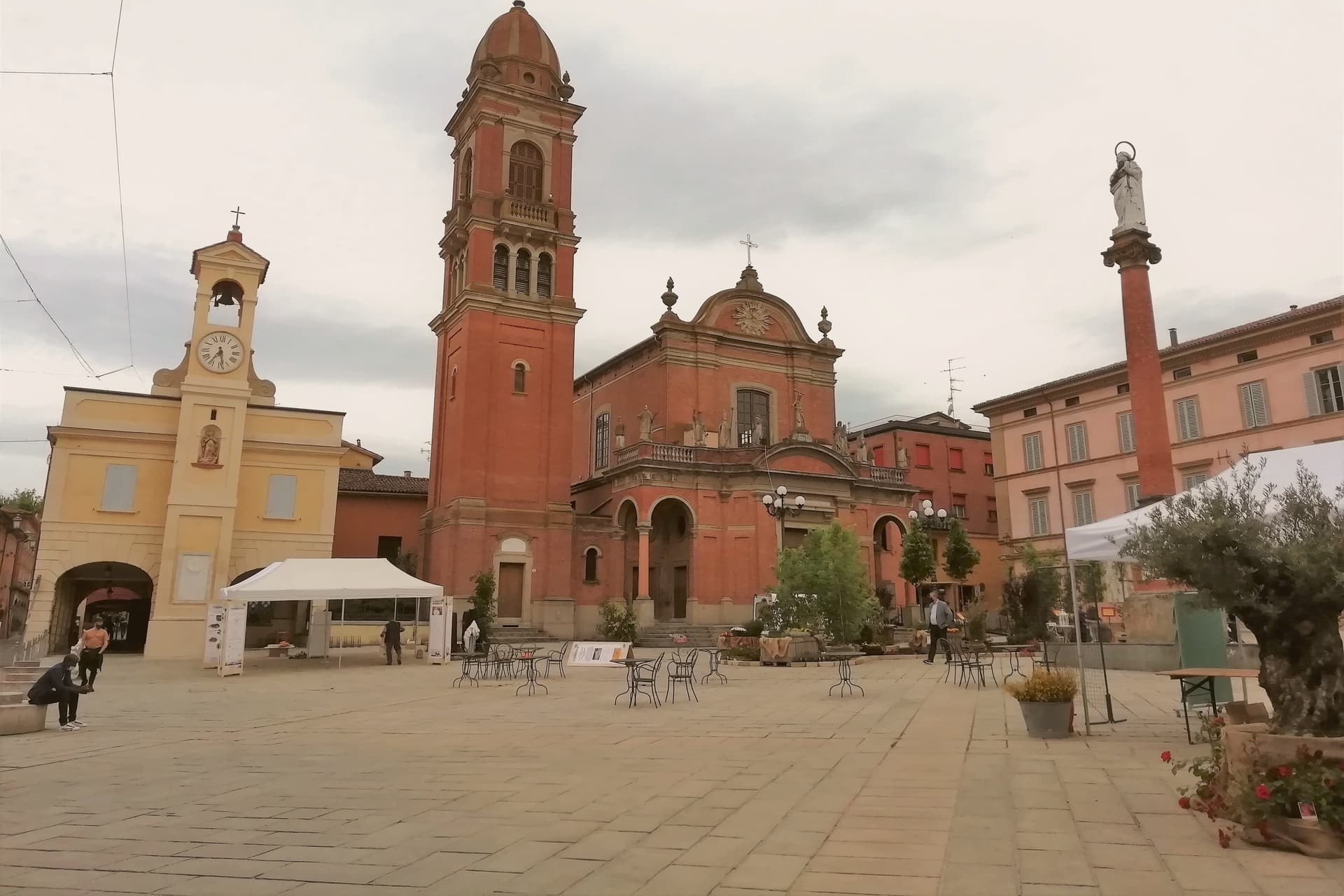
The town sits on the Sillaro river, which marks the historic border between Emilia and Romagna, twenty kilometers east of Bologna on the Via Emilia. It was founded as a Bolognese castrum in 1200, and the walled core still follows that original plan, with the river bridge on one edge and the road toward Imola leading out past the walls to the pilgrimage shrine beyond.
Castel San Pietro also joined the Città dell'Olio network for its hillside olive cultivation, a rural counterpart to the spa and civic life inside the walls. The Conservatorio Santa Caterina, founded in 1741, is one of the older female educational institutions still active in the region, sitting inside the same historic core as the gateway and the town hall.
The town reads as two things held together: a walled medieval seat on a border river, and a spa destination whose waters predate the walls by decades. Both draw on what was already there long before either was built up for visitors.
What to see in Castel San Pietro Terme
- Cassero. The gateway stands at the southern edge of the old walls, its stone face marking what was once the main entry into the castrum. Inside, the civic theater now occupies the space, so the structure that once controlled access to the town now hosts its audiences.
- Terme di Castel San Pietro. The complex draws on sulphurous, ferruginous and salt-bromine-iodide springs, with the first establishment opened in 1870. The waters run year-round from the same sources used centuries before the modern building existed.
- Santuario del Crocifisso del Piratello. Pilgrimage shrine on the Via Emilia toward Imola, built around a fifteenth-century crucifix and decorated by Innocenzo da Imola. It drew pilgrim traffic from across northern Emilia, standing apart from the walled town on the road out toward Romagna.
How to get to Castel San Pietro Terme
There is a railway station in the town, so you can arrive without a car and never need one while you are here. Bologna is roughly 39 minutes away by road.
Our tip
Castel San Pietro Terme runs all twelve months because the thermal water does. Spring and autumn are the easier months for walking the centro storico and the Sillaro valley, with mild light and the olive groves on the hill above town green or harvest-coloured. June through August touches the low thirties and humid, but the spa runs longer hours in summer and the riverside frazione of Osteria Grande stays cool.
Comacchio
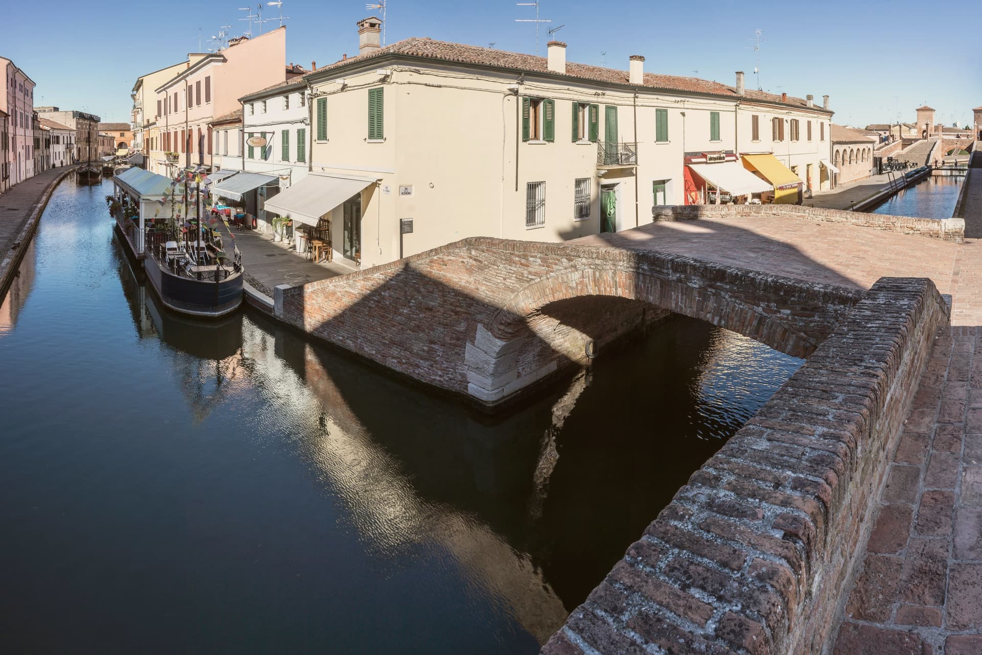
Why visit Comacchio
Comacchio sits at sea level fifty kilometers east of Ferrara and forty south of the Adriatic delta proper. The town passed through Etruscan hands, then Byzantine rule under the Exarchate of Ravenna, then the Duchy of Ferrara, then Papal government until unification, a succession that left the centro storico layered rather than uniform.
The lagoons that surround it formed from tenth-century subsidence and later silting, and now run as a protected area inside the UNESCO inscription that covers the historic Ferrara plain, linking the town to the wider delta rather than setting it apart. The old town itself is water-built: thirteen islets tied together by bridges, canals threading between the Loggia del Grano and the Loggiato dei Cappuccini, with the bridge acting as the hinge where the inland waterways meet the canal running out toward the sea.
What the layers of rule left behind in stone, the lagoon and the tides have kept in motion around it: a town whose center is inseparable from the water that surrounds it, built up in pieces by whoever governed it at the time.
What to see in Comacchio
- Ponte dei Trepponti. Built around 1638 by Luca Danese of Ravenna, the bridge is the meeting point of three internal canals with the canal Pallotta and the symbol most visible from the water.
- Valli di Comacchio. The lagoon opens flat to the horizon at the edge of the Po Delta, its surface broken by fishing stations and the pink of the resident flamingo colonies.
- Museo Delta Antico. Archaeological museum opened in 2017 inside the eighteenth-century Ospedale degli Infermi, with finds from the Etruscan necropolis of Spina.
How to get to Comacchio
Ravenna is roughly 45 minutes away by road.
Our tip
May through September is the working season for Comacchio. Late May and June are best, when the lagoons hold migrating birds and the heat has not yet pushed visitor numbers into the August peak. The Valli boat tours run from spring to autumn, with flamingos visible all year round on the brackish edges. Festa di San Cassiano falls in August.
Cervia
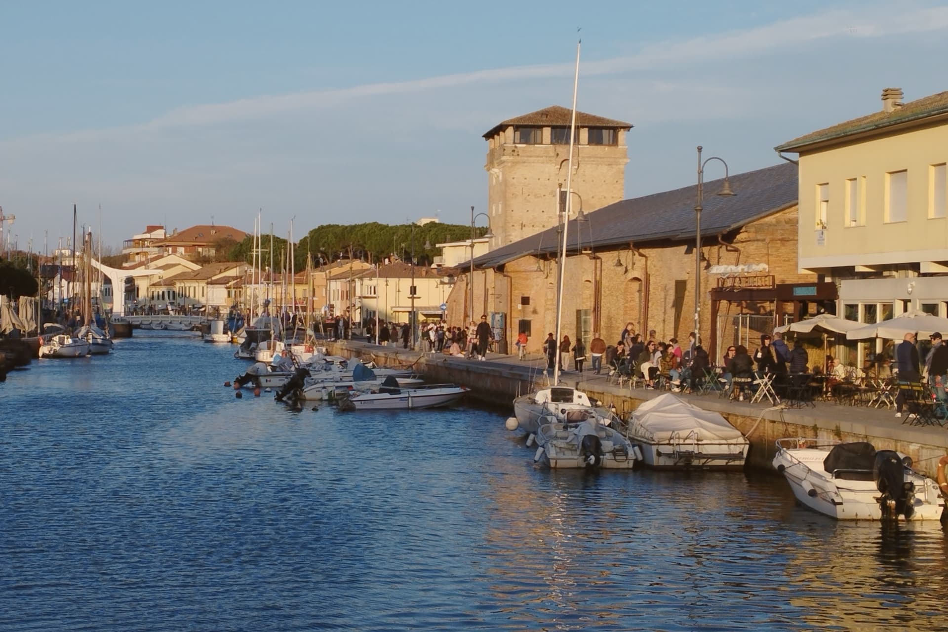
Why visit Cervia
Cervia sits at sea level on the Adriatic, twenty kilometers south of Ravenna, between the pine forest of Milano Marittima and the salt pans that have given the town its identity since Roman times. The original settlement, Ficocle, stood inside the saline itself; the move to the coast in 1697 put the grid of workers' housing where it now stands, closer to the water and to the canal port that the tower on its north side was built to guard.
The two halves of the municipality read as a pairing of extraction and leisure: the saline and the old grid town to the south, worked continuously and still yielding salt by hand at one basin, and the planted pine forest to the north, laid out as a garden-city resort in the following century. The museum inside the old salt warehouse holds two thousand years of the tools and records that connect the two eras.
The beach carries Bandiera Blu recognition along nine kilometers of coast. What holds the town together is that its shape was dictated by salt long before tourism arrived: the grid, the tower, the canal and even the forest to the north all trace back to the working of the saline, with the resort at Milano Marittima grown from land the salt industry had left standing.
What to see in Cervia
- Saline di Cervia. Working salt pans covering 827 hectares, the northernmost in Italy, with the Camillone basin still harvested by hand using nineteenth-century methods.
- Torre San Michele. Defensive tower built in 1691 to protect the salt warehouses and control the canal port, on the north side of the harbor.
- MUSA - Museo del Sale. Salt museum inside the Magazzino del Sale Torre, with tools, documents and photographs gathered from former salt workers.
How to get to Cervia
There is a railway station in the town, so you can arrive without a car and never need one while you are here. Forlì is roughly 29 minutes away by road.
Our tip
May through September is the Cervia season. Late May and June hold the best balance of warm sea and quiet beach, before the Italian holiday peak. July and August bring full beach and full pine forest, with thirty-degree afternoons broken by the evening sea breeze. Festa di San Lorenzo falls in August.
Imola
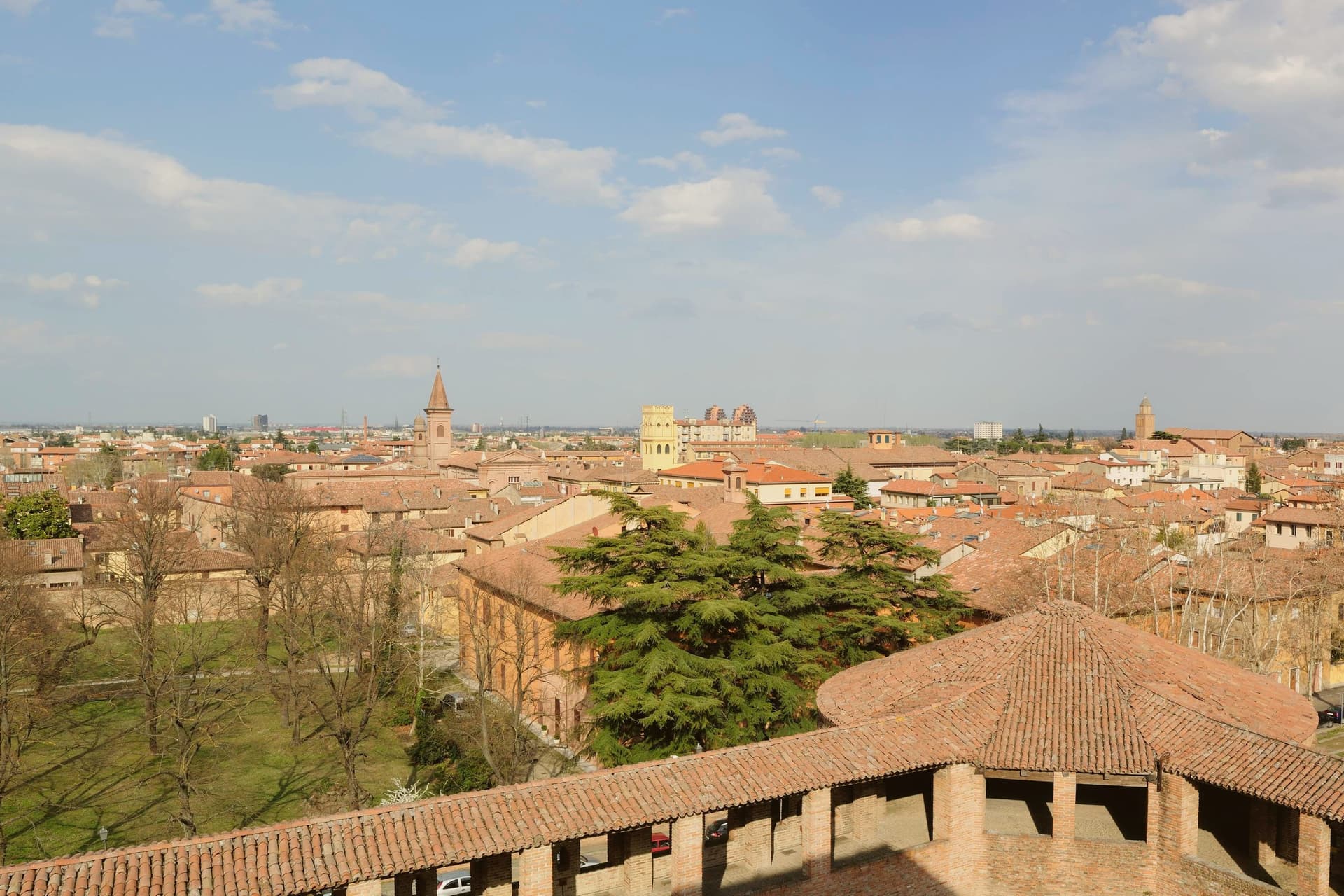
Why visit Imola
Imola is two cities sharing a name. The medieval one is a quietly handsome Romagna brick town 35 km southeast of Bologna along the Via Emilia, with the Rocca Sforzesca (rebuilt by Caterina Sforza in 1473–1499 — the Tigress of Forlì, who held this fortress through the Borgia siege of 1500) anchoring the centro.
The Palazzo Tozzoni museum, the 11th-century Cattedrale di San Cassiano with its crypt of the city's patron, the Palazzo Sersanti on the central piazza, and the medieval grid of porticoed brick streets all read as a smaller-scale Bologna. The OTHER Imola is the Autodromo Enzo e Dino Ferrari — the 4.9-km F1 circuit on the south bank of the Santerno, built 1953 and named for Enzo Ferrari and his son Dino after Dino's death.
It hosted the San Marino Grand Prix every May from 1981 to 2006 (and again 2020–present), and is the circuit where Ayrton Senna died in 1994 at the Tamburello corner — a memorial still stands there. The Emilia Romagna Grand Prix in April–May is the city's biggest tourist event of the year.
Outside race weekends the circuit is a public park; locals jog the track. The food is Romagna: piadina romagnola (the city is Città dell'Olio, and the local Brisighella Nostrana di Brisighella DOP olive oil is what dresses it), passatelli in brodo, cappelletti, Sangiovese di Romagna from the surrounding hills, and the local nocino walnut liqueur made by every grandmother in the foothills.
What to see in Imola
- Rocca Sforzesca. Caterina Sforza's 1499 four-towered brick fortress at the centro's edge — the Tigress of Forlì held it against Cesare Borgia in 1500. Museum of arms and ceramics inside.
- Autodromo Enzo e Dino Ferrari. The 4.9-km F1 circuit on the Santerno. Senna memorial at Tamburello. Open as a public park outside race weekends — locals jog the track.
- Cattedrale di San Cassiano + crypt. 11th-c cathedral with the city patron's crypt; the Madonna del Piratello pilgrimage church just outside the walls is a major regional sanctuary.
How to get to Imola
There is a railway station in the town, so you can arrive without a car and never need one while you are here. Forlì is roughly 34 minutes away by road.
Our tip
Imola is best April–June and September–October. The Emilia Romagna Grand Prix (last weekend April / first weekend May) fills every hotel for 80 km — wonderful if you're going, brutal if you're not. Summer is hot and sticky. Baccanale Imola falls in October.
More from Anywhere Italy
 The best hot spring towns in Emilia-Romagna
 The best hot-spring towns within 90 minutes of Bologna
- The best hot-spring towns within two hours of Padua
- The best towns known for what they grow within an hour of Rimini
- The best wine towns within 75 minutes of Rimini
- The best hot-spring towns within two hours of Parma