
The prettiest villages you can reach by train in Piemonte
Piemonte rewards slow arrival. The regional lines climb out of Torino and thread past hazelnut groves, terraced Nebbiolo, rice plains and the mouths of Alpine valleys, and the stations are small enough that the village is usually uphill and in sight. Autumn is the season people plan around, when the fog sits in the valleys, the truffle markets open and the restaurants bring out tajarin, agnolotti del plin, bagna cauda and braises made with the local red. The houses change as you go: warm brick and painted stucco in the Monferrato, grey stone and slate roofs where the mountains start.
The bulk of visitors go to Alba and the wine villages around Barolo, and with reason, because the cellars, the white truffle fair and the vineyard views are the best-known things Piemonte does. What that concentrates is traffic. Harvest weekends fill the hill roads, the tasting rooms book out, and the whole area works best if you have a car and a plan made months ahead.
The same hills, the same kitchens and the same railway keep going. Monferrato has its own hilltop villages with a station at the bottom, the Langhe extend past the famous names, the Ligurian border valleys carry a line down through chestnut woods, and a branch off the Domodossola route reaches a lake that most people arrive at by coach. These are the villages on that network.
Of the 65 communes we have mapped in Piemonte, 7 qualify as prettiest villages you can reach by train: each has passed the national assessment of Italy's most beautiful villages, and we have confirmed each is reachable without a car. The smallest, Mombaldone, has 197 residents.
Two more lists worth reading alongside this one: The prettiest villages within 90 minutes of Novara and The prettiest villages that eat well in Piemonte.
Why visit Mombaldone
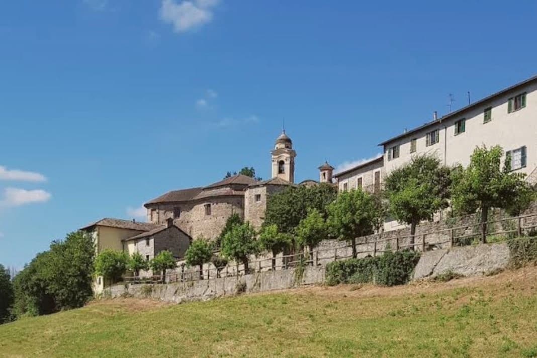
The village sits at 260 meters on a ridge, fifty kilometers north of Genova and well outside the Barolo and Barbaresco circuits. The Aleramici held the land from 991, when they founded the monastery of San Quintino di Spigno; in 1209 control passed to the Del Carretto, whose descendants still own property in the village.
The castle on the high point fell in 1637 and stands in ruin, a square tower and a stretch of wall, while the walled center below has kept its ring intact around the resident population. The church built into the old moat carries canvases by the Monevi family of Acqui, a 17th-century addition to an 18th-century building.
Bormida-valley badlands open below the walls toward Liguria. The layout reads as a sequence: ruined high point, intact walled ring beneath it, open valley beyond.
What survives is not the seat of power but the perimeter that once served it, outlasting the family and the castle both.
We confirmed you can reach this one by train.
What to see in Mombaldone
- Castello dei Del Carretto. 13th-century castle on the highest point of the ridge, partially demolished in 1637; a square tower and wall fragments survive.
- Chiesa di San Nicolao. 18th-century Baroque parish church by Matteo Zucchi on a hexagonal plan, built into the old castle moat.
- Centro storico murato. Complete medieval walled perimeter, the only one preserved in full in the Langa Astigiana, enclosing the small borgo intact.
How to get to Mombaldone
There is a railway station in the town, so you can arrive without a car and never need one while you are here. Genova is roughly 84 minutes away by road.
Our tip
April through June bring the hills back to green and the walls draw a few weekend walkers from Acqui and Asti. September and October are dry and gold, with truffle weeks in nearby communes pulling small crowds onto the ridge roads. July and August can push past thirty degrees and the centro stays empty between two and six.
Why visit Orta San Giulio
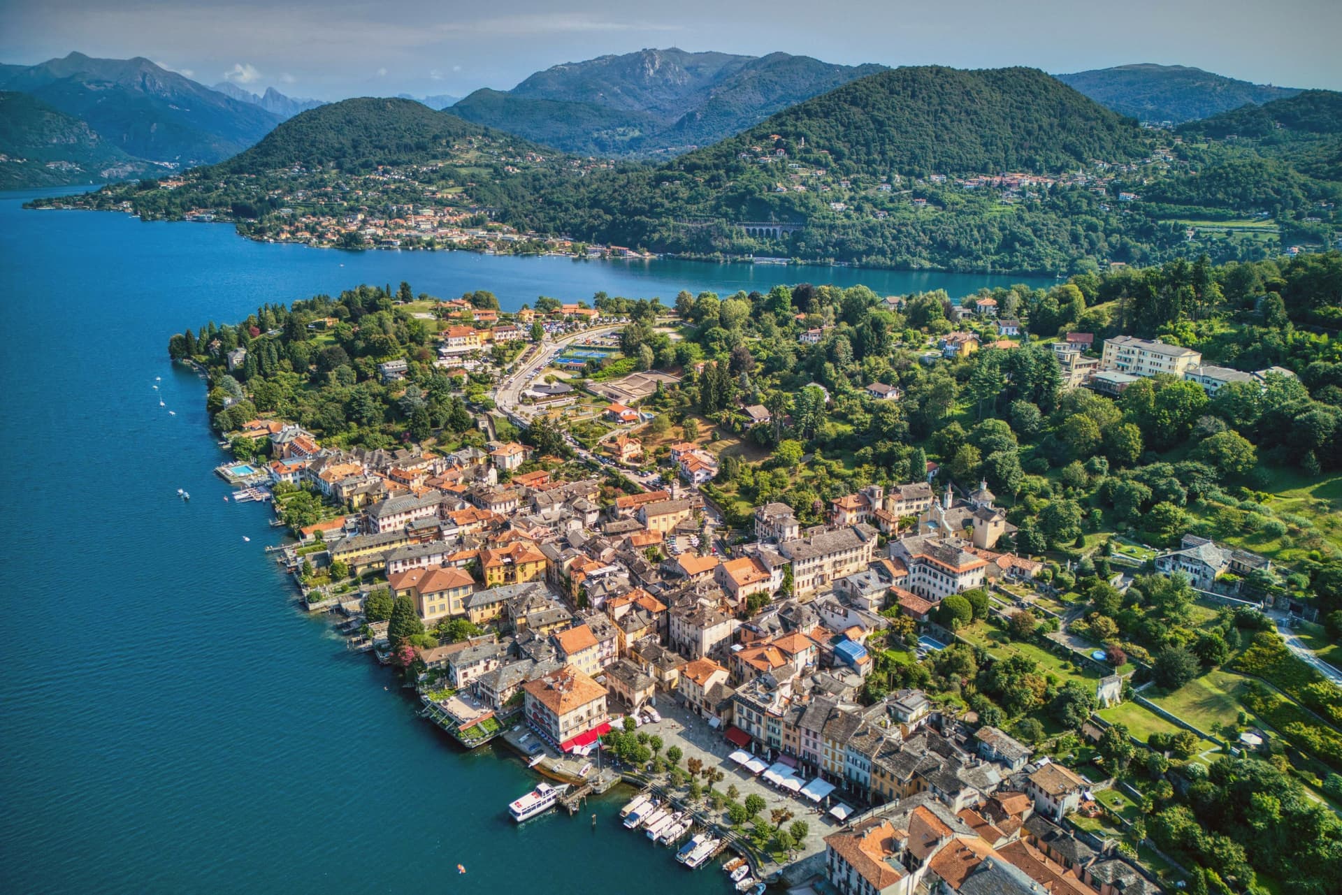
The town occupies a promontory pushed into the eastern shore of the lake, facing the small island 275 meters long and 140 meters wide. The two are close enough that the island reads as an extension of the town rather than a separate place, and a five-minute motorboat from the piazza is the only way across.
The old town holds three Tier-A signals at once: Borghi più belli, Bandiera Arancione, and the UNESCO inscription of 2003. The relationship between the three parts of the town explains how it works: the waterfront square and its lanes sit at lake level, facing the island directly across the water, while the hill above holds the devotional complex, reached by climbing away from the shore rather than along it.
Piazza Motta was also the seat of the Comunità della Riviera di San Giulio, an autonomous federation of lake towns that survived from the Middle Ages to the mid-eighteenth century, which is why the square, not the hill or the island, was built as a civic center. What results is a town in three registers at once: civic life at the water's edge, monastic life offshore, and devotional life on the hill above, each occupying its own ground and visible from the others.
We confirmed you can reach this one by train.
What to see in Orta San Giulio
- Basilica di San Giulio. Serpentine ambo inside and a silver shrine dated 1697. Reached by boat, the basilica stands close to the water's edge, the focal point of the view from every point on the promontory.
- Piazza Motta and Palazzo della Comunità. The broletto's arcades face the water directly, and the square narrows toward the boat landing where the crossing to the island begins.
- Sacro Monte di Orta. The chapels climb the wooded hillside in sequence, each framing a scene, with the town and the lake opening up in views between them as the path gains height.
How to get to Orta San Giulio
There is a railway station in the town, so you can arrive without a car and never need one while you are here. Novara is roughly 46 minutes away by road.
Our tip
April through June brings the Sacro Monte chapels into the chestnut shade and the lake water warm enough for the open-air bars on Piazza Motta. July and August fill the ferry to the island and the piazza turns over by the hour; the centro pedestrian zone slows to a queue at lunch. September and October are the clearest window: low light on the basilica across the water, fewer day-trippers from Milano, and the Sacro Monte path almost empty after eleven.
Why visit Vogogna
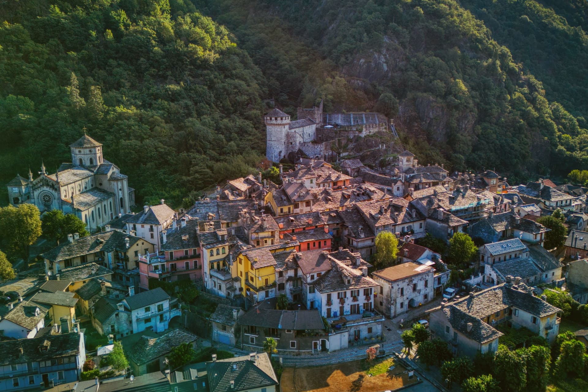
Vogogna sits at 226 meters on the floor of Val d'Ossola, at the narrow point of the valley where the Toce bends south toward Lago Maggiore. The castle went up on the spur above the village as part of a broader reinforcement of the Duchy of Milan against Swiss incursions over the Sempione, built alongside an older fortified rock that had already held the same defensive line.
Together they anchored the town's promotion to administrative seat for the lower half of the valley, in balance with Domodossola further up, which held the upper half. Spanish rule from the sixteenth century onward reduced the castle's strategic weight, and in 1798 it passed into municipal hands, used at one stage as a prison, before the long restoration that closed in 2005.
The borgo carries Borghi più belli d'Italia and the Bandiera Arancione, and Val Grande National Park borders the commune on the west. What the town amounts to is a lower valley's seat of government grown around a fortress that outlived its military purpose by centuries, wedged between wilderness on one side and the river's bend on the other.
We confirmed you can reach this one by train.
What to see in Vogogna
- Castello Visconteo. Restored from 1990 to 2005, the castle is now open to visitors with a multimedia conference room installed inside its walls.
- Rocca di Vogogna. Earlier fortified rock above the Visconti castle, the original medieval defensive post over the narrow point of the Toce valley.
- Centro storico. Medieval core below the castle with stone houses, narrow streets and the Palazzo Pretorio, the historic administrative seat of Ossola Inferiore.
How to get to Vogogna
There is a railway station in the town, so you can arrive without a car and never need one while you are here. Novara is roughly 75 minutes away by road.
Our tip
April through June brings clear walking weather to the Toce valley, with the upper Val Grande slopes drying out and the Visconti castle terraces open for full hours. September and October are the harvest months in Ossola, when chestnut woods turn on the lower slopes and the cooler air carries the view from the Rocca down the valley toward Lago Maggiore. July and August warm the valley floor, but the stone houses of the centro storico keep the streets shaded.
Why visit Neive
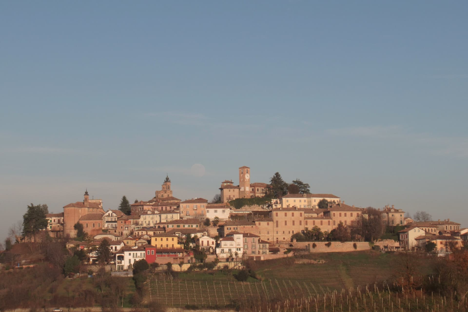
Neive sits at 308 meters on a Langhe ridge, fifty kilometers southeast of Torino and eight kilometers from Alba. The name traces to the gens Naevia, a Roman family that held the land in antiquity.
The medieval village was fought over between Asti and Alba; its castle was destroyed in 1276 and rebuilt repeatedly through the Middle Ages. The Torre dell'Orologio dates from 1224 and embeds a Roman funeral plaque to Valeria Terza in its wall, a deliberate piece of spolia from the older settlement.
Neive is one of three Barbaresco communes (with Barbaresco and Treiso) and is the one locals call the township of four wines: Barbera, Dolcetto, Moscato and Nebbiolo all produced in commercial volume from the same hills. The centro storico is Borghi più belli, eight centuries of layered building stacked tightly enough that the old gates still mark the entry to the village.
We confirmed you can reach this one by train.
What to see in Neive
- Torre dell'Orologio. Civic tower of 1224 with a Roman funeral plaque to Valeria Terza set in its wall, the symbol of Neive's centro storico.
- Centro storico. Hilltop Borghi più belli village stacked across eight centuries, with surviving medieval gates and Renaissance palazzi.
- Palazzo del Municipio. White Baroque civic palace on the main piazza, decorated with arch motifs and standing beside the Torre dell'Orologio.
How to get to Neive
There is a railway station in the town, so you can arrive without a car and never need one while you are here. Torino is roughly 66 minutes away by road.
Our tip
April through June bring green vines and mild evenings on the ridge. September and October are harvest, with the Alba truffle fair eight kilometers away pulling buyers across the Langhe; the centro fills on weekends. July and August can push past thirty degrees and the village empties between two and six in the afternoon, though the elevation makes evenings tolerable.
Why visit Castagnole delle Lanze
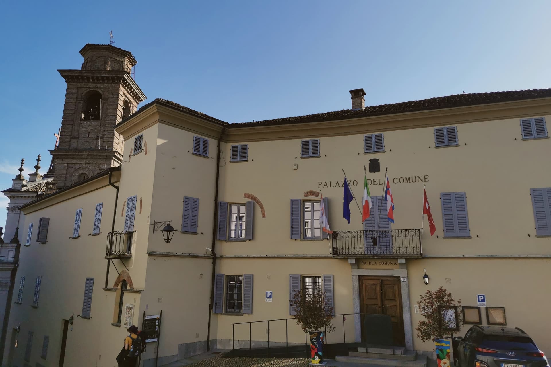
Fifteen kilometers south of Asti, Castagnole delle Lanze lies in the UNESCO Vineyard Landscape of Piedmont, on ground once crossed by a Roman road branching off the Via Aemilia between Acqui and Pollenzo. In the Middle Ages the lands belonged to the counts of Loreto, with Manfredo I the count most tied to the community; their castle, probably destroyed in 1255 when the contado fell, has not survived, and from the thirteenth century the town passed under the Comune of Asti.
The main square and Piazza Balbo hold the two churches that anchor the lower town, while the Parco della Rimembranza occupies the highest ground of the village, looking over the Tinella and Tanaro valleys. What remains is a settlement built in layers: a Roman route, a lost medieval castle, a pair of Baroque churches, and a nineteenth-century tower, each belonging to a different century and none of them replacing the one before it.
We confirmed you can reach this one by train.
What to see in Castagnole delle Lanze
- Chiesa di San Pietro in Vincoli. Parish church of 1681 on the main square, Ligurian-Piedmontese Baroque with a twin-bell-tower façade.
- Chiesa dei Battuti Bianchi. Confraternity church of 1668 in Piazza Balbo, deconsecrated and now used as a space for cultural events.
- Torre di San Robert. Built by Count Paolo Ballada di San Robert, the tower stands at the top of the Parco della Rimembranza and still functions as a lookout over the surrounding hills.
How to get to Castagnole delle Lanze
There is a railway station in the town, so you can arrive without a car and never need one while you are here. Torino is roughly 72 minutes away by road.
Our tip
April through June brings the vines into leaf and the Tinella valley into clear light, with the Torre di San Robert opening on weekends. September and October are harvest, the high season for the Langhe-Monferrato hills and the time the Adotta un filare initiative runs its tastings. July and August get hot on the south-facing slopes; mornings in the Parco della Rimembranza and evenings on the main piazza are the cooler hours. Borgo diVino tour falls in October.
Why visit Candelo
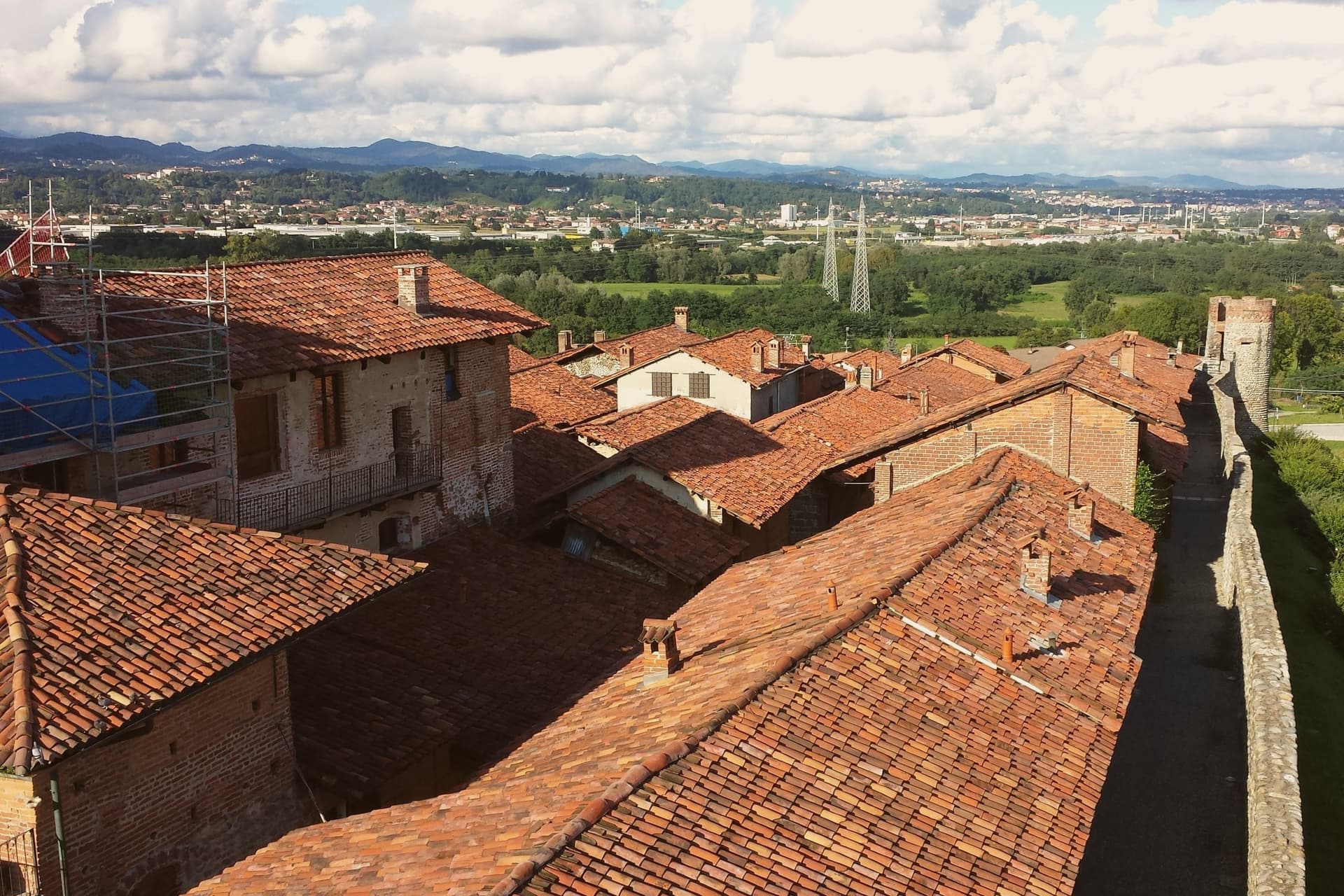
Candelo sits at 350 meters on the right bank of the Cervo torrent, ten kilometers from Biella, with a third of its territory on the Baraggione plateau, a wild grassland of about 5,000 hectares now protected as the Riserva Naturale delle Baragge. The Ricetto is what people come for.
It is a late-medieval fortified shelter built by the local farming community in the thirteenth and fourteenth centuries: roughly two hundred stone cellule arranged on a pentagonal plan of 13,000 square meters, crossed by five east-west rue and two transverse, the perimeter walls running 470 meters. Goods, grain, wine and forage were stored here under the protection of the local lord.
Only in extreme attack did the population itself withdraw inside. It is the best-preserved structure of its kind in Piedmont.
Candelo joined the Borghi più belli d'Italia in 2002 and has held the Bandiera Arancione of the Touring Club Italiano since 2007.
We confirmed you can reach this one by train.
What to see in Candelo
- Ricetto di Candelo. Thirteenth- to fourteenth-century fortified shelter on a pentagonal plan, with about two hundred stone cellule and 470 meters of walls.
- Rue del Ricetto. Five east-west streets and two transverse, paved in river stone, the cellule grouped along them for storing grain and wine.
- Chiesa di Santa Maria Maggiore. Parish church of Candelo next to the Ricetto, on the centro storico side of the town.
How to get to Candelo
There is a railway station in the town, so you can arrive without a car and never need one while you are here. Novara is roughly 54 minutes away by road.
Our tip
April through June brings the Baraggia into bloom and the Ricetto walls dry enough for the swallows. September and October are the harvest months on the Cervo plain, with vineyards on the Coste della Sesia turning to gold. July and August can sit humid in the river basin; the cellule, half-underground in places, hold cool inside even when the piazza is hot.
Why visit Biella
Biella sits at 417 meters at the foot of the Biellese Alps, in a basin where fast Alpine streams cut down from Mont Mars and the Oropa range. The statutes of 1245 already named the woolworkers' and weavers' guilds, and the city built itself around them: by the nineteenth century, vertical mills along the streams had turned Biella into the Manchester of Italy.
The names still on the labels, Zegna, Cerruti, Loro Piana, Piacenza, Fila, were founded here. The upper town, Biella Piazzo, sits above the modern Piano on a small hill, reached since 1885 by a water-counterbalance funicular that still runs the same 60-meter climb.
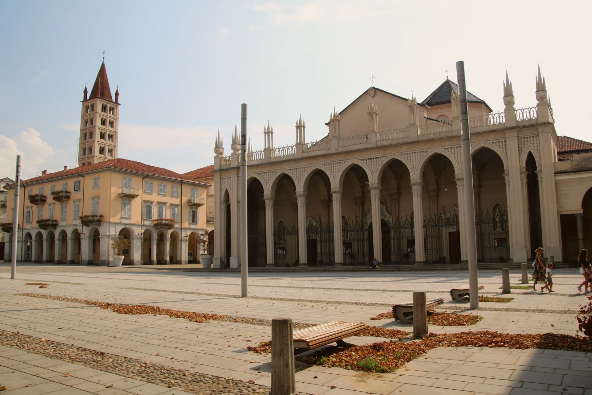
The Romanesque Baptistery on Piazza Duomo is the city's oldest stone, ninth or tenth century, set next to the cathedral. Above the city, the Sacro Monte di Oropa belongs to the UNESCO Sacri Monti site, and Biella was named a UNESCO Creative City for Crafts and Folk Art in 2019.
We confirmed you can reach this one by train.
What to see in Biella
- Biella Piazzo. Medieval upper town on a small hill above the modern Piano, with arcaded palazzi and narrow stone streets, reached by funicular since 1885.
- Funicolare del Piazzo. Historic funicular opened in December 1885, covering a 60-meter altitude gradient in 177 meters between Via Curiel and Via Avogadro.
- Battistero di Biella. Romanesque baptistery on Piazza Duomo, ninth to tenth century, the oldest standing monument in the city.
How to get to Biella
There is a railway station in the town, so you can arrive without a car and never need one while you are here. Novara is roughly 63 minutes away by road.
Our tip
April through June brings green pastures on the Biellese Alps and clean light off the streams that built the mills. September and October are the dry, gold months, when the chestnut woods around Oropa turn and the textile fairs run in town. July and August stay cooler than the Po Valley but can sit humid; the upper Piazzo holds breeze that the Piano does not. Bolle di Malto - Salone Italiano della Birra falls in August.
More from Anywhere Italy
 The prettiest villages within 90 minutes of Novara
 The prettiest villages that eat well in Piemonte
- The best hill towns within 90 minutes of Novara
 The prettiest villages within 90 minutes of Torino
- The best towns with a World Heritage site that eat well in Piemonte
 The best lake towns you can reach by train in Piemonte