
The best hill towns in the province of Cosenza
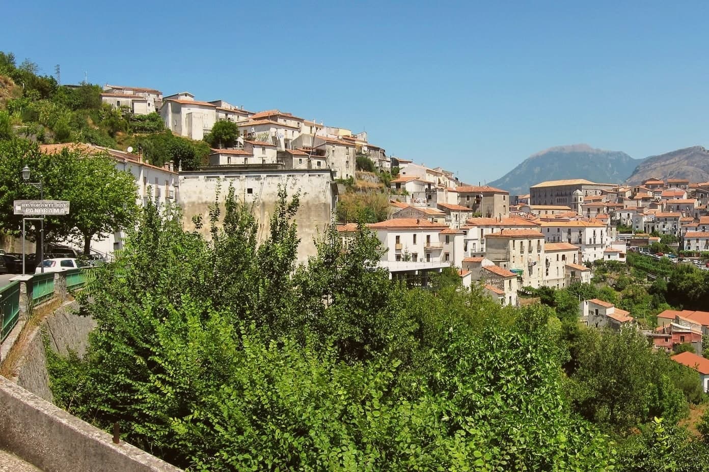
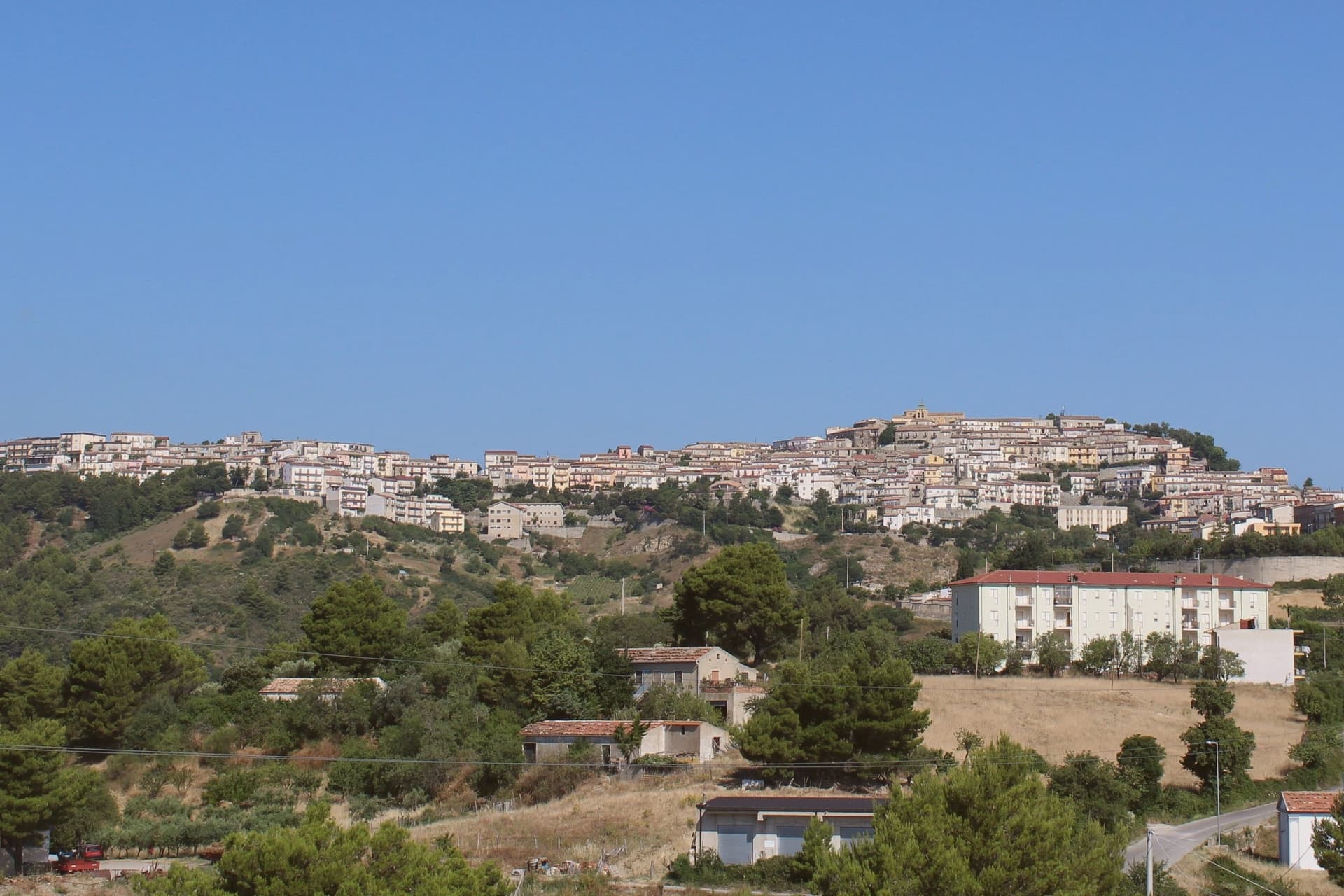
The inland province of Cosenza is built on slopes, and the villages there show it: houses of local sandstone and brick stacked along contour lines, streets that turn into stairs, balconies looking down onto olive terraces and chestnut woods. The mountains do the framing, the Pollino to the north with its beech forest and snow into spring, the Sila to the east with its pine and its cattle. Food follows altitude. Pork cured with chilli, pecorino and caciocavallo from high pasture, dried figs, peppers hung to dry on house walls in late summer, bread from wood ovens, and the wine of the Pollino foothills, along with the bitter greens and beans that carry the winter table.
People who come to Calabria mostly come for the water, and the water is good. The Tyrrhenian stretch around Tropea fills from June, its cliff-and-sand postcard reproduced on every regional brochure, and the car parks above the beaches sell out by mid-morning in August. Diamante and Scalea pull the same crowd further north. All of it is coast, all of it is booked, and almost none of it is more than a short drive from mountains nobody photographs.
Those mountains carry on behind the beach resorts, and so do the villages. The same ridges that shelter the coast hold hill towns with Norman castles, Albanian-speaking parishes founded by refugees from the Ottoman advance, Angevin churches and sanctuaries cut into limestone above gorges. Fewer people go, which is a matter of roads and habit rather than merit. The towns below are the inland ones worth the climb.
Of the 26 communes we have mapped in the province of Cosenza, 10 qualify as hill towns: each is an inland hill settlement built on ground too steep to spread. The smallest, Aieta, has 753 residents.
If you are still choosing, we have also written The best hidden towns inside a national park in the province of Cosenza and The best hill towns inside a national park in Calabria.
Aieta
Why visit Aieta
Aieta sits at 524 metres in the western Pollino, eight kilometres above the Tyrrhenian coast at Praia a Mare. The name comes from the Greek aetós, eagle, a description of the spur the village holds.
The Palazzo Martirano-Spinelli is the reason most visitors climb the road in: a U-shaped sixteenth-century Renaissance building with a five-arch loggia on Tuscan columns in local grey stone, one of the rare full Renaissance palazzi in the whole region. The Marquises Cosentino built it; it passed to the Cosentino-Scalea line in 1571 and to the Spinelli in 1767, was declared a national monument in 1913, and became municipal property in 1980.
Around it, the centro storico keeps a tight network of stone-portalled houses worked by mason families between the seventeenth and eighteenth centuries. The mother church of Santa Maria della Visitazione and the Convent of the Minor Observant Fathers, founded in 1520, complete the centre.
The population sits at 753.
What to see in Aieta
- Palazzo Martirano-Spinelli. Sixteenth-century Renaissance palazzo with a U-shaped plan and a five-arch loggia on Tuscan columns, one of the few in Calabria; national monument since 1913.
- Chiesa di Santa Maria della Visitazione. Sixteenth-century mother church on the upper level of the centro storico, anchoring the religious life of the village.
- Convento dei Minori Osservanti. Franciscan convent founded in 1520 with sixteenth-century wooden choir stalls and a set of carved wooden saint statues.
How to get to Aieta
Salerno is roughly 140 minutes away by road.
Our tip
At 524 metres in the western Pollino, Aieta runs cooler than the Praia a Mare coast below. April through October is the working window: green hills, mild evenings, the Palazzo open for visits and the Convent accessible. July and August stay tolerable in the low thirties, though midday in the centro storico empties as residents step indoors.
San Benedetto Ullano
Why visit San Benedetto Ullano
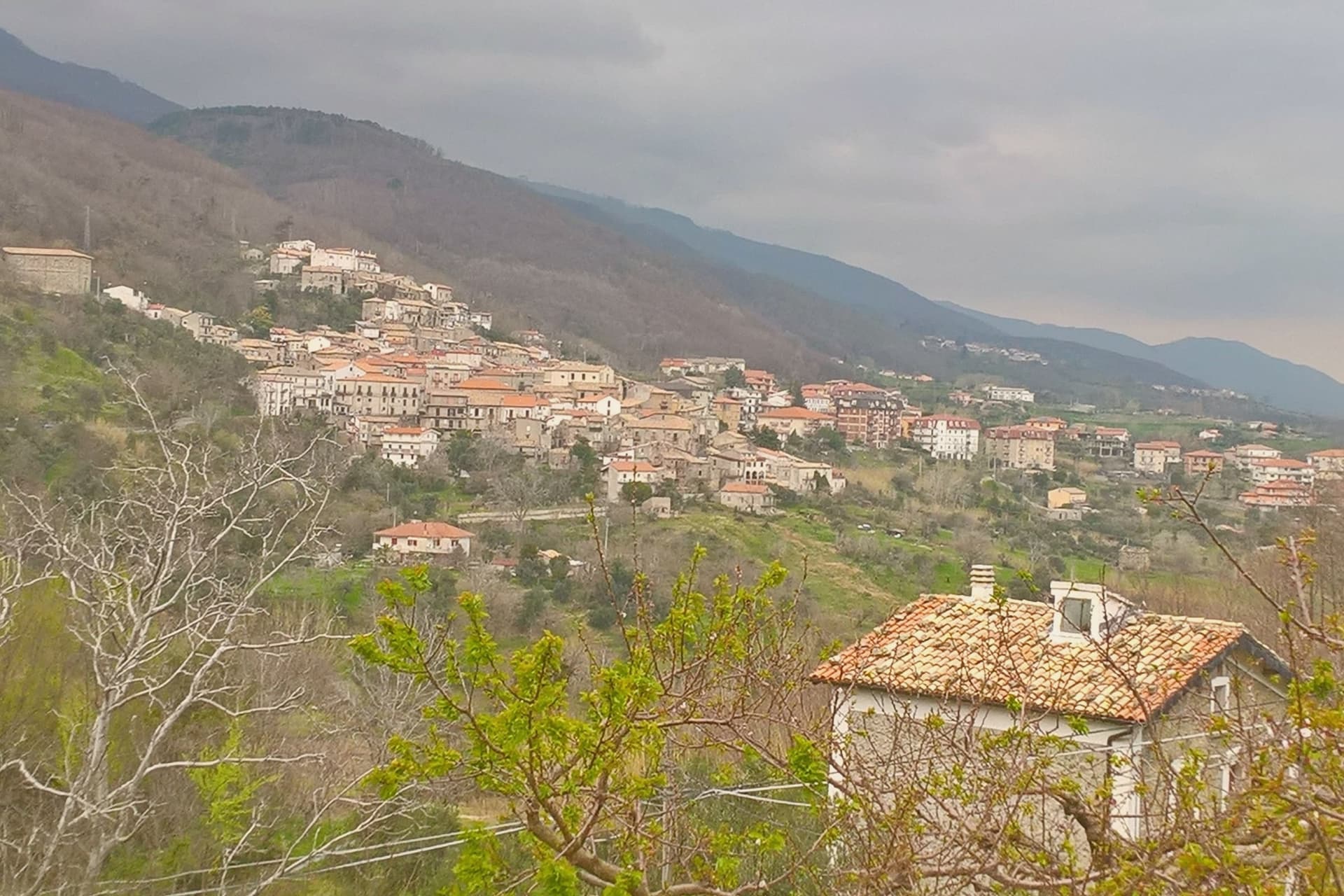
San Benedetto Ullano (Shën Benedhiti in Arbëreshë) sits twenty kilometers from Cosenza, on the inland slope of the Catena Costiera. It is one of the twenty-seven Arbëreshë communes of Calabria, founded by Albanian refugees who arrived between the fifteenth and eighteenth centuries fleeing the Ottoman advance, and the language founded then is still spoken at home.
The college that trained Greek-Albanian clergy became a centre of Albanian culture in Italy and produced prominent figures of the Arbëreshë intellectual revival before it was moved in 1794 to San Demetrio Corone, taking the town's role as seat of that institution with it. The village itself stayed a frazione of Montalto Uffugo until 1937, when it became an autonomous commune, a late administrative independence for a place whose religious and linguistic identity had been settled for centuries.
The festa of Sant'Antonio in June draws Arbëreshë families back from across Italy. What remains is a village whose civic history is short and whose cultural history is long: a place that outlasted the institution that once made it notable, and kept the rite and the language after the college itself moved on.
What to see in San Benedetto Ullano
- Chiesa di San Pietro e Paolo. Parish church where the iconostasis and frescoes still stand behind the Albanian chant sung at services.
- Sede storica del Collegio Corsini. The building Pope Clement XII's college once occupied, before it moved on and left this as the surviving trace of it in the village.
- Centro storico. Compact Arbëreshë centre of stone houses, with the original Albanian street names and the small square in front of the church.
How to get to San Benedetto Ullano
Reggio Calabria is roughly 157 minutes away by road.
Our tip
April through October is the working season for the hill villages west of Cosenza. Spring brings broom and orchids on the slopes; June is when Sant'Antonio fills the square with Arbëreshë families. July and August are hot but more bearable than down on the coast, and 460 meters means the evenings cool quickly.
Aiello Calabro
Why visit Aiello Calabro
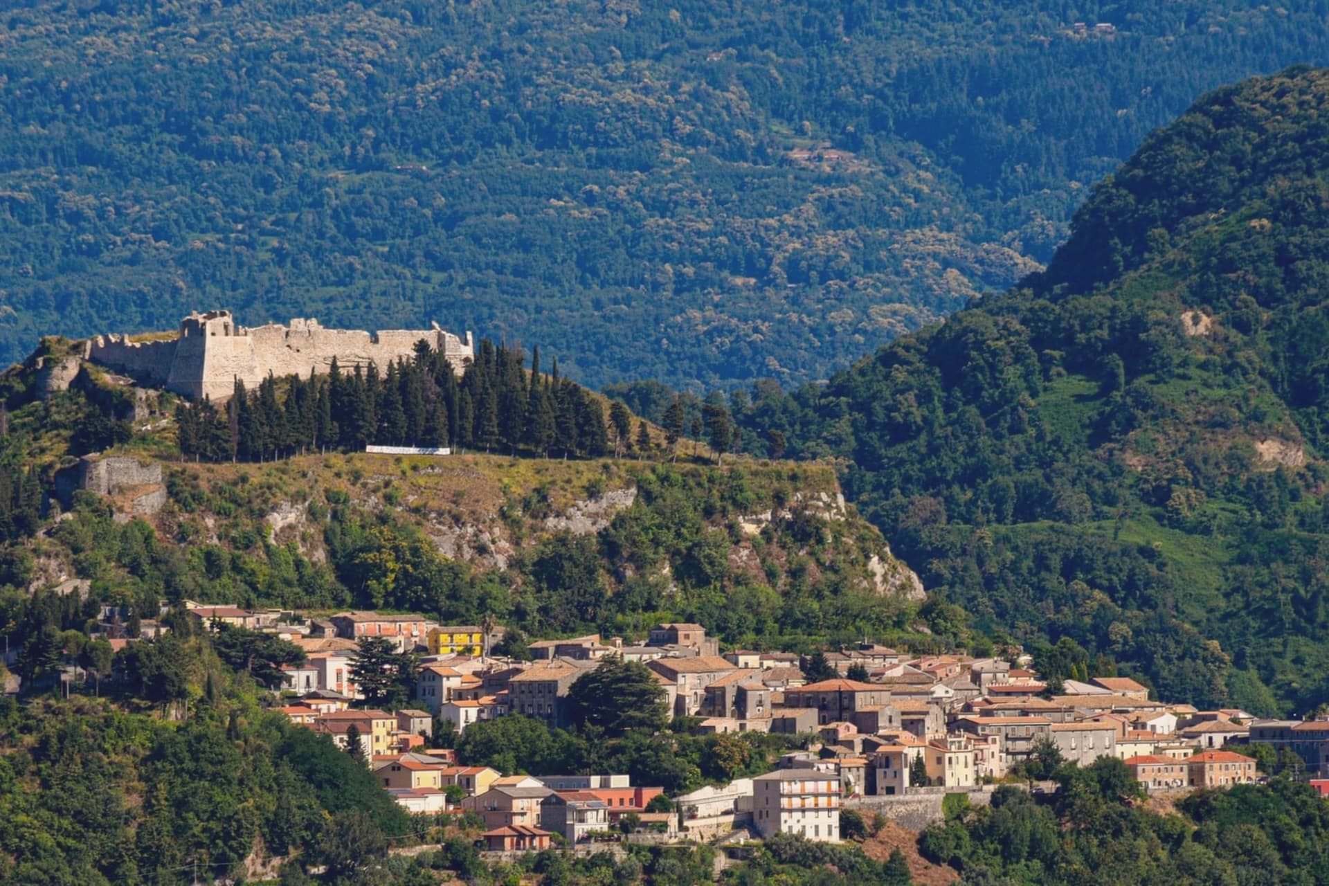
Aiello Calabro sits at 502 meters on a ridge in the Tyrrhenian hinterland, twenty kilometers from Cosenza and about fifteen from the sea. Archaeological tombs from around 550 BC found in the Valle locality place the area inside the orbit of ancient Temesa, between the Oliva and Savuto rivers.
Roberto il Guiscardo's Normans took the town in 1065 after a four-month siege. In 1566 the Cybo-Malaspina, a Ligurian-Tuscan dynasty from Massa, bought the fief for 38,000 ducats; they held it as marquisate, then duchy, until feudalism was abolished.
The family's sixteenth-century palace still stands in the historic center, alongside the ruins of the medieval castle and the tenth-century Chiesa Madre that holds the relics of San Geniale. A 1905 earthquake destroyed much of the settlement and the population has fallen ever since.
The town joined the Borghi più belli d'Italia in recognition of the preserved medieval grid.
What to see in Aiello Calabro
- Palazzo Cybo-Malaspina. Sixteenth-century palace built by the Ligurian-Tuscan family that ruled Aiello for two centuries, with the Cappella di Alfonso Cybo inside.
- Castello medievale. Ruins of the medieval fortress on the highest point of the ridge, called one of the first fortresses of the kingdom by Leandro Alberti in 1525.
- Chiesa Madre di Santa Maria Maggiore. Tenth-century mother church on the lower ridge, holding the relics of San Geniale, patron of the town.
How to get to Aiello Calabro
Reggio Calabria is roughly 117 minutes away by road.
Our tip
April through June and September into October are the best months. The ridge at 502 meters catches the sea breeze from the Tyrrhenian, and temperatures stay below thirty most days. July and August push past thirty-five degrees; the centro storico empties at midday.
Montegiordano
Why visit Montegiordano
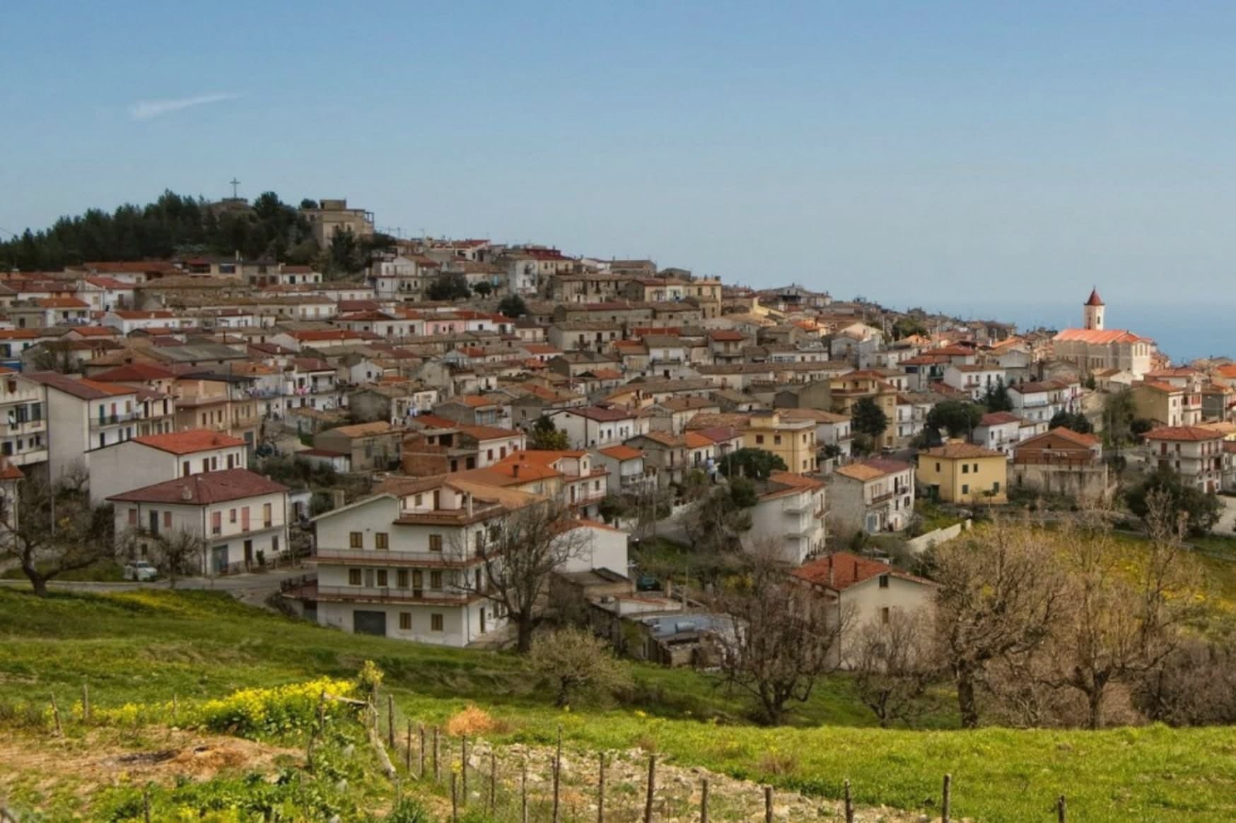
The commune sits on a ridge above the Ionian in the Alto Jonio Cosentino, with the Pollino massif behind it. It has two centres, the hill town at 619 meters and the marina on the coast below, joined by the road that passes the small chapel on the plain.
Records of settlement here go back to the fourth century BC. The castle stands in the Piano delle Rose locality, built by the Pignone del Carretto as a winter residence and hunting lodge; the de Martino family later ruled the feudo from 1748 until the abolition of feudalism in 1806.
The commune carries the designations Borgo Autentico, Spiga Verde and Città del Vino. What holds the two centres and the centuries together is the sense of a working village rather than a preserved one: a hill town still occupied and repainted, a castle still standing over its own courtyard, a marina still adding beach length, and a plain between them still crossed on the old route from residence to coast.
What to see in Montegiordano
- Castello Pignone del Carretto. Four kilometers from the marina, built as a winter residence by the Neapolitan Pignone del Carretto family who held the feudo from the seventeenth century.
- Centro storico dei murales. The hilltop old town itself, its walls and lanes given over entirely to the mural project, each one telling a piece of the village story rather than standing as decoration alone.
- Cappella Madonna del Carmine. Small chapel on the plain near the castle, a few hundred meters from the Pignone residence, on the road between hill and marina.
How to get to Montegiordano
There is a railway station in the town, so you can arrive without a car and never need one while you are here. Taranto is roughly 88 minutes away by road.
Our tip
April through June and September into October are the right months to walk Montegiordano's mural-painted alleys and look from the 619-meter ridge over the Ionian. July and August are hot on the coast but the hill stays at workable temperatures and catches the sea breeze in the evening. November through March is quiet: most of the marina lidi close, the castle keeps limited hours, and the cantine work but visit by appointment.
Laino Borgo
Why visit Laino Borgo
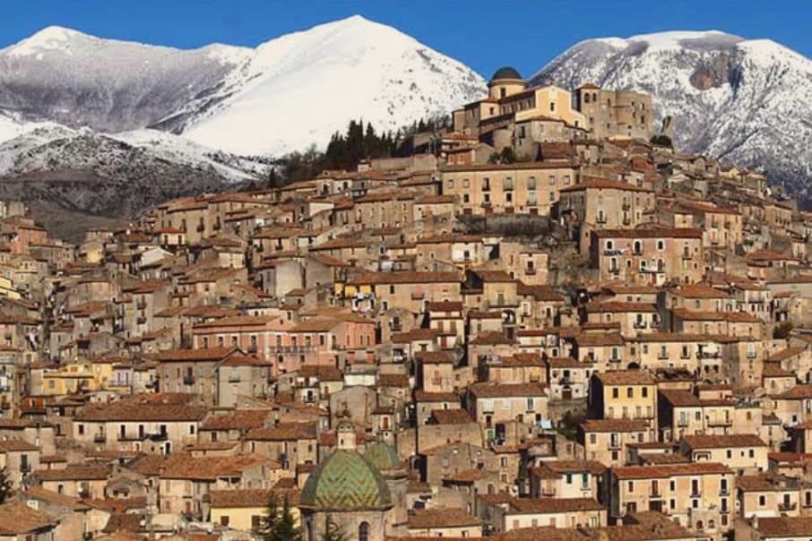
Laino Borgo sits at 582 meters on the border between Calabria and Basilicata. The name traces to the river Lao, itself named after the ancient Greek city of Laüs founded on the Tyrrhenian coast below.
The centro storico climbs toward the castle ruins at its upper edge, looking across the valley to the Pollino slopes opposite, while the river runs through its canyon at the base of the settlement, the same stretch of water that carries the rafting trade through the warmer months. Garlic and hazelnuts are grown on the slopes around the village, and the commune holds Borgo Autentico d'Italia status.
The chapels on the pilgrimage route sit apart from this daily geography, on property outside the village proper, added to a settlement otherwise defined by its river, its border position and its castle height. What holds the place together is the Lao itself: it gave the town its name, cut the canyon that draws the rafters, and marks the edge between two regions the village has always sat astride.
What to see in Laino Borgo
- Santuario delle Cappelle (Sacro Monte). Only Sacro Monte in southern Italy, sixteen pilgrimage chapels begun in 1557 by Domenico Longo after a journey to the Holy Land, depicting scenes from the Bethlehem grotto to the Crucifixion.
- Rafting on the Lao river. Main rafting and canoeing centre of southern Italy, with descents through a 200-meter canyon, launches from a wooden bridge near Piazza Navarro.
- Castello Normanno. Norman castle ruins on the upper edge of the centro storico, a vantage point over the Lao valley and the Pollino slopes opposite.
How to get to Laino Borgo
Salerno is roughly 93 minutes away by road.
Our tip
April through June and September into October are the months the Lao runs at workable rafting levels and the Pollino trails open. July and August reach the mid-thirties in the canyon, though the river itself stays cold and the rafting outfitters run their busiest weeks. The Sacro Monte pilgrimage path, walked between the sixteen chapels, fills around 8 September for the feast of the Madonna dello Spasimo.
Oriolo
Why visit Oriolo
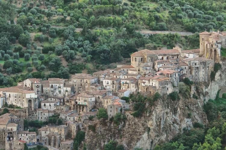
Oriolo sits on a sandstone outcrop at 450 meters above the Ferro valley, on the eastern slopes of the Pollino National Park and twenty kilometers inland from the Ionian Sea. The settlement grew up as a refuge for coastal populations fleeing Saracen raids, and twelfth-century Greek documents already record the toponym Orzoùlon, from the Latin Hordeolus meaning barleycorn.
The Aragonese castle on the highest rock spur dates back to Byzantine foundations and was rebuilt by the Sanseverino family; in 1552 Marcello Pignone bought the barony for 12,000 ducats and turned the fortress into a noble residence, painted and frescoed. In 1647 it was besieged during the Masaniello revolt.
The Church of San Giorgio, with a Renaissance portal, anchors the lower part of the borgo. The town carries both the Borghi più belli d'Italia and Bandiera Arancione signals, a combination rare in this corner of the Pollino.
What to see in Oriolo
- Castello di Oriolo. Aragonese fortress on the highest sandstone spur, rebuilt by the Sanseverino family on Byzantine foundations, later residence of the Pignone marquises.
- Chiesa di San Giorgio. Mother church of the borgo with a Renaissance portal, named for the patron saint of Oriolo.
- Centro storico. Medieval walled borgo preserving its original urban layout of stepped alleys converging on the castle rock.
How to get to Oriolo
Taranto is roughly 114 minutes away by road.
Our tip
April through June and September into October are the dry, walkable months in Oriolo, when the Ferro valley turns green and temperatures stay in the low twenties. July and August are hot, often above thirty degrees on the exposed outcrop, and the borgo empties from mid-afternoon. November through March is quiet: many shops close, the wind comes off the Pollino, and the castle rock catches early morning fog from the river below.
Cerchiara di Calabria
Why visit Cerchiara di Calabria
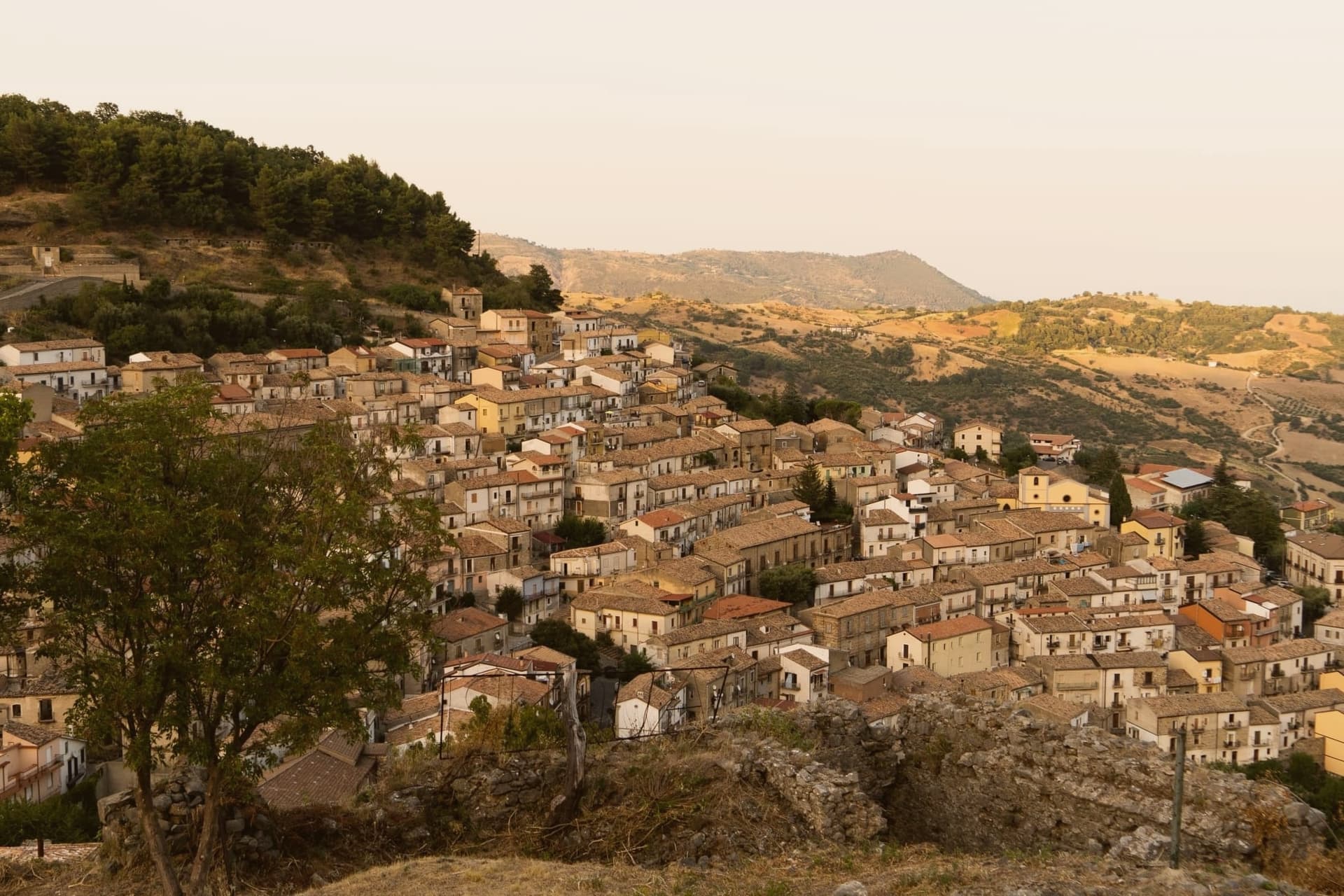
Cerchiara di Calabria sits at 650 meters on the eastern flank of the Pollino massif, inside the national park. The site has been settled since the Magna Graecia period under the name Arponium, later the Byzantine Circlarium, with hermit cells documented on the mountain above by the tenth century: the sanctuary that stands there now grew out of that older hermit presence, enlarged over more than a century into the pilgrimage site it became.
Below the village, a cavity in the rock carries sulphurous water down to feed the thermal complex, while the Serra del Gufo caves and the Balze di Cristo cliffs make up the rest of the karst geology on the slopes above the town. The village itself reads as a single line from summit to foot: hermitage and sanctuary at height, thermal water and caves at the base, the settled center holding the bread ovens in between.
It is a place organized by elevation, with worship, water, and daily bread each keeping to their own level of the mountain.
What to see in Cerchiara di Calabria
- Santuario di Santa Maria delle Armi. A small rock chapel enlarged in the early sixteenth century, standing above the village on Mount Sellaro. The climb up trades the village roofscape for the open flank of the massif.
- Terme della Grotta delle Ninfe. The cave mouth sits at the foot of the mountain, water still running warm and mineral-heavy out of the rock before the complex channels it below.
- Museo del Pane. Tools and large wood ovens laid out in the centro storico, the working evidence of a bread-making practice the town is named for.
How to get to Cerchiara di Calabria
Taranto is roughly 131 minutes away by road.
Our tip
April through June and September into October are the dry months when the trails to the Madonna delle Armi sanctuary at 1,015 meters are walkable and the thermal complex is comfortable. July and August are hot, with the lower part of the commune touching thirty-five; the cave waters stay at constant temperature year-round but the road up to Sellaro empties between noon and four. November through March is quiet on the Pollino slopes, with snow possible above 1,000 meters and many trattorie closed weekdays.
Saracena
Why visit Saracena
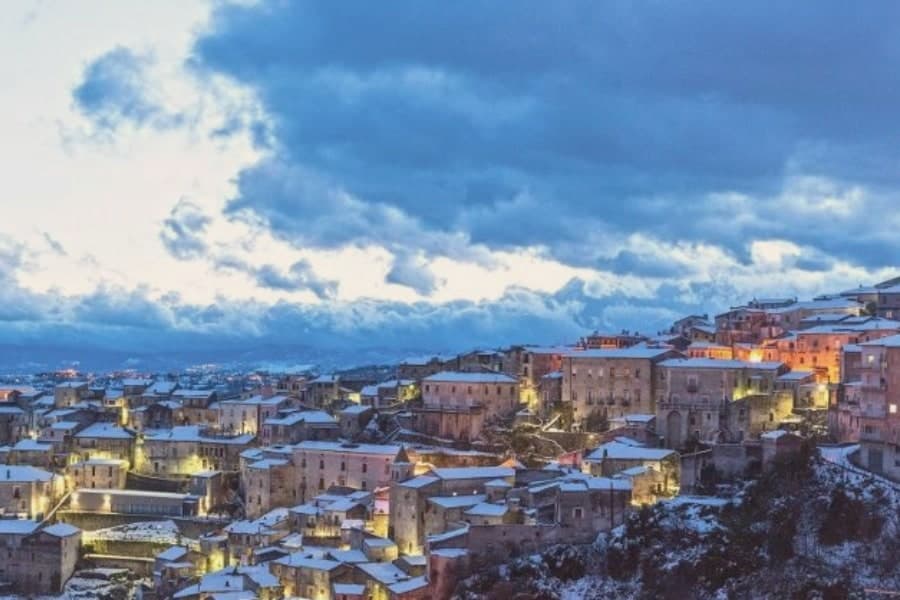
Saracena sits at 606 meters on the eastern slopes of the Orsomarso mountains, inside the Pollino National Park, fifty-five kilometers north of Cosenza. The town gets its name from the Saracens who conquered it around 900 AD; like Palermo and Tropea it kept a souk through the Arab-Sicilian and early Norman centuries, and the Byzantine army eventually retook it.
The mother monument is the twelfth-century Chiesa di San Leone, a Byzantine foundation that still holds the patron's relics. What carries the village now is wine: Moscato di Saracena, a passito blended from Guarnaccia, Malvasia, Odoacra and Moscatello, fermented slowly into an amber dessert wine first documented in the sixteenth century.
The production sits under a Slow Food Presidium, and a Casa del Moscato opened in the former town hall in May 2026. Olives, truffles and Pollino trekking fill the rest of the calendar.
What to see in Saracena
- Chiesa di San Leone. Twelfth-century Byzantine church dedicated to the patron San Leone di Catania, celebrated twice a year, in spring and late summer.
- Castello baronale. Ruins of the baronial castle around which the historic centre rises, a vantage point over the Pollino slopes and the Esaro valley.
- Casa del Moscato di Saracena. Visitor centre opened in May 2026 in the former town hall, dedicated to the production method of the Slow Food Presidium passito.
How to get to Saracena
Salerno is roughly 170 minutes away by road.
Our tip
April through June and September into October are the dry months that Saracena was built for, when the Pollino slopes are walkable and the moscato grapes either flower or come in. July and August touch the mid-thirties; the old town shaded alleys hold up but the trails climb above eight hundred meters to stay comfortable. November through March is quiet, with snow possible on the Orsomarso ridges and several cantine closed to visitors.
Altomonte
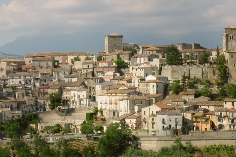
Why visit Altomonte
Altomonte sits at 455 meters in the Valle dell'Esaro, forty-five kilometers north of Cosenza, between the Pollino slopes and the Ionian plain. The village is built around the church, its stairways and alleys climbing the hillside toward the square in front of it, which gives the settlement its layout and its nickname as Calabria's wedding village.
The Dominicans took over the church in 1443 and founded the convent that now houses library and museum, joining under one roof the religious life of the town and the collection that grew out of it. Altomonte is one of I Borghi più belli d'Italia, a Cittaslow, and a Città dell'Olio and del Pane.
The recognitions and the produce sit alongside the medieval fabric rather than apart from it: a small hill town whose civic identity, from bread ovens to heritage listings, has grown around the same core the church and its square have held since the fourteenth century.
What to see in Altomonte
- Chiesa di Santa Maria della Consolazione. Built on a Norman foundation of 1070, raised over it by Filippo Sangineto. French stonework distinguishes the interior, the reason the church is ranked above any other Gothic-Angevin building in the region.
- Museo Civico di Altomonte. Housed in the former Dominican convent, with Simone Martini's panel of Saint Ladislaus commissioned by Filippo Sangineto in 1326 in Siena.
- Castello Normanno-Aragonese. Hilltop castle of Norman origin remodelled under the Aragonese, dominating the centro storico and the Esaro valley below.
How to get to Altomonte
Salerno is roughly 146 minutes away by road.
Our tip
April, May, June and September into October are the right months to walk Altomonte's stairways without sweating and to enter the Consolazione church when the afternoon light hits the rose window. July and August reach the mid-thirties on the Esaro plain, though the 455-meter perch holds an evening breeze the lowland towns do not get. November through March is quiet: many restaurants close midweek and the museum keeps shorter hours.
Mendicino
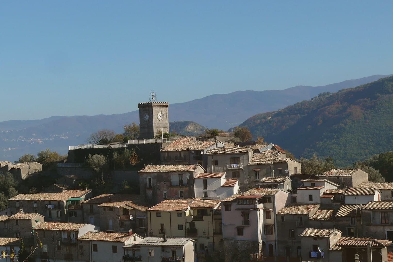
Why visit Mendicino
Mendicino sits at 475 meters, on a territory that climbs from 250 meters to the shared summit with Longobardi on the Tyrrhenian side. The first historical mention is attributed to Hecataeus of Miletus in the sixth century BC, who listed Moenekine among the cities of the region.
The place became a comune in 1811 under the Napoleonic reorganization of the Kingdom of Naples, long after that first record and long before silk gave it a second identity. Cosenza is close enough that residents commute, but the slope above the houses is still oak and chestnut, the same wood that once fed the looms below.
The town's history runs in two layers: a documented antiquity reaching back to that sixth-century BC mention, and a working economy built centuries later on mulberry leaves and water power. What stands today, the mill on the stream and the stone core on the hill, is the physical residue of that second layer, kept rather than replaced.
What to see in Mendicino
- Setificio Gaudio. Sits on the stream below the centro storico, where the wheels once turned on water alone; the machinery remains as it worked.
- Monte Cocuzzo. Views from the summit reach across the Tyrrhenian to the Aeolian Islands.
- Centro storico. Stone houses and narrow lanes on the hill, the core that carries the Borghi Autentici designation.
How to get to Mendicino
Reggio Calabria is roughly 148 minutes away by road.
Our tip
April through June and September through October are the working months in Mendicino. Mid-elevation foothills mean cooler nights than the Cosenza valley below, oak and chestnut leafing out in spring, the same forests turning copper in autumn. July and August can run hot, though the 475-meter altitude takes the worst edge off.
More from Anywhere Italy
 The best hidden towns inside a national park in the province of Cosenza
- The best hill towns inside a national park in Calabria
- The prettiest villages in the province of Cosenza
- The best wine towns in Calabria
 The best hidden hill towns within 90 minutes of Taranto
 The best hidden towns you can reach by train in the province of Cosenza