
The best hill towns that eat well in Emilia-Romagna
Emilia-Romagna is flat where the trains run and steep everywhere else. Climb south from the Via Emilia and the plain gives way to vine terraces, chestnut woods and ridges of pale sandstone, with villages built of brick and river stone tightening around a rocca. The food changes as you climb: less lambrusco-and-salumi ease, more tortelli d'erbetta, wild boar, chestnut flour, tigelle cooked on iron, pecorino from the high pastures. Autumn is the season it all lands at once, when the grapes come in around Castelvetro and the mist sits in the valleys until noon.
Most people meet the region's cooking in Bologna, and with reason: the porticoes, the Quadrilatero, the ragù, the queue outside every osteria with a name. Modena and Parma take the overflow, the balsamic cellars and the prosciutto tours booked months out. It is very good and it is very busy, and the tables that matter are reserved long before you arrive. The plain city circuit is also, by design, a circuit, which is why it feels the same in June as it does in October.
The kitchens do not stop at the edge of the plain. The same larder carries up into the hills of Piacenza, Modena, Forlì and the Rimini hinterland, into villages where a dining guide has named a table and the room holds a few dozen covers. Fewer people go, the parking is free, and the walk back after lunch is uphill through a medieval gate. These are those towns.
Of the 45 communes we have mapped in Emilia-Romagna, 8 qualify as hill towns that eat well: each is an inland hill settlement, and a dining guide has named a table in each. The smallest, Portico e San Benedetto, has 723 residents.
Two more lists worth reading alongside this one: The best small towns that eat well in Emilia-Romagna and The prettiest villages that eat well in Emilia-Romagna.
Portico e San Benedetto
Why visit Portico e San Benedetto
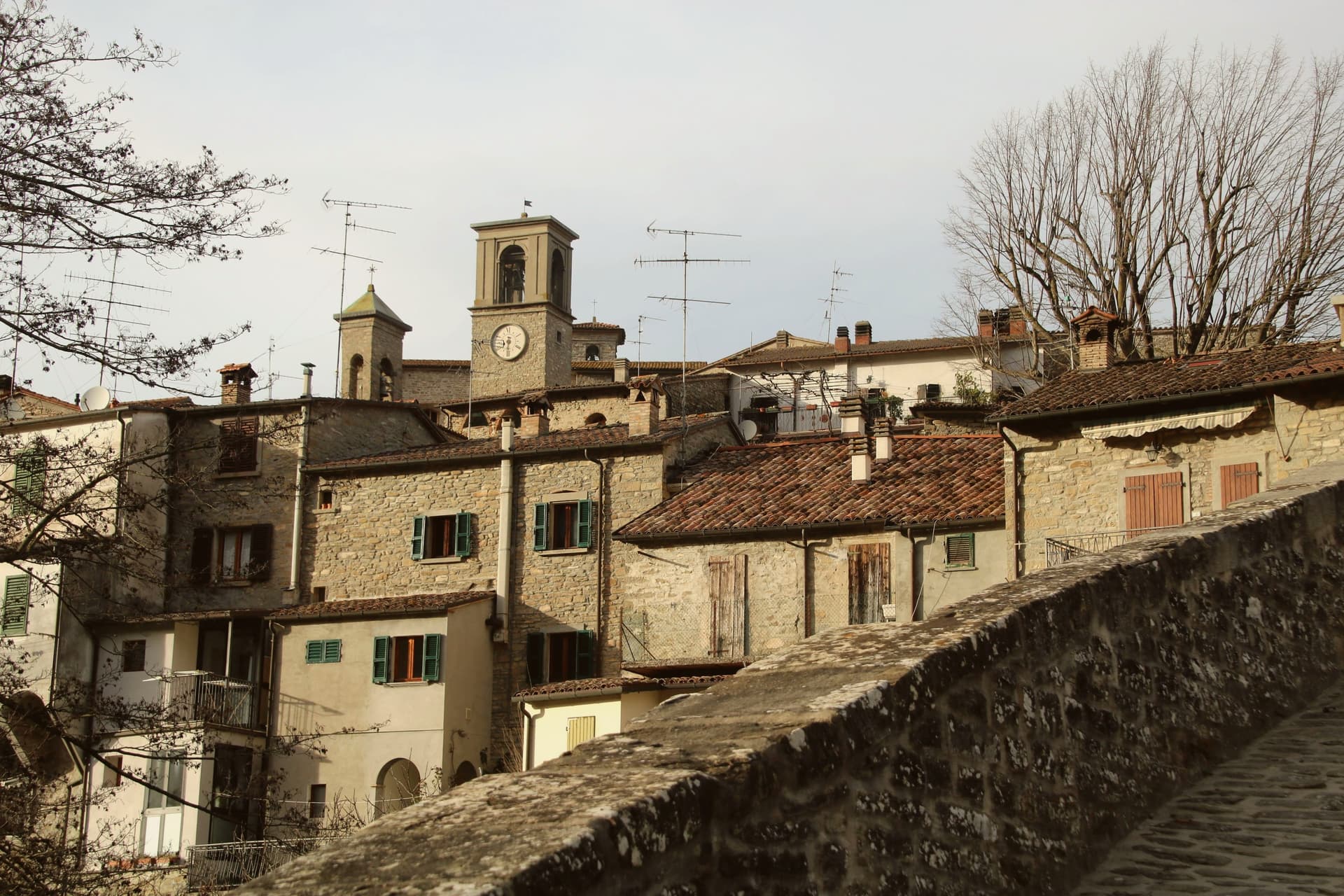
The Tuscan-Romagnolo Apennines place the borgo forty-five kilometers north of Florence and sixty southeast of Bologna, on the Montone river. The upper part holds the castle and the parish church, the middle the noble palazzi along Via Roma, the lower the artisan houses built vertically over four floors: a layout that follows the slope down from fortress to workshop.
Twelve kilometers upriver, the frazione of San Benedetto in Alpe holds the ruins of the abbey and the waterfall, joining the seat of Florentine administration to a stretch of the same valley given over to monastic settlement and to the poem that named its sound. The municipality lies inside the Parco Nazionale delle Foreste Casentinesi and carries the Bandiera Arancione.
What holds the two ends of the valley together is the Montone itself: one town built in tiers to govern the river's lower course, one abbey and one waterfall marking its upper reaches, twelve kilometers and several centuries apart but read here as a single territory.
Al Vecchio Convento have been named by a guide.
What to see in Portico e San Benedetto
- Centro storico di Portico. The slope divides into castle quarter above, noble palazzi along Via Roma at mid-level, and artisan houses built vertically below.
- Palazzo Portinari. Fourteenth-century palace on Via Roma, by tradition the residence of Folco Portinari's family.
- Cascata dell'Acquacheta. The torrent falls among rocks near San Benedetto in Alpe, the muffled roar the detail Dante fixed in Inferno XVI.
How to get to Portico e San Benedetto
Forlì is roughly 40 minutes away by road.
Our tip
April through June brings water in the Acquacheta and green on the Apennine ridges, the best months for the walk up from San Benedetto in Alpe. September and October give the chestnut harvest and the porcini in the Foreste Casentinesi; the Montone valley turns copper into November. July and August touch thirty degrees and the centro storico empties between two and five, though the river pools below the Ponte della Maestà are cold. Sagra della Tagliatella falls in August.
Montegridolfo
Why visit Montegridolfo
Montegridolfo sits at 290 meters on the Romagna-Marche border ridge, twenty kilometers south of Rimini and just inland from the Adriatic. A first castle is documented here in 1148, belonging to the Abbey of San Pietro of Rimini; the village took its name from the Gridolfi, a Rimini Guelph family that settled here during the conflicts with the Ghibellines.
After a sack in 1288, the Malatesta rebuilt the walls in 1337 with four corner towers. One tower survives, plus the bell tower over the gate.
The borgo passed back and forth between Malatesta and Montefeltro through the fifteenth century, fell briefly to Cesare Borgia in 1502, then to Venice, then to the Papal States in 1509. The walled nucleus today holds barely 200 of the commune's 994 residents, with the rest in Trebbio, San Pietro, and Cabaldo.
Olive oil from the surrounding ridges carries the Colli di Romagna DOP designation; the town joined the Città dell'Olio network on that basis.
Osteria dell'Accademia have been named by a guide.
What to see in Montegridolfo
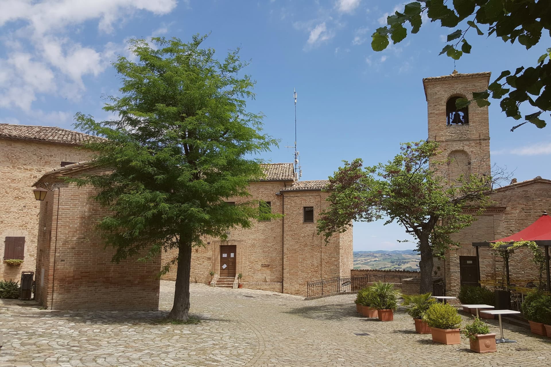
- Castello di Montegridolfo. Walled fourteenth-century burg built by the Malatesta in 1337 with four corner towers, of which one survives along with the bell tower over the original gate.
- Chiesa di San Rocco. Fifteenth-century church inside the walls, built in thanks after the village was spared a plague outbreak, with frescoes attributed to the school of the Marchigiana.
- Borgo murato. Compact walled nucleus of stone houses, narrow streets and a single piazza, restored in the 1990s and inhabited by artisans and a small permanent population.
How to get to Montegridolfo
Rimini is roughly 42 minutes away by road.
Our tip
April through October are the months that work in Montegridolfo. Spring brings clear views from the walls down to the Conca valley; September and October are the dry, gold months with the olive harvest beginning at the end of October. July and August are hot but the ridge catches the Adriatic breeze and the walled nucleus stays cool in shade.
Montefiore Conca
Why visit Montefiore Conca
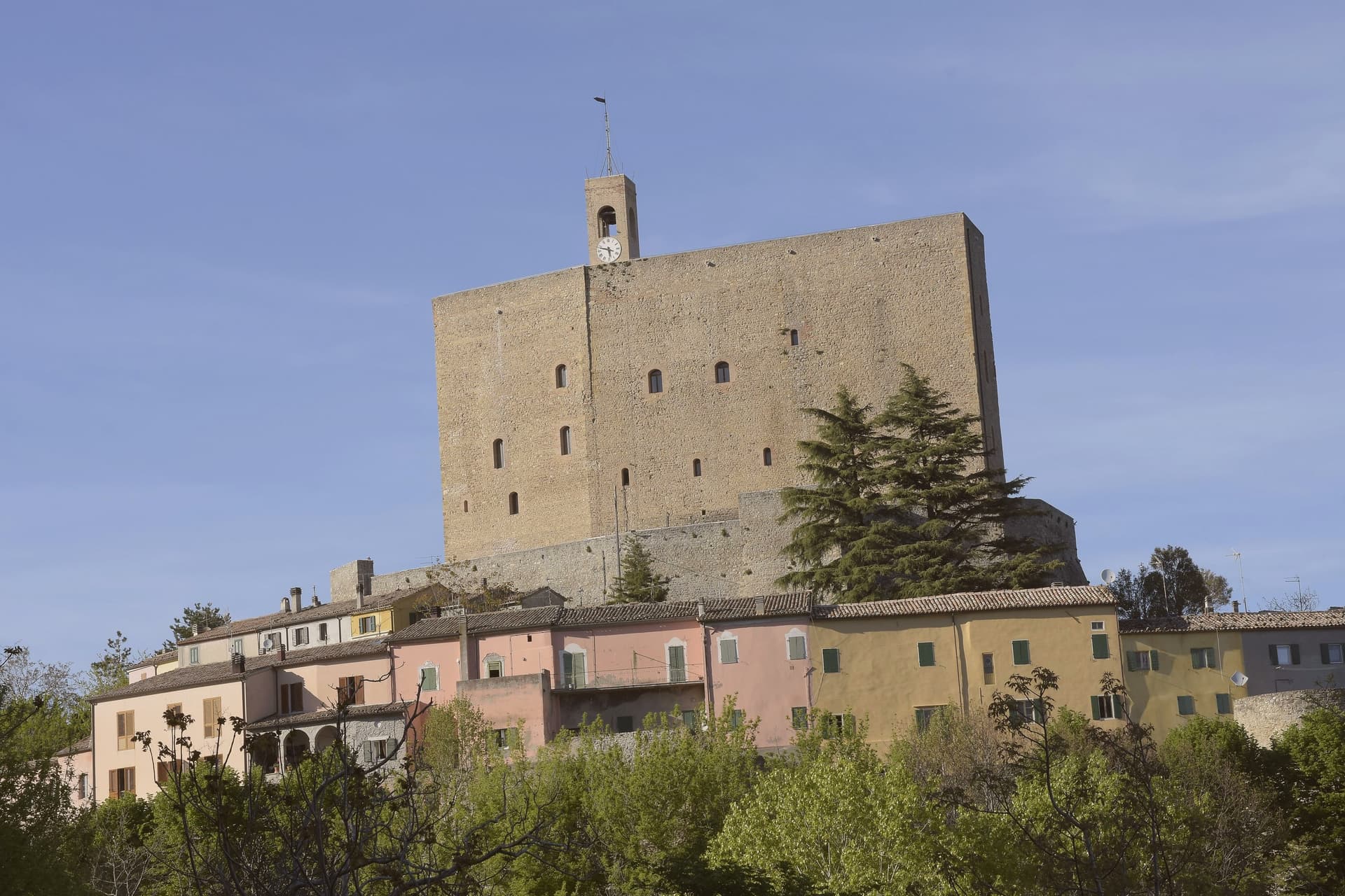
Montefiore Conca sits above the Conca river valley, twenty kilometers south of Rimini, on a hill the Malatesta chose for both military and seasonal reasons: high enough to anchor a defensive ring, mild enough for a residence to be built alongside the garrison. The fortress and the walled borgo that grew around it form a single hilltop nucleus, with the Porta Curina gate marking the point where, after Federico da Montefeltro's troops took the town in the late fifteenth century, control reverted to the Holy See, a shift the villagers recorded by carving the arms of Pope Pius II into the stone themselves.
The commune extends beyond that nucleus into the frazioni of Serbadone and Marazzano and out to the ridge holding the Santuario della Bonora, spreading the settlement from a single fortified point into the surrounding hills. Recognition is double: Borghi più belli d'Italia and Bandiera Arancione, a pairing that reads less as decoration than as confirmation that the hill the Malatesta picked for defense and comfort still functions, centuries on, as both a place to look out from and a place worth looking at.
La Cerqua have been named by a guide.
What to see in Montefiore Conca
- Rocca Malatestiana. Mid-fourteenth-century fortress built under Malatesta Ungaro, combining military bulk with a residential wing whose frescoed halls received Pope Gregory XII and Louis I of Hungary.
- Santuario della Madonna di Bonora. Sanctuary reached on a wooded ridge two kilometers from the centro storico, with a venerated fresco of the Madonna and Child still the object of the pilgrimage traffic it draws.
- Borgo medievale. Walled hilltop nucleus around the fortress, with the Porta Curina gate carrying the Piccolomini arms of Pope Pius II carved by the villagers in the late fifteenth century, after control of the town reverted to the Holy See.
How to get to Montefiore Conca
Rimini is roughly 35 minutes away by road.
Our tip
April through June and September through October are the strongest months, with mild evenings on the hill and clear views to the coast. July and August are hot in the Conca valley but the Rocca terrace catches the breeze that the riviera below does not. The fortress opens daily in summer, weekends only from November through March.
Bobbio
Why visit Bobbio
Bobbio sits on the left bank of the Trebbia at 272 meters, at the foot of Monte Penice in the Piacentine Apennines. The land was granted to Saint Columbanus by the Lombard king Agilulf in 614, and the monastery he raised on it grew, by the eighth century, into one of the principal libraries north of Rome, copying Greek, Latin, and Irish manuscripts that survived nowhere else.
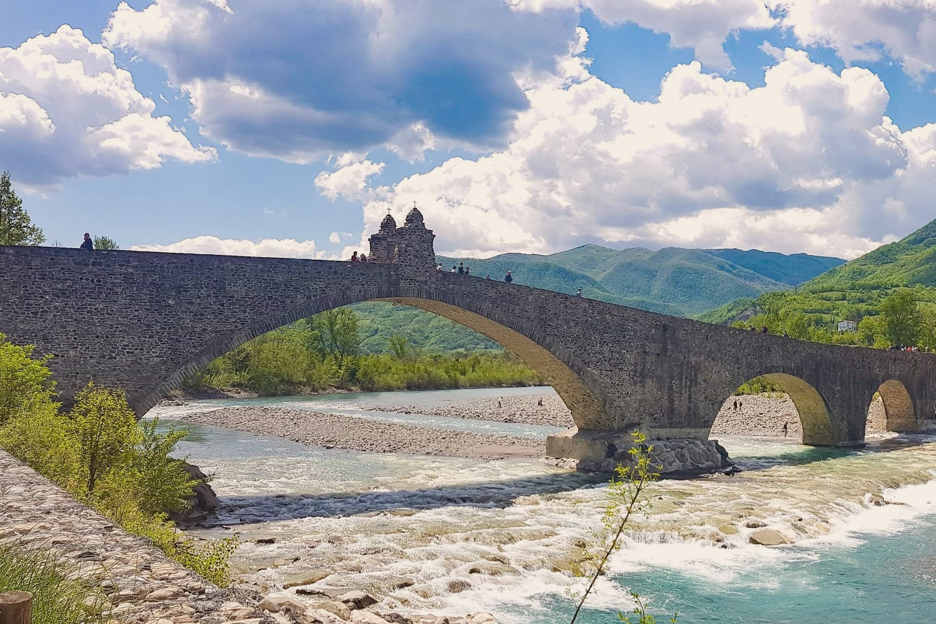
The French suppressed the monastery in 1803; what the scriptorium and library once held now lives in fragments, kept in the basilica and its museum. The town below the abbey is crossed by the Trebbia on the Ponte Gobbo, its eleven irregular arches stretching 273 meters, a shape that gave rise to the story of the Devil and the saint dividing the bridge between them.
Bobbio still carries the Borghi più belli and Bandiera Arancione designations alongside the 2019 RAI title. A river crossing, a hill fortress, and a monastery ruin sit within reach of one another here, each holding a different piece of the same long settlement, one built by faith, one by feudal power, and one by the river itself.
Enoteca San Nicola, Piacentino have been named by a guide.
What to see in Bobbio
- Abbazia di San Colombano. The basilica and grounds where Saint Columbanus settled still stand; the scriptorium he founded is gone but its output is documented in surviving manuscripts held elsewhere.
- Ponte Gobbo. The eleven arches sit unevenly across the riverbed, the irregularity of their spacing the source of both the Devil's Bridge name and the Columbanus legend attached to it.
- Duomo di Bobbio. Romanesque cathedral begun in 1075, dedicated to Santa Maria Assunta, with a fifteenth-century fresco cycle in the apse.
How to get to Bobbio
Piacenza is roughly 63 minutes away by road.
Our tip
April through June brings the green Val Trebbia season, when the river runs clear enough for swimming holes downstream. September and October are the working months for chestnuts, mushrooms, and the maccheroni alla bobbiese the town fills its trattorie with. July and August can hit thirty-three degrees in the valley, and the 2019 Borgo dei Borghi win still draws weekend crowds that fill the Ponte Gobbo. La Festa del Pinolo falls in August.
Castell'Arquato
Why visit Castell'Arquato
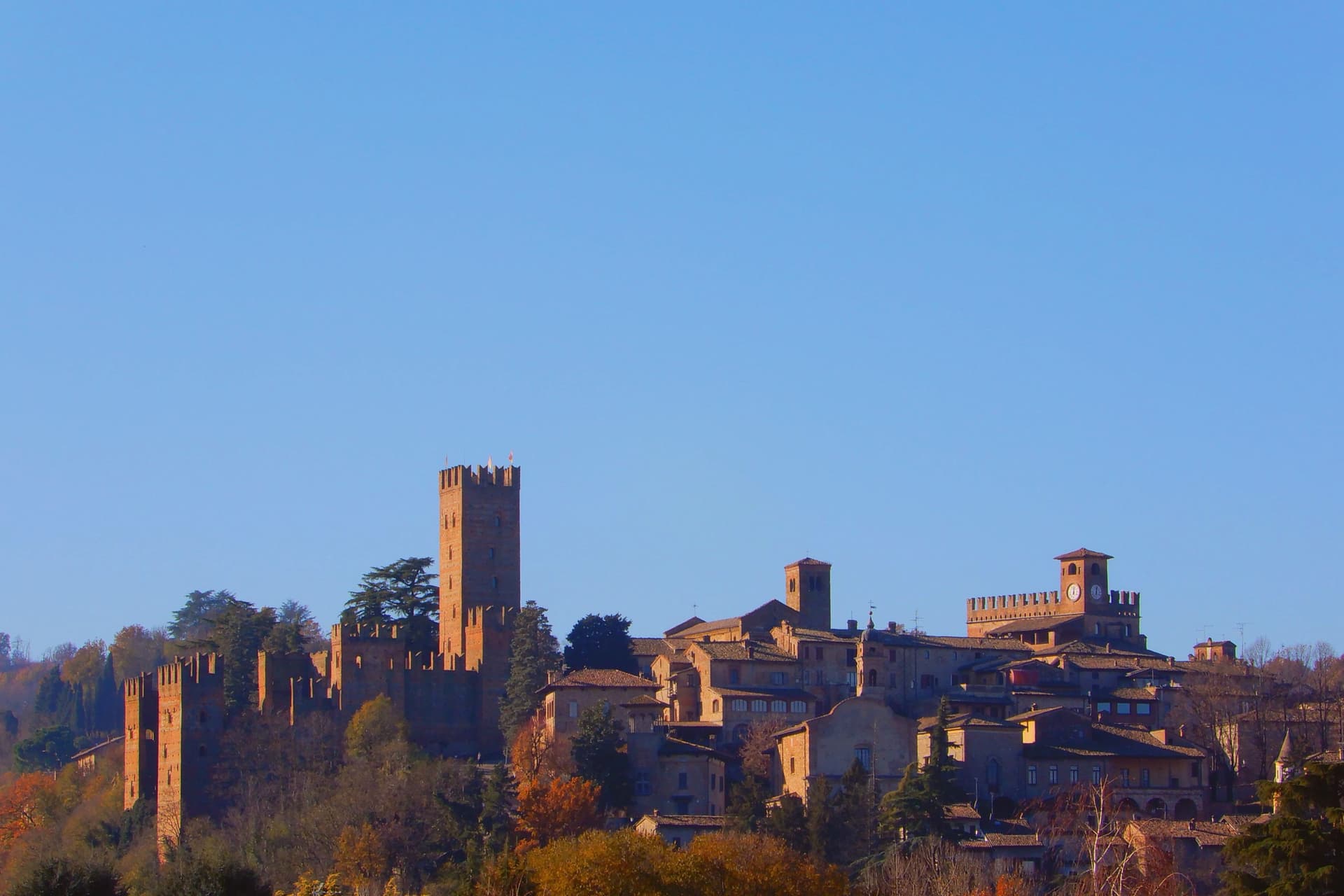
Castell'Arquato sits on the first hills of the Val d'Arda at 224 meters, thirty kilometers from Piacenza, the medieval borgo arranged in tight concentric levels around the old rock. The Collegiata di Santa Maria, founded by the noble Magnus in the eighth century, was rebuilt in 1122 after the 1117 earthquake destroyed the earlier church and is one of the finest Romanesque buildings in the Piacentino.
The Rocca Viscontea, with its thirty-five-meter tower, was begun in 1342 by Luchino Visconti, lord of Milan, to lock down the valley for Piacenza. The Palazzo del Podestà next door dates from 1292 and still anchors the Piazza Monumentale.
Luigi Illica, the librettist of Tosca, Madama Butterfly, La bohème and Andrea Chénier, was born in town in 1857; the museum dedicated to him sits in the house next to his birthplace. The Val d'Arda hills around the town produce the white wines that earned Castell'Arquato Città del Vino status.
Da Faccini have been named by a guide.
What to see in Castell'Arquato
- Rocca Viscontea. Fortress begun in 1342 by Luchino Visconti for the municipality of Piacenza, with a thirty-five-meter tower at the highest point of the borgo.
- Collegiata di Santa Maria Assunta. Romanesque collegiate church, founded in the eighth century and rebuilt in 1122 after the 1117 earthquake destroyed the earlier structure.
- Palazzo del Podestà. Civic palace from 1292 facing the Collegiata, with the original ghibelline merlons and a fourteenth-century loggia along its lower level.
How to get to Castell'Arquato
Piacenza is roughly 38 minutes away by road.
Our tip
April through June is the best season for the Val d'Arda hills: the vineyards on the slopes below the borgo are green and the air clear enough to see across to the Appennino Piacentino. September and October bring the white-wine harvest and the chestnut weeks. July and August touch thirty-three degrees and the unshaded Piazza Monumentale becomes uncomfortable between noon and four.
Longiano
Why visit Longiano
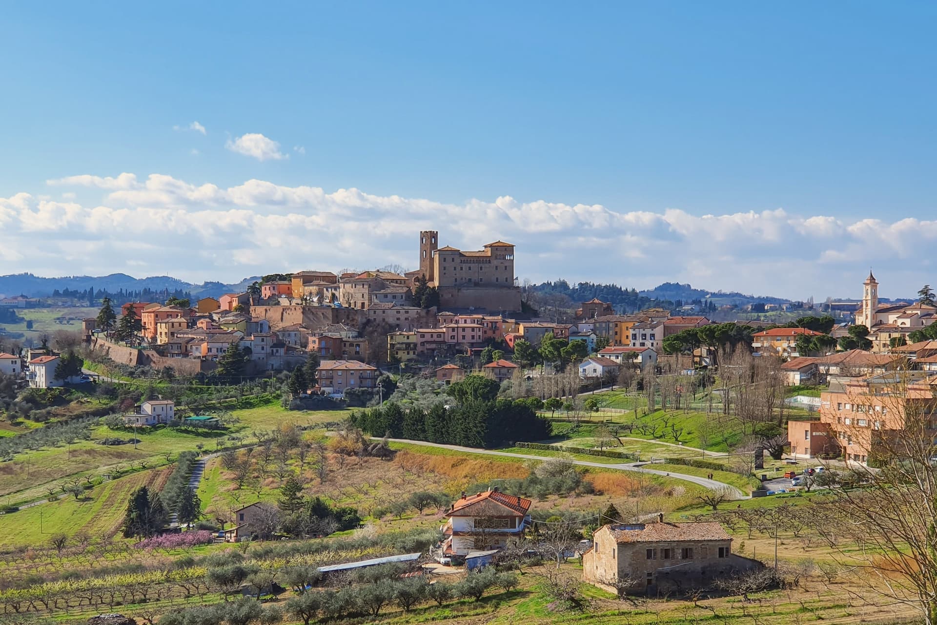
Longiano sits at 179 meters on the first hill line between Cesena and Rimini, eleven kilometers inland from Cesenatico and within sight of the Adriatic. The town shifted from the plain to the hill in the seventh and eighth centuries, when the local population moved up to escape Lombard raids, and the settlement that resulted is the hilltop borgo still walled today, with the castle at its center and the theater just below it.
Longiano passed to the Church in 1581 and stayed under papal rule until unification, before the castle came to the commune in 1989. The sanctuary stands apart from this hilltop cluster, built around its painted crucifix and held by Franciscan presence for over seven centuries, a separate thread of the town's history running alongside the Malatesta line and the civic one.
What ties the parts together is the hill itself: a defensive move made in the seventh and eighth centuries left Longiano with a compact center where a former ruling family's fortress, a nineteenth-century theater and a walled medieval borgo all sit within reach of each other, while the sanctuary's much older devotional history runs on its own separate track nearby.
Magnolia, Dei Cantoni, Terre Alte have been named by a guide.
What to see in Longiano
- Castello Malatestiano. Fortified hilltop seat of the Malatesta of Rimini, later passing to the Church and then the commune. Its rooms now hold the Fondazione Tito Balestra, so the walls that once housed a ruling family now hold paintings, drawings and sculpture.
- Teatro Petrella. Sits just below the castle. Restored in 1986, it is known today for its acoustics inside the horseshoe-shaped hall.
- Santuario del Santissimo Crocifisso. Franciscan sanctuary built around a thirteenth-century painted crucifix on oak panel, with continuous Franciscan presence for over seven centuries.
How to get to Longiano
There is a railway station in the town, so you can arrive without a car and never need one while you are here. Rimini is roughly 30 minutes away by road.
Our tip
April through June and September through October are the months for Longiano. The hilltop catches a breeze the coastal plain below does not, and the views run from the Apennines to the Adriatic on clear days. July and August touch the low thirties and the centro storico empties between two and five; many visitors come up from Cesenatico and Cervia in the late afternoon for the cooler air and the castle. Crocetta 30 in Festa falls in August.
Castelvetro di Modena
Why visit Castelvetro di Modena
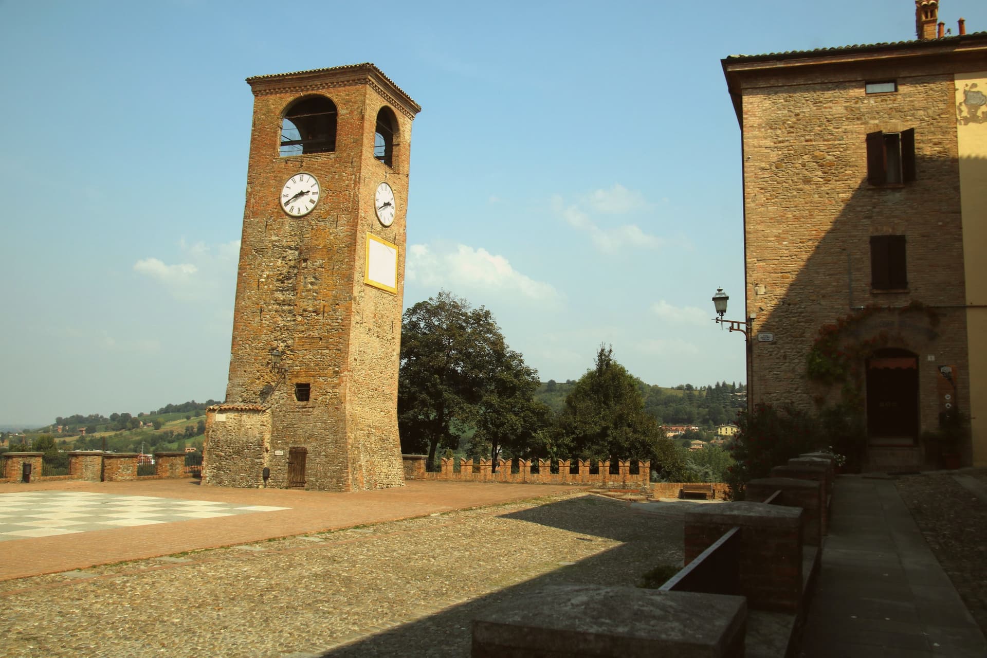
Castelvetro di Modena sits on a hill at 152 meters, eighteen kilometers southeast of Modena and at the northern edge of the Apennine foothills. The medieval centro storico rises around the Piazza Roma, paved in alternating white and black stones that earned it the name Piazza della Dama, the checkerboard piazza, framed by the four surviving towers of the old castle.
The Grasparossa grape grows on the clay slopes around the town, the sandy soil and the south-facing aspect producing the deepest, most tannic of the three main Lambruschi; Lambrusco Grasparossa di Castelvetro received DOC status in 1970. Above the piazza, the Palazzo Rinaldi houses the Museo del Vino and the Museo dell'Aceto Balsamico, the second tracing the same Modenese tradition that nearby Spilamberto codifies.
The municipality holds three institutional signals: Borghi più belli, Bandiera Arancione, Città del Vino. The Sagra dell'Uva e del Lambrusco runs the last weekend of September, when the streets fill with the chess players from the surrounding Lambrusco towns dressed as living pieces on the piazza.
Locanda del Feudo, Opera|02 have been named by a guide.
What to see in Castelvetro di Modena
- Piazza Roma. Checkerboard piazza paved in alternating white and black stones, framed by the four surviving towers of the medieval castle.
- Castello di Levizzano Rangone. Tenth-century fortified frazione four kilometers north, with a tower built in the 990s and a fully preserved medieval village.
- Museo del Vino. Wine museum inside the Palazzo Rinaldi, tracing the Grasparossa production cycle and the DOC zone established in 1970.
How to get to Castelvetro di Modena
There is a railway station in the town, so you can arrive without a car and never need one while you are here. Modena is roughly 28 minutes away by road.
Our tip
April through June and September through October are the Castelvetro months. The hills around the borgo turn green in spring and red in autumn when the Grasparossa vines colour up before the harvest. July and August are hot, thirty-five degrees in the valley, less in the hills above, and the cantine slow down. Sagra dell'Uva e del Lambrusco Grasparossa di Castelvetro falls in September.
Sasso Marconi
Why visit Sasso Marconi
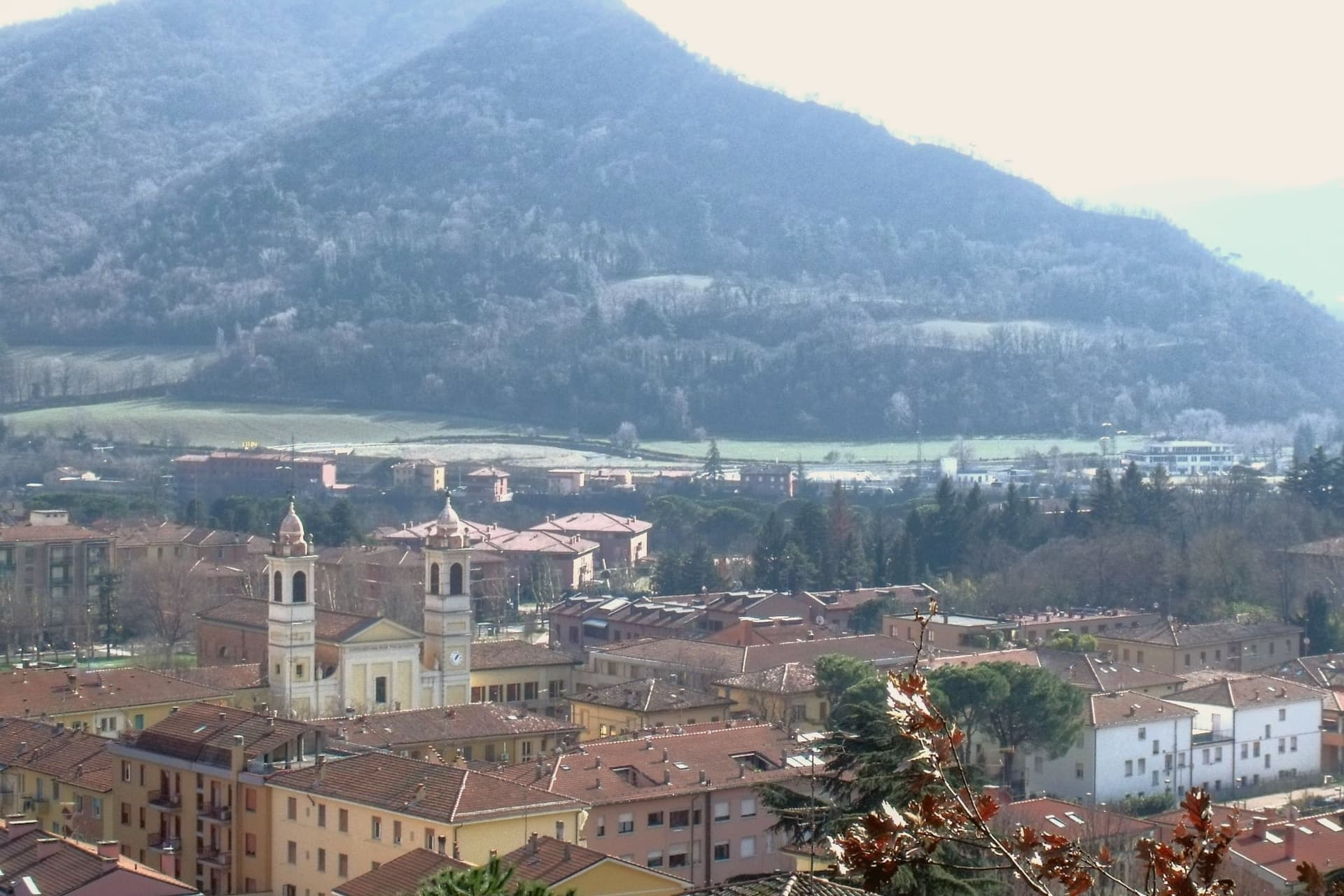
The Setta and Reno rivers meet below the rock that gives the town its name, at the point where the pre-Apennine hills begin their climb south of Bologna. The Sasso della Glosina dominates the bend, a Pliocene formation old enough to have shaped how the crossing below it was used long before the valley took its modern name.
The town itself was called Sasso Bolognese until 1938, when it was renamed for the family whose estate lies in the frazione of Pontecchio, on the valley floor rather than on the rock itself. The territory reaches from that river confluence up into the Apennine slopes, and the change in elevation shows in what the land produces: white truffle from the valley floor near the Reno, and vineyards on the hills around Pieve del Pino and Mongardino, recognition earned on two different registers of the same ground.
The lower town, built around the rivers and the old road to Pistoia, and the upper slopes, given to woods and terraced vines, read as one territory doing two different kinds of work.
Casa Mazzucchelli, Antica Trattoria la Grotta dal 1918 have been named by a guide.
What to see in Sasso Marconi
- Villa Griffone - Museo Marconi. Marconi family villa in the frazione of Pontecchio. The mausoleum sits alongside the attic laboratory, and the museum holds working reproductions of his early apparatus.
- Sasso della Glosina. The rock rises directly over the river bend, its bulk visible from the crossing below and from much of the surrounding valley.
- Confluenza Setta-Reno. Meeting of the two valleys at the foot of the rock, with the historic crossing of the Via Porrettana toward Pistoia.
How to get to Sasso Marconi
There is a railway station in the town, so you can arrive without a car and never need one while you are here. Bologna is roughly 26 minutes away by road.
Our tip
April through October is the working season in Sasso Marconi. Spring and early autumn are best on the Reno valley trails and at Villa Griffone, with mild temperatures and the Apennine foothills green or autumn-coloured. July and August can touch thirty-five degrees in the valley, though the higher frazioni stay cooler; many visitors come up from Bologna for a day on a weekend. Fira di Sdaz di Sasso Marconi falls in September.
More from Anywhere Italy
- The best small towns that eat well in Emilia-Romagna
- The prettiest villages that eat well in Emilia-Romagna
- The best hidden towns with a serious restaurant in Emilia-Romagna
- The prettiest small villages in Emilia-Romagna
- The best hill towns that eat well within 90 minutes of Rimini
 The best hill towns you can reach by train in Emilia-Romagna