
The best small hill towns within 90 minutes of Rimini
Inland from the Adriatic, the land stands up fast. Limestone crags rise out of the Marecchia and Conca valleys, and on top of them sit walled villages of pale sandstone with a rocca at the highest point, built when this was contested ground between Malatesta and Montefeltro. Autumn is the season the hills earn their reputation: white truffles from the beech and oak woods, chestnuts roasted in the piazza, cheese aged in tufa pits, and the heavy pastas of the Romagna and Marche border, strozzapreti, cappelletti in brodo, passatelli. Winter mist sits in the valleys below the ridge roads, so the towns float above it.
Almost everyone who comes to this stretch of coast stays on the sand. Rimini's beach concessions run for kilometres in unbroken rows of umbrellas, the seafront hotels fill from June, and the day-trip circuit adds San Marino, which receives millions of visitors a year for its towers, its duty-free shops and its car parks. It is a legitimate outing and the view from Monte Titano is wide. It is also busy, and it absorbs nearly all the attention that the hills behind it might otherwise get.
The same ridges continue past San Marino in both directions, and they carry fortresses, hilltop churches and truffle markets the whole way. The towns here are small, many of them a single street between two gates, with fewer people arriving and rooms available in October when the coast has emptied. They sit close enough to the sea for a morning swim and far enough inland to feel like a different region entirely.
Of the 21 communes we have mapped within 90 minutes of Rimini, 13 qualify as hill towns: each is an inland hill settlement. This list is the small ones, 8 in all, ordered smallest first. The smallest, Montegridolfo, has 994 residents.
Two more lists worth reading alongside this one: The prettiest small villages within 90 minutes of Rimini and The 9 prettiest villages within 90 minutes of Rimini.
Montegridolfo
Why visit Montegridolfo
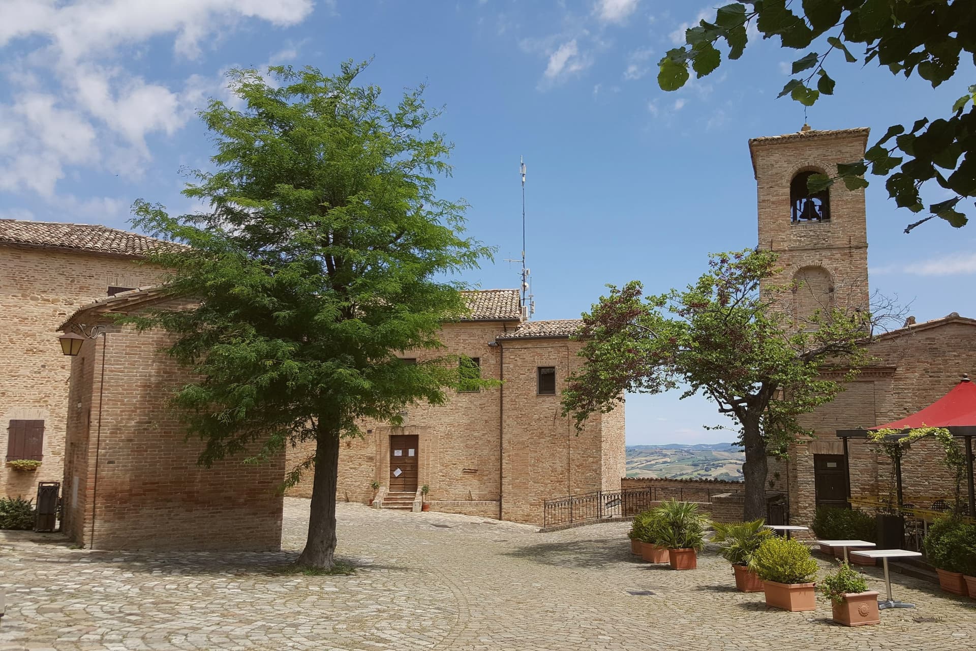
Montegridolfo sits at 290 meters on the Romagna-Marche border ridge, twenty kilometers south of Rimini and just inland from the Adriatic. A first castle is documented here in 1148, belonging to the Abbey of San Pietro of Rimini; the village took its name from the Gridolfi, a Rimini Guelph family that settled here during the conflicts with the Ghibellines.
After a sack in 1288, the Malatesta rebuilt the walls in 1337 with four corner towers. One tower survives, plus the bell tower over the gate.
The borgo passed back and forth between Malatesta and Montefeltro through the fifteenth century, fell briefly to Cesare Borgia in 1502, then to Venice, then to the Papal States in 1509. The walled nucleus today holds barely 200 of the commune's 994 residents, with the rest in Trebbio, San Pietro, and Cabaldo.
Olive oil from the surrounding ridges carries the Colli di Romagna DOP designation; the town joined the Città dell'Olio network on that basis.
What to see in Montegridolfo
- Castello di Montegridolfo. Walled fourteenth-century burg built by the Malatesta in 1337 with four corner towers, of which one survives along with the bell tower over the original gate.
- Chiesa di San Rocco. Fifteenth-century church inside the walls, built in thanks after the village was spared a plague outbreak, with frescoes attributed to the school of the Marchigiana.
- Borgo murato. Compact walled nucleus of stone houses, narrow streets and a single piazza, restored in the 1990s and inhabited by artisans and a small permanent population.
How to get to Montegridolfo
Rimini is roughly 42 minutes away by road.
Our tip
April through October are the months that work in Montegridolfo. Spring brings clear views from the walls down to the Conca valley; September and October are the dry, gold months with the olive harvest beginning at the end of October. July and August are hot but the ridge catches the Adriatic breeze and the walled nucleus stays cool in shade.
Monte Grimano Terme
Why visit Monte Grimano Terme
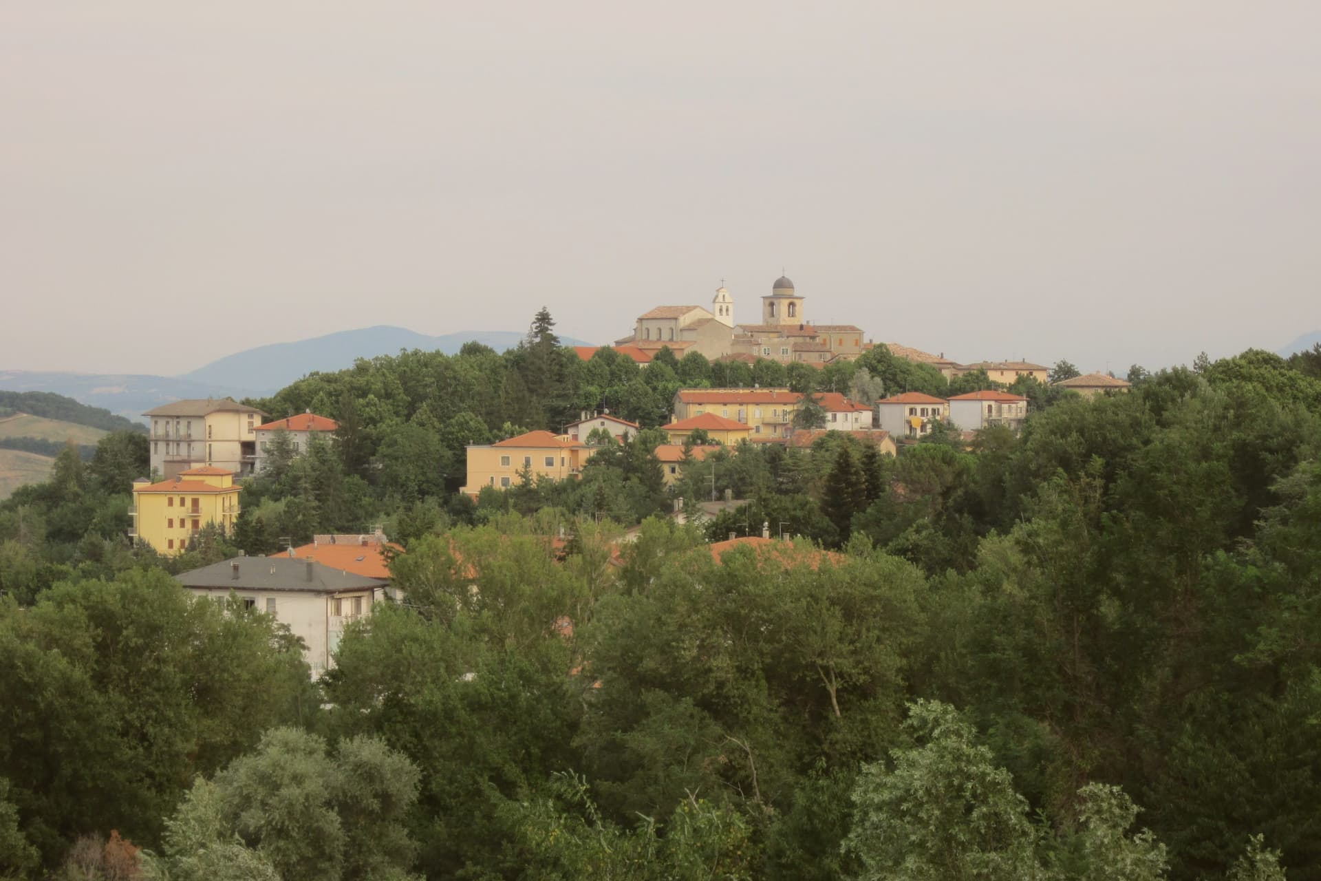
Monte Grimano Terme sits at 536 meters on a rocky spur in the Montefeltro hills, on the border between Marche and Romagna, ninety kilometers northwest of Ancona. The Romans knew the springs that surface below the borgo, though the first written record of their properties came only in 1571, in De Thermis, the early modern catalogue of Italian thermal waters.
The waters are alkaline and sulphurous. The town divides cleanly between the medieval upper settlement, ringed by the remains of its walls on the spur, and the spa below drawing on the same water source.
From the belvedere at the edge of the old town the ground drops toward the Conca valley, with the Carpegna ridge on one side and, on clear days, the Adriatic visible near Cattolica. Between them lies San Marino, part of the same Montefeltro setting that shaped the borgo's inclusion among the Borghi più belli d'Italia.
The Comuni Virtuosi membership adds a modern layer, an environmental program run by the same small commune whose waters were first written down centuries earlier. What holds the place together is that continuity: a mountain village and its springs, still working the same ground.
What to see in Monte Grimano Terme
- Centro storico. Medieval upper town on the rocky spur, with the remains of the walls, the Chiesa di San Silvestro and stone lanes around the central piazza.
- Terme di Monte Grimano. Modern spa complex below the upper town, running on the same springs Andrea Bacci catalogued, used today for respiratory, dermatological and digestive cures.
- Chiesa di San Silvestro. Parish church on the central piazza of the borgo, with later interventions on a medieval core, dedicated to the patron San Silvestro.
How to get to Monte Grimano Terme
Rimini is roughly 56 minutes away by road.
Our tip
April through October is the main window for Monte Grimano Terme. The Montefeltro hills turn green from April, the spa runs through the warm months for cure cycles, and the borgo stays cool at 536 meters when the lowland valleys touch the high twenties in July and August. June and September give the clearest air for the belvedere view across to the Carpegna ridge and the San Marino tower.
Macerata Feltria
Why visit Macerata Feltria
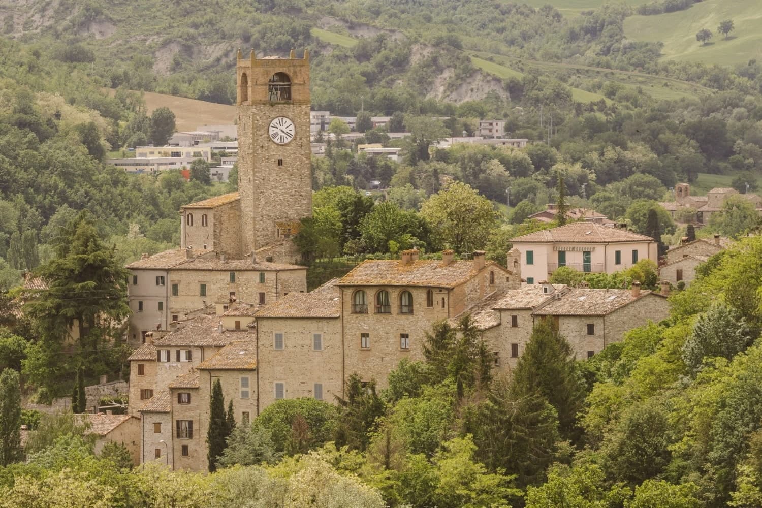
Macerata Feltria sits in the Montefeltro, the borderland shared by the Marche, Emilia-Romagna and the Republic of San Marino, on the Pesaro side of that territory. The name Pitinum Pisaurense points to its origin as a stop on the Roman road between Pisaurum, now Pesaro, and the upper Tiber, which explains why the excavated forum and baths sit at the edge of today's centro rather than beneath it: the Roman town and the modern one occupy adjoining ground, not the same footprint.
After the 8th century the site was rebuilt as a feud under the Montefeltro family, the line that produced Federico da Montefeltro, Duke of Urbino, whose profile in Piero della Francesca's portrait is the standard image of the Renaissance prince. That period left the fortifications in town and the outlying Castello di Pietrarubbia 5 km north, and it was in this same span that the parish church was raised over an earlier basilica, so the building itself is a second layer built on a first.
The 19th century added a third: the Roman thermal springs were put back into use, leading to the 1898 spa building, still running on the same sulphurous water. The Montefeltro setting also places the town among better-known neighbours: San Leo 15 km north, Urbino 30 km south, San Marino 25 km east.
Food follows the same regional line, passatelli in brodo, tagliatelle al ragù di lepre, crescia sfogliata, Bianchello del Metauro and Montefeltro Pecorino, with the Festa del Patrono San Cassiano on 13 August as the year's fixed point. Three eras, Roman, Montefeltro and the modern spa town, sit on the same small plot of ground, each one building over rather than replacing the last.
What to see in Macerata Feltria
- Parco Archeologico di Pitinum Pisaurense. The forum, amphitheatre and bath foundations sit on the edge of the modern centro, low walls in open ground rather than a reconstructed ruin. A small site museum stands next to the free excavated area.
- Pieve di San Cassiano. Stone and brick exterior largely original, with 14th-c frescoes restored inside. The building stands over an earlier Christian basilica, so the floor plan carries two churches at once.
- Terme di Macerata Feltria. A modest single building rather than a resort complex, drawing on mineral water that has been in use since Roman times. Treatment is still limited to digestive and skin conditions.
How to get to Macerata Feltria
Rimini is roughly 63 minutes away by road.
Our tip
Macerata Feltria is best April–June and September–October — the Montefeltro borderland gets hot in summer but the 321m altitude offers some relief. The Festa di San Cassiano (13 August) is the year's main civic event. The Terme are open year-round.
Sant'Agata Feltria
Why visit Sant'Agata Feltria
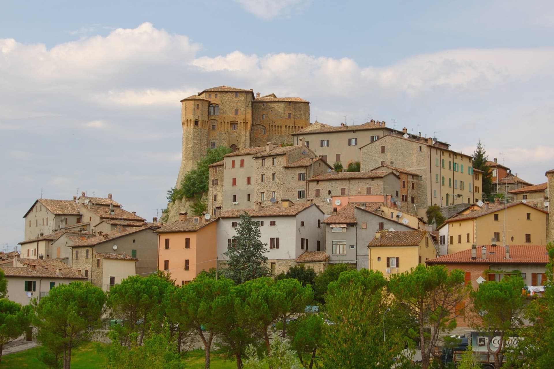
Sant'Agata Feltria sits at 607 meters in the upper Valmarecchia, in the historic Montefeltro region eighty-five kilometers north of Perugia and twenty inland from the Adriatic. The outcrop behind the centro carries overhanging walls on three quarters of its perimeter and a thirty-meter drop from summit to base, and its fortress is tenth-century in origin, rebuilt in the fifteenth century for the Fregoso family of Genoa, who gave it their name and held it until the seventeenth century.
Before them the town belonged in turn to the Malatesta of Rimini and the Montefeltro of Urbino, each leaving their mark on a settlement whose stone houses cluster below the fortress along the main street, past the convent of San Girolamo. Inside the borgo, the theater opened in 1605 is one of the oldest still-active theaters in Italy.
Every Sunday in October the centro hosts the white truffle fair, running since 1985, the reason the town carries the Città del Tartufo designation. A hill town this small, held by three ruling families and still staging theater in a four-century-old hall, has kept more of its layered past standing than its size would suggest.
What to see in Sant'Agata Feltria
- Rocca Fregoso. Sandstone fortress on the Sasso del Lupo, rebuilt by Francesco di Giorgio Martini in 1474, with overhanging walls on three sides and a thirty-meter drop.
- Teatro Angelo Mariani. Wooden theater opened in 1605 inside the medieval Palazzo Comunale, one of the oldest active theaters in Italy, named for the conductor born here in 1821.
- Chiesa Collegiata. Sixteenth-century collegiate church with a Baroque interior, housing relics of Sant'Agata and the venerated wooden image known as the Madonna del Soccorso.
How to get to Sant'Agata Feltria
Rimini is roughly 57 minutes away by road.
Our tip
April through June brings green hills and clear views over the Valmarecchia toward the San Marino ridge. July and August touch thirty-two degrees and the borgo empties between two and five, though evenings at six hundred meters cool quickly. September brings the porcini and the run-up to the truffle fair; the four Sundays in October are the busiest weekends of the year, with the centro full of stalls and trucks from the surrounding farms.
Montefiore Conca
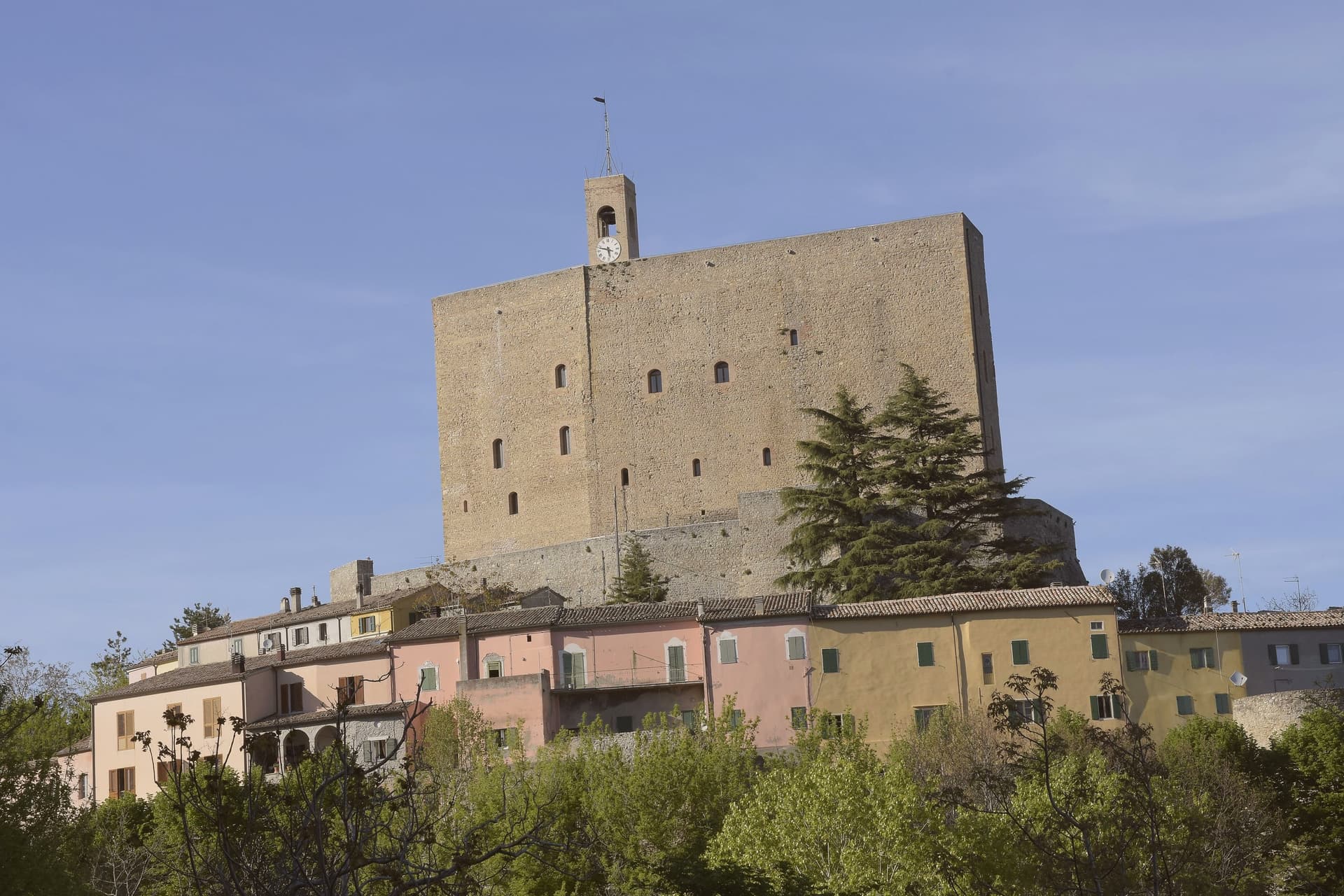
Why visit Montefiore Conca
Montefiore Conca sits above the Conca river valley, twenty kilometers south of Rimini, on a hill the Malatesta chose for both military and seasonal reasons: high enough to anchor a defensive ring, mild enough for a residence to be built alongside the garrison. The fortress and the walled borgo that grew around it form a single hilltop nucleus, with the Porta Curina gate marking the point where, after Federico da Montefeltro's troops took the town in the late fifteenth century, control reverted to the Holy See, a shift the villagers recorded by carving the arms of Pope Pius II into the stone themselves.
The commune extends beyond that nucleus into the frazioni of Serbadone and Marazzano and out to the ridge holding the Santuario della Bonora, spreading the settlement from a single fortified point into the surrounding hills. Recognition is double: Borghi più belli d'Italia and Bandiera Arancione, a pairing that reads less as decoration than as confirmation that the hill the Malatesta picked for defense and comfort still functions, centuries on, as both a place to look out from and a place worth looking at.
What to see in Montefiore Conca
- Rocca Malatestiana. Mid-fourteenth-century fortress built under Malatesta Ungaro, combining military bulk with a residential wing whose frescoed halls received Pope Gregory XII and Louis I of Hungary.
- Santuario della Madonna di Bonora. Sanctuary reached on a wooded ridge two kilometers from the centro storico, with a venerated fresco of the Madonna and Child still the object of the pilgrimage traffic it draws.
- Borgo medievale. Walled hilltop nucleus around the fortress, with the Porta Curina gate carrying the Piccolomini arms of Pope Pius II carved by the villagers in the late fifteenth century, after control of the town reverted to the Holy See.
How to get to Montefiore Conca
Rimini is roughly 35 minutes away by road.
Our tip
April through June and September through October are the strongest months, with mild evenings on the hill and clear views to the coast. July and August are hot in the Conca valley but the Rocca terrace catches the breeze that the riviera below does not. The fortress opens daily in summer, weekends only from November through March.
San Leo
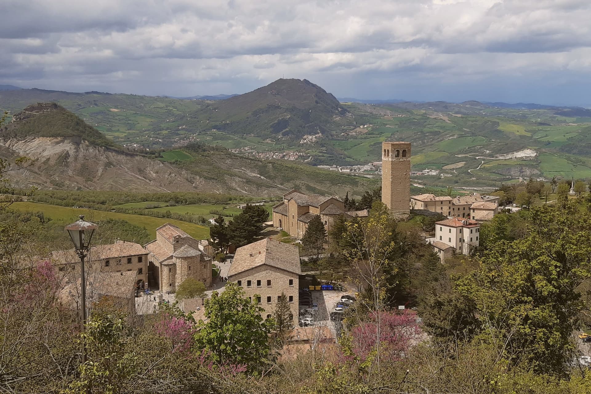
Why visit San Leo
San Leo does not look quite real from below: a medieval town built on a single limestone outcrop rising straight out of the rolling Montefeltro hills southwest of Rimini, reached by one switchback road carved into the cliff face. The geography is the entire historical reason the town exists in its present form.
Saint Francis came in 1213 and received the gift of Mount La Verna from Count Orlando Cattani as a hermitage. The Hohenstaufen rebuilt an earlier fortress on the same rock in the 13th century, before the Renaissance-era rebuild that stands today, the work of Federico da Montefeltro's military architect between 1479 and 1502.
The fortress's notoriety came in 1791, when the Papal States turned it into a high-security prison for political dissidents. The most famous of them was an alchemist, occultist and Freemason who was the talk of late-Enlightenment Europe: held here by the Holy Office from 1791, he was dead in his cell by 1795 under circumstances never fully explained, and the cell itself still stands, windowless, with a single opening high above the floor once used to pass in food and remove waste.
Beyond the fortress on its rock, the town's religious core sits on the central piazza below: a 9th-century parish church, the oldest Romanesque building in Romagna, raised on reused Roman columns, stands beside a 12th-century sandstone Duomo built over a Lombard crypt. Together they anchor the lower town the way the fortress anchors the outcrop above it.
A 12th-century bell tower nearby gives the same panoramic sweep the fortress does, across the Montefeltro toward the Adriatic and toward San Marino, 12 km east and visible from both terraces. This is borderland: Emilia-Romagna, Marche and the Republic of San Marino meet here, and the kitchen mixes all three, piadina romagnola, passatelli in brodo, gnocchi al sugo di lepre and cappelletti, washed down with Sangiovese di Romagna or the local Albana DOCG white.
The town holds both the Borghi più belli d'Italia inscription and the Bandiera Arancione mark, and as with other hilltop fortress towns, the population has thinned with time, from 5,500 residents in 1951 to 2,820 today. What the rock has always offered, defensibility, isolation, a commanding view, is also what has slowly emptied it: the same vertical geography that made San Leo impossible to take is what makes it hard to keep living in.
What to see in San Leo
- Forte di San Leo (Francesco di Giorgio Martini, 1479–1502). Rebuilt by Federico da Montefeltro's military architect directly on top of the outcrop, reached by the single switchback road cut into the cliff. Cagliostro's cell is visitable inside. The defining sight of the town.
- Pieve di Santa Maria Assunta + Duomo. The parish church and the adjacent Duomo sit side by side on the central piazza, the older building raised on reused Roman columns, the Duomo built in sandstone over a Lombard crypt with a single nave.
- Torre Civica + panorama. 12th-c bell tower with the panoramic view across the Montefeltro toward the Adriatic + San Marino (12 km east, visible from the same terrace).
How to get to San Leo
Rimini is roughly 37 minutes away by road.
Our tip
San Leo is best April–June and September–October — the Forte and the Pieve are open year-round, but the single switchback road up the cliff is unpleasant in heavy rain and can close briefly in winter snow. October is the harvest in the Sangiovese hills around the Montefeltro. Summer is dry and the panoramic view at sunset toward San Marino is the season's highlight.
Sant'Angelo in Vado
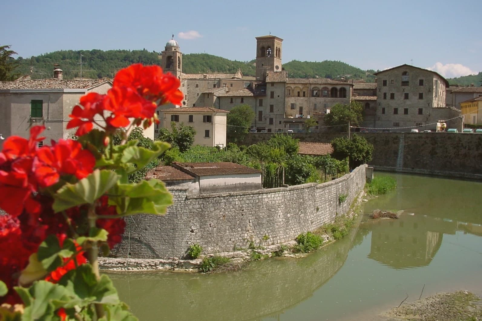
Why visit Sant'Angelo in Vado
Sant'Angelo in Vado sits at 359 meters on a river terrace on the right bank of the upper Metauro, sixty kilometers from Perugia and twenty from Urbino. The Roman city of Tifernum Mataurense lies underneath the modern town: a municipium from the first century BC, built on a grid with the cardo maximus running past the public baths to a forum under the former convent of Santa Caterina.
Excavations from 2003 onward uncovered the Domus del Mito, a 1,000-square-meter noble house from the late first century AD with 27 rooms and a sequence of polychrome figurative mosaics of Neptune and Amphitrite, Dionysus and Medusa that survive almost intact. The white truffle fair began in 1963, the oldest in Italy after Alba, and runs across the weekends of October and the first half of November in Palazzo Mercuri and the streets around it.
The Centro Sperimentale di Tartuficoltura, the national research center for truffle cultivation, has been based here since the 1980s.
What to see in Sant'Angelo in Vado
- Domus del Mito. Roman noble house from the late first century AD, 1,000 square meters across 27 rooms, with intact polychrome mosaics of Neptune, Amphitrite, Dionysus and Medusa.
- Palazzo Mercuri. Liberty-style palace with frescoed rooms, used as the central venue of the Mostra Nazionale del Tartufo Bianco each October and November.
- Mostra Nazionale del Tartufo Bianco. Italy's oldest white truffle fair after Alba, founded 1963, running across the weekends of October and the first half of November.
How to get to Sant'Angelo in Vado
Rimini is roughly 86 minutes away by road.
Our tip
April through June and September into November are the working months for Sant'Angelo in Vado. The Metauro valley turns green from April, the Domus del Mito and the archaeological park run guided visits through the warm months, and the white truffle fair fills the centro storico across the October and November weekends. July and August touch the high twenties at 359 meters; the terrace position above the river keeps the evenings cooler than the lower Metauro plain.
Acqualagna
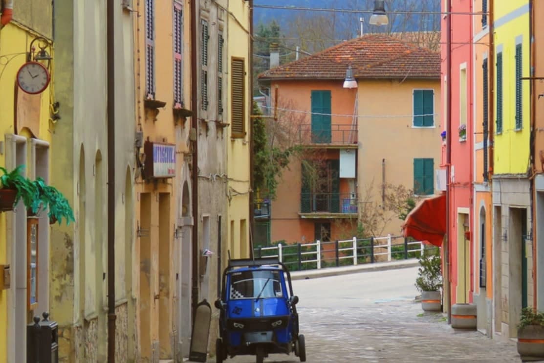
Why visit Acqualagna
Acqualagna sits at 204 meters in the Metauro valley, twelve kilometers from Urbino, on the plain just downstream from the gorge cut by the Candigliano river. The Roman city of Pitinum Mergens stood nearby until Alaric's Goths destroyed it; the survivors founded Montefalcone, the castle from which today's village grew.
The name Acqualagna comes from Aqua Lanea, water of slaughter, after the sixth-century battle fought on that same plain. Three fairs anchor the year: black truffle on the last Sunday of February, summer black on the last Sunday of July, white truffle across the last weekend of October and the two that follow.
The town below and the gorge above read as one unit, a river valley that has carried Roman road traffic, monastic settlement and truffle trade in turn, each leaving its mark on the ground without erasing what came before.
What to see in Acqualagna
- Gola del Furlo. The gorge narrows between Monte Paganuccio (977 m) and Monte Pietralata (888 m); the 38-meter Roman tunnel, cut in 76 AD, is still driven through by the Via Flaminia today.
- Abbazia di San Vincenzo al Furlo. Medieval Benedictine monastery set into the slopes above the gorge, counted among the oldest religious foundations in the Metauro valley.
- Riserva Naturale Statale Gola del Furlo. Nature reserve established in 2001, covering 3,600 hectares of woodland, grazing land and ridgeline above the river.
How to get to Acqualagna
There is a railway station in the town, so you can arrive without a car and never need one while you are here. Rimini is roughly 81 minutes away by road.
Our tip
April through June and September into October are the months for Acqualagna. The Metauro hills hold their green, the woods around Monte Paganuccio are open for walking, and summer truffle season turns the piazzas over to tasting tables in late July. July and August touch the high twenties; the gorge stays cooler than the valley floor. Fiera Regionale del Tartufo d'Estate falls in August.
More from Anywhere Italy
- The prettiest small villages within 90 minutes of Rimini
- The 9 prettiest villages within 90 minutes of Rimini
- The best small hill towns in the province of Pesaro e Urbino
- The best hill towns that eat well within 90 minutes of Rimini
- The prettiest small villages in Emilia-Romagna
- The best towns with a serious restaurant that eat well within 90 minutes of Rimini