
The best hill towns that eat well within 90 minutes of Rimini
The land behind Rimini rises quickly. Within half an hour of the beach the coast road gives way to ridges of pale sandstone, oak and truffle woods, vineyards of Sangiovese planted on slopes that face the sea without ever quite seeing it. The food changes with the altitude: piadina cooked on a testo, passatelli dropped into capon broth, formaggio di fossa dug out of its pit in autumn, wild boar and white truffle from the Metauro valley. Winter is when this eating is at its best, when the fires are lit and the dining rooms are small and full of locals rather than visitors.
Almost everyone who comes to this stretch of Emilia-Romagna stays on the sand. Rimini's beach clubs run in ranks for kilometres, the Riviera fills from June to September, and the evening pattern is a plate of fried fish and a walk along the lungomare. It works, and it is why the coast is one of the busiest holiday strips in Italy. It also means the restaurants are cooking for a crowd that arrives, eats and leaves, and the queues in Rimini's old centre reflect that.
The hills carry on regardless, and so does the cooking. Cross into the Valconca, the Marecchia or over the border into the Montefeltro and the Marche, and the same broths, the same cured meats, the same truffle season turn up in towns where the dining room seats a couple of dozen people. These are places built of stone rather than concrete, with a rocca on the high point and a butcher who still knows where the pig came from. Fewer people go, and the drive from the coast is short.
Of the 21 communes we have mapped within 90 minutes of Rimini, 6 qualify as hill towns that eat well: each is an inland hill settlement, and a dining guide has named a table in each. The smallest, Montegridolfo, has 994 residents.
If you are still choosing, we have also written The best towns with a serious restaurant that eat well within 90 minutes of Rimini and The best hill towns that eat well in Emilia-Romagna.
Montegridolfo
Why visit Montegridolfo
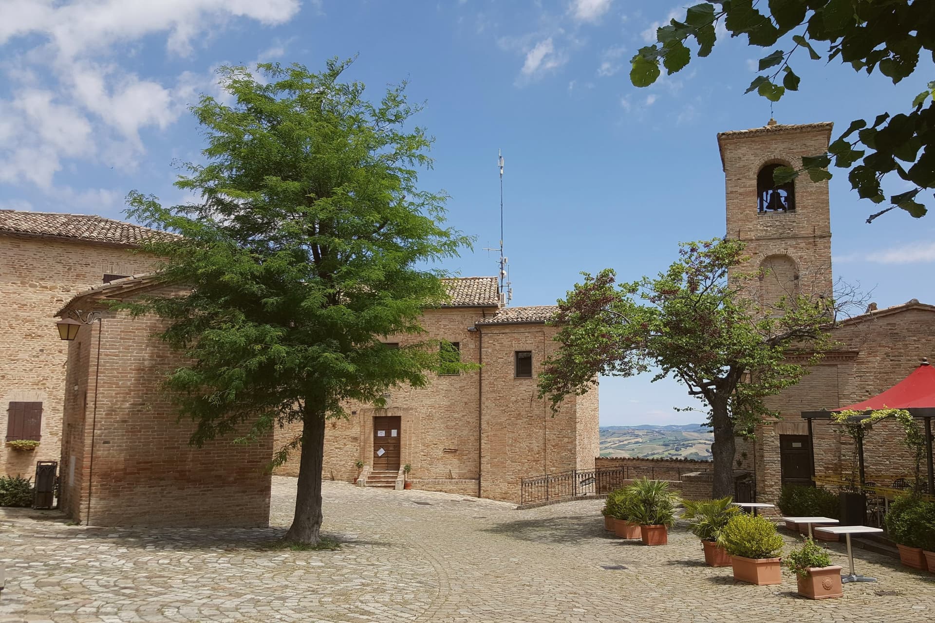
Montegridolfo sits at 290 meters on the Romagna-Marche border ridge, twenty kilometers south of Rimini and just inland from the Adriatic. A first castle is documented here in 1148, belonging to the Abbey of San Pietro of Rimini; the village took its name from the Gridolfi, a Rimini Guelph family that settled here during the conflicts with the Ghibellines.
After a sack in 1288, the Malatesta rebuilt the walls in 1337 with four corner towers. One tower survives, plus the bell tower over the gate.
The borgo passed back and forth between Malatesta and Montefeltro through the fifteenth century, fell briefly to Cesare Borgia in 1502, then to Venice, then to the Papal States in 1509. The walled nucleus today holds barely 200 of the commune's 994 residents, with the rest in Trebbio, San Pietro, and Cabaldo.
Olive oil from the surrounding ridges carries the Colli di Romagna DOP designation; the town joined the Città dell'Olio network on that basis.
Osteria dell'Accademia have been named by a guide.
What to see in Montegridolfo
- Castello di Montegridolfo. Walled fourteenth-century burg built by the Malatesta in 1337 with four corner towers, of which one survives along with the bell tower over the original gate.
- Chiesa di San Rocco. Fifteenth-century church inside the walls, built in thanks after the village was spared a plague outbreak, with frescoes attributed to the school of the Marchigiana.
- Borgo murato. Compact walled nucleus of stone houses, narrow streets and a single piazza, restored in the 1990s and inhabited by artisans and a small permanent population.
How to get to Montegridolfo
Rimini is roughly 42 minutes away by road.
Our tip
April through October are the months that work in Montegridolfo. Spring brings clear views from the walls down to the Conca valley; September and October are the dry, gold months with the olive harvest beginning at the end of October. July and August are hot but the ridge catches the Adriatic breeze and the walled nucleus stays cool in shade.
Montefiore Conca
Why visit Montefiore Conca
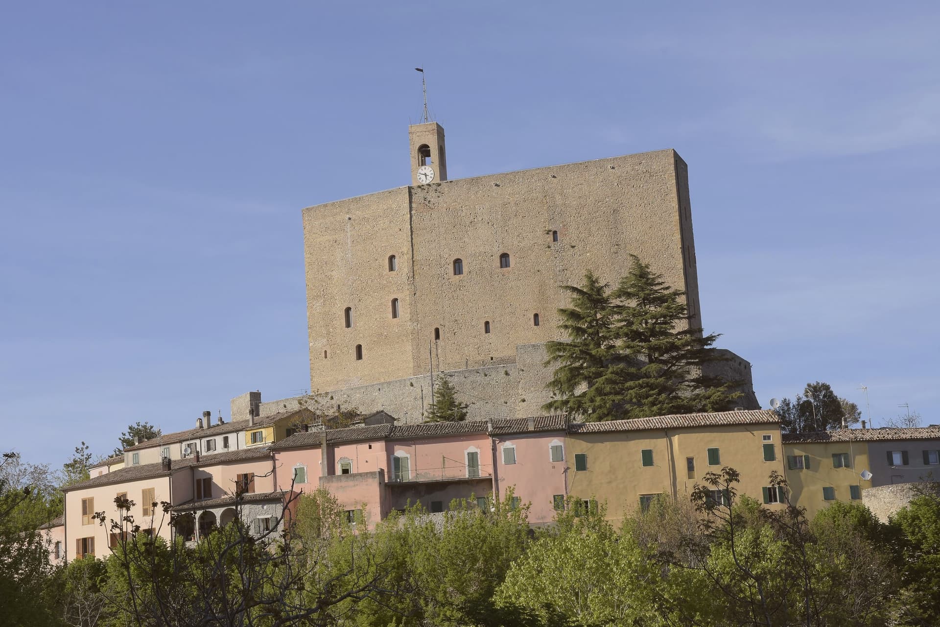
Montefiore Conca sits above the Conca river valley, twenty kilometers south of Rimini, on a hill the Malatesta chose for both military and seasonal reasons: high enough to anchor a defensive ring, mild enough for a residence to be built alongside the garrison. The fortress and the walled borgo that grew around it form a single hilltop nucleus, with the Porta Curina gate marking the point where, after Federico da Montefeltro's troops took the town in the late fifteenth century, control reverted to the Holy See, a shift the villagers recorded by carving the arms of Pope Pius II into the stone themselves.
The commune extends beyond that nucleus into the frazioni of Serbadone and Marazzano and out to the ridge holding the Santuario della Bonora, spreading the settlement from a single fortified point into the surrounding hills. Recognition is double: Borghi più belli d'Italia and Bandiera Arancione, a pairing that reads less as decoration than as confirmation that the hill the Malatesta picked for defense and comfort still functions, centuries on, as both a place to look out from and a place worth looking at.
La Cerqua have been named by a guide.
What to see in Montefiore Conca
- Rocca Malatestiana. Mid-fourteenth-century fortress built under Malatesta Ungaro, combining military bulk with a residential wing whose frescoed halls received Pope Gregory XII and Louis I of Hungary.
- Santuario della Madonna di Bonora. Sanctuary reached on a wooded ridge two kilometers from the centro storico, with a venerated fresco of the Madonna and Child still the object of the pilgrimage traffic it draws.
- Borgo medievale. Walled hilltop nucleus around the fortress, with the Porta Curina gate carrying the Piccolomini arms of Pope Pius II carved by the villagers in the late fifteenth century, after control of the town reverted to the Holy See.
How to get to Montefiore Conca
Rimini is roughly 35 minutes away by road.
Our tip
April through June and September through October are the strongest months, with mild evenings on the hill and clear views to the coast. July and August are hot in the Conca valley but the Rocca terrace catches the breeze that the riviera below does not. The fortress opens daily in summer, weekends only from November through March.
Acqualagna
Why visit Acqualagna
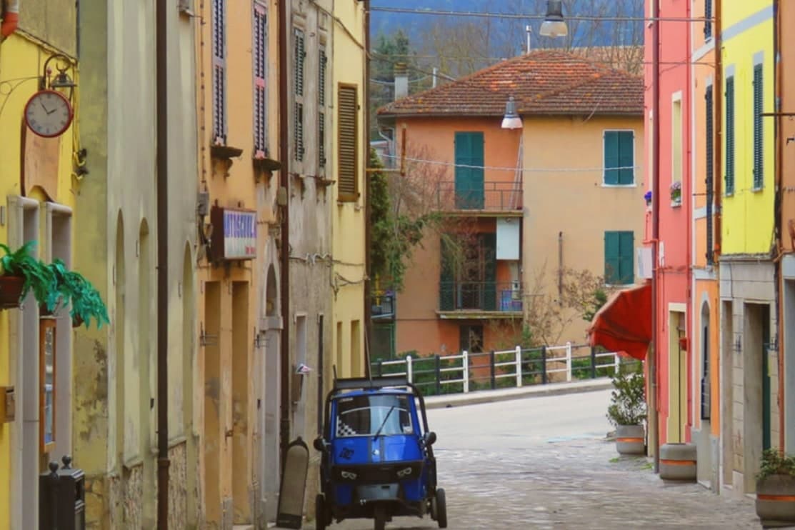
Acqualagna sits at 204 meters in the Metauro valley, twelve kilometers from Urbino, on the plain just downstream from the gorge cut by the Candigliano river. The Roman city of Pitinum Mergens stood nearby until Alaric's Goths destroyed it; the survivors founded Montefalcone, the castle from which today's village grew.
The name Acqualagna comes from Aqua Lanea, water of slaughter, after the sixth-century battle fought on that same plain. Three fairs anchor the year: black truffle on the last Sunday of February, summer black on the last Sunday of July, white truffle across the last weekend of October and the two that follow.
The town below and the gorge above read as one unit, a river valley that has carried Roman road traffic, monastic settlement and truffle trade in turn, each leaving its mark on the ground without erasing what came before.
Anticofurlo have been named by a guide.
What to see in Acqualagna
- Gola del Furlo. The gorge narrows between Monte Paganuccio (977 m) and Monte Pietralata (888 m); the 38-meter Roman tunnel, cut in 76 AD, is still driven through by the Via Flaminia today.
- Abbazia di San Vincenzo al Furlo. Medieval Benedictine monastery set into the slopes above the gorge, counted among the oldest religious foundations in the Metauro valley.
- Riserva Naturale Statale Gola del Furlo. Nature reserve established in 2001, covering 3,600 hectares of woodland, grazing land and ridgeline above the river.
How to get to Acqualagna
There is a railway station in the town, so you can arrive without a car and never need one while you are here. Rimini is roughly 81 minutes away by road.
Our tip
April through June and September into October are the months for Acqualagna. The Metauro hills hold their green, the woods around Monte Paganuccio are open for walking, and summer truffle season turns the piazzas over to tasting tables in late July. July and August touch the high twenties; the gorge stays cooler than the valley floor. Fiera Regionale del Tartufo d'Estate falls in August.
Longiano
Why visit Longiano
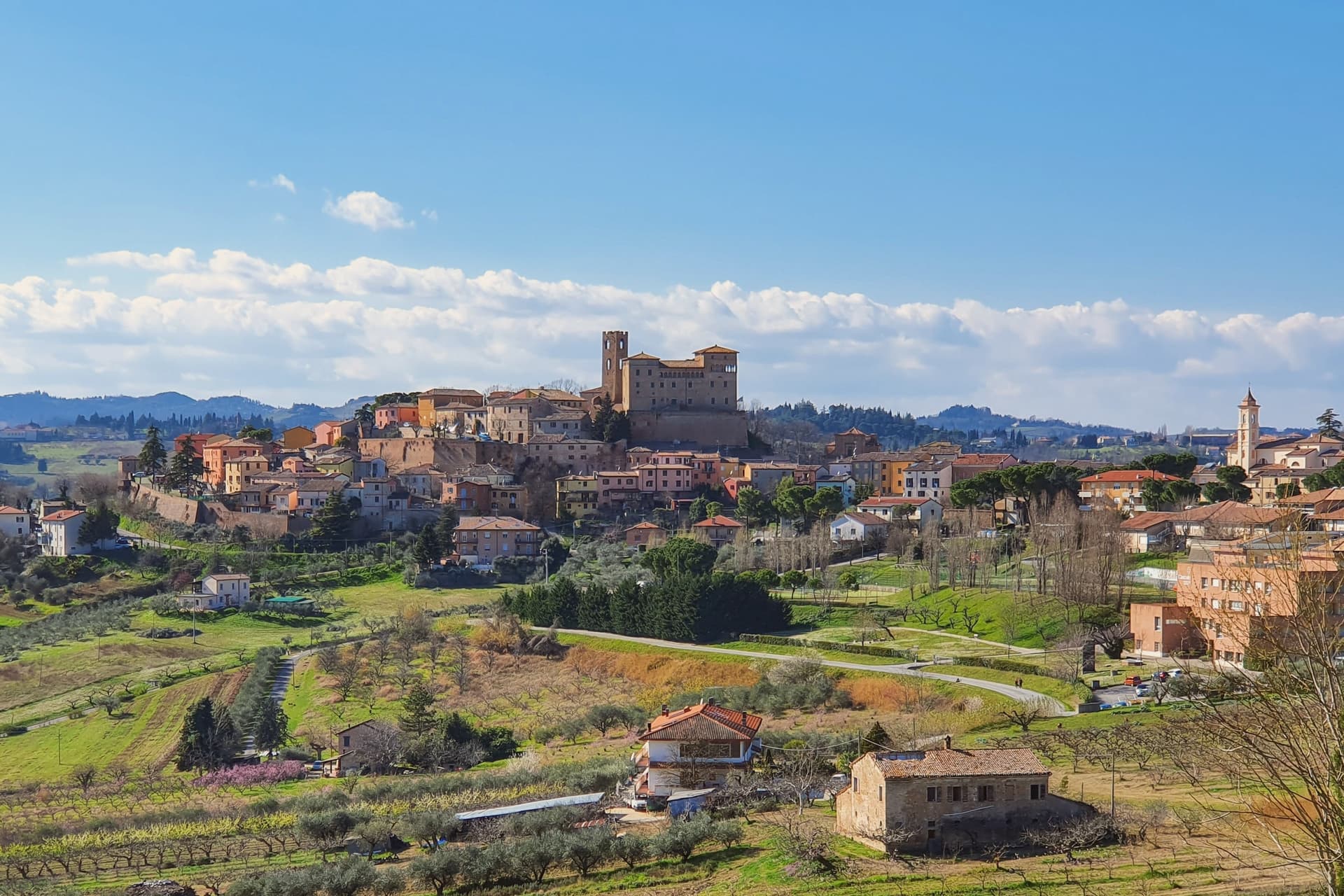
Longiano sits at 179 meters on the first hill line between Cesena and Rimini, eleven kilometers inland from Cesenatico and within sight of the Adriatic. The town shifted from the plain to the hill in the seventh and eighth centuries, when the local population moved up to escape Lombard raids, and the settlement that resulted is the hilltop borgo still walled today, with the castle at its center and the theater just below it.
Longiano passed to the Church in 1581 and stayed under papal rule until unification, before the castle came to the commune in 1989. The sanctuary stands apart from this hilltop cluster, built around its painted crucifix and held by Franciscan presence for over seven centuries, a separate thread of the town's history running alongside the Malatesta line and the civic one.
What ties the parts together is the hill itself: a defensive move made in the seventh and eighth centuries left Longiano with a compact center where a former ruling family's fortress, a nineteenth-century theater and a walled medieval borgo all sit within reach of each other, while the sanctuary's much older devotional history runs on its own separate track nearby.
Magnolia, Dei Cantoni, Terre Alte have been named by a guide.
What to see in Longiano
- Castello Malatestiano. Fortified hilltop seat of the Malatesta of Rimini, later passing to the Church and then the commune. Its rooms now hold the Fondazione Tito Balestra, so the walls that once housed a ruling family now hold paintings, drawings and sculpture.
- Teatro Petrella. Sits just below the castle. Restored in 1986, it is known today for its acoustics inside the horseshoe-shaped hall.
- Santuario del Santissimo Crocifisso. Franciscan sanctuary built around a thirteenth-century painted crucifix on oak panel, with continuous Franciscan presence for over seven centuries.
How to get to Longiano
There is a railway station in the town, so you can arrive without a car and never need one while you are here. Rimini is roughly 30 minutes away by road.
Our tip
April through June and September through October are the months for Longiano. The hilltop catches a breeze the coastal plain below does not, and the views run from the Apennines to the Adriatic on clear days. July and August touch the low thirties and the centro storico empties between two and five; many visitors come up from Cesenatico and Cervia in the late afternoon for the cooler air and the castle. Crocetta 30 in Festa falls in August.
Fossombrone
Why visit Fossombrone
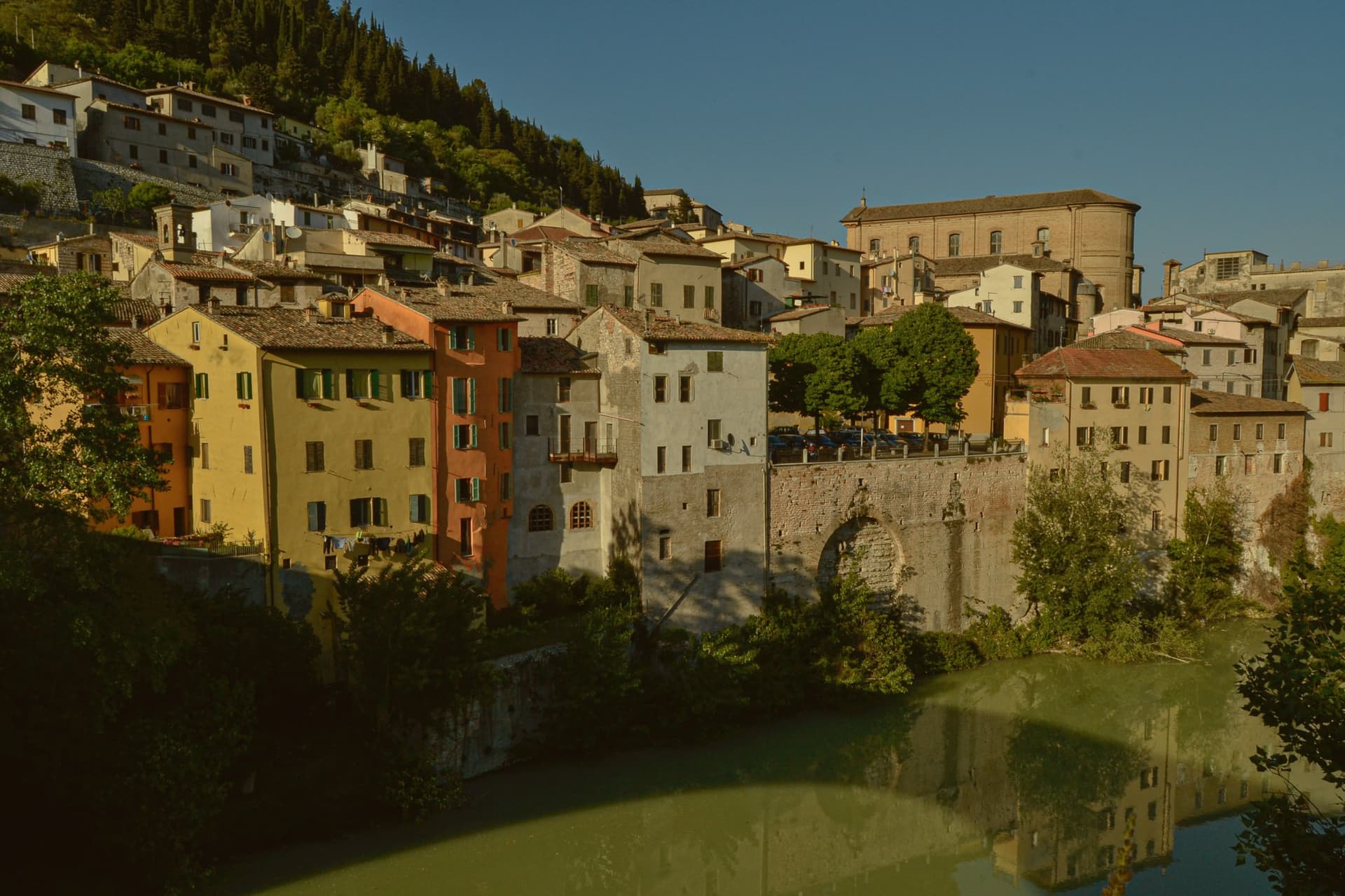
Fossombrone sits on the Metauro river in the foothills of the central Apennines, 30 km inland from Pesaro. The site has been continuously occupied since the 8th century BC: a north-Piceno village, then a partial Celtic settlement, then the Roman colony founded around 120 BC by the consul Caius Sempronius Gracchus.
The town's layers sit stacked in physical order. The Roman city's remains lie in the flat ground just east of the modern centre.
Above it, the medieval and Renaissance town climbs a single long street to the ducal court at its summit. Lower down, the Casa Cattabrini and the cathedral anchor the centro storico by the river.
Upstream, 8 km from the centre, the Metauro narrows into the gorge that gives the town its wider setting, its cliffs cut through by the Roman engineers and now enclosed within a nature reserve. The geography explains the sequence: river valley first, road town second, fortified height last, each built on what the one before had left standing.
Osteria Zanchetti have been named by a guide.
What to see in Fossombrone
- Forum Sempronii (area archeologica). Excavations east of the modern centre reveal the forum, basilica and domus mosaics, with a continuous stratigraphy running from the north-Piceno village through the Roman imperial city. The Via Flaminia ran through the colony.
- Corte Alta. The palace begun by Federico da Montefeltro and completed under the Della Rovere dukes sits at the top of a single long street climbing from the lower town. It holds a small civic museum alongside the frescoed hall.
- Galleria del Furlo (76 AD). The tunnel runs 38 metres through limestone above the narrowing Metauro, with the gorge around it protected as a nature reserve, some of the wildest ground in the Marche.
How to get to Fossombrone
Rimini is roughly 69 minutes away by road.
Our tip
April through October is the open season on the Metauro. May and June are the best months for the Furlo Gorge walks — wildflowers, cool gorge shade, the river running clear. July and August are warm in the valley but the gorge stays cooler than the coast; the Corte Alta keeps regular hours.
Urbino
Why visit Urbino
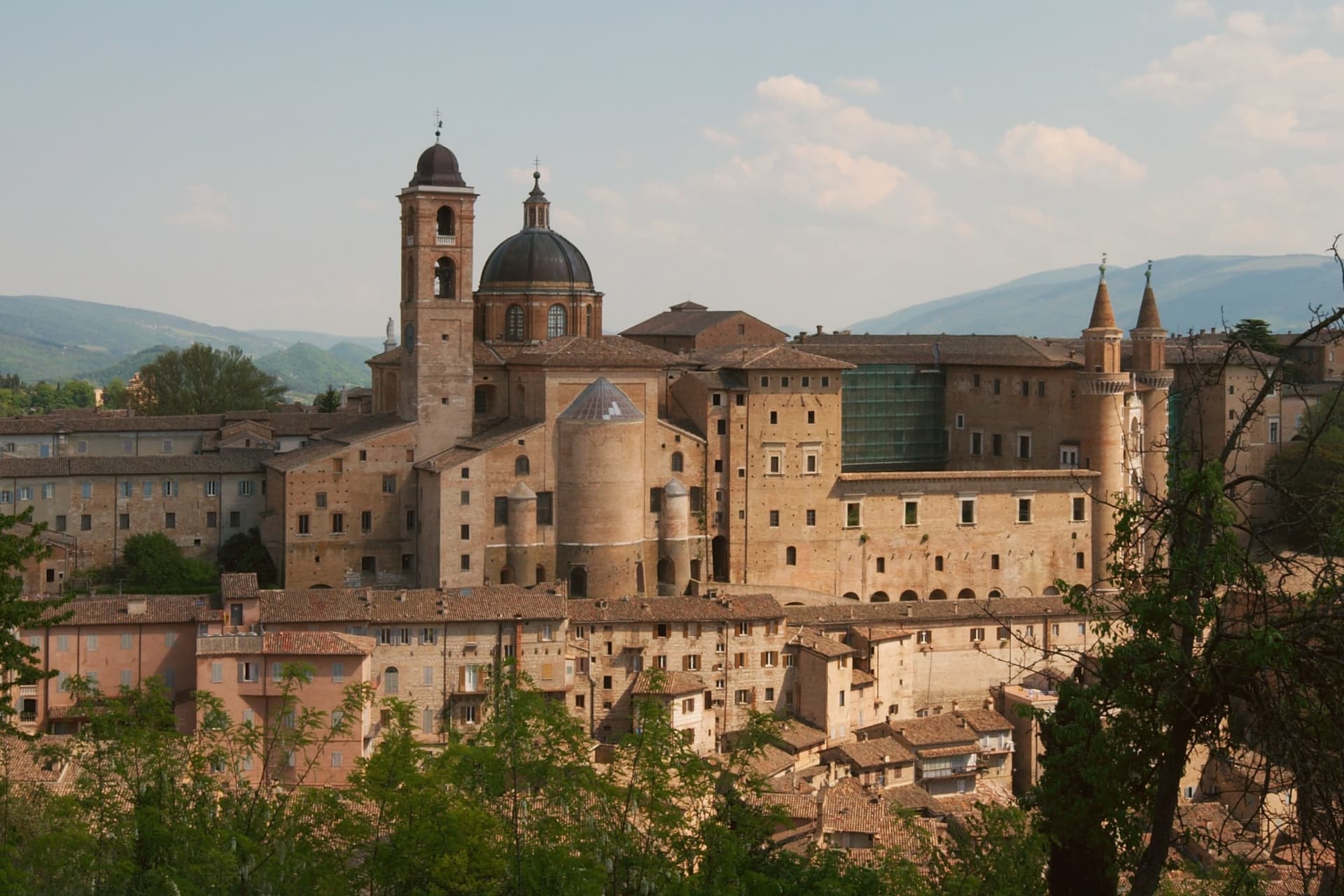
Urbino sits at 451 meters in the Apennine foothills, seventy kilometers north of Perugia, its historic core spread across twin hills with the fortress on the higher of the two and the palace complex below on the other. Federico II da Montefeltro ruled from 1444 to 1482, and under him the town became one of the central courts of the Italian Renaissance: he was condottiere, diplomat, patron and humanist at once, and the building campaign he set running through the 1450s to the 1470s, first under Maso di Bartolomeo, gave the city the asymmetric silhouette that still defines it from a distance.
The university, founded in 1506, keeps that Renaissance investment active in the present rather than fossilized: the centro storico holds roughly 14,000 residents and around 14,000 enrolled students, so the old town runs on a population it did not have in the fifteenth century. The two hills, the ducal seat and the fortress above it, read as the same civic project seen from two elevations: one built to project a court outward, the other to hold the higher ground behind it.
What the 1998 inscription recognizes is that this pairing, court and citadel, survives largely as Federico left it.
Portanova have been named by a guide.
What to see in Urbino
- Palazzo Ducale. Federico da Montefeltro's Renaissance palace begun 1444, completed by Luciano Laurana with the twin torricini facade, now housing the Galleria Nazionale delle Marche.
- Galleria Nazionale delle Marche. One of the most important Renaissance painting collections in Italy, with Raffaello, Piero della Francesca's Flagellazione and Madonna di Senigallia, Paolo Uccello and Tiziano.
- Casa Natale di Raffaello. Fifteenth-century house on Via Raffaello where the painter was born in 1483 in the workshop of his father Giovanni Santi, now a museum of the early years.
How to get to Urbino
There is a railway station in the town, so you can arrive without a car and never need one while you are here. Rimini is roughly 65 minutes away by road.
Our tip
April through June and September into October are the best months for Urbino. The hills hold their green, the city's brick warms in afternoon light, and the long climb to the Fortezza Albornoz is bearable in mild weather. July and August touch the low thirties at 451 meters; the Palazzo Ducale stays cool inside, but the steep streets in afternoon sun are slow going.
More from Anywhere Italy
- The best towns with a serious restaurant that eat well within 90 minutes of Rimini
 The best hill towns that eat well in Emilia-Romagna
- The best small hill towns within 90 minutes of Rimini
- The 6 best hidden hill towns with a serious restaurant in Marche
- The best hill towns with a serious restaurant in Marche
- The best hidden towns you can reach by train that eat well in Marche