
The best small hill towns in Sicilia
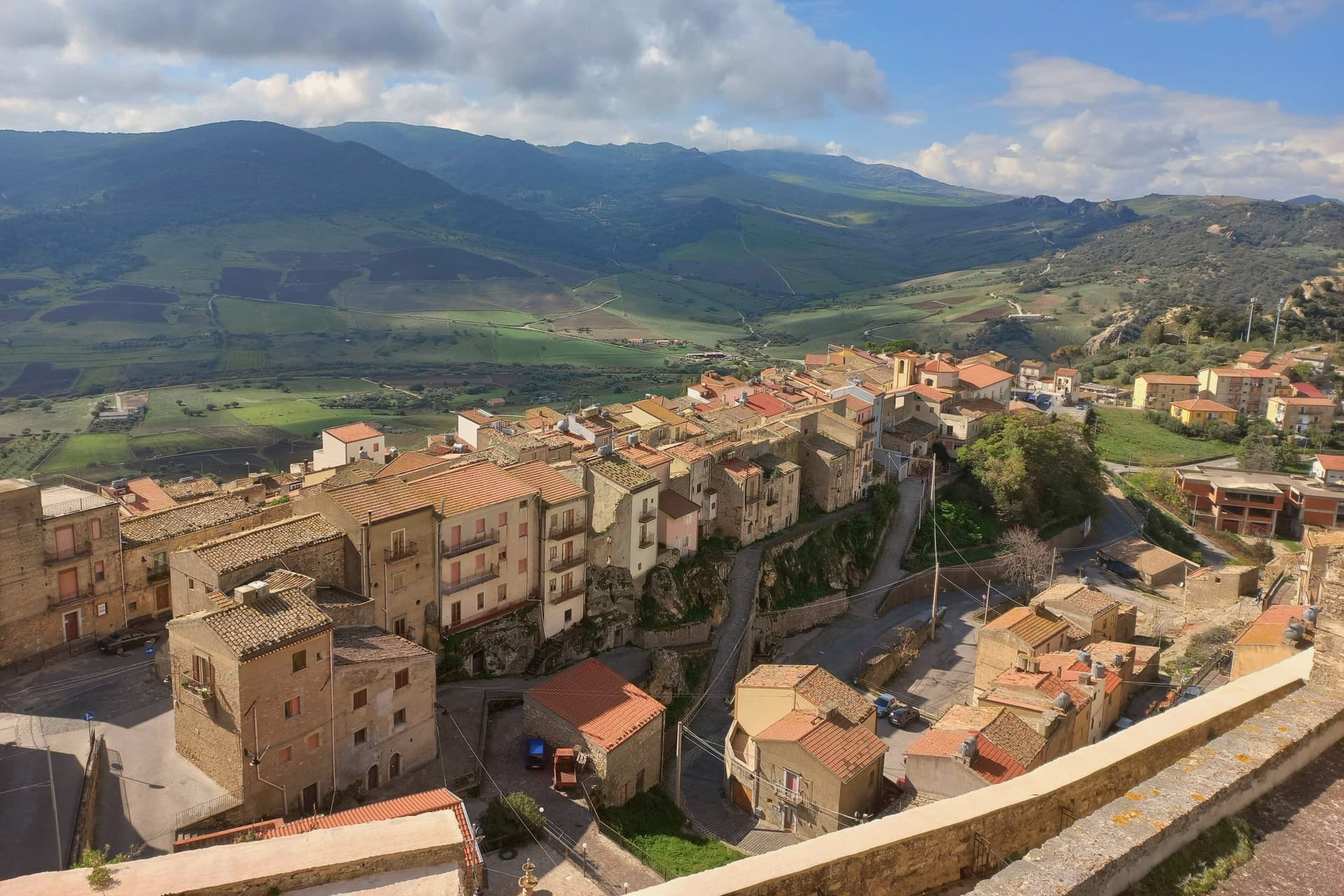
Sicilia away from the sea is mostly upland, and the towns sit where the rock gave them a ledge. Houses go up in local sandstone and tufa, roofs in curved terracotta, lanes narrowing to stairs because there is nowhere flat to put a street. Spring brings green wheat and wild fennel across the interior, and by high summer the same hills are the colour of straw, which is when the altitude earns its keep and the evenings turn cool. The kitchens run on ricotta, lamb, wild greens, almonds, pork sausage flecked with fennel seed, bread baked in wood ovens and pastries fried for the town's patron saint. Look north or east from the right piazza and you get the Madonie, the Nebrodi, or the snow line on Etna.
There is a well-worn inland circuit, and most of it ends at Taormina, with its Greek theatre, its terrace views over the Ionian and its coach parking. Agrigento and the Valle dei Templi absorb another large share, and the Baroque set pieces of Noto and Ragusa Ibla take the rest. All of them deserve the attention. All of them are busiest exactly when the interior is at its best, and in August the queues in the theatre and the temples move slowly.
The hills do not stop at the edge of the famous places. The same ridges continue west into the Madonie and the Sicani, north along the Nebrodi towards the Tyrrhenian, and south into the sulphur country, and they are lined with small towns that never grew because the ground would not let them. Some were settled by Albanian communities and still keep the language and the Byzantine rite. Some hold a Norman castle cut into living rock, or a Basilian monastery, or a Norman church looking down at the coast. Those are the towns in this list, and fewer people go to any of them.
Of the 61 communes we have mapped in Sicilia, 25 qualify as hill towns: each is an inland hill settlement built on ground too steep to spread. This list is the small ones, 10 in all, ordered smallest first. The smallest, Sperlinga, has 674 residents.
Elsewhere in the catalogue: The best hill towns within 90 minutes of Catania and The best small towns inside a nature park in Sicilia.
Sperlinga
Why visit Sperlinga
Sperlinga sits at 750 meters on the southern slopes of the Nebrodi, in the inland Enna province with about 670 residents. The name comes from the Latin spelunca, meaning cave.
The village is carved directly into a sandstone monolith, with around fifty rupestrian dwellings connected by streets and steps also cut from the rock. The Norman castle, built between the late eleventh and early twelfth centuries on the highest point of the same monolith, includes stables, prisons and forges all hewn into the stone.
Sperlinga is famous for one historical refusal. During the Sicilian Vespers of 1282, when the whole island rose against the Angevin French, Sperlinga alone gave shelter to a French garrison and held out against the rebels.
An inscription over a castle doorway once read quod Siculis placuit sola Sperlinga negavit, what pleased the Sicilians, only Sperlinga denied. The village is listed among the Borghi più belli d'Italia.
What to see in Sperlinga
- Castello di Sperlinga. Norman-era castle carved into the sandstone monolith above the village, with stables, forges and prisons cut directly into the rock.
- Grotte rupestri. Around fifty cave dwellings hewn from the sandstone mass, inhabited until the last century and connected by rock-cut streets and steps.
- Borgo rupestre. Rock village around and beneath the castle, the largest surviving troglodyte settlement in inland Sicily.
How to get to Sperlinga
Catania is roughly 113 minutes away by road.
Our tip
April through June and September through November are the months for Sperlinga. The Nebrodi foothills are green in spring and gold in autumn, and the 750-meter altitude keeps the rock and the castle cool when the inland plains bake. July and August push past thirty-five degrees in the valleys, though the village stays bearable inside the stone houses.
Santa Cristina Gela
Why visit Santa Cristina Gela
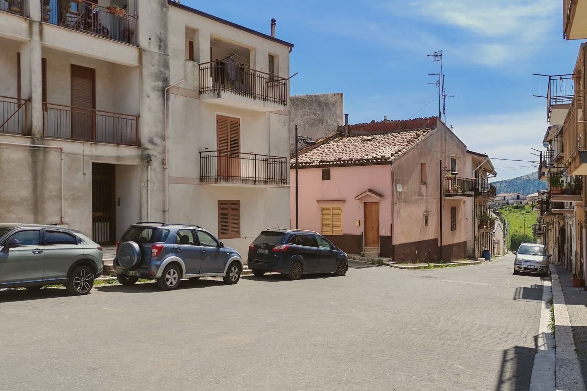
Santa Cristina Gela sits at 692 metres in the hills southwest of Palermo, fifteen kilometres from the city and four from Piana degli Albanesi. It is the smallest and the newest of the three Arbëreshë communities in Sicily, the others being Piana and Contessa Entellina.
On 31 May 1691 the local fiefdom was granted in emphyteusis to eighty-two Arbëreshë colonists from Piana, descendants of the Albanian families who had crossed to Sicily in the fifteenth century to escape the Ottoman advance. Their descendants still translanguage between Arbërisht, Sicilian and Italian.
Ecclesiastically the village belongs to the Byzantine-rite Eparchy of Piana degli Albanesi, though the main church here uses the Latin rite to accommodate residents of non-Albanian origin. The town is the seat of the Union of Albanian Municipalities of Sicily, the BESA.
The patronal feast of Santa Cristina Megalomartire of Bolsena, on 24 July, brings the silver urn from Palermo cathedral up the hill in procession.
What to see in Santa Cristina Gela
- Chiesa di Santa Cristina Vergine e Martire. The Latin-rite parish church on the main square, dedicated to the patron saint celebrated each year on 24 July.
- Centro abitato arbëresh. The compact village core founded in 1691 by the eighty-two Arbëreshë families from Piana degli Albanesi.
- Panorama sui monti. Views over the hills southwest of Palermo and across to Piana degli Albanesi, four kilometres away through the valley.
How to get to Santa Cristina Gela
Palermo is roughly 45 minutes away by road.
Our tip
April through June is the green season in the hills above Palermo, with wildflowers across the high pastures and clear evenings. September through November is the second window, mild and dry once the August heat lifts. July and August are hot and bright at 692 metres, though cooler than the city below; the late-July festival of Santa Cristina is the busiest week of the year.
Novara di Sicilia
Why visit Novara di Sicilia
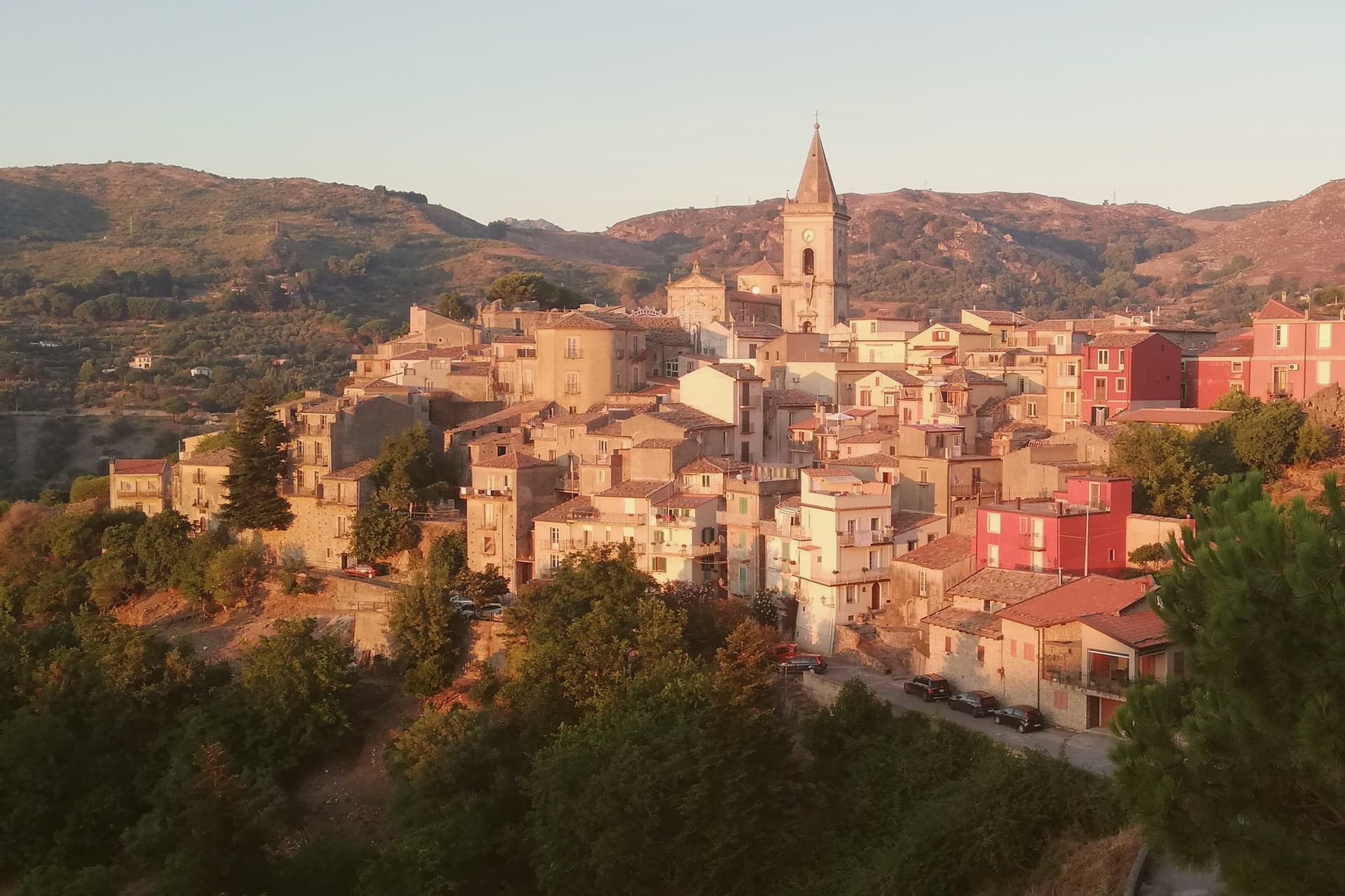
Novara di Sicilia sits at 650 meters at the point where the Peloritani and Nebrodi ranges meet, with the pointed limestone Rocca Salvatesta rising to 1,340 meters behind it. Lombards from northern Italy settled here between 1061 and 1072 under the Norman conquest, and a Gallo-Italic dialect from that migration is still spoken in the village.
Roger of Lauria built a castle here in the thirteenth century. The Duomo di Santa Maria Assunta dates from the sixteenth, a sandstone Renaissance building above the medieval lanes.
Every Carnival the village hosts the Lancio del Maiorchino, recognized by UNESCO as intangible heritage: teams roll 10-to-18-kilogram wheels of aged pecorino cheese two kilometers downhill from Via Duomo to Piano Don Michele, a contest that dates from the early 1600s when shepherds tested the maturation of their cheese on these same stones.
What to see in Novara di Sicilia
- Duomo di Santa Maria Assunta. Sixteenth-century cathedral in sandstone, the main building of the historic center with a Renaissance façade overlooking the village.
- Rocca Salvatesta. Pointed limestone peak of 1,340 meters behind the village, called the Matterhorn of Sicily for its shape and dominating the Peloritani-Nebrodi divide.
- Centro storico. Medieval stone village of arched lanes and decorated façades on the slopes of Rocca Salvatesta, listed among the Borghi più belli d'Italia.
How to get to Novara di Sicilia
Messina is roughly 64 minutes away by road.
Our tip
April through June and September through November are the months for Novara. The 650-meter altitude keeps temperatures manageable when the coast bakes, and the trail up Rocca Salvatesta is best in dry weather. July and August are warm but the Peloritani forests above town stay cool; the village empties between two and six in the afternoon. Festino dell'Assunta e di S. Ugo a Novara di Sicilia falls in August.
Sutera
Why visit Sutera
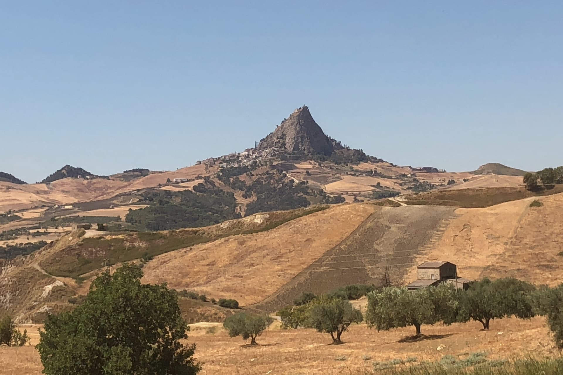
Sutera sits at 600 meters in the Nisseno interior, under the great limestone block of Monte San Paolino that rises another 220 meters above the village. The name comes from the Greek Soter, meaning savior, attached to a fortified Byzantine outpost that controlled the inland passes between Agrigento and Palermo.
The medieval village is divided into three quarters: Rabato, Rabatello and Giardinello. Rabato, the Arab quarter, preserves its original lattice of plastered houses, narrow lanes and stairs climbing toward the mountain.
The Santuario di San Paolino on the summit, reachable by a steep staircase cut into the rock, holds the relics of the town's two patron saints, Paolino and Onofrio. Sutera is one of the Borghi più belli d'Italia.
About 1,180 people live in the commune, with around 200 inside the historic Rabato itself. In recent years the village has hosted refugee families through the Italian SPRAR program and slowed its depopulation.
What to see in Sutera
- Monte San Paolino. Limestone monolith rising 820 meters above the plain, dominating the village and crowned by the patronal sanctuary.
- Rabato. Arab-era quarter on the slope of the mountain, with the original lattice of plastered houses, narrow paved lanes and steep stairs.
- Santuario di San Paolino. Sanctuary on the summit of Monte San Paolino, reached by a rock-cut staircase and holding the relics of the patrons Paolino and Onofrio.
How to get to Sutera
Palermo is roughly 113 minutes away by road.
Our tip
April through June and September through November are the best months in Sutera. The Nisseno plains push past forty degrees in midsummer; the 600-meter perch under Monte San Paolino takes the edge off, but the climb to the sanctuary is hard at midday. The Festa di San Paolino on 29 June fills the rock-cut staircase with pilgrims and the Rabato with bands.
Castel di Lucio
Why visit Castel di Lucio
Castel di Lucio sits at 750 meters in the northwestern Nebrodi, on a ridge that marks the boundary between Messina, Palermo and Enna provinces. The Ventimiglia family built the castle around 1090, after the Norman conquest; the village stayed part of the Mistretta fief until it gained autonomy in the eighteenth century.
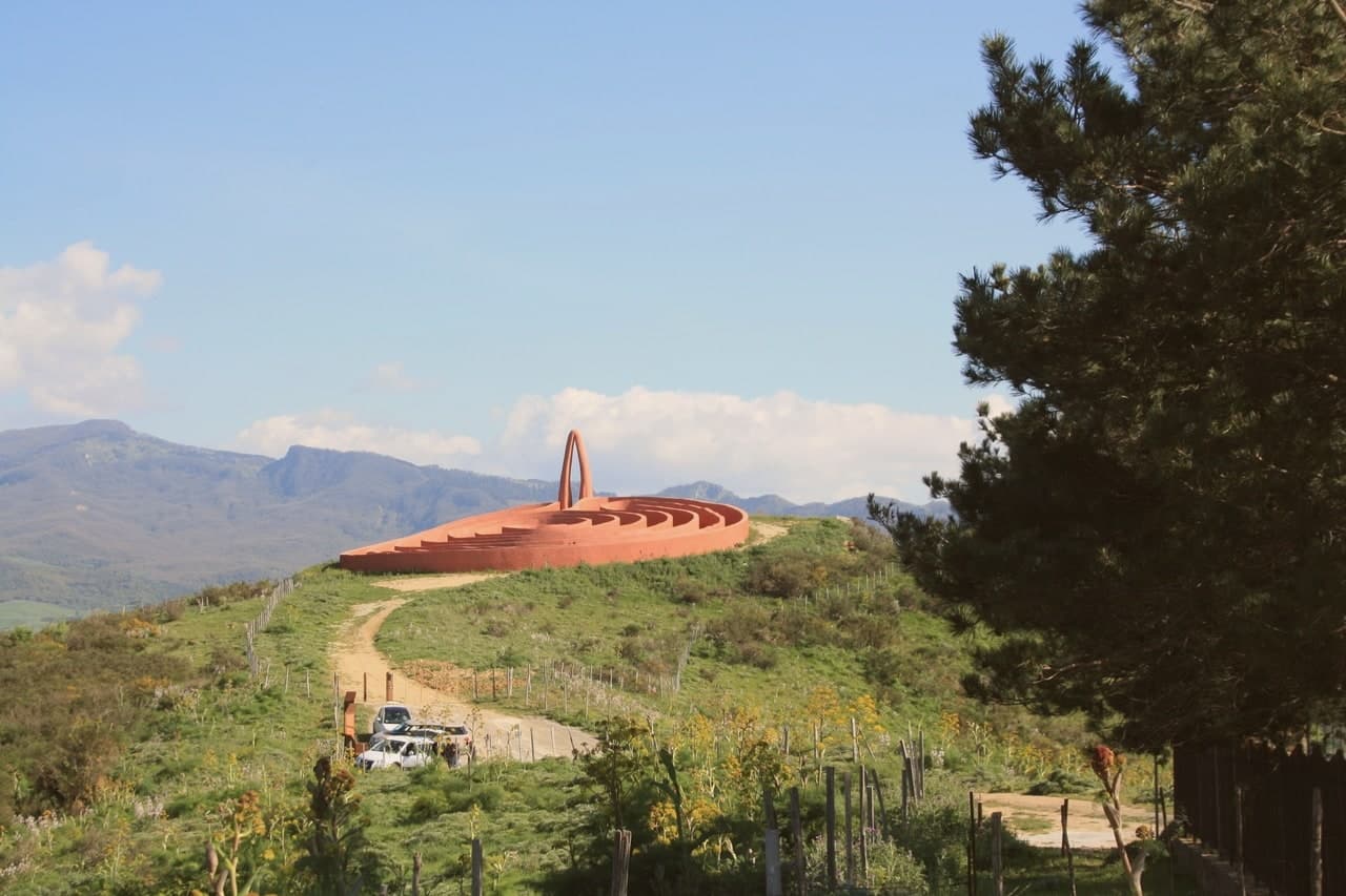
The Chiesa Madre dei Santi Pietro e Paolo anchors the historic centre, and the ruined castle still tops the rock above. In 1988 Paolo Schiavocampo's sculpture A Curve Thrown Behind Time was installed on a hill just outside the village, part of Antonio Presti's Fiumara d'Arte, the open-air monumental sculpture park scattered across six Nebrodi communes.
The town is small, just over twelve hundred residents, and the surrounding pastures still feed sheep and produce the hard cheeses the inner Nebrodi has made for centuries.
What to see in Castel di Lucio
- Castello dei Ventimiglia. Eleventh-century fortress built around 1090 after the Norman conquest, ruined but still the high point of the rock above the village.
- Chiesa Madre dei Santi Pietro e Paolo. Mother church of the historic centre, with a Baroque interior and a campanile that anchors the village skyline.
- Una Curva Gettata alle Spalle del Tempo. 1988 sculpture by Paolo Schiavocampo on a hill outside the village, part of Antonio Presti's Fiumara d'Arte open-air museum.
How to get to Castel di Lucio
Palermo is roughly 110 minutes away by road.
Our tip
April through June and September into November are the right months in the inner Nebrodi. Beech forest in spring, gold pasture in autumn, and the air at 750 meters stays clear while the coast forty kilometers north sweats. July and August cross thirty degrees but rarely more, and the village stays usable through the day.
Sant'Alfio
Why visit Sant'Alfio
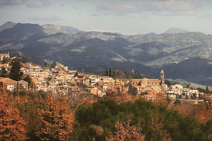
Sant'Alfio sits at 537 meters on the eastern slope of Etna, eight kilometers from the active crater. The village grew around a seventeenth-century sanctuary dedicated to the brothers Alfio, Filadelfo and Cirino, three Christian martyrs deported from the Greek Aegean to Sicily under Decius and venerated as the town's patrons.
The real draw is older. The Castagno dei Cento Cavalli, on the Linguaglossa road just outside the centro, is the largest and oldest sweet chestnut in the world, between 2,000 and 4,000 years old, listed by Guinness for a recorded girth of 57.9 meters in 1780.
The trunk has since split into separate stems sharing one root system. The legend gives the tree its name: Queen Joanna of Aragon and her hundred mounted retainers are said to have sheltered beneath it during a storm.
The slopes around the village produce Etna Rosso DOC from Nerello Mascalese and cherries that fill the late-June sagra.
What to see in Sant'Alfio
- Castagno dei Cento Cavalli. Sweet chestnut between 2,000 and 4,000 years old on the Linguaglossa road, recorded by Guinness for a girth of 57.9 meters.
- Santuario dei Santi Martiri Alfio, Filadelfo e Cirino. Seventeenth-century parish sanctuary dedicated to the three brother martyrs, raised on a staircase of black Etna lava stone.
- Versante orientale dell'Etna. Lava fields and chestnut and oak woods on the volcano's east flank, crossed by trails from the village toward the summit craters.
How to get to Sant'Alfio
Catania is roughly 44 minutes away by road.
Our tip
April through June and September through November are the working months on the east slope of Etna. The chestnut woods leaf out in May, the Sagra della Ciliegia fills the last weekend of June, and the grape harvest runs from late September into October. July and August stay cooler than the Catania plain because of the 537-meter elevation, but the sun is hard and many visitors come for the volcano rather than the village.
San Marco d'Alunzio
Why visit San Marco d'Alunzio
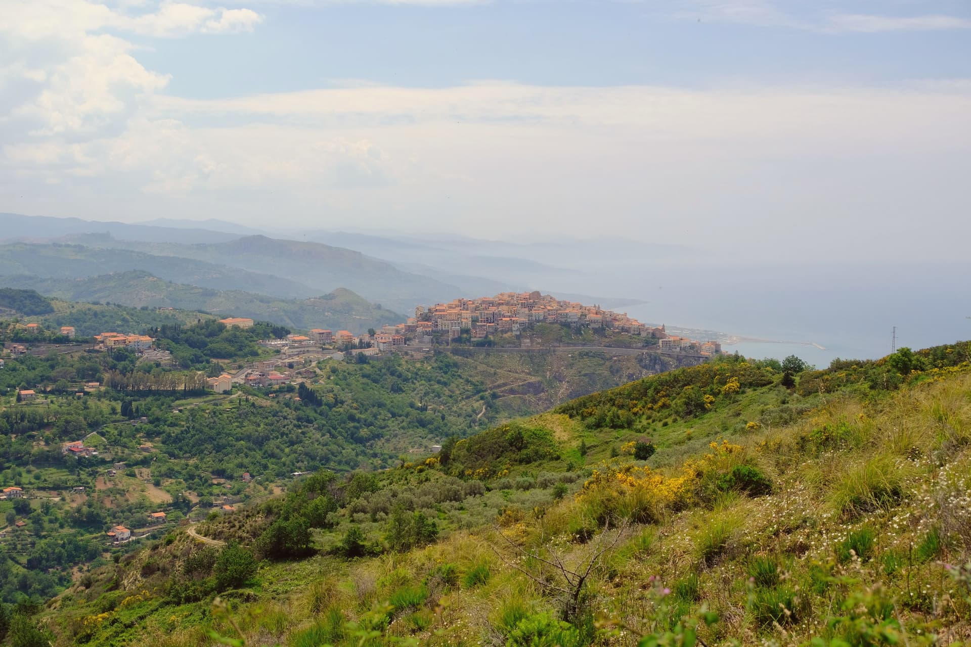
The borgo sits on Mt. Castro, five kilometers from the Tyrrhenian coast.
The Greeks founded it as Alontion, prosperous enough to mint its own currency, and the settlement they built has never fully left: what they raised became the base for what came after, layer on layer, rather than being cleared away for it. The upper town holds the ruins on Monte Rotondo, the lookout that gave the Normans command of the coast below.
The historic center, walled and compact, holds twenty-two churches and is listed among the Borghi più belli d'Italia. Through all of it runs the same pink stone, quarried on the surrounding hills, cut for church interiors, piazza fountains and, beyond the town itself, for the interior of the Messina town hall.
A place built repeatedly from its own ground: Greek temple, Norman stronghold and marble borgo standing on the same hill in the same rose-colored rock.
What to see in San Marco d'Alunzio
- Tempio di Ercole. The foundations sit beneath the Chiesa di San Marco, making it the oldest visible structure in the borgo, its stones absorbed into the later church above.
- Ruderi del Castello Normanno. Ruins on Monte Rotondo above the village, standing as the lookout point over the Tyrrhenian coast.
- Chiesa di Santa Maria delle Grazie (Aracoeli). Renaissance church built entirely in the local rose-colored stone, with elaborate marble carvings inside the chapel.
How to get to San Marco d'Alunzio
Messina is roughly 85 minutes away by road.
Our tip
April through June and September through November are the best months. The 540-meter ridge stays cooler than the Tyrrhenian below, the pink Aluntina stone catches the afternoon light, and the climb up to the Norman castle ruins is easy in dry weather. July and August are hot but the centro storico shaded streets give shelter.
Ferla
Why visit Ferla
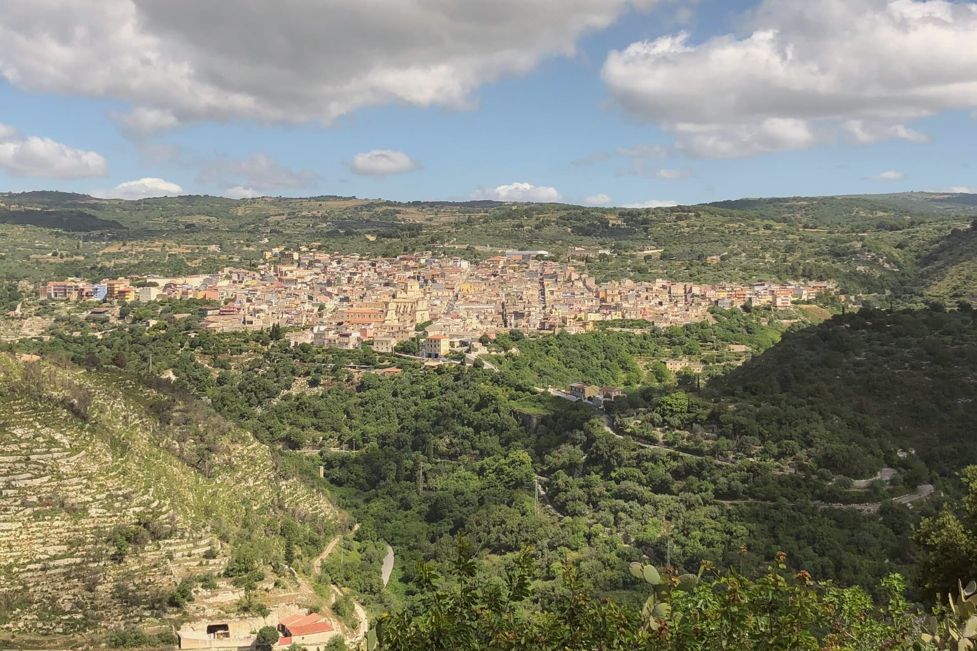
Ferla sits at 500 meters on the slopes of Monte Lauro in the Iblei, the western gateway to the rock-cut necropolis of Pantalica, eleven kilometers down the road through the Anapo valley. The Pantalica tombs, around four thousand chambers cut into the limestone between the thirteenth and seventh centuries BC, became a UNESCO World Heritage site with Syracuse in 2005.
The village name dates to the Norman refoundation, possibly from the Lombard farra meaning community. The 1693 Val di Noto earthquake leveled Ferla and the town rebuilt itself in Iblei baroque between 1700 and the 1750s.
The Basilica di San Sebastiano, the largest church in the village, was begun in 1481, destroyed in 1693 and completed in its current baroque form in 1741. Ferla is a Comune Virtuoso, recognized for its waste reduction and small-scale environmental programs, one of the few in eastern Sicily inside the network.
What to see in Ferla
- Basilica di San Sebastiano. Largest church in the village, founded 1481, destroyed in the 1693 earthquake and completed in 1741 in Iblei baroque; central monument of the rebuild.
- Chiesa di San Giacomo. Baroque parish church on the upper square, rebuilt after 1693 with a polychrome marble altar and the village's patron statue.
- Necropoli di Pantalica. Around 4,000 rock-cut chamber tombs from the thirteenth to seventh centuries BC on a limestone promontory 11 km east; UNESCO site since 2005.
How to get to Ferla
Siracusa is roughly 61 minutes away by road.
Our tip
April through June and September through November are the right windows for Ferla. The Anapo trail through the gorge to Pantalica is open and walkable, the limestone tombs cool in the rock, and the village stays around twenty degrees. July and August push past thirty-three; the centro storico empties in the afternoons and the Pantalica trails close to vehicles. Festa del Tartufo Nero di Ferla falls in August.
Mezzojuso
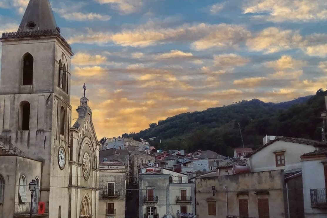
Why visit Mezzojuso
Mezzojuso sits at 534 meters on the lower slope of the massif, forty-five kilometers southeast of Palermo. The Arabic Manzil Yusuf, the houses of Joseph, names a tenth-century Saracen hamlet that passed into Norman hands in 1091.
In 1448 King Alfonso of Aragon granted the depopulated village to an Albanian commander who led three battalions of Arbëreshë soldiers across the Adriatic; in 1501 their community formalised the rebuilding of the church and the use of the Byzantine Greek rite. Today Mezzojuso is one of the Sicilian Arbëreshë communes, alongside Piana degli Albanesi and Palazzo Adriano: the language is mostly gone but the Greek rite holds.
The Latin and Greek parishes sit as two mother churches within the same small town, each still active, each keeping its own liturgy, a division that runs through the community rather than across it. A Basilian monastery, restored in the 1920s, keeps a library of Greek codices and sixteenth-century editions apart from the two parishes, evidence of a religious life that took more than one institutional form.
What survives is not a single rite preserved by isolation but two rites maintained side by side, an arrangement that has held since the fifteenth-century resettlement rather than dissolved into one.
What to see in Mezzojuso
- Chiesa di Santa Maria delle Grazie. Sixteenth-century Greek-rite church with frescoes by Olivio Sozzi from 1752 and an iconostasis of sixteenth-century icons among the most valuable in Sicily.
- Chiesa Maria Santissima Annunziata. On the main piazza, the Latin-rite mother church stands as the parallel parish to the Greek-rite church nearby.
- Chiesa di San Nicolò di Mira. Byzantine liturgy is still celebrated here by priests of the Eparchy of Piana degli Albanesi.
How to get to Mezzojuso
Palermo is roughly 54 minutes away by road.
Our tip
April through June and September through November are the working months on the Rocca Busambra slope. May runs the Festa del Crocifisso, with the Byzantine and Latin parishes processing on different days through the same streets. The chestnut harvest is October.
Calascibetta
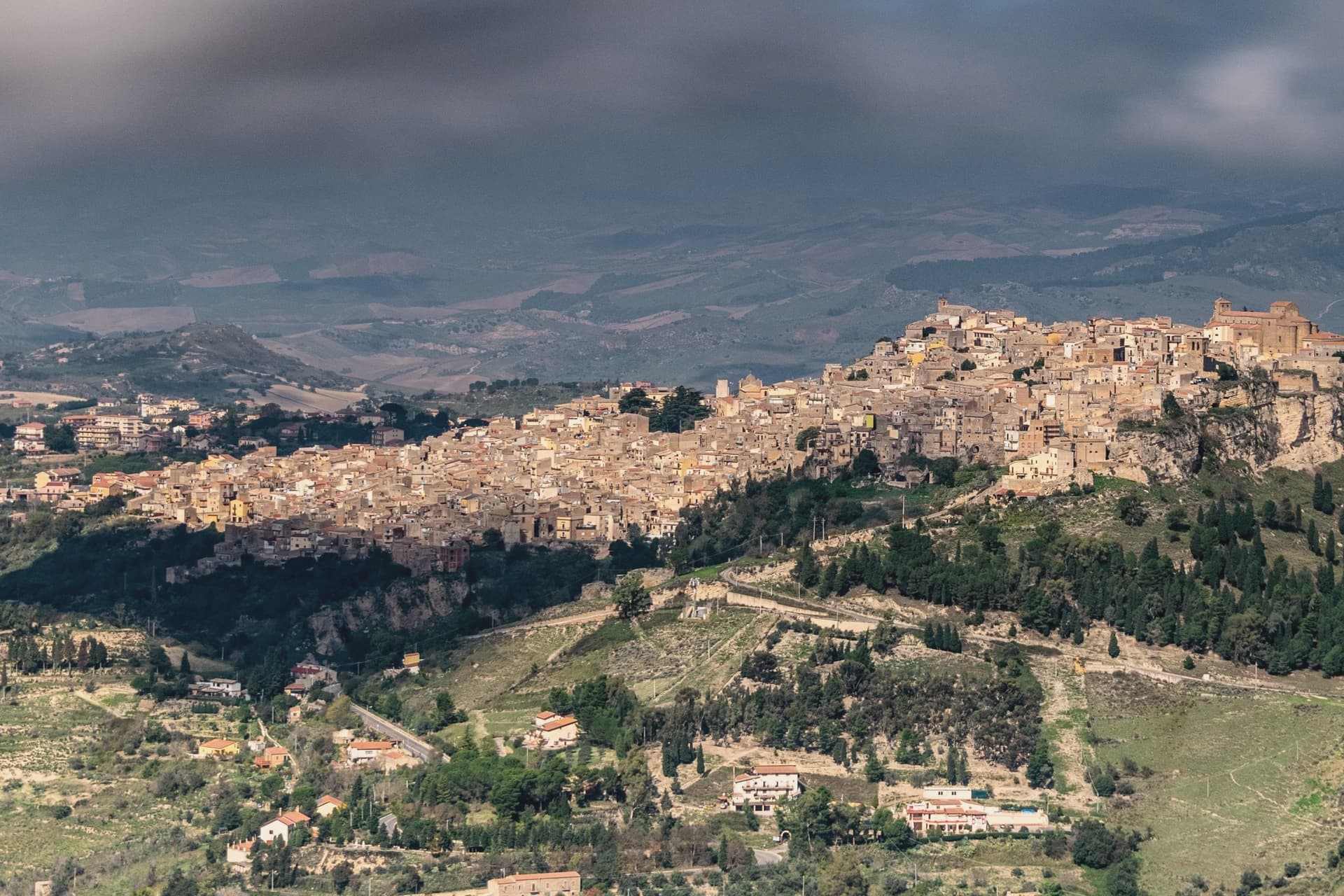
Why visit Calascibetta
Calascibetta sits on a limestone promontory at 691 meters, two and a half kilometers north of Enna across a deep ravine, in the geographic centre of Sicily. The town was founded in the ninth century as a Muslim military camp built to besiege Byzantine Henna on the opposite hill.
After the Norman conquest it stayed in the orbit of Enna, the two settlements visible from each other from any rooftop. Three kilometers northwest, the Necropoli di Realmese cuts 288 rock tombs into white limestone cliffs, dating from the eleventh to the sixth century BC; it is the second-largest pre-Greek necropolis in Sicily after Pantalica.
The historic centre keeps its medieval bones: the Chiesa Madre di San Pietro on the high point, narrow lanes climbing the rock, the Aragonese mint quarter where the kingdom struck coins in the fourteenth century. From the belvedere the view runs from Etna in the east to the Madonie in the north.
What to see in Calascibetta
- Necropoli di Realmese. 288 rock-cut tombs from the eleventh to sixth century BC, the second-largest pre-Greek necropolis in Sicily after Pantalica.
- Chiesa Madre di San Pietro. Fourteenth-century mother church at the top of the historic centre, with a Gothic-Catalan portal and views across the ravine to Enna.
- Quartiere Castello. The oldest district on the rock, with stepped lanes and remains of the medieval fortification that gave the town its name.
How to get to Calascibetta
Catania is roughly 83 minutes away by road.
Our tip
April through June and September into November are the months that work in central Sicily. Wildflowers cover the slopes around Realmese in spring, the wheat ripens in early summer, and the autumn light turns the limestone gold. July and August routinely cross thirty-five degrees; the interior bakes and the centro storico empties in mid-afternoon. Festa di San Pietro a Calascibetta falls in August.
More from Anywhere Italy
- The best hill towns within 90 minutes of Catania
- The best small towns inside a nature park in Sicilia
- The best hill towns within 90 minutes of Palermo
 The prettiest villages in the province of Messina
- The best hill towns within 90 minutes of Siracusa
 The prettiest villages inside a nature park in Sicilia