
The best hill towns within 90 minutes of Catania
Sicily's eastern interior is a landscape of ridges, and the towns sit on top of them, on outcrops of limestone or on ground made of Etna's own basalt. The building material changes as you climb: dark lava stone around the volcano's eastern slopes, pale tufa and limestone in the Iblei, glazed majolica everywhere there was clay and a kiln. Food follows the altitude too, ricotta still warm in the morning, thyme and orange-blossom honey, sausage flavoured with wild fennel, chestnuts and mushrooms in autumn. Spring and October are the kind seasons, when the plain below Catania is already hot and the hill air still holds a chill after sunset.
Most visitors leaving Catania point the car at Etna, and reasonably so. The Rifugio Sapienza road, the crater tours, the cable car and the four-wheel-drive convoys absorb an enormous share of everyone who lands at Fontanarossa, and in August the car parks fill by mid-morning. Taormina takes much of the rest, its Greek theatre and Corso Umberto working at full capacity from Easter until late autumn. Both are worth the time. Neither is quiet.
The same hills continue well past the volcano's southern skirt and the coast road, though, up into the Nebrodi, across the Erei ridges towards Enna, and south into the Iblei plateau where the limestone is cut by deep gorges. Towns up there were rebuilt in the same Baroque decades and by some of the same hands, so the staircases and church facades are familiar while the crowds are not. Fewer people go, and the drive from Catania is shorter than most assume. These are the towns on the high ground, all of them within reach of the city for a day or a long weekend.
Of the 24 communes we have mapped in a 90-minute drive of Catania, 9 qualify as hill towns: each stands on high ground rather than on the plain. The smallest, Novara di Sicilia, has 1,174 residents.
Elsewhere in the catalogue: The best hill towns with a World Heritage site in Sicilia and The best hill towns within 90 minutes of Siracusa.
Novara di Sicilia
Why visit Novara di Sicilia
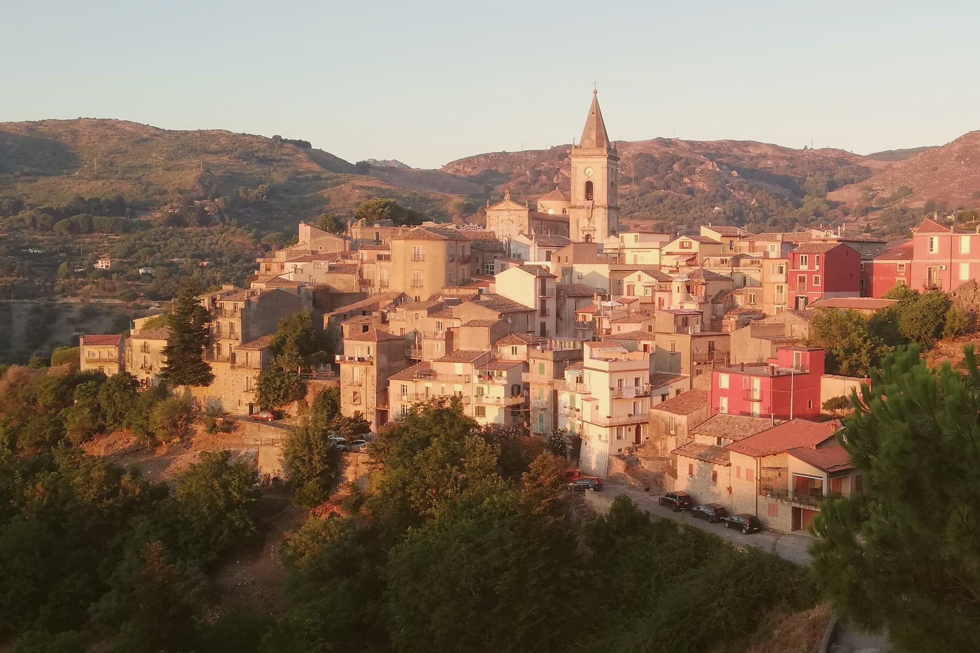
Novara di Sicilia sits at 650 meters at the point where the Peloritani and Nebrodi ranges meet, with the pointed limestone Rocca Salvatesta rising to 1,340 meters behind it. Lombards from northern Italy settled here between 1061 and 1072 under the Norman conquest, and a Gallo-Italic dialect from that migration is still spoken in the village.
Roger of Lauria built a castle here in the thirteenth century. The Duomo di Santa Maria Assunta dates from the sixteenth, a sandstone Renaissance building above the medieval lanes.
Every Carnival the village hosts the Lancio del Maiorchino, recognized by UNESCO as intangible heritage: teams roll 10-to-18-kilogram wheels of aged pecorino cheese two kilometers downhill from Via Duomo to Piano Don Michele, a contest that dates from the early 1600s when shepherds tested the maturation of their cheese on these same stones.
What to see in Novara di Sicilia
- Duomo di Santa Maria Assunta. Sixteenth-century cathedral in sandstone, the main building of the historic center with a Renaissance façade overlooking the village.
- Rocca Salvatesta. Pointed limestone peak of 1,340 meters behind the village, called the Matterhorn of Sicily for its shape and dominating the Peloritani-Nebrodi divide.
- Centro storico. Medieval stone village of arched lanes and decorated façades on the slopes of Rocca Salvatesta, listed among the Borghi più belli d'Italia.
How to get to Novara di Sicilia
Messina is roughly 64 minutes away by road.
Our tip
April through June and September through November are the months for Novara. The 650-meter altitude keeps temperatures manageable when the coast bakes, and the trail up Rocca Salvatesta is best in dry weather. July and August are warm but the Peloritani forests above town stay cool; the village empties between two and six in the afternoon. Festino dell'Assunta e di S. Ugo a Novara di Sicilia falls in August.
Sant'Alfio
Why visit Sant'Alfio
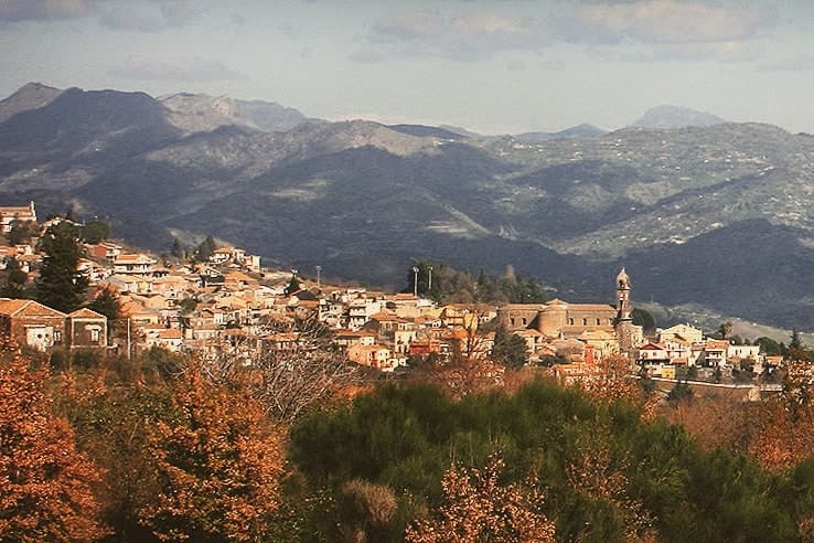
Sant'Alfio sits at 537 meters on the eastern slope of Etna, eight kilometers from the active crater. The village grew around a seventeenth-century sanctuary dedicated to the brothers Alfio, Filadelfo and Cirino, three Christian martyrs deported from the Greek Aegean to Sicily under Decius and venerated as the town's patrons.
The real draw is older. The Castagno dei Cento Cavalli, on the Linguaglossa road just outside the centro, is the largest and oldest sweet chestnut in the world, between 2,000 and 4,000 years old, listed by Guinness for a recorded girth of 57.9 meters in 1780.
The trunk has since split into separate stems sharing one root system. The legend gives the tree its name: Queen Joanna of Aragon and her hundred mounted retainers are said to have sheltered beneath it during a storm.
The slopes around the village produce Etna Rosso DOC from Nerello Mascalese and cherries that fill the late-June sagra.
What to see in Sant'Alfio
- Castagno dei Cento Cavalli. Sweet chestnut between 2,000 and 4,000 years old on the Linguaglossa road, recorded by Guinness for a girth of 57.9 meters.
- Santuario dei Santi Martiri Alfio, Filadelfo e Cirino. Seventeenth-century parish sanctuary dedicated to the three brother martyrs, raised on a staircase of black Etna lava stone.
- Versante orientale dell'Etna. Lava fields and chestnut and oak woods on the volcano's east flank, crossed by trails from the village toward the summit craters.
How to get to Sant'Alfio
Catania is roughly 44 minutes away by road.
Our tip
April through June and September through November are the working months on the east slope of Etna. The chestnut woods leaf out in May, the Sagra della Ciliegia fills the last weekend of June, and the grape harvest runs from late September into October. July and August stay cooler than the Catania plain because of the 537-meter elevation, but the sun is hard and many visitors come for the volcano rather than the village.
Ferla
Why visit Ferla
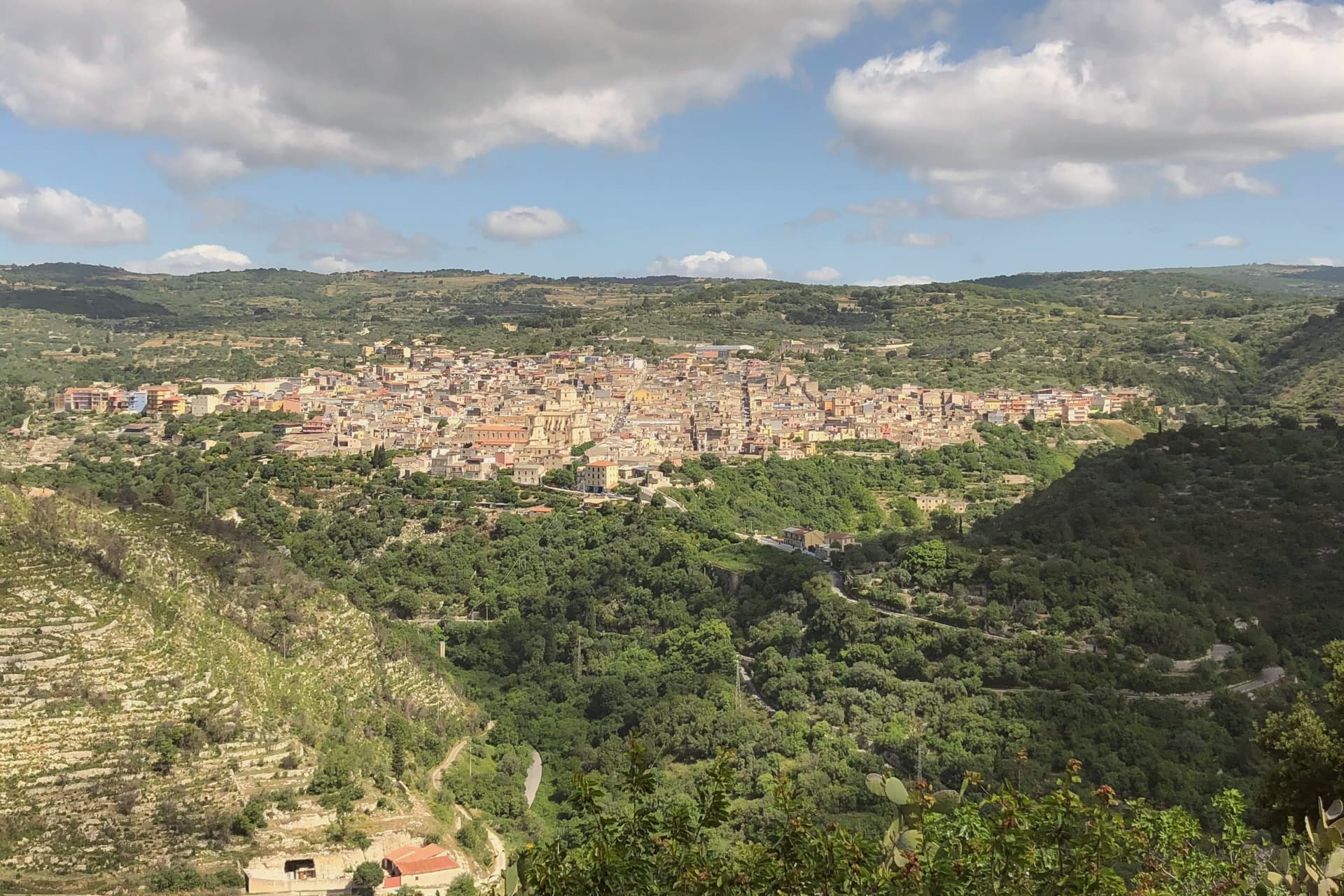
Ferla sits at 500 meters on the slopes of Monte Lauro in the Iblei, the western gateway to the rock-cut necropolis of Pantalica, eleven kilometers down the road through the Anapo valley. The Pantalica tombs, around four thousand chambers cut into the limestone between the thirteenth and seventh centuries BC, became a UNESCO World Heritage site with Syracuse in 2005.
The village name dates to the Norman refoundation, possibly from the Lombard farra meaning community. The 1693 Val di Noto earthquake leveled Ferla and the town rebuilt itself in Iblei baroque between 1700 and the 1750s.
The Basilica di San Sebastiano, the largest church in the village, was begun in 1481, destroyed in 1693 and completed in its current baroque form in 1741. Ferla is a Comune Virtuoso, recognized for its waste reduction and small-scale environmental programs, one of the few in eastern Sicily inside the network.
What to see in Ferla
- Basilica di San Sebastiano. Largest church in the village, founded 1481, destroyed in the 1693 earthquake and completed in 1741 in Iblei baroque; central monument of the rebuild.
- Chiesa di San Giacomo. Baroque parish church on the upper square, rebuilt after 1693 with a polychrome marble altar and the village's patron statue.
- Necropoli di Pantalica. Around 4,000 rock-cut chamber tombs from the thirteenth to seventh centuries BC on a limestone promontory 11 km east; UNESCO site since 2005.
How to get to Ferla
Siracusa is roughly 61 minutes away by road.
Our tip
April through June and September through November are the right windows for Ferla. The Anapo trail through the gorge to Pantalica is open and walkable, the limestone tombs cool in the rock, and the village stays around twenty degrees. July and August push past thirty-three; the centro storico empties in the afternoons and the Pantalica trails close to vehicles. Festa del Tartufo Nero di Ferla falls in August.
Calascibetta
Why visit Calascibetta
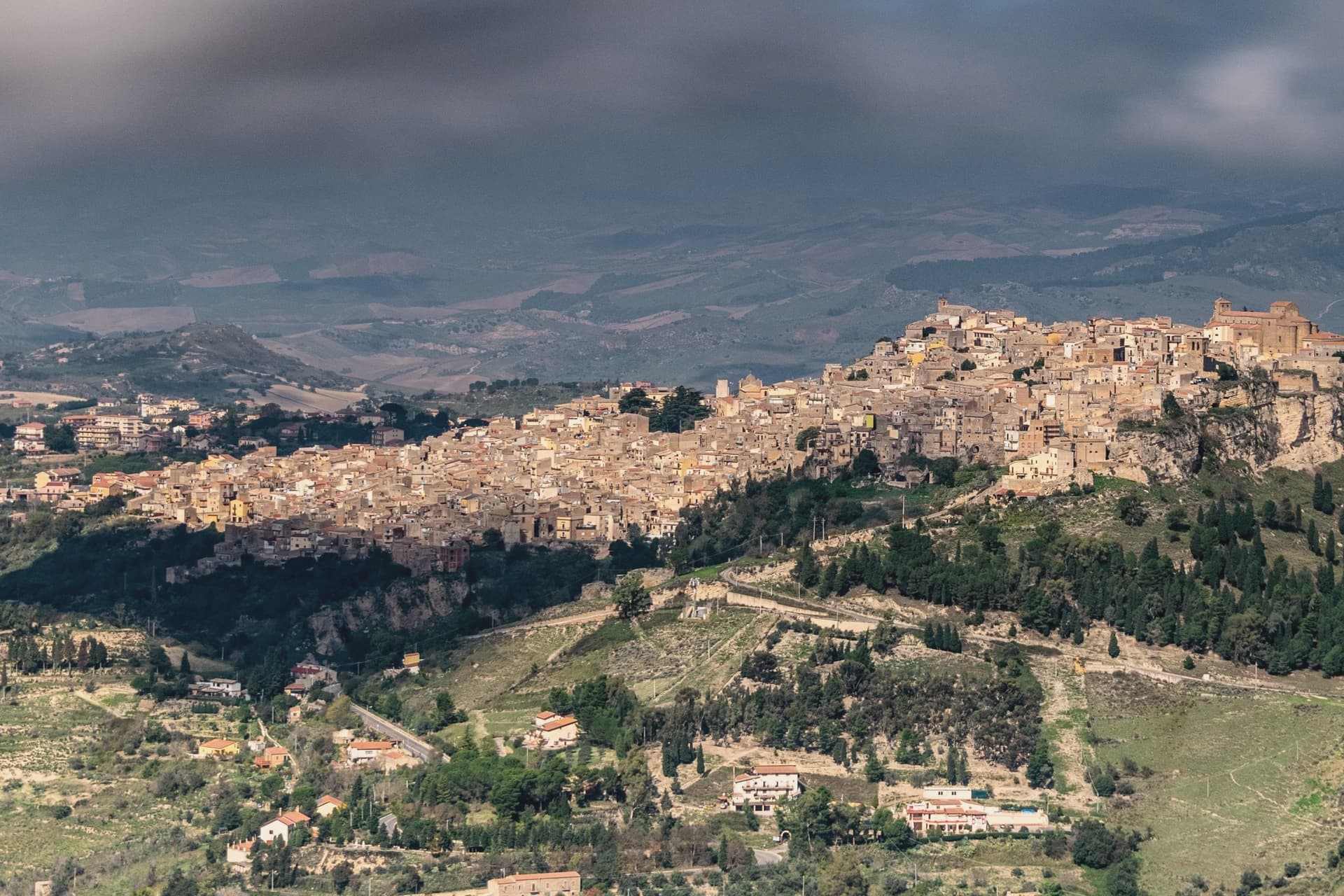
Calascibetta sits on a limestone promontory at 691 meters, two and a half kilometers north of Enna across a deep ravine, in the geographic centre of Sicily. The town was founded in the ninth century as a Muslim military camp built to besiege Byzantine Henna on the opposite hill.
After the Norman conquest it stayed in the orbit of Enna, the two settlements visible from each other from any rooftop. Three kilometers northwest, the Necropoli di Realmese cuts 288 rock tombs into white limestone cliffs, dating from the eleventh to the sixth century BC; it is the second-largest pre-Greek necropolis in Sicily after Pantalica.
The historic centre keeps its medieval bones: the Chiesa Madre di San Pietro on the high point, narrow lanes climbing the rock, the Aragonese mint quarter where the kingdom struck coins in the fourteenth century. From the belvedere the view runs from Etna in the east to the Madonie in the north.
What to see in Calascibetta
- Necropoli di Realmese. 288 rock-cut tombs from the eleventh to sixth century BC, the second-largest pre-Greek necropolis in Sicily after Pantalica.
- Chiesa Madre di San Pietro. Fourteenth-century mother church at the top of the historic centre, with a Gothic-Catalan portal and views across the ravine to Enna.
- Quartiere Castello. The oldest district on the rock, with stepped lanes and remains of the medieval fortification that gave the town its name.
How to get to Calascibetta
Catania is roughly 83 minutes away by road.
Our tip
April through June and September into November are the months that work in central Sicily. Wildflowers cover the slopes around Realmese in spring, the wheat ripens in early summer, and the autumn light turns the limestone gold. July and August routinely cross thirty-five degrees; the interior bakes and the centro storico empties in mid-afternoon. Festa di San Pietro a Calascibetta falls in August.
Agira
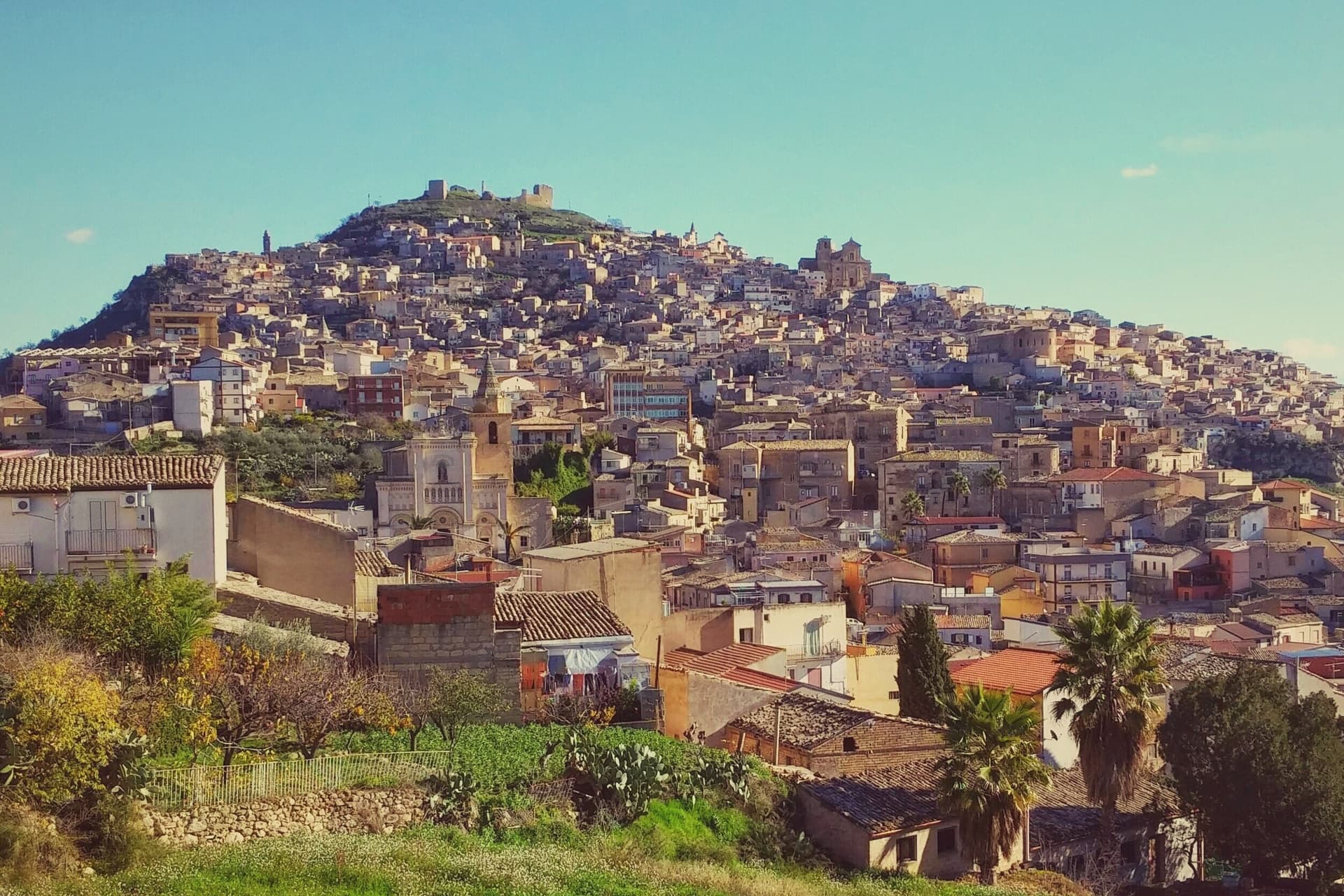
Why visit Agira
Agira sits on the summit and slopes of Monte Teja in the mid-valley of the Salso river, thirty-five kilometers east of Enna. The town stands on the site of the Sicel city of Agyrion, where the Greek general Timoleon settled ten thousand colonists in 339 BC.
The lower town spreads at the base of the mountain while the old quarter climbs its slopes in stone lanes toward the castle at the summit, a layout that stacks Greek, Byzantine, Norman and Aragonese remains one above the other as the ground rises. In July 1943 Agira fell to the Canadians after five days of fighting, the largest Canadian battle of the Sicilian campaign.
The town's position on high ground, the same position that made it a Sicel stronghold and a Norman abbey seat centuries earlier, is what made it worth the five days of fighting: whoever held Monte Teja held the central Sicilian interior below it.
What to see in Agira
- Reale Abbazia di San Filippo. The church stands as the central monument of the town, its Basilian origins folded into the Norman reconstruction; the crypt beneath holds the patron saint.
- Castello di Agira. Medieval fortress on the summit of Monte Teja above the town, with surviving walls and towers; the strategic outpost that controlled the central Sicilian interior.
- Agira Canadian War Cemetery. The cemetery sits on a hill outside the town, its rows of graves facing the slopes of Monte Teja where the fighting that put the soldiers there took place.
How to get to Agira
Catania is roughly 53 minutes away by road.
Our tip
April through June and September through November are the windows for Agira. The hilltop town stays in the low twenties through May, the trails up Monte Teja are dry, and the Canadian Cemetery on its outside hill is the right walk in cool morning light. July and August push past thirty-five in the interior; the centro storico empties in the afternoons and the climb to the castle is for sunrise only.
Palazzolo Acreide
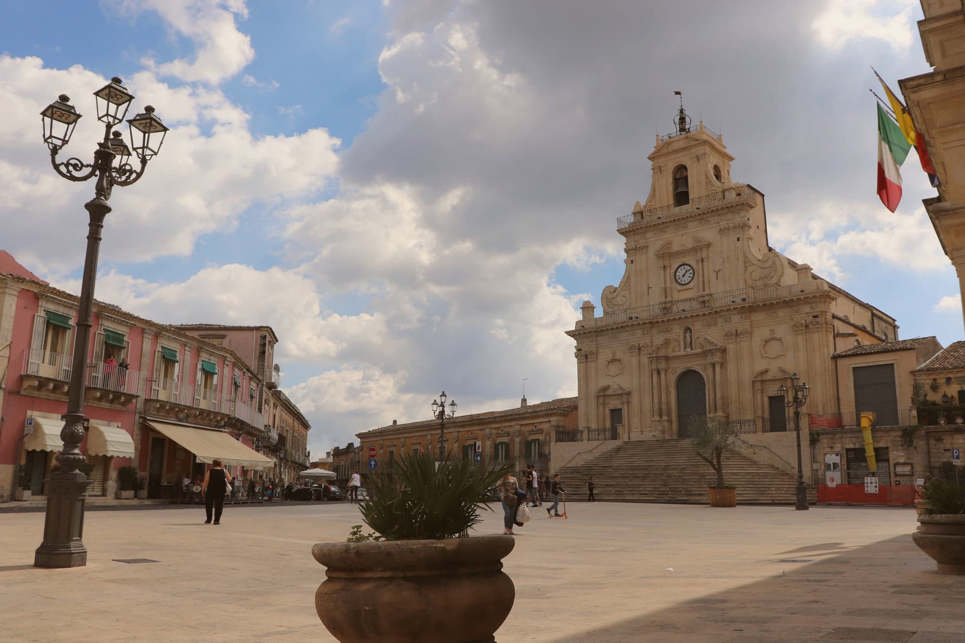
Why visit Palazzolo Acreide
The Greek city was founded by Syracuse in 664 BC as an inland defensive outpost, set to guard the Iblei plateau on the route between Syracuse and Gela. That siting explains why the town carries a Greek substrate no other Val di Noto town has: the theatre, the quarries turned catacombs, and the rock sanctuary all belong to the outpost, not to the later town built above it.
The quarries themselves, the latomie, were cut for stone and only afterward pressed into service as Christian burial places, and the surrounding city walls and necropolis extend the ancient site well past the theatre alone. The 1693 earthquake destroyed the medieval settlement outright, collapsing three-quarters of its buildings and killing sixty percent of the population.
The rebuilding over the following fifty years laid out wide, regular streets and raised palazzi in honey-coloured limestone, with churches given concave façades and elaborate stairways. Beyond the two great set-pieces already named, the Basilica di San Pietro and the Palazzo Iudica-Cafici with its stone-carved balconies round out the Baroque core that UNESCO's inscription emphasizes, and together the two churches, the basilica, and the palazzo form the honey-coloured centre that sits directly above the buried Greek outpost.
Palazzolo also holds a place on the Borghi più belli d'Italia list, and its table carries the same plateau character noted above, extended by pasta with broccolo siciliano and ricotta salata alongside the sausage and truffle. The Festa di San Paolo in late June, with fireworks on the night of the 28th and 29th, is the year's main event.
What sits on the plateau today is a town built twice: once as a Greek outpost guarding a route, once by survivors rebuilding after the ground gave way, and the lower ancient layer and the upper Baroque layer have never fully merged into one story.
What to see in Palazzolo Acreide
- Teatro Greco di Akrai. 600 seats cut into the hillside, acoustics intact, the theatre is still used for summer Greek-drama festivals staged in its original setting rather than a reconstruction.
- I Santoni (Cybele rock sanctuary). The figures sit carved directly into the cliff face, cult images of Cybele set into rock rather than housed in a museum, just outside the modern centre.
- Chiesa di San Sebastiano + Chiesa di San Paolo (UNESCO). Concave façades, curved staircases climbing to the doors, organ-equipped twin towers. Built roughly a decade apart in the rebuilding years, they read as a matched pair from the street below.
How to get to Palazzolo Acreide
There is a railway station in the town, so you can arrive without a car and never need one while you are here. Siracusa is roughly 47 minutes away by road.
Our tip
Palazzolo Acreide is best April–June and September–October. The Iblei plateau at 670m stays much cooler than Sicily's coast — summer 28-30°C vs the coast's 35°C+. The Festa di San Paolo (28-29 June) with its fireworks is the year's headline. Agrimontana – I Sapori degli Iblei falls in October.
Sortino
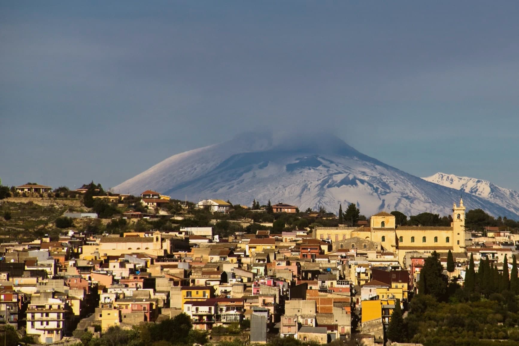
Why visit Sortino
Sortino sits at 438 meters on the eastern Iblei, the other side of the Pantalica plateau from Ferla, sixteen kilometers from the Anapo gorge that holds the necropolis. The 1693 Val di Noto earthquake destroyed the medieval town on a different site; Peter Gaetani moved the rebuild to the current ridge and gave it the baroque grid still visible in the centro storico.
The Necropoli di Pantalica, around four thousand rock-cut chamber tombs from the thirteenth to the seventh centuries BC, sits between the two communes and joined the UNESCO inscription with Syracuse in 2005. Sortino is the official Sicilian Città del Miele, with a beekeeping tradition documented for a thousand years and a Slow Food presidium for the local thyme and orange-blossom honey.
The town's other signature is pizzolo, a 20-centimeter stuffed flatbread topped with olive oil, oregano and parmesan, served only in Sortino and a handful of nearby villages.
What to see in Sortino
- Necropoli di Pantalica. Around 4,000 rock-cut chamber tombs from the thirteenth to seventh centuries BC on the limestone plateau between Sortino and Ferla; UNESCO since 2005.
- Chiesa Madre (San Giovanni Evangelista). Eighteenth-century baroque mother church, rebuilt after the 1693 earthquake on the relocated ridge town under Peter Gaetani.
- Convento di San Francesco. Baroque convent complex with a richly decorated interior, part of the post-1693 rebuild commissioned by Peter Gaetani during the relocation of the town.
How to get to Sortino
Siracusa is roughly 54 minutes away by road.
Our tip
April through June and September through November are the windows for Sortino. The Anapo valley walking trail to Pantalica is open, the limestone tombs cool inside the rock, and the centro storico stays around twenty-two degrees. July and August push past thirty-three at 438 meters; the Pantalica trails close to vehicles and the village empties in the afternoons. Festa in onore di Santa Sofia falls in August.
Noto
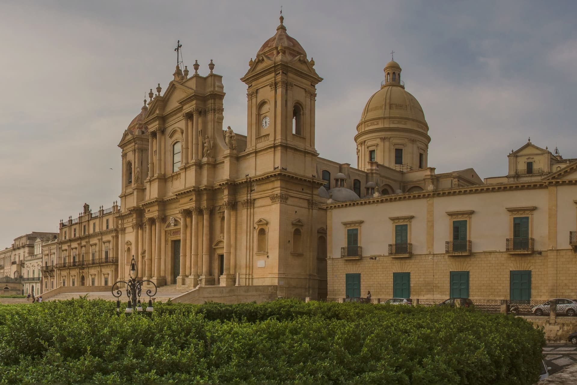
Why visit Noto
Noto stands at 152 meters on a Hyblean foothill ten kilometers inland from the Ionian. The medieval town of Netum, on Monte Alveria eight kilometers north, was abandoned after the 1693 earthquake and rebuilt down the slope as Noto Nuova on a single orthogonal grid, the plan that anchors the Late Baroque Towns of the Val di Noto inscribed by UNESCO in 2002.
The cathedral sits at the top of its stairs on Piazza Municipio, facing the civic cluster of Palazzo Ducezio across the square. Behind it, the ground rises again into Via Nicolaci, defined by the palace built in 1731 and covered each May, since the early 1980s, in petal mosaics for three days.
Further along Corso Vittorio Emanuele the Jesuit church adds its own bell tower and a view back over the rooftops. Fifteen kilometers south the coast turns to salt marsh and reserve, a different register of the same limestone country.
The local stone itself, a soft tufaceous limestone, turns gold in late light, which is the thread running under the grid, the staircases and the carved balconies alike: a single rebuilding, in a single material, read at every scale from a town plan down to a corbel.
What to see in Noto
- Cattedrale di San Nicolò. The staircase it commands is wide enough to hold the whole width of Piazza Municipio in front of it, so the facade reads as the square's far wall as much as a building in its own right.
- Palazzo Nicolaci di Villadorata. The balconies along the street are carried on carved corbels of grotesques and animals, stone figures that project out over the passersby below.
- Piazza Municipio and Palazzo Ducezio. Civic square facing the cathedral, with Palazzo Ducezio, the eighteenth-century town hall designed by Vincenzo Sinatra after the rebuild.
How to get to Noto
There is a railway station in the town, so you can arrive without a car and never need one while you are here. Siracusa is roughly 42 minutes away by road.
Our tip
April through June and September through November are the right months for Noto. The Infiorata falls on the third weekend of May; Via Nicolaci is closed to traffic and the petal mosaics go down for three days, the largest single event in the calendar. July and August push past thirty-five degrees and the day-trippers from Catania and Siracusa fill the cathedral steps from mid-morning.
Caltagirone
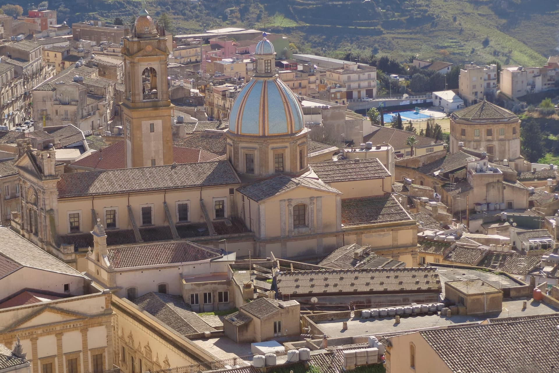
Why visit Caltagirone
Caltagirone sits at 611 meters on the Monti Erei between the plains of Catania and Gela, sixty kilometers inland from the coast. The Arabs took the town in the tenth century and brought the glazing technique that turned local terracotta into majolica; Caltagirone became the first majolica center the North Africans established in Sicily, and the trade survived under Norman, Hohenstaufen and Aragonese rule.
The 1693 Val di Noto earthquake destroyed the city. The rebuild produced the late-baroque centro storico that joined the UNESCO Val di Noto inscription in 2002, alongside Noto, Modica, Ragusa, Scicli and three others.
The 142-step Scala di Santa Maria del Monte, cut in 1606, was tiled in 1956 with majolica risers, each band a different pattern from Sicilian, Arab, Norman and Spanish design traditions. For three days every July, four thousand oil lamps line the steps for the patron San Giacomo.
Ceramic workshops still operate in the old town, the trade unbroken since the Arabs.
What to see in Caltagirone
- Scala di Santa Maria del Monte. 142 baroque steps cut in 1606 connecting lower and upper town, tiled in 1956 with majolica risers, each band a different pattern from the city's ceramic tradition.
- Cattedrale di San Giuliano. Eighteenth-century rebuild of the medieval cathedral destroyed in the 1693 earthquake; neo-baroque façade and bell tower added in the early twentieth century.
- Museo della Ceramica. Regional ceramics museum at the Giardino Pubblico, tracing Caltagirone production from the prehistoric era through medieval Arab glazes to twentieth-century studios.
How to get to Caltagirone
There is a railway station in the town, so you can arrive without a car and never need one while you are here. Catania is roughly 72 minutes away by road.
Our tip
April through June brings the green Erei hills and mild dry weather, the right window for the ceramic workshops and the long climb up the Scala. July and August are hot inland, often past thirty-five, but the four-thousand-lamp Luminaria on 24-25 July is the spectacle the city was built around. September through November is dry and golden, the second best window, with the Scala Infiorata flower display in late spring and the patron's feast already past. Festa Maria SS del Ponte a Caltagirone falls in August.
More from Anywhere Italy
- The best hill towns with a World Heritage site in Sicilia
- The best hill towns within 90 minutes of Siracusa
 The best small hill towns in Sicilia
- The best cheese towns within two hours of Catania
 The 6 best hill towns with a serious restaurant in Sicilia
 The prettiest villages within 90 minutes of Catania