
Sicily · Caltanissetta
Sutera
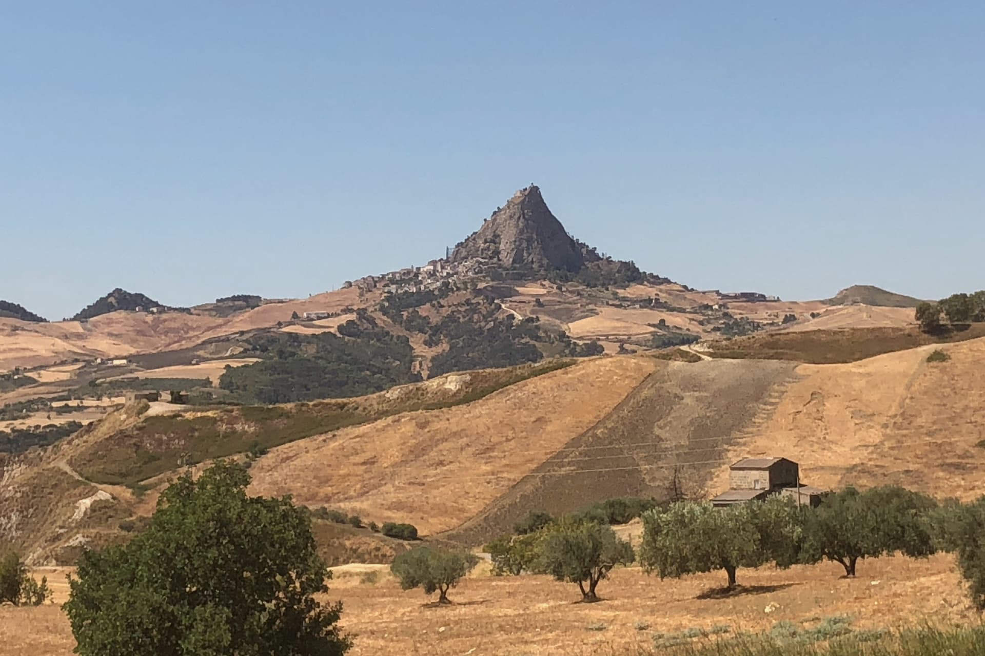
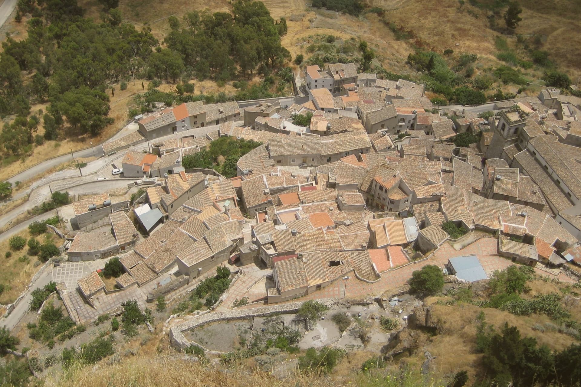
A medieval village clinging to the base of a 800-meter monolith in the Nisseno interior, with an Arab quarter and a sanctuary on the summit.
- Best time
- Apr–Jun, Sep–Nov
- By car
- 1 h 53 min from Palermo
- Population
- 1,178

Known for
MONTE SAN PAOLINO
Limestone block rising 820 meters above the Nisseno interior with the patronal sanctuary at the top, the geographic anchor of the village.
RABATO
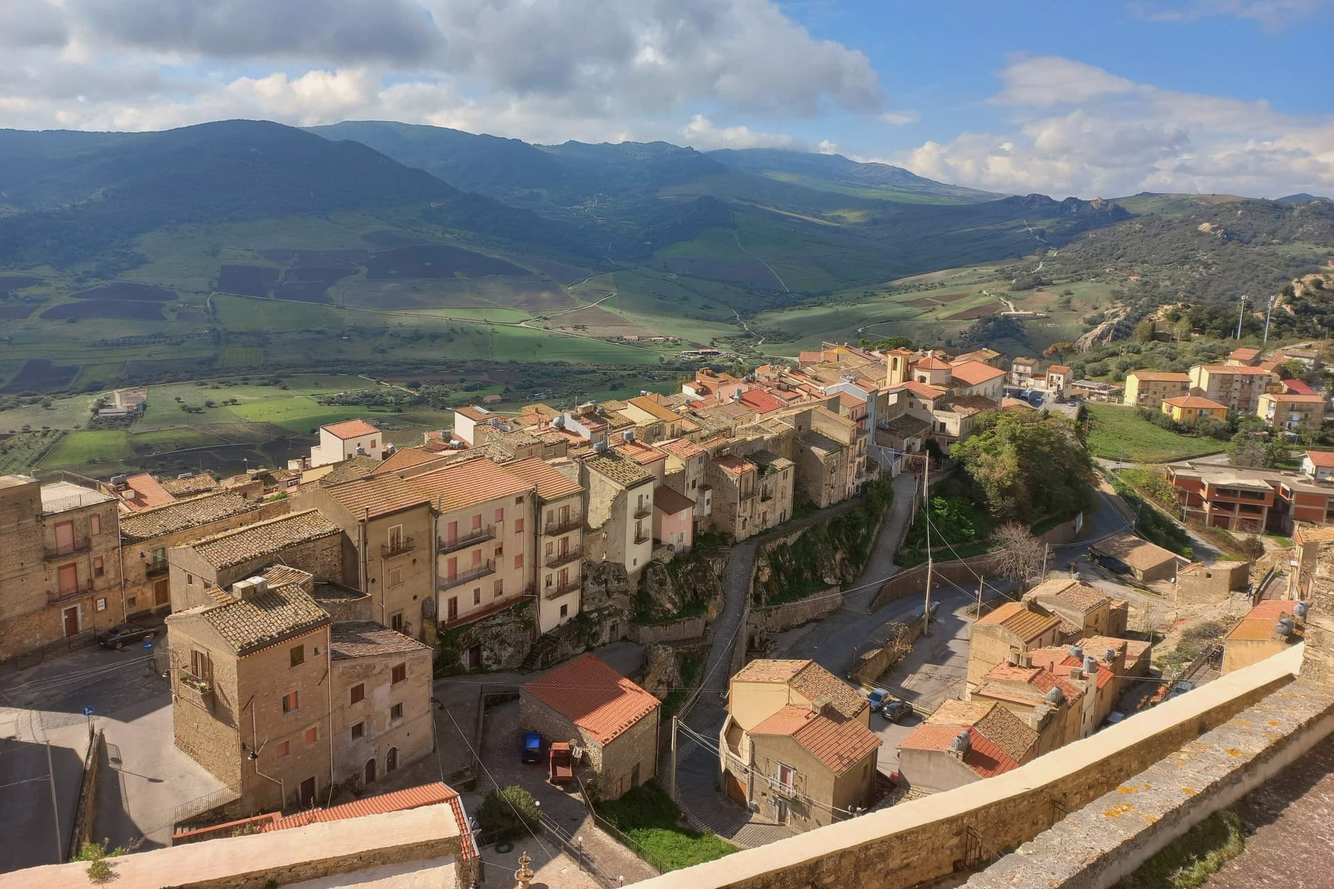
Arab quarter of plastered houses, narrow lanes and rock-cut stairs, one of the best-preserved medieval districts in inland Sicily.
REFUGEE BORGO
Hosts refugee families through the SPRAR program, slowing the depopulation that emptied the inland Nisseno villages.
When to visit
Best · Apr–Jun, Sep–Nov
- J12°
- F13°
- M14°
- A17°
- M23°
- J29°
- J33°
- A32°
- S28°
- O23°
- N17°
- D13°
- Best
- Hot or crowded
- Quiet
- Mostly closed
Daytime averages, 2020–2024. Weather data by Open-Meteo.com.
Why come
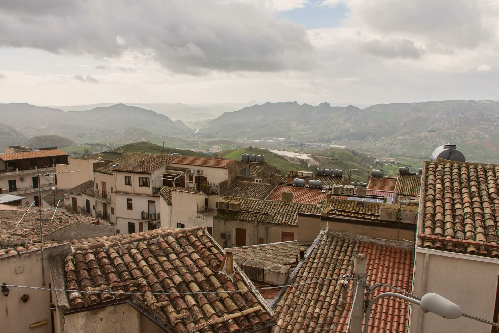
Sutera sits at 600 meters in the Nisseno interior, under the great limestone block of Monte San Paolino that rises another 220 meters above the village. The name comes from the Greek Soter, meaning savior, attached to a fortified Byzantine outpost that controlled the inland passes between Agrigento and Palermo. The medieval village is divided into three quarters: Rabato, Rabatello and Giardinello.
Rabato, the Arab quarter, preserves its original lattice of plastered houses, narrow lanes and stairs climbing toward the mountain. The Santuario di San Paolino on the summit, reachable by a steep staircase cut into the rock, holds the relics of the town's two patron saints, Paolino and Onofrio. Sutera is one of the Borghi più belli d'Italia.
About 1,180 people live in the commune, with around 200 inside the historic Rabato itself. In recent years the village has hosted refugee families through the Italian SPRAR program and slowed its depopulation.
The Sunday letter
Sutera is on our list. Its letter is still to come.
We are writing about all 1,000 of these towns, one at a time, in a free letter every Sunday: the photo, the food, the festa. That is our mission. Sign up and you will be there when Sutera comes up. By Peter & Sophia, from Pietrasanta.
How to get there
From Catania (CTA), about 2h 14m by car.
By car from the centre of Palermo 2 hours.
What to see
Monte San Paolino
Limestone monolith rising 820 meters above the plain, dominating the village and crowned by the patronal sanctuary.
Rabato
Arab-era quarter on the slope of the mountain, with the original lattice of plastered houses, narrow paved lanes and steep stairs.
Santuario di San Paolino
Sanctuary on the summit of Monte San Paolino, reached by a rock-cut staircase and holding the relics of the patrons Paolino and Onofrio.
Chiesa Madre
Mother church of Sutera at the foot of the rock, the religious center of the village outside the patronal feast.
The slow-trip planner
Building a trip? Find where Sutera fits in a slow Italy circuit.
Answer five questions. We will shape a geographically coherent slow trip from the 1,000 Italian towns most travelers skip. Yours to save and share.
Living here
- Population 1,178
- In-betweeni
- Pharmacy in town
- High school within a 30-minute drive
- Nearest airport Catania, 2 h 14 min drive
- Regional capital Palermo, 1 h 53 min drive
Common questions
- What is Sutera known for?
- Sutera is a medieval village clinging to the base of a 800-meter monolith in the Nisseno interior, with an Arab quarter and a sanctuary on the summit.
- Where is Sutera?
- Sutera is a comune in the province of Caltanissetta, in Sicily, at 600 meters above sea level.
- What is the nearest airport to Sutera?
- Catania (CTA), about 2h 14m by car.
- How long is the drive from Palermo to Sutera?
- About 2 hours by car.
- When is the best time to visit Sutera?
- Best in Apr–Jun, Sep–Nov. July is the warmest month, averaging 33 degrees, and November the wettest, with about 11 rain days.
- Which other towns are like Sutera?
- Santa Cristina Gela, Novara di Sicilia and Castel di Lucio.
- How many people live in Sutera?
- 1,178 at the 2023 count.
Tags & datadesignations · numbers · sources
Recognised as
The numbers
- Elevation: 600 m
- Population: 1,178
- Surface area: 35.58 km²
These figures were compiled from public directories: ISTAT, OpenStreetMap and Wikidata, and from the official listings of the guides named on this page. Town details change; verify with official sources before you travel.
Similar
Towns like Sutera
Santa Cristina Gela
Province: Palermo
both inland in Sicily · both under 3,000 people
Novara di Sicilia
Province: Messina
both inland in Sicily · both under 3,000 people
Castel di Lucio
Province: Messina
both inland in Sicily · both under 3,000 people
Calascibetta
Province: Enna
both inland in Sicily · both high up, between 600 and 1,000 metres
Monte Isola
Province: Brescia
both under 3,000 people · both high up, between 600 and 1,000 metres
Bleggio Superiore
Province: Trento
both under 3,000 people · both high up, between 600 and 1,000 metres
🎨 Borghi più belli d'Italia
More Borghi più belli d'Italia towns in Sicily
Agira
Province: Enna
Birthplace of the Greek historian Diodorus Siculus and burial site of 490 Canadian soldiers of the 1943 campaign.
Buccheri
Province: Siracusa
The highest village in the province of Syracuse, world capital of Tonda Iblea olive oil at the 2015 Sol d'Oro.
Calascibetta
Province: Enna
A promontory town at 691 meters facing Enna across a ravine, founded in the ninth century as a Muslim camp to besiege Byzantine Henna.
Castelmola
Province: Messina
A rock village at 529 meters directly above Taormina, the upper acropolis of ancient Tauromenium with a Norman castle and a 1947 almond-wine bar.
Castiglione di Sicilia
Province: Catania
A hill town on the north flank of Etna at 621 meters, base camp for the Alcantara valley and the volcano's most serious red wines.