The prettiest villages in the province of Messina
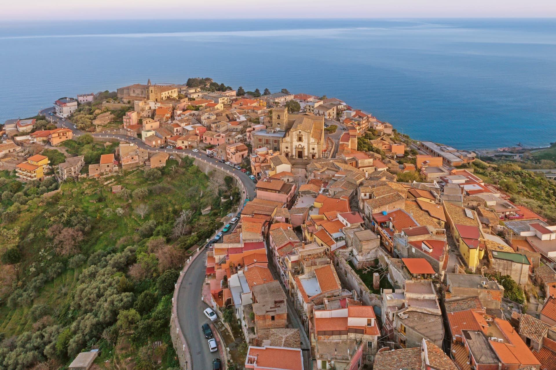
The province of Messina stacks its villages on ridges, which is why they look the way they do. Houses are built of local sandstone and lava rock, roofs run in curved terracotta, and the lanes climb in ramps rather than straight lines because the rock underneath refused to be flattened. Up in the Nebrodi the food turns pastoral: provola dei Nebrooi smoked over its own whey, black pork, wild mushrooms in autumn, ricotta still warm in spring. Closer to the Ionian side the citrus comes back, along with almonds, capers and the cold white wines of the Etna foothills.
Nearly everyone who reaches this corner of Sicily goes to Taormina. The Greek theatre with Etna behind it is one of the great views in the Mediterranean and deserves its reputation, but Corso Umberto in July moves at the pace of a cruise-ship queue, hotel rates behave like Capri, and the terraces are full by mid-morning. The town is small, the buses are frequent, and the arithmetic of that combination is visible on any summer afternoon.
The same coast and the same mountains carry on inland and along the ridges, and the villages up there were built by the same Normans, Arabs and Aragonese. A short drive from the crowded promenade puts you among balconies overlooking Cape Sant'Alessio, castles on volcanic outcrops, and Byzantine crypts in villages where fewer people go. These are the smaller places in the province, and each one has been assessed and admitted by the national association of Italy's most beautiful villages.
Of the 10 communes we have mapped in the province of Messina, 7 qualify as prettiest villages: each has passed the assessment of the national association of Italy's most beautiful villages. The smallest, Forza d'Agrò, has 835 residents.
Two more lists worth reading alongside this one: The best coastal towns in the province of Messina and The best small coastal towns in Sicilia.
Forza d'Agrò
Why visit Forza d'Agrò
The first record of the settlement, vicum Agrillae, is in a 1117 decree of Roger II. It names a lower site, the one the residents eventually abandoned when they moved uphill to the rock and renamed the place Fortilicium d'Agrò, the fortress of Agrò, a name the ruin on the peak still carries.
The move from lower ground to the high rock explains the layout that remains: the fortress and its silhouette at the top, the mother church rebuilt after the 1648 and 1693 earthquakes lower down, and the Trinità with its convent of Sant'Agostino set apart from both, reached by its own staircase. The village looks north to Calabria across the strait and sits ten kilometers from Taormina, close enough to the coast to be seen from it but built with its back to the sea.
What the earthquakes and the rebuilding left behind is a village whose churches carry more damage and repair in their walls than its ruined castle does, a place shaped as much by disaster and recovery as by the Norman name on the summit.
What to see in Forza d'Agrò
- Castello Normanno. The ruin still crowns the highest point of the village, visible from the coast road below as the shape that names the place.
- Duomo di Maria Santissima Annunziata e Assunta. Mother church built 1400, damaged by the 1648 and 1693 earthquakes, rebuilt with a Spanish Baroque façade and spiral volutes.
- Chiesa della Santissima Trinità. The church sits above its own staircase, attached to the convent of Sant'Agostino, a quieter approach than the steps below suggest.
How to get to Forza d'Agrò
Messina is roughly 67 minutes away by road.
Our tip
May through October is the season the ridge village works best. The Ionian below stays usable, the air at 420 meters is several degrees cooler than Taormina, and the lanes fill on the days when tour buses come up from the coast to film the Godfather staircase. July and August are crowded with day-trippers and warm but rarely hostile, the sea breeze cuts through the village from late afternoon.
Castelmola
Why visit Castelmola
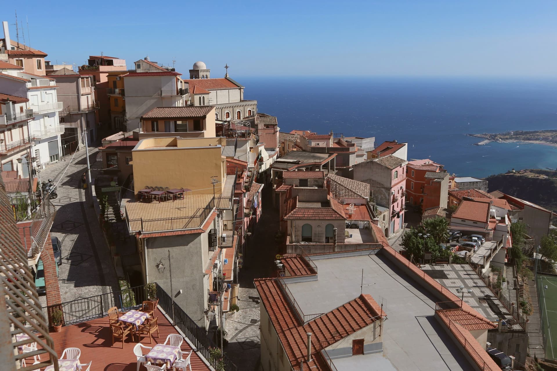
The village occupies a steep limestone rock two kilometers and several hundred meters above the coast, reached by a climb that Taormina itself does not require. The site served as an upper acropolis to Greek Tauromenium below it from the late fourth century BC, a relation of height and defense rather than distance: whoever held the summit watched the lower town and the sea beyond it.
The Byzantines fortified the rock around 800, and the local leader Costantino Caramalo strengthened the walls against Arab raids in the ninth century, work the Normans later built on when they raised the castle whose ruins still stand. The medieval plan of stone lanes climbs from the church at the center up toward that castle, the whole village stacked along the one rock rather than spread across it.
The result is a place defined by its verticality: a fortress town that grew inward and upward because it had nowhere else to go, and that still looks down on the city it was built to guard.
What to see in Castelmola
- Castello Normanno (Castello di Mola). Ruined walls on the summit, standing over Byzantine and Greek foundations. The climb up gives no roof and no interior, only the rock line and the drop on every side.
- Duomo di San Nicolò di Bari. Mother church at the centre of the village, rebuilt in the early twentieth century with a Baroque interior and original portal.
- Piazza Sant'Antonio. Mosaic-paved belvedere with views of Etna, the Gulf of Naxos, and Taormina five hundred meters below.
How to get to Castelmola
Catania is roughly 63 minutes away by road.
Our tip
May through October is the season Castelmola was built for. The Taormina coast fills with tourists, the village above empties out by dusk when the day-trippers descend, and the air at 529 meters stays cooler than the beach. July and August are crowded and hot; the climb from Taormina by foot is two hours and forty minutes of switchbacks.
Novara di Sicilia
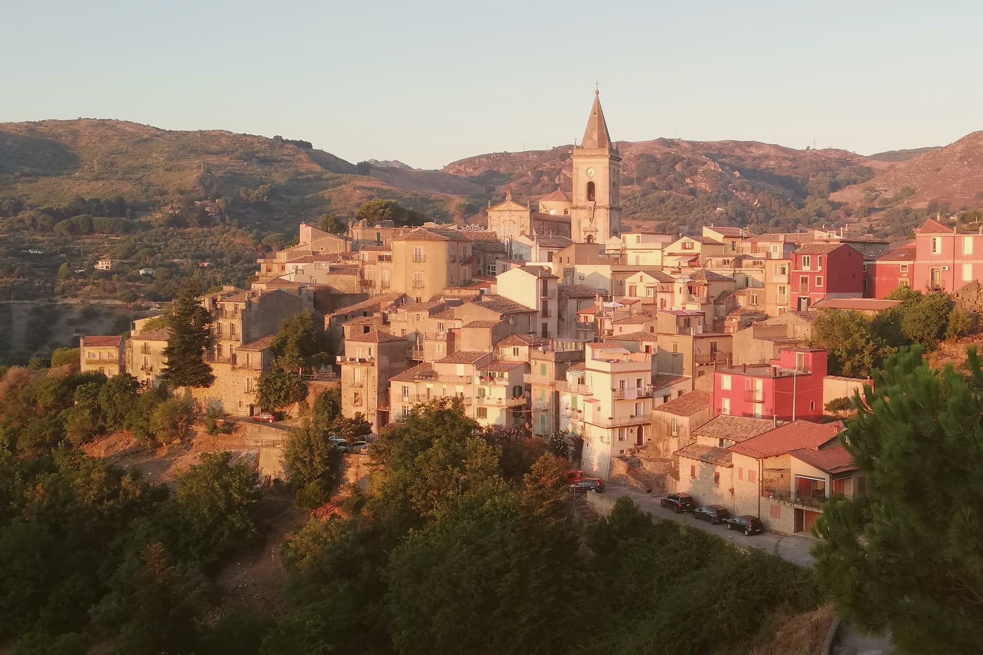
Why visit Novara di Sicilia
Novara di Sicilia sits at 650 meters at the point where the Peloritani and Nebrodi ranges meet, with the pointed limestone Rocca Salvatesta rising to 1,340 meters behind it. Lombards from northern Italy settled here between 1061 and 1072 under the Norman conquest, and a Gallo-Italic dialect from that migration is still spoken in the village.
Roger of Lauria built a castle here in the thirteenth century. The Duomo di Santa Maria Assunta dates from the sixteenth, a sandstone Renaissance building above the medieval lanes.
Every Carnival the village hosts the Lancio del Maiorchino, recognized by UNESCO as intangible heritage: teams roll 10-to-18-kilogram wheels of aged pecorino cheese two kilometers downhill from Via Duomo to Piano Don Michele, a contest that dates from the early 1600s when shepherds tested the maturation of their cheese on these same stones.
What to see in Novara di Sicilia
- Duomo di Santa Maria Assunta. Sixteenth-century cathedral in sandstone, the main building of the historic center with a Renaissance façade overlooking the village.
- Rocca Salvatesta. Pointed limestone peak of 1,340 meters behind the village, called the Matterhorn of Sicily for its shape and dominating the Peloritani-Nebrodi divide.
- Centro storico. Medieval stone village of arched lanes and decorated façades on the slopes of Rocca Salvatesta, listed among the Borghi più belli d'Italia.
How to get to Novara di Sicilia
Messina is roughly 64 minutes away by road.
Our tip
April through June and September through November are the months for Novara. The 650-meter altitude keeps temperatures manageable when the coast bakes, and the trail up Rocca Salvatesta is best in dry weather. July and August are warm but the Peloritani forests above town stay cool; the village empties between two and six in the afternoon. Festino dell'Assunta e di S. Ugo a Novara di Sicilia falls in August.
Savoca
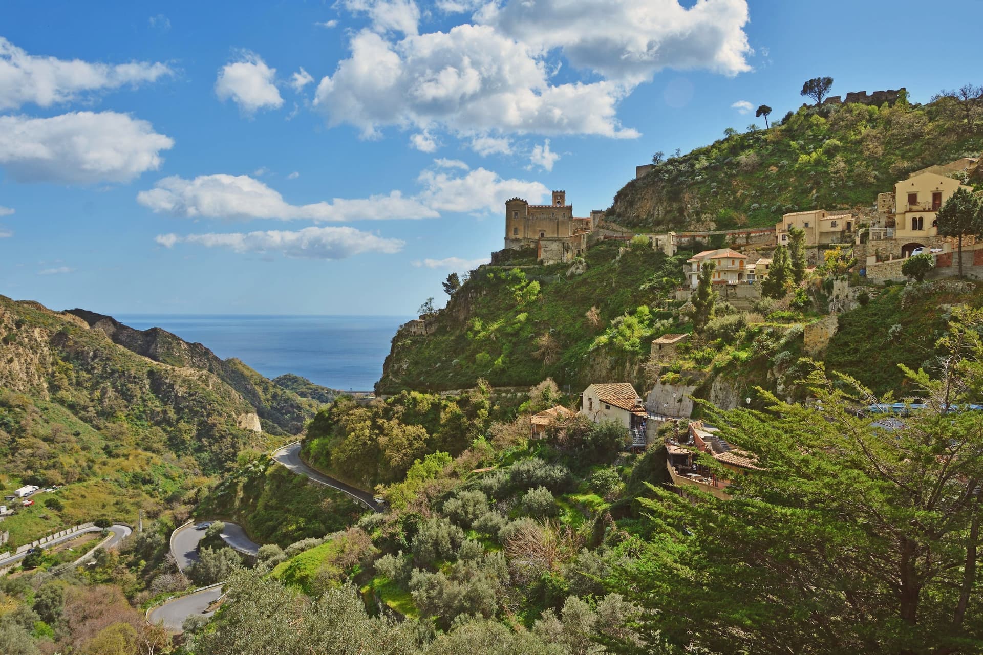
Why visit Savoca
Savoca sits fifteen kilometers north of Taormina, on a hill above the Ionian coast. The centro storico runs along the ridge in stepped lanes and balconied stone houses, with the Capuchin convent below it at the lower edge of the village and the castle ruin above at the highest point, the two anchoring the village from bottom to top.
The convent's crypt holds thirty-seven mummified bodies of notables from the eighteenth and nineteenth centuries, preserved in a colatoio that desiccated the corpses with vinegar and salt. In the summer of 1971, Francis Ford Coppola and Mario Puzo arrived to film the Sicilian scenes of The Godfather here, after the original Corleone in Palermo province was judged too modern for the camera.
The village's shape, a compact ridge with a church at one end and a bar in the lower piazza, gave the film both its wedding location and its courtship scene without need for another set. What draws people now is largely what drew Coppola then: a village small enough to read in a single walk, old enough to need no dressing.
What to see in Savoca
- Chiesa di San Nicolò. Thirteenth-century church suspended on a rock promontory at the top of the village. The Godfather's wedding scene between Michael and Apollonia was filmed here.
- Bar Vitelli. Eighteenth-century palazzo and family bar in the lower piazza, still operating as it did when it stood in for Apollonia's father's bar in The Godfather.
- Cripta dei Frati Cappuccini. Crypt of the Capuchin convent below the centro storico, its ventilated chamber holding the mummified bodies of local notables.
How to get to Savoca
There is a railway station in the town, so you can arrive without a car and never need one while you are here. Messina is roughly 39 minutes away by road.
Our tip
May through October are the months Savoca is busy. The Godfather pilgrims arrive year-round, but the village photographs best in spring and autumn, when the Ionian below is clear and the hill stays cool. July and August are warm; the centro storico is shaded in late afternoon, and the climb up to Pentefur is best at dawn.
San Marco d'Alunzio
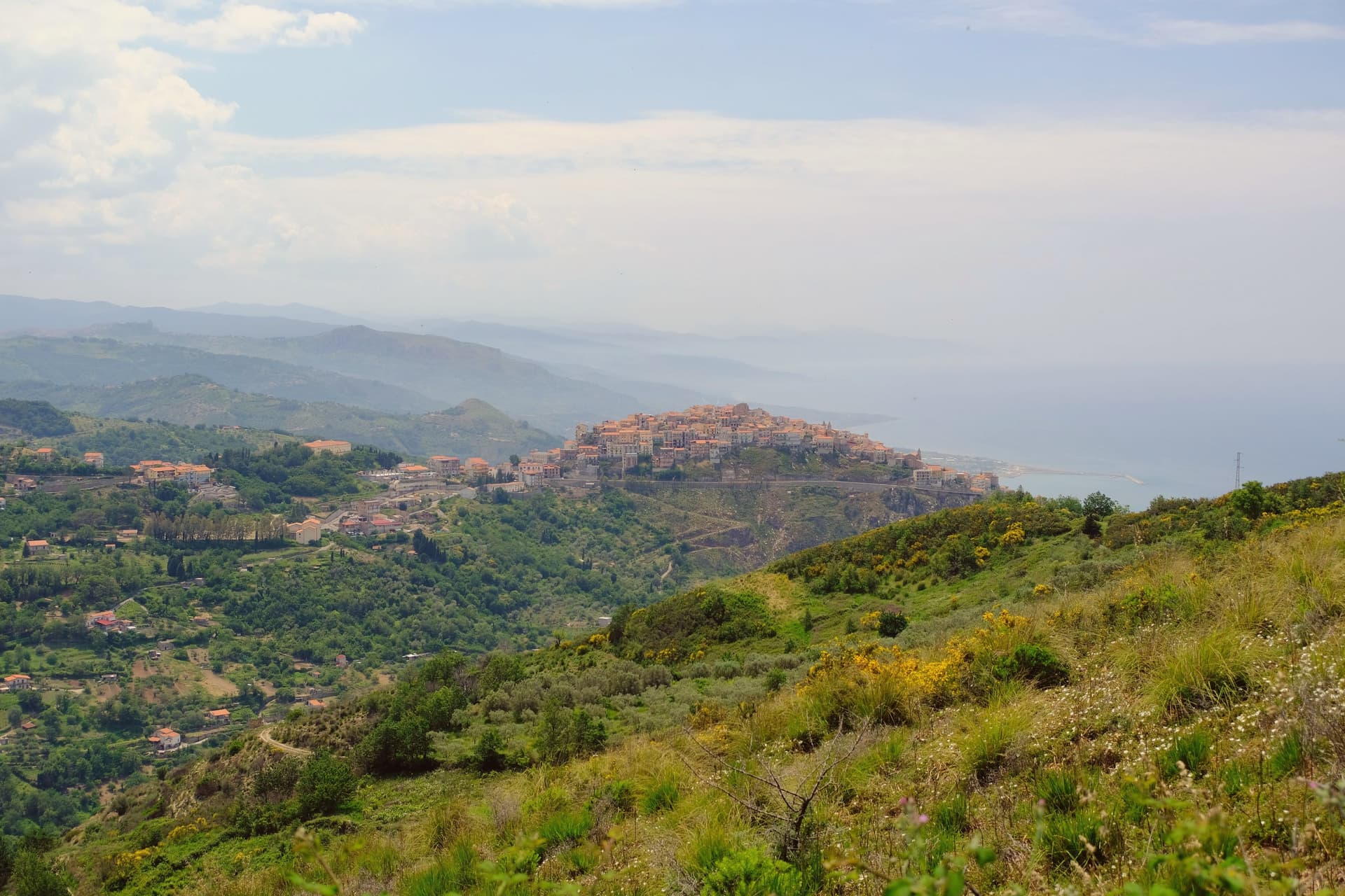
Why visit San Marco d'Alunzio
The borgo sits on Mt. Castro, five kilometers from the Tyrrhenian coast.
The Greeks founded it as Alontion, prosperous enough to mint its own currency, and the settlement they built has never fully left: what they raised became the base for what came after, layer on layer, rather than being cleared away for it. The upper town holds the ruins on Monte Rotondo, the lookout that gave the Normans command of the coast below.
The historic center, walled and compact, holds twenty-two churches and is listed among the Borghi più belli d'Italia. Through all of it runs the same pink stone, quarried on the surrounding hills, cut for church interiors, piazza fountains and, beyond the town itself, for the interior of the Messina town hall.
A place built repeatedly from its own ground: Greek temple, Norman stronghold and marble borgo standing on the same hill in the same rose-colored rock.
What to see in San Marco d'Alunzio
- Tempio di Ercole. The foundations sit beneath the Chiesa di San Marco, making it the oldest visible structure in the borgo, its stones absorbed into the later church above.
- Ruderi del Castello Normanno. Ruins on Monte Rotondo above the village, standing as the lookout point over the Tyrrhenian coast.
- Chiesa di Santa Maria delle Grazie (Aracoeli). Renaissance church built entirely in the local rose-colored stone, with elaborate marble carvings inside the chapel.
How to get to San Marco d'Alunzio
Messina is roughly 85 minutes away by road.
Our tip
April through June and September through November are the best months. The 540-meter ridge stays cooler than the Tyrrhenian below, the pink Aluntina stone catches the afternoon light, and the climb up to the Norman castle ruins is easy in dry weather. July and August are hot but the centro storico shaded streets give shelter.
Montalbano Elicona
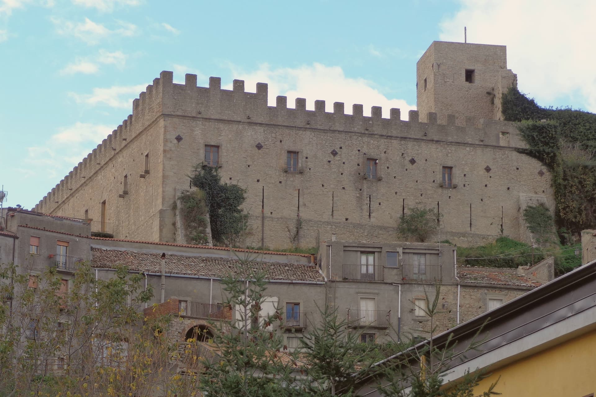
Why visit Montalbano Elicona
Montalbano Elicona stands at 907 meters in the Nebrodi mountains, north of Etna and inland from the Tyrrhenian coast above Patti. The Castello di Montalbano was raised in 1233 under Frederick II of Swabia, then rebuilt and adopted as a summer royal residence by Frederick III of Aragon between 1302 and 1308, who brought his physician Arnaldo da Villanova with him to treat his gout.
The castle still combines a Norman rectangular nucleus with crenellated towers and an Aragonese addition with arrow slits and large windows. The town won the RAI Borgo dei Borghi competition in 2015.
A short drive from the village, the Argimusco plateau holds a set of large eroded sandstone formations that some scholars read as a fourteenth-to-eighteenth-century hermetic site and others as wind-and-water sculpture. The surrounding hills are Città della Nocciola territory; hazelnut groves run from 700 to 1,000 meters.
What to see in Montalbano Elicona
- Castello di Montalbano. Frederick II castle of 1233 rebuilt as the summer residence of Frederick III of Aragon between 1302 and 1308, two towers and a Norman-Aragonese hybrid plan.
- Megaliti dell'Argimusco. Eroded sandstone plateau twelve kilometers from the village, large free-standing formations read variously as natural sculpture and a medieval hermetic site.
- Chiesa Madre di Santa Maria Assunta. Norman-era mother church near the castle, fourteenth-century reworking and a Renaissance baptismal font, restored after twentieth-century seismic damage.
How to get to Montalbano Elicona
Messina is roughly 70 minutes away by road.
Our tip
May through October are the working months at 907 meters. The Nebrodi air stays cooler than the coast through July and August, often a ten-degree drop from Patti, and the Bosco di Malabotta gives shade for walking. Late July brings the Festa del Corteo Storico, with reenactments of Frederick III's court and a procession from the castle through the medieval quarter. Feste Aragonesi di Montalbano Elicona falls in August.
Castroreale
Why visit Castroreale
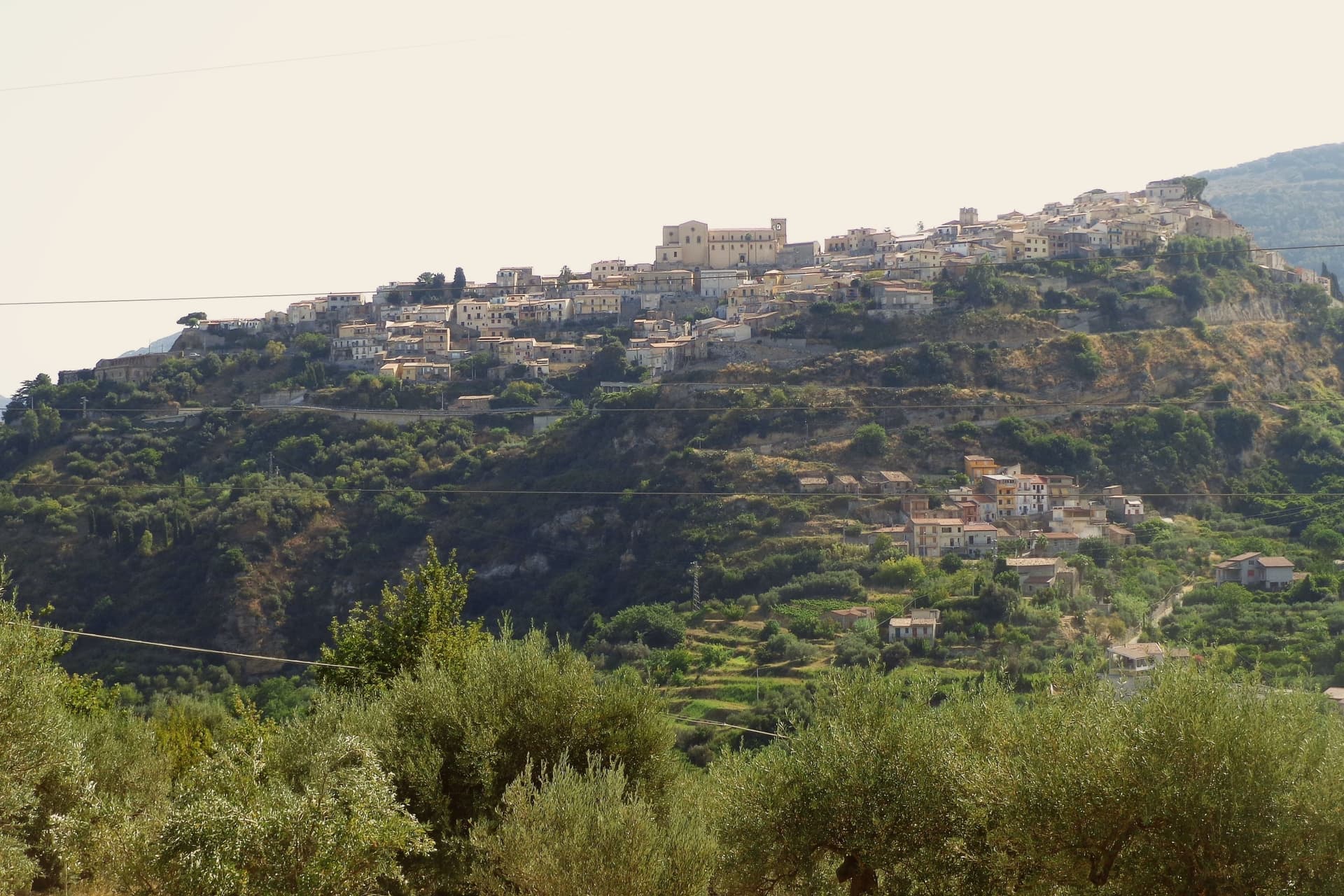
The ridge that carries the town sits between the Peloritani slopes and the Tyrrhenian, 394 meters above the Milazzo plain, a position that gave the place its name: castrum regale, the royal fortress. By the fifteenth century a Jewish community lived in the quarter behind what became the Monte di Pietà, and an arch of the lost Synagogue still stands there.
The 1717 earthquake killed many residents and brought down buildings across the town, a break that separates what survives now from what came before it. Against that loss, the church count is striking: over eighty churches for barely 2,246 people, a density that has left more sacred buildings than the town could ever have kept in active use, which is part of why so much of what remains ended up gathered into a single museum rather than left scattered through the countryside.
The upper ridge, the site of the vanished Jewish quarter, and the churches spread through the streets below are three layers of the same small footprint, royal, mercantile and devotional, compressed onto one spur of rock above the plain.
What to see in Castroreale
- Torre di Federico II d'Aragona. The tower stands on the highest point of the ridge, the last upright piece of the castle Frederick II of Aragon ordered rebuilt, still read from the plain below as the mark of the town.
- Duomo di Santa Maria Assunta. Mother church on the central piazza, with a Renaissance portal and works from the fifteenth and sixteenth centuries.
- Pinacoteca di Santa Maria degli Angeli. Parish museum housing what could be gathered after the territory's chapels and monasteries were lost, the objects now given a single roof.
How to get to Castroreale
Messina is roughly 59 minutes away by road.
Our tip
May through October is the season the ridge handles well. The Tyrrhenian below stays clear, the air at 394 meters is cooler than Milazzo on the plain, and the centro storico opens its trattorie and churches. July and August push past thirty-two degrees and the lanes empty in mid-afternoon, though the evening sea breeze cools the ridge quickly.