
The 6 best hidden towns inside a nature park in Toscana
Tuscany keeps its wilder edges where the roads narrow: chestnut woods in the Garfagnana, the white scars of the marble quarries in the Apuane, holm oak and strawberry tree on the mining hills above the Val di Cornia. The towns built into these places are made of the rock underneath them, grey sandstone in the north, warm limestone and volcanic stone in the south, and the food follows the same logic. Chestnut flour and farro and pecorino in the mountains, wild boar and Val di Cornia red and new oil in the hills near the coast. Autumn is the strongest season for all of it, when the chestnut ovens are lit and the mushroom stalls appear at the weekly markets, though spring in the high pastures runs a close second.
Most visitors put their Tuscan walking days into the Chianti and the Val d'Orcia, and the reasons are honest ones: cypress avenues, easy wine estates, hilltop skylines that photograph well from the car park. Siena and San Gimignano anchor the same route, so the whole strip carries coach traffic from Easter until late October, and hotel prices move with it. The landscape there is farmed and pretty rather than wild. It is worth the visit, but it does not put you inside a park.
The parks are elsewhere, and so are the towns inside them. The Apuane rise straight out of the Versilia coast into ridges and marble basins, and the mining hills that made the Etruscans rich still run in a wooded band behind the Gulf of Baraccia, protected as regional parkland with paths, iron age slag heaps and abandoned shafts along them. Fewer people go to these towns, partly because the roads are slower and partly because the names are not on the standard itinerary. All six here sit inside a regional nature park, which means the walking starts at the edge of the houses.
Of the 84 communes we have mapped in Toscana, 11 qualify as towns inside a nature park: each sits inside a regional nature park. This list is the hidden ones, 6 in all, ordered smallest first. The smallest, Stazzema, has 2,856 residents.
Two more lists worth reading alongside this one: The best towns inside a nature park that you can reach by train in Toscana and The 6 best coastal towns inside a nature park in Toscana.
Stazzema
Why visit Stazzema
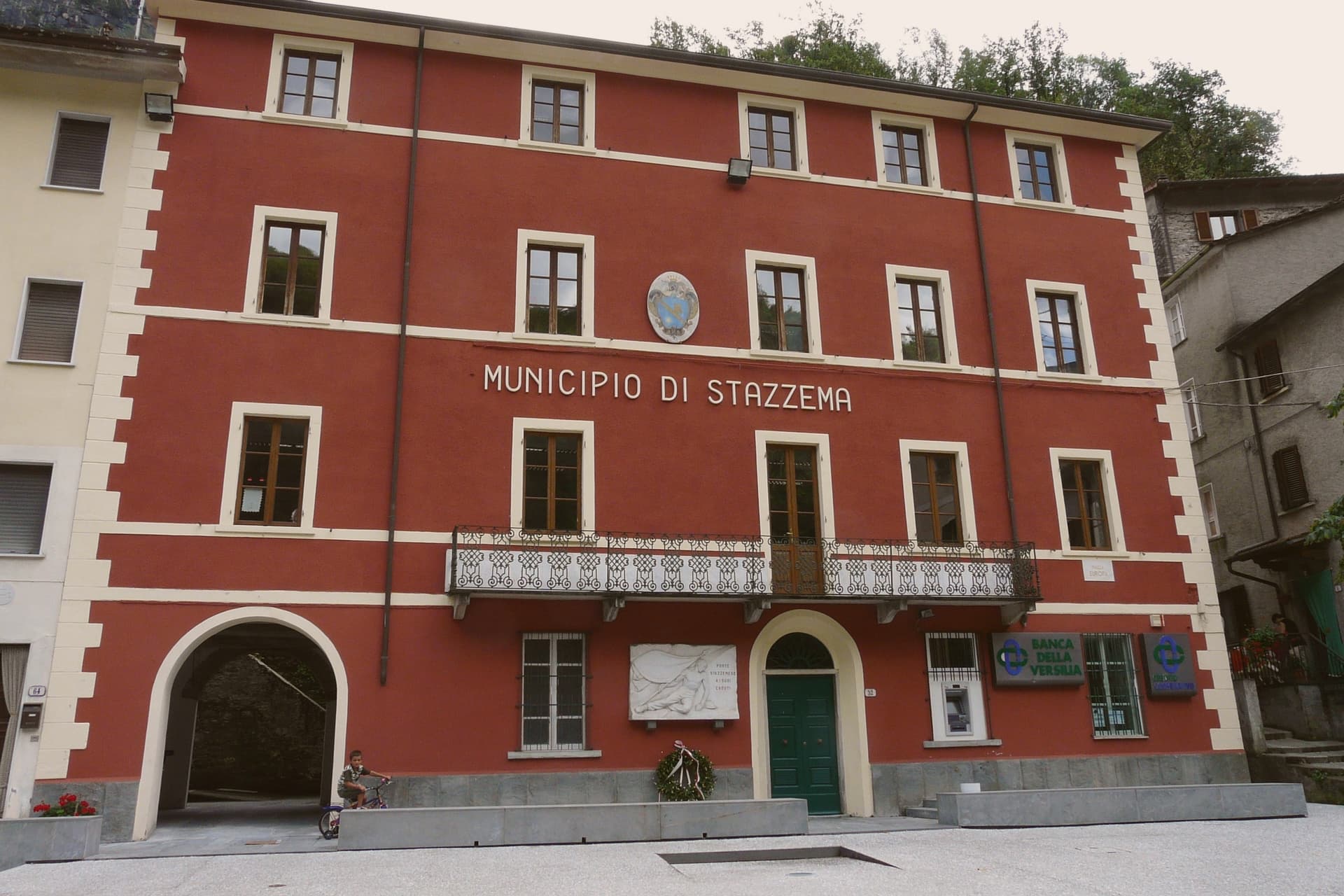
Stazzema is the only entirely mountainous commune in Versilia, seventeen hamlets spread across the western slopes of the Apuan Alps, the highest point at Pania della Croce at 1,858 meters. The main village sits at 440 meters; Sant'Anna di Stazzema, the most-visited frazione, sits at 750 meters between Monte Ornato and Monte Gabberi.
On 12 August 1944 the Waffen-SS and the Italian Black Brigades killed around 560 villagers and refugees at Sant'Anna, more than a hundred of them children. The site became the Parco Nazionale della Pace in 2000, with a museum opened in 1982 by President Sandro Pertini.
The Antro del Corchia, accessed from Levigliani, runs 53 kilometers of mapped tunnels and is the largest karst system in Italy. The commune earned its Comuni Virtuosi signal for waste reduction and energy policy and its Città delle Grotte signal for the Corchia.
What to see in Stazzema
- Antro del Corchia. 53 kilometers of mapped tunnels and shafts in the Levigliani frazione, the largest karst system in Italy and one of the largest in Europe.
- Sant'Anna di Stazzema. Mountain frazione at 750 meters, site of the 12 August 1944 SS massacre and now the Parco Nazionale della Pace memorial complex.
- Museo Storico della Resistenza. Resistance and massacre museum in Sant'Anna's former primary school, inaugurated in 1982 by Sandro Pertini.
How to get to Stazzema
Pisa is roughly 65 minutes away by road.
Our tip
April through October works for the trails and the cave. June and September are the best brackets: long daylight, dry rock for the Pania ridge, and the Corchia interior holds at 7.6 degrees year-round so a guided visit needs a sweater regardless of season. July and August are warm enough at altitude but the parking at Sant'Anna and Levigliani fills early on weekends.
Massa Marittima
Why visit Massa Marittima
Massa Marittima sits on an isolated hill in the Colline Metallifere, the Tuscan hills that supplied copper and silver from Etruscan times. Despite the name, the sea is roughly twenty kilometers away.
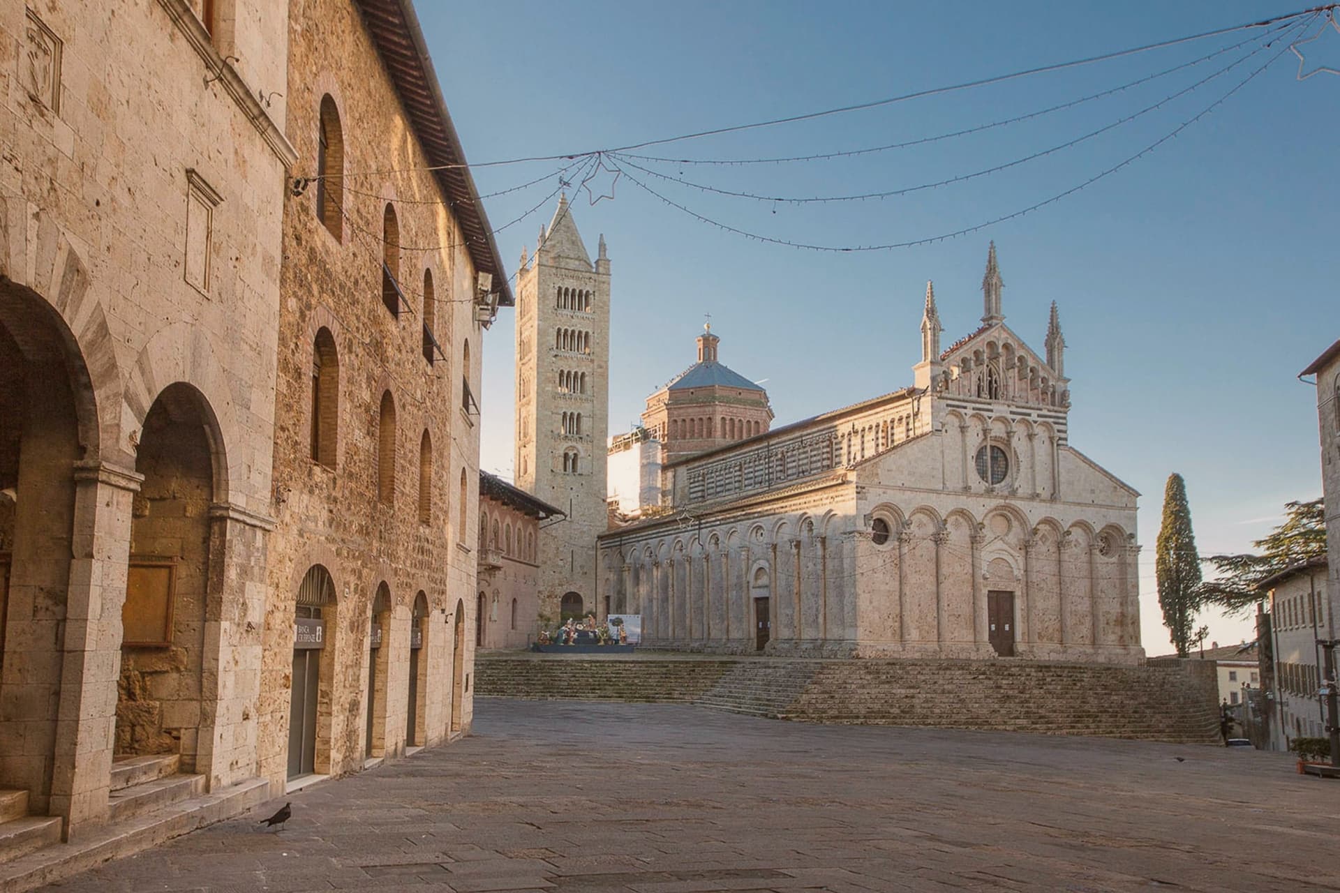
The town's wealth as a free commune was built on that ore, and the buildings on Piazza Garibaldi still date from the century of its independence: the cathedral, the communal palace, the Palazzo Comunale, all raised while the mines were active. The old center keeps a medieval grid, with the Città Nuova rising above it and the watchtower marking the join between the two.
Mining gave way to tourism after the seams ran out, but the layout never had to be redrawn for cars or commerce: what stands today is largely what stood when the terzieri divided the town for its crossbow contest. The hill, the ore beneath it and the thirteenth-century square form one continuous fact: the town's shape was set by what it dug out of the ground, and its history stopped adding new layers once the ground stopped paying.
What to see in Massa Marittima
- Duomo di San Cerbone. Pisan Romanesque cathedral on Piazza Garibaldi, its facade rising in tiers above the square. The Arca inside holds the saint's remains beneath carved marble figures.
- Fonti dell'Abbondanza. The vaulted fountain building where the fresco survives on the interior wall, plaster and pigment exposed after centuries hidden under whitewash.
- Palazzo del Podestà. Communal palace on Piazza Garibaldi, now housing the Museo Archeologico, with the Maestà by Ambrogio Lorenzetti among its rooms.
How to get to Massa Marittima
There is a railway station in the town, so you can arrive without a car and never need one while you are here. Livorno is roughly 95 minutes away by road.
Our tip
April through June and September into October are the months Massa Marittima opens up. The Balestro del Girifalco runs on the fourth Sunday of May and again on the second Sunday of August, and the town fills with archers in costume from the three terzieri. July and August are hot inland and the centro storico thins in the afternoon; the Tyrrhenian beaches at Follonica are half an hour away by car. Balestro del Girifalco di Agosto a Massa Marittima falls in August.
Seravezza
Why visit Seravezza
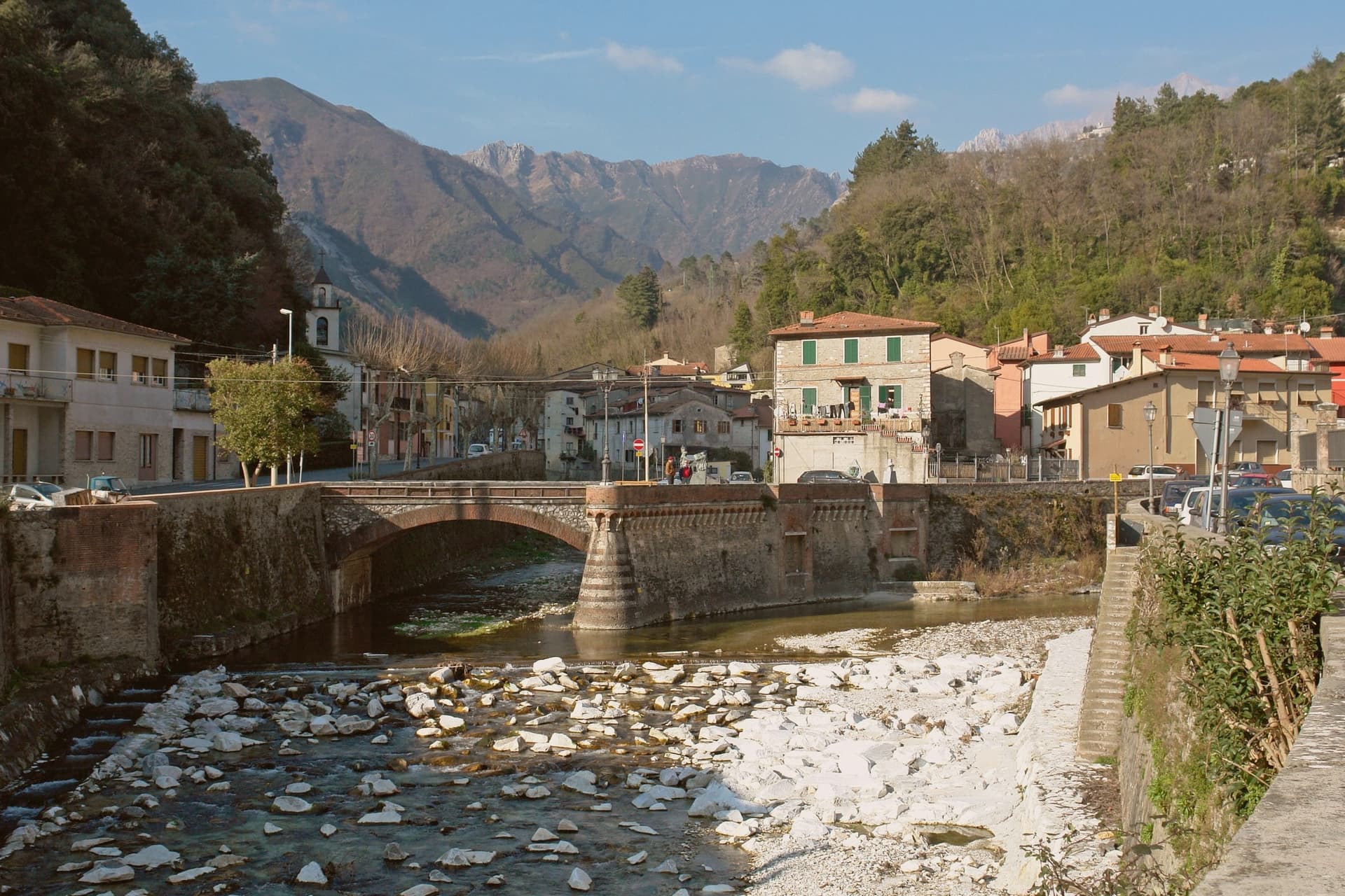
Seravezza sits at 100 meters where the Vezza and Serra streams meet, in Versilia Storica, between the Apuan Alps and the Tyrrhenian. The territory was contested between Pisa, Lucca, Genoa and Florence for centuries before passing to the Medici, and the town's position at the junction of the two watercourses, with the mountains at its back and the coast within reach, explains why it mattered enough for all four to want it.
Michelangelo spent three years on Monte Altissimo behind the town, found his veins of white stone, and built a road to take it down toward the sea. Half a century later Cosimo I commissioned the Palazzo Mediceo here, a summer residence rather than a fortress, which says something about how settled Medici rule had become by the time it was built.
The two episodes, a papal quarry and a ducal villa, sit one above the other on the same small territory: the mountain supplied the stone that Florence wanted, and the valley below became a place worth building a palace in once the stone trade had made the route familiar.
What to see in Seravezza
- Palazzo Mediceo. The residence stands in the centro, its design passed from one architect to the next as the project went on. It carries the UNESCO listing among the Medici Villas.
- Pieve di San Martino alla Cappella. Eleventh-century Romanesque parish church between Seravezza and Azzano, with the ruined Annunziata Oratory alongside.
- Monte Altissimo. The peak rises behind the town at 1,589 meters. The road Michelangelo built to bring the stone down still marks the route from quarry to valley, and the mountain is worked as a quarry to this day.
How to get to Seravezza
There is a railway station in the town, so you can arrive without a car and never need one while you are here. Pisa is roughly 63 minutes away by road.
Our tip
May through September is the working Versilia season, the inland equivalent of the coastal months at Forte dei Marmi and Pietrasanta six kilometers away. June and September are the best moments to walk up to the Cappella and Azzano: the mountain trails open, the marble quarries above visible from below. July and August are hot in the lower town but cool on the slopes, and the Apuan rains hold off until late September. Sagra di Fine Estate falls in August.
Suvereto
Why visit Suvereto
Suvereto sits at 127 meters on the inland edge of the Val di Cornia, twelve kilometers from the Tyrrhenian coast. The name comes from the Latin suberetum, a wood of cork oaks, and the surrounding forests still hold them.
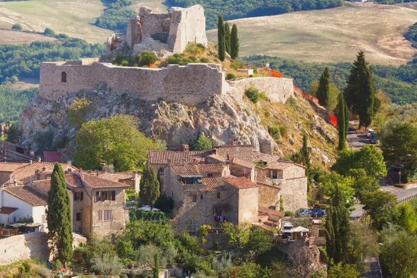
The Rocca Aldobrandesca, first documented in 973, occupies the highest point of the borgo; the Aldobrandeschi family who controlled it also ruled large sections of southern Toscana and the Maremma. The town reached its golden age in the thirteenth century, when Frederick II granted it a charter of freedoms in 1216 and the Palazzo Comunale was built.
The centro storico is a tight grid of stone vicoli that runs uphill from the Romanesque Pieve di San Giusto to the fortress. Suvereto carries five institutional signals at once, a rare combination in the province of Livorno, and the surrounding wine country falls under the Val di Cornia DOC and Suvereto DOCG appellations.
What to see in Suvereto
- Rocca Aldobrandesca. Fortress at the highest point of the borgo, documented from 973, expanded in the twelfth century and partly restored as an open archaeological site.
- Pieve di San Giusto. Eleventh-century Romanesque parish church at the foot of the borgo, with a sandstone façade and a single nave divided by stone columns.
- Palazzo Comunale. Thirteenth-century town hall with a double external staircase and Ghibelline merlons, one of the earliest surviving civic palaces of the Maremma.
How to get to Suvereto
Livorno is roughly 84 minutes away by road.
✷ We have written about Suvereto
“That is the thing the young man on the beach did not see, and the man who lives here cannot stop seeing. This is an industrial coast wearing a beach towel. Run it back far enough and the whole of it, the swamp and the steel and the slag and the white water, is one long story about iron, and the holiday is the costume the story put on after the work ran out.”
Read our piece on Suvereto →The Iron Coast | The Wrong Sea
Our tip
April through June and September into October are the dry months in the Val di Cornia, when the cork forests behind the town hold their light and the wine harvest runs in September. The Sagra del Cinghiale, celebrating the wild boar of the surrounding hills, runs across two weekends in December and draws a different crowd. July and August are hot at 127 meters and most visitors descend to the Tyrrhenian coast in the afternoon. Palio dell'Imperatore falls in August.
Castelnuovo di Garfagnana
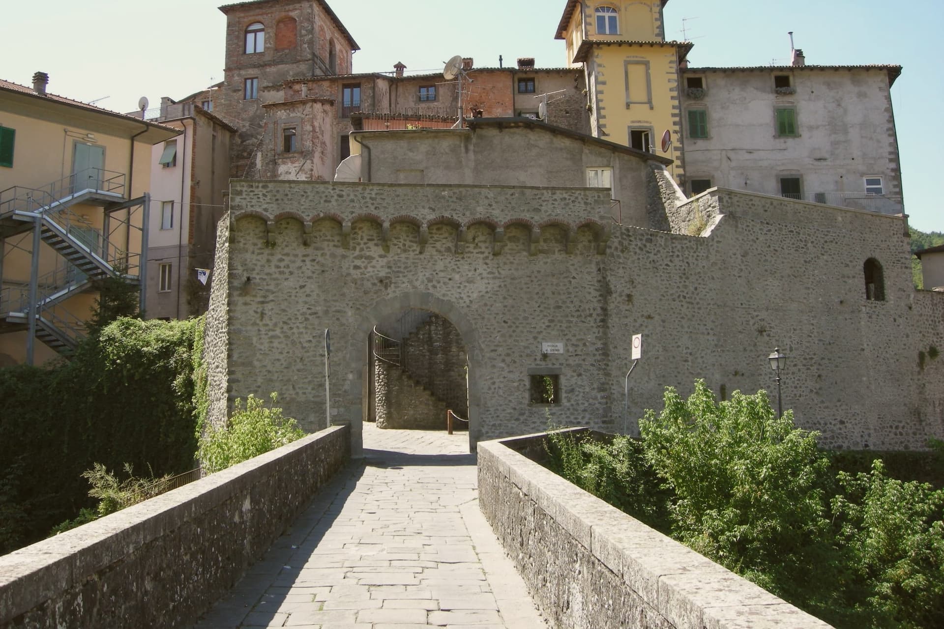
Why visit Castelnuovo di Garfagnana
Castelnuovo di Garfagnana is the historic capital of the Garfagnana, the deep mountain valley between the Apuane Alps and the Tuscan Apennine main ridge, 50 km north of Lucca along the Serchio river. The town sits where the Serchio meets the Turrite, and it anchors the valley both politically and economically: 5,600 residents, and the only real services, hospital, secondary schools, government offices, for the 30,000 people spread across the Garfagnana comuni around it.
The historic core is the fortress that now serves as the municipal museum, the building where the Este governor lived out his posting writing to friends about being stuck among bandits and chestnut-eaters even as he completed the final additions to his poem. Above the town, on the hill, stands the much larger Este fortress of 1579, built to control the trans-Apennine trade route and now a cultural centre and concert venue with the most photographed view of the Apuane peaks.
The two fortresses read together as a record of how the valley was held: one seat of government inside the town, one larger garrison commanding the pass above it. Castelnuovo is also the point of departure for the higher ground: the Apuane Regional Park, whose white-marble peaks are the same stone quarried at Carrara seen from the back, the Parco dell'Orecchiella further up, the show cave reached 45 minutes to the south, the Eremo di Calomini cliff-monastery, and over 200 km of marked Apennine trails.
The valley's food follows the same logic of scarcity turned to identity: alongside the farro and the chestnut dishes there is formentone otto file, a local maize cornbread, pecorino della Garfagnana, biroldo, a sweet-spiced blood sausage, and salt-cured prosciutto bazzone from the indigenous Garfagnana pig breed. A town built to govern a valley still does exactly that: the fortress on the hill and the one in the center were both instruments of control over a mountain pass, and the food still served in its bakeries and trattorie is what the same isolation once made necessary.
What to see in Castelnuovo di Garfagnana
- Rocca Ariostesca. The fortress core of the town, now the municipal museum. Its rooms hold the record of the governor who complained about the posting even as he finished his poem here.
- Fortezza di Mont'Alfonso. Larger Este fortress on the hill above town (1579), built to control the trans-Apennine route. Now a cultural centre and concert venue with the great Apuane view.
- Farro della Garfagnana IGP + zuppa di farro. Terraced hillsides still grow the grain that shows up in every trattoria's soup bowl. Bags of it are sold at the Saturday market.
How to get to Castelnuovo di Garfagnana
There is a railway station in the town, so you can arrive without a car and never need one while you are here. Pisa is roughly 84 minutes away by road.
✷ We have written about Castelnuovo di Garfagnana
“There are two ways to drive from Aulla to Lucca. The first is the one everyone takes: the coast, the A12, the cruise control, ninety minutes of the same Tyrrhenian to your right. The second is the one we took with Daniel, on a clear day in November, and it is two and a half hours longer if you stop, but it is in a different country.”
Read our piece on Castelnuovo di Garfagnana →Apuan Roadtrip | A Steak, a Friend, and the Long Way Down to Lucca
Our tip
Castelnuovo di Garfagnana is mountain-seasonal — June through September is the sweet spot, when the trails are clear, the festivals run (Sagra del Farro late August, San Pellegrino in Alpe pilgrimages), and the high refugi are open. October is chestnut and porcini season — the best food month. Winter is alpine — heavy snow possible above 800m, several ski-touring options, but the borgo itself stays accessible.
Campiglia Marittima
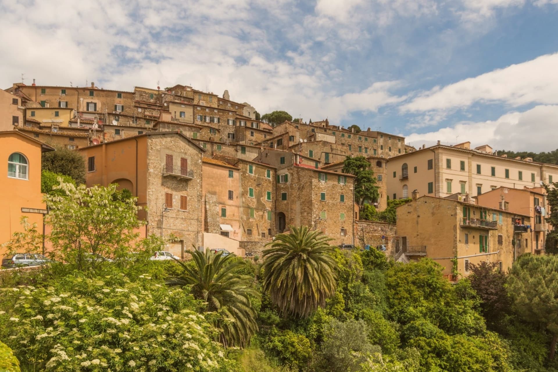
Why visit Campiglia Marittima
Campiglia Marittima sits at 231 meters on the last slopes of the Colline Metallifere above the Val di Cornia, eight kilometers inland from the Tyrrhenian coast and 60 kilometers southeast of Livorno. The Rocca occupies the highest point at 281 meters, a fortified semicircle whose 14th-century tower and town walls trace the medieval defensive line.
The territory has been mined since the Etruscans: copper, silver, lead and tin from the hills behind town, worked continuously until the last galleries closed in 1976. The Parco Archeominerario di San Silvestro, opened in 1996 on 450 hectares behind the town, centers on Rocca San Silvestro, a tenth and eleventh-century miners' village abandoned in the fourteenth century and excavated since 1984.
Visitors enter through restored galleries on a small electric train. Down on the plain the DOC Val di Cornia produces Sangiovese and Cabernet, and the thermal springs at Venturina, the frazione south of town, have flowed since Roman use as Aquae Populoniae.
What to see in Campiglia Marittima
- Rocca di Campiglia. Fortified semicircle at 281 meters with the 14th-century tower, walls and the Pieve di San Giovanni, the highest point of the town.
- Parco Archeominerario di San Silvestro. 450-hectare park behind town, opened 1996, with restored mining galleries, a small electric train, and the abandoned medieval miners' village of Rocca San Silvestro.
- Centro storico. Walled hilltop borgo of stone houses, with Piazza della Repubblica at its center, the medieval gates Porta a Mare and Porta Fiorentina still intact.
How to get to Campiglia Marittima
There is a railway station in the town, so you can arrive without a car and never need one while you are here. Livorno is roughly 67 minutes away by road.
Our tip
May through September is the season on the Val di Cornia: warm days, sea breezes that climb the hill, harvest of Sangiovese and Vermentino from late August. The beaches at San Vincenzo and Baratti are eight to fifteen kilometers away and pull the day-traffic. July and August are hot and busy on the coast; the borgo on the hill stays a few degrees cooler.
More from Anywhere Italy
- The best towns inside a nature park that you can reach by train in Toscana
- The 6 best coastal towns inside a nature park in Toscana
- The 7 best towns inside a nature park that have a serious restaurant in Toscana
 The best hidden coastal towns you can reach by train in Toscana
 The best hidden wine towns with a medieval festival in Toscana
 The best mountain towns in Toscana