
The best mountain towns in the province of Isernia
Upper Molise is built out of limestone and beech wood. The houses are grey stone with heavy lintels, stacked along ridges above valleys that fill with cloud in the early morning, and the roads climb past drystone walls into pasture where sheep still move along the old drove routes, the tratturi, in spring and autumn. This is knife-making country and bell-founding country, and it is caciocavallo and pecorino country, with stracciata cheese pulled by hand and pasta cut with a guitar-string frame. Winter is long and cold here, with some of the heaviest snowfall recorded anywhere in the Apennines, and summer stays cool enough that Neapolitans and Romans come up for the air.
Most people who set out for the central Apennines end up on the Abruzzo side of the border, at Roccaraso and Rivisondoli, or inside the Parco Nazionale d'Abruzzo, Lazio e Molise on the well-signed Pescasseroli approach. The ski lifts, the hotel blocks and the coach parks are all concentrated there, and in February and August the Altopiano delle Cinque Miglia moves slowly. The mountains deserve the attention. The problem is that the attention arrives all at once, in the same weeks, on the same handful of roads.
The same range keeps going south and west into the province of Isernia, past the border, and the geology does not change when the province does. Beech forest, high meadow, black pine on the Pescopennataro slopes, the Matese massif with its lake and its wolves, the Mainarde rising in a wall above Castel San Vincenzo. The towns on these slopes have fewer beds, fewer lifts and fewer visitors, and several of them sit above the snow line for months. They are listed below.
Of the 14 communes we have mapped in the province of Isernia, 7 qualify as mountain towns: each sits in the mountains. The smallest, Pescopennataro, has 239 residents.
If you are still choosing, we have also written The best high-altitude villages in the province of Isernia and The best towns inside a national park in the province of Isernia.
Pescopennataro
Why visit Pescopennataro
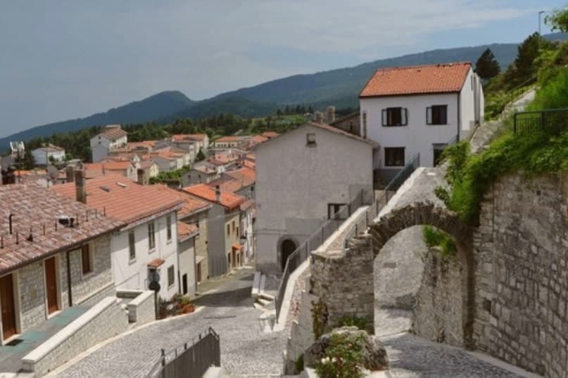
Pescopennataro sits at 1,190 meters in Alto Molise, twelve kilometers north of Capracotta on the same ridge above the Sangro valley. The village is nicknamed il paese della pietra e degli abeti, the village of stone and firs: most of its buildings are made from local stone and Pescopennataro carries a school of stonemasons and sculptors documented from the 1700s.
Below the village, the Bosco degli Abeti Soprani is one of the most important high-altitude fir forests in southern Italy and one of the rare survivals of natural white fir, Abies alba, in the southern Apennines. The commune holds 239 residents and a single Borghi Autentici badge.
The walking trails into the Abeti Soprani run north toward the Eremo di San Luca, a small hermitage in the forest; the same trails ski-tour in winter. Few inland villages in Molise sit higher.
The village sits at 1190 metres.
What to see in Pescopennataro
- Bosco degli Abeti Soprani. High-altitude white-fir forest below the village, one of the rare natural Abies alba survivals in the southern Apennines.
- Centro storico. Tightly built stone village at 1,190 meters, with buildings carved from the local limestone by generations of village stonemasons.
- Eremo di San Luca. Small forest hermitage on the trail north of the village, in the heart of the Abeti Soprani fir woods.
How to get to Pescopennataro
Pescara is roughly 98 minutes away by road.
Our tip
June through September is the summer season for Pescopennataro. The Abeti Soprani trails clear of snow by late May and the village fills again with emigrant families through August. December through March is the winter season: ski-touring on the trails through the firs, the village locked tight against the wind, the stove on.
Pizzone
Why visit Pizzone
Pizzone sits at 724 meters on the eastern flank of the range that closes the northern edge of Molise against the Abruzzo border. In 1990 the commune ceded part of its territory to the national park, together with Castel San Vincenzo, Rocchetta a Volturno, Filignano and Scapoli, adding high pasture and beech forest to what became the Mainarde sector.
The karst plateau on Pizzone's own territory is one of the signature high meadows of the southern Apennines. The Volturno springs at the foot of the range and the Rio Jemmare that crosses Pizzone feed the lake just below the village.
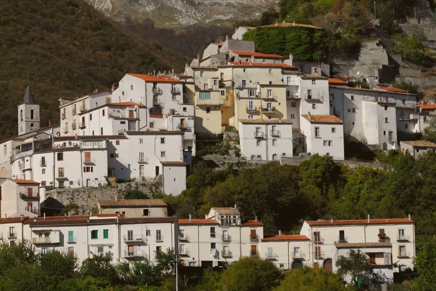
The village itself is small, stone houses set on a ridge under the peaks, with the church at its centre. A few kilometers north stands the abbey of San Vincenzo al Volturno.
Pizzone reads as a mountain edge settlement: its territory gave ground to the park and kept the high meadow, while the water descending from its slopes shapes the lake and the abbey site below.
The village sits at 724 metres.
What to see in Pizzone
- Mainarde. Limestone mountain range on the Abruzzo-Molise border, the Molise sector of the Parco Nazionale d'Abruzzo, Lazio e Molise.
- Pianoro delle Forme. Karst high meadow on Pizzone's territory, one of the signature plateaus of the southern Apennines and a summer pasture for grazing flocks.
- Lago di Castel San Vincenzo. Turquoise artificial lake at the foot of the range, four kilometers downhill from the village.
How to get to Pizzone
Napoli is roughly 115 minutes away by road.
Our tip
May through October is the open season for Pizzone. The Mainarde trails clear of snow by late May and stay walkable into October. June through September is peak: alpine flowers on the Pianoro delle Forme in early summer, summer pasture in July and August, the first turning of the beech woods in late September.
Castel San Vincenzo
Why visit Castel San Vincenzo
Castel San Vincenzo sits at 749 meters in the upper Volturno valley, in the Parco Nazionale d'Abruzzo, Lazio e Molise, fifteen kilometers northwest of Isernia. The village shares its name and its territory with the Abbazia di San Vincenzo al Volturno, a Benedictine monastery founded in the eighth century near the river source.
Charlemagne granted it fiscal and jurisdictional privileges; by the early ninth century it housed more than three hundred monks and held estates across central and southern Italy. Saracen raiders sacked it in 881, killing the abbot.
The community returned in 914 and rebuilt across the river in a defensible position, and Pope Paschal II consecrated the new abbey church in 1115. The standout survival is the Cripta di Epifanio, frescoed between 824 and 842 with one of the most important ninth-century cycles in Europe.
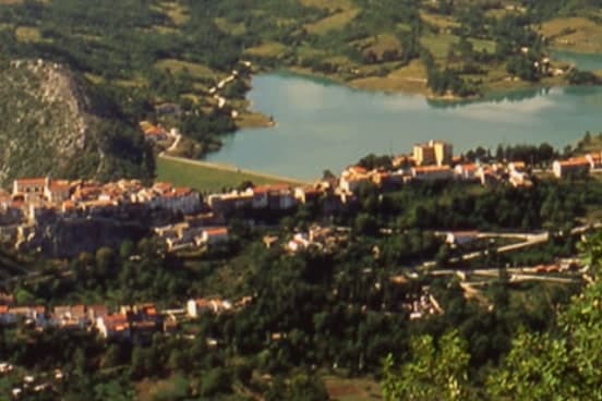
World War II bombing damaged the site again. Below the village, the artificial Lago di Castel San Vincenzo, built in the 1950s for hydroelectric use, reflects the Mainarde peaks.
The village sits at 749 metres.
What to see in Castel San Vincenzo
- Abbazia di San Vincenzo al Volturno. Benedictine abbey founded in the eighth century, one of the most powerful in medieval Europe; current church consecrated in 1115.
- Cripta di Epifanio. Frescoed crypt built by Abbot Epiphanius between 824 and 842, one of the most important Carolingian fresco cycles in Europe.
- Lago di Castel San Vincenzo. Artificial lake built in the 1950s for a hydroelectric plant, with the Mainarde mountains reflected in its water.
How to get to Castel San Vincenzo
Napoli is roughly 104 minutes away by road.
Our tip
May through October is the season at 749 meters. The Mainarde trails open, the lake reaches full level, and the abbey complex is reachable on foot from the village in a long morning. June and September give the clearest air.
Capracotta
Why visit Capracotta
Capracotta sits at 1,421 meters in Alto Molise, the second-highest commune near the centre of Italy and the forty-first highest in the country. On 5 March 2015 a single 24-hour snowfall dropped 2.56 metres on the village, a Guinness world record that has not been broken since.
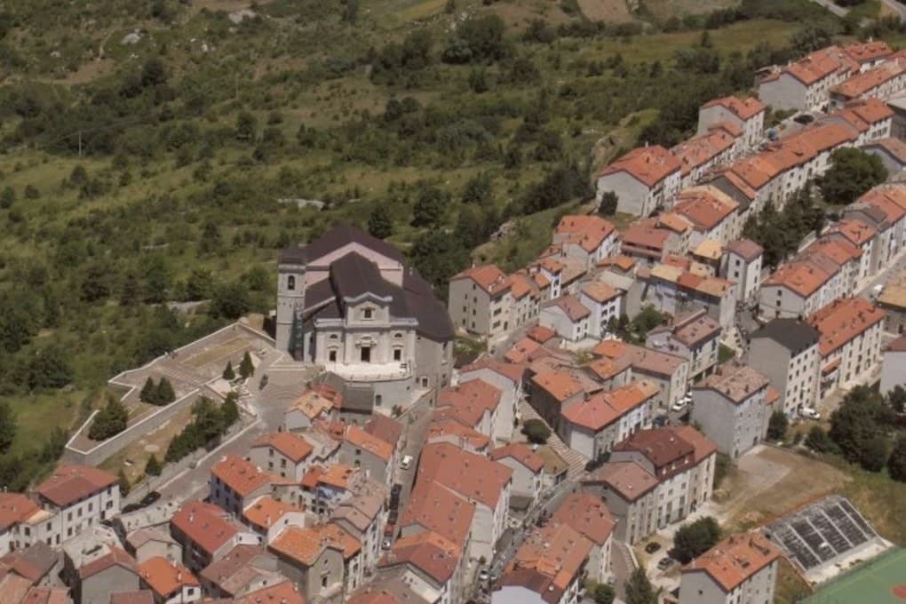
Cross-country skiing has been the winter discipline here for decades: the Prato Gentile plateau, set among beech woods at the head of the village, holds the Mario Di Nucci ski trail and hosted the Italian National Cross-Country Ski Championships in 1997. The village itself is stone, narrow and tightly packed against the wind, eight hundred residents in winter and roughly twice that in August when emigrant families return.
The summer pasture, the wildflowers on the Prato Gentile, and the wide views into Abruzzo make Capracotta as much a June-to-September place as a December-to-March one. The shoulder months stay cold and quiet.
The village sits at 1421 metres.
What to see in Capracotta
- Prato Gentile. Beech-fringed plateau above the village, home to the Mario Di Nucci cross-country ski trail and host of the 1997 Italian national championships.
- Monte Campo. Local peak above the village, the high ground that funnels the snow systems and gives Capracotta its record-setting winter precipitation.
- Centro storico. Tightly packed stone village built against the wind at 1,421 meters, with low arches and short streets that funnel the snow off the roofs.
How to get to Capracotta
Pescara is roughly 110 minutes away by road.
Our tip
Capracotta has two seasons. June through September is the high pasture and walking season: temperatures rarely cross twenty-five degrees even in August, the Prato Gentile fills with wildflowers, and the village swells to twice its winter size when emigrant families return for the August fiesta. December through March is the snow season, when the cross-country trails open on the Prato Gentile and the village turns to skiing and the stove. Sagra della pezzata falls in August.
Roccamandolfi
Why visit Roccamandolfi
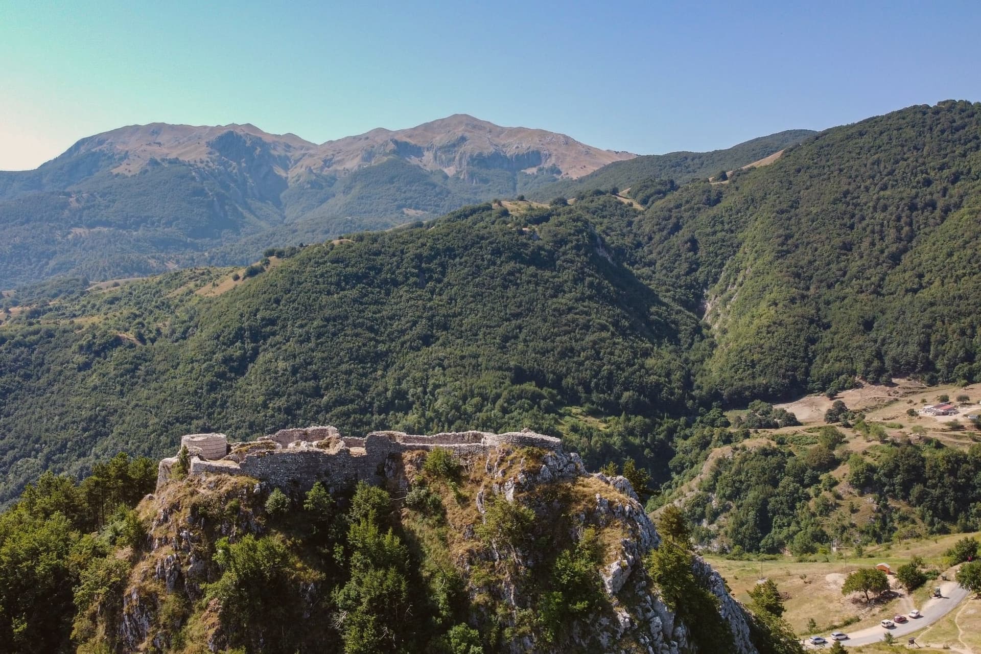
Roccamandolfi sits at 850 meters on the Molise flank of the Matese massif, the high karst range that separates the region from Campania, with Monte Miletto rising above it to the west. The Samnites held this ground before Rome.
The village itself reads as two layers stacked on the slope: the ruined castle on the hill above, and the centro storico below it gathered around the parish church, with the woods beyond still marked by the paths the nineteenth-century brigands used and the village now retraces with its documentation centre and signed route. The Callora stream cuts a canyon below the settlement, and the suspension bridge that now crosses it sits at the start of a trail running up toward the Sentiero dei Fringuelli, so the walk out of the village leads a hiker from the ruins on the hill, past the memory of the brigands in the streets, and out over the canyon toward the mountain itself.
A Lombard rock, a resisted emperor, a century of outlaws in the woods, and a modern steel span: the village has kept building new reasons to climb the same slope.
The village sits at 850 metres.
What to see in Roccamandolfi
- Castello Longobardo. Ruined fortress on the hill above the village, demolished in 1223 by order of Frederick II after its lord defied imperial authority. The broken walls are still the first thing seen against the skyline from the houses below.
- Ponte Tibetano. The suspension deck sways over open air where the Callora canyon drops away beneath it, at the start of a marked Matese trail.
- Monte Miletto. Highest peak of the Matese at 2,050 meters, the western anchor of the range that frames the village.
How to get to Roccamandolfi
Napoli is roughly 147 minutes away by road.
Our tip
May through October is the window for Roccamandolfi. The Matese trails open, the Tibetan bridge sees its busiest months, and the temperature at 850 meters stays mild through August while the lowlands swelter. June and September give the clearest light off Monte Miletto.
Frosolone
Why visit Frosolone
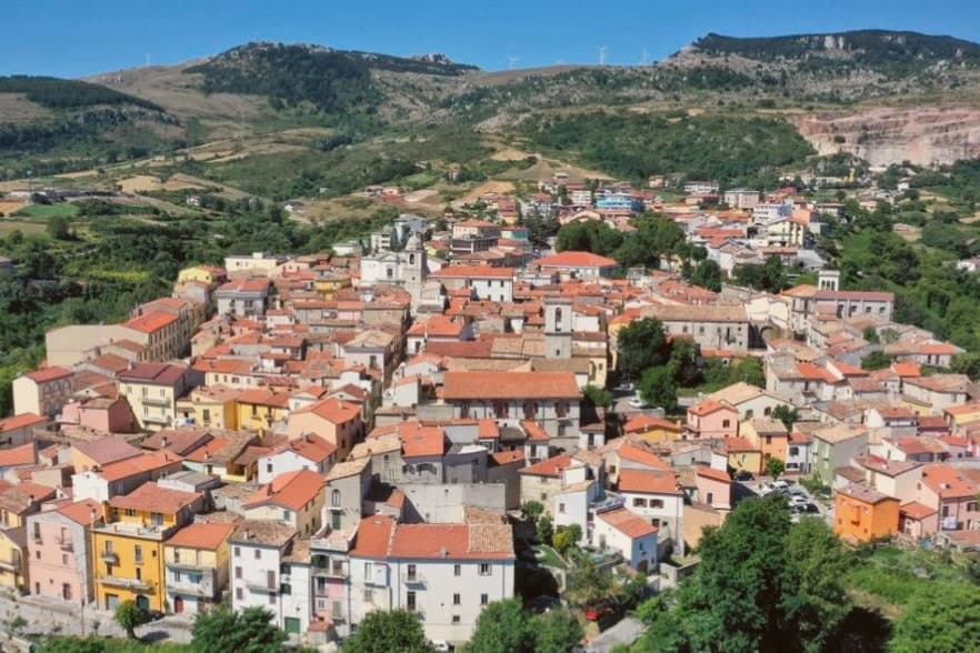
Frosolone sits at 894 meters in the Matese foothills, twenty kilometers east of Isernia. The town's economy has been forged in steel for two centuries: the early 1800s turned an older tradition of metalworking into industrial production of knives, scissors and scalpels, and through most of the nineteenth century Frosolone blades competed with the more famous workshops of Toledo.
A few family forges still operate, and the Museo dei Ferri Taglienti at the entrance to the centro storico holds hundreds of pieces donated by the heirs of the leading nineteenth-century cutlers. The village itself is stone, narrow streets winding up to a ridge at the foot of the Civita di Frosolone plateau, with views over the Tammaro and Volturno valleys.
Frosolone is one of two Borghi più belli in this part of Molise and a Bandiera Arancione on top, recognition for a town whose craft has outlasted its industry.
The village sits at 894 metres.
What to see in Frosolone
- Museo dei Ferri Taglienti. Town museum dedicated to the blade craft, with hundreds of knives, scissors and scalpels donated by the families that ran the nineteenth-century forges.
- Centro storico. Stone houses winding up the ridge from the main piazza, with the iron-shop signs and family forges still operating on the side streets.
- Civita di Frosolone. Limestone plateau above the town with sweeping views over the Tammaro and Volturno valleys, a favorite walk for residents on summer evenings.
How to get to Frosolone
Pescara is roughly 129 minutes away by road.
Our tip
May through October is the open season at 894 meters: temperatures rarely climb past twenty-eight in August, and the Civita plateau above the town is a favorite walk for residents on summer evenings. The annual Mostra Mercato dei Coltelli, the blade fair that brings family forges out of the workshops and into the piazza, runs in early August. November through April is quiet and often cold; snow can close the road up from Isernia for short stretches in January and February. Sagra baccalà e peperuol falls in August.
Agnone
Why visit Agnone
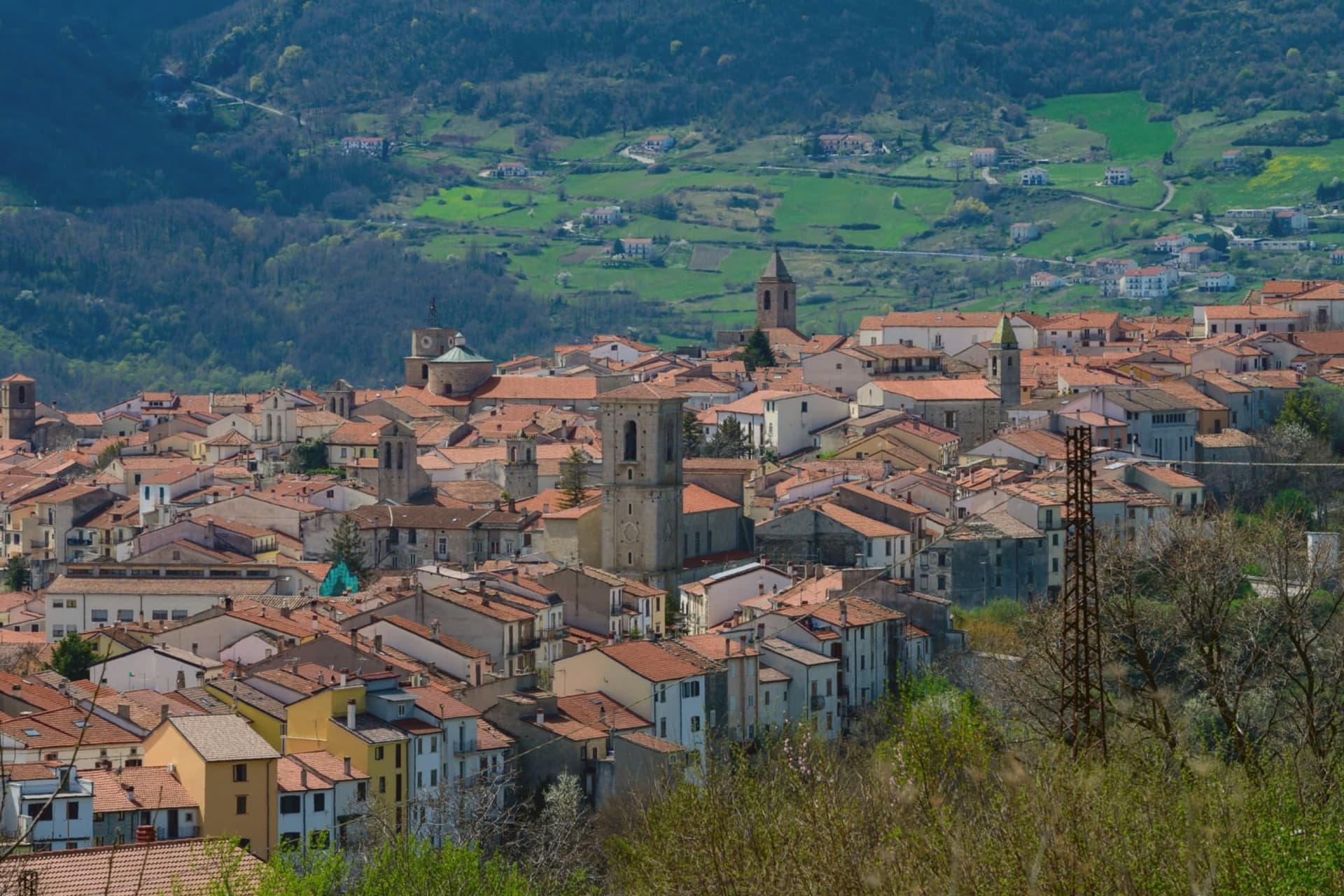
Agnone sits 53 kilometers northwest of Campobasso. The Samnite Pentri held this ground, and the name is said to derive from Aquilonia, the city Papirius burned on his way to Bovianum.
The most important pre-Roman document found in the region, the Tabula Osca, a bronze inscription in Oscan dated to the third century BC, was unearthed in 1848 at Fonte di Romito between here and Capracotta, and now sits in the British Museum. The town is called the Athens of the Sannio for the density of this archaeological record, and the stone centro storico runs along a ridge in the Alto Molise, its churches and workshops a legacy of the bell-casting trade that has occupied the town for centuries.
What the finds at Fonte di Romito and the bells cast in the same streets share is continuity: a settlement that has kept working the same ground, in bronze and stone, since before Rome held it.
The village sits at 840 metres.
What to see in Agnone
- Pontificia Fonderia Marinelli. Granted pontifical status in 1924; bells cast here hang at the UN, the FAO, and St Peter's Square, alongside Beijing and Jerusalem.
- Chiesa di Sant'Emidio. Town church in the centro storico, with works tied to the long ecclesiastical history that earned the town its epithet as the Athens of the Sannio.
- Centro storico. Stone old town along a ridge in the Alto Molise, dense with churches and workshops from the bell-casting trade.
How to get to Agnone
Pescara is roughly 114 minutes away by road.
Our tip
May through October is the open window in Agnone. The Alto Molise green comes in late spring, and June and September give the steadiest hiking weather toward Pietrabbondante and the surrounding ridges. July and August stay cooler than the coast at 840 meters. Fiera casearia falls in the season.
More from Anywhere Italy
- The best high-altitude villages in the province of Isernia
- The best towns inside a national park in the province of Isernia
- The best small towns inside a national park in Molise
 The best towns that eat well in the province of Isernia
 The 10 best hidden mountain towns in Calabria
 The 6 best mountain towns in the province of Palermo