
The best lake towns in the province of Brescia
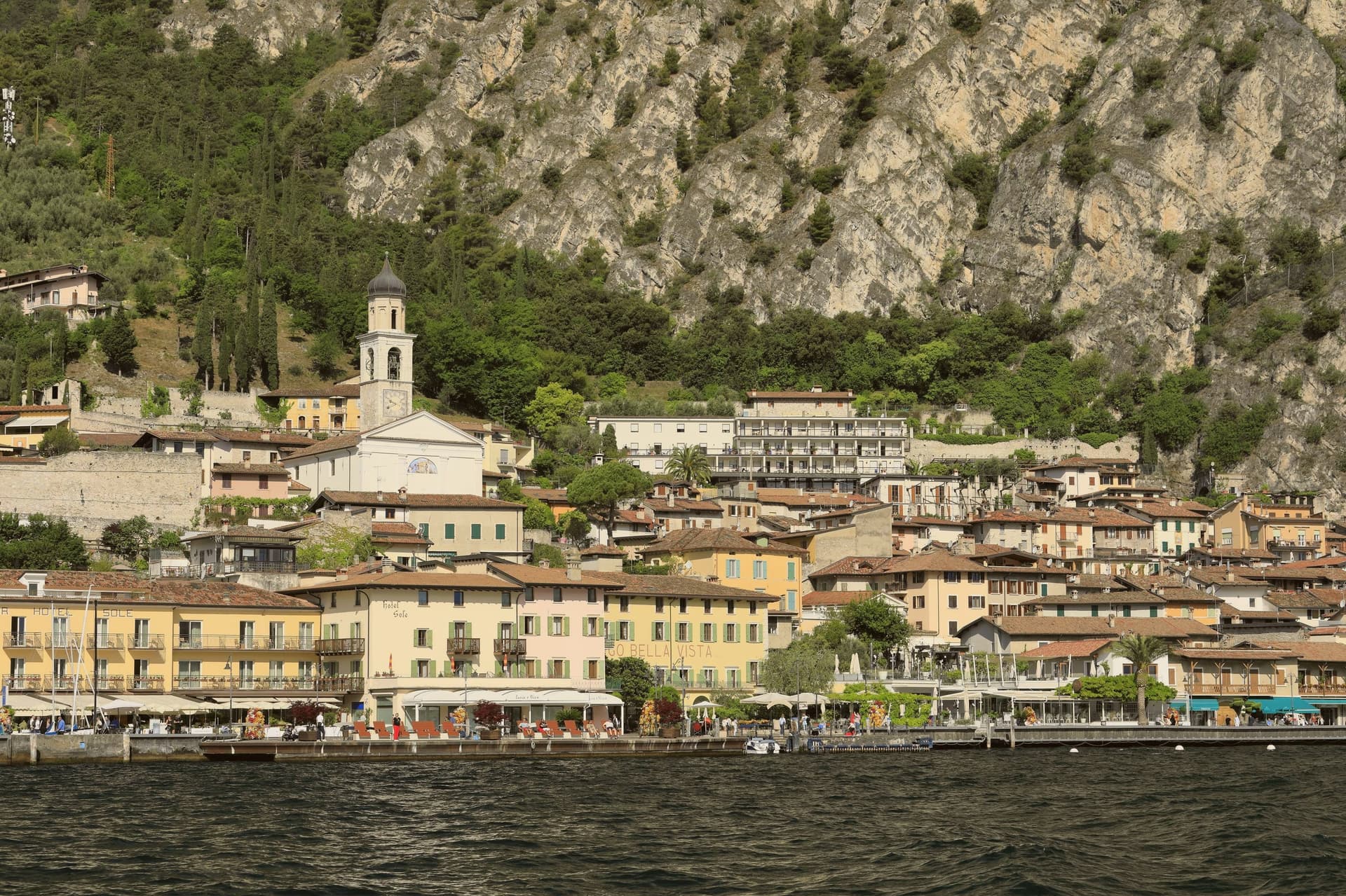
The province of Brescia gets the good side of two lakes. On Garda's western shore the mountains drop almost straight into the water, and the towns are built in pale limestone and stucco the colour of butter, stacked on terraces where lemons were once grown under wooden frames that still stand in ruins above the road. Olive oil comes off these slopes, some of the most northerly in the world, and it tastes thin and grassy next to anything from the south. Lake Iseo, over the ridge to the west, is quieter and greener, ringed by reed beds and vineyards on the Franciacorta side, where the sparkling wine is made by the same method as champagne. Late spring and September are the seasons, when the water is warm enough to swim and the ferries still run on a full timetable.
Most people arriving from Milan or Verona head for the eastern shore of Garda and the theme parks around Peschiera, or push north into Trentino for Riva del Garda and the windsurfing at Torbole. Those places are busy for good reasons: big beaches, the wind that arrives on schedule every afternoon, hotels that have handled crowds for a century. In August the lakeside road becomes a queue and the car parks fill by mid-morning. Verona and its arena pull much of the same traffic through, so the whole eastern corridor moves as one crowd.
The same water continues along the Brescian side, and the shoreline there is longer, steeper and better supplied with small harbours. Ferries connect most of it, which means a day can be spent moving between towns without a car at all. The towns below sit on Garda and on Iseo, some of them on cliffs above the lake, one of them on an island in it. Fewer people go, and the swimming is the same lake.
Of the 17 communes we have mapped in the province of Brescia, 10 qualify as lake towns: each sits on a lake shore. The smallest, Limone sul Garda, has 1,130 residents.
Elsewhere in the catalogue: The 8 best hidden towns that eat well in the province of Brescia and The best lake towns that eat well within 90 minutes of Brescia.
Limone sul Garda
Why visit Limone sul Garda
Limone sul Garda sits on the western shore of Lake Garda at the foot of vertical limestone cliffs, the northernmost commercial lemon-growing town in the world at almost 46 degrees north. The Latin limes, meaning border, gave the place its name; the Bettoni counts gave it its industry.
From the seventeenth century, limonaie, stone-pillared greenhouses heated and covered through winter, allowed lemons to be exported to Austria, Germany, Poland and Russia. The road to Riva del Garda, the Gardesana Occidentale, was carved into the cliff and finished in 1932; until then the town reached the outside world by boat or mule track.
In 1974 a Milanese pharmacologist traced a mutant apolipoprotein, ApoA-1 Milano, to a single eighteenth-century resident, Giovanni Pomarelli. Roughly forty of his descendants in town carry the variant, which suppresses cardiovascular disease and helps a handful of residents past one hundred.
The town sits on the water, at 65 metres.
What to see in Limone sul Garda
- Limonaia del Castèl. Restored seventeenth-century lemon greenhouse on stone pillars above the lake, demonstrating the heated wooden cover that protected the trees through winter.
- Chiesa di San Benedetto. Eighteenth-century parish church on the lake front, with a single nave and Baroque altars rebuilt over an older medieval foundation.
- Centro storico. Tight grid of stone alleys between the old harbour and the cliff, with narrow porticoes that survive from the pre-road fishing and citrus village.
How to get to Limone sul Garda
Trento is roughly 57 minutes away by road.
Our tip
April through June and September into October are the months that suit Limone. The lake holds spring temperatures, the lemons flower, the cliff above the town keeps morning shade until noon. July and August fill the lakefront and the cycle path, with peak crowds on weekends drawn from Verona, Milano and German-speaking Europe.
Monte Isola
Why visit Monte Isola
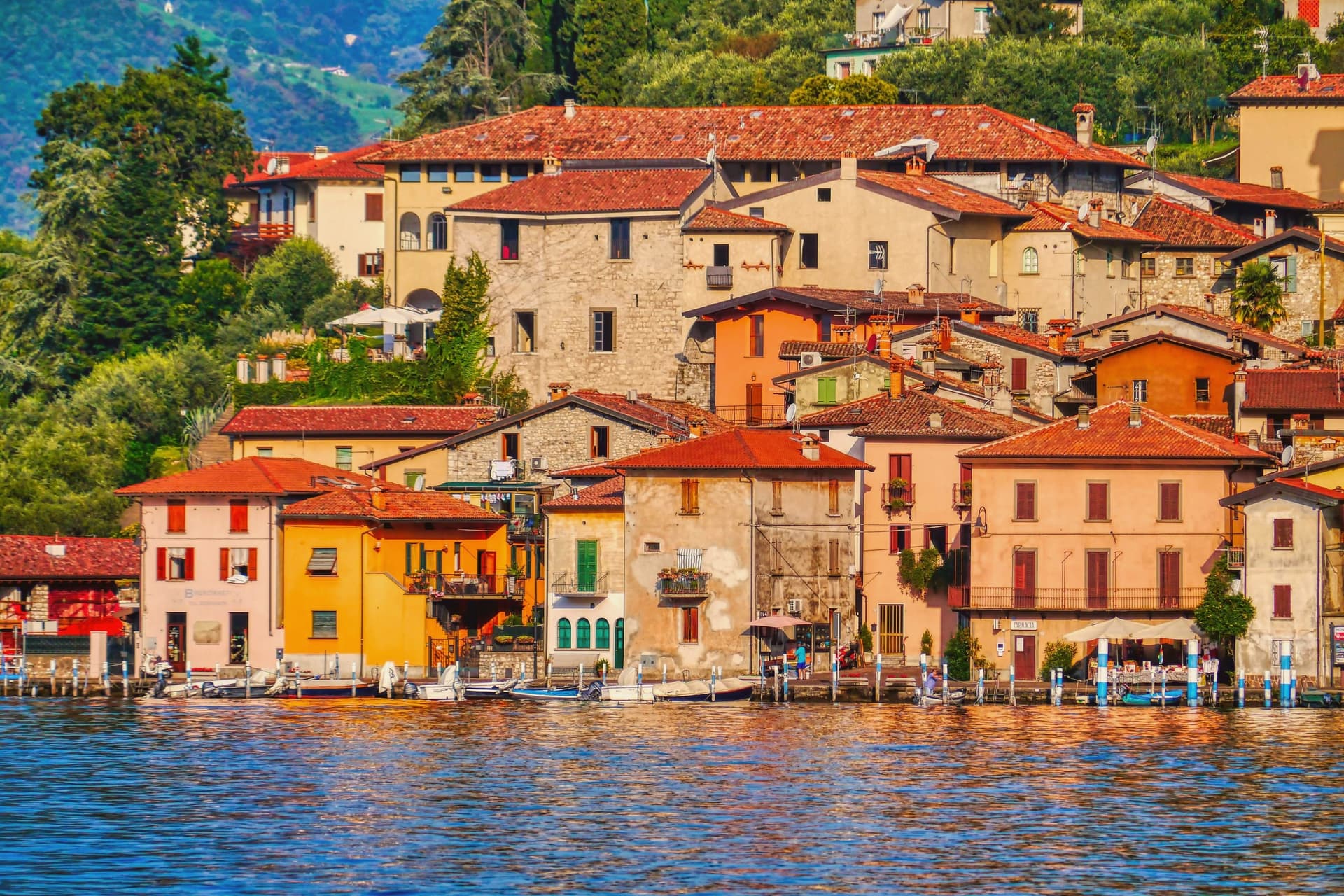
Monte Isola covers 4.5 square kilometers in the middle of Lake Iseo, the largest lake island in southern and central Europe. Eleven villages and hamlets line the shore and climb the slopes: Peschiera Maraglio and Sensole on the south, Siviano on the north, with smaller settlements between.
The Madonna della Ceriola sanctuary stands at 600 meters at the summit, documented in 1410 but built older, holding a twelfth-century wooden sculpture of the Virgin and Child. No private cars are allowed on the island; mopeds, bicycles and feet are the way around.
The Comune still keeps the small island of San Paolo and the privately owned Loreto as part of its territory. Fishing nets are still woven here by hand for use across the lakes of northern Italy, and wooden boats are still built by a handful of craftsmen in Peschiera Maraglio.
In summer 2016, Christo and Jeanne-Claude floated their orange piers from Sulzano to the island, drawing 1.2 million visitors in sixteen days.
The town sits on the water, at 600 metres.
What to see in Monte Isola
- Santuario della Madonna della Ceriola. Pilgrimage church at the summit, 600 meters above the lake, holding a twelfth-century wooden Virgin and Child and reached only on foot from Cure.
- Peschiera Maraglio. Main lake-side village on the south of the island, with the ferry landing, the boatyards and the long stone lakefront facing San Paolo.
- Siviano. Capital of the comune on the north of the island, a fortified medieval hamlet with tower houses, narrow streets and the parish church.
How to get to Monte Isola
There is a railway station in the town, so you can arrive without a car and never need one while you are here. Brescia is roughly 48 minutes away by road.
Our tip
April through October is the season Monte Isola is built for. May, June, September and early October are the best months: ferries run on schedule, the perimeter road is open to bikes, the Ceriola climb is dry. July and August bring weekend day-trippers from Brescia, Bergamo and Milano, especially Sundays; the ferries fill and Peschiera Maraglio is at capacity by mid-morning.
Tremosine sul Garda
Why visit Tremosine sul Garda
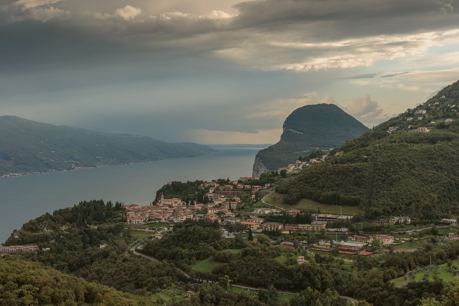
The plateau sits above the strip of road called the Gardesana Occidentale, its cliff edge dropping straight to the water. The commune divides into 18 frazioni scattered between that edge and the Alpe di Tremosine inland; Pieve, the capoluogo, holds the town hall and the Borghi più belli listing, while Campione del Garda, down at lake level, is the one frazione with direct shore access and a windsurfing beach.
The distance between Pieve on its cliff and Campione on the water is the whole shape of the place: a plateau town with a single foothold on the lake itself. The only road climb from that shore is the route designed by Arturo Cozzaglio of Tremosine and built between 1908 and 1913 through the gorge carved by the Brasa stream: 200 meters of vertical, tunnels and switchbacks cut through limestone.
Winston Churchill called it the eighth wonder of the world. The Tignale and Limone communes are close on either side along the cliff.
What holds Tremosine together, then, is verticality: a plateau of hamlets, a single road up from the water, and a capoluogo that sits at the edge looking straight down.
The town sits on the water, at 414 metres.
What to see in Tremosine sul Garda
- Pieve. Capoluogo and one of the Borghi più belli d'Italia, on the limestone cliff edge at 413 meters directly above the lake.
- Terrazza del Brivido. Concrete platform at the Hotel Paradiso, suspending visitors over the void with a full view of the southern Lake Garda.
- Strada della Forra. 5.8-kilometer cliff road by Arturo Cozzaglio, built 1908-1913 through the gorge of the Brasa stream; used in Quantum of Solace.
How to get to Tremosine sul Garda
Trento is roughly 117 minutes away by road.
Our tip
April through October is the lake season. The Strada della Forra is open for cars and motorbikes, the Terrazza del Brivido draws weekend traffic, and the cliff air keeps Pieve cooler than the lake floor. July and August are the busiest months, with the Bond-road crowd and the European motorcycle riders.
Gardone Riviera
Why visit Gardone Riviera
Gardone Riviera sits at 71 meters on the western shore of Lake Garda, in the province of Brescia. The lake here runs deep against the wall of Monte Pizzocolo, and the climate stays mild enough that lemons, olives and bamboo grow within walking distance of each other.
The town divides between the lakefront and the hill above it. Along the water, Gardone Sotto holds the promenade and harbour; above the centro storico, the ground rises toward the estate grounds and, further up, toward the garden that has drawn on the same mild hillside climate since the start of the twentieth century.
The boathouse on the estate holds a torpedo boat from a 1918 wartime raid, alongside the villa called the Prioria, an amphitheatre and a circular mausoleum. The garden above town spent six decades being arranged, one man working a single hillside into bamboo groves, alpine ravines, Japanese ponds and waterfalls.
The lakefront promenade carries the Bandiera Blu. What holds the town together is that division of altitude: a working lakefront below, and above it two hillside projects, one architectural and one botanical, each built slowly and by a single hand over decades on the same slope.
The town sits on the water, at 71 metres.
What to see in Gardone Riviera
- Vittoriale degli Italiani. Nine-hectare hillside estate occupied by Gabriele D'Annunzio from 1922 to 1938, with villa, amphitheatre, mausoleum and the cruiser Puglia.
- Nave Puglia. Protected cruiser of the Regia Marina set into the slope above the lake, gifted to D'Annunzio in 1923 and assembled on land at the Vittoriale.
- Giardino Botanico Hruska (Heller Garden). Botanical garden begun around 1901 by Arturo Hruska, with bamboo, Japanese ponds, alpine ravines and waterfalls on a single hillside.
How to get to Gardone Riviera
Brescia is roughly 53 minutes away by road.
Our tip
April through June and September into October are the months western Garda works best. The Vittoriale grounds are walkable, the Heller Garden is in full bloom, and the ferry between Salò and Riva del Garda runs regular service. July and August fill the lakefront with day-trippers and the Vittoriale amphitheatre hosts its summer opera season; afternoons get warm but the lake breeze holds steady.
Manerba del Garda
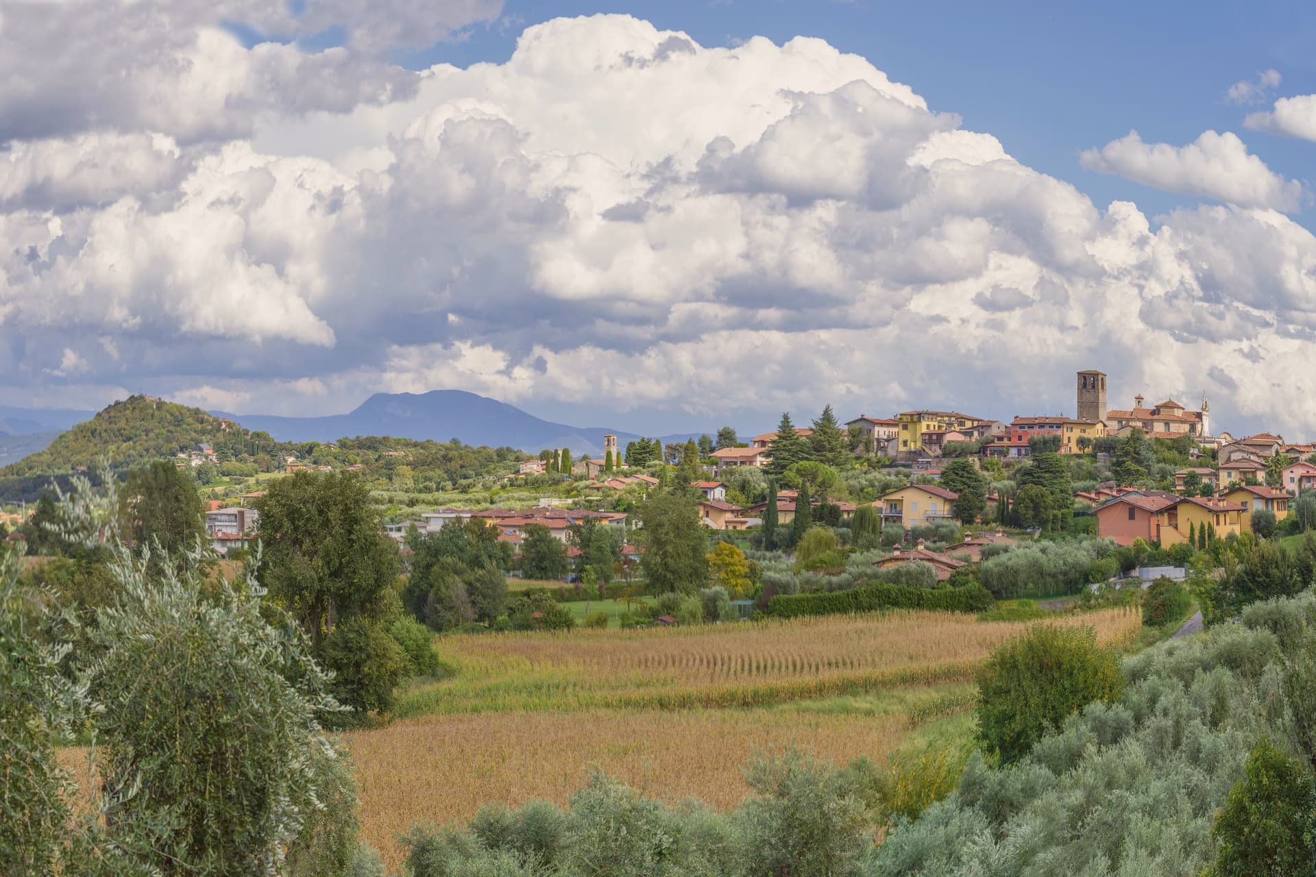
Why visit Manerba del Garda
Manerba sits in the Valtenesi, between Salò and Desenzano. The name comes from a Roman temple to Minerva that once stood on the limestone spur now called the Rocca, which reads from kilometers away and rises above Lake Garda.
The hill carries its layers stacked rather than scattered: a Bronze Age settlement, the Minerva temple foundations, and the twelfth-century castle of the Valtenesi feudal lords, demolished by the Republic of Venice in 1574, all on the same outcrop. The village below relates to that cliff the way a working shoreline relates to a landmark it grew up beneath: the pile-dwelling sites documented in the park spread along the water, the beaches at Punta Belvedere and Porto Torchio sit within the same protected boundary, and the vineyards on the hills behind produce the Chiaretto that the area bottled before others in Italy did.
What this adds up to is a small stretch of shore where prehistoric, Roman, medieval and agricultural layers all sit within walking distance of each other, none of them requiring a detour to reach.
The town sits on the water, at 132 metres.
What to see in Manerba del Garda
- Rocca di Manerba. Bronze Age, Roman and medieval ruins stacked on the same hill, with a clifftop walk that takes in the layers underfoot as much as the view.
- Parco Archeologico Naturalistico. UNESCO-listed park covering the cliff's prehistoric pile dwellings, the temple foundations and the castle remains, the ground on which the rest of the site's history sits.
- Isola di San Biagio. Locally called Isola dei Conigli, offshore from the western shore, crossed on foot through shallow water in summer.
How to get to Manerba del Garda
Brescia is roughly 49 minutes away by road.
Our tip
April through October is the lake's working season. The Rocca and the archaeological park open in April; the water warms enough for swimming in June, peaks in August at around 26 degrees, and stays usable into early October. July and August bring the largest crowds from Germany and Austria, and the parking lots near the park fill by ten.
Toscolano-Maderno
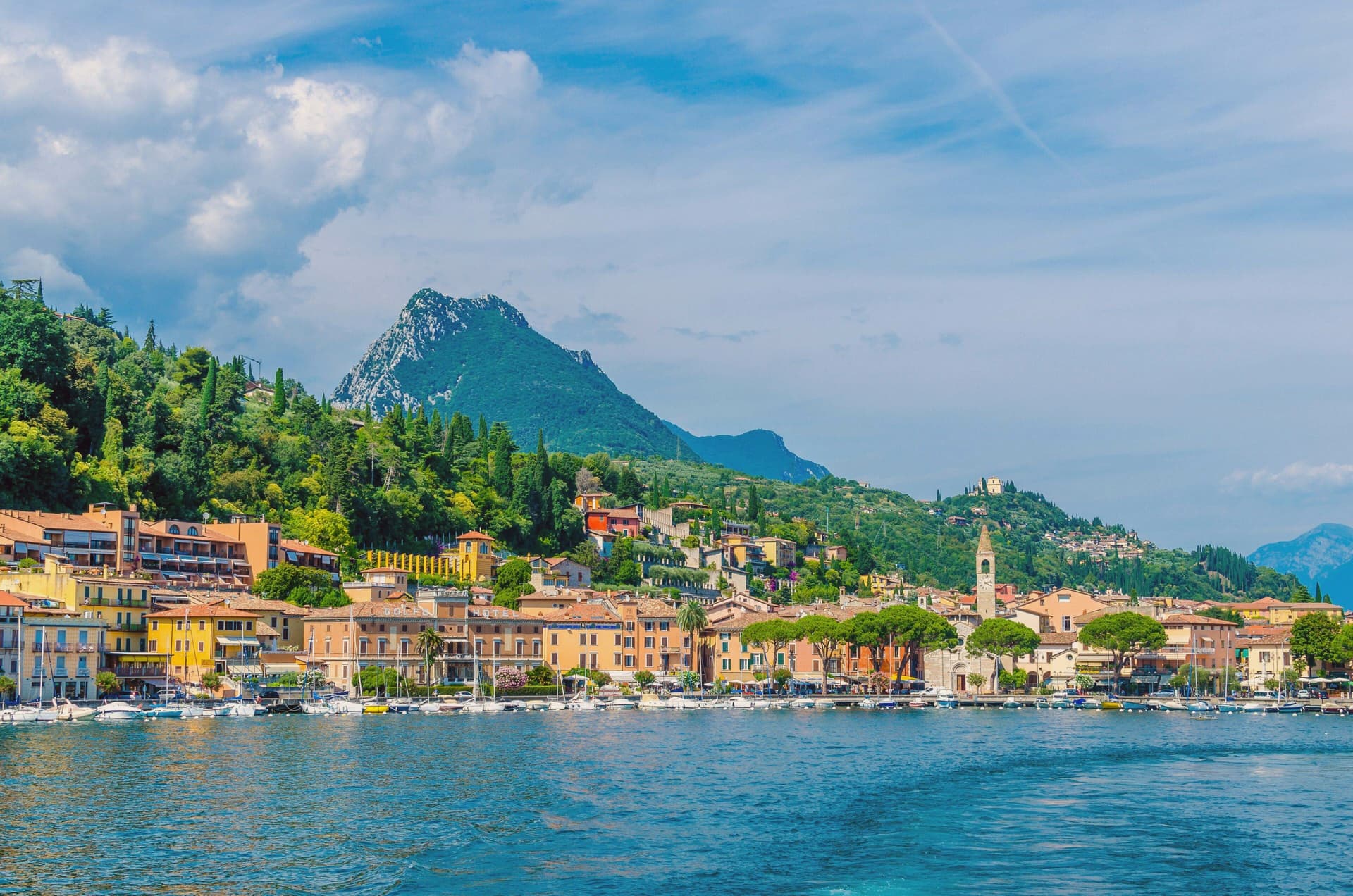
Why visit Toscolano-Maderno
Toscolano-Maderno sits on a wide flat fan on the western shore of Lake Garda, where two old villages, Toscolano and Maderno, face each other across the river that gives the valley its name. They were stitched into a single commune only in 1928, and the split is still legible on the ground: Maderno holds the older administrative and religious weight, Toscolano the industrial valley behind it.
Maderno was once the capital of the Magnifica Patria della Riviera di Salò, until Beatrice della Scala moved the seat to Salò in the 14th century. The town's administrative standing never returned, but paper filled the gap.
Mills had already been working the Toscolano river since around 1300, and by the 15th and 16th centuries they were supplying the printers of the Venetian Republic, their sheets marked with an ox-head watermark and sent out as far as royal libraries. What is left today is a town whose center of gravity moved once, from government to manufacture, and left physical evidence of both: an old civic and religious core in Maderno, an industrial valley cut into the hillside behind Toscolano, and a shoreline that now does the plain work of a lake town, swimming and the ferry crossing, once the mills and the magistrates had both gone quiet.
The town sits on the water, at 72 metres.
What to see in Toscolano-Maderno
- Basilica di Sant'Andrea. Carved portals on the marble facade, the interior kept plain by comparison. It stands over the foundations of the pagan temple it replaced, at the edge of the older quarter of Maderno.
- Chiesa dei Santi Pietro e Paolo. The parish church of Toscolano, rebuilt in 1584 over the remains of an earlier church on the same spot. The frescoed interior is the draw, not the exterior.
- Villa romana dei Nonii. The mosaic floors survive in the open air, set into the lakeside park rather than behind glass, giving a sense of the villa's original footprint.
How to get to Toscolano-Maderno
Brescia is roughly 56 minutes away by road.
Our tip
April through October is Toscolano-Maderno's open season. May and June bring the lake into swimming temperature and the paper-mill valley out of its winter mud. July and August are warm and crowded with German and Austrian families on the lungolago; the ferry to Torri del Benaco runs full.
Sirmione
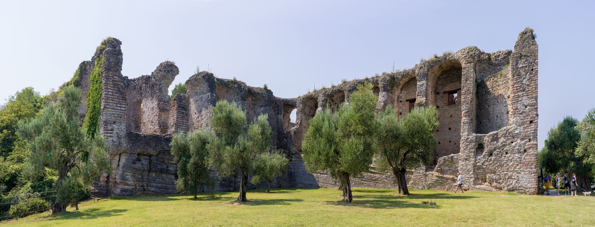
Why visit Sirmione
The peninsula runs four kilometers into the southern end of the lake, narrow enough that the old town occupies a triangle of land just over a mile long. Three low hills organize it: Cortine, San Pietro, and the rise at the tip where the Roman villa stands.
The fortress sits at the single entrance to the walled town, so the only way in by land passes through its gate, and the water it once enclosed as a fortified port is still shut in behind it. Past that gate the medieval streets are packed between the hills, and the ground rises toward the church at the highest point before falling away again toward the villa ruins at the peninsula's end.
The name attached to the villa is literary rather than archaeological: the poet's return in his thirty-first poem was to a family property on this tip of land, and nothing dug from the ground proves the two are the same place, but the name has held for a thousand years regardless. Maria Callas kept a villa here through the 1950s and 60s.
Between the enclosed water at one end and the hot spring at the other, the peninsula reads as a strip of land defined entirely by what edges it: lake on three sides, a gated approach on the fourth, and a history that settled into the name of a poem long before anyone could confirm it belonged there.
The town sits on the water, at 91 metres.
What to see in Sirmione
- Castello Scaligero. Fortress at the entrance to the old town, with a 37-meter keep and a fortified port still enclosing a piece of the lake.
- Grotte di Catullo. Villa complex built late first century BC to early first century AD, its ruins scattered across olive terraces at the tip of the peninsula.
- Terme di Catullo. Thermal spa drawing on the same mineral spring that surfaces offshore in Lake Garda.
How to get to Sirmione
Verona is roughly 36 minutes away by road.
Our tip
April through October is the lake season. The Grotte di Catullo open with the spring archaeological calendar, the Scaligero is open year-round, and the peninsula promenade fills with day-trippers from Verona and the German A22 corridor. July and August are the heaviest months, with the old town packed between ten and seven; April, May, September and October are the easier months.
Iseo
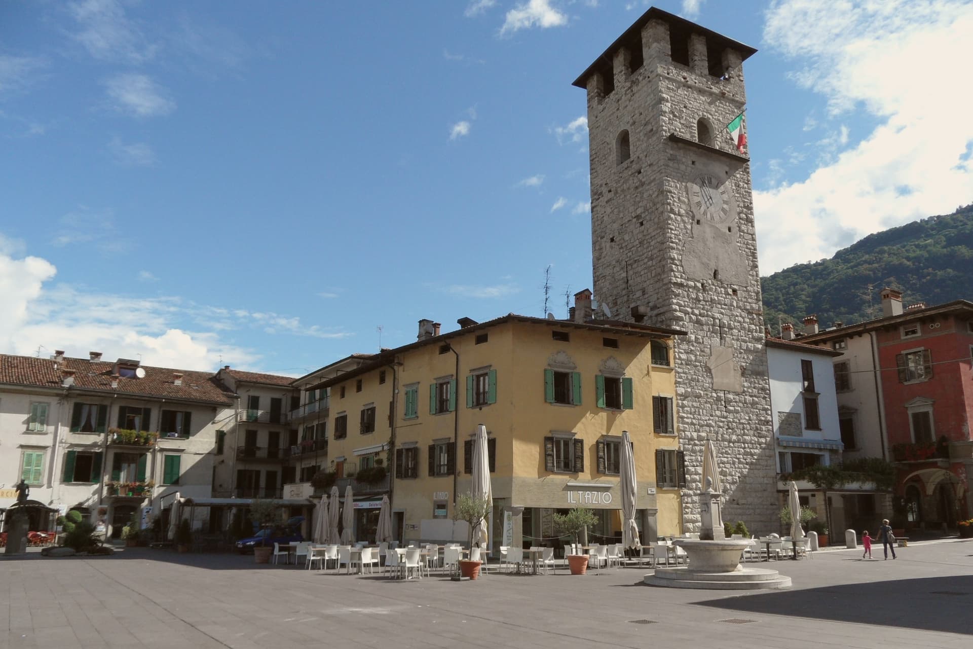
Why visit Iseo
Iseo sits at 198 meters on the southeast shore of Lake Iseo, the fourth-largest lake in Lombardia, fed by the Oglio. The town was founded around a monastery in the 900s and grew under the Sozzi, the Isei, and finally the Oldofredi.
From 1428 to 1797 Iseo was part of the Republic of Venice. The lakefront and the vineyards to the south form the town's two working halves: one facing the water and the ferries that cross it, the other rising into the Franciacorta hills where the metodo classico grapes are grown.
Ferries from the lakefront connect to Monte Isola, the largest lake island in southern Europe, and to Sarnico across the water in Bergamo province. A lake town that turned its inland edge to wine and its waterfront to the island: the two directions, water and vineyard, still define how the town is used.
The town sits on the water, at 198 metres.
What to see in Iseo
- Castello Oldofredi. The stone fortress stands above the lakefront, its walls facing the water rather than the town center, a reminder that it was built to watch the lake approach.
- Pieve di Sant'Andrea. Founded by Bishop Vigilio, the church keeps its bell tower set into the middle of the façade rather than beside or behind it, an arrangement rare among Lombard Romanesque buildings.
- Piazza Garibaldi. Main lakeside square with the first Italian statue of Garibaldi, erected in 1883, the year after his death.
How to get to Iseo
There is a railway station in the town, so you can arrive without a car and never need one while you are here. Brescia is roughly 28 minutes away by road.
Our tip
April through October runs Iseo's lake season. April and May open the ferries to Monte Isola, the Franciacorta wineries reopen for tastings, and the lakefront fills on weekends. June through August is the peak window: warm enough to swim, hot enough that the centro empties between 14:00 and 17:00, and the lake breeze keeps evenings comfortable.
Salò
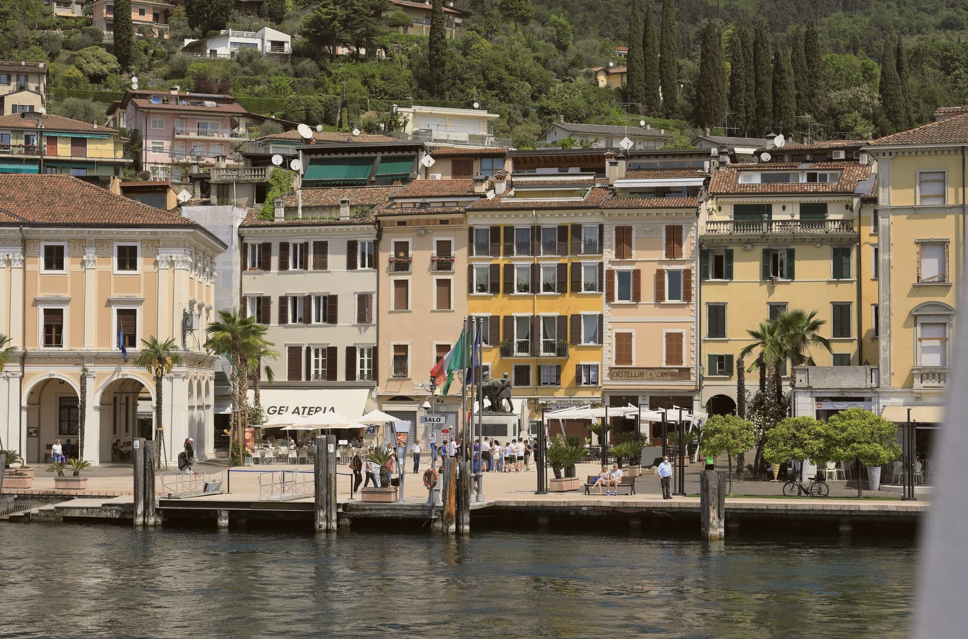
Why visit Salò
Salò sits at 65 meters on the deepest gulf of Lake Garda, between the Brescia hills and the western lakeshore. Ancient Romans founded the colony of Pagus Salodium here; the modern commune separated from Brescia at the end of the 13th century.
From 1334 to 1797, Salò was the capital of the Magnifica Patria, a federation of town councils along the western lakeshore and the Valsabbia, first known as Riperia Lacus Gardae Brixiensis: a name for the same stretch of shore the promenade now runs along. The cathedral's builders left the façade unfinished, a state it remains in above the lakefront where the palace once housed that federation's council.
In 1943-1945 the town lent its name to Mussolini's last German-backed state, headquartered in villas commandeered along that same lakefront. Today Salò runs on tourism, lake events, and the MuSa museum, which opened in 2015 in the former church of Santa Giustina and carries the town's history from the Romans who founded it through the republic that later took its name.
A federation's capital, a commandeered wartime seat, a single waterfront: three centuries of Salò's public life have all faced the same three kilometers of water.
The town sits on the water, at 65 metres.
What to see in Salò
- Duomo di Santa Maria Annunziata. The cathedral's façade was left unfinished, and the rose window dates to 1506-1508. Inside, the scale of the nave explains its old claim to being the largest church on the lake.
- MuSa. Civic museum opened in 2015 in the former church of Santa Giustina, covering Salò and its territory from Roman times through the Italian Social Republic.
- Lungolago. The promenade runs between the central pier and the gulf's southern point, three kilometers of open water on one side and the town's lakefront villas on the other.
How to get to Salò
Brescia is roughly 41 minutes away by road.
Our tip
April through October is the long Garda season. April and May bring camellias along the lungolago, the lake stays mild, and the western coast road is open without the August traffic. June through August is peak season, with hot days, swimming weather, and the lakefront cafés full from morning to midnight.
Lonato del Garda
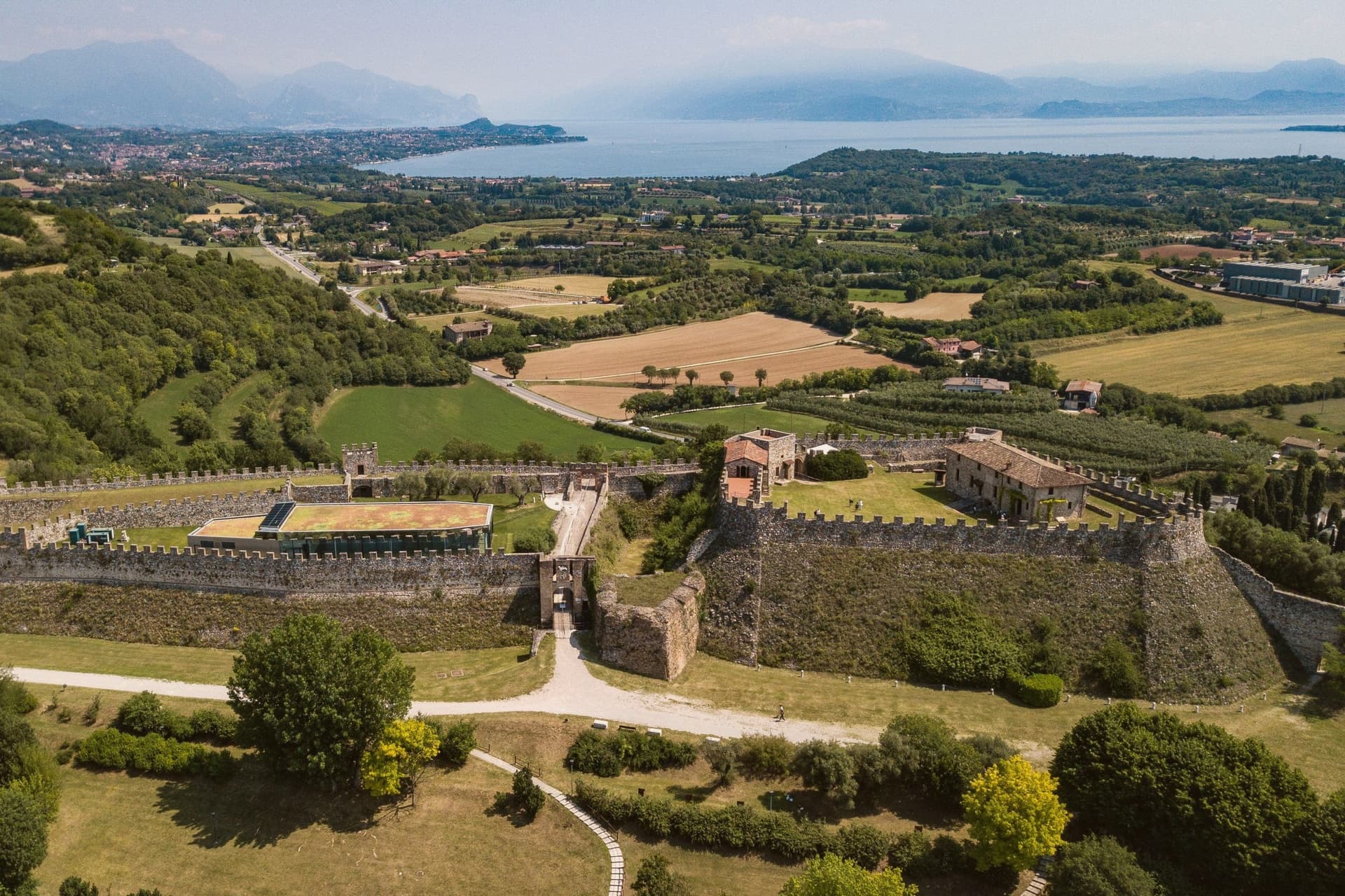
Why visit Lonato del Garda
Lonato del Garda sits on a low morainic hill on the southwestern side of Lake Garda, between Brescia and the Mincio, halfway between Milan and Venice. The castle was raised on the recognition that this rise commanded the surrounding plain, a position the wife of Bernabò Visconti judged worth fortifying.
The Venetian rectors who later governed the town from their seat below the hill were themselves administering territory for a republic that reached this far inland from the lagoon, a detail the building's later life as a private museum has mostly obscured. That seat passed in 1906 to a Brescian senator and his wife, who furnished it room by room rather than converting it into something else, which is why it now reads as a residence rather than an institution.
South of the centre the ground flattens into the vineyards of the Lugana zone, the same morainic soil finishing out toward the lake's edge. The town, then, is a hill town in shape only at its summit: castle above, rectors' house and church at the level below, and the flat wine country taking over where the moraine runs out toward the water.
The town sits on the water, at 188 metres.
What to see in Lonato del Garda
- Rocca di Lonato. The upper structure stands 180 metres long, with the so-called Quartier Generale below it. The walls carry the reshaping of the 15th and 16th centuries over the original 1376 order from Regina della Scala.
- Casa del Podestà. Rooms furnished as left by their restorer, with paintings, sculpture and majolica alongside the library, including a notable collection of incunabula.
- Duomo di San Giovanni Battista. Late Baroque collegiate church in the centre, a single nave with sculpted altars and a frescoed dome.
How to get to Lonato del Garda
There is a railway station in the town, so you can arrive without a car and never need one while you are here. Brescia is roughly 32 minutes away by road.
Our tip
April through October is the working season for southern Garda, and Lonato runs on it. May and June open the Rocca and the Casa del Podestà to long visits and bring the Lugana vineyards into bloom. July and August bring lake heat and weekend crowds from Brescia and Verona, but the hill keeps temperatures three or four degrees cooler than down at the water.
More from Anywhere Italy
- The 8 best hidden towns that eat well in the province of Brescia
- The best lake towns that eat well within 90 minutes of Brescia
 The 8 best towns inside a nature park in the province of Brescia
 The best lake towns inside a nature park in Lombardia
 The best wine towns in Lombardia
- The prettiest villages in the province of Brescia