
The prettiest villages in the province of Brescia
Brescia's province stacks its landscapes: the long blue trough of Lake Garda in the south, the Valle Camonica running north between chestnut woods and rock engravings, and the Val Sabbia in between, where houses are built of grey local stone and roofed in slate. Spring brings lemon houses on the Garda shore back into leaf and the olive terraces into flower, while autumn belongs to the valleys, chestnuts roasting on braziers and casoncelli served with butter and sage. Lake fish appears on menus as coregone or sardine essiccate, and inland the cooking turns to spit-roast meats and polenta taragna heavy with cheese. Village centres here are compact and vertical, arcaded squares giving way to lanes that climb.
We know most people come to Brescia province for Sirmione, and the reasons are honest: the Scaligero castle at the end of the peninsula, the Roman villa above the water, the thermal springs. On a summer weekend the causeway into the old town moves at walking pace, and the queue for the castle bridge stretches back past the gelaterie. Desenzano and Salo absorb the overflow with ferry traffic and lakefront hotels, and the shoreline road between them can be slow work in August.
The same lake continues north, and so do the hills behind it. Terraces of olive and lemon rise towards Alpine cliffs, mountain roads switchback above the water, and the valleys inland keep working forges and carnival traditions that predate the tourism entirely. Fewer people go to these villages, though they sit on the same coast and eat the same fish. They are worth a detour, and most can be reached on a day out from the lake.
Of the 17 communes we have mapped in the province of Brescia, 6 qualify as prettiest villages: each has passed the assessment of the national association of Italy's most beautiful villages. The smallest, Limone sul Garda, has 1,130 residents.
If you are still choosing, we have also written The best lake towns in the province of Brescia and The 8 best towns inside a nature park in the province of Brescia.
Limone sul Garda
Why visit Limone sul Garda
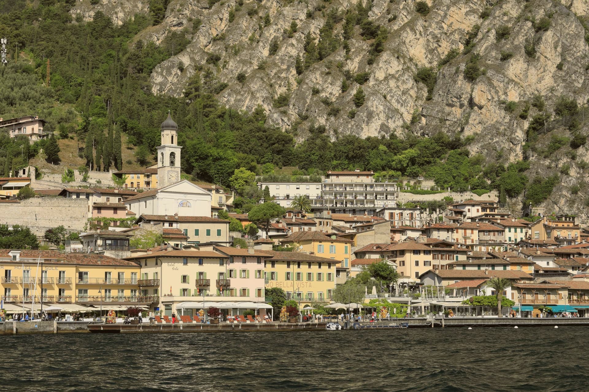
Limone sul Garda sits on the western shore of Lake Garda at the foot of vertical limestone cliffs, the northernmost commercial lemon-growing town in the world at almost 46 degrees north. The Latin limes, meaning border, gave the place its name; the Bettoni counts gave it its industry.
From the seventeenth century, limonaie, stone-pillared greenhouses heated and covered through winter, allowed lemons to be exported to Austria, Germany, Poland and Russia. The road to Riva del Garda, the Gardesana Occidentale, was carved into the cliff and finished in 1932; until then the town reached the outside world by boat or mule track.
In 1974 a Milanese pharmacologist traced a mutant apolipoprotein, ApoA-1 Milano, to a single eighteenth-century resident, Giovanni Pomarelli. Roughly forty of his descendants in town carry the variant, which suppresses cardiovascular disease and helps a handful of residents past one hundred.
What to see in Limone sul Garda
- Limonaia del Castèl. Restored seventeenth-century lemon greenhouse on stone pillars above the lake, demonstrating the heated wooden cover that protected the trees through winter.
- Chiesa di San Benedetto. Eighteenth-century parish church on the lake front, with a single nave and Baroque altars rebuilt over an older medieval foundation.
- Centro storico. Tight grid of stone alleys between the old harbour and the cliff, with narrow porticoes that survive from the pre-road fishing and citrus village.
How to get to Limone sul Garda
Trento is roughly 57 minutes away by road.
Our tip
April through June and September into October are the months that suit Limone. The lake holds spring temperatures, the lemons flower, the cliff above the town keeps morning shade until noon. July and August fill the lakefront and the cycle path, with peak crowds on weekends drawn from Verona, Milano and German-speaking Europe.
Monte Isola
Why visit Monte Isola
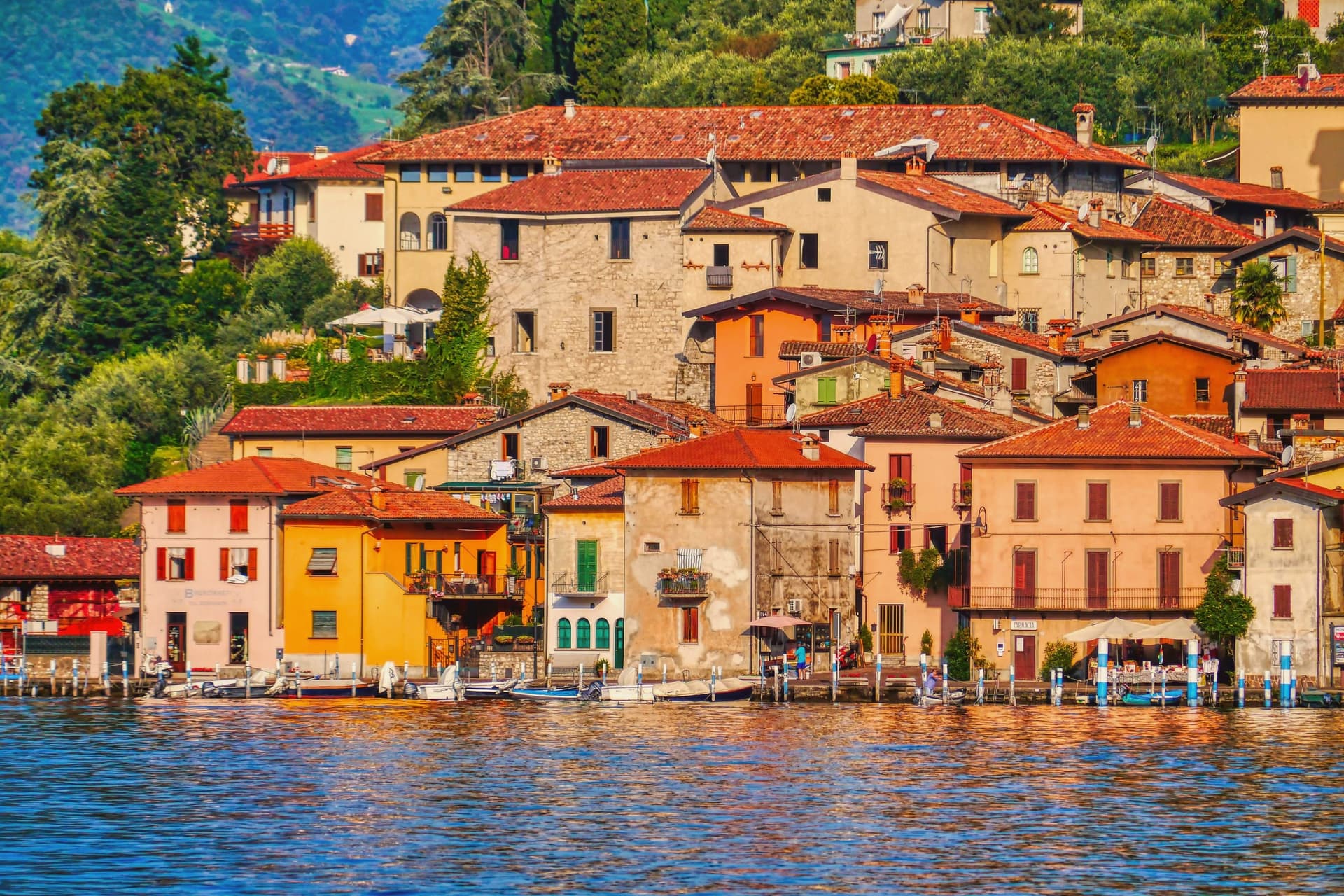
Monte Isola covers 4.5 square kilometers in the middle of Lake Iseo, the largest lake island in southern and central Europe. Eleven villages and hamlets line the shore and climb the slopes: Peschiera Maraglio and Sensole on the south, Siviano on the north, with smaller settlements between.
The Madonna della Ceriola sanctuary stands at 600 meters at the summit, documented in 1410 but built older, holding a twelfth-century wooden sculpture of the Virgin and Child. No private cars are allowed on the island; mopeds, bicycles and feet are the way around.
The Comune still keeps the small island of San Paolo and the privately owned Loreto as part of its territory. Fishing nets are still woven here by hand for use across the lakes of northern Italy, and wooden boats are still built by a handful of craftsmen in Peschiera Maraglio.
In summer 2016, Christo and Jeanne-Claude floated their orange piers from Sulzano to the island, drawing 1.2 million visitors in sixteen days.
What to see in Monte Isola
- Santuario della Madonna della Ceriola. Pilgrimage church at the summit, 600 meters above the lake, holding a twelfth-century wooden Virgin and Child and reached only on foot from Cure.
- Peschiera Maraglio. Main lake-side village on the south of the island, with the ferry landing, the boatyards and the long stone lakefront facing San Paolo.
- Siviano. Capital of the comune on the north of the island, a fortified medieval hamlet with tower houses, narrow streets and the parish church.
How to get to Monte Isola
There is a railway station in the town, so you can arrive without a car and never need one while you are here. Brescia is roughly 48 minutes away by road.
Our tip
April through October is the season Monte Isola is built for. May, June, September and early October are the best months: ferries run on schedule, the perimeter road is open to bikes, the Ceriola climb is dry. July and August bring weekend day-trippers from Brescia, Bergamo and Milano, especially Sundays; the ferries fill and Peschiera Maraglio is at capacity by mid-morning.
Tremosine sul Garda
Why visit Tremosine sul Garda
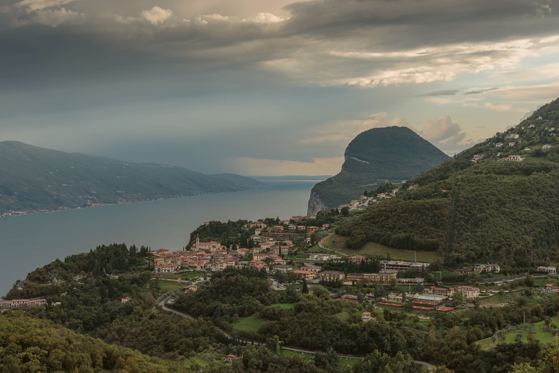
The plateau sits above the strip of road called the Gardesana Occidentale, its cliff edge dropping straight to the water. The commune divides into 18 frazioni scattered between that edge and the Alpe di Tremosine inland; Pieve, the capoluogo, holds the town hall and the Borghi più belli listing, while Campione del Garda, down at lake level, is the one frazione with direct shore access and a windsurfing beach.
The distance between Pieve on its cliff and Campione on the water is the whole shape of the place: a plateau town with a single foothold on the lake itself. The only road climb from that shore is the route designed by Arturo Cozzaglio of Tremosine and built between 1908 and 1913 through the gorge carved by the Brasa stream: 200 meters of vertical, tunnels and switchbacks cut through limestone.
Winston Churchill called it the eighth wonder of the world. The Tignale and Limone communes are close on either side along the cliff.
What holds Tremosine together, then, is verticality: a plateau of hamlets, a single road up from the water, and a capoluogo that sits at the edge looking straight down.
What to see in Tremosine sul Garda
- Pieve. Capoluogo and one of the Borghi più belli d'Italia, on the limestone cliff edge at 413 meters directly above the lake.
- Terrazza del Brivido. Concrete platform at the Hotel Paradiso, suspending visitors over the void with a full view of the southern Lake Garda.
- Strada della Forra. 5.8-kilometer cliff road by Arturo Cozzaglio, built 1908-1913 through the gorge of the Brasa stream; used in Quantum of Solace.
How to get to Tremosine sul Garda
Trento is roughly 117 minutes away by road.
Our tip
April through October is the lake season. The Strada della Forra is open for cars and motorbikes, the Terrazza del Brivido draws weekend traffic, and the cliff air keeps Pieve cooler than the lake floor. July and August are the busiest months, with the Bond-road crowd and the European motorcycle riders.
Gardone Riviera
Why visit Gardone Riviera
Gardone Riviera sits at 71 meters on the western shore of Lake Garda, in the province of Brescia. The lake here runs deep against the wall of Monte Pizzocolo, and the climate stays mild enough that lemons, olives and bamboo grow within walking distance of each other.
The town divides between the lakefront and the hill above it. Along the water, Gardone Sotto holds the promenade and harbour; above the centro storico, the ground rises toward the estate grounds and, further up, toward the garden that has drawn on the same mild hillside climate since the start of the twentieth century.
The boathouse on the estate holds a torpedo boat from a 1918 wartime raid, alongside the villa called the Prioria, an amphitheatre and a circular mausoleum. The garden above town spent six decades being arranged, one man working a single hillside into bamboo groves, alpine ravines, Japanese ponds and waterfalls.
The lakefront promenade carries the Bandiera Blu. What holds the town together is that division of altitude: a working lakefront below, and above it two hillside projects, one architectural and one botanical, each built slowly and by a single hand over decades on the same slope.
What to see in Gardone Riviera
- Vittoriale degli Italiani. Nine-hectare hillside estate occupied by Gabriele D'Annunzio from 1922 to 1938, with villa, amphitheatre, mausoleum and the cruiser Puglia.
- Nave Puglia. Protected cruiser of the Regia Marina set into the slope above the lake, gifted to D'Annunzio in 1923 and assembled on land at the Vittoriale.
- Giardino Botanico Hruska (Heller Garden). Botanical garden begun around 1901 by Arturo Hruska, with bamboo, Japanese ponds, alpine ravines and waterfalls on a single hillside.
How to get to Gardone Riviera
Brescia is roughly 53 minutes away by road.
Our tip
April through June and September into October are the months western Garda works best. The Vittoriale grounds are walkable, the Heller Garden is in full bloom, and the ferry between Salò and Riva del Garda runs regular service. July and August fill the lakefront with day-trippers and the Vittoriale amphitheatre hosts its summer opera season; afternoons get warm but the lake breeze holds steady.
Bagolino
Why visit Bagolino
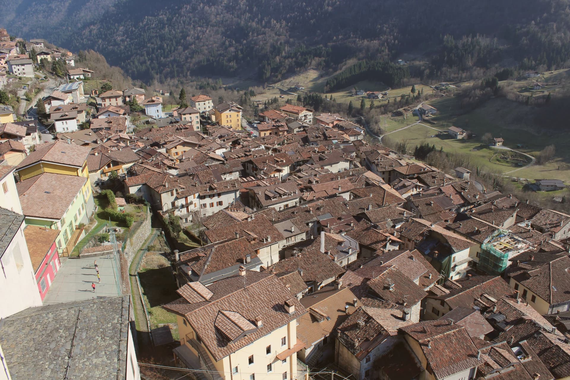
Bagolino sits at 778 meters in the Valle del Caffaro, the right flank of the Valle Sabbia, on the road that runs from Brescia to Lake Idro and over the Crocedomini pass into Val Camonica. The name probably traces to Pagolus, small village; the place was a Roman horse-changing station before anything else.
From the seventh century it sat in the Lombard duchy of Trento, then under the prince-bishops of Trento until the Venetian Republic took it over. The Chiesa di San Giorgio, designed by Giovanni Battista Lantana and built in three years in the early seventeenth century, is the third largest church in the province, with works attributed to Titian, Tintoretto, Palma il Giovane and Pietro Mera.
The Carnevale di Bagolino runs three days each February: Balari in inherited costumes, dancing to the violin and guitar of the Sonadur in tunes closer to Austria than Brescia. Bagòss, the saffron-tinted hard cheese, is still made here from Alpine Brown cow milk, about 10,000 wheels a year.
What to see in Bagolino
- Chiesa di San Giorgio. Third largest church in the province of Brescia, designed by Giovanni Battista Lantana and built in three years in the early seventeenth century, with works attributed to Titian and Tintoretto.
- Centro storico. Stone-house medieval village stacked on the slope above the Caffaro, with covered passages and the dark wood balconies typical of the Lombard prealps.
- Chiesa di San Rocco. Sixteenth-century votive church on the village edge, dedicated to the plague saint, with frescoes inside and a small porch facing the valley.
How to get to Bagolino
Brescia is roughly 76 minutes away by road.
Our tip
May through October is the season at 778 meters. June, July and September are the strongest: alpine pastures green, the Maniva pass open, Lago d'Idro warm enough to swim, the village cool at night while Brescia bakes. August fills with weekend visitors from the Bresciano plain, especially when the Bagòss producers open their cellars.
Bienno
Why visit Bienno
Bienno sits at 445 meters on the eastern flank of the middle Val Camonica, north of Lago d'Iseo. From the tenth century the Benedictines diverted the Grigna stream into an artificial canal, which still powers a string of fucine, small water-hammer forges, along its course.
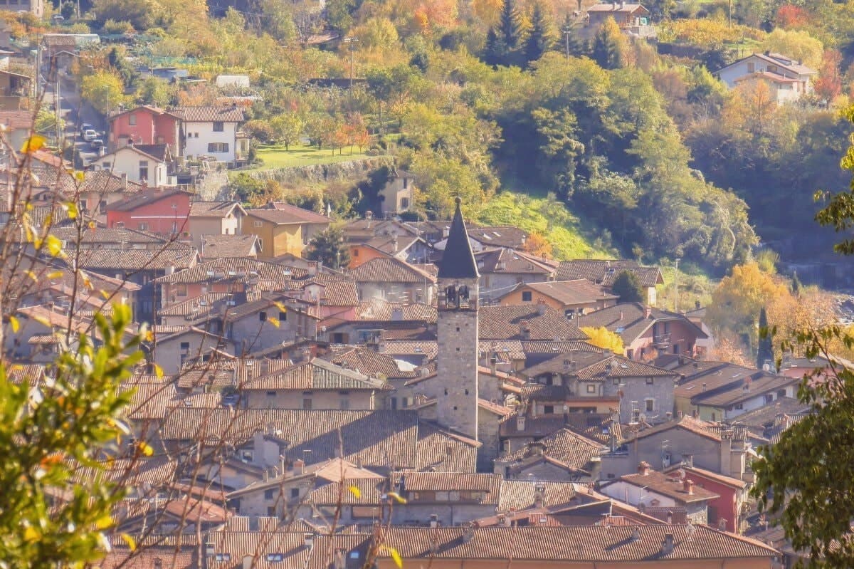
The valley was working iron from the bloomery furnaces of late Antiquity through the high blast furnaces of the late Middle Ages; Bienno became the master village, what Brescia called il paese dei magli, the village of the hammers. The centro storico runs along the stream in stone houses, frescoed facades and arcaded passages, the forges set directly into the fabric of the lanes rather than gathered apart from them.
The palace and the ethnographic museum sit within this same fabric, holding the tools, costumes and reconstructed workshops that explain what the canal was built to serve. Each August the streets fill again with working forges and craftsmen from across the Alpine arc, a working echo of the trade the canal was dug for so long before.
What the town amounts to is this: a village organized, street by street, around a single diverted stream and the iron it was made to move.
What to see in Bienno
- Fucina-Museo. Working water-hammer forge along the Vaso Re canal, kept in operating order, where the Grigna stream still turns the wheels that drive the hammers.
- Chiesa di Santa Maria Annunciata. Fifteenth-century church holding the frescoes in the presbytery, plus earlier work by Giovanni Pietro da Cemmo elsewhere in the building.
- Palazzo Simoni-Fè. Sixteenth-century palace in the centro storico, with frescoed halls and a small museum of the iron and ethnographic traditions of the valley.
How to get to Bienno
Brescia is roughly 92 minutes away by road.
Our tip
April through October is the open season in Bienno. The Vaso Re runs full, the forges open for demonstration days, and the trails up to the Mortirolo and around the Val Camonica are walkable. The last week of August brings the Mostra Mercato, when the streets light with torches at night and the magli pound through the day.
More from Anywhere Italy
- The best lake towns in the province of Brescia
 The 8 best towns inside a nature park in the province of Brescia
 The best lake towns inside a nature park in Lombardia
- The best small towns inside a nature park in Lombardia
- The 8 best hidden towns that eat well in the province of Brescia
 The 6 prettiest small villages that eat well in Lombardia