
The best hot-spring towns within two hours of Padua
The Veneto plain sits on hot water. Rain that fell on the Little Dolomites decades ago comes back up through the Euganean Hills at scalding temperatures, carrying the mineral clay that spa towns here cure in tanks and spread warm on shoulders and knees. Winter is the season for it, when the vine terraces above the hills are bare, the fog sits low over the canals and the pools steam in the open air. Lunch afterwards runs to bigoli with duck, radicchio from Treviso, jujube brandy in the hill villages, and a glass of Colli Euganei red made from grapes grown on volcanic trachyte, the same dark stone the older houses and church steps are cut from.
Most visitors treat all of this as a day trip from Venice, and the spa hotels in the hills fill accordingly with coach groups working through a week of treatments on a schedule. Venice itself absorbs the rest, so the thermal belt becomes a place people sleep rather than a place they look at, and the pools are busiest between mid-morning and mid-afternoon when everyone has been bussed in at once. The bigger resorts book out months ahead in spring and autumn.
The water does not stop at the famous spa strip. It comes up again on a peninsula in Lake Garda, in the reclaimed marsh towns of the Po delta where the springs run salty, in the canal town where retired barge captains keep their own museum, and in the valleys north of Trento where Habsburg-era bathhouses still work. Those towns have the same water, the same mud, the same long lunches, and fewer people queuing for them.
Of the 80 communes we have mapped in a 120-minute drive of Padua, 10 qualify as hot-spring towns: each has thermal water a town has been built around. The smallest, Arquà Petrarca, has 1,810 residents.
If you are still choosing, we have also written The best hot-spring towns within two hours of Verona and The best hot-spring towns within two hours of Venice.
Arquà Petrarca
Why visit Arquà Petrarca
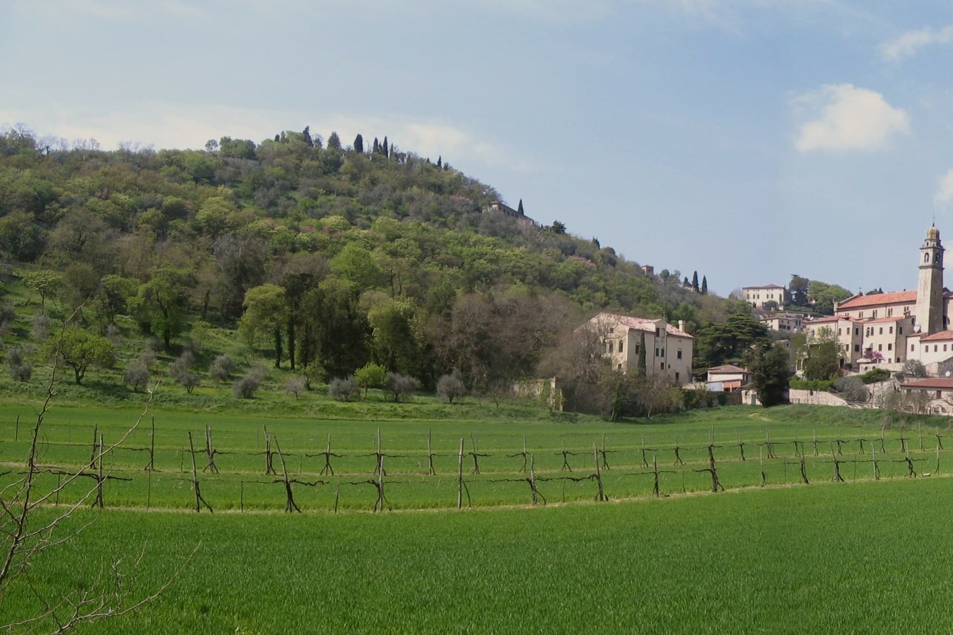
Arquà sits between Monte Ventolone and Monte Castello, in the Euganean Hills south of Padova. The name dates to medieval records; the suffix Petrarca was added in 1868, after the Veneto's annexation to the Kingdom of Italy, as a public homage to the poet who chose to die here.
Francesco Petrarca arrived in 1370 and lived in a thirteenth-century house he renovated himself across two stories, the Casa del Petrarca, now a museum with frescoes from the fifteenth and sixteenth centuries. He died at his desk on the night of 18-19 July 1374.
His tomb, an ark in red Verona marble inspired by Roman sarcophagi, was placed in the churchyard of Santa Maria Assunta in 1380 and reset in 1965. The village kept its medieval layout: two piazzas linked by a stepped path, the Casa above and the church and tomb below.
The hills around it grow Colli Euganei DOC wine, olives, and the giuggiole that go into the local liqueur Brodo di Giuggiole.
What to see in Arquà Petrarca
- Casa di Francesco Petrarca. The poet's thirteenth-century house, renovated by him on two floors and now a museum with frescoes added by later owners in the fifteenth and sixteenth centuries.
- Tomba di Petrarca. Sarcophagus in red Verona marble in the churchyard of Santa Maria Assunta, placed in 1380, six years after the poet's death.
- Chiesa di Santa Maria Assunta. Parish church first documented in 1026, enlarged through the centuries, with frescoes of the Venetian-Byzantine school up to the fifteenth century.
How to get to Arquà Petrarca
There is a railway station in the town, so you can arrive without a car and never need one while you are here. Padova is roughly 28 minutes away by road.
Our tip
April through June and September through October are the months Arquà is built for. The hills are green in spring and gold in autumn; the slope from Piazza Roma down to the church is comfortable walking weather. July and August push past thirty degrees and the village empties between two and six, though Padova day-trippers still arrive in the late afternoon.
Battaglia Terme
Why visit Battaglia Terme
Battaglia Terme sits at 9 meters on the eastern edge of the Euganean Hills, fifteen kilometers south of Padova. The Paduans dug the Battaglia Canal between 1189 and 1201 to link Padova to Monselice, Este and ultimately the Adige and the lagoon; the town grew up at the confluence with the older Bisato Canal from Monselice, completed in 1139.
For seven centuries Battaglia lived from the barge traffic that hauled wheat, marble and wine north and south through the navigable network. The Museo della Navigazione Fluviale, the only river navigation museum in Italy, holds more than four thousand objects from boats and tools to navigation charts and boatmen's diaries.
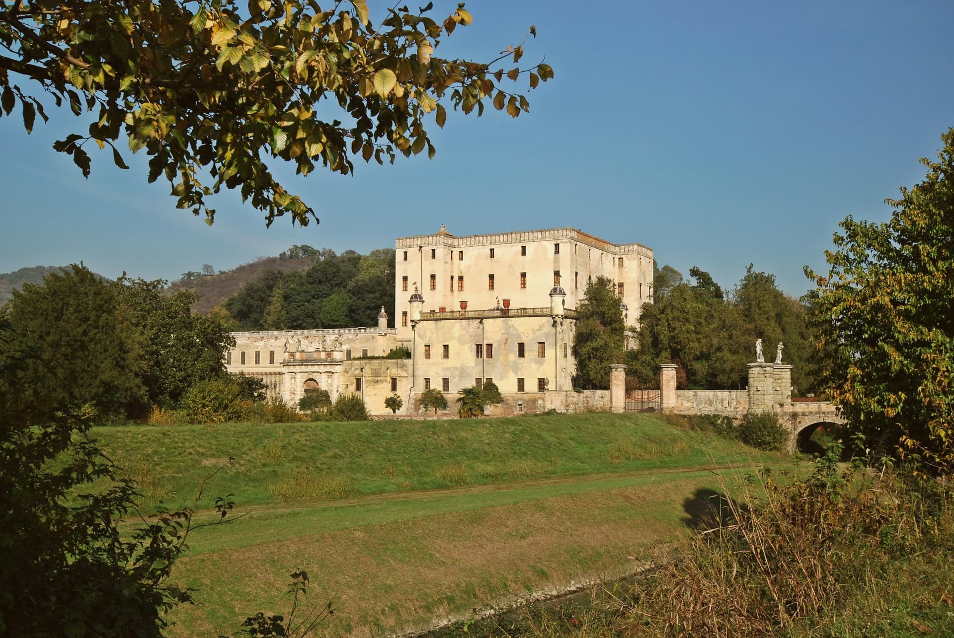
The thermal springs surface here too: warm saline water and a natural vapour grotto known since the Middle Ages, exploited from the eighteenth century at the Terme di Battaglia. Above town stands the Castello del Catajo, built 1570-73 by Pio Aeneas I degli Obizzi to control the canal, with frescoes and Renaissance esoteric symbols across forty rooms.
What to see in Battaglia Terme
- Castello del Catajo. Hilltop castle built 1570-73 by Pio Aeneas I degli Obizzi, with frescoes and esoteric Renaissance symbols across more than forty rooms.
- Museo della Navigazione Fluviale. Italy's only river navigation museum, with over four thousand objects from boats and tools to boatmen's diaries and navigation charts.
- Canale di Battaglia. Canal dug 1189-1201 by the Paduans, still navigable, running through the center of town and crossed by historic bridges.
How to get to Battaglia Terme
There is a railway station in the town, so you can arrive without a car and never need one while you are here. Padova is roughly 21 minutes away by road.
Our tip
Battaglia works year-round through the springs, but the canal-and-castle season runs April through October. Spring and autumn are best for walking the towpaths between Battaglia, Monselice and Este, when the Euganean hills above are green and the canal water is clear. July and August are warm and mosquito-thick along the canal; the spa hotels keep the visitors but the towpaths empty.
Grado
Why visit Grado
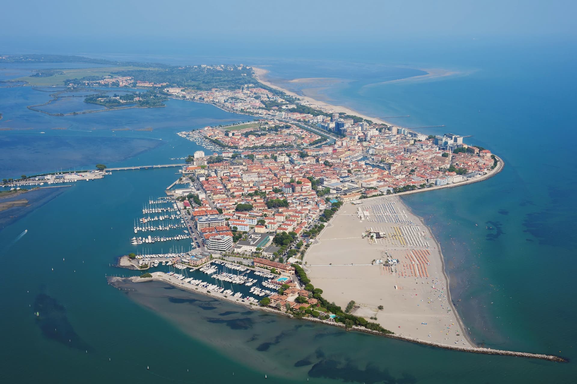
Grado is an island town in the Marano-Grado Lagoon, between Venice and Trieste, on a 90-square-kilometer mosaic of shallow water, sandbanks, and reedbeds. When the Lombards took Aquileia in 568, the metropolitan fled here; the Aquileian see was transferred to Grado in 579 and the town became known as New Aquileia.
Bishop Elia consecrated the Basilica of Sant'Eufemia on November 3, 579, on the patriarchal square. The patriarchate moved to Venice in 1105 and was formally suppressed in 1451, but Grado kept the basilica, the sixth-century baptistery, and the lapidarium.
The town became Italian seaside in the Habsburg sense in the nineteenth century, when Empress Sissi's circle gave it the imperial bathing certification; the long sandy beaches and lagoon climate did the rest. Today it carries the Bandiera Blu and is the only Italian Adriatic resort that opens directly south, with full-day sun.
The casoni, thatched fishermen's huts on the lagoon islets, are still in use.
What to see in Grado
- Basilica di Sant'Eufemia. Sixth-century basilica consecrated in 579 by Patriarch Elia, with original mosaic floor, lapidarium, and the suppressed patriarchal cathedra of Grado.
- Battistero di Sant'Eufemia. Hexagonal sixth-century baptistery next to the basilica, with octagonal immersion font and the oldest preserved liturgical architecture in the lagoon.
- Basilica di Santa Maria delle Grazie. Fifth- to sixth-century three-nave basilica on the patriarchal square, with original mosaic flooring and remains of the earlier early-Christian structure.
How to get to Grado
Udine is roughly 46 minutes away by road.
Our tip
May through September is the season the town was rebuilt for. Beach umbrellas line the southern shore, lagoon boats run scheduled trips out to the casoni and the Valle Cavanata, restaurant tables spread out along the riva. July and August fill with Austrian, German, and Italian families on full bathing weeks; book ahead and expect price surcharges.
Levico Terme
Why visit Levico Terme
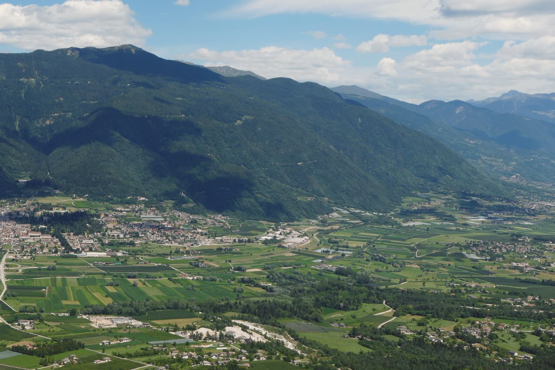
Levico Terme sits at 520 metres in the Valsugana, twenty kilometres east of Trento, between the Lagorai chain and the high plateaus of Folgaria and Lavarone. The settlement passed under Habsburg jurisdiction in 1779 and was elevated to city rank in 1894 by decree of Franz Joseph I.
The spa quarter, the park and the lake sit close together at the edge of the old centre, with the fort watching all three from the hill above. The historic centre, with its imperial-era villas and the parish church of Santissimo Redentore, grew up around the spa rather than the other way round: the streets follow the shape of a resort built in the space of a few decades under Austro-Hungarian rule, rather than a town that predates it.
What survives is a place whose entire layout, from park gate to lakeshore to the fort on the ridge, still reads as the imperial spa it was built to be.
What to see in Levico Terme
- Parco delle Terme. Grounds laid out by Georg Ziehl around the spa buildings and the hotel, with paths shaded by mature planting where the Christmas market sets up each winter.
- Grand Hotel Imperial. Art Nouveau facade facing the park it anchors, the rooms where Empress Elisabeth stayed still forming the core of the working hotel.
- Terme di Levico. The spa buildings that gave the town its purpose, drawing on water piped down from the mountain springs and still run as a treatment centre today.
How to get to Levico Terme
There is a railway station in the town, so you can arrive without a car and never need one while you are here. Trento is roughly 30 minutes away by road.
Our tip
Levico runs year-round: the thermal cures operate from spring through autumn, the Christmas market fills the Habsburg park through December, and the spa hotels stay open through the cold months. May through October is the lake season, with the Bandiera Blu waters warm enough for swimming from mid-June and the sailing and windsurfing clubs open. June through August can hit thirty degrees in the valley floor; the park and the lakeside hold the heat better than the centro storico in the afternoon.
Sirmione
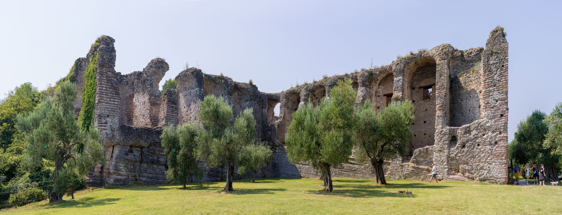
Why visit Sirmione
The peninsula runs four kilometers into the southern end of the lake, narrow enough that the old town occupies a triangle of land just over a mile long. Three low hills organize it: Cortine, San Pietro, and the rise at the tip where the Roman villa stands.
The fortress sits at the single entrance to the walled town, so the only way in by land passes through its gate, and the water it once enclosed as a fortified port is still shut in behind it. Past that gate the medieval streets are packed between the hills, and the ground rises toward the church at the highest point before falling away again toward the villa ruins at the peninsula's end.
The name attached to the villa is literary rather than archaeological: the poet's return in his thirty-first poem was to a family property on this tip of land, and nothing dug from the ground proves the two are the same place, but the name has held for a thousand years regardless. Maria Callas kept a villa here through the 1950s and 60s.
Between the enclosed water at one end and the hot spring at the other, the peninsula reads as a strip of land defined entirely by what edges it: lake on three sides, a gated approach on the fourth, and a history that settled into the name of a poem long before anyone could confirm it belonged there.
What to see in Sirmione
- Castello Scaligero. Fortress at the entrance to the old town, with a 37-meter keep and a fortified port still enclosing a piece of the lake.
- Grotte di Catullo. Villa complex built late first century BC to early first century AD, its ruins scattered across olive terraces at the tip of the peninsula.
- Terme di Catullo. Thermal spa drawing on the same mineral spring that surfaces offshore in Lake Garda.
How to get to Sirmione
Verona is roughly 36 minutes away by road.
Our tip
April through October is the lake season. The Grotte di Catullo open with the spring archaeological calendar, the Scaligero is open year-round, and the peninsula promenade fills with day-trippers from Verona and the German A22 corridor. July and August are the heaviest months, with the old town packed between ten and seven; April, May, September and October are the easier months.
Abano Terme
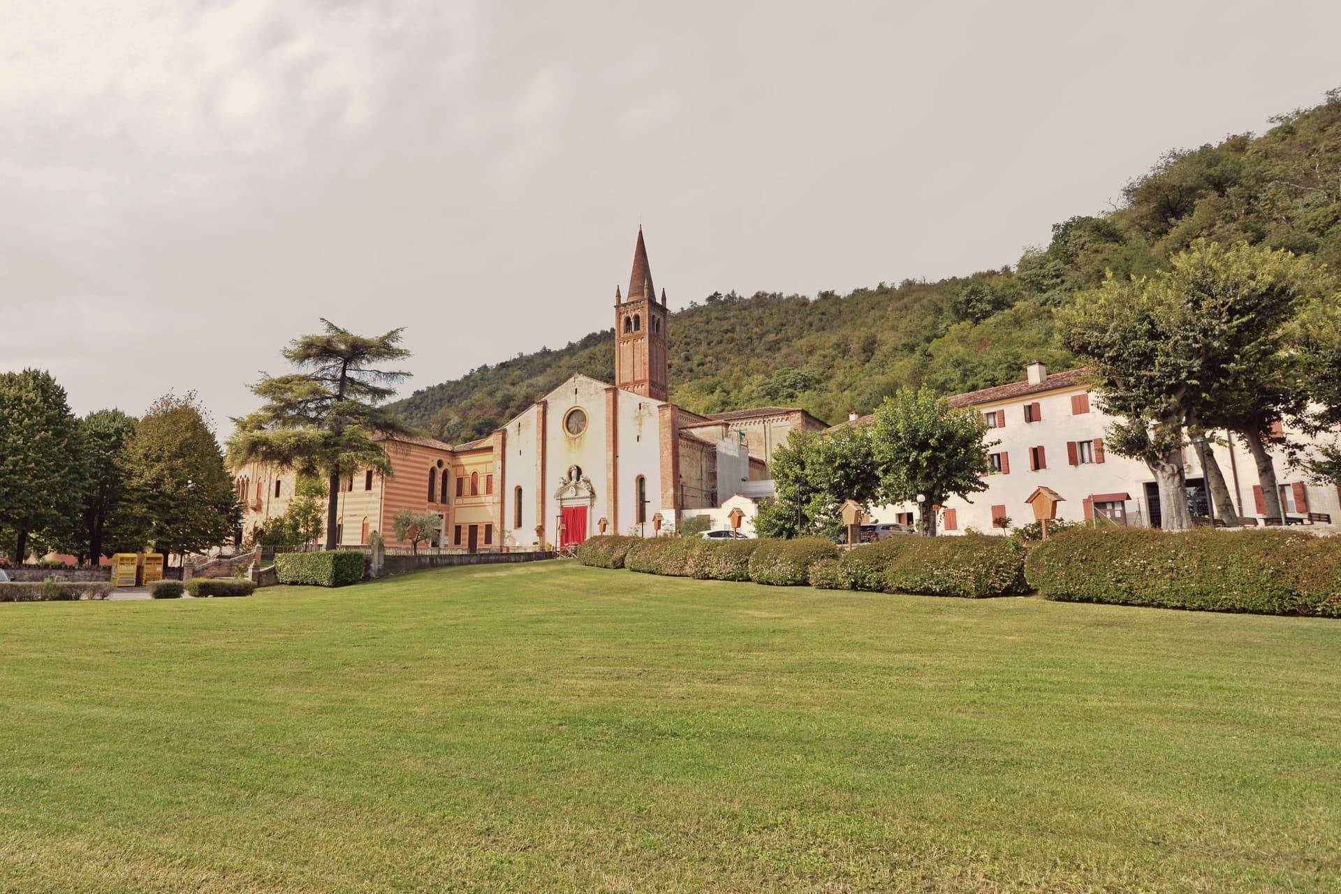
Why visit Abano Terme
Abano Terme sits at 14 meters on the eastern slope of the Euganean Hills, ten kilometers southwest of Padova. The springs surface at 80°C, classified as hyperthermal bromo-iodine-salt water, and the Veneti were already worshipping them in the eighth century BC.
The Romans built a temple to Aponus here and called the place Aquae Patavinae. The Lombards destroyed the baths in the sixth century.
They were rebuilt when Abano became an autonomous comune in the twelfth, enlarged again in the late fourteenth, and absorbed into the Republic of Venice from 1405 to 1797. The Colle Montirone archaeological site still holds traces of the Roman thermal complex, and the Duomo di San Lorenzo, rebuilt in 1780 over an older church, anchors the historic center.
The contemporary draw is fango-balneotherapy: mineral mud aged for sixty days in the source basins, then applied at body temperature. Most of the 250 hotels in Abano-Montegrotto are spa hotels.
What to see in Abano Terme
- Duomo di San Lorenzo. Cathedral rebuilt in 1780 over a pre-existing church, with a campanile dating to the fourteenth century and a Baroque interior.
- Colle Montirone. Archaeological site on a small thermal hill, with traces of the Roman baths of Aponus and an obelisk erected in the eighteenth century.
- Parco Termale Urbano. Public thermal park threading the centro storico, with footpaths between hotels, gardens and the source pools.
How to get to Abano Terme
There is a railway station in the town, so you can arrive without a car and never need one while you are here. Padova is roughly 15 minutes away by road.
Our tip
Abano works year-round because the heat comes from underground. January through March is peak spa season for residents of northern Italy: the contrast between cold air and hot pools is part of the appeal, and hotel cure programs run twelve days at this time. April through June and September through October bring the hills into play, with walking weather and lighter spa traffic.
Castel San Pietro Terme
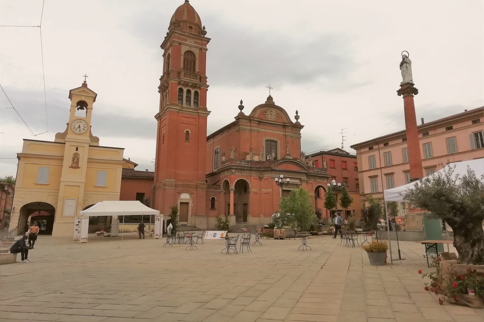
Why visit Castel San Pietro Terme
The town sits on the Sillaro river, which marks the historic border between Emilia and Romagna, twenty kilometers east of Bologna on the Via Emilia. It was founded as a Bolognese castrum in 1200, and the walled core still follows that original plan, with the river bridge on one edge and the road toward Imola leading out past the walls to the pilgrimage shrine beyond.
Castel San Pietro also joined the Città dell'Olio network for its hillside olive cultivation, a rural counterpart to the spa and civic life inside the walls. The Conservatorio Santa Caterina, founded in 1741, is one of the older female educational institutions still active in the region, sitting inside the same historic core as the gateway and the town hall.
The town reads as two things held together: a walled medieval seat on a border river, and a spa destination whose waters predate the walls by decades. Both draw on what was already there long before either was built up for visitors.
What to see in Castel San Pietro Terme
- Cassero. The gateway stands at the southern edge of the old walls, its stone face marking what was once the main entry into the castrum. Inside, the civic theater now occupies the space, so the structure that once controlled access to the town now hosts its audiences.
- Terme di Castel San Pietro. The complex draws on sulphurous, ferruginous and salt-bromine-iodide springs, with the first establishment opened in 1870. The waters run year-round from the same sources used centuries before the modern building existed.
- Santuario del Crocifisso del Piratello. Pilgrimage shrine on the Via Emilia toward Imola, built around a fifteenth-century crucifix and decorated by Innocenzo da Imola. It drew pilgrim traffic from across northern Emilia, standing apart from the walled town on the road out toward Romagna.
How to get to Castel San Pietro Terme
There is a railway station in the town, so you can arrive without a car and never need one while you are here. Bologna is roughly 39 minutes away by road.
Our tip
Castel San Pietro Terme runs all twelve months because the thermal water does. Spring and autumn are the easier months for walking the centro storico and the Sillaro valley, with mild light and the olive groves on the hill above town green or harvest-coloured. June through August touches the low thirties and humid, but the spa runs longer hours in summer and the riverside frazione of Osteria Grande stays cool.
Comacchio
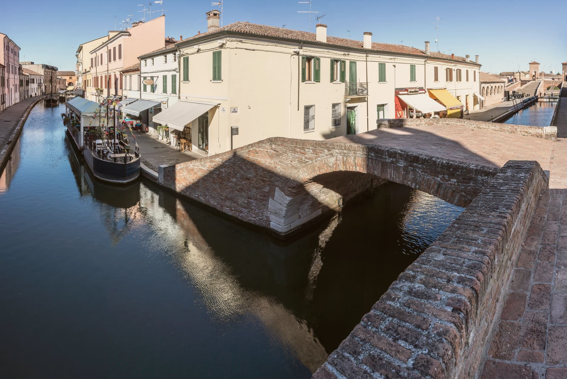
Why visit Comacchio
Comacchio sits at sea level fifty kilometers east of Ferrara and forty south of the Adriatic delta proper. The town passed through Etruscan hands, then Byzantine rule under the Exarchate of Ravenna, then the Duchy of Ferrara, then Papal government until unification, a succession that left the centro storico layered rather than uniform.
The lagoons that surround it formed from tenth-century subsidence and later silting, and now run as a protected area inside the UNESCO inscription that covers the historic Ferrara plain, linking the town to the wider delta rather than setting it apart. The old town itself is water-built: thirteen islets tied together by bridges, canals threading between the Loggia del Grano and the Loggiato dei Cappuccini, with the bridge acting as the hinge where the inland waterways meet the canal running out toward the sea.
What the layers of rule left behind in stone, the lagoon and the tides have kept in motion around it: a town whose center is inseparable from the water that surrounds it, built up in pieces by whoever governed it at the time.
What to see in Comacchio
- Ponte dei Trepponti. Built around 1638 by Luca Danese of Ravenna, the bridge is the meeting point of three internal canals with the canal Pallotta and the symbol most visible from the water.
- Valli di Comacchio. The lagoon opens flat to the horizon at the edge of the Po Delta, its surface broken by fishing stations and the pink of the resident flamingo colonies.
- Museo Delta Antico. Archaeological museum opened in 2017 inside the eighteenth-century Ospedale degli Infermi, with finds from the Etruscan necropolis of Spina.
How to get to Comacchio
Ravenna is roughly 45 minutes away by road.
Our tip
May through September is the working season for Comacchio. Late May and June are best, when the lagoons hold migrating birds and the heat has not yet pushed visitor numbers into the August peak. The Valli boat tours run from spring to autumn, with flamingos visible all year round on the brackish edges. Festa di San Cassiano falls in August.
Imola
Why visit Imola
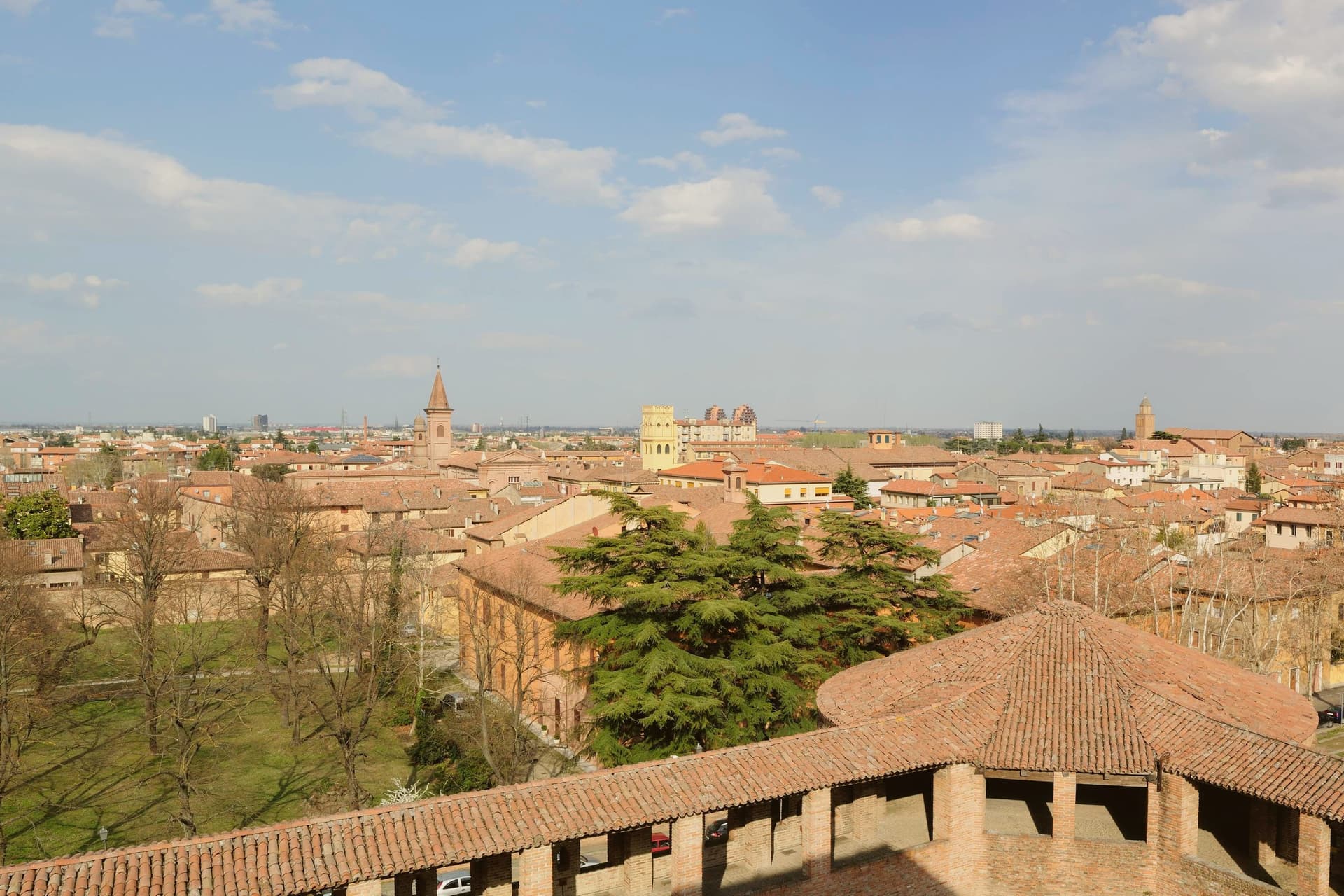
Imola is two cities sharing a name. The medieval one is a quietly handsome Romagna brick town 35 km southeast of Bologna along the Via Emilia, with the Rocca Sforzesca (rebuilt by Caterina Sforza in 1473–1499 — the Tigress of Forlì, who held this fortress through the Borgia siege of 1500) anchoring the centro.
The Palazzo Tozzoni museum, the 11th-century Cattedrale di San Cassiano with its crypt of the city's patron, the Palazzo Sersanti on the central piazza, and the medieval grid of porticoed brick streets all read as a smaller-scale Bologna. The OTHER Imola is the Autodromo Enzo e Dino Ferrari — the 4.9-km F1 circuit on the south bank of the Santerno, built 1953 and named for Enzo Ferrari and his son Dino after Dino's death.
It hosted the San Marino Grand Prix every May from 1981 to 2006 (and again 2020–present), and is the circuit where Ayrton Senna died in 1994 at the Tamburello corner — a memorial still stands there. The Emilia Romagna Grand Prix in April–May is the city's biggest tourist event of the year.
Outside race weekends the circuit is a public park; locals jog the track. The food is Romagna: piadina romagnola (the city is Città dell'Olio, and the local Brisighella Nostrana di Brisighella DOP olive oil is what dresses it), passatelli in brodo, cappelletti, Sangiovese di Romagna from the surrounding hills, and the local nocino walnut liqueur made by every grandmother in the foothills.
What to see in Imola
- Rocca Sforzesca. Caterina Sforza's 1499 four-towered brick fortress at the centro's edge — the Tigress of Forlì held it against Cesare Borgia in 1500. Museum of arms and ceramics inside.
- Autodromo Enzo e Dino Ferrari. The 4.9-km F1 circuit on the Santerno. Senna memorial at Tamburello. Open as a public park outside race weekends — locals jog the track.
- Cattedrale di San Cassiano + crypt. 11th-c cathedral with the city patron's crypt; the Madonna del Piratello pilgrimage church just outside the walls is a major regional sanctuary.
How to get to Imola
There is a railway station in the town, so you can arrive without a car and never need one while you are here. Forlì is roughly 34 minutes away by road.
Our tip
Imola is best April–June and September–October. The Emilia Romagna Grand Prix (last weekend April / first weekend May) fills every hotel for 80 km — wonderful if you're going, brutal if you're not. Summer is hot and sticky. Baccanale Imola falls in October.
Trento
Why visit Trento
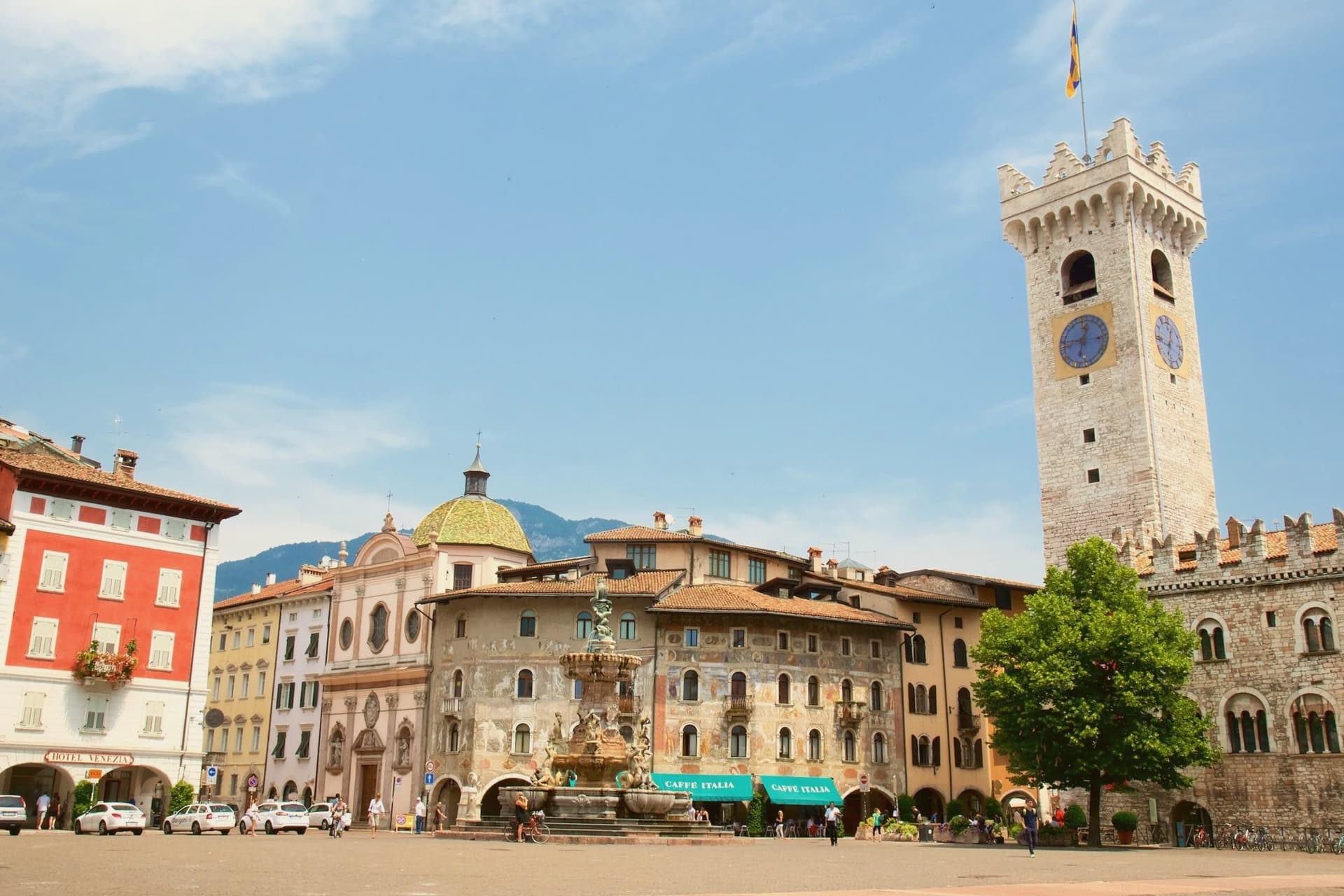
Trento sits at 194 metres on the Adige, the city Italy chose as the seat of one of its two northern autonomous provinces and the regional capital of Trentino-Alto Adige. Monte Bondone rises to two thousand metres directly above the western edge; the Brenta Dolomites are an hour west.
Between 1545 and 1563, the Council of Trent met here in twenty-five sessions across the Duomo di San Vigilio and the Castello del Buonconsiglio, formulating the Catholic response to the Protestant Reformation and shaping the next four centuries of European Christianity. The Duomo, begun in 1212 on the foundations of a late-Roman basilica, still stands at the centre of Piazza Duomo.
The Buonconsiglio, built 1239 to 1255 as the residence of the prince-bishops, is now the city's main museum. In 2013 Renzo Piano completed MUSE, the natural science museum on the south edge of town, with a six-storey jagged roofline that imitates the Dolomites.
What to see in Trento
- Castello del Buonconsiglio. Thirteenth-century residence of the prince-bishops of Trento, host to sessions of the Council of Trent and now the city's main museum, with Gothic frescoes in the Torre Aquila.
- Duomo di San Vigilio. Romanesque-Gothic cathedral begun in 1212 on the remains of a late-Roman basilica, where most public sessions of the Council of Trent were held between 1545 and 1563.
- MUSE. Museum of natural science by Renzo Piano, opened 2013, with a 130-metre roofline that rises and falls in imitation of the Dolomites visible to the east.
How to get to Trento
There is a railway station in the town, so you can arrive without a car and never need one while you are here. Trento is roughly 4 minutes away by road.
Our tip
April through June brings green slopes on Monte Bondone, mild evenings in Piazza Duomo and the start of the open-air concert season. September and October are dry and clear, with the Trento Film Festival of mountain cinema and the start of the autumn wine sagre in the Vallagarina to the south. July and August can hit thirty-three degrees in the city centre at 194 metres; the air cools sharply if you climb Monte Bondone, and locals spend afternoons on the mountain or at the lake. Trento Busker Food falls in September.
More from Anywhere Italy
- The best hot-spring towns within two hours of Verona
- The best hot-spring towns within two hours of Venice
- The best hot-spring towns within 90 minutes of Bologna
- The best hot-spring towns within two hours of Brescia
 The best hot-spring towns within two hours of Parma
- The best hot spring towns in Emilia-Romagna