
The best hot-spring towns within two hours of Brescia
The Po plain and the valleys above it are unusually generous with hot water. It rises sulphurous and slightly salty in the Euganean hills, iron-rich in the Val Camonica, faintly bitter in the limestone of the Brembana valley, and towns have been built around it, spa halls in cut stone and stucco, colonnades, pump rooms, hotels with tiled corridors that still smell of mineral steam. Autumn and late winter are the seasons for it, when the air is cold enough for the pools to smoke and the kitchens turn to casoncelli, polenta taragna, boiled meats with mostarda, spit-roasted birds on the Brescian hills. The volcanic soil around the southern springs grows Moscato and prosecco-adjacent whites that taste of the same geology. A thermal town in this part of Italy is a working place rather than a resort, with a public pool, a doctor's certificate and a hard-earned habit of taking cures seriously.
Most people arriving in the region make for Lake Garda's southern shore or drive on to Verona, and in high summer the promenades along the water are a slow shuffle of coach parties and gelato queues. Padua absorbs another share, its arcades and Scrovegni Chapel booked out months ahead. Both are worth the time they take, but neither leaves much room for the quiet part of a spa visit, which is the point of a spa visit. Parking, in July, is its own event.
The water does not stop where the crowds do. The same geothermal seams run under smaller towns with their own bathhouses, their own drinking fountains and their own arrangements for mud, and fewer people go to them. These are the places within a couple of hours of Brescia where the spring came first and the town arranged itself around it.
Of the 91 communes we have mapped in a 120-minute drive of Brescia, 9 qualify as hot-spring towns: each has thermal water a town has been built around. The smallest, Arquà Petrarca, has 1,810 residents.
Two more lists worth reading alongside this one: The best hot-spring towns within two hours of Verona and The best hot-spring towns within two hours of Padua.
Arquà Petrarca
Why visit Arquà Petrarca
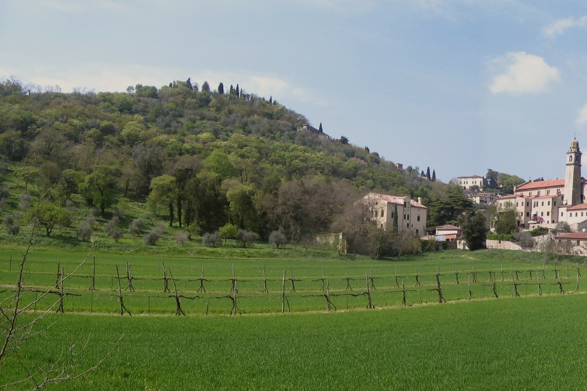
Arquà sits between Monte Ventolone and Monte Castello, in the Euganean Hills south of Padova. The name dates to medieval records; the suffix Petrarca was added in 1868, after the Veneto's annexation to the Kingdom of Italy, as a public homage to the poet who chose to die here.
Francesco Petrarca arrived in 1370 and lived in a thirteenth-century house he renovated himself across two stories, the Casa del Petrarca, now a museum with frescoes from the fifteenth and sixteenth centuries. He died at his desk on the night of 18-19 July 1374.
His tomb, an ark in red Verona marble inspired by Roman sarcophagi, was placed in the churchyard of Santa Maria Assunta in 1380 and reset in 1965. The village kept its medieval layout: two piazzas linked by a stepped path, the Casa above and the church and tomb below.
The hills around it grow Colli Euganei DOC wine, olives, and the giuggiole that go into the local liqueur Brodo di Giuggiole.
What to see in Arquà Petrarca
- Casa di Francesco Petrarca. The poet's thirteenth-century house, renovated by him on two floors and now a museum with frescoes added by later owners in the fifteenth and sixteenth centuries.
- Tomba di Petrarca. Sarcophagus in red Verona marble in the churchyard of Santa Maria Assunta, placed in 1380, six years after the poet's death.
- Chiesa di Santa Maria Assunta. Parish church first documented in 1026, enlarged through the centuries, with frescoes of the Venetian-Byzantine school up to the fifteenth century.
How to get to Arquà Petrarca
There is a railway station in the town, so you can arrive without a car and never need one while you are here. Padova is roughly 28 minutes away by road.
Our tip
April through June and September through October are the months Arquà is built for. The hills are green in spring and gold in autumn; the slope from Piazza Roma down to the church is comfortable walking weather. July and August push past thirty degrees and the village empties between two and six, though Padova day-trippers still arrive in the late afternoon.
Bobbio
Why visit Bobbio
Bobbio sits on the left bank of the Trebbia at 272 meters, at the foot of Monte Penice in the Piacentine Apennines. The land was granted to Saint Columbanus by the Lombard king Agilulf in 614, and the monastery he raised on it grew, by the eighth century, into one of the principal libraries north of Rome, copying Greek, Latin, and Irish manuscripts that survived nowhere else.
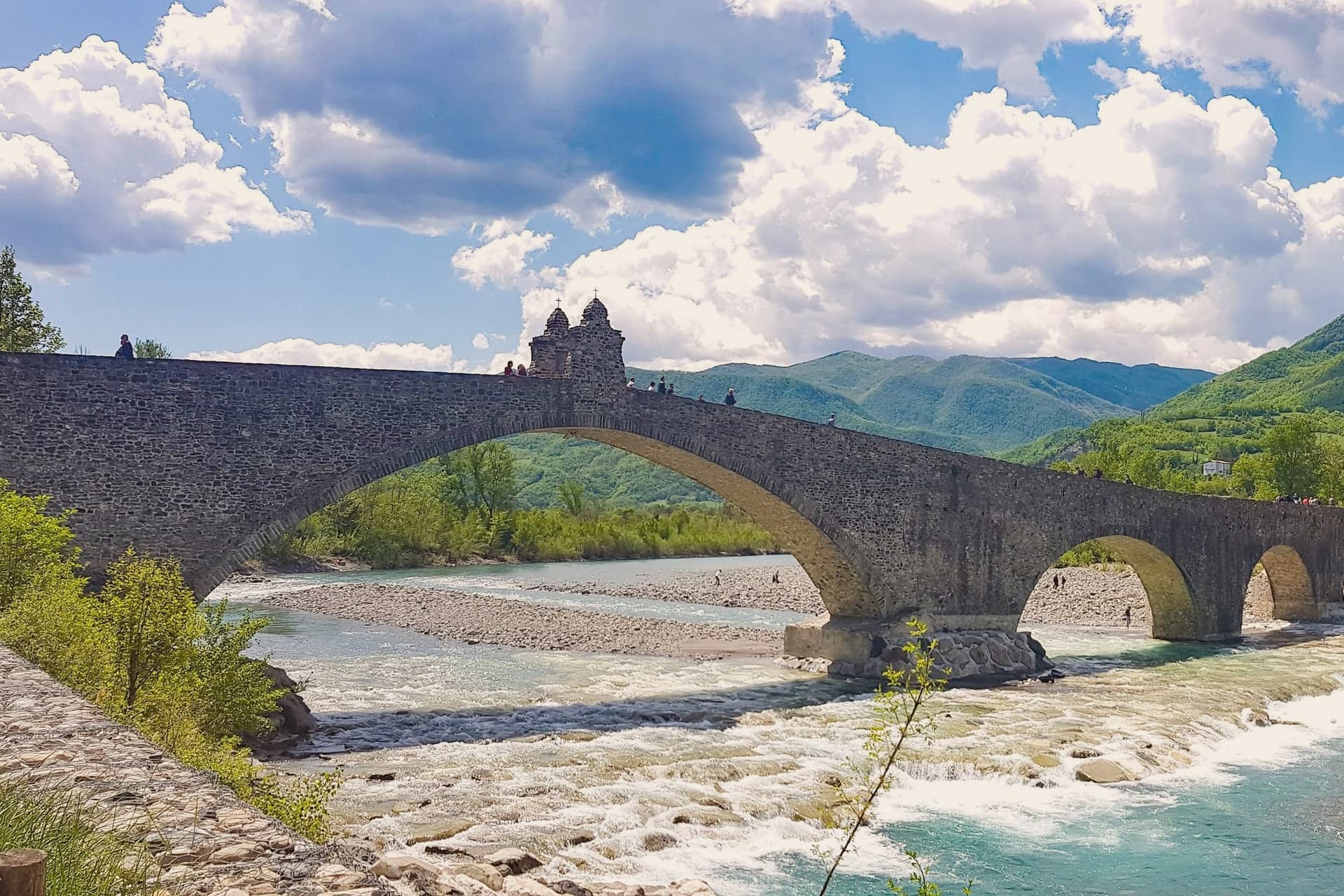
The French suppressed the monastery in 1803; what the scriptorium and library once held now lives in fragments, kept in the basilica and its museum. The town below the abbey is crossed by the Trebbia on the Ponte Gobbo, its eleven irregular arches stretching 273 meters, a shape that gave rise to the story of the Devil and the saint dividing the bridge between them.
Bobbio still carries the Borghi più belli and Bandiera Arancione designations alongside the 2019 RAI title. A river crossing, a hill fortress, and a monastery ruin sit within reach of one another here, each holding a different piece of the same long settlement, one built by faith, one by feudal power, and one by the river itself.
What to see in Bobbio
- Abbazia di San Colombano. The basilica and grounds where Saint Columbanus settled still stand; the scriptorium he founded is gone but its output is documented in surviving manuscripts held elsewhere.
- Ponte Gobbo. The eleven arches sit unevenly across the riverbed, the irregularity of their spacing the source of both the Devil's Bridge name and the Columbanus legend attached to it.
- Duomo di Bobbio. Romanesque cathedral begun in 1075, dedicated to Santa Maria Assunta, with a fifteenth-century fresco cycle in the apse.
How to get to Bobbio
Piacenza is roughly 63 minutes away by road.
Our tip
April through June brings the green Val Trebbia season, when the river runs clear enough for swimming holes downstream. September and October are the working months for chestnuts, mushrooms, and the maccheroni alla bobbiese the town fills its trattorie with. July and August can hit thirty-three degrees in the valley, and the 2019 Borgo dei Borghi win still draws weekend crowds that fill the Ponte Gobbo. La Festa del Pinolo falls in August.
Battaglia Terme
Why visit Battaglia Terme
Battaglia Terme sits at 9 meters on the eastern edge of the Euganean Hills, fifteen kilometers south of Padova. The Paduans dug the Battaglia Canal between 1189 and 1201 to link Padova to Monselice, Este and ultimately the Adige and the lagoon; the town grew up at the confluence with the older Bisato Canal from Monselice, completed in 1139.
For seven centuries Battaglia lived from the barge traffic that hauled wheat, marble and wine north and south through the navigable network. The Museo della Navigazione Fluviale, the only river navigation museum in Italy, holds more than four thousand objects from boats and tools to navigation charts and boatmen's diaries.
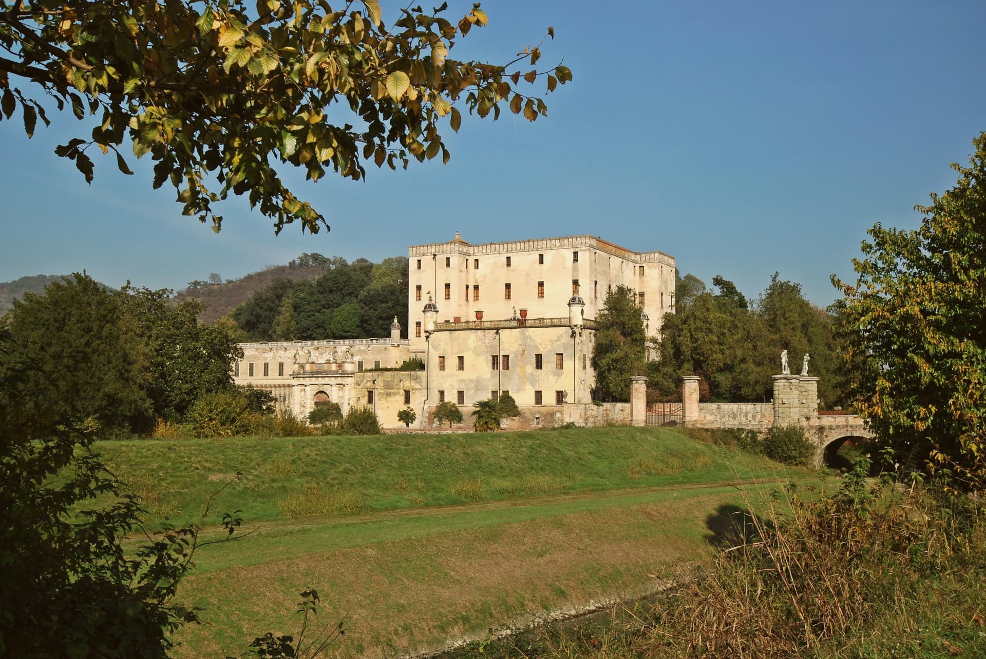
The thermal springs surface here too: warm saline water and a natural vapour grotto known since the Middle Ages, exploited from the eighteenth century at the Terme di Battaglia. Above town stands the Castello del Catajo, built 1570-73 by Pio Aeneas I degli Obizzi to control the canal, with frescoes and Renaissance esoteric symbols across forty rooms.
What to see in Battaglia Terme
- Castello del Catajo. Hilltop castle built 1570-73 by Pio Aeneas I degli Obizzi, with frescoes and esoteric Renaissance symbols across more than forty rooms.
- Museo della Navigazione Fluviale. Italy's only river navigation museum, with over four thousand objects from boats and tools to boatmen's diaries and navigation charts.
- Canale di Battaglia. Canal dug 1189-1201 by the Paduans, still navigable, running through the center of town and crossed by historic bridges.
How to get to Battaglia Terme
There is a railway station in the town, so you can arrive without a car and never need one while you are here. Padova is roughly 21 minutes away by road.
Our tip
Battaglia works year-round through the springs, but the canal-and-castle season runs April through October. Spring and autumn are best for walking the towpaths between Battaglia, Monselice and Este, when the Euganean hills above are green and the canal water is clear. July and August are warm and mosquito-thick along the canal; the spa hotels keep the visitors but the towpaths empty.
San Pellegrino Terme
Why visit San Pellegrino Terme
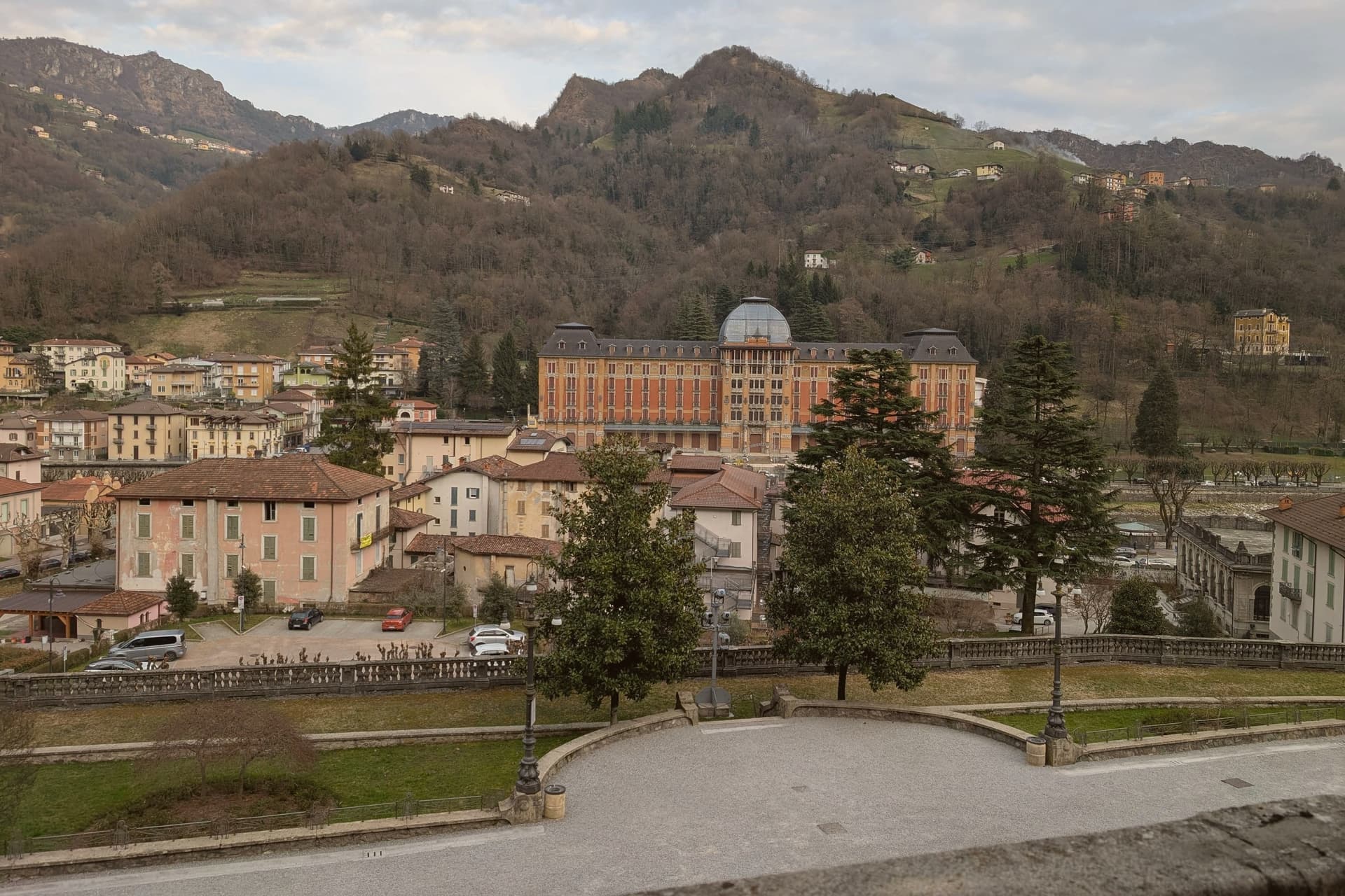
The town sits along a single bend of the Brembo river, where mineral and sulfur springs had been documented since the 13th century but were only commercialised after the railway from Bergamo reached the valley. That timing explains why the whole ensemble reads as one build: the hotel, the casino and the bath house went up within a few years of each other, facing each other across the water rather than scattered through the town.
The bottling plant sits a kilometre downstream from the springs, turning the source into the mineral water sold worldwide. Above the built-up centre, the funicular climbs to the Vetta panoramic point on the ridge, putting the whole valley below in view.
The Val Brembana around it is one of Lombardia's Cittaslow-style slow-tourism valleys, with the Borghi-più-belli of Cornello dei Tasso fifteen kilometres north and a chain of cycling routes along the river. What holds the town together, in the end, is the water itself: it drew the springs' early notice, funded the Liberty building spree once the railway arrived, and still leaves the valley in bottles long after the casino stopped taking bets.
What to see in San Pellegrino Terme
- Grand Hotel San Pellegrino. Completed in 1904, the most elaborate facade of the ensemble: cast-iron balconies, stained glass, and a marble entrance hall by Romolo Squadrelli.
- Casinò Municipale (Casinò Liberty). Matching Liberty style across the Brembo from the hotel, closed to gaming since 1917 but open for events and as a visitable architectural set piece.
- Terme di San Pellegrino (QC Terme). Original 1900 building running on the historic sulfur springs, operated today by QC Terme as a full-day spa with indoor and outdoor pools at 36°C.
How to get to San Pellegrino Terme
There is a railway station in the town, so you can arrive without a car and never need one while you are here. Bergamo is roughly 30 minutes away by road.
Our tip
April through October is the prime spa-town season — outdoor pools open at the Terme, funicular running, and the riverfront promenade in full use. May and September are the architectural-photography months: warm Liberty facades, fewer guests at the Grand Hotel, long light. July-August is busiest — the QC Terme can be fully booked weekends.
Sirmione
Why visit Sirmione
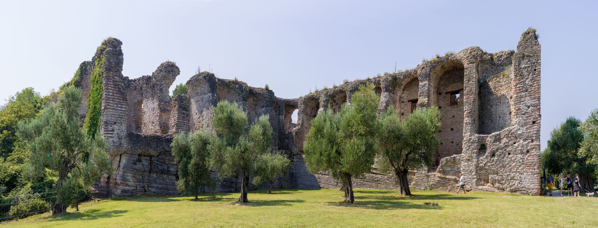
The peninsula runs four kilometers into the southern end of the lake, narrow enough that the old town occupies a triangle of land just over a mile long. Three low hills organize it: Cortine, San Pietro, and the rise at the tip where the Roman villa stands.
The fortress sits at the single entrance to the walled town, so the only way in by land passes through its gate, and the water it once enclosed as a fortified port is still shut in behind it. Past that gate the medieval streets are packed between the hills, and the ground rises toward the church at the highest point before falling away again toward the villa ruins at the peninsula's end.
The name attached to the villa is literary rather than archaeological: the poet's return in his thirty-first poem was to a family property on this tip of land, and nothing dug from the ground proves the two are the same place, but the name has held for a thousand years regardless. Maria Callas kept a villa here through the 1950s and 60s.
Between the enclosed water at one end and the hot spring at the other, the peninsula reads as a strip of land defined entirely by what edges it: lake on three sides, a gated approach on the fourth, and a history that settled into the name of a poem long before anyone could confirm it belonged there.
What to see in Sirmione
- Castello Scaligero. Fortress at the entrance to the old town, with a 37-meter keep and a fortified port still enclosing a piece of the lake.
- Grotte di Catullo. Villa complex built late first century BC to early first century AD, its ruins scattered across olive terraces at the tip of the peninsula.
- Terme di Catullo. Thermal spa drawing on the same mineral spring that surfaces offshore in Lake Garda.
How to get to Sirmione
Verona is roughly 36 minutes away by road.
Our tip
April through October is the lake season. The Grotte di Catullo open with the spring archaeological calendar, the Scaligero is open year-round, and the peninsula promenade fills with day-trippers from Verona and the German A22 corridor. July and August are the heaviest months, with the old town packed between ten and seven; April, May, September and October are the easier months.
Montechiarugolo
Why visit Montechiarugolo
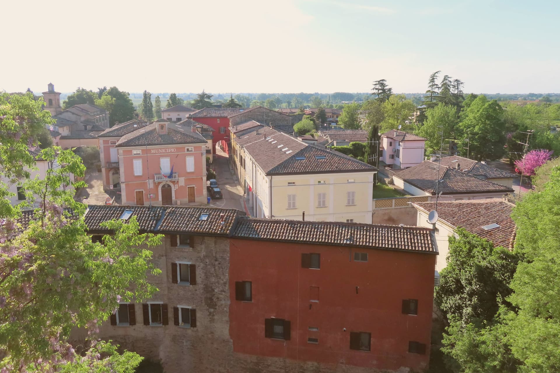
Montechiarugolo sits ten kilometers southeast of Parma at the edge of the Enza valley, on the historical border between the Duchy of Parma and the Reggio territory. The Sanvitale family raised a first military outpost here in 1121; the current castle, polygonal in plan with walls five meters thick and a thirty-meter ditch, was rebuilt by the Torelli after 1406 and hosted Pope Paul III and Francis I of France during the sixteenth century.
The Kingdom of Italy sold the manor to Antonio Marchi in 1864, and his descendants still own and open it. The surrounding fields run with the middle Enza dairies that produce Parmigiano-Reggiano under the Parma consortium.
The commune extends to the Monticelli spa frazione, the only thermal complex in the province. Beyond Parmigiano and the castle, Montechiarugolo holds two institutional signals: Borghi più belli d'Italia and Comuni Virtuosi for its environmental policy.
What to see in Montechiarugolo
- Castello di Montechiarugolo. Polygonal fourteenth-century fortress on a promontory above the Enza, with five-meter walls, a wide ditch, and frescoed halls; still privately owned by the Marchi family.
- Chiesa di San Quintino. Eighteenth-century parish church on the edge of the centro storico, rebuilt after the older medieval pieve was incorporated into the castle complex.
- Terme di Monticelli. Thermal spa in the Monticelli frazione, drawing on iodine-bromine-salt waters discovered in 1924 during oil exploration in the Enza plain.
How to get to Montechiarugolo
Parma is roughly 24 minutes away by road.
Our tip
April through June and September through October are the working months. The Enza fields turn green in spring and stay that way until the cheese-making cycle quiets in summer. July and August touch thirty-five degrees on the plain and the castle terrace becomes the coolest spot in the borgo.
Darfo Boario Terme
Why visit Darfo Boario Terme
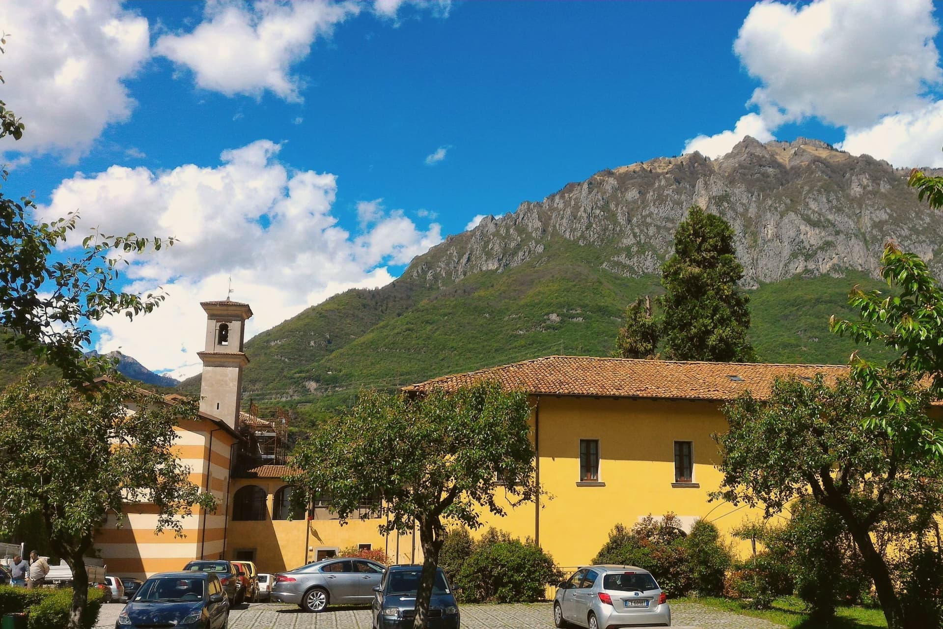
The commune sits at the lower end of the valley, a few kilometres north of Lake Iseo, where the Oglio leaves the mountains for the plain. Its name joins two places: Darfo, the capoluogo, and the spa hamlet of Boario Terme.
The thermal water was already in use in the 18th century, and Doctor Biffi called it the most active in Lombardy in 1857, well before the first spa building went up with its dome in 1906. The Comuni Virtuosi recognition the town holds today reflects later environmental commitments rather than this older history.
The rock-art park sits inside the commune boundary, its engraved surfaces part of a wider world heritage site spanning the valley, the first Italian entry on that list in 1979. The castle above the centre and the small church above the river belong to a different register of the town's past, one of fortification and parish life rather than prehistory or cure.
Between the thermal hamlet, the rock park, the castle spur and the river church, Darfo Boario Terme reads as a place where several distinct pasts, geological, medieval and modern, sit within walking distance of each other without overlapping.
What to see in Darfo Boario Terme
- Terme di Boario. Thermal complex with an Art Nouveau dome, set inside an early 20th-century spa park.
- Parco delle Incisioni Rupestri di Luine. Open-air rock-art park with more than a hundred engraved surfaces, part of the Valle Camonica UNESCO world heritage site.
- Castello di Gorzone. 13th-century Federici castle on a rock spur above the centre, still partly inhabited.
How to get to Darfo Boario Terme
There is a railway station in the town, so you can arrive without a car and never need one while you are here. Brescia is roughly 54 minutes away by road.
Our tip
May through October is the main season. Spring opens the rock-art parks and dries the trails above the valley; summer brings spa guests up from Brescia and Milan for water cures, and the temperature in the valley stays cooler than in the Po plain below. September and October are the cleanest months for walking the Luine engravings and the Capo di Lago promontory.
Abano Terme
Why visit Abano Terme
Abano Terme sits at 14 meters on the eastern slope of the Euganean Hills, ten kilometers southwest of Padova. The springs surface at 80°C, classified as hyperthermal bromo-iodine-salt water, and the Veneti were already worshipping them in the eighth century BC.
The Romans built a temple to Aponus here and called the place Aquae Patavinae. The Lombards destroyed the baths in the sixth century.
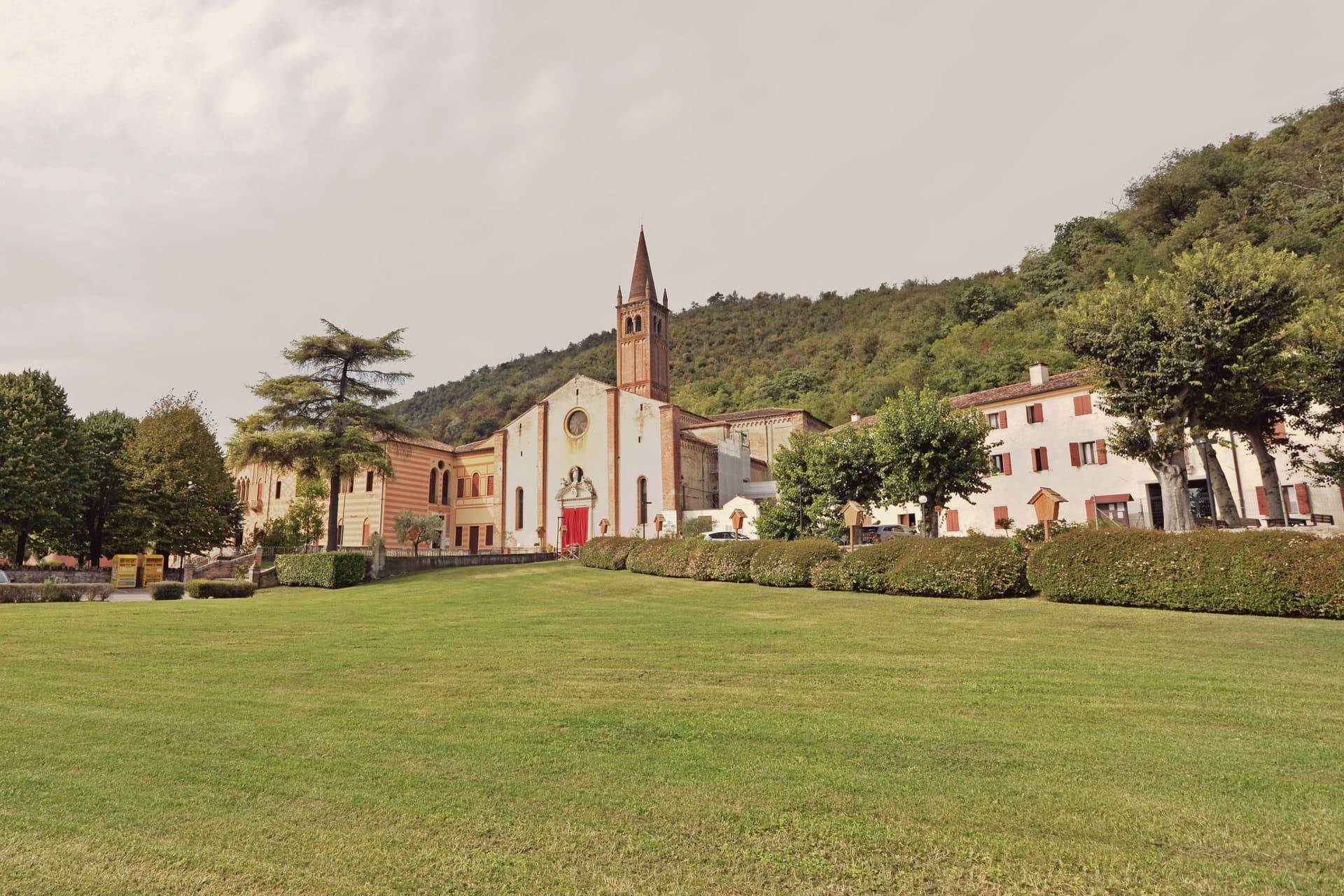
They were rebuilt when Abano became an autonomous comune in the twelfth, enlarged again in the late fourteenth, and absorbed into the Republic of Venice from 1405 to 1797. The Colle Montirone archaeological site still holds traces of the Roman thermal complex, and the Duomo di San Lorenzo, rebuilt in 1780 over an older church, anchors the historic center.
The contemporary draw is fango-balneotherapy: mineral mud aged for sixty days in the source basins, then applied at body temperature. Most of the 250 hotels in Abano-Montegrotto are spa hotels.
What to see in Abano Terme
- Duomo di San Lorenzo. Cathedral rebuilt in 1780 over a pre-existing church, with a campanile dating to the fourteenth century and a Baroque interior.
- Colle Montirone. Archaeological site on a small thermal hill, with traces of the Roman baths of Aponus and an obelisk erected in the eighteenth century.
- Parco Termale Urbano. Public thermal park threading the centro storico, with footpaths between hotels, gardens and the source pools.
How to get to Abano Terme
There is a railway station in the town, so you can arrive without a car and never need one while you are here. Padova is roughly 15 minutes away by road.
Our tip
Abano works year-round because the heat comes from underground. January through March is peak spa season for residents of northern Italy: the contrast between cold air and hot pools is part of the appeal, and hotel cure programs run twelve days at this time. April through June and September through October bring the hills into play, with walking weather and lighter spa traffic.
Trento
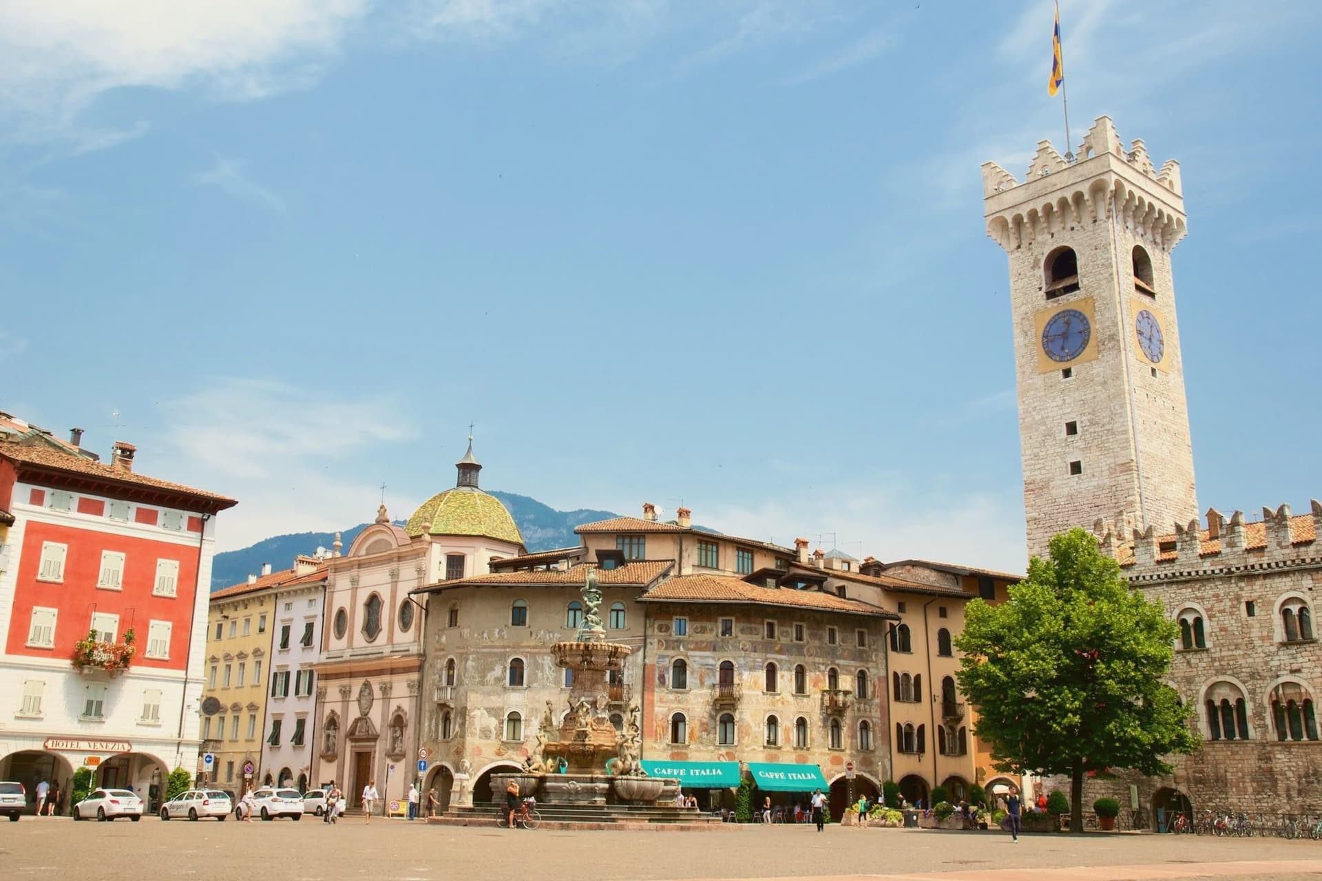
Why visit Trento
Trento sits at 194 metres on the Adige, the city Italy chose as the seat of one of its two northern autonomous provinces and the regional capital of Trentino-Alto Adige. Monte Bondone rises to two thousand metres directly above the western edge; the Brenta Dolomites are an hour west.
Between 1545 and 1563, the Council of Trent met here in twenty-five sessions across the Duomo di San Vigilio and the Castello del Buonconsiglio, formulating the Catholic response to the Protestant Reformation and shaping the next four centuries of European Christianity. The Duomo, begun in 1212 on the foundations of a late-Roman basilica, still stands at the centre of Piazza Duomo.
The Buonconsiglio, built 1239 to 1255 as the residence of the prince-bishops, is now the city's main museum. In 2013 Renzo Piano completed MUSE, the natural science museum on the south edge of town, with a six-storey jagged roofline that imitates the Dolomites.
What to see in Trento
- Castello del Buonconsiglio. Thirteenth-century residence of the prince-bishops of Trento, host to sessions of the Council of Trent and now the city's main museum, with Gothic frescoes in the Torre Aquila.
- Duomo di San Vigilio. Romanesque-Gothic cathedral begun in 1212 on the remains of a late-Roman basilica, where most public sessions of the Council of Trent were held between 1545 and 1563.
- MUSE. Museum of natural science by Renzo Piano, opened 2013, with a 130-metre roofline that rises and falls in imitation of the Dolomites visible to the east.
How to get to Trento
There is a railway station in the town, so you can arrive without a car and never need one while you are here. Trento is roughly 4 minutes away by road.
Our tip
April through June brings green slopes on Monte Bondone, mild evenings in Piazza Duomo and the start of the open-air concert season. September and October are dry and clear, with the Trento Film Festival of mountain cinema and the start of the autumn wine sagre in the Vallagarina to the south. July and August can hit thirty-three degrees in the city centre at 194 metres; the air cools sharply if you climb Monte Bondone, and locals spend afternoons on the mountain or at the lake. Trento Busker Food falls in September.
More from Anywhere Italy
- The best hot-spring towns within two hours of Verona
- The best hot-spring towns within two hours of Padua
- The best hot-spring towns within two hours of Milan
- The best hot-spring towns within two hours of Venice
- The best hot-spring towns within 90 minutes of Bologna
- The best hot-spring towns within two hours of Parma