
The 8 best wine towns within 90 minutes of Salerno
Wine near Salerno comes in two distinct landscapes. Inland, past Avellino, the hills rise into cool clay and volcanic soil where Aglianico ripens late, often into November, and Fiano and Greco come off slopes that hold morning fog until midday. On the coast, the vines are pergola-trained on dry-stone terraces above the sea, worked by hand because no machine can reach them, the walls built from the same grey limestone as the houses. Autumn is the season that makes sense here: harvest smoke, chestnuts, wood-fired bread, and cellars cut into tuff rock that stay cold in any weather.
Most visitors to this stretch of Campania go to Amalfi and Positano, and with good reason, since the churches, the lemon terraces and the sea are all worth the trip. The coast road carries more traffic than it was ever built for, and in high summer the buses queue nose to tail above the water. Positano in August is a town where finding a table takes longer than eating at it. The wine, meanwhile, is largely treated as something poured alongside the view.
The vines do not stop where the crowds do. They run up behind the coast into the hill parishes and over the ridge into Irpinia and the Sannio, where the cellars are working buildings and the tasting happens at the kitchen table. These are the towns on that continuous line of wine country, all of them members of the national association of Italian wine towns, and all of them reachable from Salerno inside a morning's drive.
Of the 33 communes we have mapped within 90 minutes of Salerno, 8 qualify as wine towns: each belongs to the national association of wine towns. The smallest, Furore, has 688 residents.
Elsewhere in the catalogue: The best small wine towns in Campania and The best towns known for what they grow within 45 minutes of Salerno.
Furore
Why visit Furore
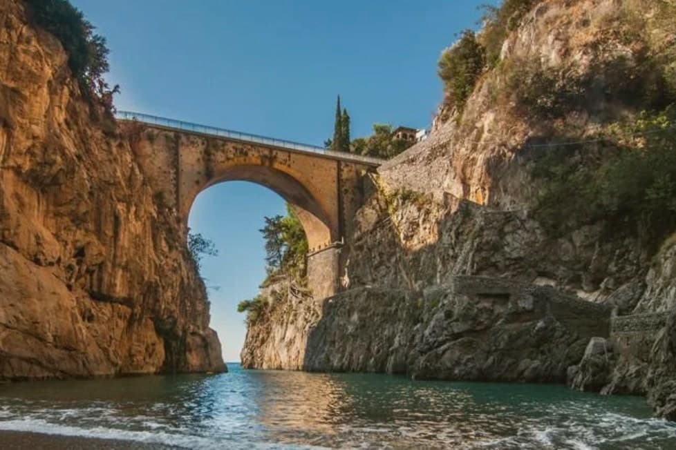
Furore stretches up the cliff between Praiano and Conca dei Marini on the UNESCO-listed Costiera Amalfitana, six hundred and eighty-eight people across houses that don't share a single piazza. The main settlement sits at 300 meters in the upper Vallone del Furore; the commune drops to sea level at the Fiordo di Furore, a narrow ria carved by the Schiato torrent that flows down from Agerola at 550 meters.
The historian Matteo Camera traced the name to the roar storms make through the gorge. Since the late 1980s the painter Silvio Vetrano's project Il Paese Dipinto has invited artists each September to paint murals on the village walls, which is why Furore is sometimes called the painted village or the village that doesn't exist.
The commune is a Borgo più bello d'Italia and a Città del Vino: the Fiorduva white from the Marisa Cuomo winery is grown on terraces above the fjord.
The comune belongs to the national association of wine-producing towns.
What to see in Furore
- Fiordo di Furore. Narrow ria cut by the Schiato torrent, southern Italy's only fjord, with a stone bridge crossed by the SS163 and a pebble beach below.
- Il Paese Dipinto. Open-air mural circuit started in 1980 by Silvio Vetrano, with new works added each September by invited Italian and international artists.
- Chiesa di Sant'Elia Profeta. Parish church on the upper part of the village, with a majolica-tiled dome and a small square overlooking the terraces below.
How to get to Furore
Salerno is roughly 36 minutes away by road.
Our tip
May, June, September and early October are the strongest months on this stretch of the Amalfi Coast. The sea climbs past twenty degrees, the SS163 buses run on a working timetable, and the Fiordo di Furore beach is accessible without a queue. July and August are full: the day-trippers come up from Amalfi and the small parking pockets on the SS163 fill before nine.
Tufo
Why visit Tufo
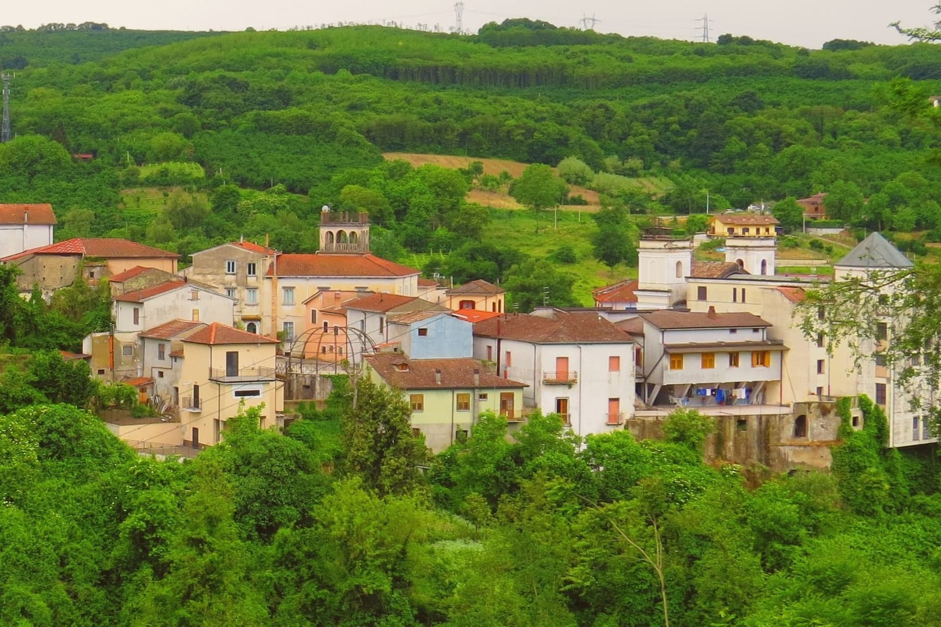
The name Tufo comes from the volcanic tuff stone the hill is built on, the same stone that runs through the slopes below and gives the local wine its mineral edge. The village sits on top of that stone at 250 meters, with the cellars at its foot and the vineyards spreading out around both.
Sulfur was mined in shafts cut into the cliffs beneath the village, work that shaped the local economy for over a century before it stopped. Most visitors are wine buyers, not tourists.
They drive in for a tasting, walk the steep main street to the medieval castle on top, and leave by dinner. The village stays quiet after they go.
What the stone gave the place economically it also gave it physically: a hill town built from the same rock that flavors what it grows, mined until the ground itself ran out of use.
The comune belongs to the national association of wine-producing towns.
What to see in Tufo
- Castello di Tufo. Medieval fortress on the top of the hill, rebuilt after the 1732 and 1980 earthquakes that damaged the village below.
- Cantine di Marzo. The cellars sit at the foot of the village, where Greco di Tufo has been produced commercially since the family took up winemaking here.
- Ex Miniere di Zolfo. Abandoned mines in the cliffs below the village, their shafts left the rock marked with rust-colored scars after closure.
How to get to Tufo
There is a railway station in the town, so you can arrive without a car and never need one while you are here. Salerno is roughly 55 minutes away by road.
Our tip
April through June covers the green months in Irpinia: vine leaves unfurling on the slopes, mild evenings on the main street. September through early October is harvest, when the cellars open more often than usual and the village smells of crushed Greco. July and August get hot in the valley, though 250 meters keeps the worst of it off.
Lapio
Why visit Lapio
The name of the grape behind the local wine, 'Apianum', comes from the Roman word for bee, api, because the grape was said to be sweet enough to draw them. It has been grown across the Irpinia hills east of Avellino since at least the 1st century AD, though it only became a serious modern DOCG from the 1990s onward, thanks to producers here and in Montefredane, Summonte, and the neighbouring villages.
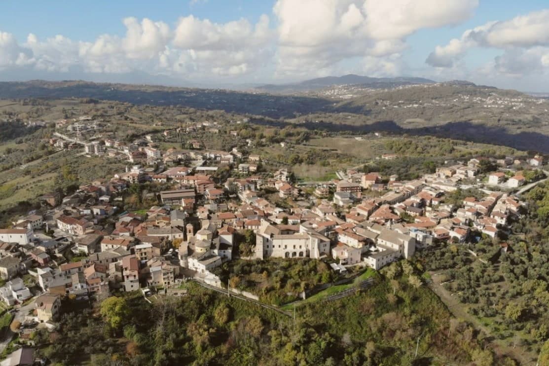
The comune itself sits at 590m on a hilltop, its narrow stone-paved vicoli climbing from the central piazza up to the castle at the high point, past the Chiesa Madre di San Pietro Apostolo and the Convento dei Cappuccini just outside the walls. The four Città designations held here, del Vino, dell'Olio, del Miele, della Nocciola, are not scattered honours but a single picture: Fiano and Aglianico from the vineyards, Irpinia DOP oil from the terraces, chestnut and multifloral honey from the Apennine forests above town, and the hazelnut trade that makes Avellino province the second-largest producer in Italy after Cuneo.
Beyond the comune: Avellino 24 km west, Mirabella Eclano with its Roman Forum and Carro di San Pellegrino procession 15 km north, and the Partenio and Sannio mountains immediately east, whose forests supply both the honey and the local game. The food follows the same logic: pasta al ragù di castrato, brodo di tagliolini con scarola, Caciocavallo Podolico matured 12 or more months on Apennine pastures, torrone tenero made with hazelnuts and honey, and the wine with all of it.
Depopulation has cut the town from 2,400 residents in 1951 to 1,428 today, but the surrounding land, vine, olive, forest, and hazelnut grove, still accounts for nearly everything the place is known for.
The comune belongs to the national association of wine-producing towns.
What to see in Lapio
- Fiano di Avellino DOCG cellars. Lapio is one of the historic cru villages, 'Apianum' grape since Roman times, modern DOCG only since 1990s. 10+ cellars in the comune + immediate neighbours open for tastings.
- Castello Filangieri. 11th-c Norman castle rebuilt by the Filangieri family in the 16th c. Anchors the high point of the medieval centro with the panoramic view across the Sabato river valley + the Partenio massif.
- Centro storico + Chiesa Madre. Intact stone-paved vicoli climbing from the central piazza to the castle. The 15th-c Chiesa Madre di San Pietro Apostolo + the Convento dei Cappuccini just outside the walls.
How to get to Lapio
There is a railway station in the town, so you can arrive without a car and never need one while you are here. Salerno is roughly 59 minutes away by road.
Our tip
Lapio is best May–June and September–October. The Festa del Fiano in late September is the year's headline. October is harvest in both the Fiano vineyards and the surrounding hazelnut orchards.
Taurasi
Why visit Taurasi
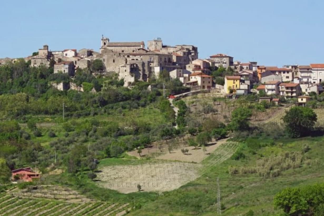
Taurasi sits at four hundred meters on a hill in the Media Valle del Calore, in the Irpinia of the Avellino province, forty kilometers inland from Salerno. The castle above the town was built in the seventh century by the Lombards, destroyed by Saracen raids between 900 and 910, rebuilt and extended by the Normans in the twelfth century with a square keep, and partly destroyed again by Alfonso d'Aragona's troops in 1461.
The Gesualdo, Filangieri, Ludovisi and Carafa families took it in turn through the early modern period, each leaving their mark on a structure that was never allowed to settle into a single style. The upper ridge holds the castle and its history of damage and repair.
The lower town holds the parish church and its patronal feast, the daily religious life set apart from the fortress above. Between them, the medieval center keeps three gates and the noble palaces that once answered to whichever family held the keep.
Around all of it, the vineyards run down the slopes, the same ground that has outlasted every family that held the castle above it. What the place adds up to is a hill town where the fortress changed hands over and over while the vines below kept producing, so the wine, not the castle, became the more durable claim to distinction.
The comune belongs to the national association of wine-producing towns.
What to see in Taurasi
- Castello Marchionale. The keep stands on the upper ridge, its stone showing the patchwork of repeated rebuilding across centuries of raids and sieges. The square Norman keep is the most legible surviving structure.
- Enoteca Regionale. Regional wine cellar inside the castle, with a Percorso Tau sensory route through the Taurasi, Fiano di Avellino and Greco di Tufo appellations.
- Centro storico. Medieval village with three surviving gates, Porta Sant'Angelo, Porta Piccola and Porta Maggiore, and noble palaces with corner towers.
How to get to Taurasi
Salerno is roughly 74 minutes away by road.
Our tip
April through June and September into October are the working months for Taurasi. The Aglianico vines bud in late spring, the slopes turn through copper into November after harvest. The vendemmia falls in late October, the latest in southern Italy because Aglianico ripens slowly.
Ravello
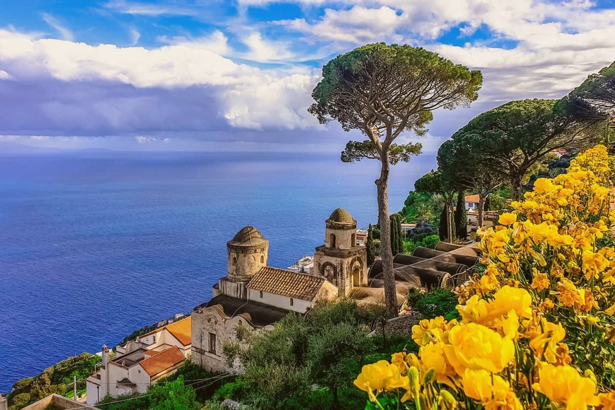
Why visit Ravello
Ravello sits on a spur above the Amalfi Coast, between the valleys of the Dragone and the Reginna Minor, 782 stairs up from Atrani at sea level. The village grew rich in the 12th and 13th centuries as a satellite of the Amalfi maritime republic, when patrician families like the Rufolo, Confalone and d'Afflitto built their houses on the ridge to escape the coastal raids.
The upper village holds the older churches and the social life of the piazza; the villas that made the town's later reputation sit toward the cliff edge, their gardens and belvederes facing the water. One villa's garden was seen by Richard Wagner in 1880 and identified by him with Klingsor's enchanted garden in his opera Parsifal, and he wrote the opera's second act on the strength of it.
The Ravello Festival began playing orchestral concerts in that same garden in 1953, the year the council decided to use Wagner's visit to rebuild a postwar economy. The town's shape, ridge above, stairs down to the coast, patrician houses turned toward the sea, is the record of why families climbed here in the first place and what they built once they had reason to stay.
The comune belongs to the national association of wine-producing towns.
What to see in Ravello
- Villa Rufolo. Patrician residence built 1270 with Moorish cloister and terraced gardens; setting for the Ravello Festival concerts and the second act of Wagner's Parsifal.
- Villa Cimbrone. Cliff-edge villa restored after 1904 by Lord Grimthorpe, ending in the Terrazza dell'Infinito, a marble belvedere over the Gulf of Salerno.
- Duomo di Ravello. Cathedral on Piazza Vescovado, founded 1086, with the bronze portal cast by Barisano da Trani in 1179 and the marble pulpit signed by Niccolò di Bartolomeo da Foggia in 1272.
How to get to Ravello
Salerno is roughly 33 minutes away by road.
Our tip
May, June, September and early October are the months Ravello reads best. The temperature on the ridge runs three to five degrees cooler than on the coast below, the festival concerts on the Villa Rufolo belvedere run from late June through August, and the gardens are full without the day-tripper bus queues of high summer. July and August fill the SITA bus from Amalfi and the road up the Dragone valley, and the festival's evening concerts under the stars are the reason most overnight visitors come.
Tramonti
Why visit Tramonti
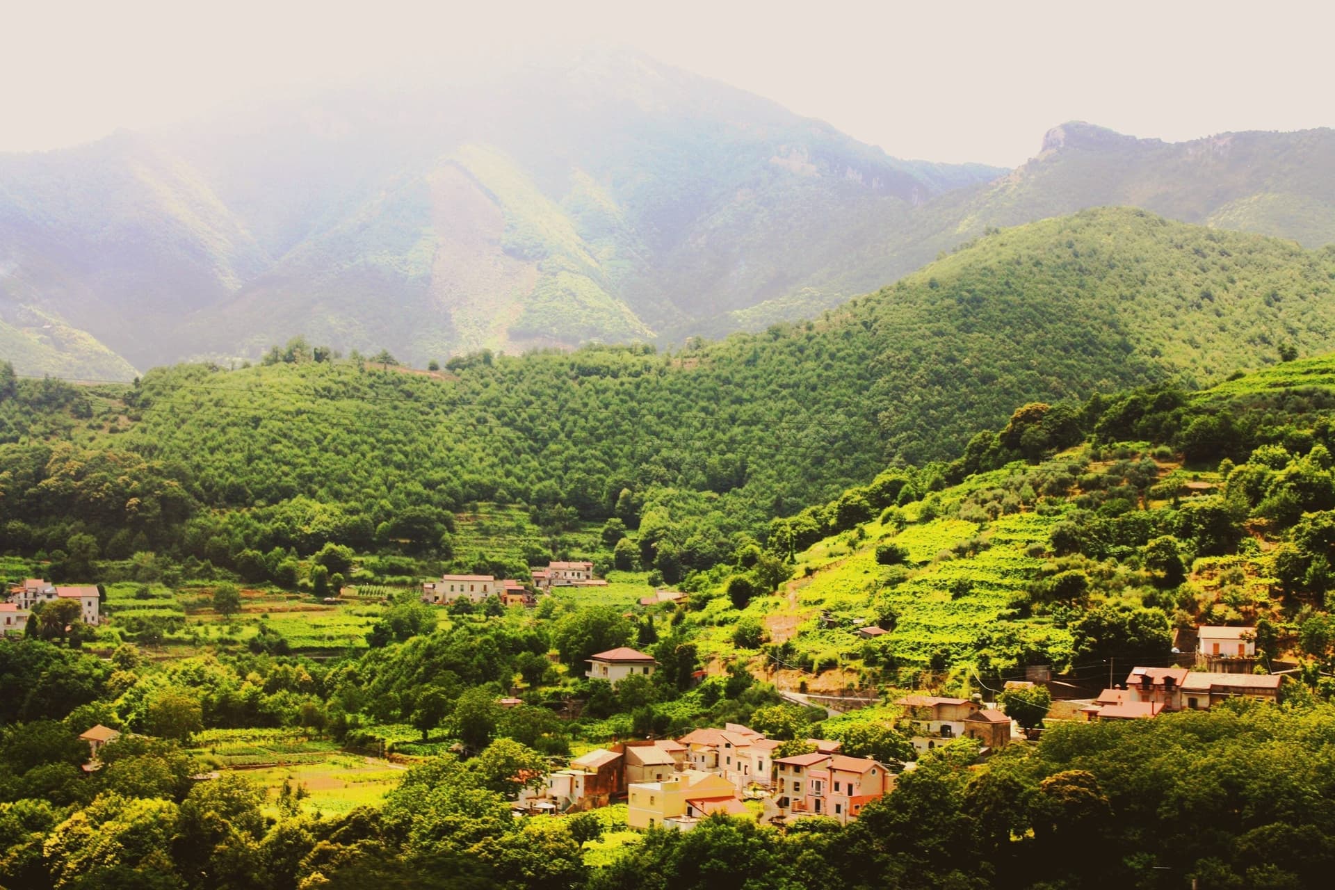
Tramonti is the Amalfi Coast that does not face the sea. The comune covers thirteen hamlets on the inland Lattari slopes above Maiori, with the seat of Polvica at 321 meters and the higher frazioni climbing past six hundred, each linked by old mule tracks rather than a single main street.
It was an important town of the Maritime Republic of Amalfi between 839 and around 1200, sitting on the inland side of the ridge that divides the coast from the Sorrento peninsula and, by way of the Valico di Chiunzi, from the Sarno valley beyond. Two exports carried the village name further than the village itself: fiordilatte mozzarella from the high pastures, and the long-fermented pizza dough that emigrants took north in the post-war years to found most of the historic pizzerias of Piedmont and Lombardy.
The slopes fall within the UNESCO Amalfi Coast site and the Monti Lattari Park, with chestnut forest and limoncello distilleries on every road. A comune this scattered, with its parishes on separate ridges and its produce known abroad before the place itself, reads less like one town than a federation of hamlets that happened to share a name.
The comune belongs to the national association of wine-producing towns.
What to see in Tramonti
- Convento di San Francesco. Fourteenth-century Franciscan convent at Polvica with cloister and a rare wooden Christ, founded by Beata Margherita Cigala in 1474.
- Costa d'Amalfi Tramonti DOC vineyards. Terraced parcels climbing the Lattari slopes at a pitch among the steepest viticultures in Italy, worked by hand where machinery cannot stand.
- Thirteen frazioni of Tramonti. Hamlets scattered up the ridges between 250 and 700 meters, each with its own parish and traditions, connected by old mule tracks.
How to get to Tramonti
Salerno is roughly 38 minutes away by road.
Our tip
May through September is the Amalfi calendar, with the inland Lattari side cooler than the coastal road and the vineyard work running into harvest in late September and October. July and August see day-trippers walking up from Maiori for cooler air and lunch; the road to Valico di Chiunzi takes the overflow from Ravello and Amalfi. The chestnut harvest falls in October and November and Pizza a Metro festivals happen in late summer.
Maiori
Why visit Maiori
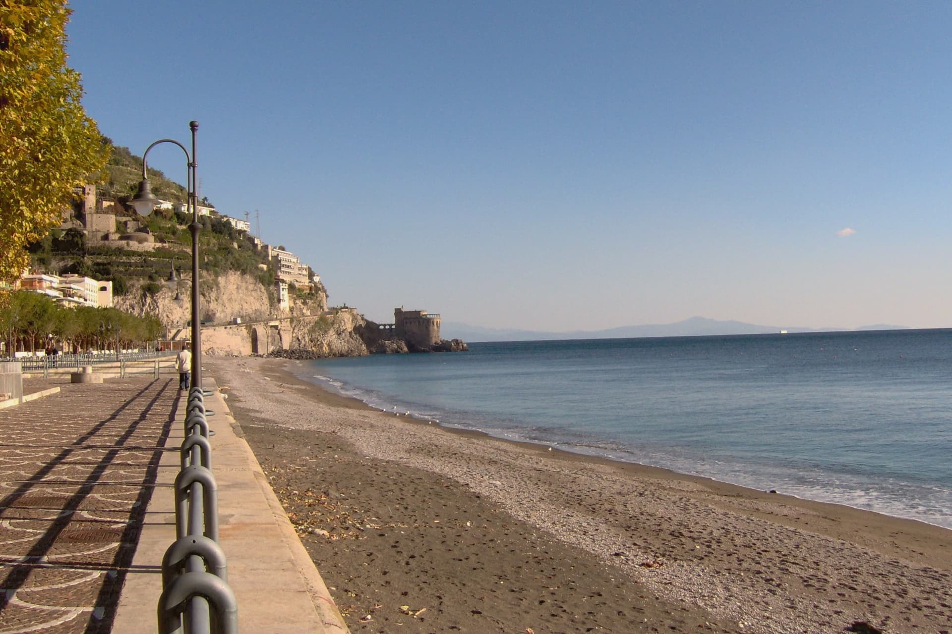
Maiori sits at the mouth of the Reginna torrent between Minori and Cetara, the widest valley on the Amalfi Coast and the only flat ground on the strip. A wall of medieval houses rose up the gorge until the night of 26 October 1954, when a freak storm dropped 500 millimeters of rain on the Lattari ridge in twelve hours.
The torrent swept the centro storico, the lemon terraces and several streets into the sea, killing over 80 people. The town was rebuilt with a rare straight grid behind a kilometer-long beach of volcanic sand, the longest on the coast.
The Castello di San Nicola de Thoro-Plano sits on the ridge above, 11th-century walls part-ruined since the Anjou siege. The Collegiata di Santa Maria a Mare, 13th-century with a green and yellow majolica dome, survived the flood and looks out from the hill.
Roberto Rossellini shot Paisà, Voyage in Italy and Il Miracolo here in the late 1940s.
The comune belongs to the national association of wine-producing towns.
What to see in Maiori
- Collegiata di Santa Maria a Mare. Thirteenth-century parish church on the hill, three-aisle neoclassical interior with gilded coffered ceiling and green-and-yellow majolica dome.
- Castello di San Nicola de Thoro-Plano. Eleventh-century fortress in partial ruin on the ridge above town, with views over the Reginna valley and the coast east to Capo d'Orso.
- Spiaggia di Maiori. Kilometer-long beach of volcanic sand, the longest on the Amalfi Coast, replanted with palms behind the seawall after the 1954 flood.
How to get to Maiori
Salerno is roughly 22 minutes away by road.
Our tip
May, June, September and early October are the months Maiori is set up for. The long beach absorbs more visitors than the cove towns nearby, the SITA bus connects west to Amalfi and east to Salerno, and the Sentiero dei Limoni is open without the heat. July and August fill the kilometer of sand and push every restaurant on the lungomare to two evening shifts.
Benevento
Why visit Benevento
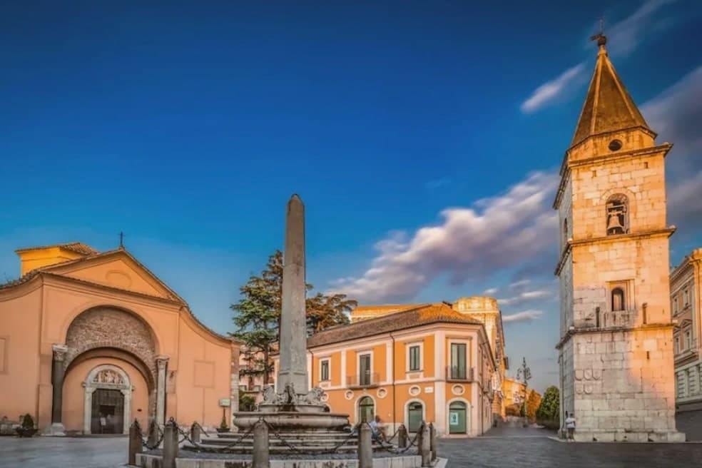
Benevento sits at 130 meters at the confluence of the Calore and Sabato rivers, fifty-five kilometers northeast of Naples, the historic capital of the Sannio. The Lombard Duchy of Benevento was founded in 571, well before the small circular church that survives from around 760, and the city centre still carries that double layer of Roman provincial capital and Lombard duchy seat.
Walking from the cathedral down Corso Garibaldi, past the cloister sculptures set against the medieval wall, ends at the triumphal arch, so the route itself moves from the Lombard and medieval town toward the point where the Roman road left for Brindisi. The countryside around the city is Aglianico del Taburno wine and the herbal liqueur distilled here since 1860.
What holds the city together is this sequence along one line of streets: two civic identities, Roman and Lombard, laid end to end and still walkable in that order.
The comune belongs to the national association of wine-producing towns.
What to see in Benevento
- Arco di Traiano. The marble reliefs facing the road show Trajan's domestic policy, those facing the town his military campaigns, a pairing read as deliberate rather than decorative. The Via Traiana ran from this point to Brindisi.
- Chiesa di Santa Sofia. The circular plan is unusual for the period, and the interior keeps traces of the original Lombard fabric beneath later additions. It stands apart from the rectangular churches common elsewhere in the city.
- Teatro Romano. Roman theatre begun under Hadrian and completed under Caracalla, capacity for ten thousand spectators, still used for summer performances.
How to get to Benevento
There is a railway station in the town, so you can arrive without a car and never need one while you are here. Salerno is roughly 84 minutes away by road.
Our tip
April through June and September into October are the city's dry months, with mild evenings along the Calore and the Roman amphitheatre's summer programme starting in June. July and August push the inland Sannio past thirty-five degrees, and the old town empties between three and six in the afternoon while the riverbanks become the local refuge. November through March is wet, foggy at dawn, with rain a constant in February.
More from Anywhere Italy
- The best small wine towns in Campania
- The best towns known for what they grow within 45 minutes of Salerno
- The best wine towns that eat well in Campania
- The best wine towns within 90 minutes of Naples
 The best hill towns within 90 minutes of Salerno
- The best towns with a World Heritage site within 45 minutes of Salerno