The best hill towns within 90 minutes of Milan
Milan sits on a flat plain, and the relief starts sooner than most people assume. Within an easy morning's drive the land rises into the Oltrepò Pavese, the Tortonese hills, the Monferrato edge and the mouths of the Ossola valleys, where towns were built on high ground for defence and stayed there. The building material changes as you go: river stone and slate in the north, warm brick and sandstone in the hills below the Po. Autumn is the season that pays best, with grape harvest in the vineyards, chestnuts roasting, salame di Varzi on the counter and fog lying in the valleys below while the ridges stay clear.
The default weekend escape from Milan is the water, above all Lake Como. Bellagio and Varenna are beautiful and they are also a queue: ferry crowds, coach parties, restaurant terraces booked out from spring to October, and a lakeside road that stops moving on Sunday afternoon. The same pressure now reaches Lake Maggiore and the Franciacorta wine trail. None of it is undeserved, but it means the most photographed corners near Milan are also the least restful.
The hills carry on well past the lakes, and they are quieter because nobody has told anyone to go. These towns stand on ridges and rock spurs rather than on the plain, some of them castle villages in the Oltrepò, some of them stone settlements guarding the road to the Alps, some of them wine towns whose names are better known on a bottle than on a map. Trains and motorways reach most of them inside an hour and a half of the city. Fewer people go, and the food, the wine and the views are the same ones the crowds came for.
Of the 45 communes we have mapped in a 90-minute drive of Milan, 12 qualify as hill towns: each stands on high ground rather than on the plain. This list is 10 of them. The smallest, Montesegale, has 258 residents.
Elsewhere in the catalogue: The best wine towns within 90 minutes of Milan and The best hill towns within 90 minutes of Novara.
Montesegale
Why visit Montesegale
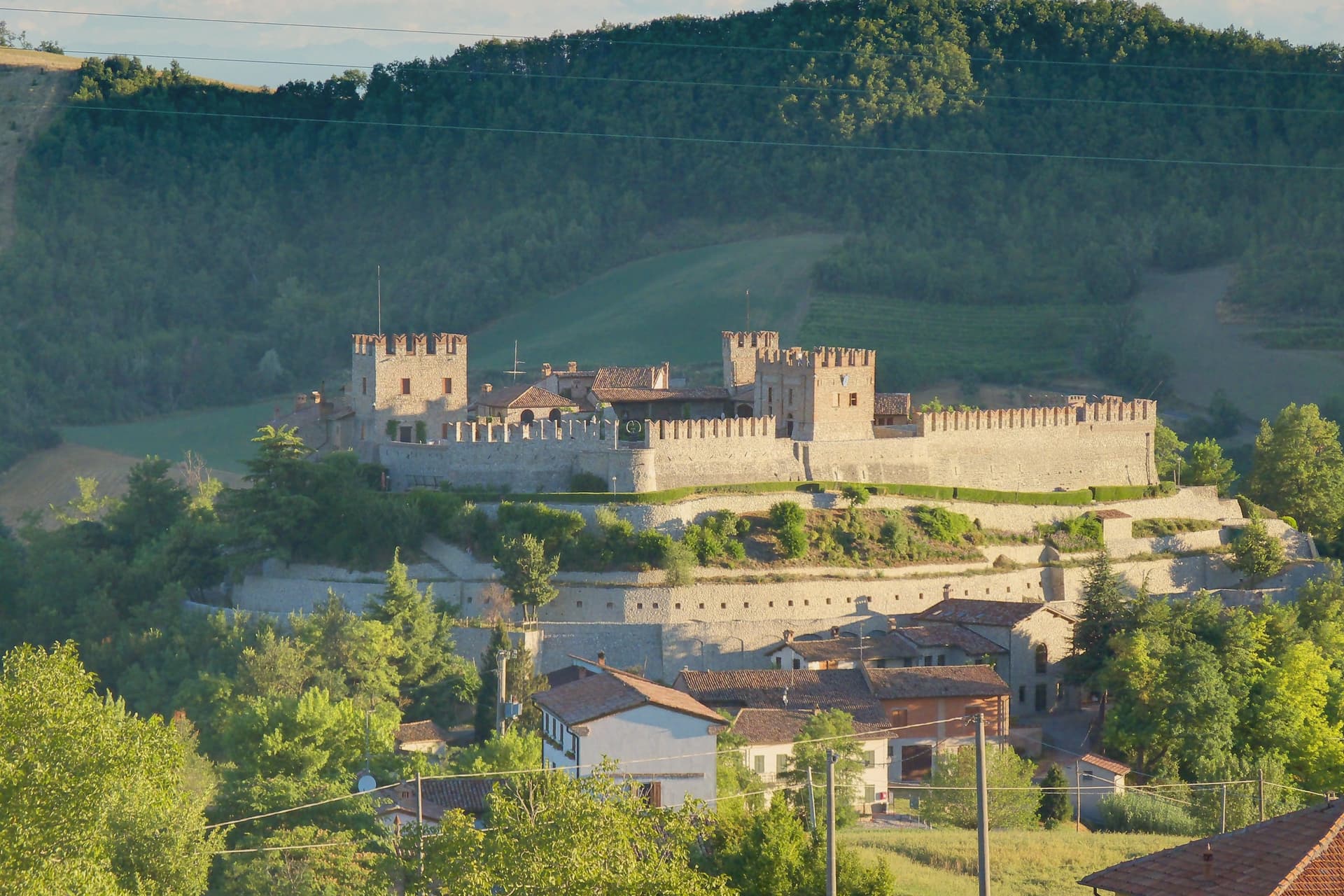
The village takes its position from the hill above the Val Ardivestra, the stream valley that separates its wheat fields and vineyards from the wider Oltrepò Pavese around it. The first historical record dates to the eleventh century, under the bishop of Tortona.
In 1164, Federico Barbarossa transferred the fief to the Counts Palatines of Lomello, whose Gambarana branch took it over in 1311 and held the title of Lords of Montesegale until feudalism ended in 1797. The upper part of the settlement is still organized around the castle those lords built and rebuilt, while the parish church sits below it, a later, separate addition from 1700 serving the working village rather than its lords.
The Borghi Autentici and Città del Pane designations recognize that working character directly: a handful of bakeries, the local Salame di Varzi country, and a wine-and-grain landscape that has changed use only in the castle itself, where the seat of feudal power now holds a contemporary art collection instead of a garrison.
What to see in Montesegale
- Castello dei Conti Gambarana. The fortress dominates the village from its hilltop, reshaped across successive building phases before the seventeenth-century restoration that gave it its present form. The Counts Palatines of Lomello line held it through the Gambarana branch until feudalism ended in 1797.
- Chiesa dei Santi Cosma e Damiano. Parish church built in 1700 below the castle, dedicated to the twin physician saints, with a single nave and Baroque altar.
- Centro storico. Small hill village around the castle, with stone houses, narrow lanes and the steep approach road from the Ardivestra valley below.
How to get to Montesegale
Piacenza is roughly 64 minutes away by road.
Our tip
April through October is the workable window. May, June and September are the strongest: vines in leaf, oak woods green, the castle approach open and dry. July and August push past thirty degrees on the Pavese hills; the village empties between two and six in the afternoon.
Garbagna
Why visit Garbagna
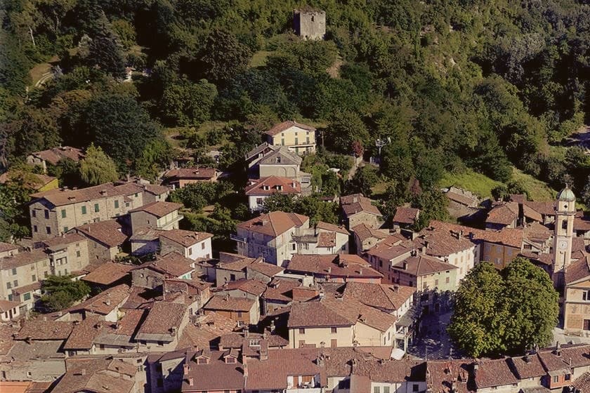
The town sits in the Tortonese hills of eastern Piedmont, forty kilometers from Genova and thirty-five from Alessandria, at the point where the Curone, Grue and Ossona valleys meet. The architecture leans south toward Liguria rather than west toward the wider Piedmontese hill towns: tall houses pressed together, narrow stone streets, carved portals and an aristocratic palace surviving at the center, all giving the place the feel of a Ligurian entroterra village transplanted into Piedmont.
The upper Val Curone around the town is the growing ground for the Ciliegia Bella di Garbagna, the deep-red cherry harvested by hand each June, with Garbagna standing as its commercial center. The same eastern slopes fall inside the Colli Tortonesi DOC, where Pinot Nero is grown alongside the cherry orchards.
The town's built form and its produce both point the same direction: a Piedmontese address with a Ligurian character, shaped as much by the valley's geography as by the province it belongs to on the map.
What to see in Garbagna
- Palazzo Fieschi-Alvigini. Historic palace in the centro storico, the surviving aristocratic anchor of the medieval Ligurian-style core.
- Centro storico. Tall houses leaning against each other along narrow streets, arches and carved portals, closer in feel to Ligurian than Piedmontese borghi.
- Cherry orchards of the Val Curone. Hand-harvested groves of the Ciliegia Bella di Garbagna across the central weeks of June, the town's signature agricultural landscape.
How to get to Garbagna
Genova is roughly 65 minutes away by road.
Our tip
April through June is cherry country at 270 meters, with the trees in flower in April and the Ciliegia Bella harvest in mid-June. September and October bring the Colli Tortonesi grape harvest and dry, warm days that suit walking the narrow streets of the centro storico. July and August are warm in the Tortonese hills; the tall houses pressed together give shade through the hottest hours.
Vogogna
Why visit Vogogna
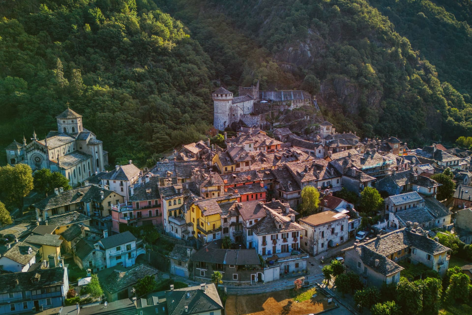
Vogogna sits at 226 meters on the floor of Val d'Ossola, at the narrow point of the valley where the Toce bends south toward Lago Maggiore. The castle went up on the spur above the village as part of a broader reinforcement of the Duchy of Milan against Swiss incursions over the Sempione, built alongside an older fortified rock that had already held the same defensive line.
Together they anchored the town's promotion to administrative seat for the lower half of the valley, in balance with Domodossola further up, which held the upper half. Spanish rule from the sixteenth century onward reduced the castle's strategic weight, and in 1798 it passed into municipal hands, used at one stage as a prison, before the long restoration that closed in 2005.
The borgo carries Borghi più belli d'Italia and the Bandiera Arancione, and Val Grande National Park borders the commune on the west. What the town amounts to is a lower valley's seat of government grown around a fortress that outlived its military purpose by centuries, wedged between wilderness on one side and the river's bend on the other.
What to see in Vogogna
- Castello Visconteo. Restored from 1990 to 2005, the castle is now open to visitors with a multimedia conference room installed inside its walls.
- Rocca di Vogogna. Earlier fortified rock above the Visconti castle, the original medieval defensive post over the narrow point of the Toce valley.
- Centro storico. Medieval core below the castle with stone houses, narrow streets and the Palazzo Pretorio, the historic administrative seat of Ossola Inferiore.
How to get to Vogogna
There is a railway station in the town, so you can arrive without a car and never need one while you are here. Novara is roughly 75 minutes away by road.
Our tip
April through June brings clear walking weather to the Toce valley, with the upper Val Grande slopes drying out and the Visconti castle terraces open for full hours. September and October are the harvest months in Ossola, when chestnut woods turn on the lower slopes and the cooler air carries the view from the Rocca down the valley toward Lago Maggiore. July and August warm the valley floor, but the stone houses of the centro storico keep the streets shaded.
Ornavasso
Why visit Ornavasso
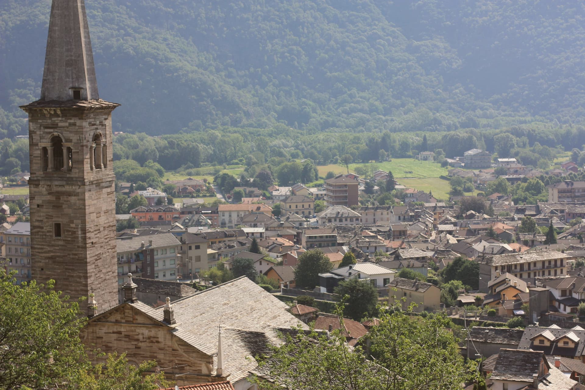
Ornavasso sits on the Toce river just upstream from Gravellona, where the valley narrows toward the southern threshold of the Val Grande. The quarries worked the right bank of the Ossola valley opposite Candoglia, and their stone traveled well beyond the commune: besides the Milan cathedral, it went into the facade of the Certosa di Pavia and the Octagon of the Duomo di Pavia, a supply line running from the fourteenth century onward.
The town's frazione, Migiandone, formed part of the same Walser settlement, colonists from the Simplon who kept a German dialect alive here into the late nineteenth century, longer than in any Walser community further up the Ossola. The ground beneath the town has its own older history: two pre-Roman necropolises, Celtic and Italic, with burials spanning the second century BC to the first century AD.
Above the centro, the devotional life of the upper Toce climbed the hillside, and in 1944 that same high ground sheltered soldiers and then partisans of the Valtoce division, in the brief Allied-recognised partisan state that held the upper valley that year. A quarry town, a language outpost, and a wartime redoubt turn out to be the same few square kilometers, stacked in time rather than spread across it.
What to see in Ornavasso
- Santuario della Madonna del Boden. Sanctuary above the town, standing 475 meters over the centro, reached by a climb that has drawn devotion from the surrounding valley since it was built.
- Santuario della Madonna della Guardia. Hilltop sanctuary that housed Italian army troops and then partisans during the brief Allied-recognised partisan state of autumn 1944.
- Cave di marmo. Quarries on the right bank of the Toce, still legible in the rock face, the source of stone for both the Duomo di Milano and the Arco della Pace.
How to get to Ornavasso
Novara is roughly 77 minutes away by road.
Our tip
April through June brings the Toce down high and clean, the chestnut and beech woods on the marble slopes filling in. July and August are warm and busy with Val Grande trekkers entering through Migiandone; the centro is quieter than Lake Maggiore but the trails fill on weekends. September and October are the strongest months: clear light on the marble quarries, the Boden sanctuary backlit at dusk, and the Val Grande in its autumn copper.
Gavi
Why visit Gavi
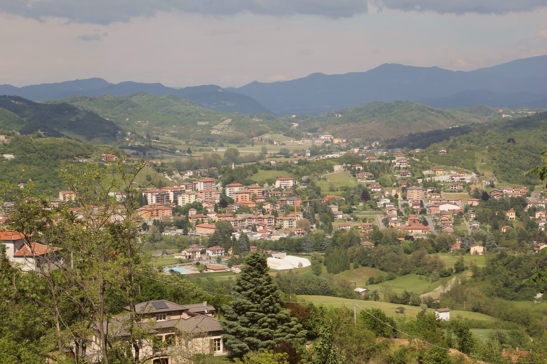
Gavi sits at 233 meters where the Lemme stream meets the Rio Neirone, the southern edge of Piemonte before the Apennines drop to Genova. The first record of vines here is a 972 tribute paid to the Republic of Genoa, three Genoese pounds of wine.
The medieval town clusters along the narrow valley below the Forte di Gavi, a polygonal star fortress built and expanded by the Genoese between 1540 and 1673 on the foundations of a tenth-century castle. The fort fell to French-Savoyard troops in 1625 and was retaken in twenty-one days; under the Savoy it became a prison, then a prisoner-of-war camp for Austro-Hungarian and later Allied soldiers in both world wars.
Cortese di Gavi was made DOC in 1974 and DOCG in 1998. Wine from vines inside the commune may be labeled Gavi di Gavi, and the consortium maintains a separate denomination for grapes grown in the historic center.
What to see in Gavi
- Forte di Gavi. Polygonal star fortress on the hill above the town, built by the Genoese 1540 to 1673, later a Savoy prison and WWI/WWII POW camp.
- Chiesa di San Giacomo Maggiore. Romanesque parish church in the medieval center, with twelfth-century stonework and a baroque interior.
- Centro storico. Stone-house old town along the Lemme stream, arcaded streets and small piazzas framed by terraced vineyards.
How to get to Gavi
Genova is roughly 54 minutes away by road.
Our tip
April through October is the year. May and June bring green hills and the Lemme running clear; September and October are dry, with the harvest and the first cool nights. July and August touch the high twenties; the Forte di Gavi closes its tower walks in the afternoon heat. Gavi sotto il Forte falls in July.
Castell'Arquato
Why visit Castell'Arquato
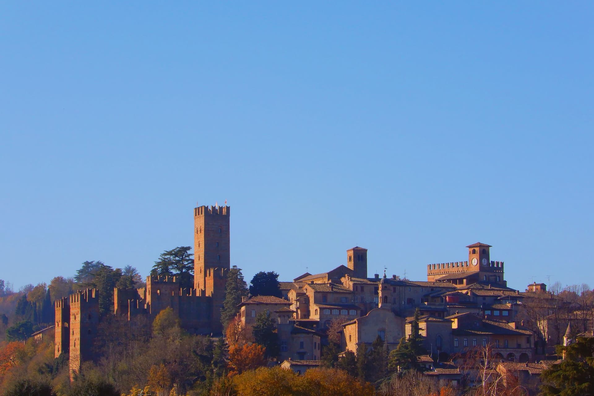
Castell'Arquato sits on the first hills of the Val d'Arda at 224 meters, thirty kilometers from Piacenza, the medieval borgo arranged in tight concentric levels around the old rock. The Collegiata di Santa Maria, founded by the noble Magnus in the eighth century, was rebuilt in 1122 after the 1117 earthquake destroyed the earlier church and is one of the finest Romanesque buildings in the Piacentino.
The Rocca Viscontea, with its thirty-five-meter tower, was begun in 1342 by Luchino Visconti, lord of Milan, to lock down the valley for Piacenza. The Palazzo del Podestà next door dates from 1292 and still anchors the Piazza Monumentale.
Luigi Illica, the librettist of Tosca, Madama Butterfly, La bohème and Andrea Chénier, was born in town in 1857; the museum dedicated to him sits in the house next to his birthplace. The Val d'Arda hills around the town produce the white wines that earned Castell'Arquato Città del Vino status.
What to see in Castell'Arquato
- Rocca Viscontea. Fortress begun in 1342 by Luchino Visconti for the municipality of Piacenza, with a thirty-five-meter tower at the highest point of the borgo.
- Collegiata di Santa Maria Assunta. Romanesque collegiate church, founded in the eighth century and rebuilt in 1122 after the 1117 earthquake destroyed the earlier structure.
- Palazzo del Podestà. Civic palace from 1292 facing the Collegiata, with the original ghibelline merlons and a fourteenth-century loggia along its lower level.
How to get to Castell'Arquato
Piacenza is roughly 38 minutes away by road.
Our tip
April through June is the best season for the Val d'Arda hills: the vineyards on the slopes below the borgo are green and the air clear enough to see across to the Appennino Piacentino. September and October bring the white-wine harvest and the chestnut weeks. July and August touch thirty-three degrees and the unshaded Piazza Monumentale becomes uncomfortable between noon and four.
Candelo
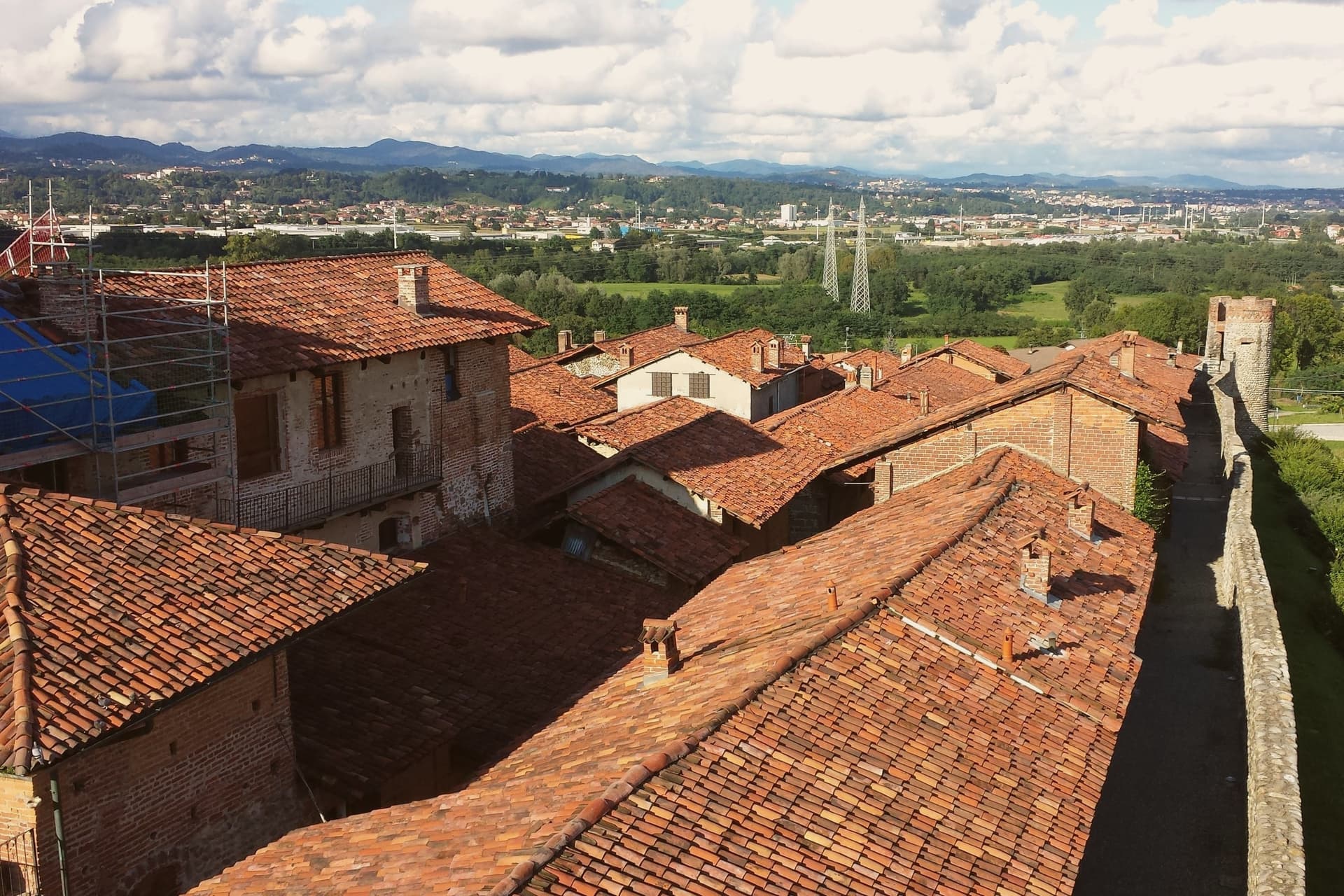
Why visit Candelo
Candelo sits at 350 meters on the right bank of the Cervo torrent, ten kilometers from Biella, with a third of its territory on the Baraggione plateau, a wild grassland of about 5,000 hectares now protected as the Riserva Naturale delle Baragge. The Ricetto is what people come for.
It is a late-medieval fortified shelter built by the local farming community in the thirteenth and fourteenth centuries: roughly two hundred stone cellule arranged on a pentagonal plan of 13,000 square meters, crossed by five east-west rue and two transverse, the perimeter walls running 470 meters. Goods, grain, wine and forage were stored here under the protection of the local lord.
Only in extreme attack did the population itself withdraw inside. It is the best-preserved structure of its kind in Piedmont.
Candelo joined the Borghi più belli d'Italia in 2002 and has held the Bandiera Arancione of the Touring Club Italiano since 2007.
What to see in Candelo
- Ricetto di Candelo. Thirteenth- to fourteenth-century fortified shelter on a pentagonal plan, with about two hundred stone cellule and 470 meters of walls.
- Rue del Ricetto. Five east-west streets and two transverse, paved in river stone, the cellule grouped along them for storing grain and wine.
- Chiesa di Santa Maria Maggiore. Parish church of Candelo next to the Ricetto, on the centro storico side of the town.
How to get to Candelo
Novara is roughly 54 minutes away by road.
Our tip
April through June brings the Baraggia into bloom and the Ricetto walls dry enough for the swallows. September and October are the harvest months on the Cervo plain, with vineyards on the Coste della Sesia turning to gold. July and August can sit humid in the river basin; the cellule, half-underground in places, hold cool inside even when the piazza is hot.
Gattinara
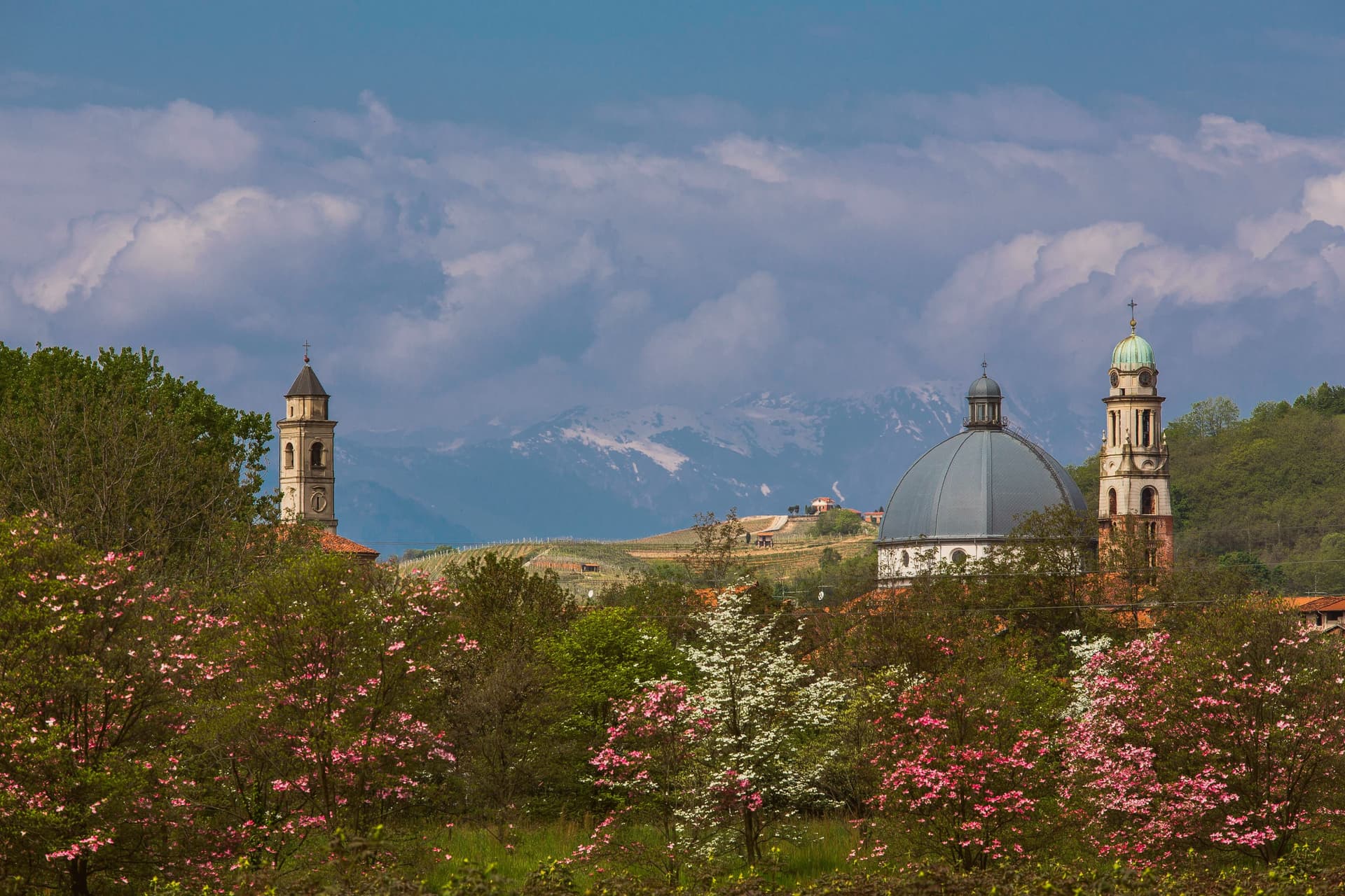
Why visit Gattinara
Gattinara sits on the right bank of the Sesia, north of Vercelli, in the Alto Piemonte wine zone where Nebbiolo is called Spanna. The hills behind the town are volcanic, the surface gravel pushed up when Africa met Europe and built Monte Rosa sixty million years ago.
Romans planted vineyards here in the second century BC. In 1242, the commune of Vercelli established a borgofranco that became the modern town.
In the early sixteenth century Cardinal Mercurino Arborio di Gattinara, Grand Chancellor to Emperor Charles V, served the local wine at his diplomatic dinners in Spain and Flanders; it stayed a court favorite for decades. The Torre delle Castelle, tenth-century watchtower above the vineyards, still stands on the ridge.
Gattinara became Italy's twentieth DOCG in 1990. The wine is at least ninety percent Nebbiolo, aged three years in wood for the riserva, and the bottles age longer than most Barolo because the volcanic minerality slows everything down.
What to see in Gattinara
- Torre delle Castelle. Tenth-century watchtower on the ridge above the vineyards, part of a fortified system that guarded the wine hills.
- Castello di San Lorenzo. Medieval fortress on the hill, paired with the Torre delle Castelle as the upper defensive line.
- Chiesa di San Pietro. Parish church in the historic center, the religious anchor of the borgofranco founded in 1242.
How to get to Gattinara
There is a railway station in the town, so you can arrive without a car and never need one while you are here. Novara is roughly 45 minutes away by road.
Our tip
April through June and September through October are the best months. The vineyards green up by Easter and the wine roads through the hills are walkable without heat. Harvest in late September pulls visitors to the cellars.
Ovada
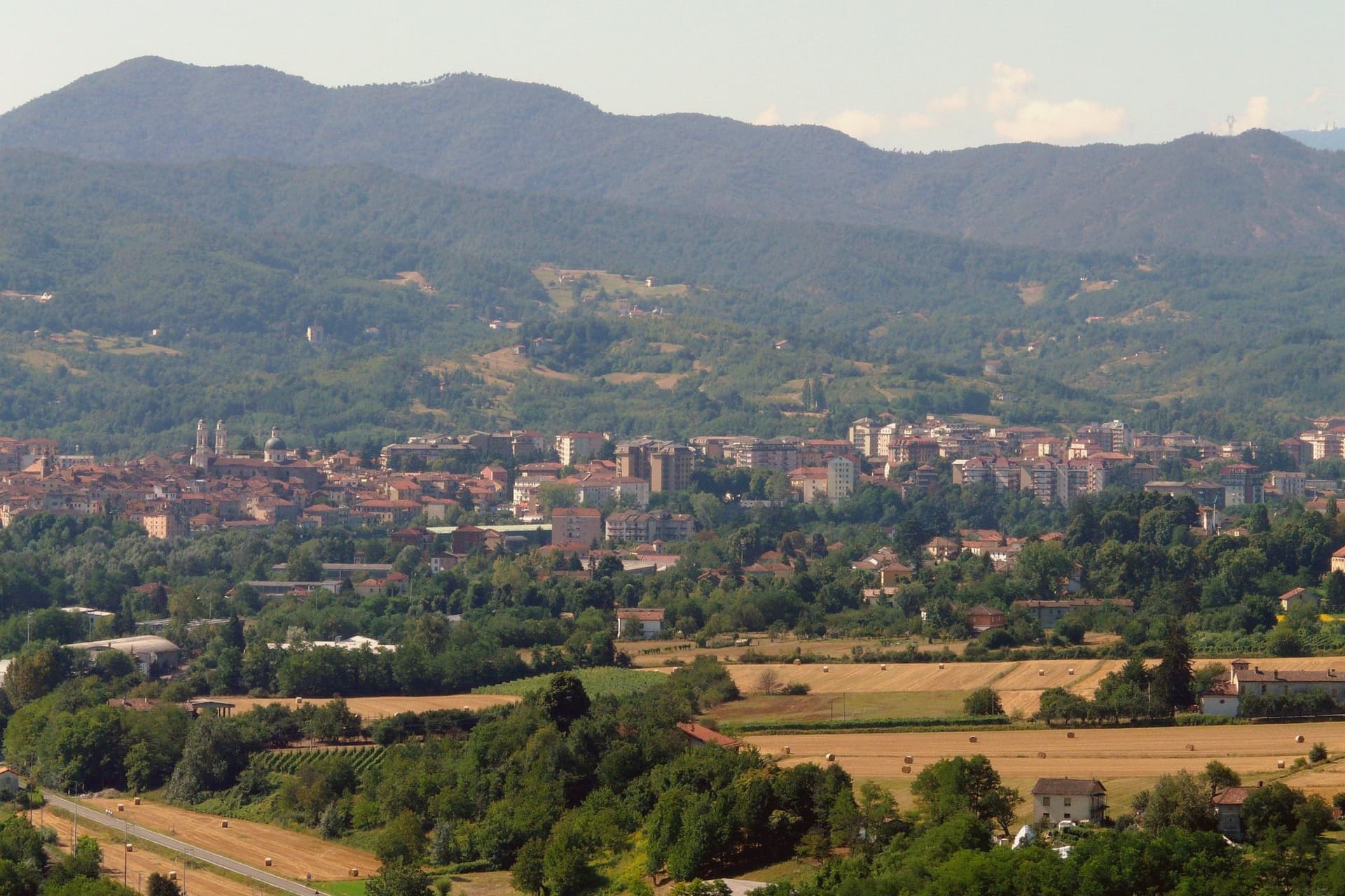
Why visit Ovada
Ovada sits at 186 meters at the confluence of the Orba and the Stura, in the southern Monferrato hills, 35 kilometres north of Genova on the old salt road between the port and the Po plain. The painted façades and the tall narrow houses still show the imprint of the Republic of Genoa, which held the town through the Middle Ages alongside the Marquises of Monferrato.
Dolcetto from the Ovadese hills was already commercialised in the Lombard period (seventh and eighth century) and was the first Dolcetto in Piemonte to win DOC status, in 1972; the DOCG for Ovada Superiore came in 2008. The Chiesa Parrocchiale di Nostra Signora Assunta, with its two twin bell towers, was designed by Gio Antonio Delfrate after the Genoese Basilica di Santa Maria delle Vigne, built from 1772 to 1781 and consecrated in 1801.
The Capuchin church was built from 1640 after a plague vow of 1631 and suppressed under Napoleon in 1810. Ovada carries Città del Vino.
What to see in Ovada
- Chiesa Parrocchiale di Nostra Signora Assunta. Twin-bell-tower parish church built 1772–1781 by Gio Antonio Delfrate, modelled on Santa Maria delle Vigne in Genova, consecrated 1801.
- Loggia di San Sebastiano. Medieval loggia, the original parish church of Ovada dedicated to Santa Maria, now used as a venue for cultural events.
- Chiesa dell'Immacolata Concezione (Cappuccini). Capuchin church begun in 1640 after a 1631 plague vow, single nave with two side chapels, suppressed in 1810 under Napoleon's ecclesiastical decree.
How to get to Ovada
There is a railway station in the town, so you can arrive without a car and never need one while you are here. Genova is roughly 47 minutes away by road.
Our tip
April through June is the green window in the Ovadese hills, vines breaking bud and the rivers running off the Ligurian Apennines. July and August touch the mid-thirties; the centro storico thins after lunch and the Orba pools become bathing spots for residents. September and October are the harvest months, the entire Ovada DOCG zone working through vendemmia, and the cantine open for tasting.
Bergamo
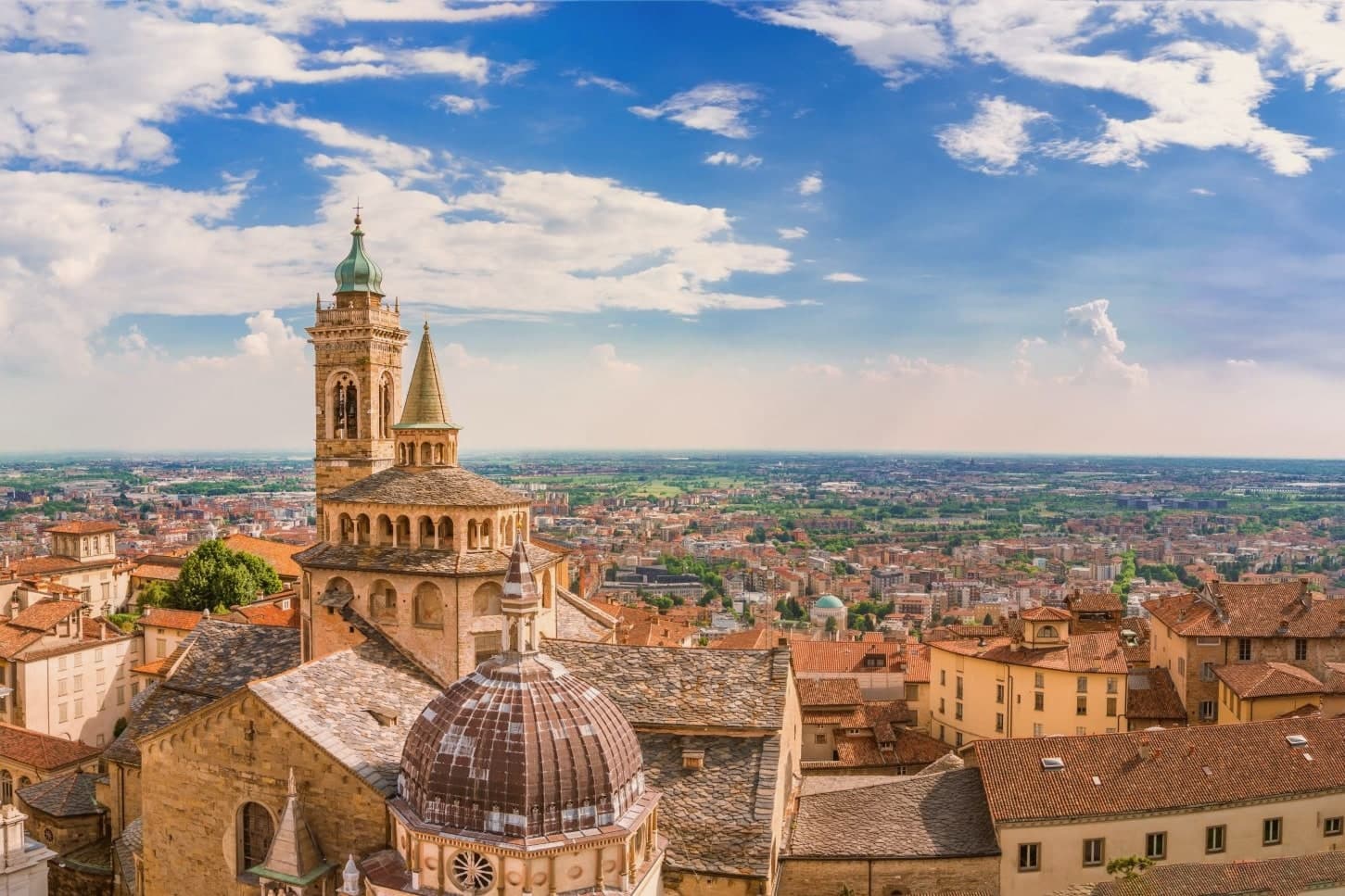
Why visit Bergamo
Bergamo's upper town occupies a spur of the Bergamasque foothills, and the lower town spreads onto the plain that runs southwest toward Milan. The walls that ring the hilltop cost the old town more than 250 buildings, including the original cathedral of Sant'Alessandro, demolished to clear ground for the defenses.
The circuit was built as part of a much larger Venetian project, inscribed together with the fortifications at Peschiera, Palmanova and sites on the Dalmatian coast: one defensive system spread across the Republic's frontier, of which this hilltop was the western anchor. The two halves of the city keep their own centuries.
The walled hilltop holds its medieval and Renaissance fabric inside the fortifications, reached by a funicular that has run the same route since the nineteenth century. The lower city is the newer half, built up through the nineteenth and twentieth centuries on the flat ground below.
Bergamo works as a place because that separation stayed intact instead of being built over: a fortified hill town and a modern city sharing one name but occupying two distinct centuries.
What to see in Bergamo
- Mura Venete. Eight bastions and four gates carry the circuit around the ridge of Città Alta, the walkway open along most of its length with views down over the lower town and the plain.
- Piazza Vecchia. Ringed by the Palazzo della Ragione, the Campanone tower, the Contarini fountain and the Biblioteca Mai, this is the square at the top of the funicular climb, the meeting point of Città Alta's streets.
- Basilica di Santa Maria Maggiore. The Romanesque exterior gives no hint of the Baroque interior inside, gilded and heavy with stucco, where the composer's tomb sits among the furnishings.
How to get to Bergamo
There is a railway station in the town, so you can arrive without a car and never need one while you are here. Bergamo is roughly 3 minutes away by road.
Our tip
April through June and September into October are the months Bergamo works best. Città Alta is walkable, the walls open at dawn, and the Accademia Carrara is uncrowded on weekday mornings. July and August are hot on the plain and full on the hill; the funicular waits stretch on weekends.