
The best hidden hill towns in Lombardia
Lombardia is usually read as flat, a plain of rice fields and motorways, which ignores everything that happens once the ground tilts. In the Oltrepò Pavese the hills run in long clay ridges planted with pinot nero and croatina, and the villages sit on top of them in courses of sandstone, with a castle keep at the highest point because that was the only place worth defending. Further east the moraine hills left by the glacier roll towards Lake Garda in grassy humps, and above the lake itself the limestone terraces hold olives, lemons and chestnut woods. Autumn is the season that pays here: salame di Varzi hung in cellars, chestnuts roasted on braziers, wild boar with polenta taragna, mushrooms from the Val Camonica woods. Winter brings fog to the plain and clear cold light to the ridges above it.
In practice most visitors to Lombardia see the water and the cities. Lake Como takes the bulk of it, with Bellagio and Varenna full from Easter until late October, ferries loading and unloading, the lakefront road jammed at every bend. Milan absorbs the rest, and the day trips out of it follow the same track towards Como or Sirmione. The reasons are good ones, and the crowds are the price of them.
The interesting fact is that the hills do not stop where the guidebooks do. The same limestone that props up the western Garda shore climbs into villages set well above the ferry piers, and the moraine ridges south of the lake carry walled hamlets around still water. South of the Po the Oltrepò hills rise steeply into stone villages with towers and long views towards the Apennines, connected by roads that were mule tracks first. The towns here are the smaller ones on that ground, where the streets are steep because there was no alternative and fewer people make the turn inland.
Of the 65 communes we have mapped in Lombardia, 11 qualify as hill towns: each is an inland hill settlement built on ground too steep to spread. This list is the hidden ones, 9 in all, ordered smallest first. The smallest, Castellaro Lagusello, has 250 residents.
Elsewhere in the catalogue: The best hill towns within 90 minutes of Piacenza and The best hill towns within 75 minutes of Brescia.
Castellaro Lagusello
Why visit Castellaro Lagusello
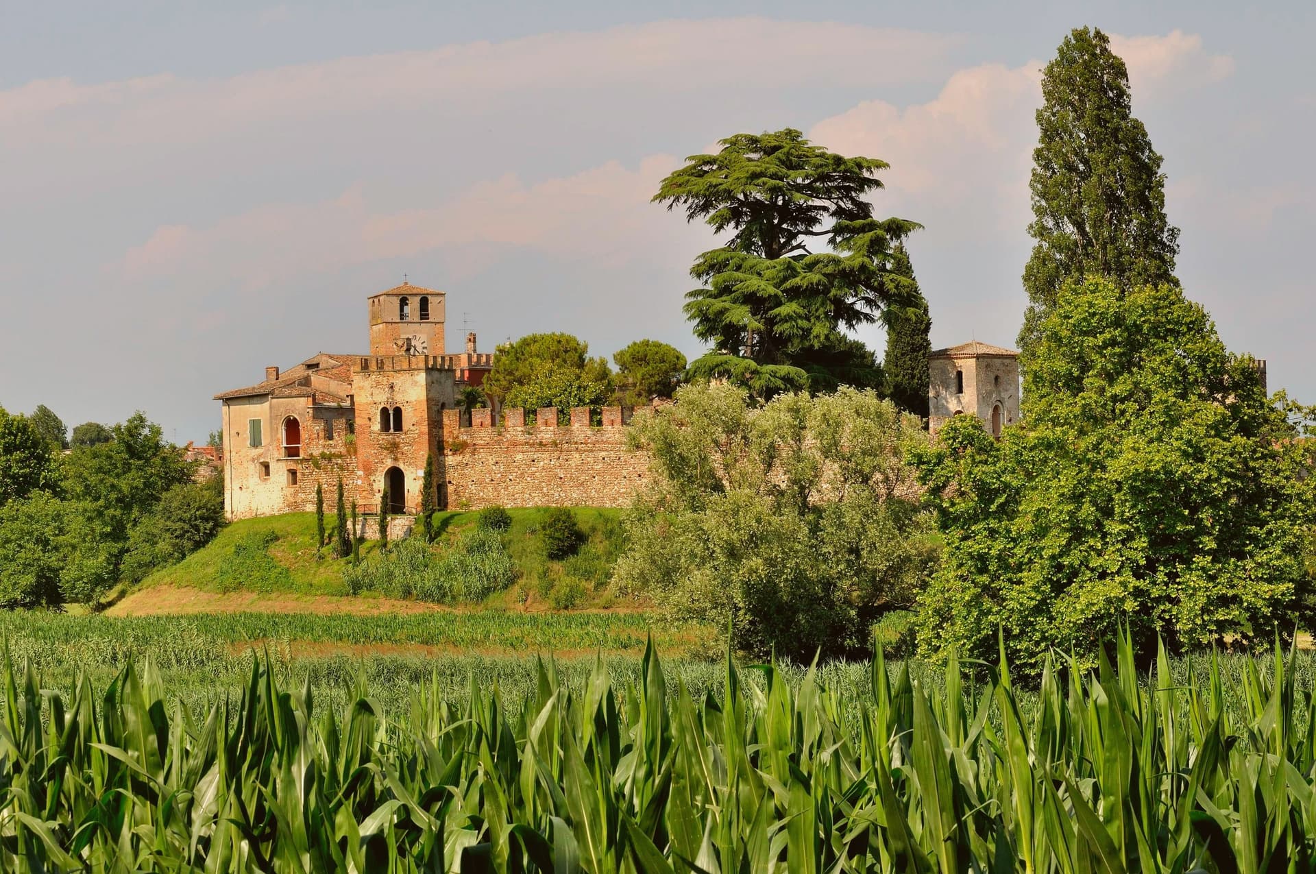
Castellaro Lagusello is a frazione of Monzambano on the morainic hills south of Lake Garda, and one of the smallest entries in the Borghi più belli d'Italia network. The village sits inside a tight ring of 13th-century stone walls built by the Scaligeri of Verona, and the single arched gate opens onto the central piazza in front of the parish church of San Nicola.
The defining feature is the small heart-shaped lake below — the laghetto di Castellaro Lagusello, a natural glacial pond formed at the end of the last ice age — which the village overlooks from its low promontory and which has shaped the village's name (Lagusello = "little lake") for centuries. The lakeside path is a marshland reserve protected by the WWF, with birdwatching hides and a constant population of herons and kingfishers.
Villa Tacoli on the south side of the village is privately held but visible from the promenade. The whole place takes less than an hour to walk and is best paired with the morning produce market in Monzambano or an afternoon at the Lago di Garda south shore, twenty minutes away.
What to see in Castellaro Lagusello
- Mura medievali e porta d'ingresso. 13th-century walled ring built by the Scaligeri of Verona, with a single arched gate opening into the village's central piazza.
- Laghetto di Castellaro Lagusello. Small heart-shaped glacial lake below the village, a WWF-protected marshland reserve with birdwatching hides and a circular footpath.
- Chiesa di San Nicola. Parish church on the central piazza, with a 16th-century facade and a single nave looking onto the village's only square.
How to get to Castellaro Lagusello
Verona is roughly 38 minutes away by road.
Our tip
April through October is the open season for the morainic hills south of Lake Garda. May and June bring the wildflowers around the heart-lake and the warmest birdwatching activity. July and August are warmer but the village stays small and uncrowded compared to the Garda shore fifteen kilometers north.
Montesegale
Why visit Montesegale
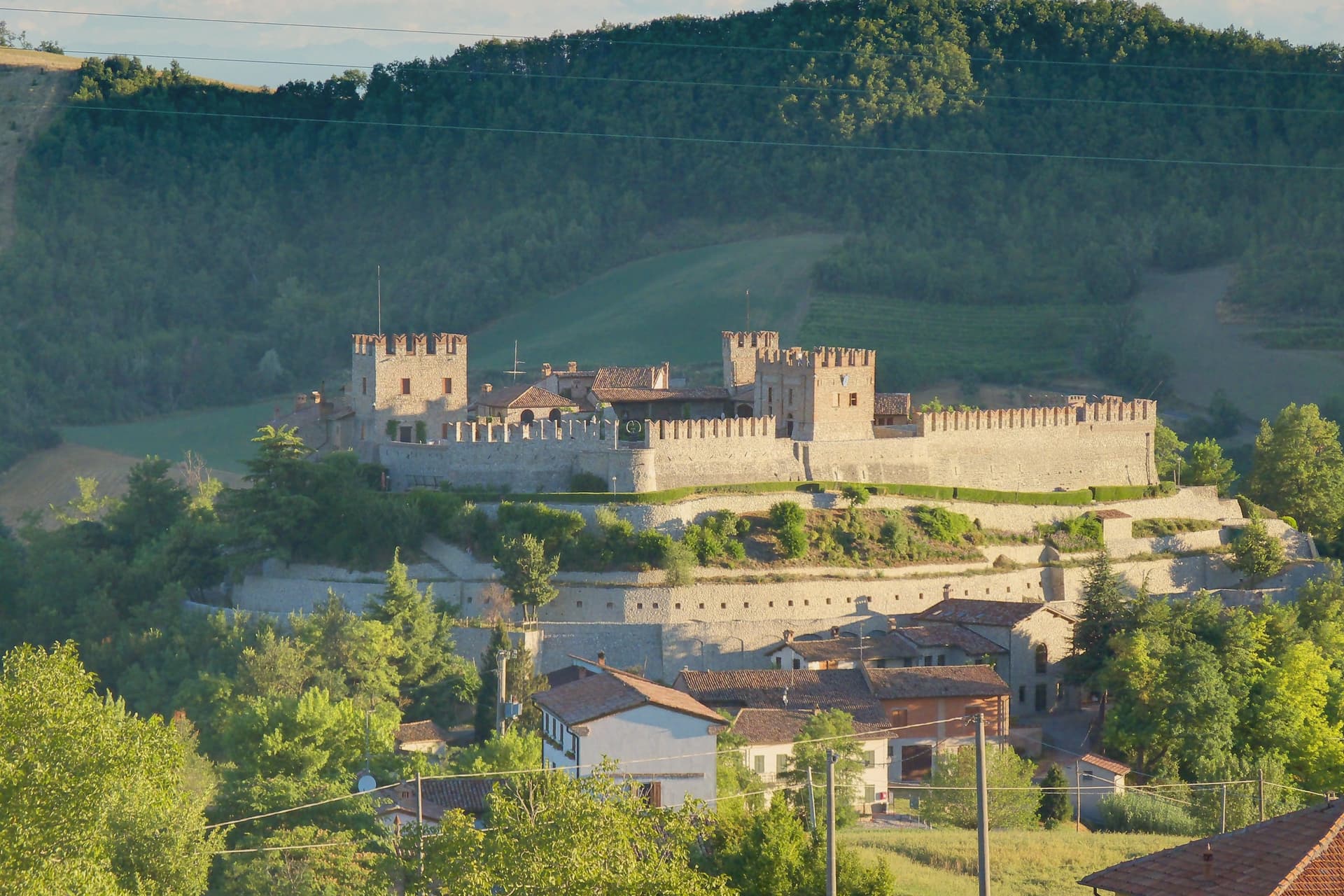
The village takes its position from the hill above the Val Ardivestra, the stream valley that separates its wheat fields and vineyards from the wider Oltrepò Pavese around it. The first historical record dates to the eleventh century, under the bishop of Tortona.
In 1164, Federico Barbarossa transferred the fief to the Counts Palatines of Lomello, whose Gambarana branch took it over in 1311 and held the title of Lords of Montesegale until feudalism ended in 1797. The upper part of the settlement is still organized around the castle those lords built and rebuilt, while the parish church sits below it, a later, separate addition from 1700 serving the working village rather than its lords.
The Borghi Autentici and Città del Pane designations recognize that working character directly: a handful of bakeries, the local Salame di Varzi country, and a wine-and-grain landscape that has changed use only in the castle itself, where the seat of feudal power now holds a contemporary art collection instead of a garrison.
What to see in Montesegale
- Castello dei Conti Gambarana. The fortress dominates the village from its hilltop, reshaped across successive building phases before the seventeenth-century restoration that gave it its present form. The Counts Palatines of Lomello line held it through the Gambarana branch until feudalism ended in 1797.
- Chiesa dei Santi Cosma e Damiano. Parish church built in 1700 below the castle, dedicated to the twin physician saints, with a single nave and Baroque altar.
- Centro storico. Small hill village around the castle, with stone houses, narrow lanes and the steep approach road from the Ardivestra valley below.
How to get to Montesegale
Piacenza is roughly 64 minutes away by road.
Our tip
April through October is the workable window. May, June and September are the strongest: vines in leaf, oak woods green, the castle approach open and dry. July and August push past thirty degrees on the Pavese hills; the village empties between two and six in the afternoon.
Fortunago
Why visit Fortunago
The name Fortunago comes from the Celtic Fortunacus, a settlement marked above a watercourse. The village sits in the Apennine half of the Oltrepò Pavese, the wedge of Pavia province that crosses the Po and presses south toward Liguria, with Varzi to the south and Pinot Nero vineyards to the east.
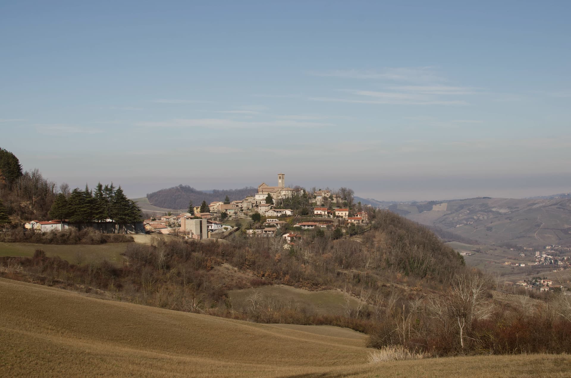
The centro storico climbs the ridge in a single line: the oratory on the lower slope, the church at the upper end, the tower and wall on the rise just past it, so that walking through the village is walking up through its history in order, watercourse settlement, medieval defense, then parish seat. Above it all the hills carry oak and chestnut wood and a pasture plateau at 600 meters.
What holds the place together is the stone itself: the same exposed façades, wooden shutters and porphyry paving run from the lower oratory to the upper church, restored as one piece rather than as separate monuments, which is why the village reads as a whole settlement rather than a scatter of old buildings.
What to see in Fortunago
- Chiesa di San Giorgio. Tempera triptych on wood signed Pesina inside, the church dominating the upper end of the village and visible above the rooftops.
- Torre del castello. One tower and a run of wall, all that stands of the fortress that once held the rise above the church.
- Oratorio di Sant'Antonio Abate. Chapel dedicated to the Virgin of Sorrows, set on the slope below the centro storico, away from the village's main religious building.
How to get to Fortunago
Piacenza is roughly 62 minutes away by road.
Our tip
April through October is the active season. May and June bring wildflowers across the high pasture plateau above the village and the first salumi festas. July and August are warm but not oppressive at this altitude, with evenings dropping into the high teens.
Zavattarello
Why visit Zavattarello
Zavattarello sits at 525 meters on a ridge in the Alta Val Tidone, the Oltrepò Pavese stretch where the Apennines slope down toward the Po. The name derives from the vulgar Latin savattarellum, the place where savatte, slippers, were made.
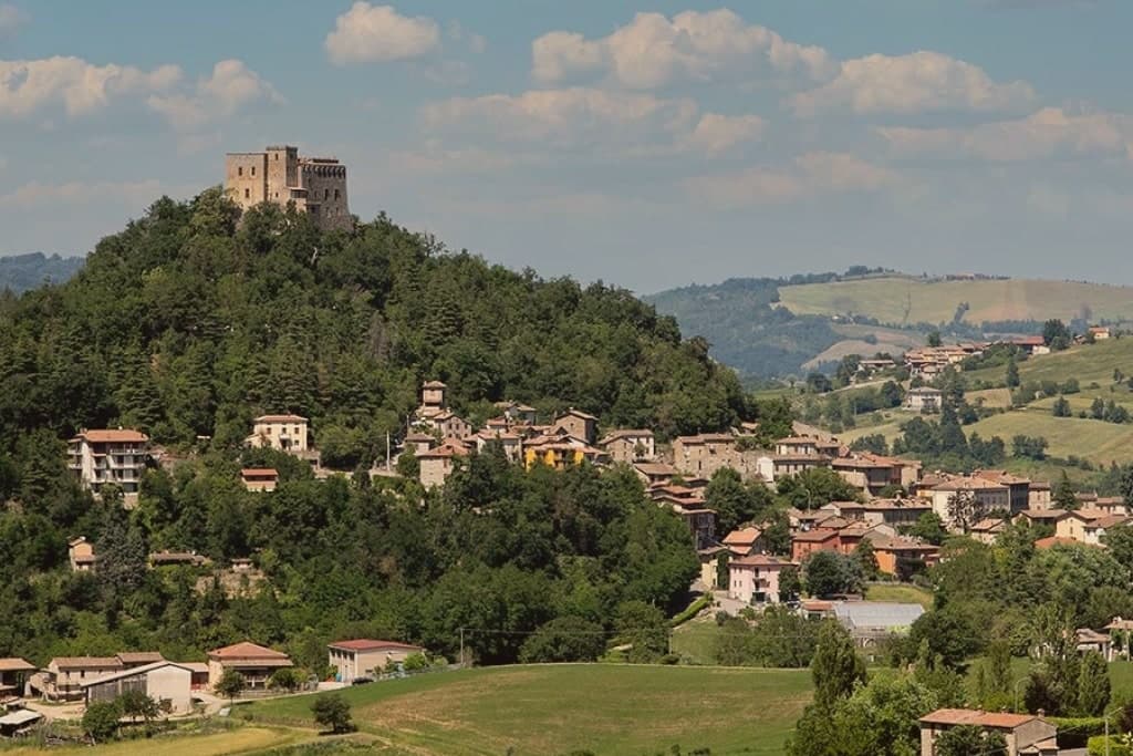
The fortress towers over the medieval borgo below, and the two read as one composition: stone village and stone stronghold, the lane climbing through covered passages toward the walls that once enclosed the whole community. The Apennine setting, midway between the Po plain and the Ligurian Sea, gives Zavattarello one of the more dramatic positions among the Borghi più belli of Lombardy.
A place named for slippers grew into a seat of counts and a captain of Milan, and what remains is the relation between the two: the working village at the foot of the ridge, and the fortress that governed it, still standing above.
What to see in Zavattarello
- Castello Dal Verme. Fortified enclosure with stables and chapel besides the keep, forty rooms in all, standing over the borgo it once ruled for six centuries.
- MACA Museo d'Arte Contemporanea Dal Verme. Contemporary art museum inside the castle, dedicated to Giuseppe and Titina Dal Verme, with the family tombs of the counts.
- Borgo medievale di Zavattarello. Stone village clinging to the ridge below the castle, partly still walled, crossed by a narrow lane with covered passages.
How to get to Zavattarello
Piacenza is roughly 57 minutes away by road.
Our tip
April through October is the right window for the Val Tidone. The castle is open, the ridge trails into the Apennine are dry, and the temperatures at 525 meters stay below the Po-plain heat. May and June bring wildflowers to the surrounding hills; September and October are the dry, gold months of the chestnut harvest.
Tignale
Why visit Tignale
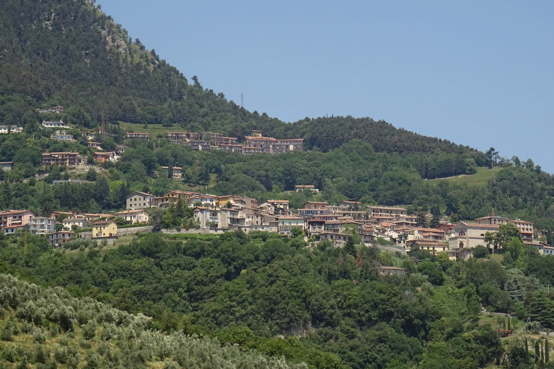
Tignale sits on a high terrace on the northern part of Lake Garda's Brescia shore, inside the Parco Alto Garda Bresciano. The municipality is six hamlets stitched together: Gardola, where the town hall stands, plus Piovere, Oldesio, Olzano, Aer and Prabione.
The territory runs from the port at lake level up to peaks near 1,600 meters. The Santuario di Montecastello stands on a limestone spur high above the water, built on the ruins of an ancient temple later converted into a castle.
The frescoes inside follow a Giottesque school, and one of the votive panels, dated to the early 1600s, is said to be among the largest ex-voto paintings in Europe. The story attached to the sanctuary is the 1200 battle on the slopes below, ended by the appearance of a star, hence the title Madonna della Stella.
Below the village, the limonaie, the stepped lemon terraces built into the cliff, mark the northern limit of Mediterranean citrus agriculture in Europe; several are still maintained as working ecomuseums.
What to see in Tignale
- Santuario di Montecastello. Clifftop sanctuary above Lake Garda with Giottesque frescoes and one of Europe's largest ex-voto paintings.
- Limonaie. Stepped lemon terraces built into the cliff, the northern limit of Mediterranean citrus in Europe.
- Parco Alto Garda Bresciano. Regional park covering Tignale and eight neighboring communes, with peaks up to 1,600 meters and a network of mule tracks.
How to get to Tignale
Brescia is roughly 90 minutes away by road.
Our tip
April through October is when Tignale works. The sanctuary opens for visitors in April, the limonaie ecomuseums run guided tours through summer, and the hiking network across the Parco Alto Garda is at its best in May and June. July and August bring the largest hiking and motorcycle traffic on the Gardesana Occidentale road below.
Polpenazze del Garda
Why visit Polpenazze del Garda
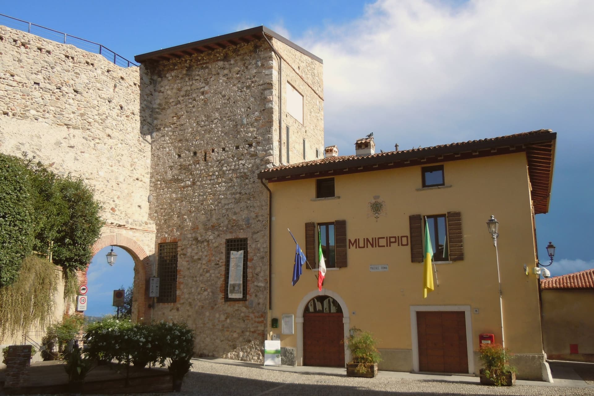
Polpenazze sits on a Valtenesi hill 207 meters above sea level, six kilometers inland from Lake Garda's western shore. The lower ground below the village was once Lake Lucone, a small basin between the hills of Cassaga, Brassina and San Pietro, progressively drained between the fifteenth and eighteenth centuries to recover farmland.
The village itself reads as a set of layers around that basin: the castle and its parish church occupy the high point, the Romanesque pieve stands on the hill facing the drained lake, and the vineyards and olive groves spread across the slopes between. The wine fair in the central piazza draws on the same Valtenesi ground that produces the Chiaretto and Garda Classico rosso poured there each May.
What holds the place together is the drained basin itself: land reclaimed from water now carries vines and olives, while the water's former bed preserved, in its clay, the traces of the people who lived on its edge millennia earlier.
What to see in Polpenazze del Garda
- Castello di Polpenazze. Medieval hilltop castle with the parish church inside its walls, the visible center of the village.
- Pieve di San Pietro in Lucone. Romanesque parish church on the hill above the basin, with twelfth-century frescoes.
- Sito palafitticolo del Lucone. The pile-dwelling site sits in the drained basin sediments, with on-site interpretation panels explaining the wooden tools, vases and fabrics preserved by the wet clay.
How to get to Polpenazze del Garda
Brescia is roughly 34 minutes away by road.
Our tip
April through October is when Polpenazze functions. The wine fair on the last weekend of May is the largest event of the year and fills the village with producers from the Valtenesi and Garda hills. June through August the Lucone path is open and the vineyards work the harvest run-up.
Varzi
Why visit Varzi
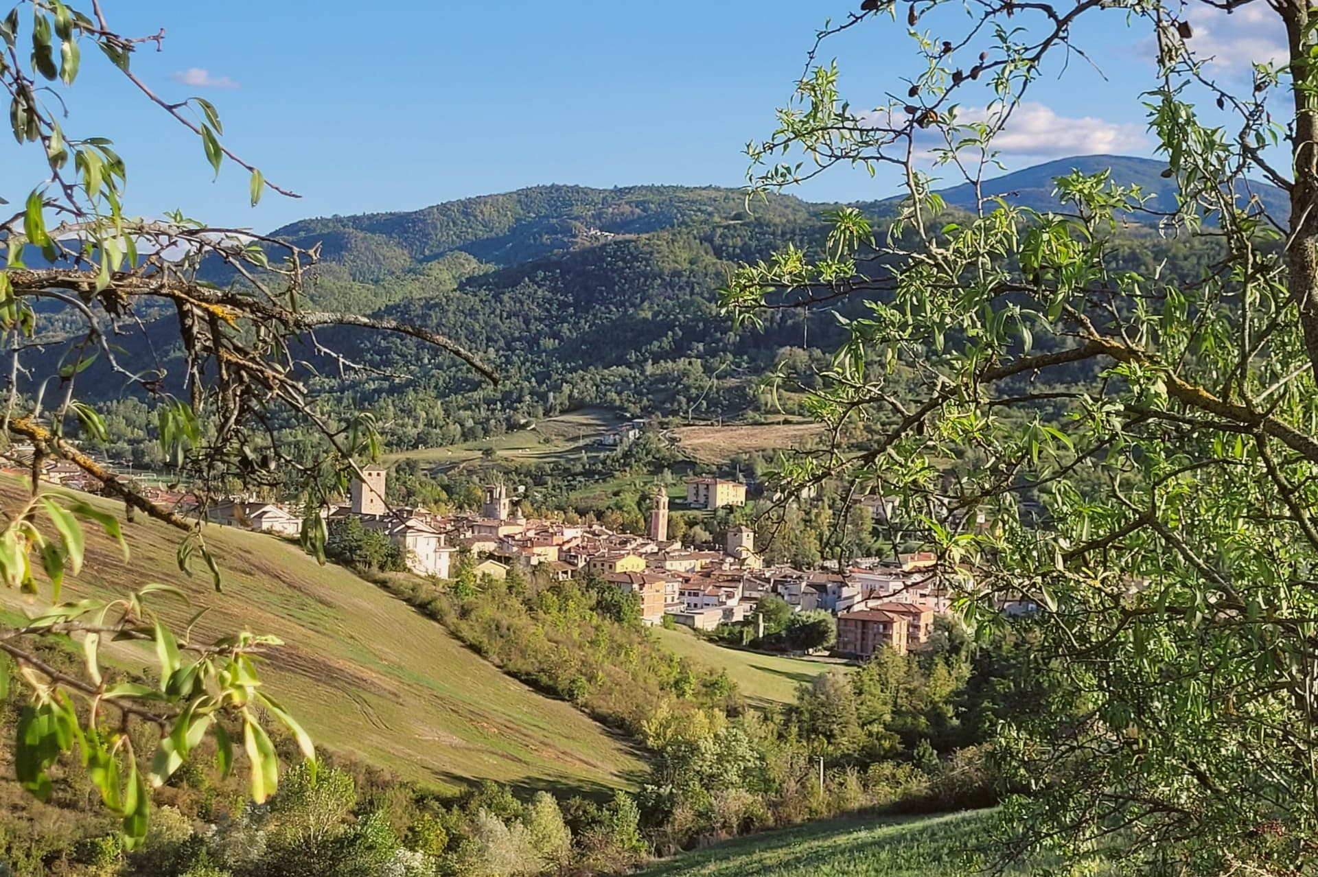
Varzi sits at 416 meters in the Staffora valley of the Oltrepò Pavese, a strip of Lombard Apennine that runs south toward Genova rather than north toward Milano. The name comes from the Ligurian root Var, meaning torrent.
In 1164 the village fell under the Malaspina, the Apennine feudal family who held it as part of their network of upland fiefdoms; the Malaspina tower, called the Torre delle Streghe, dates to the thirteenth century. The Via del Sale ran through Varzi from the Po plain to the Ligurian coast, and the salami invented to feed traders on that route is now one of Italy's first DOP cured meats: Salame di Varzi, recognized by Europe in 1996, produced by a handful of small companies in and around the town.
The 2023 production was 503,561 certified salami. The second Sunday in June, the Sagra del Salame fills the medieval streets.
The Sant'Alberto di Butrio hermitage, fourteen kilometers south through the Apennine, is the older religious anchor of the valley.
What to see in Varzi
- Torre delle Streghe. Thirteenth-century Malaspina tower in the centro storico, also called the Witches' Tower, the surviving keep of the medieval defenses.
- Castello dei Malaspina. Remains of the Malaspina castle, the seat of the feudal family that held Varzi from 1164 onward.
- Centro storico medievale. Stone streets and arched passages of the medieval borgo, with the surviving village gates from the defensive walls.
How to get to Varzi
Piacenza is roughly 78 minutes away by road.
Our tip
April through October is the right window for the Staffora valley. Mild evenings, dry trails into the surrounding Apennine, and the salami shops in full production. The Sagra del Salame on the second Sunday of June fills the centro storico. Festa della Birra e della Salamella falls in July.
Bienno
Why visit Bienno
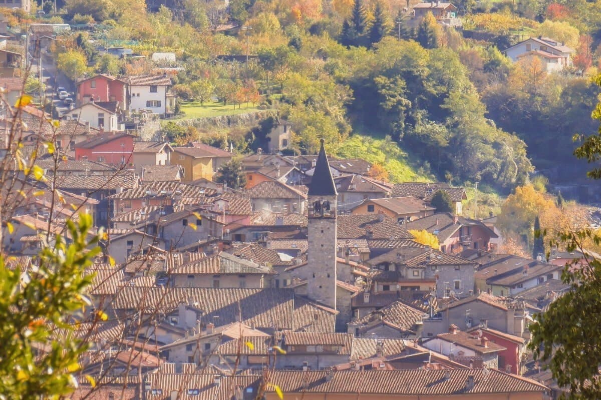
Bienno sits at 445 meters on the eastern flank of the middle Val Camonica, north of Lago d'Iseo. From the tenth century the Benedictines diverted the Grigna stream into an artificial canal, which still powers a string of fucine, small water-hammer forges, along its course.
The valley was working iron from the bloomery furnaces of late Antiquity through the high blast furnaces of the late Middle Ages; Bienno became the master village, what Brescia called il paese dei magli, the village of the hammers. The centro storico runs along the stream in stone houses, frescoed facades and arcaded passages, the forges set directly into the fabric of the lanes rather than gathered apart from them.
The palace and the ethnographic museum sit within this same fabric, holding the tools, costumes and reconstructed workshops that explain what the canal was built to serve. Each August the streets fill again with working forges and craftsmen from across the Alpine arc, a working echo of the trade the canal was dug for so long before.
What the town amounts to is this: a village organized, street by street, around a single diverted stream and the iron it was made to move.
What to see in Bienno
- Fucina-Museo. Working water-hammer forge along the Vaso Re canal, kept in operating order, where the Grigna stream still turns the wheels that drive the hammers.
- Chiesa di Santa Maria Annunciata. Fifteenth-century church holding the frescoes in the presbytery, plus earlier work by Giovanni Pietro da Cemmo elsewhere in the building.
- Palazzo Simoni-Fè. Sixteenth-century palace in the centro storico, with frescoed halls and a small museum of the iron and ethnographic traditions of the valley.
How to get to Bienno
Brescia is roughly 92 minutes away by road.
Our tip
April through October is the open season in Bienno. The Vaso Re runs full, the forges open for demonstration days, and the trails up to the Mortirolo and around the Val Camonica are walkable. The last week of August brings the Mostra Mercato, when the streets light with torches at night and the magli pound through the day.
Monzambano
Why visit Monzambano
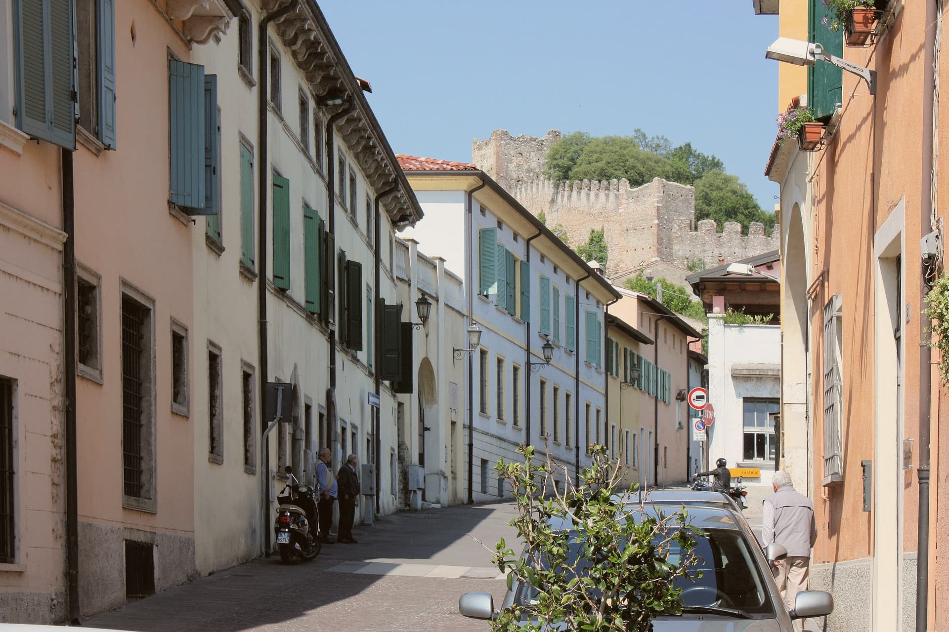
Monzambano sits at 88 meters on the right bank of the Mincio, in the moraine hills the last Alpine glacier pushed up south of Lake Garda. The commune covers 4,800 people across several frazioni, but the one travelers come for is Castellaro Lagusello, a fortified medieval village built around a small heart-shaped lake.
Pope Eugenio III's document of 1145 lists its parish among those of the Diocese of Verona. The castle and walls date to the eleventh and twelfth centuries.
The Gonzaga of Mantua tried and failed to hold it through the Quattrocento, and it passed to Venice, then to Napoleon, who in 1803 annexed it to Monzambano. Pile-dwelling settlements under the lake belong to the Prehistoric Pile Dwellings around the Alps UNESCO site.
The commune holds five institutional signals at once: Borghi più belli, Bandiera Arancione, Borgo dei Borghi finalist, Città del Vino, Città dell'Olio. The wines are Lugana and Garda Colli Mantovani; the oil is Garda DOP.
What to see in Monzambano
- Castellaro Lagusello. Fortified medieval frazione inside crenellated walls and ten towers, set above a heart-shaped lake on a moraine hill.
- Castello di Castellaro. Eleventh- to twelfth-century castle on the hill above the lake, long contested between Mantua and Venice.
- Prehistoric pile dwellings. Submerged Bronze Age stilt-house settlement in the lake, part of the UNESCO Prehistoric Pile Dwellings around the Alps.
How to get to Monzambano
Verona is roughly 39 minutes away by road.
Our tip
April through June and September into October are the months the moraine hills work best. The vines are leafing or harvested, the lake reflects the walls, and the small reserve around Castellaro is open to walkers. July and August get humid and still; Lake Garda is fifteen kilometers away and pulls the day-trippers off the back roads. Sagra di San Bartolomeo falls in August.
More from Anywhere Italy
- The best hill towns within 90 minutes of Piacenza
- The best hill towns within 75 minutes of Brescia
- The best hill towns within 75 minutes of Verona
- The best towns that cure their own meat within two hours of Brescia
- The best towns with a food festival in Lombardia
- The 6 prettiest villages in the province of Mantova