
The best hill towns inside a national park in Calabria
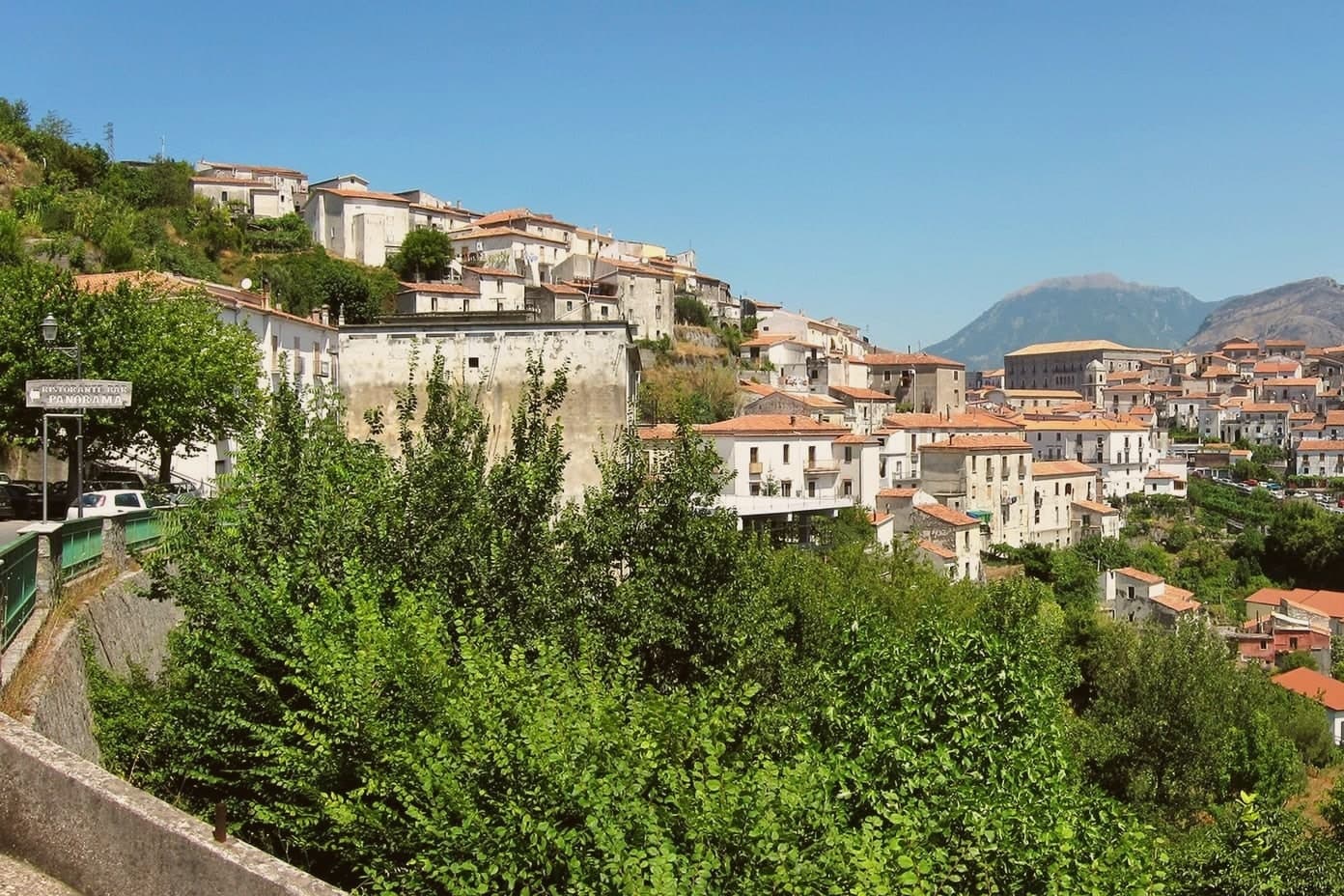
Calabria's interior is cooler than its reputation suggests. Above the olive terraces the land climbs into beech woods, silver fir and pasture, and the villages up there are built from the grey stone they stand on, roofs of old tile, streets narrow enough to hold shade all afternoon. Autumn brings porcini, chestnuts and wild boar cooked slowly with peppers; spring brings snowmelt through the gorges of the Raganello and the Lao. Caciocavallo Silano, mountain honey and bread baked in wood ovens are the everyday food, not the festival version of it.
Most people arrive in Calabria for the water and stay there. Tropea takes the bulk of it, with the beach below the cliff and the church on its rock, and by August the town is full from the car park to the sand. The coast is good, and it is also where the region concentrates almost everything it has built for visitors, which leaves the mountains an hour inland comparatively empty even in high summer.
The parks are enormous, and settlement inside them did not stop at the famous overlooks. Pollino, Sila and Aspromonte all hold working hill towns, places with a Norman doorway or a Byzantine apse, a bakery, a walking route out of the top of the village. These are the smaller ones, still inhabited, still cooking their own mountain food, and each sits within a national park boundary rather than looking at it from outside.
Of the 45 communes we have mapped in Calabria, 6 qualify as hill towns inside a national park: each is an inland hill settlement, and each sits inside a national park. The smallest, Aieta, has 753 residents.
If you are still choosing, we have also written The best hidden towns inside a national park in the province of Cosenza and The best hill towns in the province of Cosenza.
Aieta
Why visit Aieta
Aieta sits at 524 metres in the western Pollino, eight kilometres above the Tyrrhenian coast at Praia a Mare. The name comes from the Greek aetós, eagle, a description of the spur the village holds.
The Palazzo Martirano-Spinelli is the reason most visitors climb the road in: a U-shaped sixteenth-century Renaissance building with a five-arch loggia on Tuscan columns in local grey stone, one of the rare full Renaissance palazzi in the whole region. The Marquises Cosentino built it; it passed to the Cosentino-Scalea line in 1571 and to the Spinelli in 1767, was declared a national monument in 1913, and became municipal property in 1980.
Around it, the centro storico keeps a tight network of stone-portalled houses worked by mason families between the seventeenth and eighteenth centuries. The mother church of Santa Maria della Visitazione and the Convent of the Minor Observant Fathers, founded in 1520, complete the centre.
The population sits at 753.
What to see in Aieta
- Palazzo Martirano-Spinelli. Sixteenth-century Renaissance palazzo with a U-shaped plan and a five-arch loggia on Tuscan columns, one of the few in Calabria; national monument since 1913.
- Chiesa di Santa Maria della Visitazione. Sixteenth-century mother church on the upper level of the centro storico, anchoring the religious life of the village.
- Convento dei Minori Osservanti. Franciscan convent founded in 1520 with sixteenth-century wooden choir stalls and a set of carved wooden saint statues.
How to get to Aieta
Salerno is roughly 140 minutes away by road.
Our tip
At 524 metres in the western Pollino, Aieta runs cooler than the Praia a Mare coast below. April through October is the working window: green hills, mild evenings, the Palazzo open for visits and the Convent accessible. July and August stay tolerable in the low thirties, though midday in the centro storico empties as residents step indoors.
Laino Borgo
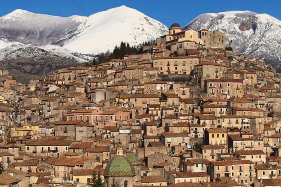
Why visit Laino Borgo
Laino Borgo sits at 582 meters on the border between Calabria and Basilicata. The name traces to the river Lao, itself named after the ancient Greek city of Laüs founded on the Tyrrhenian coast below.
The centro storico climbs toward the castle ruins at its upper edge, looking across the valley to the Pollino slopes opposite, while the river runs through its canyon at the base of the settlement, the same stretch of water that carries the rafting trade through the warmer months. Garlic and hazelnuts are grown on the slopes around the village, and the commune holds Borgo Autentico d'Italia status.
The chapels on the pilgrimage route sit apart from this daily geography, on property outside the village proper, added to a settlement otherwise defined by its river, its border position and its castle height. What holds the place together is the Lao itself: it gave the town its name, cut the canyon that draws the rafters, and marks the edge between two regions the village has always sat astride.
What to see in Laino Borgo
- Santuario delle Cappelle (Sacro Monte). Only Sacro Monte in southern Italy, sixteen pilgrimage chapels begun in 1557 by Domenico Longo after a journey to the Holy Land, depicting scenes from the Bethlehem grotto to the Crucifixion.
- Rafting on the Lao river. Main rafting and canoeing centre of southern Italy, with descents through a 200-meter canyon, launches from a wooden bridge near Piazza Navarro.
- Castello Normanno. Norman castle ruins on the upper edge of the centro storico, a vantage point over the Lao valley and the Pollino slopes opposite.
How to get to Laino Borgo
Salerno is roughly 93 minutes away by road.
Our tip
April through June and September into October are the months the Lao runs at workable rafting levels and the Pollino trails open. July and August reach the mid-thirties in the canyon, though the river itself stays cold and the rafting outfitters run their busiest weeks. The Sacro Monte pilgrimage path, walked between the sixteen chapels, fills around 8 September for the feast of the Madonna dello Spasimo.
Cerchiara di Calabria
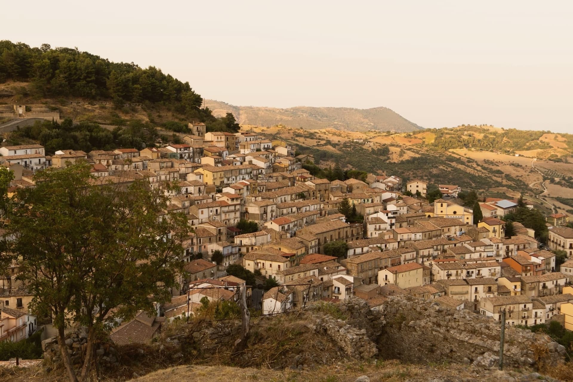
Why visit Cerchiara di Calabria
Cerchiara di Calabria sits at 650 meters on the eastern flank of the Pollino massif, inside the national park. The site has been settled since the Magna Graecia period under the name Arponium, later the Byzantine Circlarium, with hermit cells documented on the mountain above by the tenth century: the sanctuary that stands there now grew out of that older hermit presence, enlarged over more than a century into the pilgrimage site it became.
Below the village, a cavity in the rock carries sulphurous water down to feed the thermal complex, while the Serra del Gufo caves and the Balze di Cristo cliffs make up the rest of the karst geology on the slopes above the town. The village itself reads as a single line from summit to foot: hermitage and sanctuary at height, thermal water and caves at the base, the settled center holding the bread ovens in between.
It is a place organized by elevation, with worship, water, and daily bread each keeping to their own level of the mountain.
What to see in Cerchiara di Calabria
- Santuario di Santa Maria delle Armi. A small rock chapel enlarged in the early sixteenth century, standing above the village on Mount Sellaro. The climb up trades the village roofscape for the open flank of the massif.
- Terme della Grotta delle Ninfe. The cave mouth sits at the foot of the mountain, water still running warm and mineral-heavy out of the rock before the complex channels it below.
- Museo del Pane. Tools and large wood ovens laid out in the centro storico, the working evidence of a bread-making practice the town is named for.
How to get to Cerchiara di Calabria
Taranto is roughly 131 minutes away by road.
Our tip
April through June and September into October are the dry months when the trails to the Madonna delle Armi sanctuary at 1,015 meters are walkable and the thermal complex is comfortable. July and August are hot, with the lower part of the commune touching thirty-five; the cave waters stay at constant temperature year-round but the road up to Sellaro empties between noon and four. November through March is quiet on the Pollino slopes, with snow possible above 1,000 meters and many trattorie closed weekdays.
Gerace
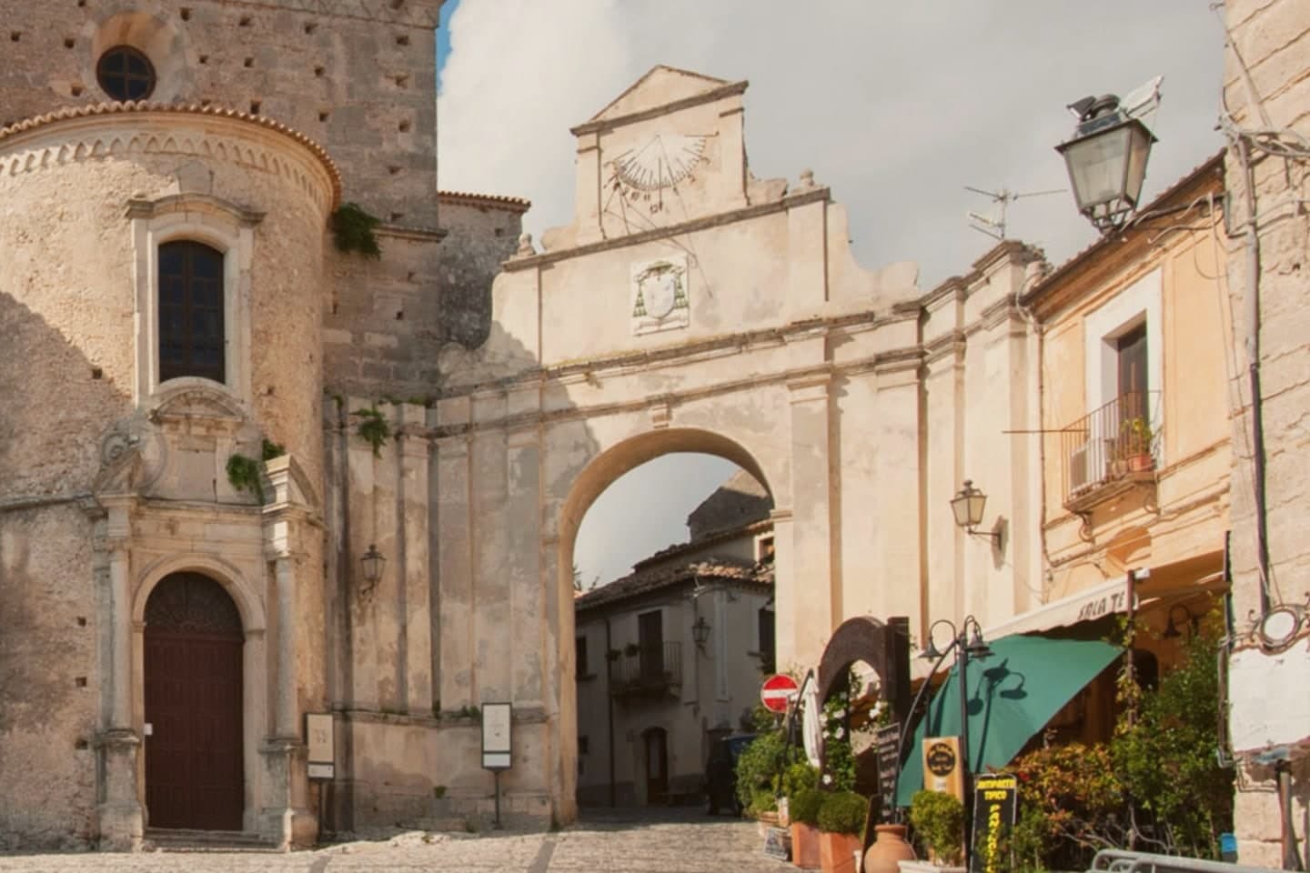
Why visit Gerace
Gerace sits ten kilometers inland from the coast, on the Ionian flank of the Aspromonte. The name comes from the Greek hierax, sparrowhawk, said to have led the founding survivors to the site after they abandoned the shore to Saracen raids.
The rock itself is older than any of that history: conglomerate built from sea fossils sixty million years old, narrow enough at the top that the centro storico had to grow along it rather than around it. The town that resulted splits along a simple line: a fortified upper rock, once carrying the Norman-Swabian castle, and a lower spread of alleys and squares where the churches accumulated, more than a hundred of them by the old count, alongside the crypt columns pulled from ruined temples down on the plain.
Upper and lower are the same settlement answering two different needs, one for defense, one for the accumulated business of a holy city. What survives now, cathedral, castle ruin, and the fossil rock beneath both, reads as the layered result of people repeatedly choosing this height for reasons that changed over a span of centuries: first safety, then faith, now simply what is left standing.
What to see in Gerace
- Cattedrale di Gerace. 1,690 square meters of Norman-period church, its crypt lined with columns of different stones and capitals, salvaged from the Magna Graecia temples of Locri Epizefiri.
- Chiesa di San Francesco d'Assisi. Late thirteenth-century church commissioned by Charles II of Anjou in 1294, with a Gothic portal and a marble high altar of the early seventeenth century.
- Castello Normanno-Svevo. Norman-Swabian castle on the upper rock, restructured around the eleventh century on a likely seventh-century foundation, partly in ruin since 1783.
How to get to Gerace
Reggio Calabria is roughly 80 minutes away by road.
Our tip
April through June and September into October are the months the rock is walkable and the light flatters the conglomerate facades. July and August are hot on the Locride plain; the rock catches sea breeze in the late afternoon, but the cathedral interior is the only consistently cool place between two and six. November through March is quiet: many of the small churches keep limited hours and the castle stays mostly closed.
Taverna
Why visit Taverna
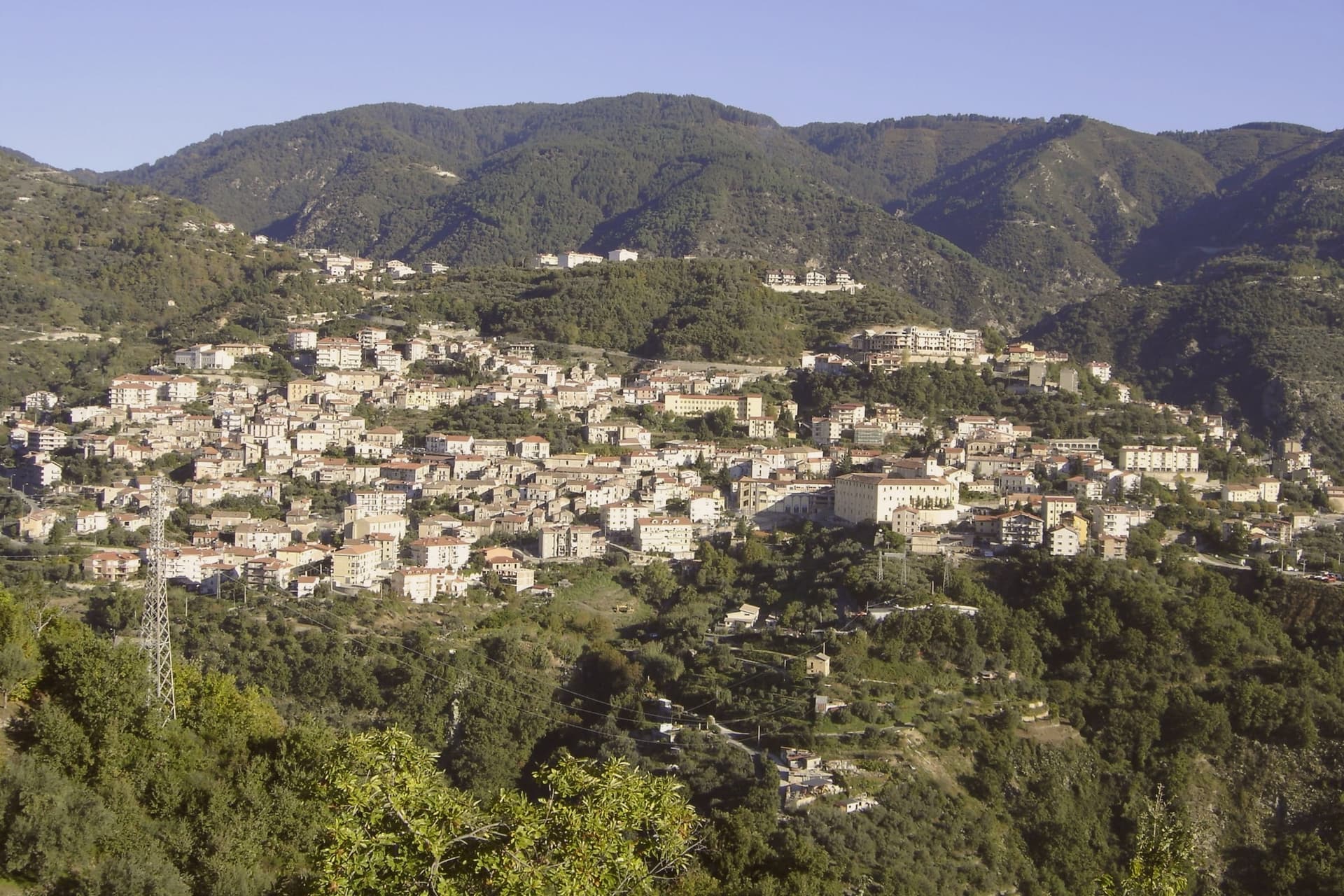
Taverna sits at around 530 meters, the built-up core arranged around the convent complex and climbing the slope beneath the forests. The mountain rises directly behind the town: beech and pine cover the plateau, and the frazione of Villaggio Mancuso sits nearly 1,400 meters above the centro, reached from below and used for summer escape and winter snow, a second, higher Taverna in effect, linked to the town below by altitude alone.
The painter born here in 1613 worked in Rome, Naples and finally Malta, where he died in 1699 after decorating the conventual church of the Order of St. John in Valletta.
He returned to Taverna repeatedly and sent paintings home rather than settling here again, which is why his work fills a convent church in a small mountain town rather than a capital. The former Dominican convent attached to that church now holds the civic museum, so the town's two collections of his work sit inside the same walls.
What Taverna adds up to is a hill settlement whose historic core was shaped by one absent painter's continued attention, standing at the foot of a plateau that the town depends on for its higher, cooler counterpart.
What to see in Taverna
- Chiesa di San Domenico. Fifteenth-century Dominican church inside the centro storico, holding eleven works by Mattia Preti including the self-portrait and the cycle on the life of San Domenico.
- Museo Civico di Taverna. Civic museum housed in the former fifteenth-century Dominican convent attached to the church, dedicated largely to Mattia Preti and the Calabrian Baroque.
- Parco Nazionale della Sila. The town falls inside Sila National Park; Sila Piccola's beech and pine forests rise directly behind the centro.
How to get to Taverna
Reggio Calabria is roughly 157 minutes away by road.
Our tip
April through October is the working season. Spring greens the Sila Piccola forests above the town; the centro at 530 meters stays cooler than the Catanzaro coast through June. July and August can run warm in the borgo but the frazione of Villaggio Mancuso, nearly 900 meters higher, draws the Catanzarese summer population.
Saracena
Why visit Saracena
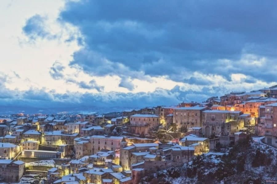
Saracena sits at 606 meters on the eastern slopes of the Orsomarso mountains, inside the Pollino National Park, fifty-five kilometers north of Cosenza. The town gets its name from the Saracens who conquered it around 900 AD; like Palermo and Tropea it kept a souk through the Arab-Sicilian and early Norman centuries, and the Byzantine army eventually retook it.
The mother monument is the twelfth-century Chiesa di San Leone, a Byzantine foundation that still holds the patron's relics. What carries the village now is wine: Moscato di Saracena, a passito blended from Guarnaccia, Malvasia, Odoacra and Moscatello, fermented slowly into an amber dessert wine first documented in the sixteenth century.
The production sits under a Slow Food Presidium, and a Casa del Moscato opened in the former town hall in May 2026. Olives, truffles and Pollino trekking fill the rest of the calendar.
What to see in Saracena
- Chiesa di San Leone. Twelfth-century Byzantine church dedicated to the patron San Leone di Catania, celebrated twice a year, in spring and late summer.
- Castello baronale. Ruins of the baronial castle around which the historic centre rises, a vantage point over the Pollino slopes and the Esaro valley.
- Casa del Moscato di Saracena. Visitor centre opened in May 2026 in the former town hall, dedicated to the production method of the Slow Food Presidium passito.
How to get to Saracena
Salerno is roughly 170 minutes away by road.
Our tip
April through June and September into October are the dry months that Saracena was built for, when the Pollino slopes are walkable and the moscato grapes either flower or come in. July and August touch the mid-thirties; the old town shaded alleys hold up but the trails climb above eight hundred meters to stay comfortable. November through March is quiet, with snow possible on the Orsomarso ridges and several cantine closed to visitors.
More from Anywhere Italy
 The best hidden towns inside a national park in the province of Cosenza
- The best hill towns in the province of Cosenza
 The 8 best hill towns inside a national park in Campania
 The best hill towns inside a national park in Puglia
 The best small hill towns inside a national park in Abruzzo
 The best wine towns in Calabria