
The best hidden hill towns you can reach by train within 90 minutes of Torino
Piedmont past the ring road is a landscape of ridges: rows of barbera and nebbiolo running along the tops, hazelnut groves on the cooler slopes, brick campanili visible from the next hill over. Further west and north the vines give way to the Alps proper, where stone villages sit under fortresses and the valley floor smells of woodsmoke by October. The eating follows the ground, tajarin with butter and sage, bagna cauda in the cold months, plin in broth, bollito misto with a sharp green sauce, and in the Alpine valleys cured lard, black bread and mountain toma. Autumn is the season everyone wants, when the fog sits in the valleys and the truffle market fills a covered hall, but spring on these hills is quieter and just as green.
Most travellers with a weekend in Torino head straight to Alba, and the reasons are obvious: the truffle fair, the wine bars, the bus tours running out to Barolo and La Morra. From October the town centre is shoulder to shoulder, restaurant tables are booked weeks out, and hotel prices in the Langhe climb accordingly. It is a good town. It is also the single point on which the whole region's tourism converges.
The same hills carry on well past it, and so does the railway. Regional trains from Torino run out along the Tanaro and the Belbo into Monferrato wine country, north across the Asti plateau, west up the Val di Susa and on towards the Aosta valley, stopping in hill towns and fortified villages where fewer people get off. These are those stops, all of them inland, all of them reachable without a car.
Of the 34 communes we have mapped within 90 minutes of Torino, 14 qualify as hill towns you can reach by train: each is an inland hill settlement, and we have confirmed each is reachable without a car. This list is the hidden ones, 10 in all, ordered smallest first. The smallest, Bard, has 108 residents.
Two more lists worth reading alongside this one: The 6 best hidden towns you can reach by train that eat well within 90 minutes of Torino and The 7 best wine towns you can reach by train within 90 minutes of Torino.
Bard
Why visit Bard
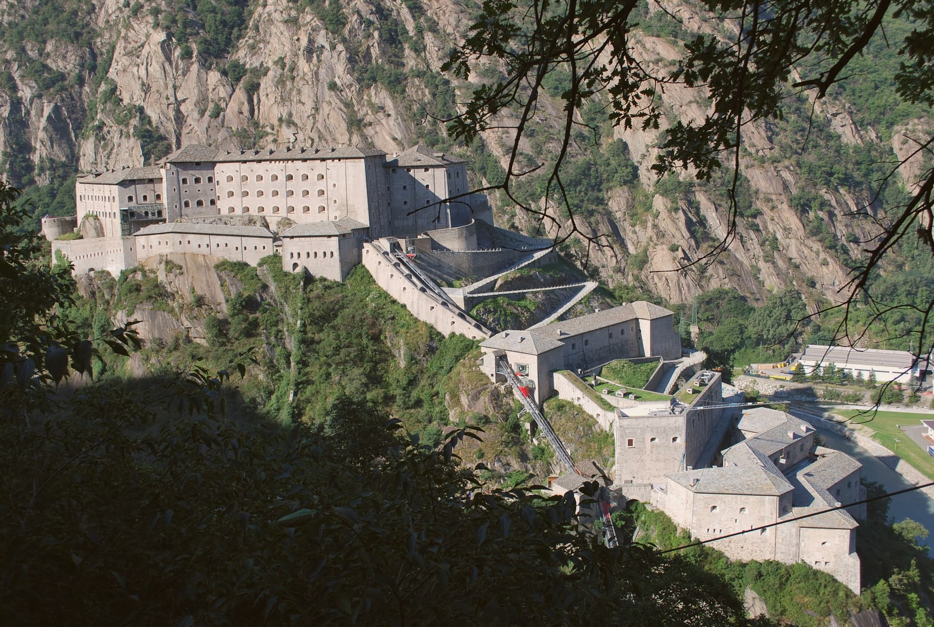
Bard sits at the entrance of the Aosta Valley, its single medieval street wedged between the Dora Baltea river and the rocky prominence that carries the fortress above it. The rock has held fortifications since at least the tenth century, when a castle stood on the site of a fifth-century structure attributed to Theodoric.
That older fort was destroyed after the 1800 siege, and Charles Albert of Savoy rebuilt the current three-tier complex on the same ground between 1830 and 1838. The village below is compact by design: one main street, noble houses from the fifteenth and sixteenth centuries, and a parish church rebuilt several times over the medieval core.
The rock and the river leave no room for the town to spread, so fortress and village occupy the same narrow footprint, one stacked above the other rather than side by side. What the place adds up to is a defensive chokepoint that never had space to become anything but a single street and the walls above it.
We confirmed you can reach this one by train.
What to see in Bard
- Forte di Bard. Three terraced levels climb the fortress rock above the village. The current structure replaced an older fort that Napoleon ordered demolished after taking it.
- Museo delle Alpi. Permanent museum inside the fortress, dedicated to the Alps as a geographical, cultural and human space, with rotating contemporary art exhibitions.
- Borgo medievale di Bard. Medieval village stretched along a single main street, lined with fifteenth- and sixteenth-century mansions and noble houses below the fortress rock.
How to get to Bard
There is a railway station in the town, so you can arrive without a car and never need one while you are here. Torino is roughly 72 minutes away by road.
Our tip
April through June is the gentlest season at the mouth of the valley, with the Forte di Bard exhibitions in full programme and the Dora Baltea running high from the snowmelt. September and October bring the autumn calendar at the fortress and cool, clear walking weather. July and August are warm and busier with day visitors arriving from the A5 motorway exit. Marché au Fort falls in October.
Verduno
Why visit Verduno
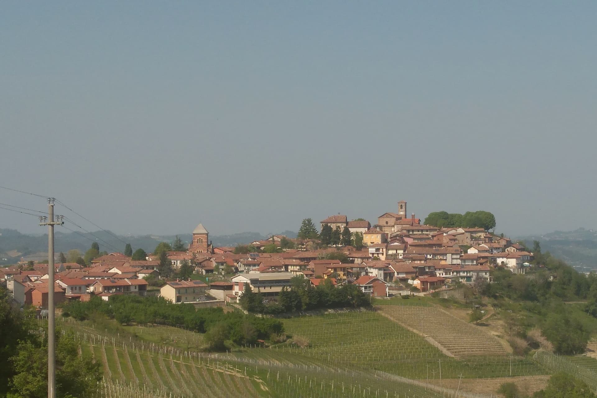
Verduno sits fifty kilometers south of Torino on a Langhe ridge above the Tanaro, its vineyards the only ones among the eleven Barolo communes to lean partly toward the river plain rather than folding back into the hills. That position, facing the water and the Alps beyond it, sets the village apart from the rest of the DOCG even before the wine is considered.
The other thing that sets it apart is Pelaverga Piccolo, a native black grape cultivated commercially in only three Langhe communes: Verduno, La Morra and Roddi. It yields a light ruby red with strawberry, rose and a distinct white-pepper finish, and the first single-variety Pelaverga vineyard on these slopes was planted in 1972.
Between the castle on the ridge and the vine on the plain-facing slope, Verduno holds two things most of its neighbors do not: a wine that is Barolo's own, structurally, and a wine that belongs to almost nowhere else.
We confirmed you can reach this one by train.
What to see in Verduno
- Castello di Verduno. The castle stands on the Langhe ridge and passed to the Burlotto family in 1909, who still work it as a winery producing Barolo and Pelaverga.
- Centro storico. Small hilltop village arranged around the castle and the parish church, with views across the Tanaro and the northern Barolo vineyards.
- Vigneti di Pelaverga. Indigenous Pelaverga Piccolo plantings on the Verduno slopes, including the first single-variety Pelaverga vineyard planted in 1972.
How to get to Verduno
There is a railway station in the town, so you can arrive without a car and never need one while you are here. Torino is roughly 60 minutes away by road.
Our tip
April through June is the green window in the Langhe, hillsides striped between Nebbiolo and Pelaverga vines, mild evenings on the Verduno ridge. September and October are the harvest months: Pelaverga first, Nebbiolo last, with the surrounding cantine open for tastings and walking through the rows possible without crowds. July and August touch the low thirties on the hills; the centro storico thins after lunch and the cellar tastings move under stone vaults to stay cool.
Cocconato
Why visit Cocconato
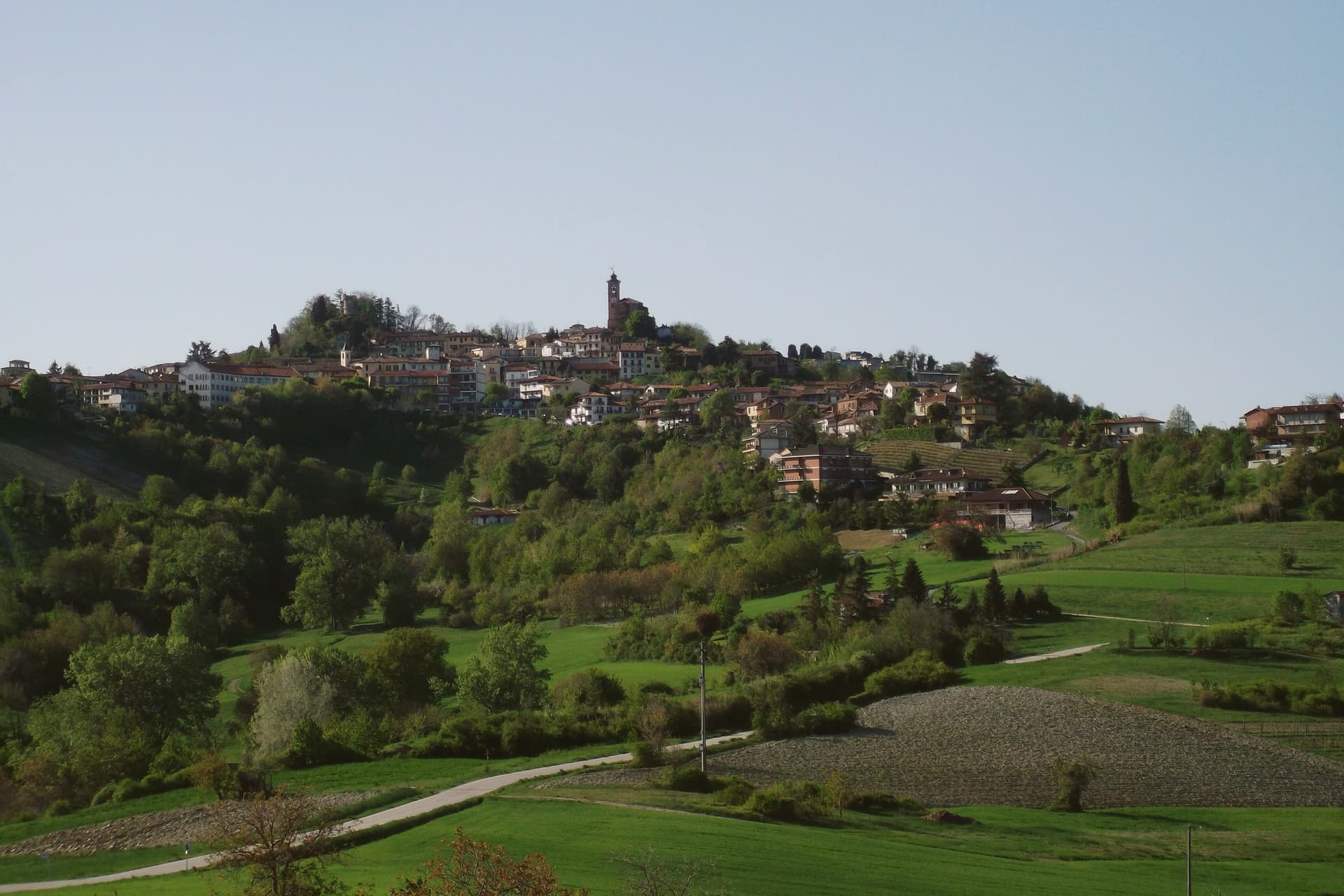
Cocconato sits thirty kilometers east of Torino, on a ridge whose south-facing slope catches enough sun to keep olives, palms and mimosas alive this far north, the reason locals call the area the Riviera del Monferrato. From the tenth century the ridge was held by the Radicati counts, a Manfredian family, as an imperial fief for four hundred years, until 1586: the centro storico that survives is their seat, not a later reconstruction.
The town's two anchors sit close together but answer to different authorities. The civic palace, built in the fifteenth century, faces the seventeenth-century parish church of Santa Maria della Consolazione across the upper piazza, government and religion holding opposite ends of the same small square.
Beyond the built center, the ridge opens onto a belvedere looking south across vineyards toward the Alta Langa and, on clear days, the Monviso massif. Since 1970 the six frazioni of Airali, Brina, Colline Magre, San Carlo, Torre and Tuffo have raced their donkeys in the Palio degli Asini, a modern rivalry laid over an old administrative one.
Cocconato is the only commune in the province of Asti to hold the Bandiera Arancione, a fitting distinction for a ridge that has been organizing the same handful of parts, fief, palace, church, frazioni, for centuries.
We confirmed you can reach this one by train.
What to see in Cocconato
- Palazzo Comunale. Pointed-arch porticoes and terracotta-framed windows on the Late Gothic facade, still the building the ridge town organizes itself around.
- Chiesa di Santa Maria della Consolazione. Seventeenth-century parish church anchoring the upper piazza, the religious counterweight to the medieval civic palace below it.
- Centro storico. Medieval ridge town that was the seat of the Radicati counts from the tenth century until 1586, well preserved on the south-facing slope.
How to get to Cocconato
There is a railway station in the town, so you can arrive without a car and never need one while you are here. Torino is roughly 57 minutes away by road.
Our tip
April through June and September through October are the months that earn Cocconato its Riviera nickname: dry warm days on the ridge, vineyards in green or gold, and the palms in the lower gardens visibly out of season. July and August are warm and busy, with Cocco Wine at the end of summer drawing crowds into the centro storico. November through March is the quiet half of the year.
Donnas
Why visit Donnas
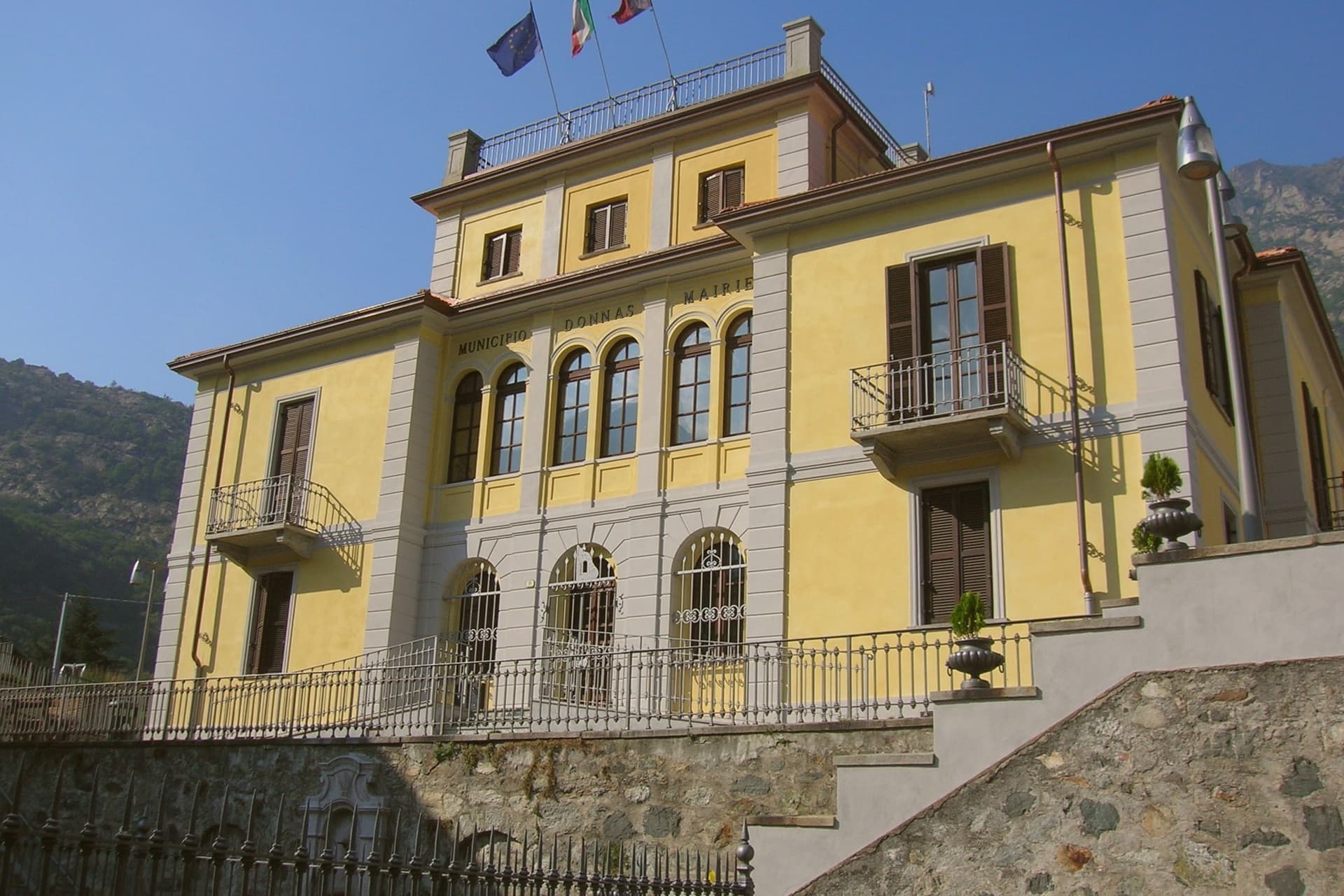
Donnas sits at 322 metres at the south-eastern mouth of the Aosta Valley, where the Dora Baltea slows and the cliffs close in on the old road. The Romans built the Via delle Gallie through here in the first century BC to connect the Po Valley with Gaul, and a 221-metre stretch of paved road, cut for more than 200 metres directly into the bedrock, still survives with cart-wheel ruts in the stone, a single Roman arch, and a milestone marking the thirty-sixth mile from Augusta Praetoria.
The medieval village rebuilt itself against the cliff face after the 1176 landslide that destroyed the older settlement of Treby a kilometre west. Wine has been documented here since 1200.
In 1971, Donnas became the first Valdostan wine to earn DOC status: 85 to 90 per cent Nebbiolo, grown on terraced slopes along the Dora, vinified at the Caves Coopératives de Donnas above the historic centre.
We confirmed you can reach this one by train.
What to see in Donnas
- Strada Romana delle Gallie. First-century BC Roman road carved directly into the bedrock for more than 200 metres, with surviving cart-wheel ruts, a single arch and a milestone.
- Arco Romano e Miliario. Roman arch cut from the rock and a milestone indicating the XXXVI mile from Augusta Praetoria, anchoring the surviving stretch of the Via delle Gallie.
- Borgo storico di Donnas. Medieval village rebuilt against the cliff face after the 1176 landslide that destroyed nearby Treby, with stone houses along the old consular road.
How to get to Donnas
There is a railway station in the town, so you can arrive without a car and never need one while you are here. Torino is roughly 85 minutes away by road.
Our tip
April through June and September through October are the working months in Donnas. The vineyards bud and leaf out in spring, the harvest runs through September into early October, and the lower-valley light is at its clearest. The Via delle Gallie is walkable year-round but most pleasant in shoulder seasons, when the rock-cut road is dry and the sun reaches the cliff face.
Castagnole delle Lanze
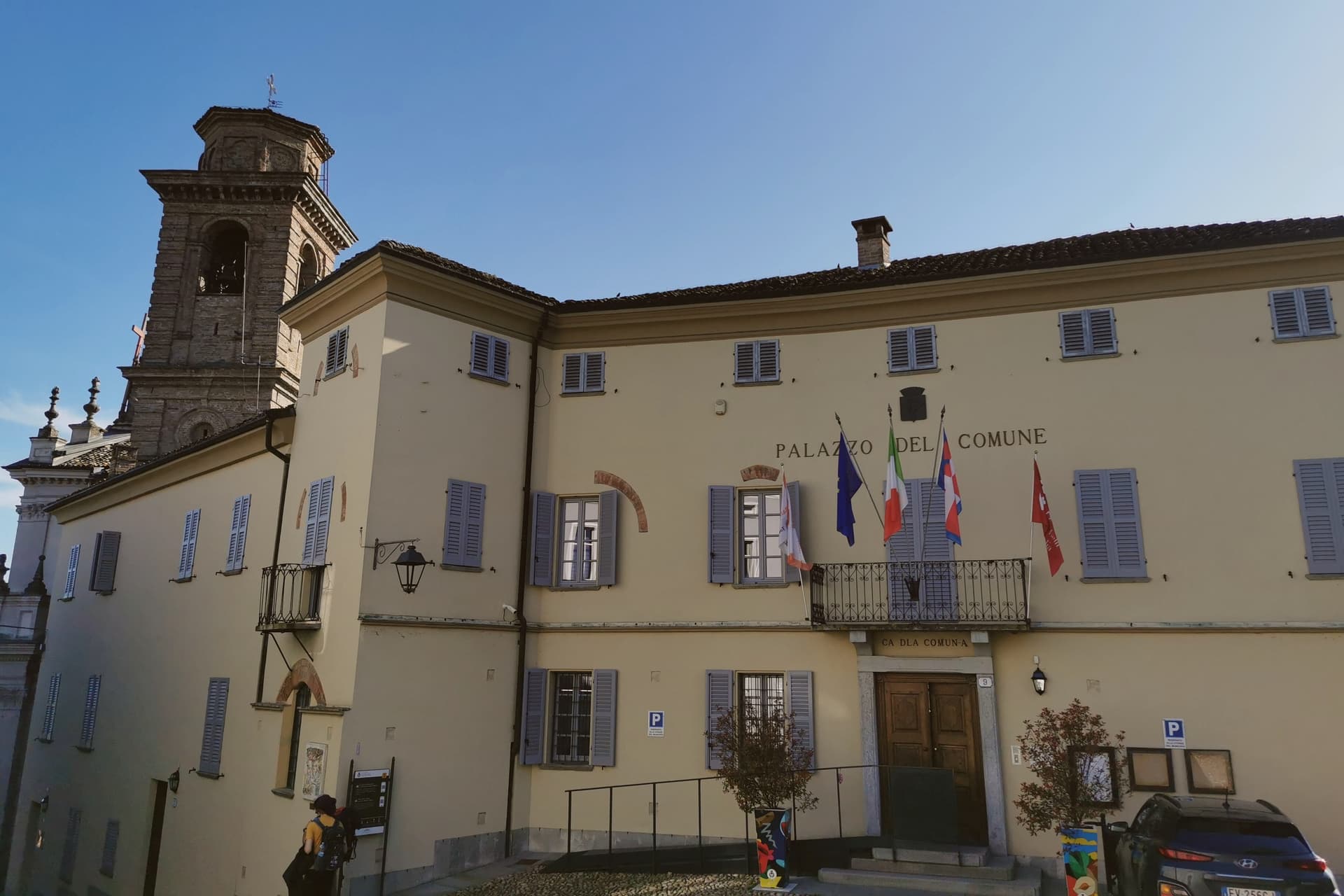
Why visit Castagnole delle Lanze
Fifteen kilometers south of Asti, Castagnole delle Lanze lies in the UNESCO Vineyard Landscape of Piedmont, on ground once crossed by a Roman road branching off the Via Aemilia between Acqui and Pollenzo. In the Middle Ages the lands belonged to the counts of Loreto, with Manfredo I the count most tied to the community; their castle, probably destroyed in 1255 when the contado fell, has not survived, and from the thirteenth century the town passed under the Comune of Asti.
The main square and Piazza Balbo hold the two churches that anchor the lower town, while the Parco della Rimembranza occupies the highest ground of the village, looking over the Tinella and Tanaro valleys. What remains is a settlement built in layers: a Roman route, a lost medieval castle, a pair of Baroque churches, and a nineteenth-century tower, each belonging to a different century and none of them replacing the one before it.
We confirmed you can reach this one by train.
What to see in Castagnole delle Lanze
- Chiesa di San Pietro in Vincoli. Parish church of 1681 on the main square, Ligurian-Piedmontese Baroque with a twin-bell-tower façade.
- Chiesa dei Battuti Bianchi. Confraternity church of 1668 in Piazza Balbo, deconsecrated and now used as a space for cultural events.
- Torre di San Robert. Built by Count Paolo Ballada di San Robert, the tower stands at the top of the Parco della Rimembranza and still functions as a lookout over the surrounding hills.
How to get to Castagnole delle Lanze
There is a railway station in the town, so you can arrive without a car and never need one while you are here. Torino is roughly 72 minutes away by road.
Our tip
April through June brings the vines into leaf and the Tinella valley into clear light, with the Torre di San Robert opening on weekends. September and October are harvest, the high season for the Langhe-Monferrato hills and the time the Adotta un filare initiative runs its tastings. July and August get hot on the south-facing slopes; mornings in the Parco della Rimembranza and evenings on the main piazza are the cooler hours. Borgo diVino tour falls in October.
Susa
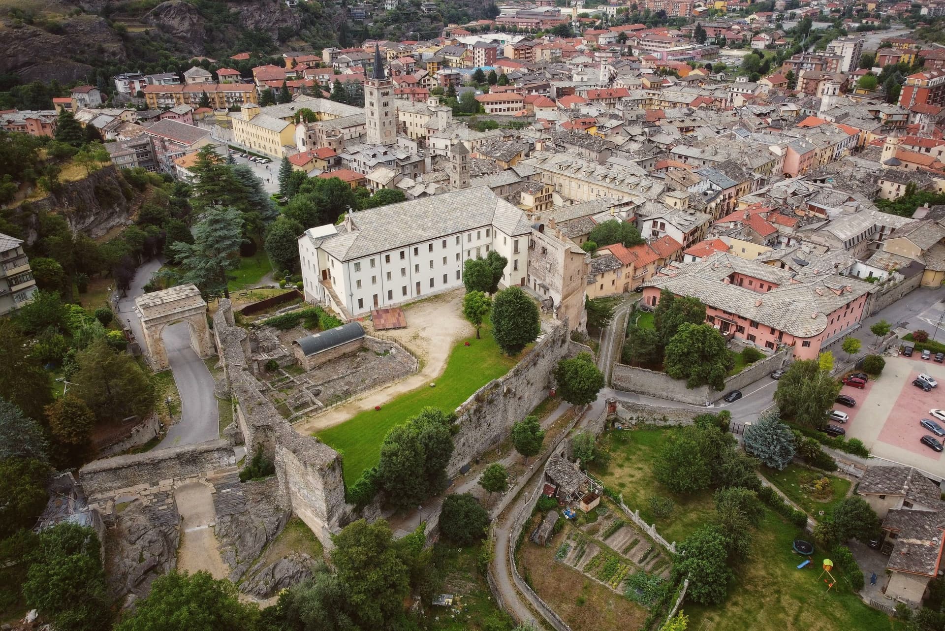
Why visit Susa
Susa sits fifty kilometers west of Torino, on the road that climbs toward the Moncenisio and Montgenèvre passes into France. Ligurians and Celts settled the site around 500 BC.
It later emerged as the capital of the kingdom of the Cozii under Marcus Julius Cottius, son of King Donnus, who allied with Rome and was confirmed as prefect of the new province of Alpes Cottiae, with Segusio, modern Susa, as its capital: the arch in the town center and the town's name in the Cottian Alps both descend from that alliance. The old core, arch, cathedral and castle, sits compact around the Roman gate that the castle absorbed into its later walls, with the amphitheatre just outside that line.
The pilgrim route threads through this core on its way down from the pass, meaning the town has functioned as a waypoint on the same north-south line, Roman road, medieval pilgrimage route, alpine crossing, since Ligurians and Celts first settled it. What the Cozii capital, the pilgrim stop and the mountain gateway add up to is a single fact repeated across the centuries the arch and the campanile have stood: Susa exists because of the road, not beside it.
We confirmed you can reach this one by train.
What to see in Susa
- Arco di Augusto. White marble arch over 13 meters tall, standing in the centre of town and counted among the best preserved of its kind in north Italy.
- Cattedrale di San Giusto. Founded by Olderico Manfredi, with the terracotta spires added in the 1480s. The campanile remains the tallest feature of the skyline.
- Castello della Contessa Adelaide. Built into a Roman gate on the line of the old walls, later reworked into a noble residence with medieval towers and Renaissance windows. It stands beside the cathedral.
How to get to Susa
There is a railway station in the town, so you can arrive without a car and never need one while you are here. Torino is roughly 53 minutes away by road.
Our tip
April through June is the green window in the Susa valley: the Cottian Alps with snow still on the upper slopes, mild evenings at 503 meters, and the Roman monuments lit clearly in the long light. July and August are warm but cooler than the Po plain; the Arch and the Cattedrale draw most of the year's visitors and the festival programme runs through summer. September and October are the second peak, with crisp air and the chestnut woods turning above the town.
Cherasco
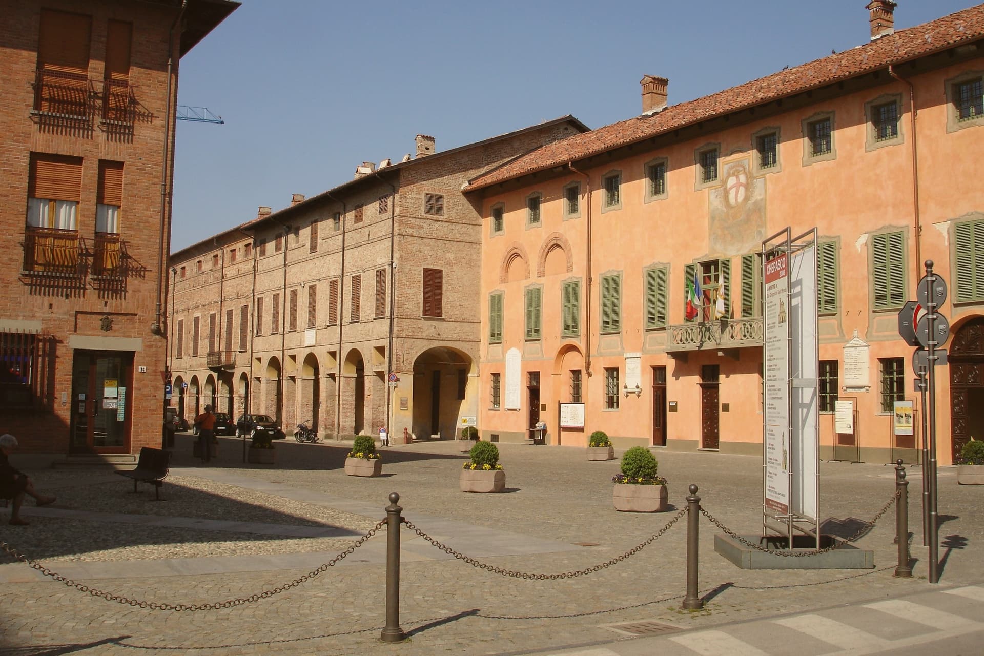
Why visit Cherasco
Cherasco sits fifty kilometers southeast of Torino, on the terrace where the Stura di Demonte joins the Tanaro. The site put the town on the frontier between the Piedmontese plain and the Langhe hills, and the 1243 planners answered it with a grid: wide streets, arcades, and walls, laid out in a single act rather than grown over centuries.
The castle anchors one end of that plan, the sanctuary another, and the palace where two treaties were signed sits within the same walkable core, so a visitor moving from arch to palace to church is retracing the town's history in the space of a few streets rather than reading it in sequence. That compactness is the point.
A town this size produced a fortress, two treaties of continental consequence, a baroque sanctuary, and a modern research institute, all within the same walled grid on the same river terrace. The snails came last and stayed longest: what began as an institute in 1973 is now the thing Cherasco is best known for, outlasting even the armistice in the town's daily life.
We confirmed you can reach this one by train.
What to see in Cherasco
- Castello Visconteo. Well preserved on the side facing the town, a museum since restoration. Begun by Luchino Visconti, it still dominates the skyline from the terrace below.
- Palazzo Salmatoris. Civic palace where the 1631 peace of Cherasco and the 1796 Napoleonic armistice were signed, now an exhibition venue.
- Santuario della Madonna del Popolo. Baroque sanctuary designed by Sebastiano Taricco, its facade and interior forming one of the architectural anchors of the centro storico.
How to get to Cherasco
There is a railway station in the town, so you can arrive without a car and never need one while you are here. Torino is roughly 65 minutes away by road.
Our tip
April through June is the green season on the Tanaro terrace, with mild days, vineyards in leaf, and the snail farms beginning their cycle. September and October bring the harvest, the Fiera del Tartufo, and the biannual Lumache di Cherasco fair in even years. July and August reach the mid-thirties on the river plain; the arcades that line Via Vittorio Emanuele are practical, not decorative, in that heat. Mercatino dell'antiquariato di Cherasco falls in September.
Canelli
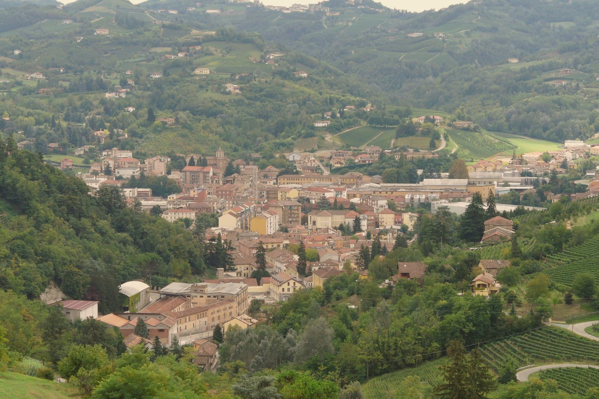
Why visit Canelli
Canelli sits at 157 meters on the Belbo, in the south-east corner of the Asti hills where the Langhe and Monferrato meet. The town is the birthplace of Italian sparkling wine: Carlo Gancia produced the first Asti Spumante here in 1865, on the model of Champagne.
Underneath the centro storico runs a network of cellars cut into the tuff by pickaxe and chisel from the sixteenth to the nineteenth century, descending as deep as 32 meters and extending about 20 kilometers through the hill below town. They are called the Cattedrali Sotterranee, and they were inscribed in the UNESCO Vineyard Landscape of Piedmont in 2014.
Above ground, the Sternia, a steep stone street, climbs from the Borgo Villanuova past the Torre dei Contini at 371 meters to the Castello Gancia, a medieval fortress transformed into a noble residence by the Scarampi in the early 1600s and still occupied by the Gancia family. The Belbo grows Moscato Bianco, Barbera and hazelnut.
We confirmed you can reach this one by train.
What to see in Canelli
- Cattedrali Sotterranee. Network of tuff-cut cellars under the centro storico, 20 km of tunnels descending to 32 meters, part of the UNESCO Vineyard Landscape since 2014.
- Castello Gancia. Medieval castle on the Sternia hill above town, transformed into a Scarampi residence in the 1600s and now home of the Gancia family.
- La Sternia. Historic stone-paved street climbing through Borgo Villanuova to the castle, the original access road to the hilltop fortress.
How to get to Canelli
There is a railway station in the town, so you can arrive without a car and never need one while you are here. Torino is roughly 82 minutes away by road.
Our tip
April through June and September into October are the months the Belbo hills work best. The vines leaf and harvest in those windows, the cellars stay 12 to 14 degrees year-round, and the climb up the Sternia to the castle is in shade most of the day. July and August get hot in the valley; the Cattedrali Sotterranee are the coolest space in town and double as a refuge between two and five in the afternoon. National Truffle Fair and San Martin Fair falls in November.
Nizza Monferrato
Why visit Nizza Monferrato
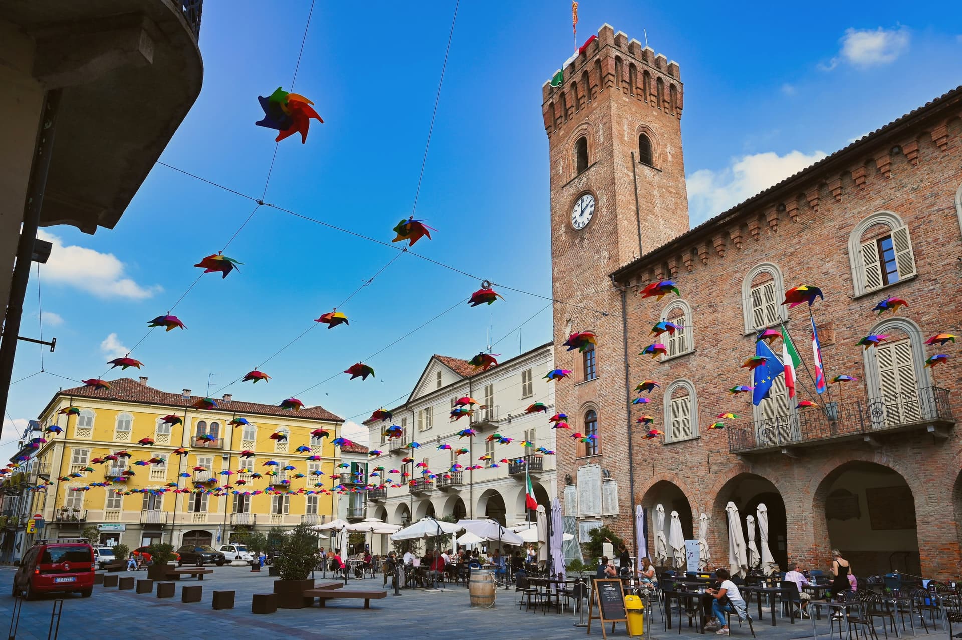
Nizza Monferrato sits at 267 meters in the south of the Asti province, thirty kilometers from Asti city. It was founded in 1225 by inhabitants displaced from castles in the Alessandria area, joined the Marquisate of Monferrato in 1264, and grew through the 19th century as the commercial center of the Barbera-growing hills around it.
The medieval grid from that 1225 founding still holds the centro storico together, with Renaissance and 18th-century palazzi lining Via Pio Corsi and Via Carlo Alberto, while the vineyards that made the town's fortune spread out beyond it at 200 to 400 meters. That agricultural hinterland and the market town at its center still explain each other: the Foro Boario, the old cattle market on Piazza Garibaldi, is the physical record of a town that existed to move what the hills produced, and it still does that job as a multipurpose hall for the antiques market and for the November weekend known as Nizza è Bagna Cauda.
At that gathering, long communal tables fill with the Cardo Gobbo, a hunchbacked cardoon grown only here and protected by a Slow Food presidium, alongside Barbera raised to DOCG status in 2014. A town built to trade a hillside's produce has ended up defined by two of that produce's most particular forms.
We confirmed you can reach this one by train.
What to see in Nizza Monferrato
- Piazza Garibaldi and Foro Boario. Main square with the old covered cattle market, now a multipurpose hall used for antiques fairs and the November bagna cauda weekend.
- Chiesa di San Giovanni in Lanero. Baroque parish church on the centro storico, with a tall bell tower visible across the surrounding vineyards.
- Museo Bersano delle Contadinerie. Wine-and-farming museum in a former cellar, with one of the largest collections of historic Piemonte viticulture tools.
How to get to Nizza Monferrato
There is a railway station in the town, so you can arrive without a car and never need one while you are here. Torino is roughly 78 minutes away by road.
Our tip
April through June and September into October are the months the Monferrato hills work best. October is harvest, with the Barbera coming in late and the cellars open for visits. November is the Cardo Gobbo and bagna cauda weekend, the largest event of the year, when the Foro Boario fills with communal tables and the Cantina di Nizza pours through the night. Mercatino dell'antiquariato nicese falls in August.
Avigliana
Why visit Avigliana
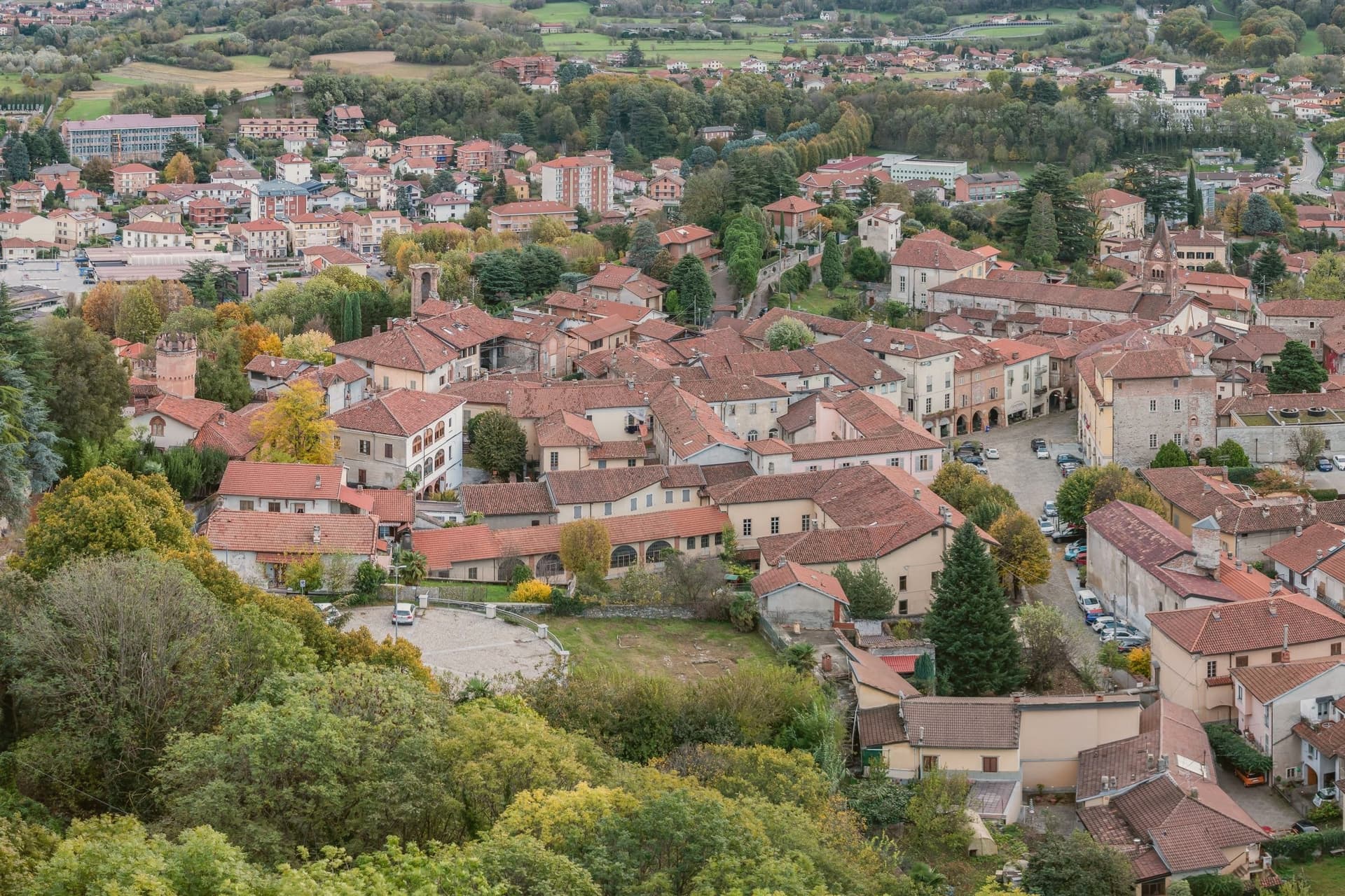
Avigliana sits at 383 meters in the lower Susa Valley, twenty-five kilometers west of Torino at the point where the Alps meet the Po plain. The first castle on Monte Pezzulano was built in 942 by the Arduinici Marquises of Turin and passed to the Counts of Savoy from 1137; Frederick Barbarossa destroyed it and Thomas I of Savoy rebuilt it, before the French marshal Catinat finally demolished it in 1691.
The medieval core that grew below the fortress is still ringed by porticoed houses from the twelfth to fifteenth centuries. The Chiesa di San Pietro and the Chiesa di San Giovanni hold frescoes spanning the eleventh through the sixteenth century, a run of decoration that outlasted the castle itself.
Below the centre, two glacial lakes, Lago Grande and Lago Piccolo, sit at 352 and 356 meters in a natural park established in 1980, while the Via Francigena passes through on its way toward the mountain above. What the town adds up to is a settlement built in layers around a single defensible height, with the ruined fortress marking the summit of Savoy power here and the abbey on the neighboring peak marking its longer, still-standing religious counterpart.
We confirmed you can reach this one by train.
What to see in Avigliana
- Piazza Conte Rosso. The square that gives the old core its shape, named for Amedeo VII of Savoy and ringed by porticoed houses whose ground floors still trace the medieval street line.
- Castello di Avigliana. Ruined Savoy fortress on Monte Pezzulano, built in 942, rebuilt by Thomas I of Savoy and demolished by Marshal Catinat in 1691.
- Chiesa di San Pietro. Romanesque church on the road to the lakes, decorated with frescoes from the 11th to the 16th century.
How to get to Avigliana
There is a railway station in the town, so you can arrive without a car and never need one while you are here. Torino is roughly 36 minutes away by road.
Our tip
April through June are the green months: the moraine lakes open for kayaking and swimming, the porticoed core stays cool under shade, and the climb to the Sacra di San Michele runs free of haze. July and August touch the low thirties in the valley, though the Sacra at 962 meters carries a steady wind. September and October bring chestnuts and the wine harvest in the surrounding Pinerolese hills.
More from Anywhere Italy
- The 6 best hidden towns you can reach by train that eat well within 90 minutes of Torino
- The 7 best wine towns you can reach by train within 90 minutes of Torino
 The 10 best hidden wine towns that eat well within 90 minutes of Torino
- The 7 best towns you can reach by train that have a serious restaurant within 90 minutes of Torino
- The best small wine towns within 90 minutes of Torino
 The best small hill towns you can reach by train in Piemonte