
The best hidden coastal towns in the province of La Spezia
The eastern end of Liguria is where the mountains stop pretending and drop straight into salt water. Houses go up rather than out, painted ochre and rose over slate doorframes, and the terraces behind them hold vines and lemons on dry stone walls that have been rebuilt by hand for generations. The eating is anchovies from the Gulf, salted or fried, trofie with pesto, focaccia eaten warm at the bar before the beach fills, and sciacchetrà poured small and sweet at the end. Late spring and September are the good windows, when the sea has warmth in it and the coastal footpaths are walkable without suffering.
There is a reason this coast is on every itinerary, and the reason is the Ligurian riviera's reputation as the most photographed shoreline in Italy. Portofino absorbs the yachts and the day-trippers arriving by ferry from Santa Margherita Ligure, its harbour ringed with tables priced for people who came to be seen. Ferries, trains and coach parties all funnel into the same few metres of quay, and by midday the queue for a boat back is longer than the crossing. It is a beautiful place, which is exactly the problem.
The cliffs do not stop where the crowds do. The same slate, the same terraces, the same anchovy boats continue south into the province of La Spezia, along a coast where the railway tunnels between beaches and the Gulf of Poets opens out towards Tuscany. Some of these towns are famous and some are barely visited, and the quieter ones sit within a train ride of the loud ones. Below are the coastal towns of the province we would send someone to, all of them on the water.
Of the 13 communes we have mapped in the province of La Spezia, 10 qualify as coastal towns: each sits directly on the sea. This list is the hidden ones, 9 in all, ordered smallest first. The smallest, Framura, has 577 residents.
Elsewhere in the catalogue: The best towns with a serious restaurant in the province of La Spezia and The 6 best towns you can reach by train in the province of La Spezia.
Framura
Why visit Framura
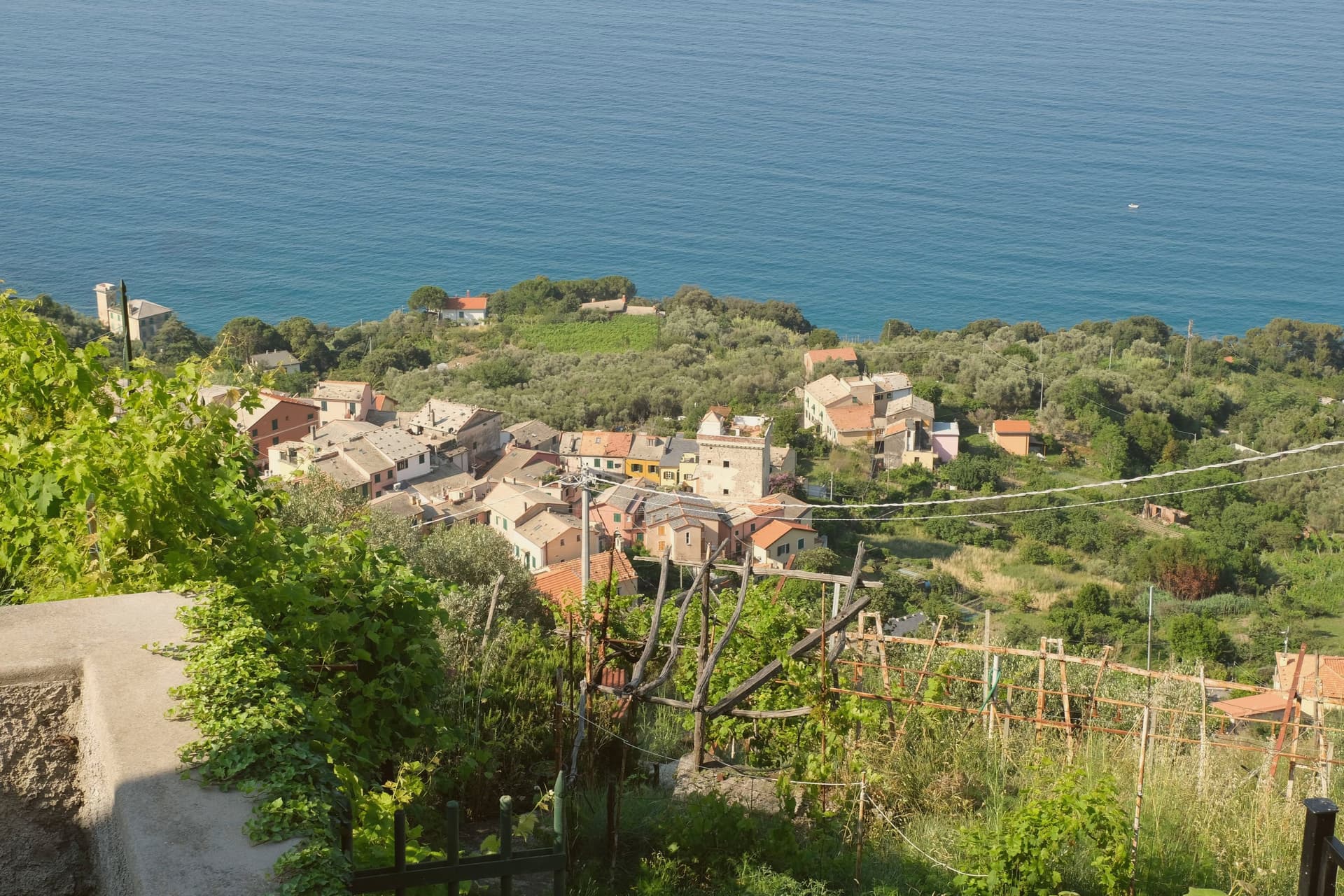
Framura is not one village but five: Anzo on the water, Setta and Ravecca on the slope, Costa above them, and Castagnola at roughly 300 meters with views back down to the coast. The commune spans from the rocky shoreline to 845 meters inland on the ridge that separates the Cinque Terre coast from the Vara valley.
Byzantine settlers built the original circular watchtowers here against Saracen raids, three of them still standing on the coast and inland. The hamlets remained agricultural until the Genova-La Spezia railway tunneled through in the late nineteenth century, opening the commune to summer visitors.
The seafront below Anzo, reached by a converted railway tunnel turned cycle path, carries the Bandiera Blu, and the same path runs north toward Bonassola and Levanto. Framura is the quiet outlier on this coast: the closest Borghi più belli village to Monterosso al Mare without being in the Cinque Terre national park.
The beach here holds the national bathing award, which a comune has to win back every year on water quality, beach management and safety.
What to see in Framura
- Torri bizantine. Three surviving Byzantine watchtowers on the coast and ridge, built to defend the village from Saracen incursions.
- Castagnola. Highest of the five hamlets at around 300 meters, with views over the lower frazioni and the Riviera di Levante.
- Anzo waterfront. Coastal hamlet at sea level with the Bandiera Blu beach access, the lowest of Framura's five settlements.
How to get to Framura
There is a railway station in the town, so you can arrive without a car and never need one while you are here. Genova is roughly 59 minutes away by road.
Our tip
April through October fits Framura, with the cycle path open and the coast walkable in any direction. May, June and September are the best for combining sea and hiking; mid-summer brings the strongest beach traffic but the upper hamlets stay calm. The Bandiera Blu beachfront below Anzo is small and fills early on August weekends.
Deiva Marina
Why visit Deiva Marina
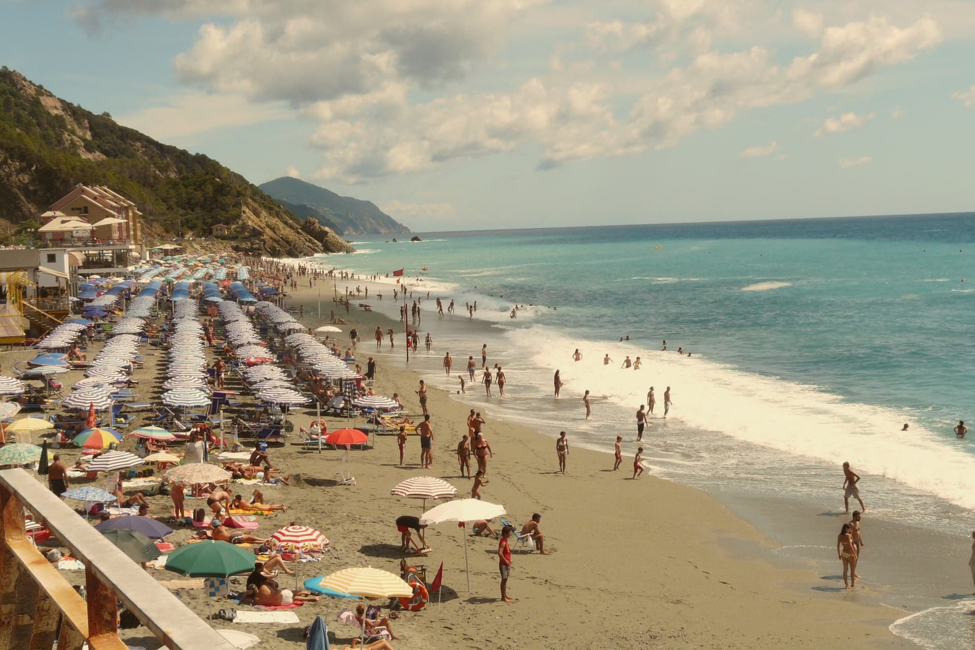
The commune sits at the bottom of a valley running from Monte San Nicolao, eight hundred meters up, down to the Ligurian Sea, fifty kilometers east of Genoa. The territory is first documented in a Carolingian imperial diploma of 774, but for most of its history the settlement stayed inland: the coastal plain flooded, and Barbary raids made the shore too exposed to live on.
The villages up the slope were the town. The seafront had no fixed population until the railway reached it, and the seafront that grew up afterward, around the station and a hotel called Albergo Savoia, is a nineteenth-century addition to a place whose real age lies up the hill.
The round watchtower near the sea was partly demolished by a flash flood in 1852, a reminder that the coast it guarded was never entirely tame even after settlement arrived. What the geography adds up to is a town in two pieces on two timelines: an old, defended, inland Deiva that predates the sea by centuries, and a young shoreline that only exists because a railway made the coast safe to build on.
What to see in Deiva Marina
- Torre Saracena. The square tower stands beside the church, its stone weathered, a lookout post scaled to a coastline once undefended by anything larger.
- Chiesa di Sant'Antonio Abate. Still the parish church, standing in what was the original inland centro storico before the seafront existed, dedicated to the Egyptian hermit.
- Spiaggia di Deiva Marina. Shallow sand and shingle running below the railway station, wide enough that the crowds it draws spread rather than crush.
How to get to Deiva Marina
There is a railway station in the town, so you can arrive without a car and never need one while you are here. Genova is roughly 50 minutes away by road.
Our tip
May through September is the beach season: the bay opens around mid-May, water temperatures climb through June, and by August the seafront fills with Genovese and Milanese families. The Cinque Terre next door pulls day-trippers off the train through the summer. April and October are the shoulder months when the inland frazioni walks are pleasant and the beach is still warm enough for swimming on a calm day.
Levanto
Why visit Levanto
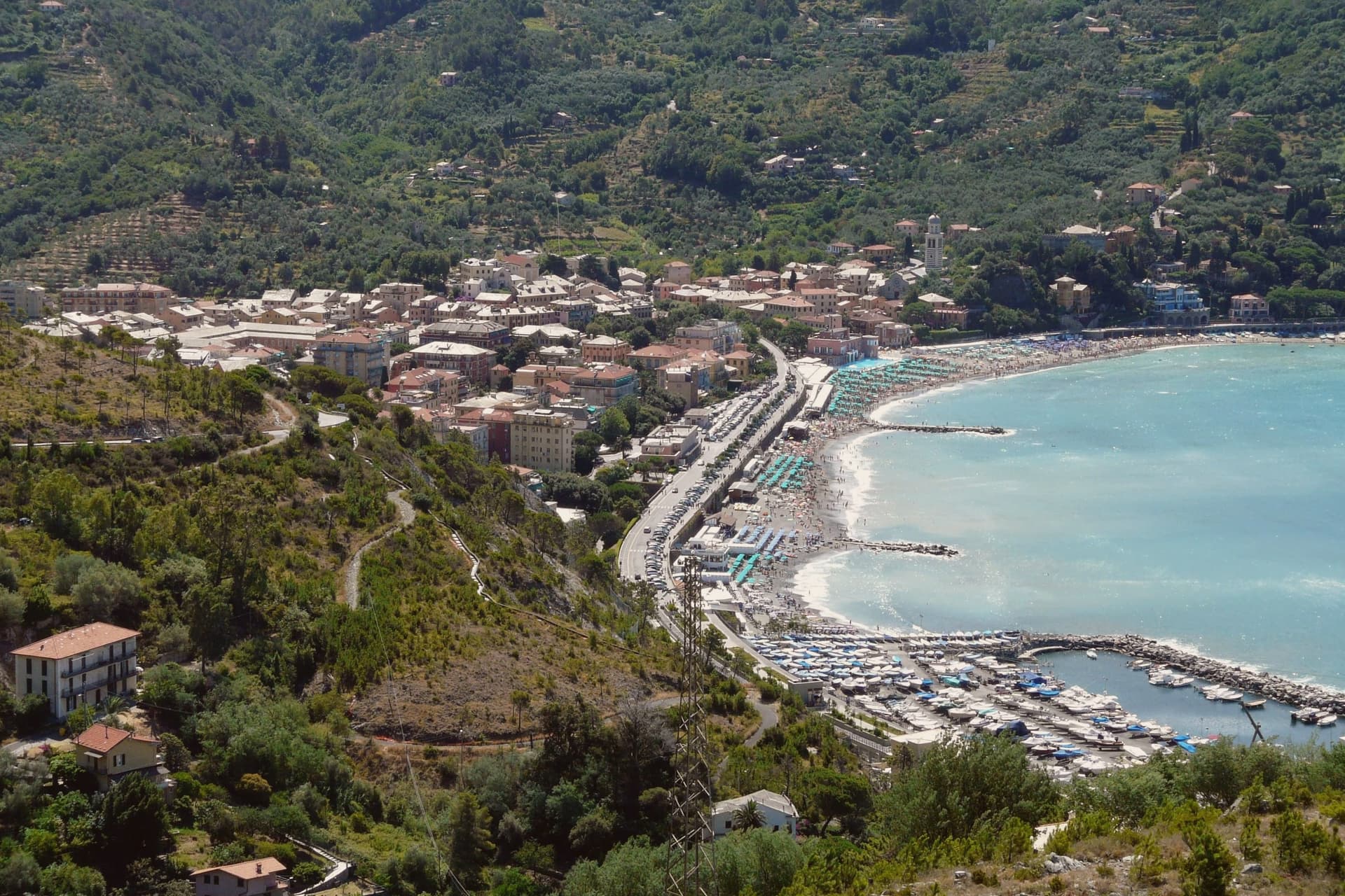
Levanto sits at sea level on the Ligurian coast, twenty kilometers northwest of La Spezia and just outside the Cinque Terre National Park. The Cinque Terre Express train stops here every half hour on its way to the five villages, but Levanto has the things they do not: a long sand-and-gravel beach with Bandiera Blu status, a flat centro storico, and a surf break that local guides classify as one of the few big-wave spots in Italy.
The Chiesa di Sant'Andrea, built in 1222, fronts the old town with horizontal bands of black and white marble and a large rose window. The thirteenth-century Loggia Comunale, on the same piazza, was awarded a UNESCO peace and culture title in 2007.
Casa Restani, on Via Grillo, is a surviving medieval merchant house with the ground floor where goods from the harbor were stored. Levanto holds Cittaslow, Bandiera Blu, Parco Nazionale, and Città dell'Olio at once.
The beach here holds the national bathing award, which a comune has to win back every year on water quality, beach management and safety. It is also rated for accessibility, which most of this coast is not.
What to see in Levanto
- Chiesa di Sant'Andrea. Parish church built in 1222 in Ligurian Gothic style, with horizontal bands of black and white marble and a large rose window over the main door.
- Castello di Levanto. Thirteenth-century defensive castle on the hillside, still intact but privately owned and closed to the public.
- Loggia Comunale. Thirteenth-century arcaded loggia on the main piazza, awarded a UNESCO title in 2007 as a monument of culture and peace.
How to get to Levanto
There is a railway station in the town, so you can arrive without a car and never need one while you are here. Genova is roughly 72 minutes away by road.
Our tip
April through June and September into October are the dry months. The sea warms enough for swimming by late May. The surf builds in autumn and winter when Atlantic systems push swell into the gulf.
Vernazza
Why visit Vernazza
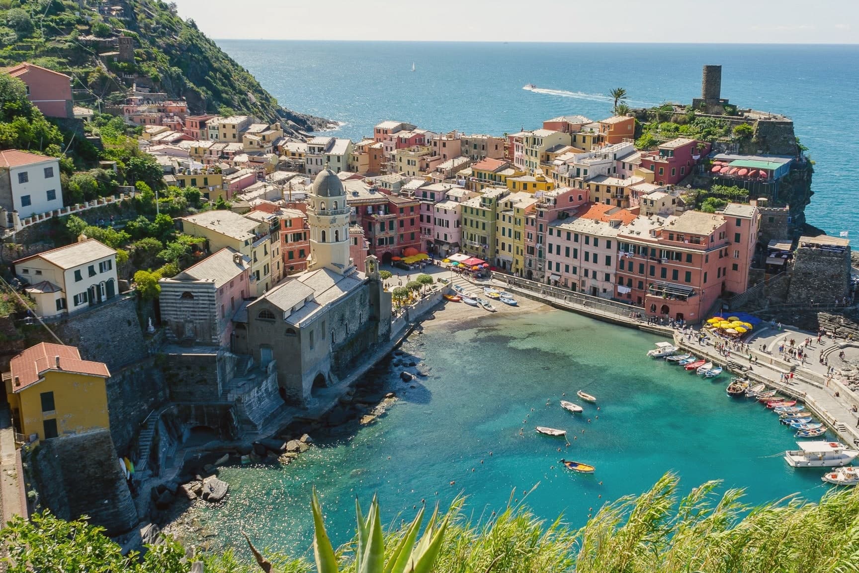
Vernazza sits at sea level, the middle of the five villages along this stretch of coast and the only one with a natural harbor. The houses stack vertically up the gorge of the Vernazzola torrent, painted in faded ochres and pinks, with the square at the harbor marking the seaward end of Via Roma and the social center of the village.
On 25 October 2011, a freak rainstorm dropped 22 inches of water in four hours. The torrent burst its culvert and buried the main street under four meters of mud and debris.
Three people died. The village was closed for months, and most of the houses on Via Roma had to be excavated to the second story before it reopened.
The harbor, the fortified height above it, and the terraced slopes behind form a single working shape: a landing place guarded from above and fed from the terraces, all of it packed into a gorge narrow enough that a few hours of rain could bury the street from end to end.
What to see in Vernazza
- Castello Doria. The keep and the Belforte tower stand over the harbor, built by the Doria as a defense against Saracen raids.
- Chiesa di Santa Margherita d'Antiochia. Fourteenth-century church on a rock platform at the edge of the harbor, documented from 1318, the gothic anchor of the village.
- Porto di Vernazza. The only natural harbor in the Cinque Terre, with a small pebble beach and a ferry pier serving the four other villages and Portovenere.
How to get to Vernazza
There is a railway station in the town, so you can arrive without a car and never need one while you are here. Genova is roughly 101 minutes away by road.
✷ We have written about Vernazza
“The Cinque Terre are five towns with a national park around them and a marketing name that adds up to five. The copies without the name are a few miles away in either direction, and the experience they sell is the same experience, with the crowd divided by a hundred.”
Read our piece on Vernazza →Cinque Terre | How To Do It Right
Our tip
April through June and September into October are the right months in the Cinque Terre. The terraces green in spring, the Sciacchetrà and Vermentino harvest runs from August into early September, and the autumn light on the painted houses is what most photographers come for. July and August are full beyond capacity: ferries, trains and trails all hit limits, the harbor square loses any quiet, and the village rationed entry on the worst weekends of 2023 and 2024. Giochi Di Santa Margherita falls in July.
Riomaggiore
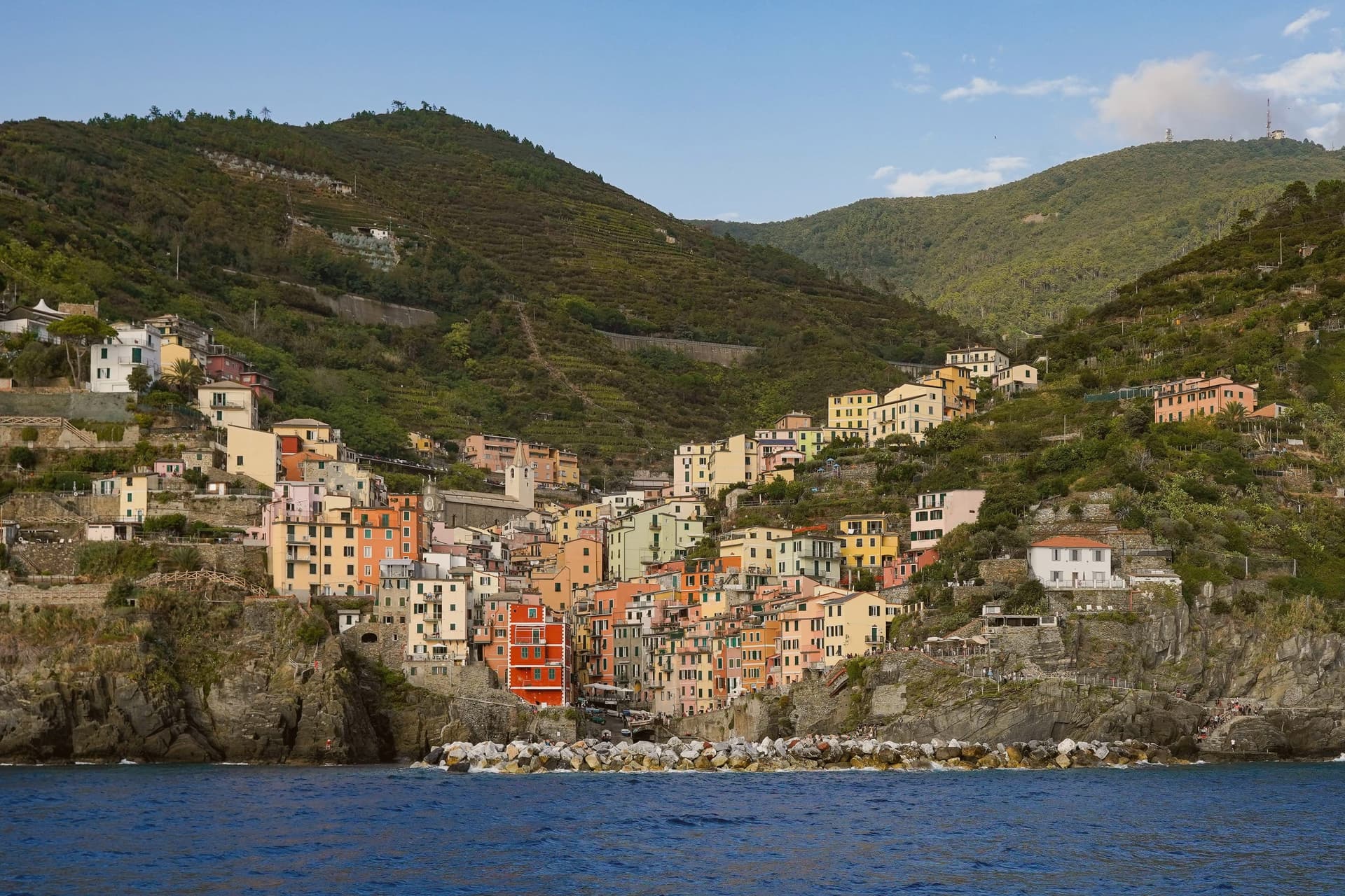
Why visit Riomaggiore
The village sits at the eastern end of the coastal line running out of La Spezia, first among the five reached along that route. It is documented from 1251, when the Carpena district swore allegiance to Genoa.
The castle went up first, begun in 1260 against pirate raids; the church followed in 1340 under Bishop Antonio Fieschi, its neo-Gothic front a much later addition from 1870, with a Maragliano crucifix still inside. The terraces above the rooftops are older than either building in continuous use, cut into the slope and worked without interruption long enough that the wine they produce carries the name of the method itself.
The built village is compact: castle and church above, the narrow harbour below at the water's edge, boats hauled onto the slipway between the breakwaters. Pixar set Luca here in 2021, lightly disguised as Portorosso.
Roughly 2.5 million annual visitors now reach a commune of 1,326 residents, a ratio that says as much about the place as any single monument: a fishing settlement of one street and one slipway, built to hold far fewer people than now pass through it, sized against a public many times its own population.
What to see in Riomaggiore
- Chiesa di San Giovanni Battista. Built in 1340 under Bishop Antonio Fieschi, rebuilt with a neo-Gothic façade in 1870, holds a wooden crucifix by Anton Maria Maragliano.
- Castello di Riomaggiore. Begun in 1260 by the Marchesi Turcotti against pirate raids, completed by Genoa two centuries later, twin cylindrical towers above the village.
- Via dell'Amore. The path clings to the cliff face between two villages, the sea directly below and the rock wall pressing close on the other side.
How to get to Riomaggiore
Pisa is roughly 134 minutes away by road.
Our tip
April through June brings the green window before the crowds: terraces in flower, train arrivals manageable, the Sentiero Azzurro walkable end to end. September and October are the dry months, harvest on the slopes above the village. July and August are hard.
Monterosso al Mare
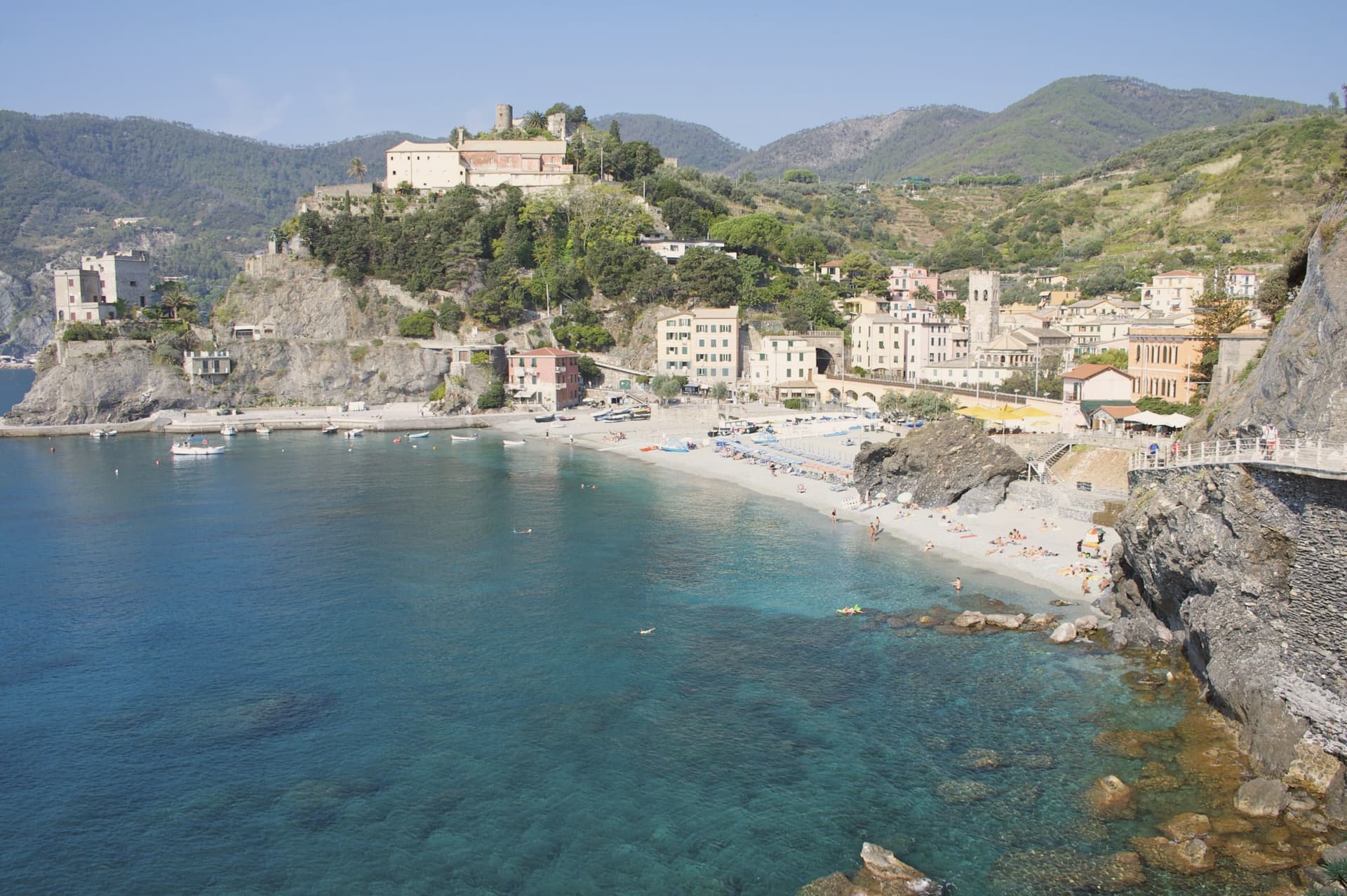
Why visit Monterosso al Mare
The village splits into two halves on either side of a headland: the older centro storico and, on the other side, the Fegina seafront where the railway runs behind the sand. The Capuchin convent looks out over both sides from that same headland, the hinge on which the whole layout turns.
Above the rooftops, at 464 meters, a hilltop sanctuary has stood on the same ground since 740, older than the village below it and the oldest Marian site in Liguria. The parish church down in the old town, banded in black and white marble, was built centuries later, so the two put a long stretch of the coast's religious history on display within sight of each other.
Montale's villa stood in Fegina, and the rocks and cliffs he carried into Ossi di seppia are the same ones visible from either half of the village. The geography here is the story: a headland dividing old from new, and a hillside holding the older of the two by several centuries.
What to see in Monterosso al Mare
- Chiesa di San Giovanni Battista. Parish church built 1282-1307 with a black-and-white-banded marble façade and a fresco of the baptism of Christ over the main portal.
- Santuario di Nostra Signora di Soviore. Hilltop sanctuary at 464 meters above the village, occupied by a church since 740, the oldest Marian site in Liguria.
- Convento dei Cappuccini. Seventeenth-century Capuchin convent on the San Cristoforo headland, separating the centro storico from Fegina.
How to get to Monterosso al Mare
There is a railway station in the town, so you can arrive without a car and never need one while you are here. Genova is roughly 78 minutes away by road.
Our tip
April through June and September through October are the workable months. The Sentiero Azzurro is open, the sea warms from late May, and the village still moves at a manageable pace. July and August are difficult: the Cinque Terre regional system caps walking-path tickets but the centro storico still saturates, and trains arrive standing-room from La Spezia. Festa del Limone falls in May.
Portovenere
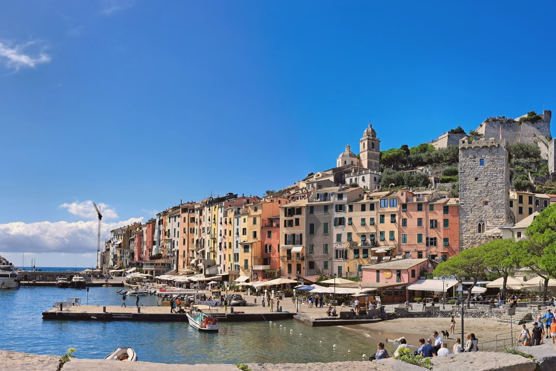
Why visit Portovenere
Portovenere closes the western mouth of the Gulf of La Spezia, three kilometers south of the city by water, facing the islands of Palmaria, Tino and Tinetto across open water. The Roman Portus Veneris dates to at least the first century BC, named for a temple to Venus on the promontory that now carries the striped church at the harbour mouth.
Genoa took control in 1113 and fortified the town as the southern anchor of its Riviera defences, opposite Pisan Lerici across the gulf: the fortress above the harbour and the church on the rock were built to face each other's rival coast rather than each other. The upper town holds the castle and its Romanesque parish church, rebuilt after a fire in 1340 damaged that quarter; the single medieval street below runs parallel to the harbour, its plan unchanged since Genoa first laid the town out in the twelfth century.
The promontory church stands apart from both, reachable along the water's edge, with the sea cave that took Byron's name cut into the rock beneath it. A fortified street, a hilltop castle and a temple site turned church: the town reads as a defensive line built along a single spine of rock, with the gulf doing the rest of the work UNESCO recognized in 1997.
What to see in Portovenere
- Chiesa di San Pietro. Consecrated 1198, black and white striped Gothic rebuild from 1256-1277, on the rocky promontory where the Roman temple of Venus stood.
- Castello Doria. First cited 1139, rebuilt 1161, expanded into the seventeenth century, the Genoese fortress above the harbour, prison under Napoleonic rule.
- Grotta dell'Arpaia. Sea cave below San Pietro, also called Byron's Grotto for the English poet who swam from here to Lerici across the gulf to visit Shelley.
How to get to Portovenere
Pisa is roughly 83 minutes away by road.
✷ We have written about Portovenere
“Most people spend a few hours in Portovenere between the ferry and the aperitivo. We gave it three weeks, and the town we got was the one the couple on the balcony lived in: vertical, repetitive, almost monastic, a town where the day is a staircase you climb the same way at the same hours, where the luxuries are a balcony the size of a doormat and an espresso stretched to thirty minutes because there is no reason on earth to drink it faster.”
Read our piece on Portovenere →Portovenere | The Slowest Coffee in Italy
Our tip
April through June and September to October are the working windows. Ferries to Palmaria run on full schedules from May onwards; the gulf is calm enough to swim by late May. July and August fill the carruggio and the Castello Doria, accommodation runs at three times shoulder rates, and the queue for the climb to San Pietro can reach an hour. Sagra Pansa E Stacca falls in June.
Ameglia
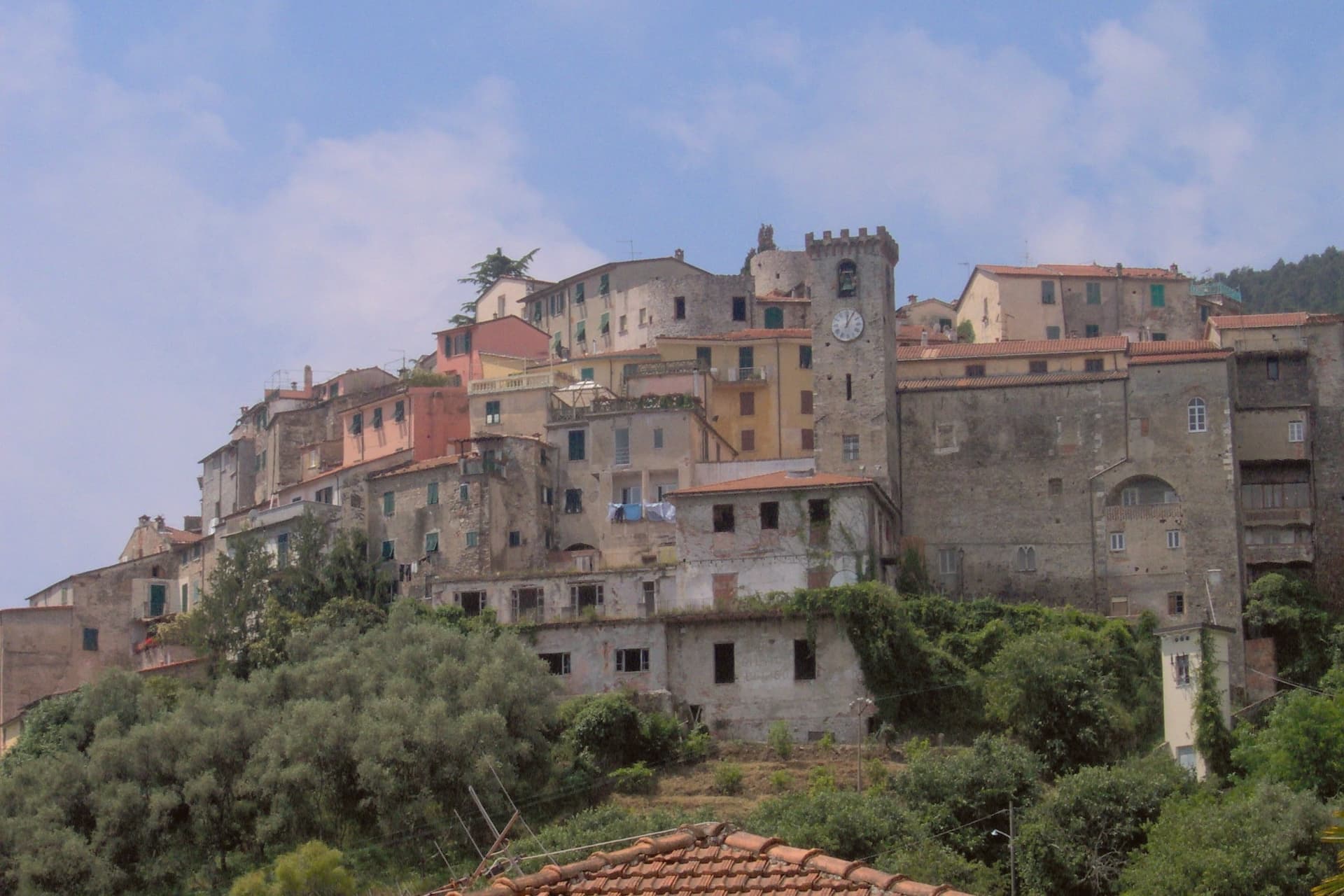
Why visit Ameglia
The Magra was the Roman Macra, the eastern boundary of Liguria, and the hill at Ameglia stands on the border between Lunigiana and the Riviera where that river reaches the sea. Genoa bought part of the fief in 1141, the bishops took it back by 1284, and Castruccio Castracani of Lucca conquered it in 1321: a small fortress passed between larger powers for three and a half centuries before it settled into the shape it now has.
The marina at the river mouth is a separate world from the hill town above it. Where the castle and its concentric streets sit on the summit, the frazione at the water is a former fishing village, flat, tied to the tide and to summer moorings rather than to the bishops who once held the heights.
The two headlands south of that marina are reachable only by boat or steep footpath, cut off from the estuary settlement by their own geography rather than by distance. The town, in effect, is two places joined by the same river: a fortified height that answered to Luni and Genoa, and a working shoreline that answered to the sea.
What to see in Ameglia
- Castello di Ameglia. Rebuilt in 1174 on a tenth-century footprint, episcopal fortress of the bishops of Luni, cylindrical keep above the Magra estuary.
- Centro storico di Ameglia. Concentric medieval streets around the castle, twelfth and thirteenth-century houses with stone arches and external staircases.
- Bocca di Magra. Old fishing village and marina at the river mouth, summer mooring for small craft, departure point for Punta Corvo by sea.
How to get to Ameglia
Pisa is roughly 60 minutes away by road.
✷ We have written about Ameglia
“It has the best panorama in Liguria, full stop, and I do not think it is close. The reasons are two. The first is the obvious one. You are 266 meters up, the cliff is high enough that there is no rocky beach below to draw a crowd, the sea on one side is the Gulf of La Spezia with Portovenere across the water and the Cinque Terre fading north, and the view on the other side is the Magra running into its delta with the white Apuane behind it and Tuscany beyond.”
Read our piece on Ameglia →Magra Delta Roadtrip | A Tagine, a Lighthouse, and a Dead Roman City
Our tip
April through June and September to October bring the river's best months: clear estuary water, the headland walks down to Punta Corvo manageable, marinas at Bocca di Magra not yet at summer capacity. July and August fill the river mouth with summer boats from across the Gulf of Poets, and the road down from the borgo backs up on weekends. The Sagra del Pesce in mid-August draws thousands. Mercato Settimanale Di Ameglia falls in August.
Lerici
Why visit Lerici
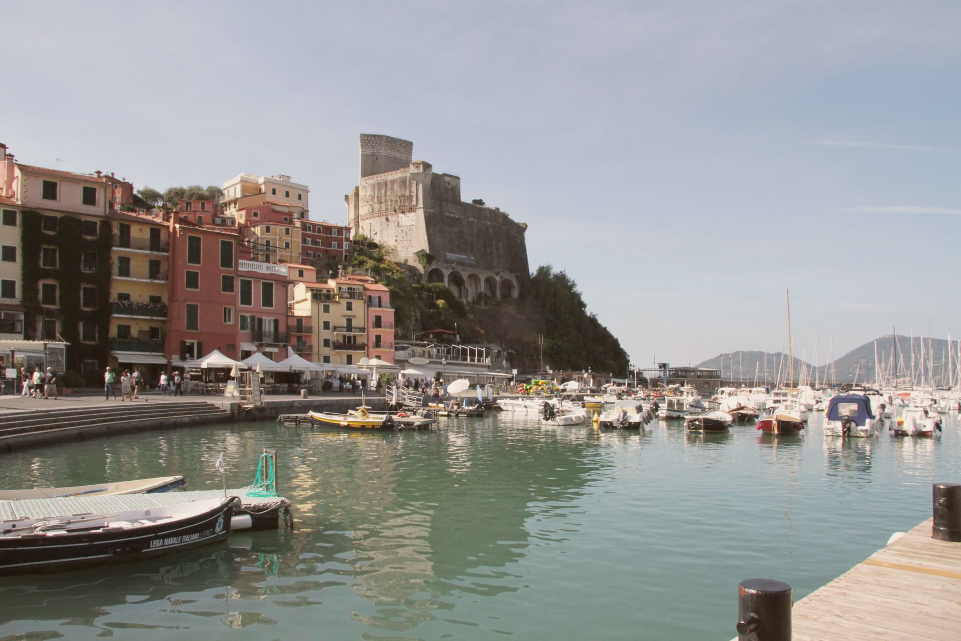
The Gulf of La Spezia takes its eastern shore here, and English Romantics renamed that shore the Bay of Poets after Byron and Shelley made it their address in the early 19th century. The fortress that defines the harbour was begun by the Pisans in 1152 to control the gulf, captured by the Genoese in 1256, and rebuilt in its present pentagonal form through the 14th and 15th centuries; it now holds a paleontology museum with Jurassic dinosaur tracks recovered from the local sandstone.
Shelley lived at a house in nearby San Terenzo in 1822, he drowned that summer sailing from Livorno, and Byron swam across the bay from Portovenere on his way to visit him. Beyond the historic harbour the commune stretches south past a colourful frazione perched on a rocky promontory above the sea, a member of the Borghi più belli d'Italia network in its own right; a coastal trail links the two through olive terraces and pine woods.
The town beach holds a Bandiera Blu and the harbour fills with sailing dinghies all summer. Upper fortress and lower water, working harbour and outlying fishing hamlet: the whole gulf edge here reads as one address that two poets happened to share, and the parts of the commune as its castle, its beach, and its outpost on the rocks.
The beach here holds the national bathing award, which a comune has to win back every year on water quality, beach management and safety.
What to see in Lerici
- Castello di Lerici. Begun by the Pisans in 1152, captured by Genoa in 1256, rebuilt in its present form in the 14th-15th centuries. The pentagonal walls still hold the harbour under them, and the paleontology museum inside keeps the Jurassic tracks pulled from the local sandstone.
- Bay of Poets / Casa Magni. The Casa Magni at San Terenzo, a Lerici frazione, was Shelley's residence in 1822, the year he drowned in the bay. The house still stands on the shore that gave the Bay of Poets its name.
- Tellaro. Pastel-coloured fishing frazione clinging to a rocky promontory at the southern edge of the bay. Linked to Lerici by the coastal Castelnuovo trail.
How to get to Lerici
Pisa is roughly 61 minutes away by road.
✷ We have written about Lerici
“We know the steep streets above the castle by heart. We know which restaurant is for the view and which is for the dinner. We know that the gelato in San Terenzo, made at a place called La Rana Golosa, is worth the half-hour walk along the sea to find. We know the underpass that takes you to the small free beach under the castle, the rocks at the back of it, and the bench halfway along the promenade to San Terenzo where, on a good day, the wind off the Gulf has the precise temperature of being alive.”
Read our piece on Lerici →Lerici | An Old Friend on the Gulf of Poets
Our tip
April through October is the open season in the Bay of Poets — warm coastal days, calm seas from late spring, and the sailing fleet active all summer. June and September are the best months: warm sea, longer light, fewer crowds than July-August. The castle is open year-round (paleontology museum included) and Tellaro is best in October-November when the colours go warm. Mytiliade a Lerici falls in September.
More from Anywhere Italy
- The best towns with a serious restaurant in the province of La Spezia
- The 6 best towns you can reach by train in the province of La Spezia
- The prettiest villages in the province of La Spezia
- The best coastal towns within two hours of Parma
- The best small coastal towns with a serious restaurant in Liguria
- The best small coastal towns you can reach by train in Liguria