
The prettiest villages in the province of La Spezia
The province of La Spezia holds two landscapes at once: a coast of steep terraces dropping into clear water, and behind it the Val di Vara, green and damp, with chestnut woods, sheep cheese and slate roofs. Village houses are tall and narrow, painted ochre and rose over stone, stacked along a single street that follows the contour of the hill. The food changes with the altitude, anchovies and stuffed vegetables near the sea, chestnut flour and testaroli inland, olive oil from the terraces in between. Late spring and September are the good months, when the sea is warm and the paths are walkable without suffering.
Almost everyone arrives with the same plan, which is to work through the coastal villages of the national park by train, and to spend an afternoon in Portovenere looking back at the islands. The reason is sound, since these are among the most photographed places in Italy, and Riomaggiore in July is a queue on a staircase. The paths are ticketed, the trains are full, and lunch is an exercise in patience.
The coast does not stop at the park boundary, and the hills behind it barely begin there. West towards Genoa the same cliffs and coves continue past Levanto, and inland the Vara valley runs up through villages with arcaded squares and river bathing. The places in this list have all passed the assessment of the national association of Italy's most beautiful villages, and fewer people go to most of them.
Of the 13 communes we have mapped in the province of La Spezia, 7 qualify as prettiest villages: each has passed the assessment of the national association of Italy's most beautiful villages. The smallest, Framura, has 577 residents.
Elsewhere in the catalogue: The best hidden coastal towns in the province of La Spezia and The 6 best towns you can reach by train in the province of La Spezia.
Framura
Why visit Framura
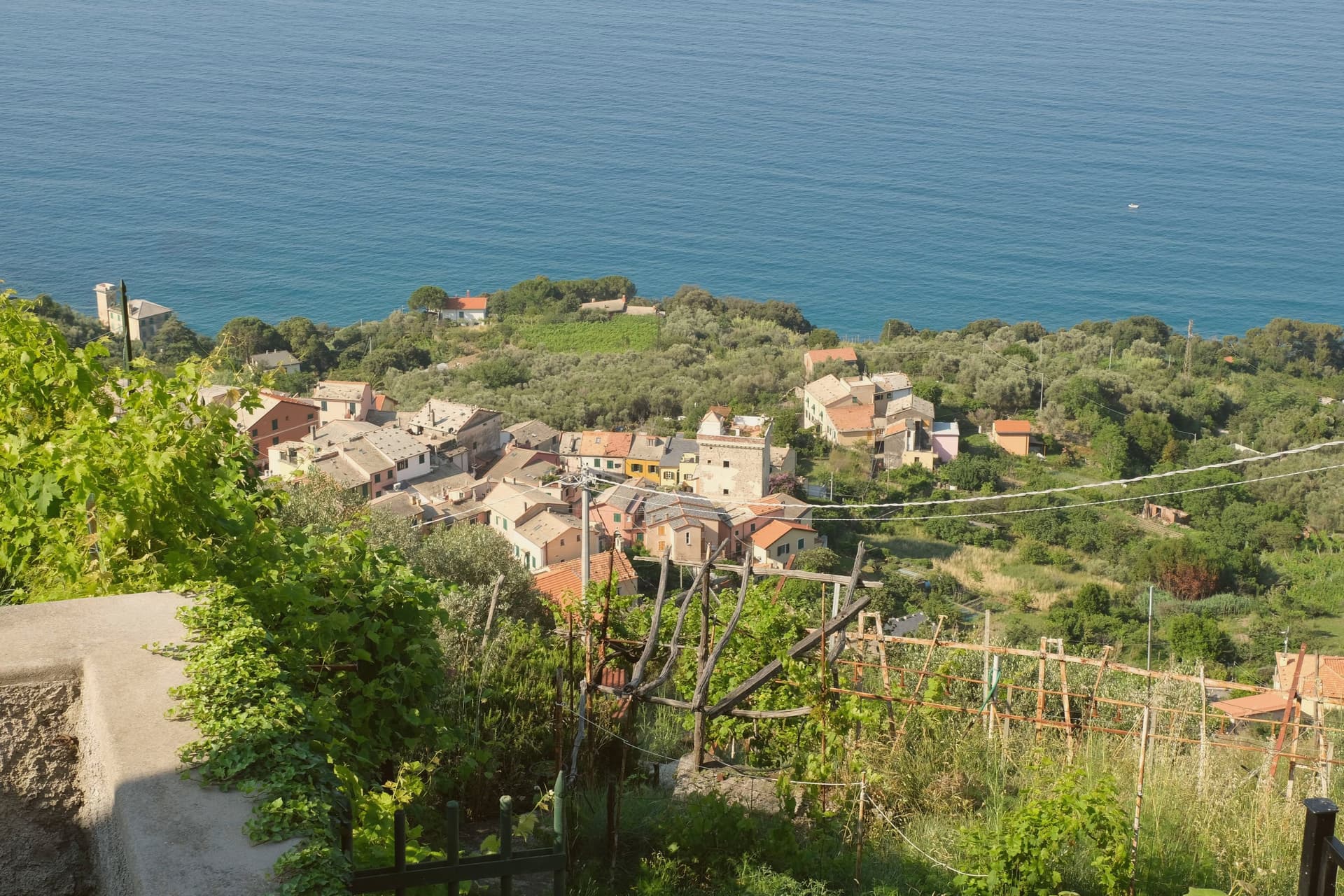
Framura is not one village but five: Anzo on the water, Setta and Ravecca on the slope, Costa above them, and Castagnola at roughly 300 meters with views back down to the coast. The commune spans from the rocky shoreline to 845 meters inland on the ridge that separates the Cinque Terre coast from the Vara valley.
Byzantine settlers built the original circular watchtowers here against Saracen raids, three of them still standing on the coast and inland. The hamlets remained agricultural until the Genova-La Spezia railway tunneled through in the late nineteenth century, opening the commune to summer visitors.
The seafront below Anzo, reached by a converted railway tunnel turned cycle path, carries the Bandiera Blu, and the same path runs north toward Bonassola and Levanto. Framura is the quiet outlier on this coast: the closest Borghi più belli village to Monterosso al Mare without being in the Cinque Terre national park.
What to see in Framura
- Torri bizantine. Three surviving Byzantine watchtowers on the coast and ridge, built to defend the village from Saracen incursions.
- Castagnola. Highest of the five hamlets at around 300 meters, with views over the lower frazioni and the Riviera di Levante.
- Anzo waterfront. Coastal hamlet at sea level with the Bandiera Blu beach access, the lowest of Framura's five settlements.
How to get to Framura
There is a railway station in the town, so you can arrive without a car and never need one while you are here. Genova is roughly 59 minutes away by road.
Our tip
April through October fits Framura, with the cycle path open and the coast walkable in any direction. May, June and September are the best for combining sea and hiking; mid-summer brings the strongest beach traffic but the upper hamlets stay calm. The Bandiera Blu beachfront below Anzo is small and fills early on August weekends.
Deiva Marina
Why visit Deiva Marina
The commune sits at the bottom of a valley running from Monte San Nicolao, eight hundred meters up, down to the Ligurian Sea, fifty kilometers east of Genoa. The territory is first documented in a Carolingian imperial diploma of 774, but for most of its history the settlement stayed inland: the coastal plain flooded, and Barbary raids made the shore too exposed to live on.
The villages up the slope were the town. The seafront had no fixed population until the railway reached it, and the seafront that grew up afterward, around the station and a hotel called Albergo Savoia, is a nineteenth-century addition to a place whose real age lies up the hill.
The round watchtower near the sea was partly demolished by a flash flood in 1852, a reminder that the coast it guarded was never entirely tame even after settlement arrived. What the geography adds up to is a town in two pieces on two timelines: an old, defended, inland Deiva that predates the sea by centuries, and a young shoreline that only exists because a railway made the coast safe to build on.
What to see in Deiva Marina
- Torre Saracena. The square tower stands beside the church, its stone weathered, a lookout post scaled to a coastline once undefended by anything larger.
- Chiesa di Sant'Antonio Abate. Still the parish church, standing in what was the original inland centro storico before the seafront existed, dedicated to the Egyptian hermit.
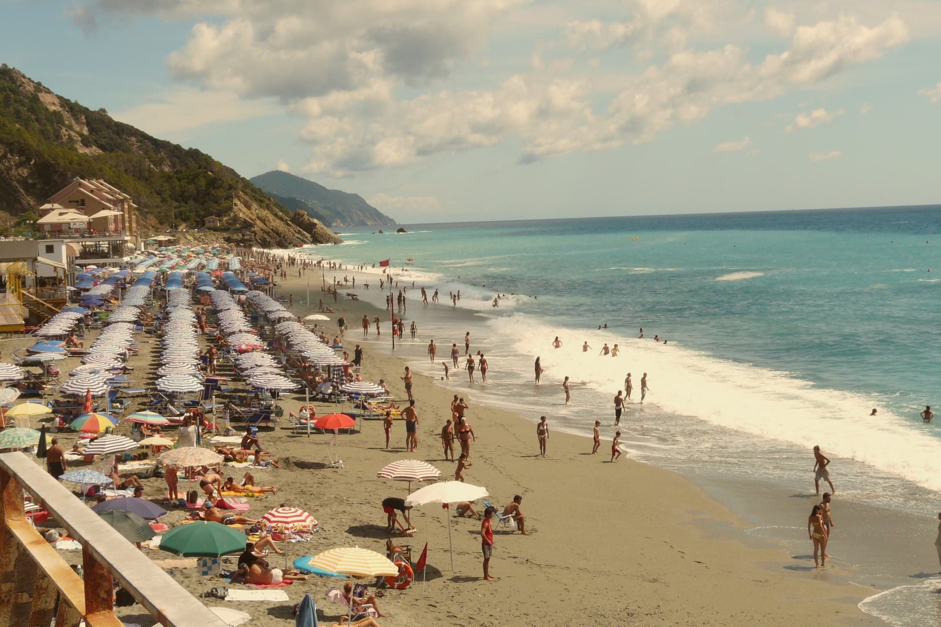
- Spiaggia di Deiva Marina. Shallow sand and shingle running below the railway station, wide enough that the crowds it draws spread rather than crush.
How to get to Deiva Marina
There is a railway station in the town, so you can arrive without a car and never need one while you are here. Genova is roughly 50 minutes away by road.
Our tip
May through September is the beach season: the bay opens around mid-May, water temperatures climb through June, and by August the seafront fills with Genovese and Milanese families. The Cinque Terre next door pulls day-trippers off the train through the summer. April and October are the shoulder months when the inland frazioni walks are pleasant and the beach is still warm enough for swimming on a calm day.
Varese Ligure
Why visit Varese Ligure
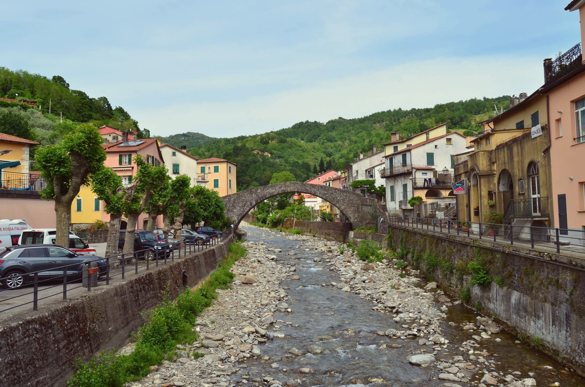
Varese Ligure sits at 358 meters in the upper Val di Vara, fifty kilometers east of Genoa. The Fieschi counts founded the borgo in the thirteenth century at the confluence of the Crovana and Gottero streams.
The Borgo Rotondo, an ellipse of pastel houses with arcaded ground floors, was laid out as a planned market town for trade between the Po valley and the Ligurian coast: the inner ring stayed open as a marketplace, the outer ring as defensive wall. The Castello dei Fieschi, two cylindrical towers and a central keep, anchors the upper end.
In 1999 Varese Ligure became the first European municipality to receive ISO 14001 environmental certification. The Val di Vara Biodistretto, founded in 2006, now counts 95 organic producers across seven communes, with 60 percent of the certified agricultural area in Varese Ligure itself organic.
The dairy cooperative was the first in Liguria certified bio. The borgo carries Bandiera Arancione and Borghi più belli badges together.
What to see in Varese Ligure
- Borgo Rotondo. Thirteenth-century elliptical plan of pastel-fronted houses with arcaded ground floors enclosing two piazzas, laid out as a market ring.
- Castello dei Fieschi. Fifteenth-century fortress at the upper edge of the borgo, two cylindrical towers and a central keep, residence of the Fieschi counts.
- Chiesa dei Santi Filippo e Giacomo. Eighteenth-century parish church on the main piazza, Baroque interior, replaced an earlier medieval church on the same footprint.
How to get to Varese Ligure
Genova is roughly 70 minutes away by road.
Our tip
May through October is the working season in the upper Val di Vara: the Crovana runs clear, the surrounding pastures green, the Borgo Rotondo arcades cool even in midsummer. The Festa di San Lorenzo in early August fills the inner ring with market stalls, the layout used as the Fieschi intended seven hundred years ago. July and August can touch 28 degrees in the valley but the 358-metre elevation keeps nights comfortable.
Vernazza
Why visit Vernazza
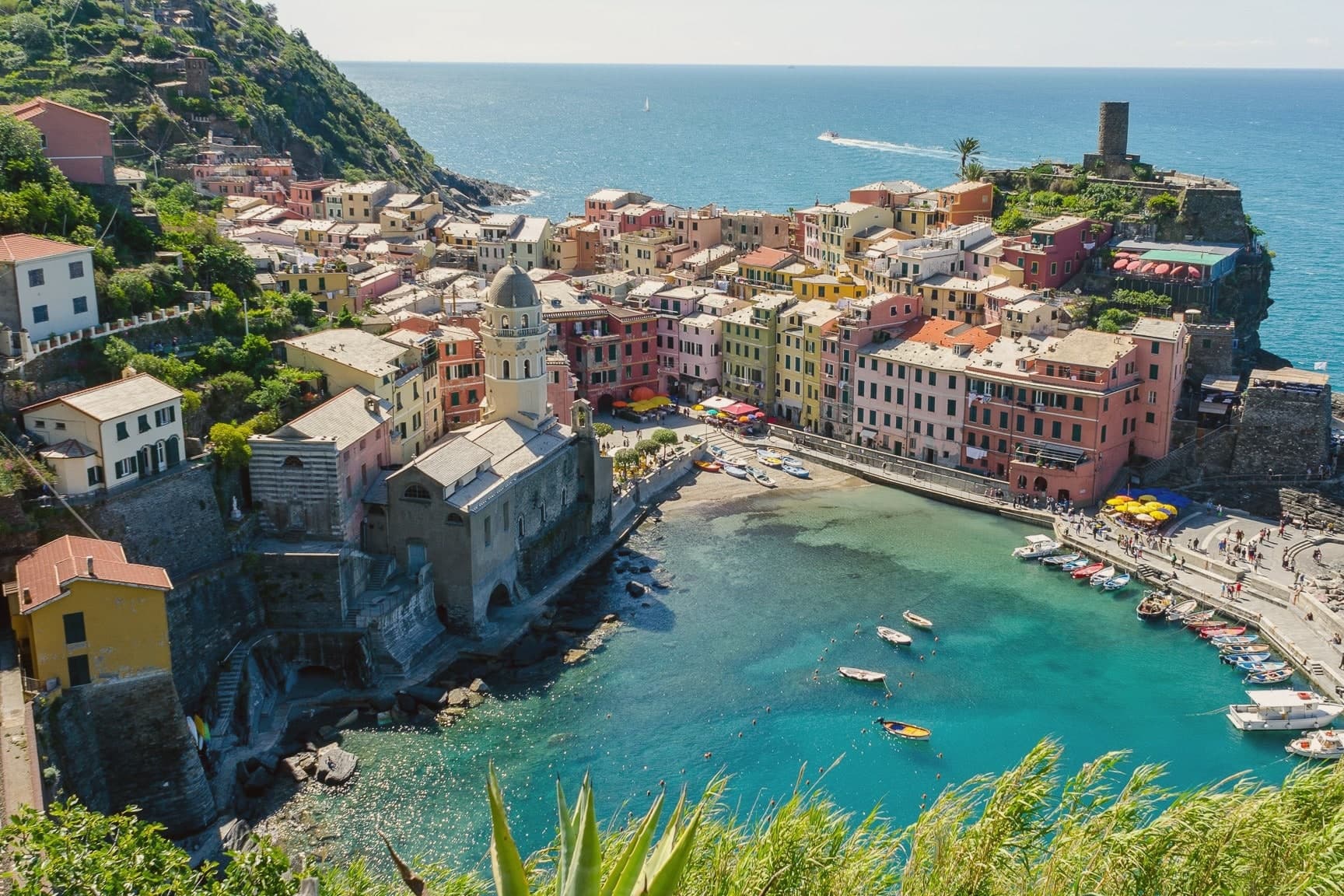
Vernazza sits at sea level, the middle of the five villages along this stretch of coast and the only one with a natural harbor. The houses stack vertically up the gorge of the Vernazzola torrent, painted in faded ochres and pinks, with the square at the harbor marking the seaward end of Via Roma and the social center of the village.
On 25 October 2011, a freak rainstorm dropped 22 inches of water in four hours. The torrent burst its culvert and buried the main street under four meters of mud and debris.
Three people died. The village was closed for months, and most of the houses on Via Roma had to be excavated to the second story before it reopened.
The harbor, the fortified height above it, and the terraced slopes behind form a single working shape: a landing place guarded from above and fed from the terraces, all of it packed into a gorge narrow enough that a few hours of rain could bury the street from end to end.
What to see in Vernazza
- Castello Doria. The keep and the Belforte tower stand over the harbor, built by the Doria as a defense against Saracen raids.
- Chiesa di Santa Margherita d'Antiochia. Fourteenth-century church on a rock platform at the edge of the harbor, documented from 1318, the gothic anchor of the village.
- Porto di Vernazza. The only natural harbor in the Cinque Terre, with a small pebble beach and a ferry pier serving the four other villages and Portovenere.
How to get to Vernazza
There is a railway station in the town, so you can arrive without a car and never need one while you are here. Genova is roughly 101 minutes away by road.
✷ We have written about Vernazza
“The Cinque Terre are five towns with a national park around them and a marketing name that adds up to five. The copies without the name are a few miles away in either direction, and the experience they sell is the same experience, with the crowd divided by a hundred.”
Read our piece on Vernazza →Cinque Terre | How To Do It Right
Our tip
April through June and September into October are the right months in the Cinque Terre. The terraces green in spring, the Sciacchetrà and Vermentino harvest runs from August into early September, and the autumn light on the painted houses is what most photographers come for. July and August are full beyond capacity: ferries, trains and trails all hit limits, the harbor square loses any quiet, and the village rationed entry on the worst weekends of 2023 and 2024. Giochi Di Santa Margherita falls in July.
Brugnato
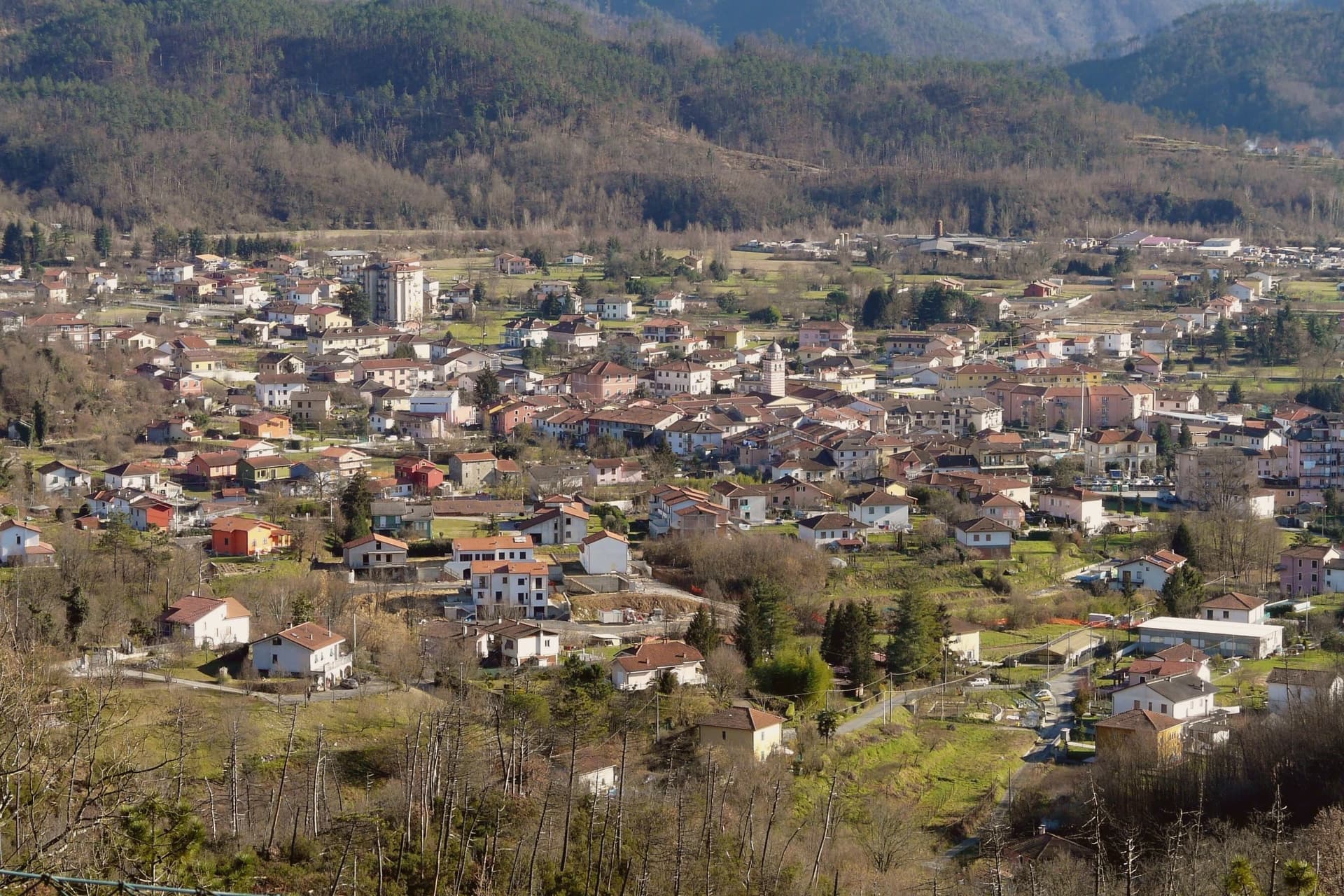
Why visit Brugnato
Brugnato sits at 115 meters in the Val di Vara, the broad inland valley that runs from the Apennine ridge down toward the La Spezia coast. The town grew around a monastery dedicated to Saint Columbanus, the Irish missionary who founded Bobbio in 614, and the settlement that formed around it took its shape from the monks' presence long before it took its later civic form.
The centro storico is laid out on a rare medieval grid for Liguria, straight lanes of pastel houses inside a walled perimeter, set on a low rise inside a meander of the river. The layout and the site both point back to the same origin: a religious foundation that outgrew its walls and organized a town around itself, one that later carried authority over the surrounding valley as a bishopric until 1820.
Brugnato holds Borghi più belli, Bandiera Arancione, and Infioritalia, the last for the Corpus Domini flower-petal carpets that cover the streets each June. The town's present character, an inland valley seat with a monastic and diocesan past now expressed mostly through architecture and a single yearly ritual, follows directly from that founding order having outlasted the institutions that built it.
What to see in Brugnato
- Concattedrale dei Santi Pietro, Lorenzo e Colombano. The building rises over the foundations of the older monastery, its eleventh and twelfth century stonework the visible layer above what the monks left underneath.
- Museo Diocesano. Diocesan museum housed in the former Episcopal Palace next to the cathedral, with sacred art and documents from the long bishopric.
- Centro storico. Walled medieval grid of pastel houses, a rare orthogonal layout in Liguria, set on a low rise inside a meander of the river.
How to get to Brugnato
Genova is roughly 62 minutes away by road.
✷ We have written about Brugnato
“You walk in expecting a town, and the town never arrives. You get the coil, the colors, the empty windows, the church waiting in the middle like a spider that stopped being hungry centuries ago. Somewhere under the cathedral floor, the diocese says, lie the remains of a Roman post and two older churches, layer under layer under layer, the whole history of the place stacked vertically because the plan never allowed it to spread.”
Read our piece on Brugnato →Brugnato | The Town With No Piazza
Our tip
April through June and September into October are the right months in the Val di Vara. The valley turns green in spring, holds its color into early summer, and dries to gold in autumn. Corpus Domini, late May or early June depending on the year, brings the Infiorata to the streets of the centro storico.
Ameglia
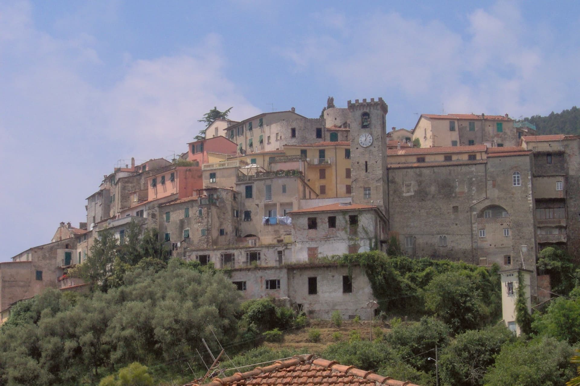
Why visit Ameglia
The Magra was the Roman Macra, the eastern boundary of Liguria, and the hill at Ameglia stands on the border between Lunigiana and the Riviera where that river reaches the sea. Genoa bought part of the fief in 1141, the bishops took it back by 1284, and Castruccio Castracani of Lucca conquered it in 1321: a small fortress passed between larger powers for three and a half centuries before it settled into the shape it now has.
The marina at the river mouth is a separate world from the hill town above it. Where the castle and its concentric streets sit on the summit, the frazione at the water is a former fishing village, flat, tied to the tide and to summer moorings rather than to the bishops who once held the heights.
The two headlands south of that marina are reachable only by boat or steep footpath, cut off from the estuary settlement by their own geography rather than by distance. The town, in effect, is two places joined by the same river: a fortified height that answered to Luni and Genoa, and a working shoreline that answered to the sea.
What to see in Ameglia
- Castello di Ameglia. Rebuilt in 1174 on a tenth-century footprint, episcopal fortress of the bishops of Luni, cylindrical keep above the Magra estuary.
- Centro storico di Ameglia. Concentric medieval streets around the castle, twelfth and thirteenth-century houses with stone arches and external staircases.
- Bocca di Magra. Old fishing village and marina at the river mouth, summer mooring for small craft, departure point for Punta Corvo by sea.
How to get to Ameglia
Pisa is roughly 60 minutes away by road.
✷ We have written about Ameglia
“It has the best panorama in Liguria, full stop, and I do not think it is close. The reasons are two. The first is the obvious one. You are 266 meters up, the cliff is high enough that there is no rocky beach below to draw a crowd, the sea on one side is the Gulf of La Spezia with Portovenere across the water and the Cinque Terre fading north, and the view on the other side is the Magra running into its delta with the white Apuane behind it and Tuscany beyond.”
Read our piece on Ameglia →Magra Delta Roadtrip | A Tagine, a Lighthouse, and a Dead Roman City
Our tip
April through June and September to October bring the river's best months: clear estuary water, the headland walks down to Punta Corvo manageable, marinas at Bocca di Magra not yet at summer capacity. July and August fill the river mouth with summer boats from across the Gulf of Poets, and the road down from the borgo backs up on weekends. The Sagra del Pesce in mid-August draws thousands. Mercato Settimanale Di Ameglia falls in August.
Lerici
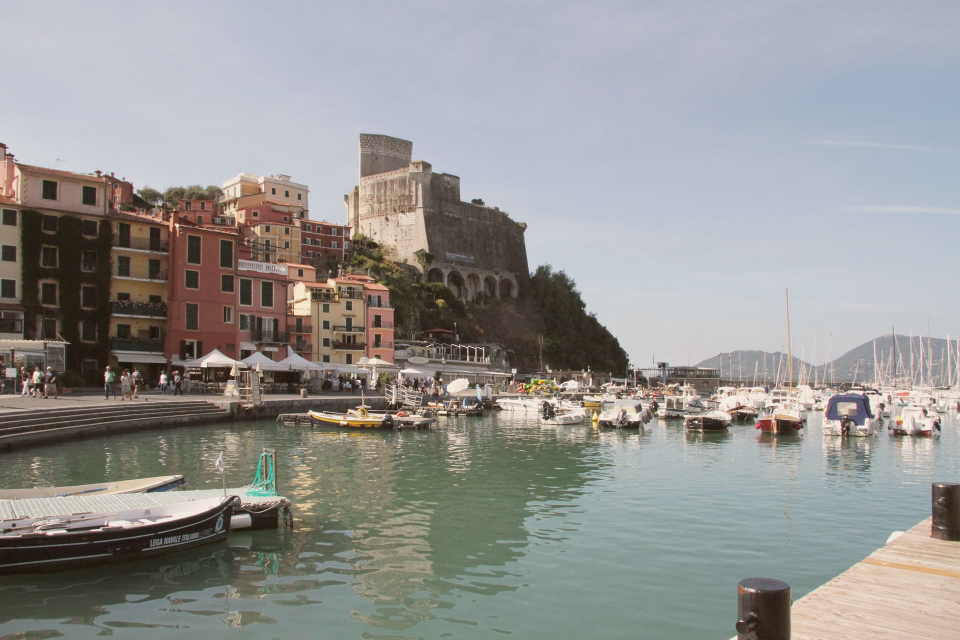
Why visit Lerici
The Gulf of La Spezia takes its eastern shore here, and English Romantics renamed that shore the Bay of Poets after Byron and Shelley made it their address in the early 19th century. The fortress that defines the harbour was begun by the Pisans in 1152 to control the gulf, captured by the Genoese in 1256, and rebuilt in its present pentagonal form through the 14th and 15th centuries; it now holds a paleontology museum with Jurassic dinosaur tracks recovered from the local sandstone.
Shelley lived at a house in nearby San Terenzo in 1822, he drowned that summer sailing from Livorno, and Byron swam across the bay from Portovenere on his way to visit him. Beyond the historic harbour the commune stretches south past a colourful frazione perched on a rocky promontory above the sea, a member of the Borghi più belli d'Italia network in its own right; a coastal trail links the two through olive terraces and pine woods.
The town beach holds a Bandiera Blu and the harbour fills with sailing dinghies all summer. Upper fortress and lower water, working harbour and outlying fishing hamlet: the whole gulf edge here reads as one address that two poets happened to share, and the parts of the commune as its castle, its beach, and its outpost on the rocks.
What to see in Lerici
- Castello di Lerici. Begun by the Pisans in 1152, captured by Genoa in 1256, rebuilt in its present form in the 14th-15th centuries. The pentagonal walls still hold the harbour under them, and the paleontology museum inside keeps the Jurassic tracks pulled from the local sandstone.
- Bay of Poets / Casa Magni. The Casa Magni at San Terenzo, a Lerici frazione, was Shelley's residence in 1822, the year he drowned in the bay. The house still stands on the shore that gave the Bay of Poets its name.
- Tellaro. Pastel-coloured fishing frazione clinging to a rocky promontory at the southern edge of the bay. Linked to Lerici by the coastal Castelnuovo trail.
How to get to Lerici
Pisa is roughly 61 minutes away by road.
✷ We have written about Lerici
“We know the steep streets above the castle by heart. We know which restaurant is for the view and which is for the dinner. We know that the gelato in San Terenzo, made at a place called La Rana Golosa, is worth the half-hour walk along the sea to find. We know the underpass that takes you to the small free beach under the castle, the rocks at the back of it, and the bench halfway along the promenade to San Terenzo where, on a good day, the wind off the Gulf has the precise temperature of being alive.”
Read our piece on Lerici →Lerici | An Old Friend on the Gulf of Poets
Our tip
April through October is the open season in the Bay of Poets — warm coastal days, calm seas from late spring, and the sailing fleet active all summer. June and September are the best months: warm sea, longer light, fewer crowds than July-August. The castle is open year-round (paleontology museum included) and Tellaro is best in October-November when the colours go warm. Mytiliade a Lerici falls in September.
More from Anywhere Italy
- The best hidden coastal towns in the province of La Spezia
- The 6 best towns you can reach by train in the province of La Spezia
 The prettiest villages inside a nature park in Liguria
- The prettiest villages with a serious restaurant in Liguria
- The best towns with a serious restaurant in the province of La Spezia
- The best coastal towns within two hours of Parma