
The best hill towns inside a nature park in Puglia
Away from the water, Puglia is a country of pale limestone: dry-stone walls running to the horizon, holm oak and thyme on thin soil, and gravine, the ravines that cut through the rock like river canyons gone dry. The towns here are built from the stone they stand on, whitewashed against the heat, with balconies of local tufa and courtyards that stay cool through August. Spring brings orchids and wild asparagus on the Murgia plateau; autumn brings mushrooms, new oil and the smell of wood smoke from the butcher-grills where bombette are cooked to order. Add capocollo, almond pastries and the Valle d'Itria's white wines, and inland eating holds its own against anything on the coast.
In summer most visitors head for Alberobello and the trulli, or down to Polignano a Mare for the cliff-cove photograph. Both are good and both are extremely busy, with coach parks, timed queues and streets where the shops sell the same ceramic whistle. The heat makes it worse: everyone arrives within the same narrow window, walks the same short circuit and leaves before dinner.
The same limestone, the same food and the same light continue inland, into the regional nature parks that cover a surprising share of Puglia's interior. These are hill settlements inside protected land, where the walk out of town leads into ravines, oak wood or open pasture rather than a car park. Fewer people go, and the towns are still working towns, which is usually the point.
Of the 59 communes we have mapped in Puglia, 6 qualify as hill towns inside a nature park: each is an inland hill settlement, and each sits inside a regional nature park. The smallest, Minervino Murge, has 8,171 residents.
Elsewhere in the catalogue: The 7 best beach towns inside a nature park in Puglia and The best towns with a serious restaurant that sit inside a nature park in Puglia.
Minervino Murge
Why visit Minervino Murge
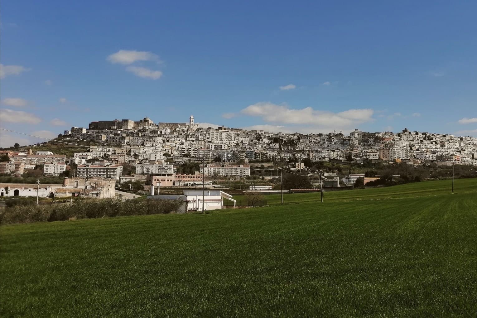
The town is built on two hills at the western edge of the Murgia plateau, where the limestone tableland gives out and the ground drops toward lower country on three sides. That break is what gives the ridge its long view and its nickname: to the east the eye crosses Murgia limestone toward the Gargano and the Adriatic, to the west it crosses cultivated fields into Basilicata, and to the north it runs the length of the Ofanto valley.
The old town sits above this drop, castle and tower on the high ground, cathedral below, the settlement organized around the same ridge that draws the view. Olive oil, almonds and grain define the rural economy beyond the walls, the plateau put to farming where it is not left to steppe grass and karst.
A ridge town, in other words, whose whole character, defensive site, pilgrimage cave, farmed hinterland, follows from the one geological fact of where the plateau ends.
What to see in Minervino Murge
- Castello Normanno-Svevo. Norman fortress remodeled in the baronial period, with surviving towers and bastions on the high ridge above the old town.
- Torre di Pirro del Balzo. Fifteenth-century tower built between 1460 and 1490 when Minervino came to Pirro del Balzo as part of Maria Donata's dowry.
- Grotta di San Michele. Cave formed roughly two million years ago, reached through the karst rather than built, and still kept as a place of pilgrimage rather than display.
How to get to Minervino Murge
There is a railway station in the town, so you can arrive without a car and never need one while you are here. Foggia is roughly 62 minutes away by road.
Our tip
April through June and September through October are the months the Alta Murgia plateau runs best. The wildflower steppe peaks in May, almond blossom comes earlier in February, and the Ofanto valley below stays mild through autumn. July and August push past thirty-five degrees on the limestone with little shade; the centro storico empties between two and five and the panoramic belvedere is best at dawn or dusk.
Castellaneta
Why visit Castellaneta
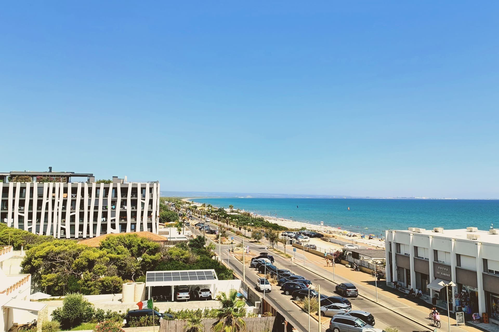
Castellaneta sits on the Murge plateau at 235 meters, on the southern rim of the Gravina Grande, a karst canyon 10 kilometers long and 145 meters deep that wraps the town in near-vertical limestone walls. The municipal territory runs from the gravina down to the Ionian coast at Castellaneta Marina, fifteen kilometers south, where the long sand beach has held Bandiera Blu for ten consecutive years.
The cathedral was founded under the Normans in the eleventh century, rebuilt in Romanesque form in the fourteenth, and given its white limestone facade in 1771. The town is best known abroad as the birthplace of Rodolfo Valentino, born here on 6 May 1895 and reborn in Hollywood as Rudolph Valentino.
A blue ceramic statue of the actor by Luigi Gheno was unveiled in the centro storico in 1961, captured in the documentary Mondo Cane, and the Museo Rodolfo Valentino opened on the 1995 centenary.
What to see in Castellaneta
- Gravina Grande. Karst canyon ten kilometers long and 145 meters deep wrapping the town on three sides, part of the Terra delle Gravine regional park.
- Cattedrale di Santa Maria Assunta. Norman cathedral of the eleventh century rebuilt as a Romanesque basilica in the fourteenth and refaced in white limestone in 1771.
- Museo Rodolfo Valentino. Civic museum opened on the actor's 1995 centenary, with the ceramic statue by Luigi Gheno unveiled in 1961 standing in the square outside.
How to get to Castellaneta
There is a railway station in the town, so you can arrive without a car and never need one while you are here. Taranto is roughly 49 minutes away by road.
Our tip
April through June and September through October are the months the Murge is dry, mild, and the gravina edges walkable. July and August push past thirty-five degrees on the plateau and the centro storico empties in the afternoon, though Castellaneta Marina fills with Italian families and the beach is at its peak. The Festa di Santa Maria della Stella in May and the Carnevale procession through the centro storico are the civic anchors of the calendar. Sagra della Farnedd dei sapori di Puglia falls in August.
Ostuni
Why visit Ostuni
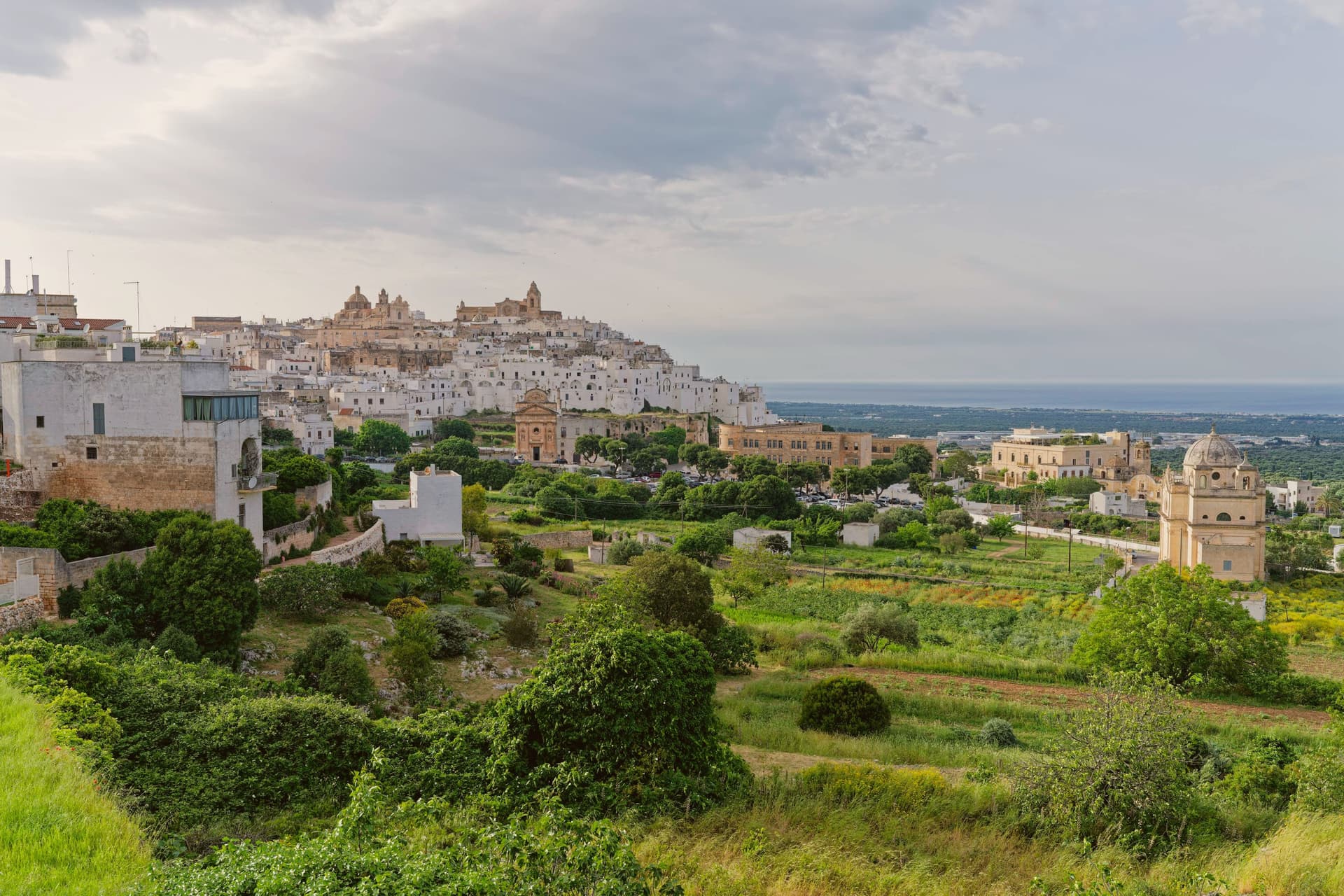
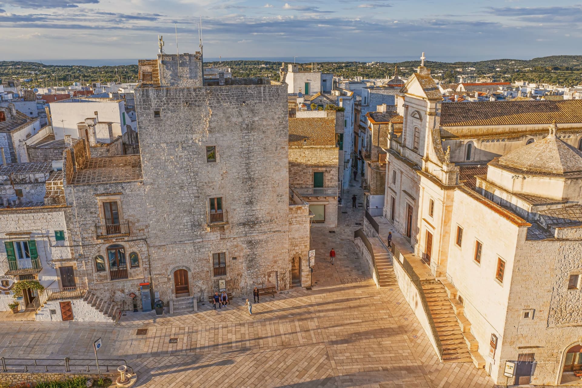
Ostuni sits at 218 meters on three hills above the Adriatic coastal plain, eight kilometers inland in the southeastern Murge. The whitewashing that gives it the name Città Bianca is medieval in origin, a hygienic measure against plague that survived as the local building convention; the entire centro storico is painted white in lime every spring and reads as a single bright mass from the surrounding olive country.
The territory has been inhabited since the Paleolithic; the Messapii founded the urban nucleus before the Romans absorbed the region. The town joined the Norman County of Lecce in 996.
In 1507 it passed to Isabella, Duchess of Bari, then to her daughter Bona Sforza, queen of Poland, who fortified the coast with watchtowers against Ottoman raids in 1539. The Cattedrale, a late-Gothic facade with a rose window of twenty-four rays, anchors the upper town.
The olive landscape around the commune holds some of the oldest cultivated trees in the Mediterranean.
What to see in Ostuni
- Cattedrale di Santa Maria Assunta. Late fifteenth-century Gothic cathedral at the highest point of the centro storico, with a rose window of twenty-four rays unique in Puglia.
- Centro storico. Whitewashed old town on three hills, lime-painted every spring against plague tradition, the single bright mass that names the Città Bianca.
- Piazza della Libertà. Lower civic square outside the medieval walls, with the Guglia di Sant'Oronzo, an early eighteenth-century baroque obelisk to the patron saint.
How to get to Ostuni
There is a railway station in the town, so you can arrive without a car and never need one while you are here. Taranto is roughly 64 minutes away by road.
Our tip
April through June and September through October are the months Ostuni works: olive plain in flower or harvest light, the white walls glowing in mild evenings, the Adriatic eight kilometers away warm enough for swimming by mid-May. July and August touch thirty-five degrees and the centro storico fills with day-trippers from Bari and Brindisi; weekends in August are shoulder to shoulder in the upper alleys. Late afternoon and after dusk are the times to walk, when the white walls cool and the crowds thin.
Nardò
Why visit Nardò
The town sits at 45 meters in the northwestern Salento, about ten kilometers inland from the Ionian coast. With just under 31,000 inhabitants and 190 square kilometers of territory, it is the second-largest commune in the province after the capital.
It was a Byzantine stronghold for centuries; in 1497 the dukes of Acquaviva acquired it and turned it into a cultural seat, with universities, academies and literary circles that drew on the same humanist current as Lecce and Gallipoli. The centro storico, built up under that ducal patronage, forms a dense fabric of palaces and church facades in the local pietra leccese, with the castle standing at its edge, now serving as the municipal seat.
Ten kilometers of inland distance separate that historic core from the municipal coastline, where the Porto Selvaggio nature reserve occupies a stretch of Mediterranean pine forest above limestone cliffs, held by the commune as a regional park. Inland seat of government and culture, coastal reserve of forest and cliff: the two halves of the commune's territory answer to different centuries and different purposes, joined only by the ten kilometers between them.
What to see in Nardò
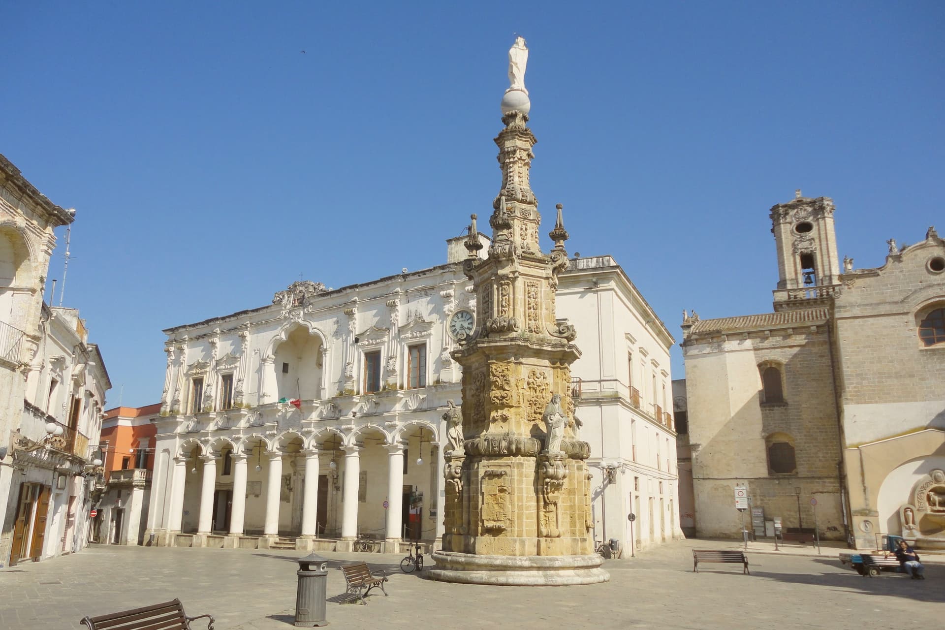
- Piazza Salandra. Central Baroque square of the centro storico, the Guglia dell'Immacolata at its center, ringed by palazzi and church facades in pietra leccese.
- Castello Acquaviva. Aragonese-Acquaviva castle on the edge of the centro storico, residence of the ducal house from 1497, now the municipal seat.
- Cattedrale di Maria Santissima Assunta. Romanesque-Baroque cathedral founded in the eleventh century and remodelled across the seventeenth, with later Baroque facade and bell tower.
How to get to Nardò
There is a railway station in the town, so you can arrive without a car and never need one while you are here. Taranto is roughly 80 minutes away by road.
Our tip
April through June and September through October are the months Nardò is at its best: Baroque facades in raking light, the Porto Selvaggio pine forest cool, the Ionian water warm enough to swim by mid-May. July and August touch thirty-six degrees and the centro storico empties between two and five in the afternoon; the coastal hamlets of Santa Caterina and Sant'Isidoro fill with Lecce families. The Festa di San Gregorio Armeno in mid-February is the local patronal day, the only large winter event.
Martina Franca
Why visit Martina Franca
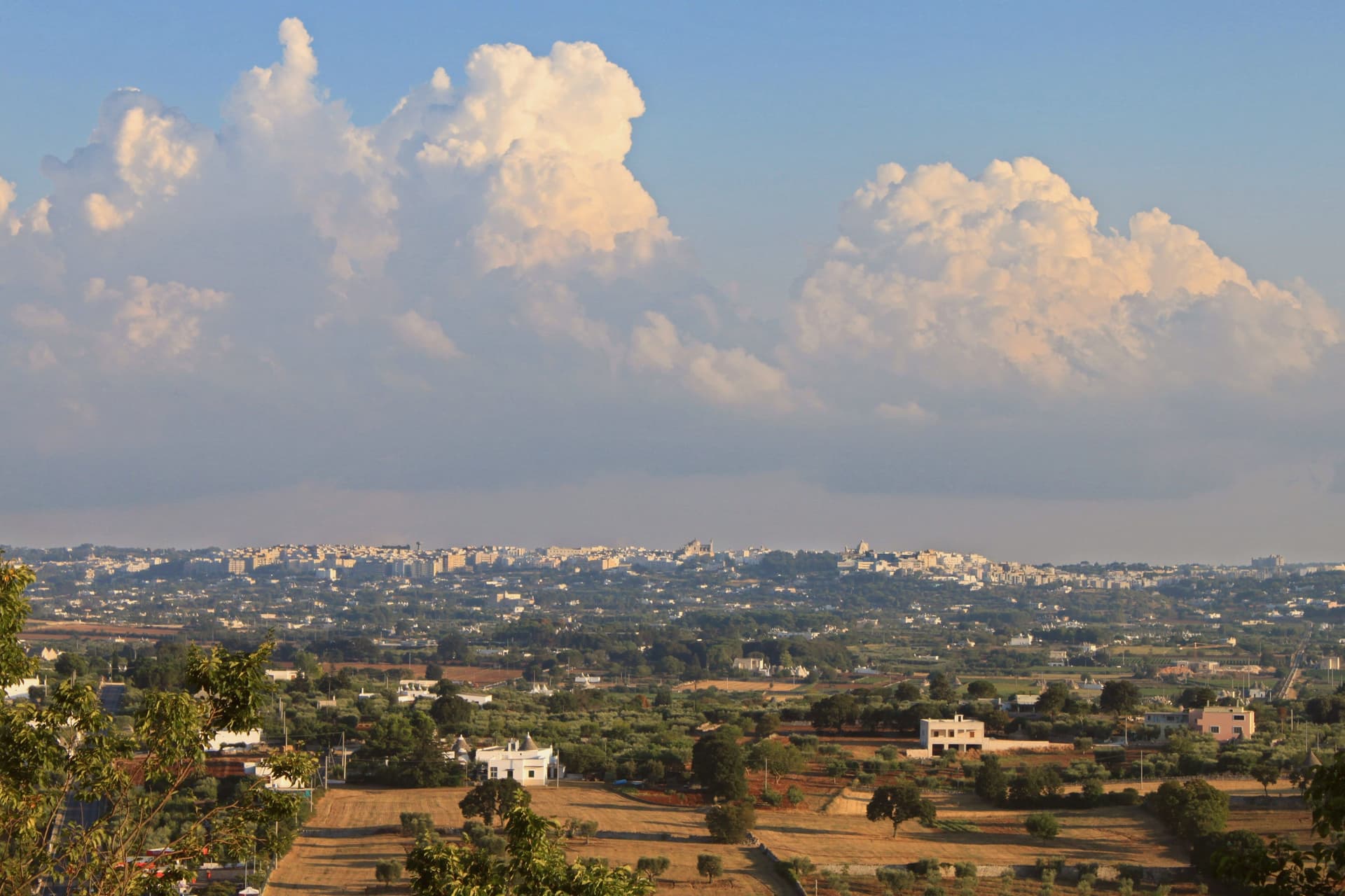
Martina Franca sits at 431 meters on the southern edge of the Valle d'Itria, on the border between the provinces of Taranto, Bari and Brindisi. The town was founded in 1310 by Philip I of Anjou, Prince of Taranto, who granted franchigie, tax exemptions, to settlers willing to repopulate the hill, hence Franca in the name.
The centro storico is the densest concentration of Rococo and late-Baroque architecture in Puglia after Lecce: wrought-iron balconies, carved stone portals, churches built or rebuilt after the 1743 earthquake. The Palazzo Ducale of 1668, raised on the foundations of a 1338 medieval castle, is the seat of the municipal offices and the open-air courtyard where the Festival della Valle d'Itria has been performed every July and August since 1975, founded specifically to recover rare and forgotten operas.
The Basilica di San Martino, begun in 1747, is the most complete example of Martinese Rococo. The surrounding plateau makes a Martina Franca DOC white wine and a strong dry-cured capocollo IGP.
What to see in Martina Franca
- Palazzo Ducale. Built in 1668 on the foundations of a 1338 medieval castle, town hall and home of the Festival della Valle d'Itria summer opera courtyard.
- Basilica di San Martino. Eighteenth-century basilica begun in 1747 after the 1743 earthquake, the most complete Martinese Rococo monument and museum of liturgical art.
- Piazza Roma and Piazza Maria Immacolata. The two main squares of the centro storico, linked by Via Cavour, lined with eighteenth-century palazzi and the town's main passeggiata.
How to get to Martina Franca
There is a railway station in the town, so you can arrive without a car and never need one while you are here. Taranto is roughly 38 minutes away by road.
Our tip
April through June and September through October are the best months on the Itria plateau. The 431-meter elevation keeps the air dry, the limestone walls reflect a clear light, and the surrounding vineyards green up in spring then turn gold by the late September harvest. July and August are hot but mitigated by the altitude; they are also the months the Festival della Valle d'Itria runs in the Palazzo Ducale courtyard, the largest cultural draw in southern Puglia. Festa della bombetta falls in August.
Lecce
Why visit Lecce
Lecce sits on the Salento plain at 49 meters above sea level, twelve kilometers inland from the Adriatic, the provincial capital. The Messapian settlement of Lupiae stood on this site by the eighth century BC.
Rome took it in the third century BC, and Hadrian later moved the settlement three kilometers away and renamed it Licea, so the modern city occupies a site distinct from either of its named predecessors. The walled centro storico is ringed by Charles V's fortifications, entered from the north through the Porta Napoli arch and anchored on its eastern edge by his castle, built over older Norman foundations.
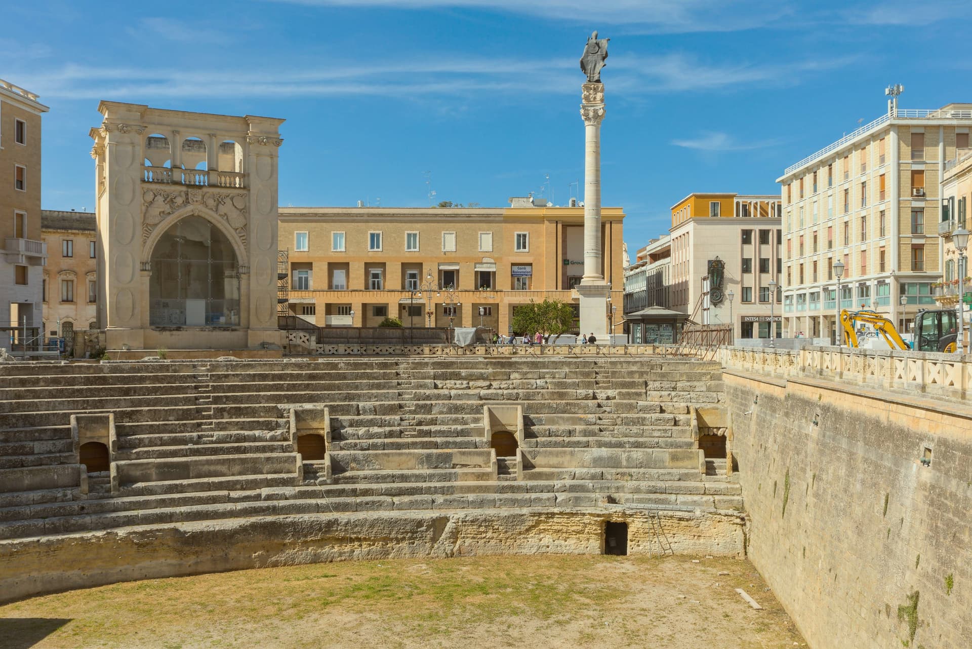
Within those walls the Baroque churches and squares sit close together, the cathedral square closed in on three sides while the amphitheater lies open and half-sunk in the middle of the newer square that formed around it. The University runs a strong humanities program, and the seafront at San Cataldo, some distance from the old center, carries Lecce's Bandiera Blu.
What holds the town together is the stone itself: soft enough to carve finely, hard enough once cut to last, so that a Messapian and Roman settlement site became, centuries later, the surface on which the south's most elaborate Baroque was cut.
What to see in Lecce
- Basilica di Santa Croce. Worked for nearly two hundred years to completion in 1695, the façade carved with cherubs, monsters and allegories layered so densely that the wall surface almost disappears beneath them.
- Piazza del Duomo. Closed on three sides, the only enclosed cathedral square of its kind in Puglia, gathering the Duomo, Campanile, Bishop's Palace and Seminary into one shared courtyard rather than an open street front.
- Piazza Sant'Oronzo. The city's central square, built around a column brought from the Appian Way to honor the patron saint, with the excavated amphitheater floor sitting below street level at its edge.
How to get to Lecce
There is a railway station in the town, so you can arrive without a car and never need one while you are here. Taranto is roughly 95 minutes away by road.
Our tip
April through June is the green window in inland Salento, with the centro storico walkable in the day and aperitivo on Piazza Sant'Oronzo running late. July and August push past thirty-five degrees and the city empties at midday; the Notte della Taranta in nearby Melpignano, the closing concert of the Salento pizzica festival, falls in late August and draws over a hundred thousand. September and October cool back down for the olive harvest. Festa di Sant'Oronzo falls in August.
More from Anywhere Italy
 The 7 best beach towns inside a nature park in Puglia
 The best towns with a serious restaurant that sit inside a nature park in Puglia
- The 10 best hill towns with a serious restaurant in Puglia
 The best hill towns worth staying overnight in Puglia
 The best beach towns worth staying overnight in Puglia
- The best towns worth staying overnight that eat well in Puglia