The best wine towns that eat well in Campania
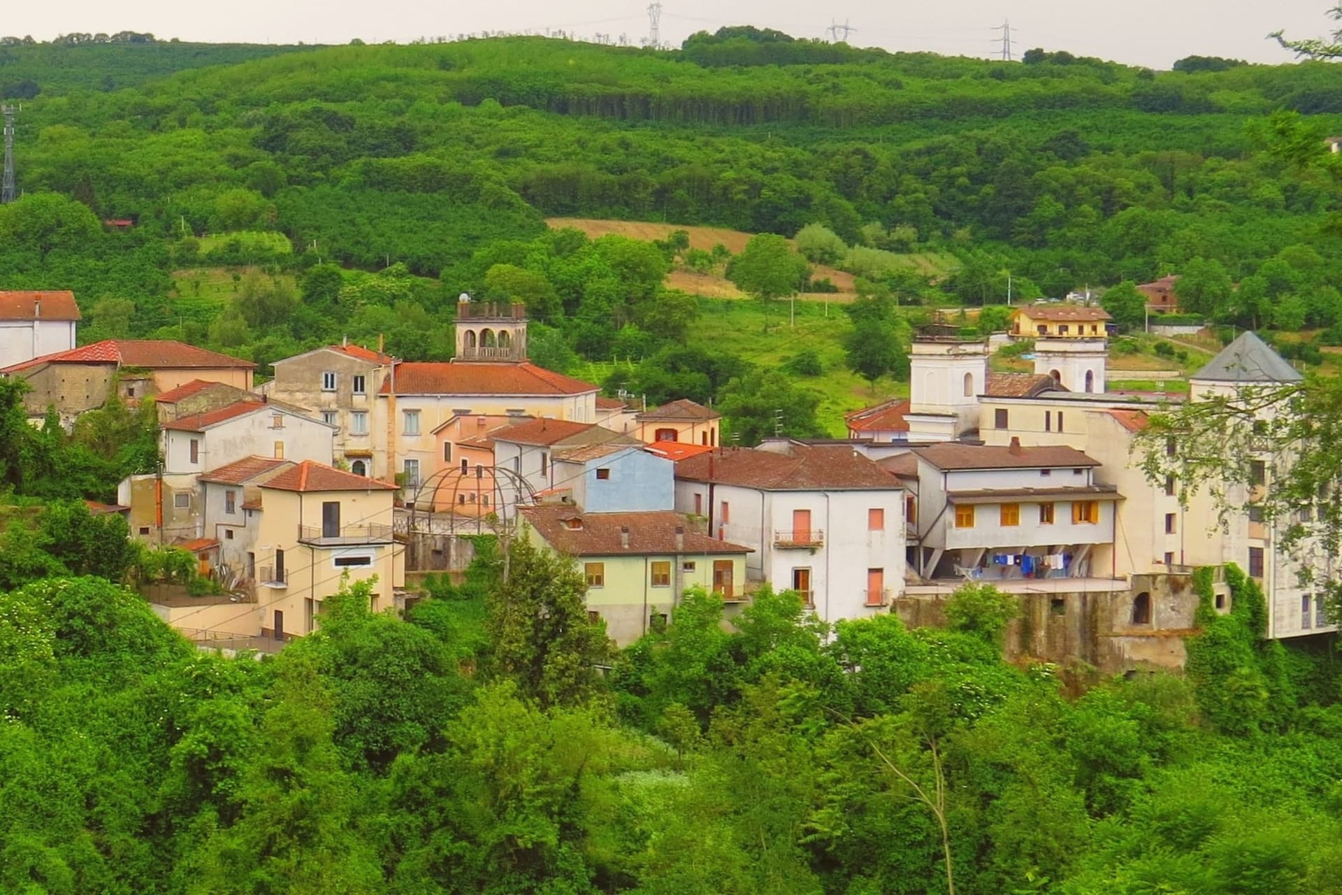
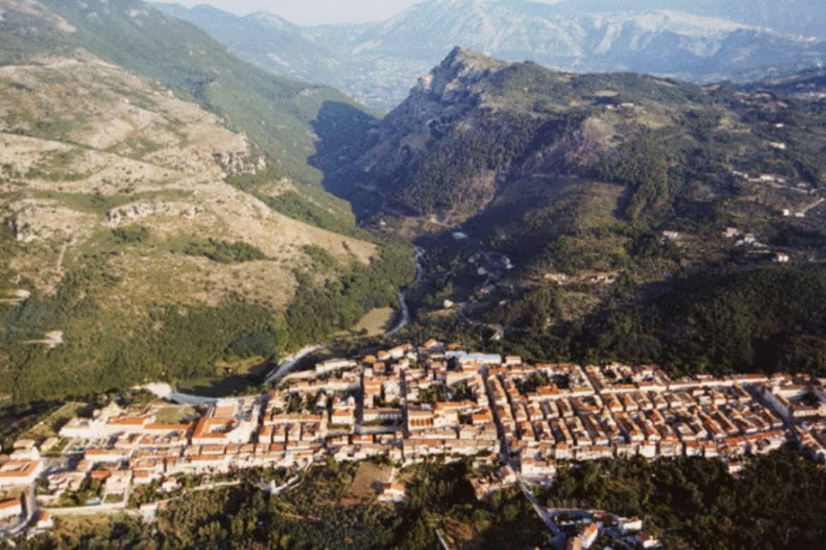
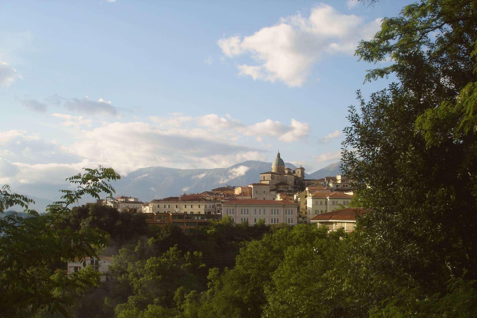
Campania grows wine in two very different registers. Inland, on the tuff and clay of the Sannio and the Taburno slopes, Aglianico and Falanghina come off vineyards that sit among hazelnut groves and olive terraces, and the autumn vendemmia fills small cellars with the smell of fermenting must. On the coast, vines are pinned to dry-stone terraces above the water, where lemon trees, anchovies from the bay and pasta with sea urchin belong to the same lunch as a glass of Costa d'Amalfi bianco. The building material tells you which Campania you are in: pale volcanic tuff and stone arcades inland, whitewash and majolica domes on the coast.
The default itinerary in this region does not go looking for either. It goes to Naples for pizza, out to Pompeii for the ruins, and along to Positano for the photograph, and by June those places are moving at the pace of the coach parties that reach them. The food is often excellent and the crowds are the price. It is a good route, and it is also the route almost everyone takes.
The vineyards and the kitchens carry on well past that stretch. The same coast keeps climbing into terraces and gorges, the same volcanic ground continues north into the Sannio hills and west into the Campi Flegrei, and the towns here belong to the national association of wine towns while a dining guide has picked out a table in each. Fewer people go, and lunch is easier to book.
Of the 66 communes we have mapped in Campania, 7 qualify as wine towns that eat well: each belongs to the national association of wine towns, and a dining guide has named a table in each. The smallest, Furore, has 688 residents.
Elsewhere in the catalogue: The 7 best hill towns that eat well in Campania and The 8 best wine towns within 90 minutes of Salerno.
Furore
Why visit Furore
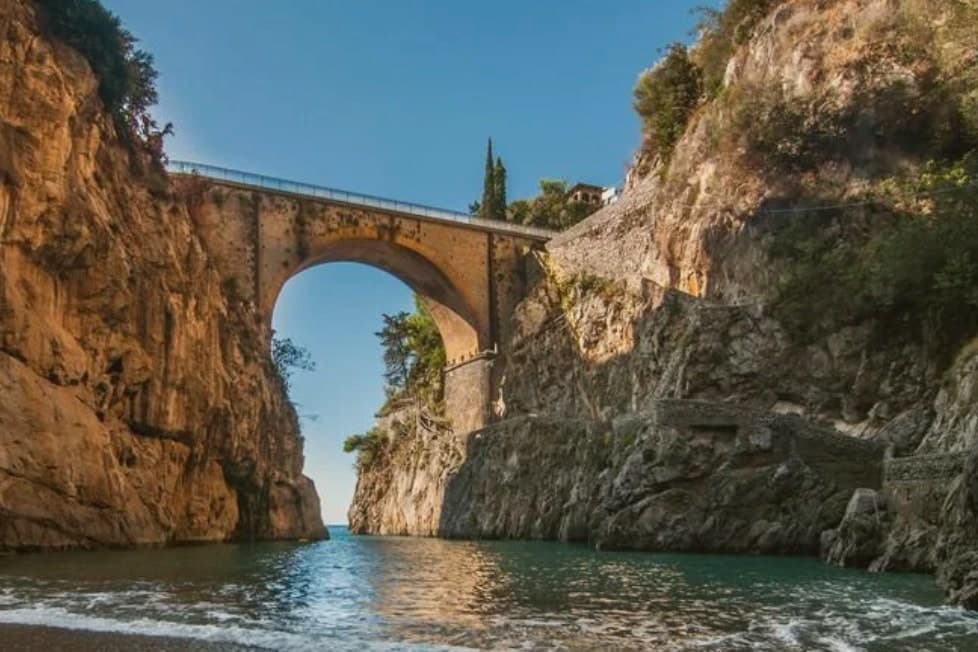
Furore stretches up the cliff between Praiano and Conca dei Marini on the UNESCO-listed Costiera Amalfitana, six hundred and eighty-eight people across houses that don't share a single piazza. The main settlement sits at 300 meters in the upper Vallone del Furore; the commune drops to sea level at the Fiordo di Furore, a narrow ria carved by the Schiato torrent that flows down from Agerola at 550 meters.
The historian Matteo Camera traced the name to the roar storms make through the gorge. Since the late 1980s the painter Silvio Vetrano's project Il Paese Dipinto has invited artists each September to paint murals on the village walls, which is why Furore is sometimes called the painted village or the village that doesn't exist.
The commune is a Borgo più bello d'Italia and a Città del Vino: the Fiorduva white from the Marisa Cuomo winery is grown on terraces above the fjord.
Bluh Furore, Hostaria Baccofurore, Melchiò have been named by a guide.
What to see in Furore
- Fiordo di Furore. Narrow ria cut by the Schiato torrent, southern Italy's only fjord, with a stone bridge crossed by the SS163 and a pebble beach below.
- Il Paese Dipinto. Open-air mural circuit started in 1980 by Silvio Vetrano, with new works added each September by invited Italian and international artists.
- Chiesa di Sant'Elia Profeta. Parish church on the upper part of the village, with a majolica-tiled dome and a small square overlooking the terraces below.
How to get to Furore
Salerno is roughly 36 minutes away by road.
Our tip
May, June, September and early October are the strongest months on this stretch of the Amalfi Coast. The sea climbs past twenty degrees, the SS163 buses run on a working timetable, and the Fiordo di Furore beach is accessible without a queue. July and August are full: the day-trippers come up from Amalfi and the small parking pockets on the SS163 fill before nine.
Ravello
Why visit Ravello
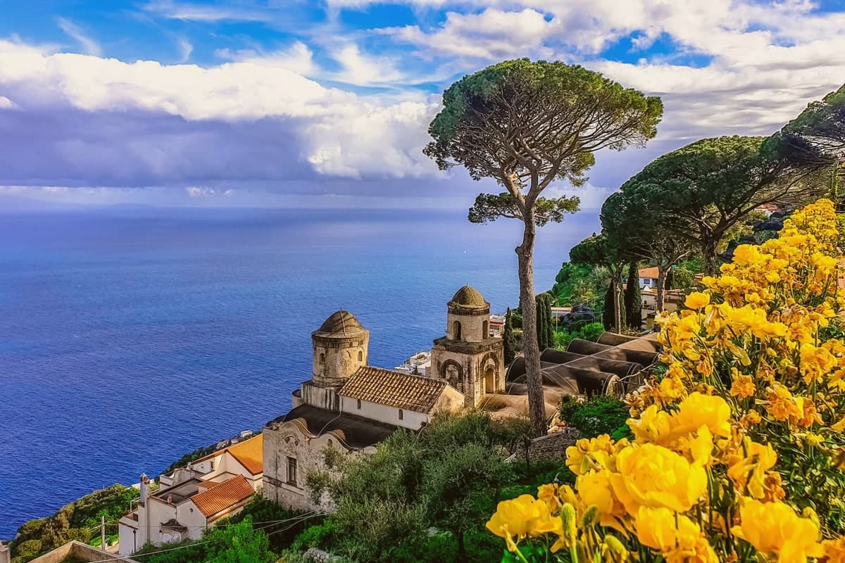
Ravello sits on a spur above the Amalfi Coast, between the valleys of the Dragone and the Reginna Minor, 782 stairs up from Atrani at sea level. The village grew rich in the 12th and 13th centuries as a satellite of the Amalfi maritime republic, when patrician families like the Rufolo, Confalone and d'Afflitto built their houses on the ridge to escape the coastal raids.
The upper village holds the older churches and the social life of the piazza; the villas that made the town's later reputation sit toward the cliff edge, their gardens and belvederes facing the water. One villa's garden was seen by Richard Wagner in 1880 and identified by him with Klingsor's enchanted garden in his opera Parsifal, and he wrote the opera's second act on the strength of it.
The Ravello Festival began playing orchestral concerts in that same garden in 1953, the year the council decided to use Wagner's visit to rebuild a postwar economy. The town's shape, ridge above, stairs down to the coast, patrician houses turned toward the sea, is the record of why families climbed here in the first place and what they built once they had reason to stay.
Rossellinis, Il Flauto di Pan, Belvedere dell'Hotel Caruso and 1 more have been named by a guide.
What to see in Ravello
- Villa Rufolo. Patrician residence built 1270 with Moorish cloister and terraced gardens; setting for the Ravello Festival concerts and the second act of Wagner's Parsifal.
- Villa Cimbrone. Cliff-edge villa restored after 1904 by Lord Grimthorpe, ending in the Terrazza dell'Infinito, a marble belvedere over the Gulf of Salerno.
- Duomo di Ravello. Cathedral on Piazza Vescovado, founded 1086, with the bronze portal cast by Barisano da Trani in 1179 and the marble pulpit signed by Niccolò di Bartolomeo da Foggia in 1272.
How to get to Ravello
Salerno is roughly 33 minutes away by road.
Our tip
May, June, September and early October are the months Ravello reads best. The temperature on the ridge runs three to five degrees cooler than on the coast below, the festival concerts on the Villa Rufolo belvedere run from late June through August, and the gardens are full without the day-tripper bus queues of high summer. July and August fill the SITA bus from Amalfi and the road up the Dragone valley, and the festival's evening concerts under the stars are the reason most overnight visitors come.
Caiazzo
Why visit Caiazzo
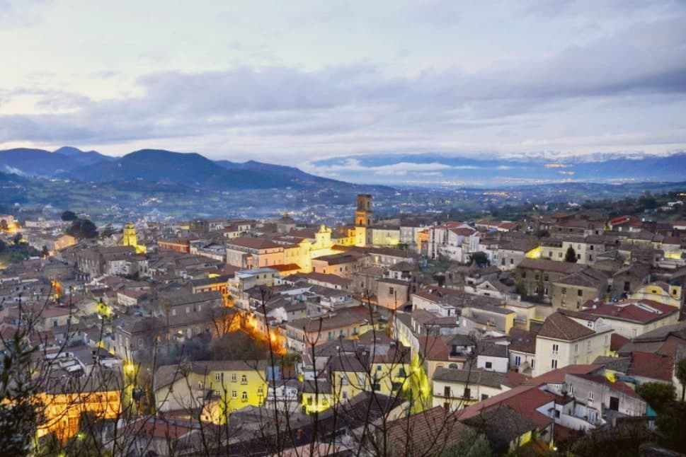
Caiazzo sits at 200 meters on a small hill above the Volturno, forty kilometres north of Naples, between the Matese foothills and the Caserta plain. The town is older than the surrounding province: Caiatia was already a Samnite then Roman centre, and the medieval cathedral preserves a Lombard crypt under its eleventh-century floor.
What pulls visitors today is not the cathedral but a pizzeria. In 2012 Franco Pepe, third-generation baker, opened Pepe in Grani in an eighteenth-century palazzo on Vico San Giovanni Battista, working long-fermented doughs with local Pallagrello flour, Conciato Romano cheese and Caiazzo olive oil.
Tre spicchi from Gambero Rosso for ten straight years and a Michelin world-best ranking in 2018 turned the centro storico into a destination that handles 800 pizzas a day. Caiazzo is a Cittaslow, a Città del Vino for Pallagrello and Casavecchia, and a Città dell'Olio.
Pepe in Grani have been named by a guide.
What to see in Caiazzo
- Cattedrale di Santa Maria Assunta. Eleventh-century cathedral with a Lombard crypt beneath the floor, baroque interior and the relics of San Stefano Minicillo, patron of Caiazzo.
- Castello di Caiazzo. Medieval castle of Lombard origin on the highest point of the centro storico, remodelled under the Normans and later princes of Caiazzo.
- Pepe in Grani. Franco Pepe's pizzeria in an eighteenth-century palazzo on Vico San Giovanni Battista, ranked best in the world by Michelin in 2018.
How to get to Caiazzo
There is a railway station in the town, so you can arrive without a car and never need one while you are here. Napoli is roughly 53 minutes away by road.
Our tip
April through June and September into October are the cleanest months in Caiazzo, when the Volturno valley is green and the Pepe in Grani tables are easier to book at lunch. July and August push the Caserta plain past thirty-five degrees and the centro storico empties between two and six in the afternoon. Harvest runs September and October for Pallagrello and Casavecchia and pulls weekend wine visitors.
Maiori
Why visit Maiori
Maiori sits at the mouth of the Reginna torrent between Minori and Cetara, the widest valley on the Amalfi Coast and the only flat ground on the strip. A wall of medieval houses rose up the gorge until the night of 26 October 1954, when a freak storm dropped 500 millimeters of rain on the Lattari ridge in twelve hours.
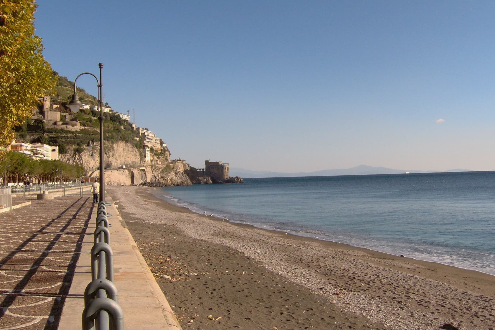
The torrent swept the centro storico, the lemon terraces and several streets into the sea, killing over 80 people. The town was rebuilt with a rare straight grid behind a kilometer-long beach of volcanic sand, the longest on the coast.
The Castello di San Nicola de Thoro-Plano sits on the ridge above, 11th-century walls part-ruined since the Anjou siege. The Collegiata di Santa Maria a Mare, 13th-century with a green and yellow majolica dome, survived the flood and looks out from the hill.
Roberto Rossellini shot Paisà, Voyage in Italy and Il Miracolo here in the late 1940s.
Oltremare have been named by a guide.
What to see in Maiori
- Collegiata di Santa Maria a Mare. Thirteenth-century parish church on the hill, three-aisle neoclassical interior with gilded coffered ceiling and green-and-yellow majolica dome.
- Castello di San Nicola de Thoro-Plano. Eleventh-century fortress in partial ruin on the ridge above town, with views over the Reginna valley and the coast east to Capo d'Orso.
- Spiaggia di Maiori. Kilometer-long beach of volcanic sand, the longest on the Amalfi Coast, replanted with palms behind the seawall after the 1954 flood.
How to get to Maiori
Salerno is roughly 22 minutes away by road.
Our tip
May, June, September and early October are the months Maiori is set up for. The long beach absorbs more visitors than the cove towns nearby, the SITA bus connects west to Amalfi and east to Salerno, and the Sentiero dei Limoni is open without the heat. July and August fill the kilometer of sand and push every restaurant on the lungomare to two evening shifts.
Sant'Agata de' Goti
Why visit Sant'Agata de' Goti
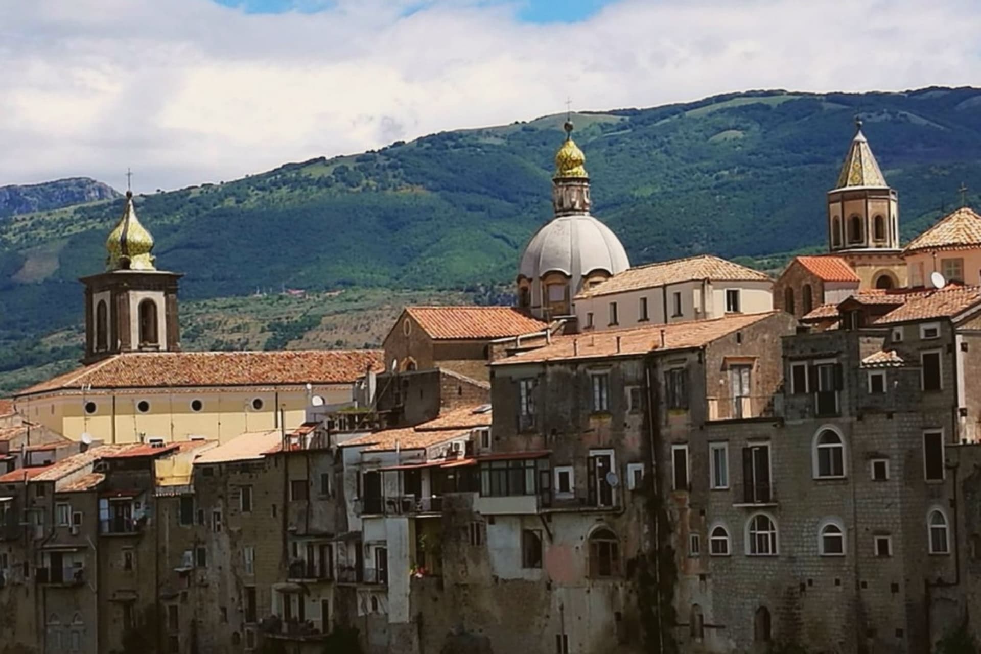
Sant'Agata de' Goti sits at 156 meters on a tuff spur between the Martorano and Riello gorges, thirty-five kilometers northeast of Naples and west of Monte Taburno. The houses on the edge of the centro are built flush with the cliff, their back walls forming a vertical face above the Isclero river thirty meters below.
The Samnites founded Saticula here in the sixth century BC; the current name comes from the Goths who held the town in the sixth century AD, then from Saint Agatha of Sicily as titular of the cathedral. The Lombards of Benevento, the Normans, and the Angevins each rebuilt the castle on the western edge.
The Duomo dell'Assunta in the centro keeps a twelfth-century crypt under a Baroque rebuild. The commune is a Bandiera Arancione of the Touring Club Italiano, holds the Sant'Agata de' Goti Aglianico DOC and Falanghina DOC, and is part of the Città della Nocciola network for the Nocciola di Avellino DOP grown around it.
Agape, Antico Borgo have been named by a guide.
What to see in Sant'Agata de' Goti
- Castello Ducale. Medieval fortress on the western edge of the cliff, rebuilt by the Lombards, the Normans and the Angevins, now a residence with restored rooms.
- Duomo dell'Assunta. Tenth-century cathedral with a twelfth-century crypt under a Baroque rebuild, columns reused from a Roman temple of Demeter.
- Chiesa dell'Annunziata. Late Gothic church with a fifteenth-century fresco of the Annunciation and a wooden ceiling carved with the symbols of Christ's passion.
How to get to Sant'Agata de' Goti
Napoli is roughly 51 minutes away by road.
Our tip
April through early June and September into October are the strongest months. The valley around Sant'Agata greens, the Aglianico and Falanghina vineyards bud and ripen, and the cliff houses stay cool when the floor of the gorge heats up. July and August can pass thirty-five degrees on the Isclero plain, though the centro on the tuff catches more breeze. Sagra Sansilvestrese a Sant'Agata De' Goti falls in August.
Benevento
Why visit Benevento
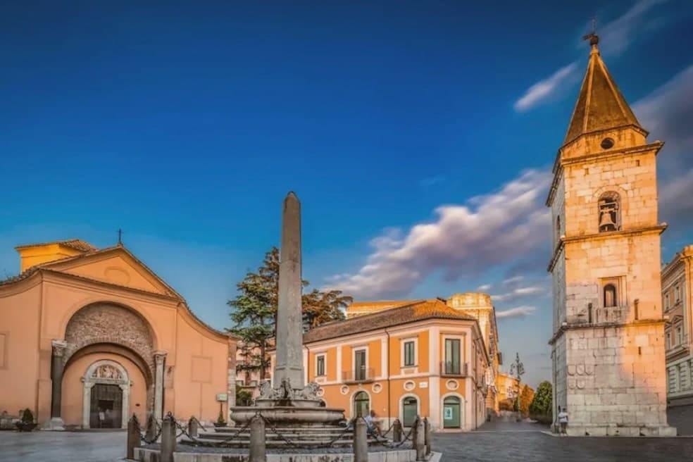
Benevento sits at 130 meters at the confluence of the Calore and Sabato rivers, fifty-five kilometers northeast of Naples, the historic capital of the Sannio. The Lombard Duchy of Benevento was founded in 571, well before the small circular church that survives from around 760, and the city centre still carries that double layer of Roman provincial capital and Lombard duchy seat.
Walking from the cathedral down Corso Garibaldi, past the cloister sculptures set against the medieval wall, ends at the triumphal arch, so the route itself moves from the Lombard and medieval town toward the point where the Roman road left for Brindisi. The countryside around the city is Aglianico del Taburno wine and the herbal liqueur distilled here since 1860.
What holds the city together is this sequence along one line of streets: two civic identities, Roman and Lombard, laid end to end and still walkable in that order.
Albori Ristorante & Bar, Alimenta, Sapori Ristorante have been named by a guide.
What to see in Benevento
- Arco di Traiano. The marble reliefs facing the road show Trajan's domestic policy, those facing the town his military campaigns, a pairing read as deliberate rather than decorative. The Via Traiana ran from this point to Brindisi.
- Chiesa di Santa Sofia. The circular plan is unusual for the period, and the interior keeps traces of the original Lombard fabric beneath later additions. It stands apart from the rectangular churches common elsewhere in the city.
- Teatro Romano. Roman theatre begun under Hadrian and completed under Caracalla, capacity for ten thousand spectators, still used for summer performances.
How to get to Benevento
There is a railway station in the town, so you can arrive without a car and never need one while you are here. Salerno is roughly 84 minutes away by road.
Our tip
April through June and September into October are the city's dry months, with mild evenings along the Calore and the Roman amphitheatre's summer programme starting in June. July and August push the inland Sannio past thirty-five degrees, and the old town empties between three and six in the afternoon while the riverbanks become the local refuge. November through March is wet, foggy at dawn, with rain a constant in February.
Pozzuoli
Why visit Pozzuoli
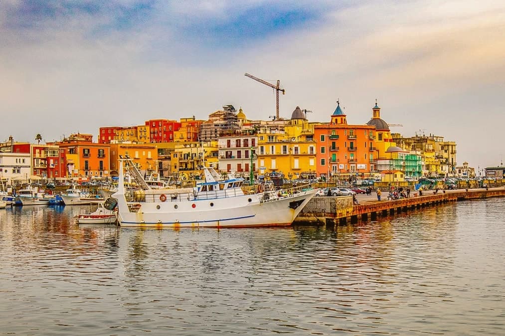
Pozzuoli sits at twenty-eight meters on the rim of the Campi Flegrei caldera, fifteen kilometers west of Napoli. Greek refugees from Samos founded the city in 531 BC as Dicearchia; Rome took it in 195 BC and renamed it Puteoli, a name the port kept through its centuries as Rome's busiest gateway by sea.
The old town and the working town are not the same ground. Rione Terra, the headland acropolis, was the city center for both the Greek and Roman settlements before it was evacuated in 1970 and reopened only piece by piece since.
The rest of Pozzuoli has grown around and below it, on a caldera that does not hold still: the crater above town still vents sulfur, and the crust beneath the whole area continues its slow rise and fall, watched closely enough that the alert level was raised again in 2023. A port city built its wealth on ground that was always going to move under it, and the town's oldest quarter has spent the last half century learning to live with that fact rather than escape it.
Abraxas, La Fattoria del Campiglione, Punto Nave and 1 more have been named by a guide.
What to see in Pozzuoli
- Anfiteatro Flavio. The cage chambers and lift machinery beneath the arena floor survive largely intact, giving a rare view of how the underground works of a Roman amphitheater actually functioned.
- Macellum (Tempio di Serapide). A market building long misread as a temple to Serapis. The three marked columns still stand at the center of the floor, close enough to touch.
- Rione Terra. The headland acropolis and original old town, evacuated in 1970 after a bradyseismic crisis and reopened only in stages since.
How to get to Pozzuoli
There is a railway station in the town, so you can arrive without a car and never need one while you are here. Napoli is roughly 25 minutes away by road.
Our tip
May through September is the working season for Pozzuoli, with June and September the easiest months. Sea temperatures rise into the mid-twenties, and the open-air sites stay accessible without afternoon heat closures. July and August are hot and crowded; the Anfiteatro and Macellum work best in the first morning slots.